Mid-17th Century Maps
to
228
260
8
268
2,936
2,181
476
3
289
34
10
127
7
35
9
2
5
4
4
2
267
2
2
1
1
14
9
2
1
1
268
268
268
31
3
1
1
1
Period: Mid-17th Century
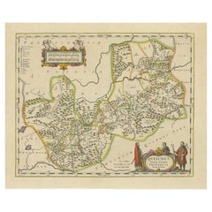
OriginaAntique 17th-Century Map of Guizhou Province, China – (Qveichev) by Blaeu
Located in Langweer, NL
Title: Antique 17th-Century Map of Guizhou Province, China – "Qveichev" by Blaeu, Richly Illustrated and Colored
Description: This remarkable map of Guizhou Province, historically known as "Qveichev," was created by Johannes Blaeu and published in 1655 as part of his *Novus Atlas Sinensis*. This atlas, developed in collaboration with Jesuit missionary Martino Martini, marked the first Western attempt at a comprehensive geographic representation of China. Blaeu’s map offers a detailed depiction of the mountainous terrain, rivers, and towns of Guizhou, a province known for its rugged beauty and cultural diversity.
The map is adorned with two decorative cartouches, each reflecting the artistic and cultural influences of the time. The title cartouche in the lower-right corner features two figures in traditional Chinese attire, symbolizing the blend of European cartographic mastery and Chinese heritage. The upper-left corner includes a secondary cartouche with an explanatory key, adding a touch of elegance to the map’s functionality. Towns, mountains, and rivers are meticulously labeled in Latin, showcasing Blaeu’s dedication to detail and accuracy.
Crafted using the copperplate engraving technique, this map demonstrates exceptional precision. The hand-coloring enhances its visual appeal, highlighting borders and geographic features with vibrant tones. Blaeu’s work is not only a tool for geographic understanding but also a piece of art that embodies the spirit of exploration during the Dutch Golden Age.
Guizhou Province, historically known as "Qveichev," is renowned for its breathtaking natural landscapes, rich ethnic diversity, and historical significance. As one of China's most mountainous regions, Guizhou is characterized by dramatic karst formations, lush green hills, and cascading waterfalls. The province is also home to a variety of ethnic minority groups, including the Miao, Dong, and Bouyei, whose traditions, colorful costumes, and vibrant festivals make the region culturally significant.
Famous features and important places include Huangguoshu Waterfall, one of Asia's largest and most iconic waterfalls, located near the city of Anshun. Zhijin Cave, a vast karst cave system, is celebrated for its stunning stalactites and stalagmites. Kaili is known as the cultural center of Miao traditions, with picturesque villages and celebrated festivals. Zunyi holds historical importance for the Zunyi Conference, a pivotal event in the Chinese Communist Party's history. Fanjing Mountain, a UNESCO World Heritage Site, stands out for its unique biodiversity and sacred Buddhist sites.
Keywords: antique map of China, Guizhou map, Qveichev, 17th-century China map...
Category
Antique Mid-17th Century Maps
Materials
Paper
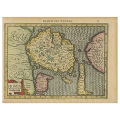
Antique Map of the Island of Funen by Kaerius, 1628
Located in Langweer, NL
Antique map titled 'Fionia'. Copper engraved map of the Island of Funen (Denmark) by P. Kaerius. Funen is Denmark's second largest island, between the Jutland peninsula, and the capi...
Category
Antique Mid-17th Century Maps
Materials
Paper
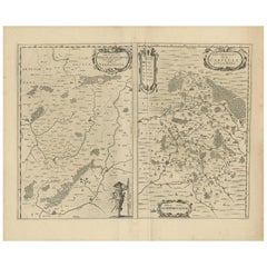
Antique Map of the Region of Vermandois and Cappelle by Janssonius, circa 1650
Located in Langweer, NL
Antique map of France titled 'Descriptio Veromanduorum - Gouvernement de la Cappelle'. Two detailed maps of France on one sheet. The Vermandois map is centered on the Oyse and Somme ...
Category
Antique Mid-17th Century Maps
Materials
Paper
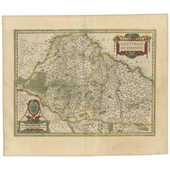
Antique Map of the Region of Étampes and Sens by Hondius, circa 1630
Located in Langweer, NL
Antique map titled 'Gastinois et Senonois'. Old map of the region of Étampes and Sens, France. It shows the cities of Sens, Melun, Étampes, Orleans, Fontainebleau, Montargis and othe...
Category
Antique Mid-17th Century Maps
Materials
Paper
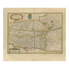
Antique Map of the Region of Lyon by Hondius, circa 1630
Located in Langweer, NL
Antique map titled 'Lionnois, Forest et Beauiolois'. Old map of the former region of Lyon, Vienne, Bresse, Rohan and the Rhône River. This map originates f...
Category
Antique Mid-17th Century Maps
Materials
Paper
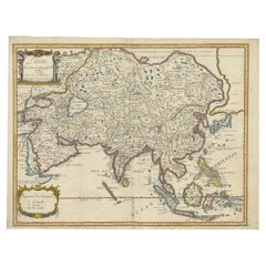
Antique Map of Asia by Pierre du Val, '1663'
Located in Langweer, NL
Antique map titled 'L'Asie'. Antique map of the Asian continent by Pierre Duval, dated 1663. Most place names represent geographical entities that currently exist or once existed. The rendition of the lower islands of Japan and the peninsula of Korea are improved over earlier studies. Details of the Great Wall of China...
Category
Antique Mid-17th Century Maps
Materials
Paper
Antique Map of the Region of Picardy by Janssonius, 1657
Located in Langweer, NL
Antique map of France titled 'Picardia vera et inferior'. Detailed map of the Picardy region of France. This map originates from 'Atlas Novus, Sive Theatrum Orbis Orbis Terrarum: In ...
Category
Antique Mid-17th Century Maps
Materials
Paper
"Nova Barbariae Descriptio", a 17th Century Hand-Colored Map of North Africa
Located in Alamo, CA
This original attractive 17th century hand-colored map of North Africa entitled "Nova Barbariae Descriptio" by Johannes Janssonius was published in Paris in 1635. It includes the Med...
Category
Dutch Antique Mid-17th Century Maps
Materials
Paper
Antique Map of the Region of Sedan and Doncheri by Janssonius, 1657
Located in Langweer, NL
Antique map of France titled 'La Souveraineté de Sedan et de Raucourt, et la prevosté de Doncheri'. Lovely map centered on Sedan and Doncheri and the Meuze River from Charleville and...
Category
Antique Mid-17th Century Maps
Materials
Paper
Antique Map of the Region of Lyonnais by Janssonius, '1657'
Located in Langweer, NL
Antique map 'Lionnois, forest, beauviolois et masconnois'. Decorative map of the Lyonnais region, France. The Lyonnais is a historical province of France which owes its name to the c...
Category
Antique Mid-17th Century Maps
Materials
Paper
Antique Map of the Region of Charolais by Janssonius, 1657
Located in Langweer, NL
Antique map 'Les environs de L'Estang de Longpendu, comprenant une grande partie du Comté de Charolois'. Decorative map of the Charolais region. This map originates from 'Atlas Novus...
Category
Antique Mid-17th Century Maps
Materials
Paper
Antique Map of Java by Janssonius, circa 1650
Located in Langweer, NL
Antique map titled 'Insulae Iavae cum parte insularum Borneo Sumatrae, et circumjacentium insularum novissima delineatio'. Beautiful map of Java and parts of Bali, Borneo, Sumatra an...
Category
Antique Mid-17th Century Maps
Materials
Paper
17th Century Hand-Colored Map of Southeastern England by Mercator and Hondius
Located in Alamo, CA
A 17th century copperplate hand-colored map entitled "The Sixt Table of England" by Gerard Mercator and Jodocus Hondius, published in Amsterdam in 1635 in 'Cosmographicall Descriptio...
Category
Dutch Antique Mid-17th Century Maps
Materials
Paper
Southeastern Ireland: A 17th Century Hand Colored Map by Mercator and Hondius
Located in Alamo, CA
A 17th century copperplate hand-colored map entitled "The Second Table of Ireland, Udrone" by Gerard Mercator and Jodocus Hondius, published in Amsterdam in 1635 in 'Cosmographicall ...
Category
Dutch Antique Mid-17th Century Maps
Materials
Paper
Prussia, Poland, N. Germany, Etc: A Hand-colored 17th Century Map by Janssonius
Located in Alamo, CA
This is an attractive hand-colored copperplate engraved 17th century map of Prussia entitled "Prussia Accurate Descripta a Gasparo Henneberg Erlichensi", published in Amsterdam by Joannes Janssonius in 1664. This very detailed map from the golden age of Dutch cartography includes present-day Poland, Latvia, Lithuania, Estonia and portions of Germany. This highly detailed map is embellished by three ornate pink, red, mint green and gold...
Category
Dutch Antique Mid-17th Century Maps
Materials
Paper
Northern Schleswig and Haderslev Map by Johannes Mejer and Johannes Blaeu, 1662
Located in Langweer, NL
The map shows the Duchy of Schleswig, which spans the area between the North Sea coast, Kolding, and Flensburg. The maps were originally published by Johannes Mejer in the regional a...
Category
Antique Mid-17th Century Maps
Materials
Paper
Mapping Stormarn: Johannes Meier's 1650 Cartographic Masterpiece
Located in Langweer, NL
This detailed description enhances our understanding of the historical map titled "Landtcarte von dem Furstenthumbe Stormarn," a copper etching by Johannes Meier (Mejer), dated to 16...
Category
Antique Mid-17th Century Maps
Materials
Paper
Greece, "Graeciae Antiquae"" A 17th Century Hand-colored Map by Sanson
Located in Alamo, CA
This is an original 17th century hand colored copperplate engraved map of Greece entitled "Graeciae Antiquae Tabula Hanc Geographicam" by Nicolas d'Abbeville Sanson, engraved and pub...
Category
French Antique Mid-17th Century Maps
Materials
Paper
Northern Scotland: A 17th Century Hand-colored Map by Mercator
Located in Alamo, CA
This is a framed hand-colored 17th century map of Northern Scotland by Gerard Mercator entitled "Scotiae pars Septentrionalis", published in Amsterdam in 1636. It is a highly detailed map of the northern part of Scotland, with the northwest Highlands and the cities Inverness and Aberdeen, as well as the Orkney Islands and the Hebrides. There is a decorative title cartouche in the upper left corner.
The map is presented in an antiqued brown wood...
Category
Dutch Antique Mid-17th Century Maps
Materials
Paper
Original Antique Regional Map of France with Orleans, Auxerre and Montargis
Located in Langweer, NL
Original antique map titled 'Gastinois et Senonois'. Beautiful regional map of France. With Corbeil in the north, Pont sur Seyne in the east, Auxerre in the south, and Orleans in the...
Category
Antique Mid-17th Century Maps
Materials
Paper
Original Antique Map of the City of Stavoren, Friesland, The Netherlands, 1649
Located in Langweer, NL
Antique map titled 'Staveren'. Original antique map of the city of Stavoren, Friesland, The Netherlands. This map originates from 'Toonneel der Steden van de Vereenighde Nederlanden'...
Category
Antique Mid-17th Century Maps
Materials
Paper
Old Print Titled from War Comes Peace, City Amara in Africa in Background, C1630
Located in Langweer, NL
Antique print, titled: 'Amara in Africa.'
Caption above the image reads: 'Ex bello Pax' (From War comes Peace). A lance is used as a roost for chickens. In the background the cit...
Category
Antique Mid-17th Century Maps
Materials
Paper
Engraved Map of Northern England, Focusing on Northumberland, 1658
Located in Langweer, NL
Antique map titled 'Ancien Royaume de Northumberland, aujourdhuy Provinces de Nort (..)'.
Engraved map of northern England, focusing on Northumber...
Category
Antique Mid-17th Century Maps
Materials
Paper
Original Map of the Military Situation After the Dutch Blockade of Antwerp, 1648
Located in Langweer, NL
Antique map titled 'Tabula Castelli ad Sandflitam (..)'.
This map depicts the complex military situation that had developed after the Dutch blockade of Antwerp. All entrenchment'...
Category
Antique Mid-17th Century Maps
Materials
Paper
Governor of Miaco (Kyoto, Japan), Leaving the City in a Carriage, 1669
Located in Langweer, NL
Antique print, titled: 'Sortie pompeuse du Gouverneur de Miaco. 't Uytreyden des Gouverneurs van Miaco.'
The governor of Miaco (Kyoto), in a carriage as part of a long procession...
Category
Antique Mid-17th Century Maps
Materials
Paper
Map of Southeast Asia, Extending from India to Tibet & Japan to New Guinea, 1640
Located in Langweer, NL
Antique map titled 'India quae Orientalis dicitur et Insulae adiacentes'.
Map of Southeast Asia, extending from India to Tibet to Japan to New Guinea. This map is one of the firs...
Category
Antique Mid-17th Century Maps
Materials
Paper
Decorative and Detailed Original Antique Map of Switzerland, 1657
Located in Langweer, NL
Antique map of Switzerland titled 'Helvetiae Rhetiae & Valesiae'.
Decorative and detailed map of Switzerland. This map originates from 'Atlas Novus, Sive Theatrum Orbis Orbis Ter...
Category
Antique Mid-17th Century Maps
Materials
Paper
Two Original Antique Engravings with the Dutch and German North Sea Coast, c1650
Located in Langweer, NL
Antique map titled 'Nieuwe Caerte waerinne vertoont wordt de gantsche Vaert van Amsterdam over de Watten tot de stadt Hamborch toe'.
Two maps with the Dutch and German North Sea ...
Category
Antique Mid-17th Century Maps
Materials
Paper
Large Panoramic View of Eisenerz, an Old Mining Town in Styria, Austria, c.1650
Located in Langweer, NL
Description: Antique print titled 'Der weyt berümpte Marckt und Bergwerck Eysenärtz im Hertzogtum Steyer'.
Large panoramic view of Eisenerz, an old mining town in the Austrian st...
Category
Antique Mid-17th Century Maps
Materials
Paper
Antique County Map of Cheshire, Dutch, Framed, Cartography, Janssonius, C.1660
Located in Hele, Devon, GB
This is an antique county map of Cheshire. A Dutch, framed atlas engraving by Johannes Janssonius, dating to the 17th century and later.
A treat for the collector or county native,...
Category
Dutch Charles II Antique Mid-17th Century Maps
Materials
Glass, Wood, Paper
Antique Map of the Region of 'Île de France' by Janssonius, circa 1650
Located in Langweer, NL
Antique map of France titled 'Le Gouvernement de L'Isle de France'. Paris is represented by a miniature plan of the city, making it distinct from the other towns of the region which ...
Category
Antique Mid-17th Century Maps
Materials
Paper
Antique Map of Loudun and Mirebeau by Janssonius '1657'
Located in Langweer, NL
Antique map 'Loudunois Laudunum - Mirebalais'. Decorative map of the region of Loudun and Mirebeau. This map originates from 'Atlas Novus, Sive Theatrum Orbis Orbis Terrarum: In quo ...
Category
Antique Mid-17th Century Maps
Materials
Paper
Antique Map of the North-Western Part of France by Janssonius (c.1657)
Located in Langweer, NL
Antique map of France titled 'Le Gouvernement de Calais'. Attractive map of the north-western part of France including the towns of Calais, Gravelines. This map originates from 'Atla...
Category
Antique Mid-17th Century Maps
Materials
Paper
Antique Map of the Region of Rethelois by Janssonius, 1657
Located in Langweer, NL
Antique map of France titled 'Dioecese de Rheims et le Païs de Rethel'. Detailed map, centered on the River Ayne and the River Velle and sowing Reims, Chalons, Sedan, Charleville, as...
Category
Antique Mid-17th Century Maps
Materials
Paper
Antique Map of Brabant 'The Netherlands' by N. Visscher, circa 1670
Located in Langweer, NL
Detailed map of the southern part of The Netherlands and the northern part of Belgium with Antwerp and Brussels. In the corner top left in Holland with Rotterdam partly on the map. S...
Category
Antique Mid-17th Century Maps
Materials
Paper
Antique Map of Dunkirk 'France' by J. Blaeu, 1649
Located in Langweer, NL
Antique map titled 'Duynkercka'. Published by J. Blaeu, 1649. Dutch text on verso.
Category
Antique Mid-17th Century Maps
Materials
Paper
