Items Similar to Western Roman Empire Map: British Isles & Gaul - 1802 Tardieu Atlas

Want more images or videos?
Request additional images or videos from the seller
1 of 7
Western Roman Empire Map: British Isles & Gaul - 1802 Tardieu Atlas
$420.86
$526.0720% Off
£311.56
£389.4520% Off
€352
€44020% Off
CA$582.36
CA$727.9520% Off
A$642.04
A$802.5520% Off
CHF 335.89
CHF 419.8720% Off
MX$7,876.63
MX$9,845.7820% Off
NOK 4,228.24
NOK 5,285.3020% Off
SEK 3,954.07
SEK 4,942.5920% Off
DKK 2,681.32
DKK 3,351.6520% Off
About the Item
Antique Map Description and title: "Partie Occidentale de l'Empire Romain ou du Monde connu des Anciens d'Après d'Anville"
Publication Details:
- **Atlas Title:** Nouvel Atlas Universel de Géographie Ancienne et Moderne
- **Purpose:** For the Nouvelle Edition de la Géographie de Guthrie
- **Mapmakers:** P. F. Tardieu, with contributions from various geographical works
- **Publisher:** Chez Hyacinthe Langlois, Libraire, quai des Augustins, n° 45
- **Year:** An X - 1802 (French Revolutionary Calendar)
**Geographical Scope:**
This antique map illustrates the western part of the Roman Empire or the known world of the ancients according to d'Anville. It focuses on the British Isles, Gaul (modern-day France), parts of Germania, and the surrounding regions.
Map Features:
- **Regions Displayed:** The British Isles (Britannia and Hibernia), Gaul (modern-day France), parts of Germania, and surrounding areas.
- **Notable Regions and Territories:** Britannia, Hibernia, Gallia, Belgica, Germania, and other regions relevant to the Roman Empire.
- **Seas and Bodies of Water:** The North Sea (Mare Germanicum), English Channel, and parts of the Atlantic Ocean.
- **Ancient Names:** Uses historical and ancient names for countries, regions, and bodies of water.
- **Topographical Details:** Includes mountain ranges, rivers, and other significant geographical features as understood in the ancient world.
- **Cartographic Style:** Detailed engraving with hand-colored boundaries, typical of early 19th-century cartography, emphasizing historical accuracy and artistic presentation.
Purpose and Use:
This map serves as a visual representation of the western part of the Roman Empire, reflecting the geographical understanding and cartographic style of the early 19th century. It is part of a larger atlas that includes 60 maps, providing a comprehensive view of both ancient and modern geography as known in 1802.
Conclusion
The antique map "Partie Occidentale de l'Empire Romain ou du Monde connu des Anciens d'Après d'Anville," published in 1802 by Hyacinthe Langlois, represents a detailed and historically informed view of the western part of the ancient Roman Empire, reflecting the cartographic and geographical knowledge of its time.
- Dimensions:Height: 16.19 in (41.1 cm)Width: 23.04 in (58.5 cm)Depth: 0.01 in (0.2 mm)
- Materials and Techniques:Paper,Engraved
- Period:
- Date of Manufacture:1802
- Condition:Condition: good, given age. Fold as published. General age-related toning and/or occasional minor defects, mainly in the margins, from handling. Please study scan carefully.
- Seller Location:Langweer, NL
- Reference Number:Seller: BG-13769-21stDibs: LU3054340556132
About the Seller
5.0
Recognized Seller
These prestigious sellers are industry leaders and represent the highest echelon for item quality and design.
Platinum Seller
Premium sellers with a 4.7+ rating and 24-hour response times
Established in 2009
1stDibs seller since 2017
2,609 sales on 1stDibs
Typical response time: <1 hour
- ShippingRetrieving quote...Shipping from: Langweer, Netherlands
- Return Policy
Authenticity Guarantee
In the unlikely event there’s an issue with an item’s authenticity, contact us within 1 year for a full refund. DetailsMoney-Back Guarantee
If your item is not as described, is damaged in transit, or does not arrive, contact us within 7 days for a full refund. Details24-Hour Cancellation
You have a 24-hour grace period in which to reconsider your purchase, with no questions asked.Vetted Professional Sellers
Our world-class sellers must adhere to strict standards for service and quality, maintaining the integrity of our listings.Price-Match Guarantee
If you find that a seller listed the same item for a lower price elsewhere, we’ll match it.Trusted Global Delivery
Our best-in-class carrier network provides specialized shipping options worldwide, including custom delivery.More From This Seller
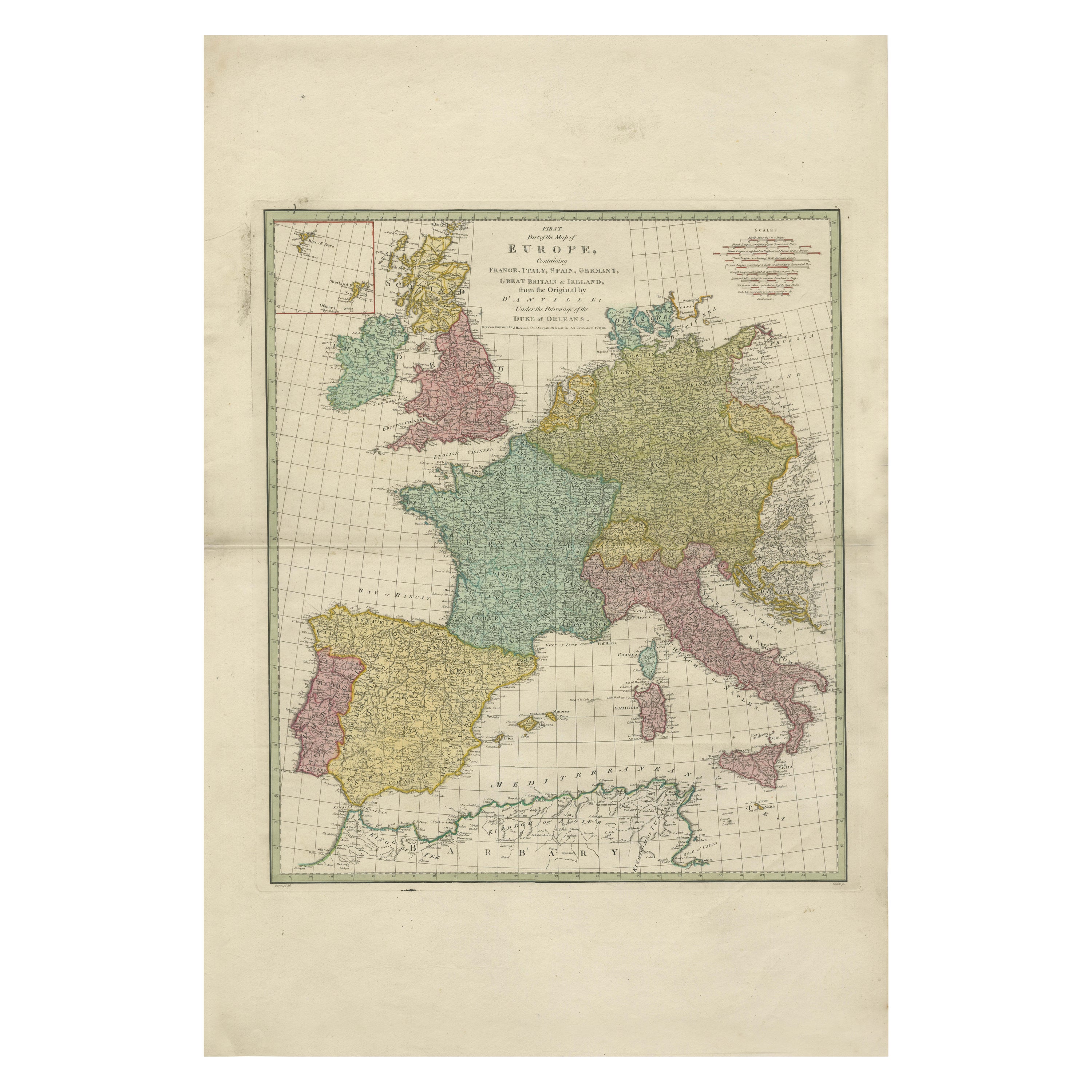
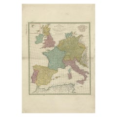
View All1788 Map of Europe - France, Italy, Spain, Germany, Great Britain & Ireland
Located in Langweer, NL
Title: "1788 Map of Europe - France, Italy, Spain, Germany, Great Britain & Ireland by D'Anville"
Description:
This detailed map of Europe, titled "First Part of the Map of Europe...
Category
Antique 1780s Maps
Materials
Paper
$1,071 Sale Price
20% Off
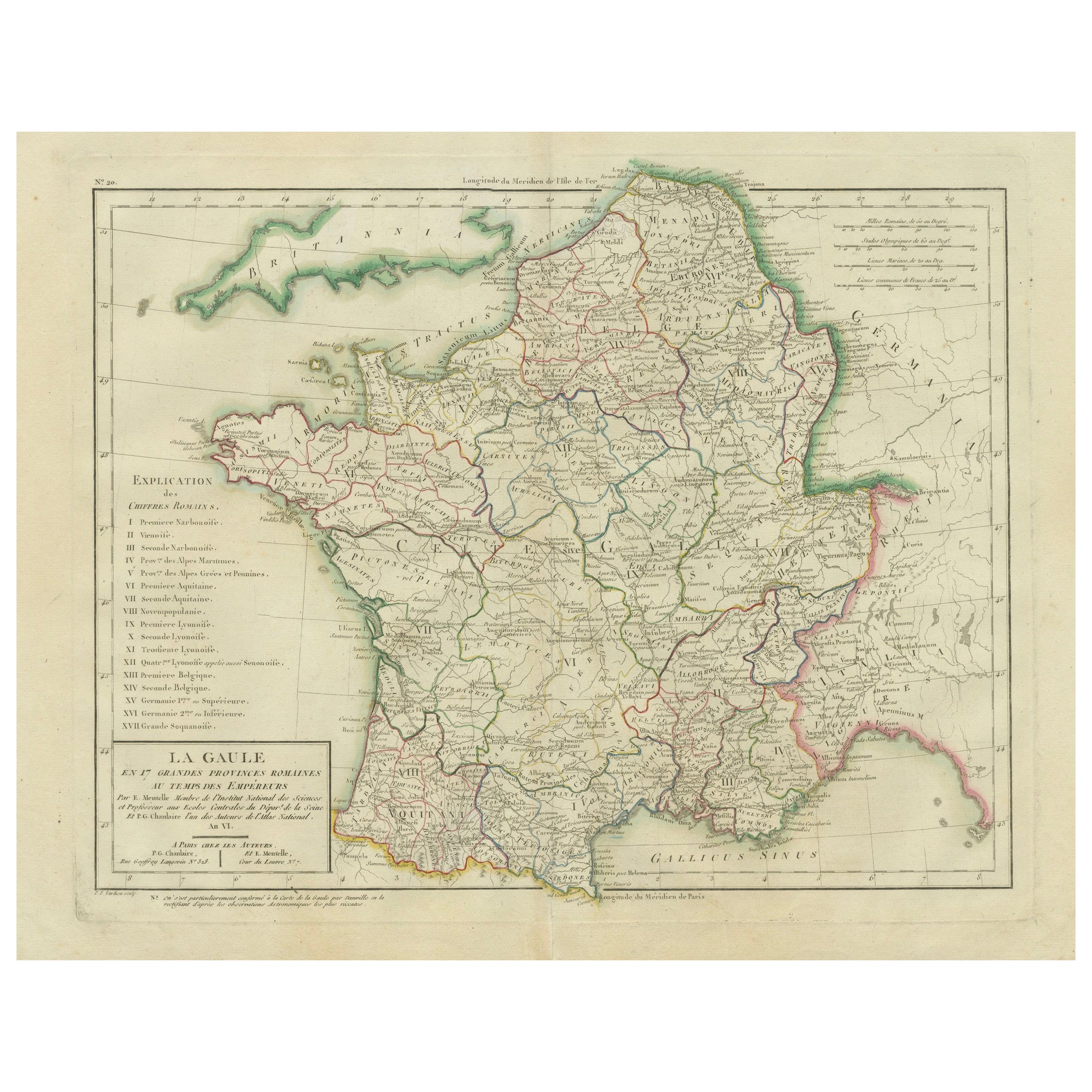
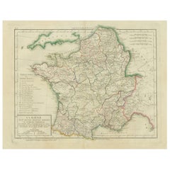
Map of Ancient Gaul & Roman Provinces: Early 19th Century - 1802 Tardieu Atlas
Located in Langweer, NL
### Antique Map Description
**Title:** La Gaule et Ses Grandes Dignités Romaines au Temps des Empereurs
**Publication Details:**
- **Atlas Title:** Nouvel Atlas Universel de Géogra...
Category
Antique Early 1800s Maps
Materials
Paper
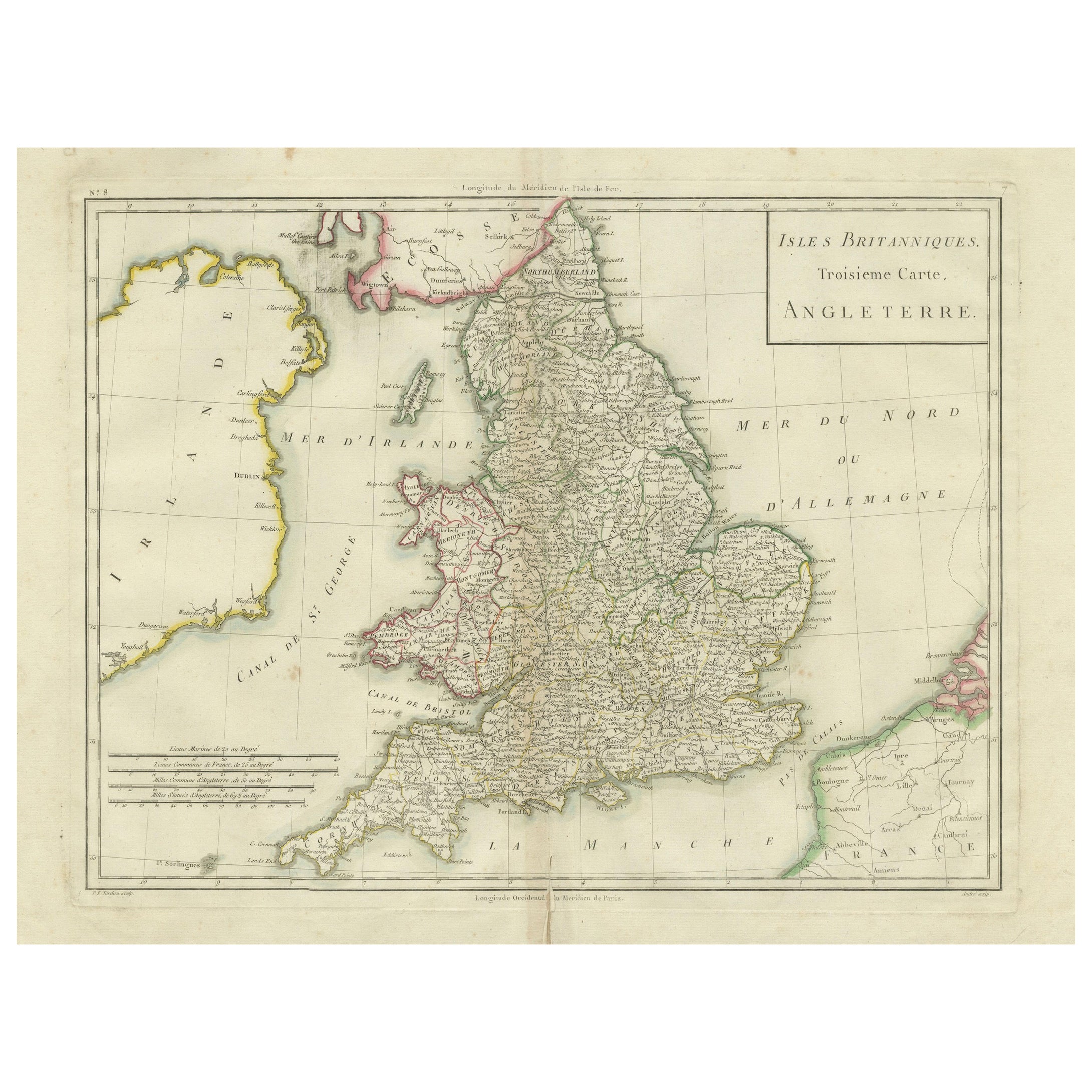
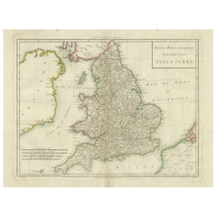
Map of England and Surrounding Regions: Early 19th Century - 1802 Tardieu Atlas
Located in Langweer, NL
Title: Isles Britanniques. Troisieme Carte, Angleterre
Publication Details:
- **Atlas Title:** Nouvel Atlas Universel de Géographie Ancienne et Moderne
- **Purpose:** For the Nouve...
Category
Antique Early 1800s Maps
Materials
Paper
$363 Sale Price
20% Off
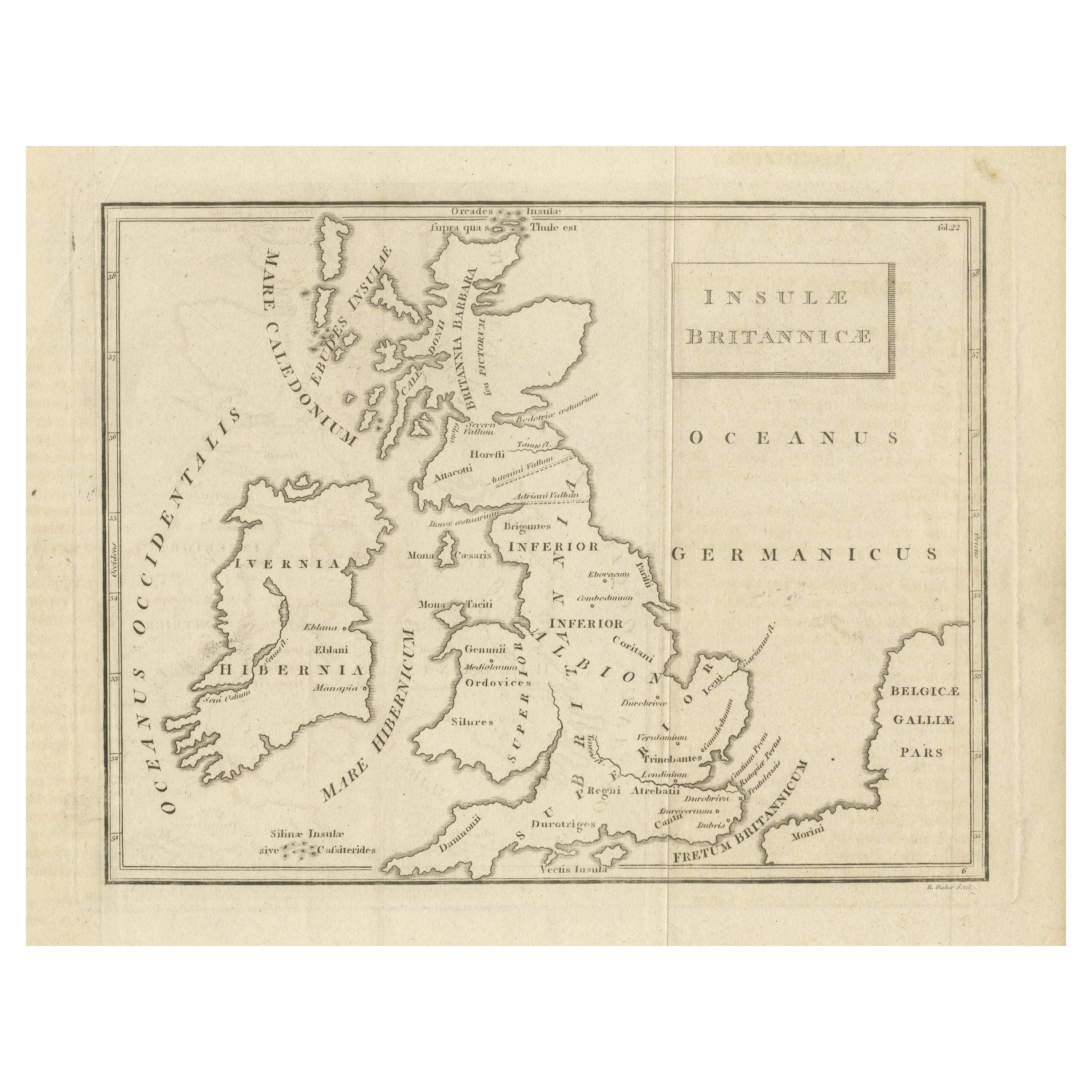
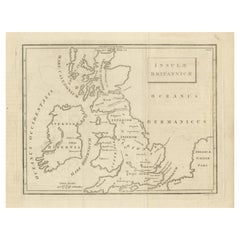
Antique Map of the British Isles According to the Geography of the Roman Empire
Located in Langweer, NL
Antique map titled 'Insulae Britannicae'. Interesting map of Britain, Scotland, and Ireland. It shows a rudimentary outline of the islands according to the geography of the Roman Emp...
Category
Antique Late 18th Century Maps
Materials
Paper
$172 Sale Price
20% Off
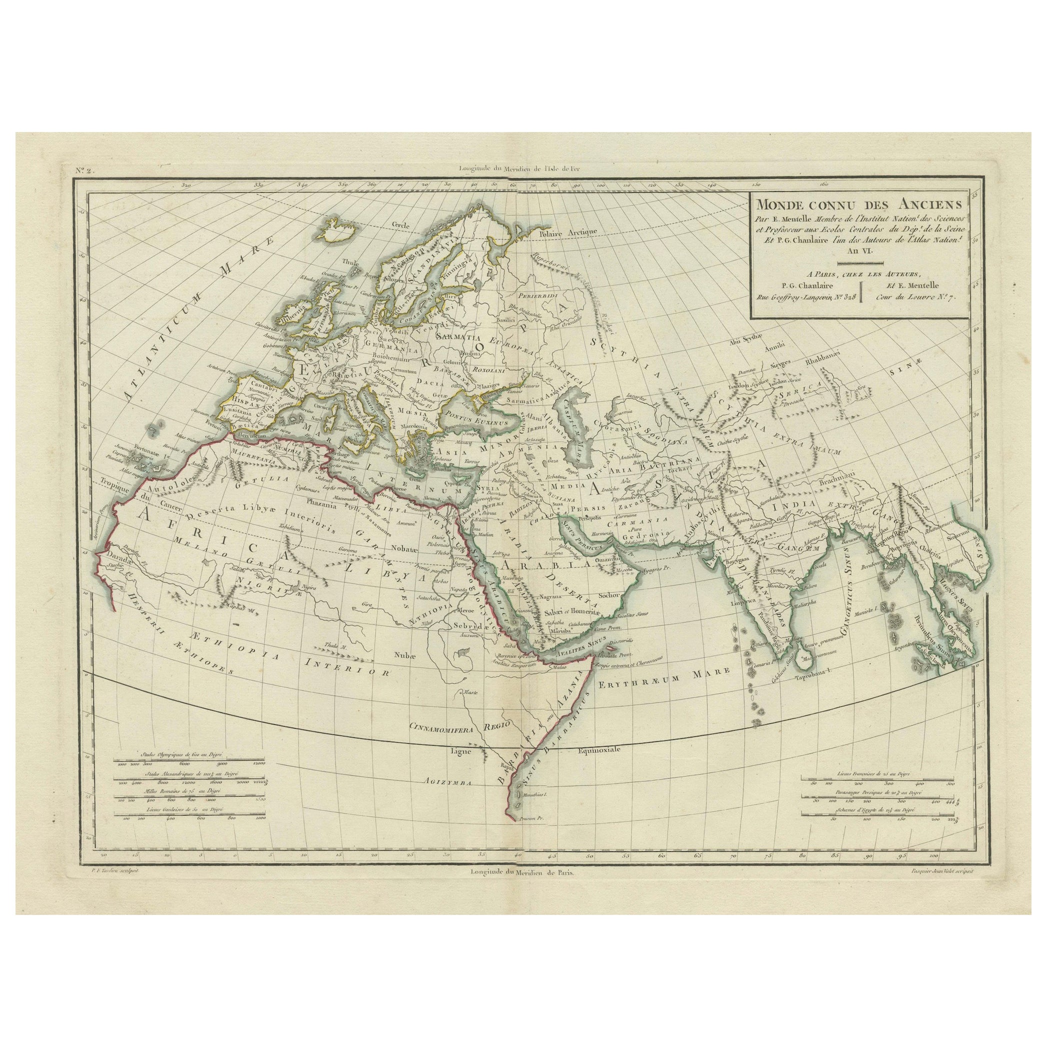
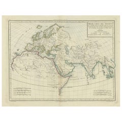
Ancient World Map: Europe, Africa & Asia - 1802 Tardieu Atlas
Located in Langweer, NL
Antique Map Description with title: "Monde Connu Des Anciens"
Publication Details:
- Atlas Title: Nouvel Atlas Universel de Géographie Ancienne et Moderne
- Purpose: For the Nouvel...
Category
Antique Early 1800s Maps
Materials
Paper
$420 Sale Price
20% Off
Political Map of Europe: Early 19th Century, from the 1802 Tardieu Atlas
Located in Langweer, NL
Antique Map Description
Title: Carte Générale et Politique de l'Europe
Publication Details:
- **Atlas Title:** Nouvel Atlas Universel de Géographie Ancienne et Moderne
- **Purpose...
Category
Antique Early 1800s French Maps
Materials
Paper

$459 Sale Price
20% Off
You May Also Like
Original Antique Map of Europe, Arrowsmith, 1820
Located in St Annes, Lancashire
Great map of Europe
Drawn under the direction of Arrowsmith.
Copper-plate engraving.
Published by Longman, Hurst, Rees, Orme and Brown, 1820
...
Category
Antique 1820s English Maps
Materials
Paper

1790 Thomas Stackhouse Map, Entitled "Russia in Europe, " , Ric.a004
Located in Norton, MA
1790 Thomas Stackhouse map, entitled
"Russia in Europe"
Ric.a004
Stackhouse, Thomas
Russia in Europe [map]
London: T. Stackhouse, 1783. Map. Matted hand-colored copper engraving. Image size: 14.5 x 15.25 inches. Mat size: 22.75 x 23.75 inches. A beautiful example of this map of Eastern Europe...
Category
Antique 17th Century Unknown Maps
Materials
Paper

Original Antique Map of The World by Thomas Clerk, 1817
Located in St Annes, Lancashire
Great map of The Eastern and Western Hemispheres
On 2 sheets
Copper-plate engraving
Drawn and engraved by Thomas Clerk, Edinburgh.
Published by Mackenzie And Dent, 1817
...
Category
Antique 1810s English Maps
Materials
Paper

Antique French Map of Asia Including China Indoneseia India, 1783
Located in Amsterdam, Noord Holland
Very nice map of Asia. 1783 Dedie au Roy.
Additional information:
Country of Manufacturing: Europe
Period: 18th century Qing (1661 - 1912)
Condition: Overall Condition B (Good Used)...
Category
Antique 18th Century European Maps
Materials
Paper

$648 Sale Price
20% Off
1714 Henri Chatelain "Nouvelle Carte Des Etatas Du Grand.Duc De Mos Moscovie Eur
Located in Norton, MA
A 1714 Henri Chatelain map, entitled
"Nouvelle Carte Des Etatas Du Grand Duc De Moscovie En Europe,"
Ricb001
Henri Abraham Chatelain (1684-1743) was a Huguenot pastor of Parisi...
Category
Antique Early 18th Century Dutch Maps
Materials
Paper

1752 Vaugoundy Map of Flanders : Belgium, France, and the Netherlands, Ric.a002
Located in Norton, MA
Large Vaugoundy Map of Flanders:
Belgium, France, and the Netherlands
Colored -1752
Ric.a002
Description: This is a 1752 Didier Robert de Vaugondy map of Flanders. The map de...
Category
Antique 17th Century Unknown Maps
Materials
Paper

More Ways To Browse
British Empire
Antique Gallia
British Empire Furniture
Sterling Silver Flatware Service For 12
Vintage Italian Leather Dining Chair
Antique Dining Tables With Leaves
Modern Low Stools
Orange Coffee Table
Round Brass Table
Set Of Four Italian Dining Chairs
Black And Chrome Lounge Chair
Pedestal Mahogany Dining Table
Round Table Base
Metal Coffee Table 1970s
Wash Stand
18th Century Blue And White Porcelain
Antique Imari Porcelain
Antique Pagoda