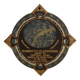
Hammett's Planisphere Celestial Map
View Similar Items


1 of 5
Hammett's Planisphere Celestial Map
$275List Price
About the Item
"Hammet's Planisphere, Showing The Principal Stars Visible For Every Hour Of The Year"
The piece is made of two pieces of solid cardboard with the top being finished with a faux leather look in black. The gold lettering and details are in excellent condition and are deeply stamped into the board creating an embossed effect. This would make a great display piece and would look handsome in a framed shadow box.
- Dimensions:Diameter: 12.5 in (31.75 cm)
- Period:
- Date of Manufacture:Early 1900's
- Condition:The condition is excellent and the map wheel easily rotates and functions very well. The gold lettering is bright and the map face has no signs of wear. There is some minor wear to the edges of the points and the back has some discoloration, but the instructions are still readable.
- Seller Location:Dallas, TX
- Reference Number:Seller: 49781stDibs: U1004308687155
Authenticity Guarantee
In the unlikely event there’s an issue with an item’s authenticity, contact us within 1 year for a full refund. DetailsMoney-Back Guarantee
If your item is not as described, is damaged in transit, or does not arrive, contact us within 7 days for a full refund. Details24-Hour Cancellation
You have a 24-hour grace period in which to reconsider your purchase, with no questions asked.Vetted Professional Sellers
Our world-class sellers must adhere to strict standards for service and quality, maintaining the integrity of our listings.Price-Match Guarantee
If you find that a seller listed the same item for a lower price elsewhere, we’ll match it.Trusted Global Delivery
Our best-in-class carrier network provides specialized shipping options worldwide, including custom delivery.You May Also Like
Very Attractive Antique Map of the World as Planisphere, Shows Cook's Voyages
Located in Langweer, NL
Antique map titled 'Chart of the World, according to Mercators Projection'. This world map shows the various discoveries of Captain James Cook during his 3 voyages between 1768 and 1780, and the English and French Explorers who followed immediately thereafter, including Vancouver and La Perouse. This edition of the map is significantly revised from the editions issued immediately after the official report of Cook's Voyages were integrated into the map, showing better detail in New Zealand, Australia, the Northwest Coast of America and North East coast of Asia, along with Greenland. A new large lake also appears for the first time in the Western part of North America, shortly before the commencement of the Lewis...
Category
Antique Late 18th Century Maps
Materials
Paper

$1,345 Sale Price
25% Off
Free Shipping
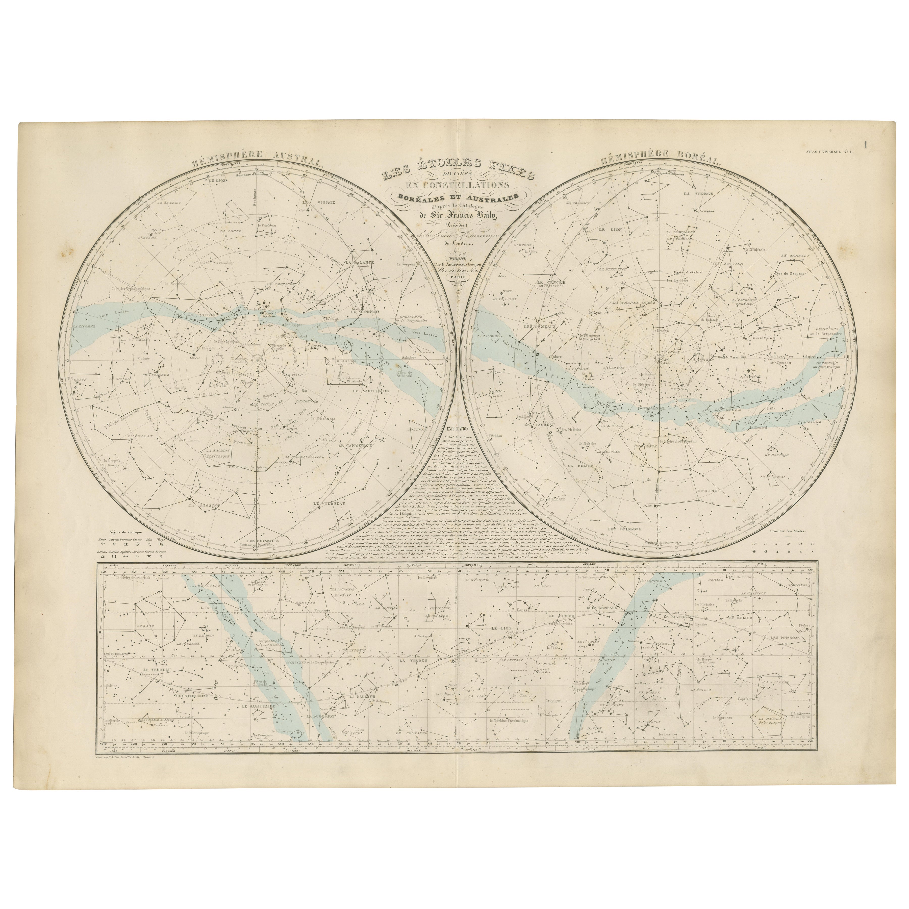
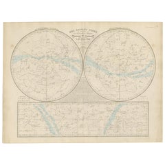
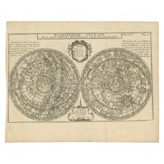
Antique Celestial Star Map – Northern & Southern Hemispheres, 1860
Located in Langweer, NL
Antique Celestial Star Map – Northern & Southern Hemispheres, Andriveau-Goujon 1860
This elegant antique celestial chart, published in Paris in 1860 by the noted French cartographer...
Category
Antique Mid-19th Century French Maps
Materials
Paper
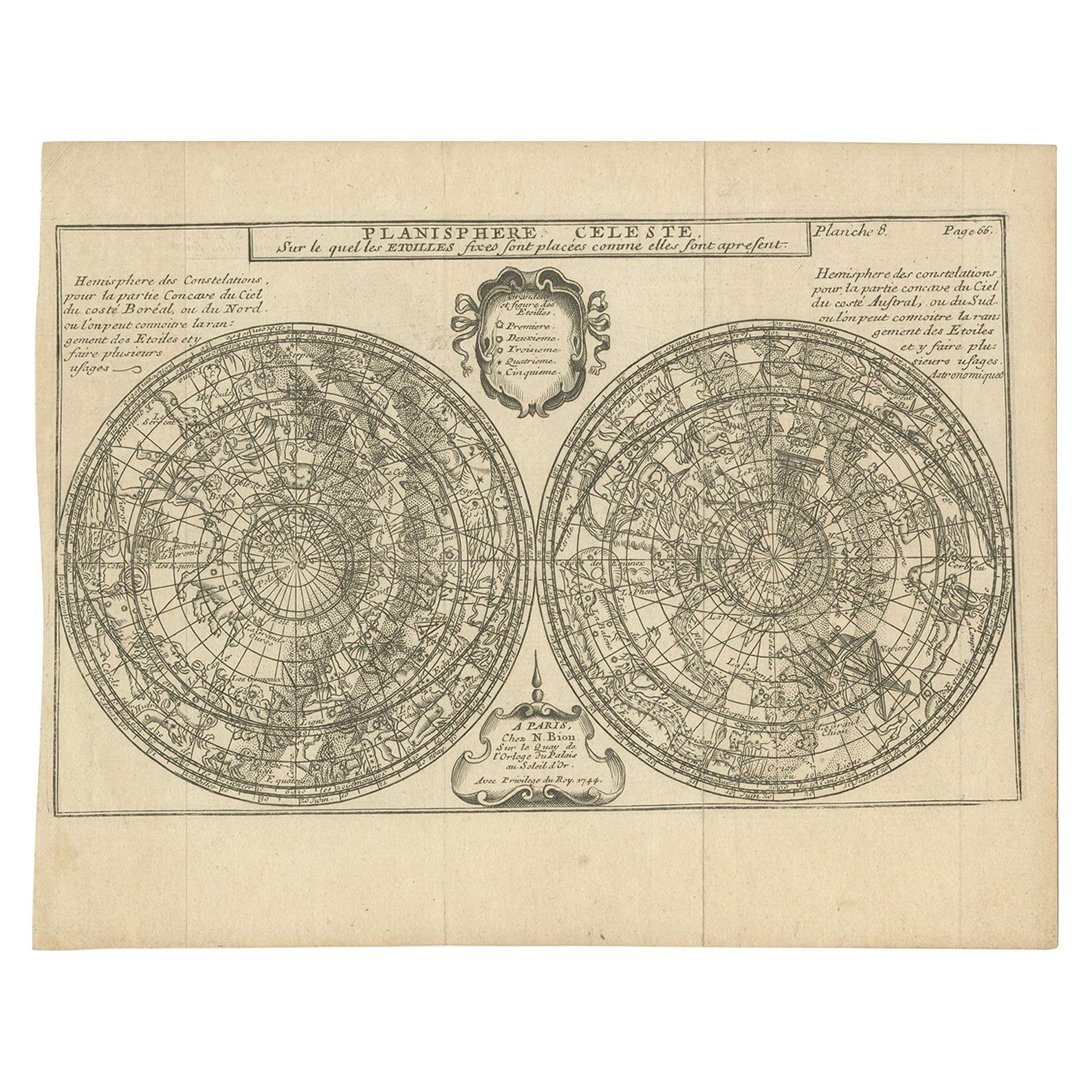
Antique Planisphere with Constellations by Bion, 1751
Located in Langweer, NL
Antique map titled 'Planisphere Celeste'. Planisphere with various constellations. This map originates from 'L'Usage des globes célestes et terrestres et des sphères (..)' by N. Bion...
Category
Antique Mid-19th Century Maps
Materials
Paper
$191 Sale Price
20% Off
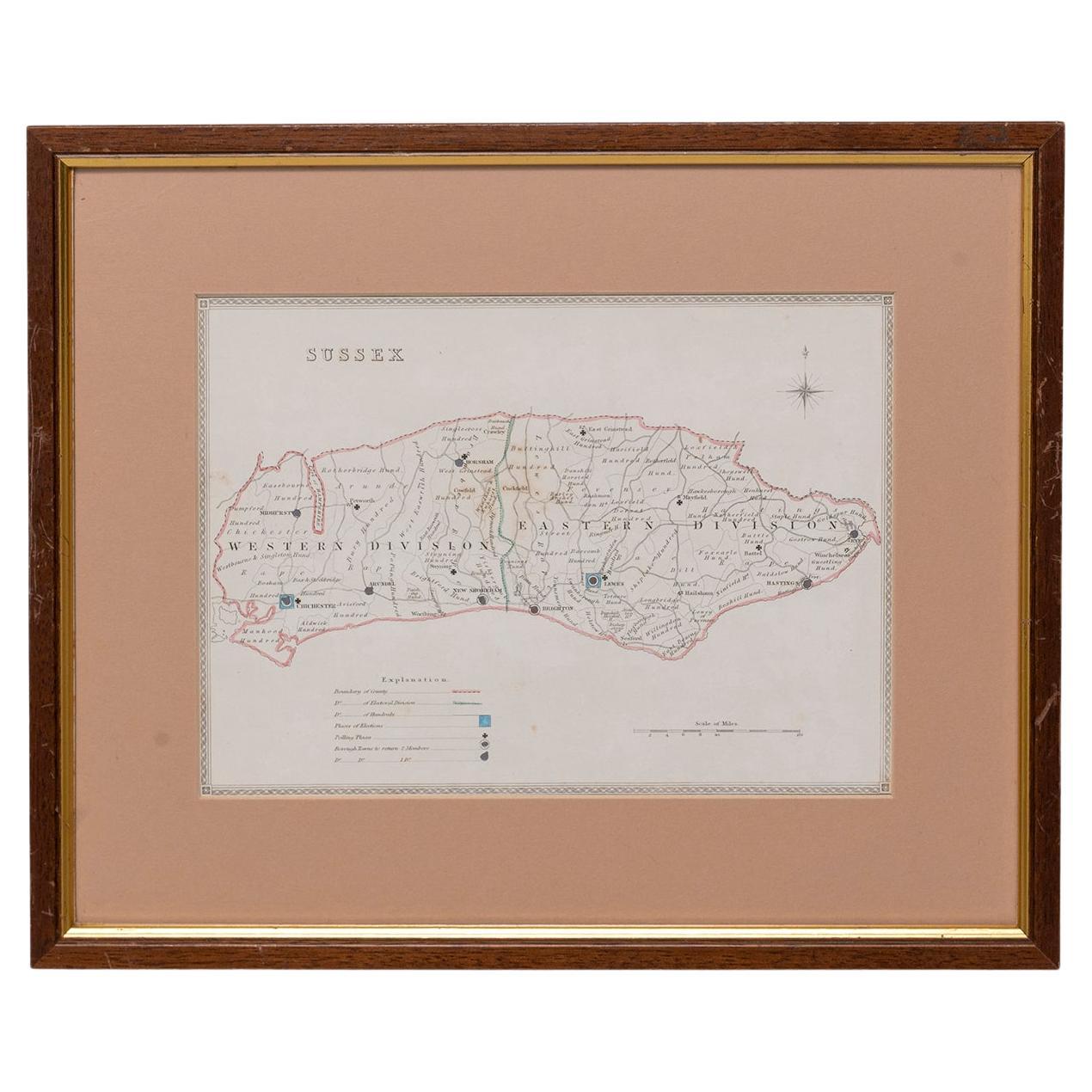
Map Sussex
Located in BUNGAY, SUFFOLK
Map of Sussex with explanation
Maker unknown.
Category
Antique 19th Century English Victorian Maps
Materials
Paper

$826
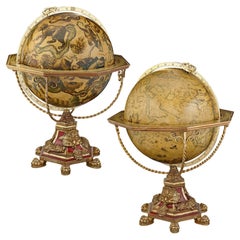
Pair of 32" Terrestrial and Celestial Globes
Located in New Orleans, LA
Pair of Terrestrial and Celestial Globes
G & T London
20th Century
This extraordinary pair of 32-inch terrestrial and celestial globes, crafted by G & T London, pays homage to the m...
Category
20th Century English Scientific Instruments
Materials
Metal
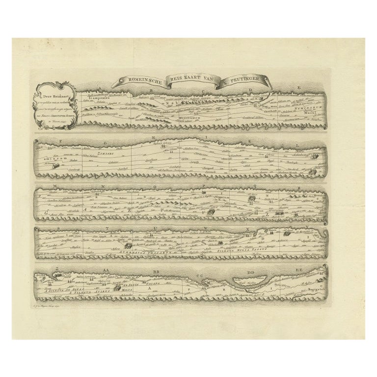
Antique Map Made After a Roman Papyrus Travel Map, Known as Peutinger Map, 1773
Located in Langweer, NL
Old Dutch engraving with title: 'Romeinsche Reis Kaart van K. Peutinger'.
Rare antique map based on the original 'Peutinger' map, the map has the shape of papyrus scrolls. Originat...
Category
Antique 18th Century Maps
Materials
Paper
$430 Sale Price
20% Off
Recently Viewed
View AllMore Ways To Browse
Astrology Map
Antique Stick Barometer Scientific Instruments
Antique Syringes
Apothecary Scale
George Iii Barometer
Large Abacus
Military Binoculars
Mother Of Pearl Opera Glasses
Opera Binoculars
Opera Glasses Mother Of Pearl
Plumb Bob
Used Dental Instrument
Victorian Compass
Antique Box Compass
Antique Compass Sundial
Antique Weather Barometer
Beam Scales
Brass And Leather Telescope