Items Similar to Original WWII Illustrated Map Poster - Time And Tide Map Of The Atlantic Charter

Want more images or videos?
Request additional images or videos from the seller
1 of 5
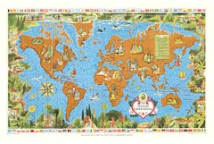
Original WWII Illustrated Map Poster - Time And Tide Map Of The Atlantic Charter
$7,533.36
£5,500
€6,464.62
CA$10,400.82
A$11,530.84
CHF 6,059.91
MX$141,118.59
NOK 75,682.08
SEK 71,035.20
DKK 48,254.39
About the Item
Original vintage illustrated map poster in Spanish by the notable graphic designer, cartographer and artist MacDonald Gill (Leslie MacDonald Gill aka Max Gill; 1884-1947) commissioned by the British Time & Tide magazine (1920-1986) following the World War Two Atlantic Charter agreement between the US President Franklin D. Roosevelt and UK Prime Minister Winston Churchill "for a better future for the world" 14 August 1941 - La Carta del Atlantico. Stunning design featuring detailed colorful pictorial depictions of agriculture and food production, Industrial raw materials and traditional life around the world including images of people, animals, trees, cattle, ships at sea, planes flying overhead and markers with a symbol box listing the locations of metals, wine, crops, petroleum, tobacco, sugar, rubber, silk, coffee, fruit, precious stones etc., surrounded by clouds on the sides and the sun shining down from The Atlantic Charter in the text box at the top with a black and white image below of an Industrial metal worker destroying tanks and machinery and a farming family ploughing a field with horses, the cities, countries, continents and quotes in banners with a seal and a compass point on both sides, all framed within a decorative border. Printed in Great Britain by Philip George & Son Ltd London and published in collaboration with the Time and Tide Publishing Company Ltd London. The London Geographical Institute. Horizontal. Large size. Very good condition, restored tears on folds, faint stains in image, backed on linen.
- Creator:"Leslie MacDonald ""Max"" Gill" (Artist)
- Dimensions:Height: 44.89 in (114 cm)Width: 34.85 in (88.5 cm)Depth: 0.04 in (1 mm)
- Materials and Techniques:
- Place of Origin:
- Period:
- Date of Manufacture:1943
- Condition:Repaired: Restored tears on folds, backed on linen. Very good condition, restored tears on folds, faint stains in image, backed on linen.
- Seller Location:London, GB
- Reference Number:1stDibs: LU101268470523
About the Seller
5.0
Platinum Seller
Premium sellers with a 4.7+ rating and 24-hour response times
Established in 2010
1stDibs seller since 2013
577 sales on 1stDibs
Typical response time: <1 hour
Associations
LAPADA - The Association of Arts & Antiques Dealers
- ShippingRetrieving quote...Shipping from: London, United Kingdom
- Return Policy
Authenticity Guarantee
In the unlikely event there’s an issue with an item’s authenticity, contact us within 1 year for a full refund. DetailsMoney-Back Guarantee
If your item is not as described, is damaged in transit, or does not arrive, contact us within 7 days for a full refund. Details24-Hour Cancellation
You have a 24-hour grace period in which to reconsider your purchase, with no questions asked.Vetted Professional Sellers
Our world-class sellers must adhere to strict standards for service and quality, maintaining the integrity of our listings.Price-Match Guarantee
If you find that a seller listed the same item for a lower price elsewhere, we’ll match it.Trusted Global Delivery
Our best-in-class carrier network provides specialized shipping options worldwide, including custom delivery.More From This Seller
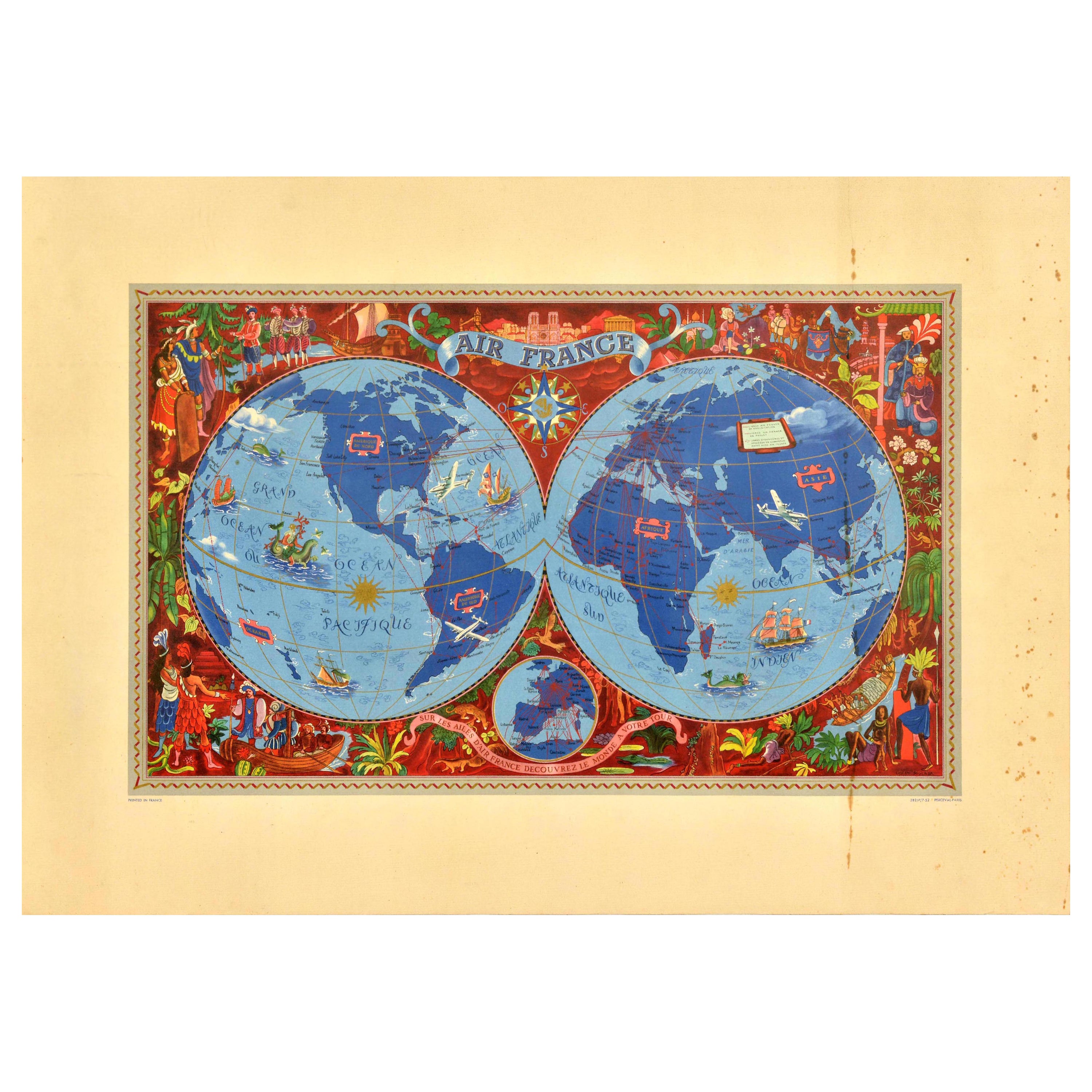
View AllOriginal Vintage Travel Poster Air France Planisphere Illustrated Map Boucher
By Lucien Boucher
Located in London, GB
Original vintage travel poster advertising Air France featuring a stunning planisphere design by the French artist Lucien Boucher (1889-1971). C...
Category
Vintage 1950s French Posters
Materials
Paper
Original Vintage Travel Route Poster Air France Planisphere Map Lucien Boucher
By Lucien Boucher
Located in London, GB
Original vintage planisphere travel route map poster promoting Air France the global air network of the French national airline carrier. Design by Lucien Boucher (1889-1971) featurin...
Category
Vintage 1940s French Posters
Materials
Paper
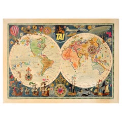
Original Vintage Travel Poster TAI Airline Planisphere Map Luc Marie Bayle
Located in London, GB
Original vintage travel advertising poster - TAI Transports Aeriens Intercontinentaux Map of the World - Colourful planisphere by Luc-Marie Bayle (1914-2000) showing the airline's ro...
Category
Vintage 1960s French Posters
Materials
Paper
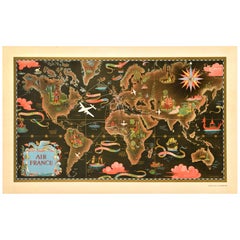
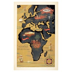
Original Vintage Advertising Poster Messageries Maritimes Far East Map H Baille
By Hervé Baille
Located in London, GB
Original vintage advertising poster for Messageries Maritimes Viet-Nam / Vietnam Cambodge / Cambodia Laos Courriers d'Extreme Orient / Far East featuring a fantastic illustrated map ...
Category
Vintage 1950s French Posters
Materials
Paper
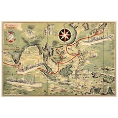
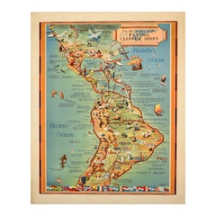
Original Vintage Travel Poster Pan Am Flying Clipper Ships South America Map
Located in London, GB
Original vintage Pan Am travel advertising map poster - On the routes of the Flying Clipper Ships - featuring a pictorial map by Kenneth W. Thompson (1907-1996) of Latin America with images of points of interest, cities, animals and people including ancient Maya ruins and Inca ruins, the Iguassu Falls, Amazon...
Category
Vintage 1940s American Posters
Materials
Paper
Original Vintage Poster Sabena Belgian Airlines To Europe Asia Africa Travel Map
Located in London, GB
Original vintage pictorial travel map poster advertising Sabena Belgian Airlines flights to Europe Asia and Africa with images of people on each cont...
Category
Vintage 1950s Belgian Posters
Materials
Paper
You May Also Like
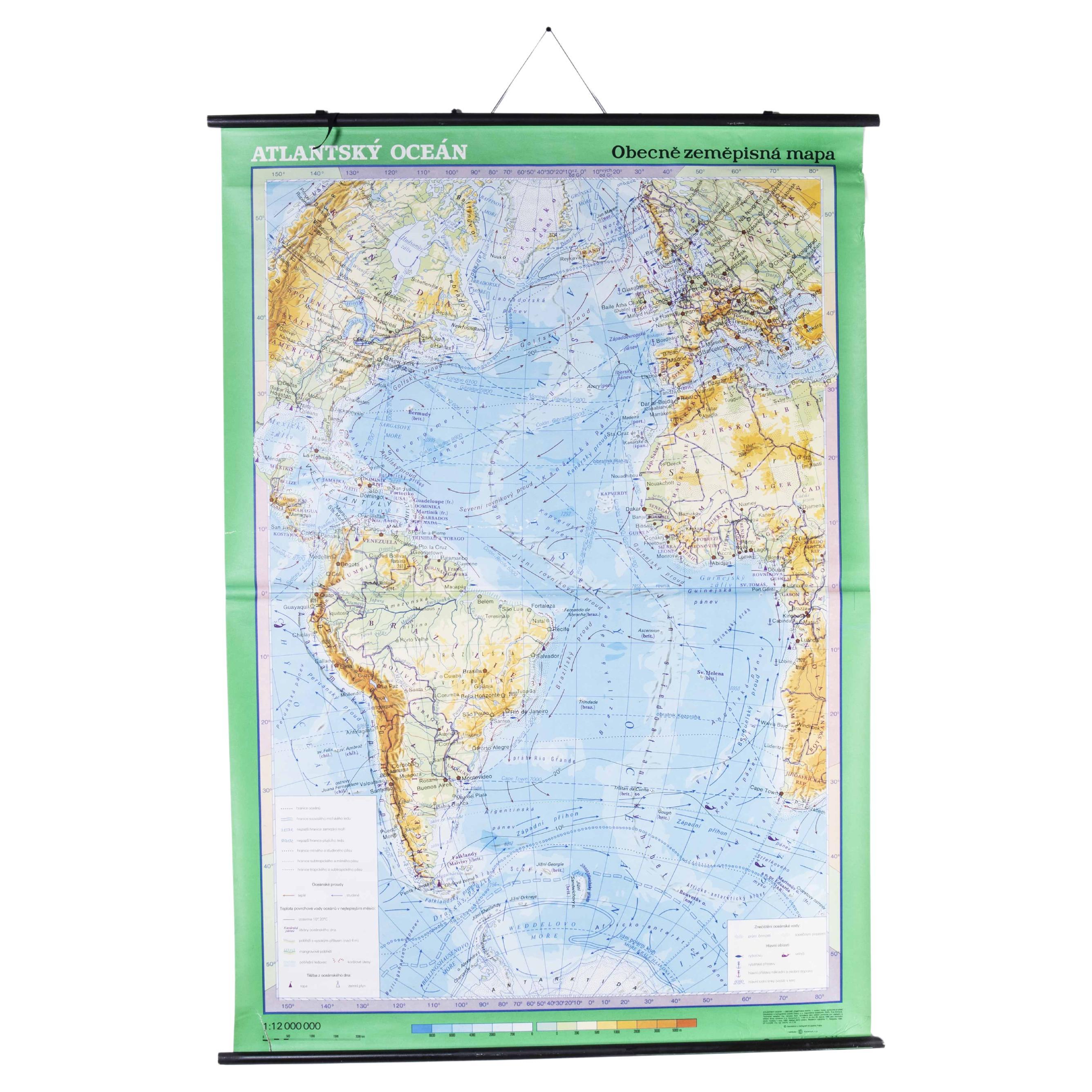
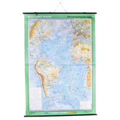
Late 20th Century Educational Geographic Map - Atlantic Currents
Located in Hook, Hampshire
Late 20th Century Educational Geographic Map – Atlantic Currents
Late 20th Century Educational Geographic Map – Atlantic Currents. Good quality roll up school educational geographic ...
Category
Late 20th Century Czech Posters
Materials
Cotton
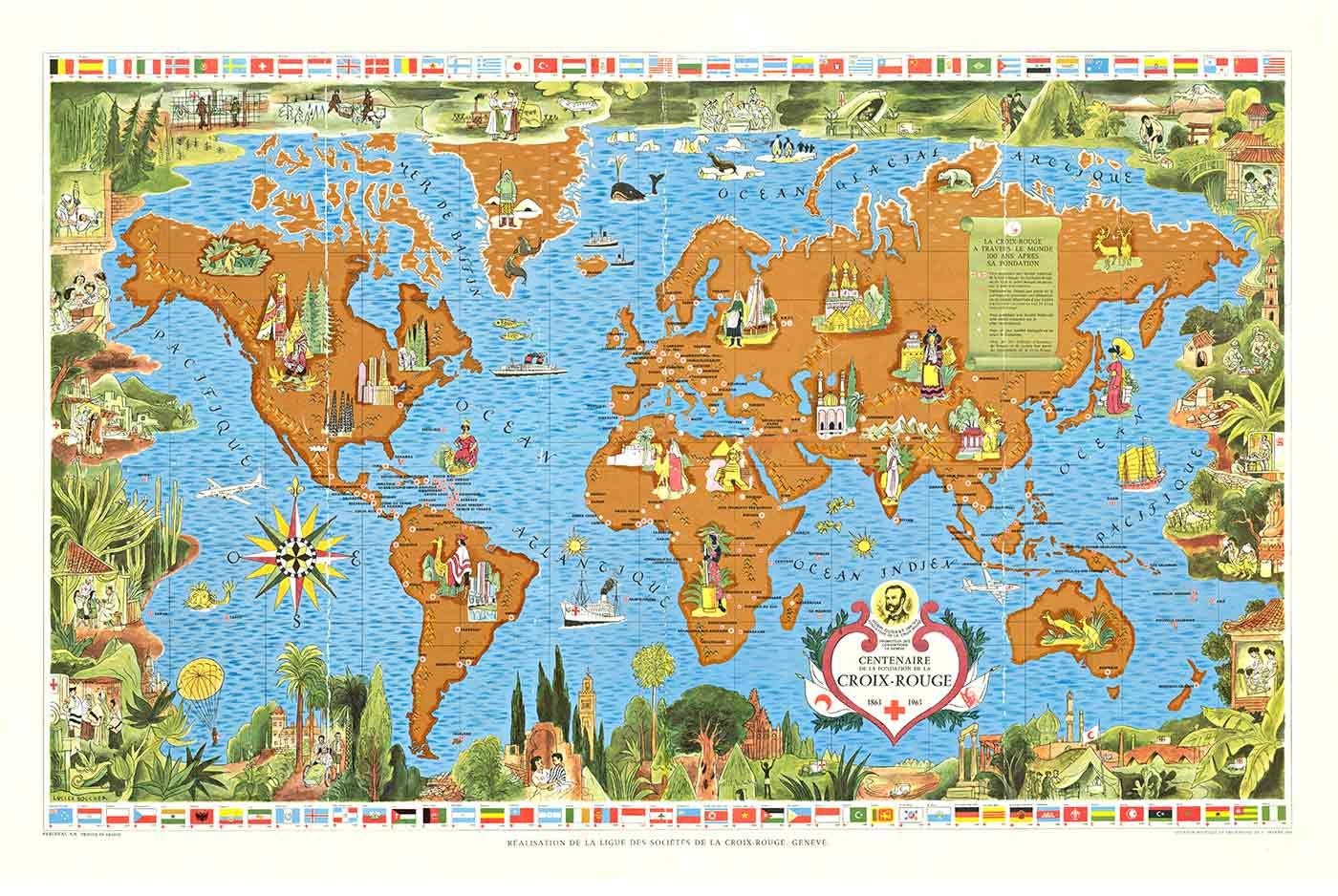
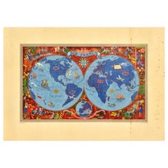
Original 100 Years of the Red Cross World Map vintage planisphere poster
By Lucien Boucher
Located in Spokane, WA
This is a vintage poster titled "Realisation de la Ligue de la Croix-Rouge, Geneva," commemorating one hundred years of the Red Cross from 1863 to 1963. Due to its folds, the poster ...
Category
1960s American Modern Landscape Prints
Materials
Lithograph
Italian Contemporary Handcolored Old Map Printed on Canvas "Planisphere Ethnics"
Located in Scandicci, Florence
Beautiful reproduction of an antique English map showing th Planisfere, with continets, views of important cities and their population, made in 1...
Category
21st Century and Contemporary Italian Prints
Materials
Cotton, Paper
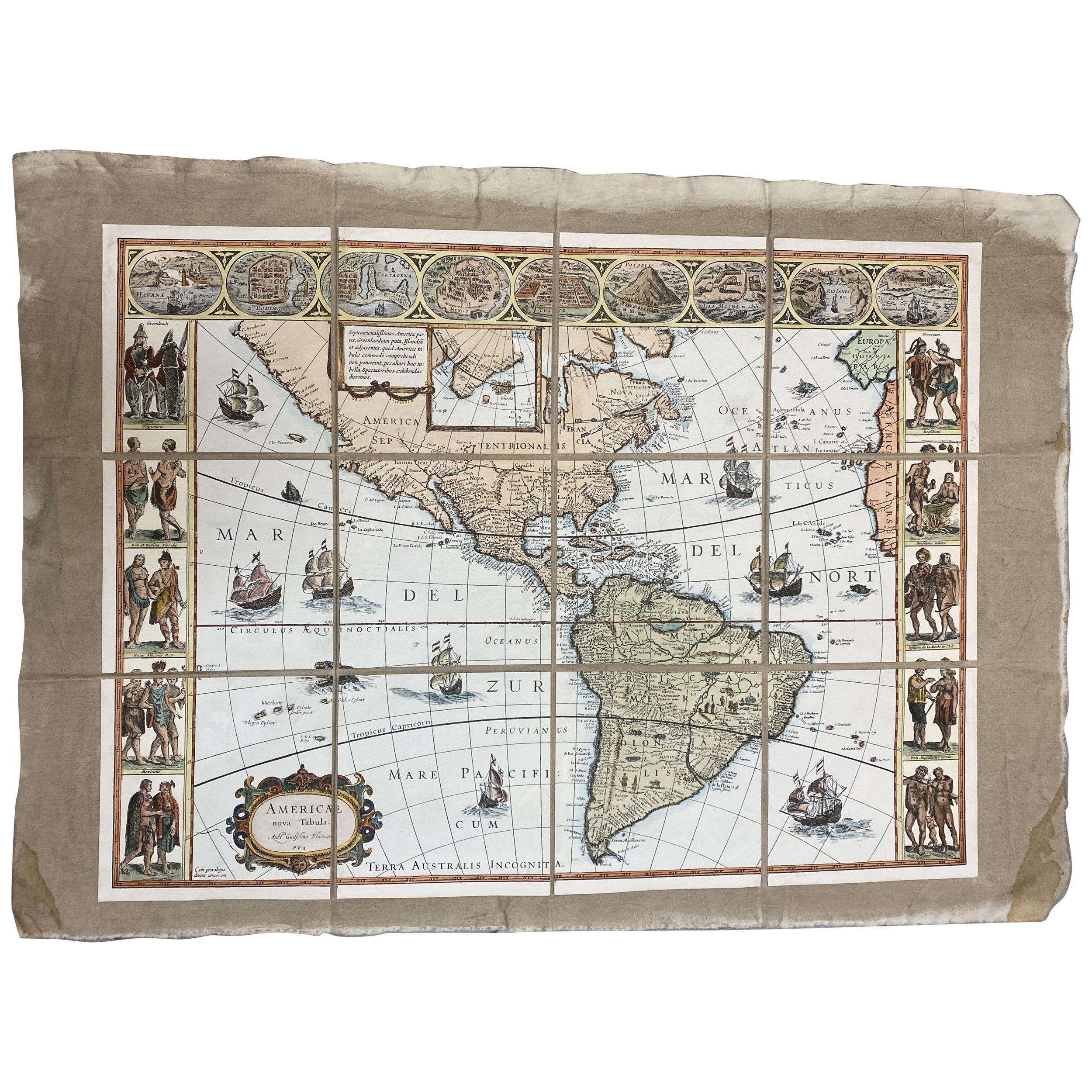
Italian Contemporary Handcolored Old Map Printed on Canvas "The Americas"
Located in Scandicci, Florence
Beautiful reproduction of an antique map showing th Planisfere, with continets, lands and their populations.
We can see with what mastery of joints and vivid colours the author depic...
Category
21st Century and Contemporary Italian Prints
Materials
Cotton, Paper
Antique World Map on Mercator's Projection, Ocean Currents and Trade Routes 1903
Located in Langweer, NL
Title: Antique World Map on Mercator's Projection, 1903, Showing Ocean Currents and Trade Routes
Description:
This antique map, titled "Chart of the World on Mercator's Projection,"...
Category
Early 20th Century Maps
Materials
Paper
Original Antique Hand-colored World Map with or without Frame, '1696'
Located in Langweer, NL
Antique world map titled 'Mappe-Monde dressee sur les Observations de Mrs. de l'Academie Royale des Sciences (..)'. Beautiful original antique world map...
Category
Antique Late 17th Century French Maps
Materials
Paper
