Items Similar to Antique Print of the Island of Gorée by Bellin, c.1748

Want more images or videos?
Request additional images or videos from the seller
1 of 5
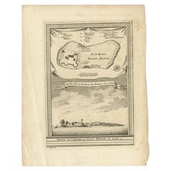
Antique Print of the Island of Gorée by Bellin, c.1748
$69.90
$87.3720% Off
£51.56
£64.4520% Off
€58.40
€7320% Off
CA$96.85
CA$121.0620% Off
A$105.16
A$131.4420% Off
CHF 55.69
CHF 69.6120% Off
MX$1,288.91
MX$1,611.1420% Off
NOK 689.16
NOK 861.4520% Off
SEK 651.22
SEK 814.0220% Off
DKK 444.59
DKK 555.7420% Off
About the Item
Antique print Africa titled 'Vue de la Rade de l'Ile de Gorée'. Antique print depicting the island of Gorée, Senegal.
Artists and Engravers: Jacques-Nicolas Bellin (1703-1772) was a French hydrographer, geographer and member of The Philosophes. His career, spanning over 50 years, caused an enormous output in maps, particular of maritime interest.
Condition: Very good, please study image carefully.
Date: c.1748
Overall size: 20 x 25 cm.
Image size: 14 x 19 cm.
Whilst cartography holds a special place in our collection, we also offer thousands of antique prints covering fields of interest as diverse as architecture, natural history, religion, ethnology and many more. Antique prints have long been appreciated for both their aesthetic and investment value. They were the product of engraved, etched or lithographed plates. These plates were handmade out of wood or metal, which required an incredible level of skill, patience and craftsmanship. Whether you have a house with Victorian furniture or more contemporary decor an old engraving can enhance your living space. We offer a wide range of authentic antique prints for any budget.
- Creator:Jacques-Nicolas Bellin (Artist)
- Dimensions:Height: 9.85 in (25 cm)Width: 7.88 in (20 cm)Depth: 0 in (0.01 mm)
- Materials and Techniques:
- Period:
- Date of Manufacture:circa 1748
- Condition:
- Seller Location:Langweer, NL
- Reference Number:Seller: BG-094371stDibs: LU3054327828662
Jacques-Nicolas Bellin
Jacques Nicolas Bellin (1703 –1772) was a French hydrographer (official cartographer) and a geographer. While still a teenager he became the chief cartographer to the French Navy and later to the king of France. Bellin created a large number of maps for Antoine François Prévost's (L'Abbe Prevost) 'Histoire Generale des Voyages', which was a 25 volume publication focused on 17th and 18th century exploration.It was published in French, Dutch and German. He also contributed maps and articles to the 35-volume Encyclopédie edited by Denis Diderot and Jean le Rond d'Alembert. He was part of the group called Philosophes, which included many of the great intellectuals of the Age of Enlightenment, including Voltaire, Rousseau and Montesquieu. Bellin died at Versailles in 1772.
About the Seller
5.0
Recognized Seller
These prestigious sellers are industry leaders and represent the highest echelon for item quality and design.
Platinum Seller
Premium sellers with a 4.7+ rating and 24-hour response times
Established in 2009
1stDibs seller since 2017
2,623 sales on 1stDibs
Typical response time: <1 hour
- ShippingRetrieving quote...Shipping from: Langweer, Netherlands
- Return Policy
Authenticity Guarantee
In the unlikely event there’s an issue with an item’s authenticity, contact us within 1 year for a full refund. DetailsMoney-Back Guarantee
If your item is not as described, is damaged in transit, or does not arrive, contact us within 7 days for a full refund. Details24-Hour Cancellation
You have a 24-hour grace period in which to reconsider your purchase, with no questions asked.Vetted Professional Sellers
Our world-class sellers must adhere to strict standards for service and quality, maintaining the integrity of our listings.Price-Match Guarantee
If you find that a seller listed the same item for a lower price elsewhere, we’ll match it.Trusted Global Delivery
Our best-in-class carrier network provides specialized shipping options worldwide, including custom delivery.More From This Seller
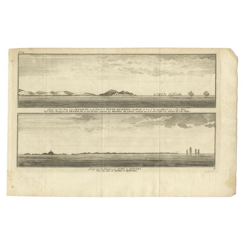
View AllAntique Print of Petatlan and Coiba Island, Near Mexico and Panama, 1749
Located in Langweer, NL
Antique print titled 'Vue de la Montagne de Petaplan, et des rochers nommés les Moines Blancs, restant au S.E. vers l'est a la distance de cinq milles' and Vue des Iles de Quibo et Q...
Category
Antique 18th Century Prints
Materials
Paper
$134 Sale Price
20% Off
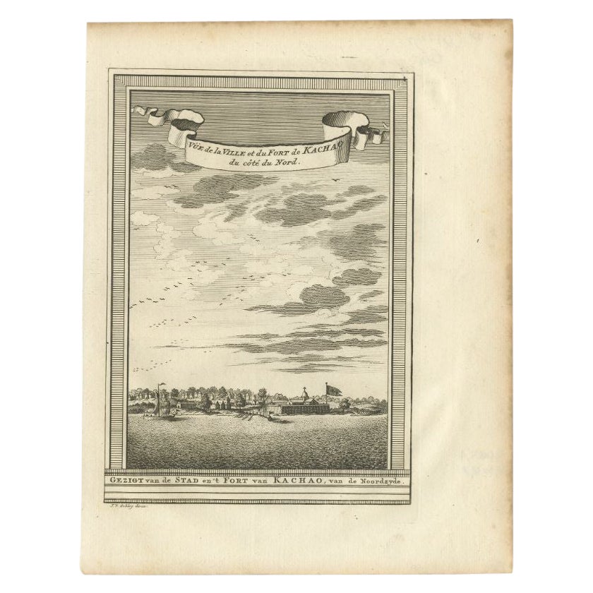
Antique Print of the City and Fortress of Kachao in Guinea Bissau, Africa, 1747
By Jakob van der Schley
Located in Langweer, NL
Antique print titled 'Gezigt van de Stad en 't Fort van Kachao'. View of the city and Fortress of Kachao, Guinea Bissau, Africa. Engraved by J. van Schley for a Dutch edition of 'l'H...
Category
Antique 18th Century Prints
Materials
Paper
$220 Sale Price
20% Off
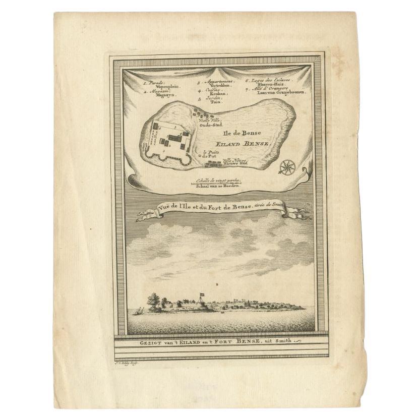
Antique Print of Bunce Island an Island in the Sierra Leone River, 1748
By Jakob van der Schley
Located in Langweer, NL
Antique print titled 'Vue de l'Ile et du Fort de Bense, tirée de Smith - Gezigt van 't Eiland en 't Fort Bense, uit Smith'. This print depicts Bunce Island, an island in the Sierra L...
Category
Antique 18th Century Prints
Materials
Paper
$210 Sale Price
20% Off
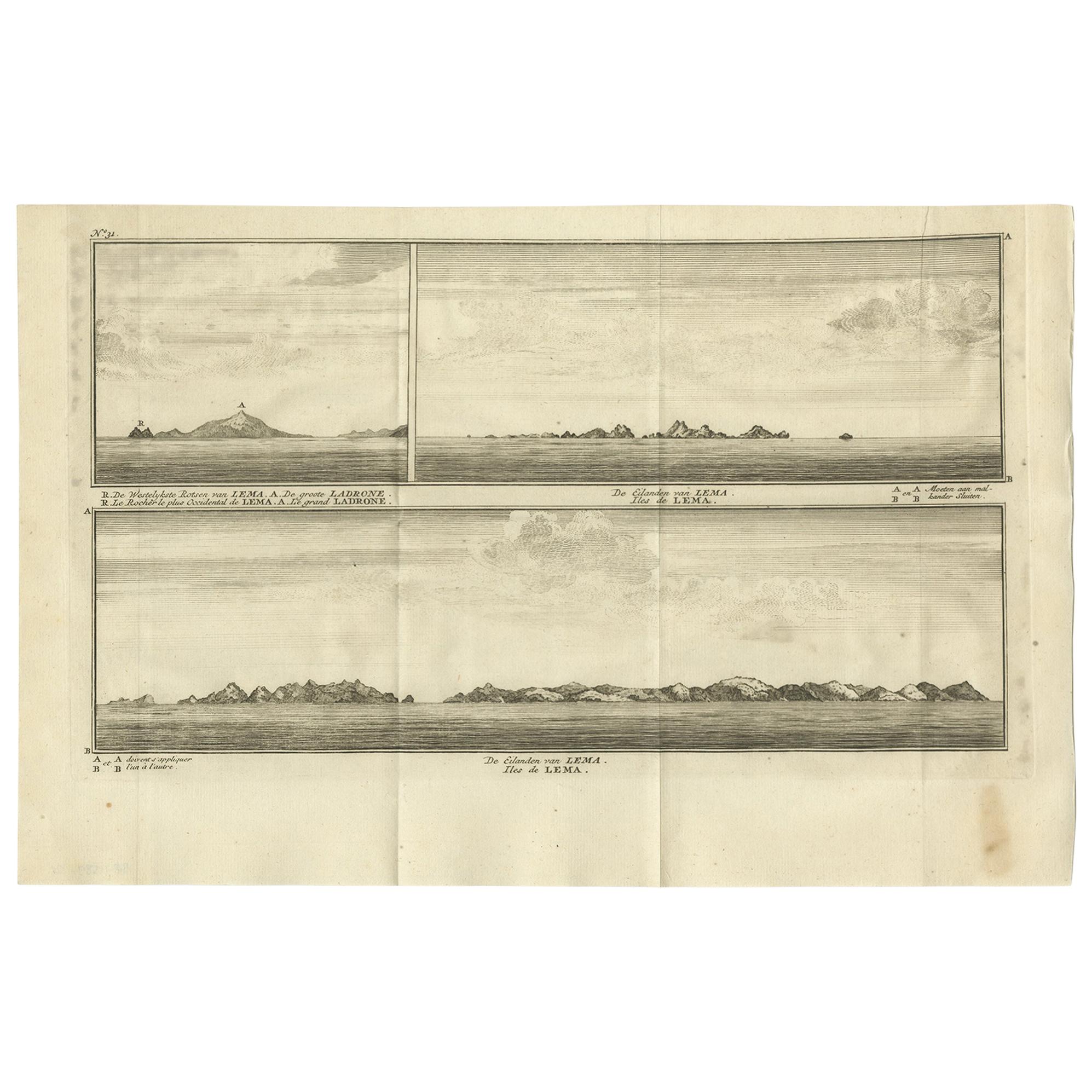
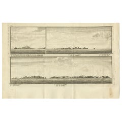
Antique Print with Views of the Lema Islands by Anson '1749'
Located in Langweer, NL
Antique print titled 'Iles de Lema (..)'. Various views of the Lema Islands, part of the Wanshan Archipelago, formerly known as the Ladrones Islands, part of Xiangzhou District in Zh...
Category
Antique Mid-18th Century Prints
Materials
Paper
$191 Sale Price
46% Off
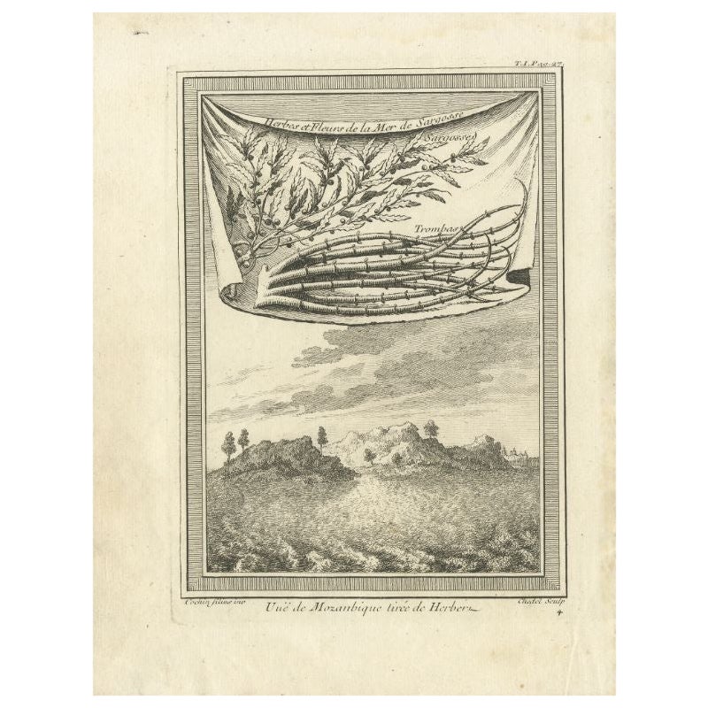
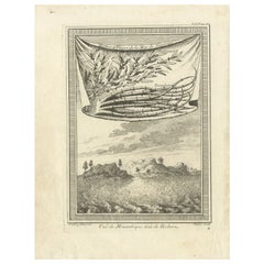
Antique Print of Mozambique and the Sargasso Sea, Africa, circa 1746
Located in Langweer, NL
Antique print titled 'Vue de Mozanbique tirée de Herbert'. Copper engraving with a view on Mozambique. Also shows herbs and flowers of the Sargasso Sea. This print originates from 'H...
Category
Antique 18th Century Prints
Materials
Paper
$105 Sale Price
20% Off
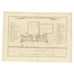
Antique Print of Fort St. Louis Near the Senegal River, circa 1747
By Jacques-Nicolas Bellin
Located in Langweer, NL
Antique print titled 'Plan du Fort St. Louis dans l'Isle de Sanaga ou du Senegal'. Old print with a plan of Fort St. Louis near the Senegal River. This print orginates from 'Histoire...
Category
Antique 18th Century Prints
Materials
Paper
$277 Sale Price
20% Off
You May Also Like
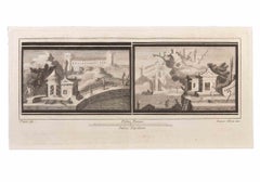
Engraving Print from the Panckoucke Encyclopédie Nautical Subject, 1782-1832
Located in Milan, IT
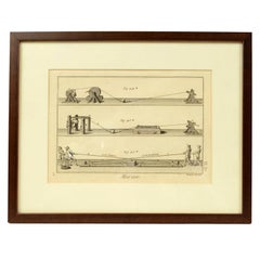
Print by engraving on copper plate from the Panckoucke Encyclopédie méthodique, end of the 18th century, volume Marine Planches (more than 1,500 figures dealing with all subjects on the marina: planes, construction, carpentry, tree trunks, armaments of maneuvers, ropes, sails, artillery, ship maneuvers and combat tactics). This is the plate no. n. 26, pag. 70 fig. 350-353; with frame cm 38.3 x 31.5. Ship ropes are depicted. The Print has the "Benard direxit...
Category
Antique 1790s French Nautical Objects
Materials
Paper
Engraving Print from the Panckoucke Encyclopédie Nautical Subject 1782-1832
Located in Milan, IT
Print by engraving on copper plate from the Panckoucke Encyclopédie méthodique, end of the 18th century, volume Marine Planches (more than 1,500 figures dealing with all subjects on ...
Category
Antique 1790s French Nautical Objects
Materials
Paper
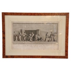
Seascape with Monument and Figures - Etching by F. Cepparuli - 18th Century
By Francesco Cepparuli
Located in Roma, IT
Seascape With Monuments is an Etching realized by Francesco Cepparuli (1750-1767).
The etching belongs to the print suite “Antiquities of Herculaneum Exposed” (original title: “Le A...
Category
Late 18th Century Old Masters Figurative Prints
Materials
Etching
Engraving Print from the Panckoucke Encyclopédie Nautical Subject 1782-1832
Located in Milan, IT
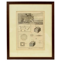
Print by engraving on copper plate from the Panckoucke Encyclopédie méthodique, end of the 18th century,volume Marine Planches (more than 1,500 figures dealing with all subjects on the marina: planes, construction, carpentry, tree trunks, armaments of maneuvers, ropes, sails, artillery, ship maneuvers and combat tactics). This is the plate no. n. 24, pag. 69 fig. 341 ; with frame cm 38.3 x 31.5. Ship ropes are depicted. The Print has the "Benard direxit...
Category
Antique 1790s French Nautical Objects
Materials
Paper
18th Century Antique Etching Print by Alessandro Mochetti
Located in Casale Monferrato, IT
Beautiful 18th century antique etching print with in walnut briar frame. Was etching by Alessandro Mochetti (1760 - 1812) was an Italian engrave...
Category
Antique 1780s Italian Prints
Materials
Paper
$1,723 Sale Price
20% Off
Seascapes with Monuments and Figures - Etching by Luigi Aloja - 18th Century
Located in Roma, IT
Seascapes With Monuments and Figures is an Etching realized by Luigi Aloja (1783-1837).
The etching belongs to the print suite “Antiquities of Herculaneum Exposed” (original title:...
Category
Late 18th Century Old Masters Figurative Prints
Materials
Etching
More Ways To Browse
Antique Primitive Box
Antique Soap Dish
Antique Wood Furniture Casters
Antique Wrought Iron Table Base
Antique Yemen
Aragon Spain
Astrology Furniture
Atelier Linne
Banana Silk
Banjo Glass
Bed End Tables
Biomorphic Glass Bowl
Black Asian Stool
Black Forest Bear Stand
Bleached Mahogany Chest
Bleached Wood Commode
Bonnet Top Furniture
Boulder Furniture