Items Similar to Old Print of the Sand Dollar and Other Sea Urchins, c.1829
Want more images or videos?
Request additional images or videos from the seller
1 of 5
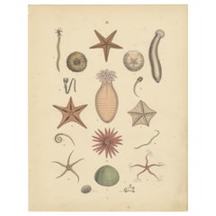
Old Print of the Sand Dollar and Other Sea Urchins, c.1829
$179.34
£132.77
€150
CA$248.16
A$273.60
CHF 143.14
MX$3,356.52
NOK 1,801.81
SEK 1,684.98
DKK 1,142.61
About the Item
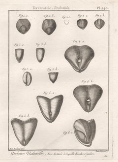
Antique print titled '1. Echinus verticillatus 2. Echinoneus semilunaris (..)'.
Old print of the sand dollar and other sea urchins. This print originates from 'Iconographie du règne animal de G. Cuvier' by F.E. Guérin-Méneville. Published between 1829 and 1844.
Artists and Engravers: Felix Edouard Guérin-Méneville (1799 - 1874) was a French entomologist.
- Dimensions:Height: 11.82 in (30 cm)Width: 8.27 in (21 cm)Depth: 0 in (0.02 mm)
- Materials and Techniques:
- Period:
- Date of Manufacture:circa 1829
- Condition:Condition: Good, image trimmed and mounted. General age-related toning, please study image carefully.
- Seller Location:Langweer, NL
- Reference Number:Seller: BG-12209-48 1stDibs: LU3054327424882
About the Seller
5.0
Recognized Seller
These prestigious sellers are industry leaders and represent the highest echelon for item quality and design.
Platinum Seller
Premium sellers with a 4.7+ rating and 24-hour response times
Established in 2009
1stDibs seller since 2017
2,609 sales on 1stDibs
Typical response time: <1 hour
- ShippingRetrieving quote...Shipping from: Langweer, Netherlands
- Return Policy
Authenticity Guarantee
In the unlikely event there’s an issue with an item’s authenticity, contact us within 1 year for a full refund. DetailsMoney-Back Guarantee
If your item is not as described, is damaged in transit, or does not arrive, contact us within 7 days for a full refund. Details24-Hour Cancellation
You have a 24-hour grace period in which to reconsider your purchase, with no questions asked.Vetted Professional Sellers
Our world-class sellers must adhere to strict standards for service and quality, maintaining the integrity of our listings.Price-Match Guarantee
If you find that a seller listed the same item for a lower price elsewhere, we’ll match it.Trusted Global Delivery
Our best-in-class carrier network provides specialized shipping options worldwide, including custom delivery.More From This Seller
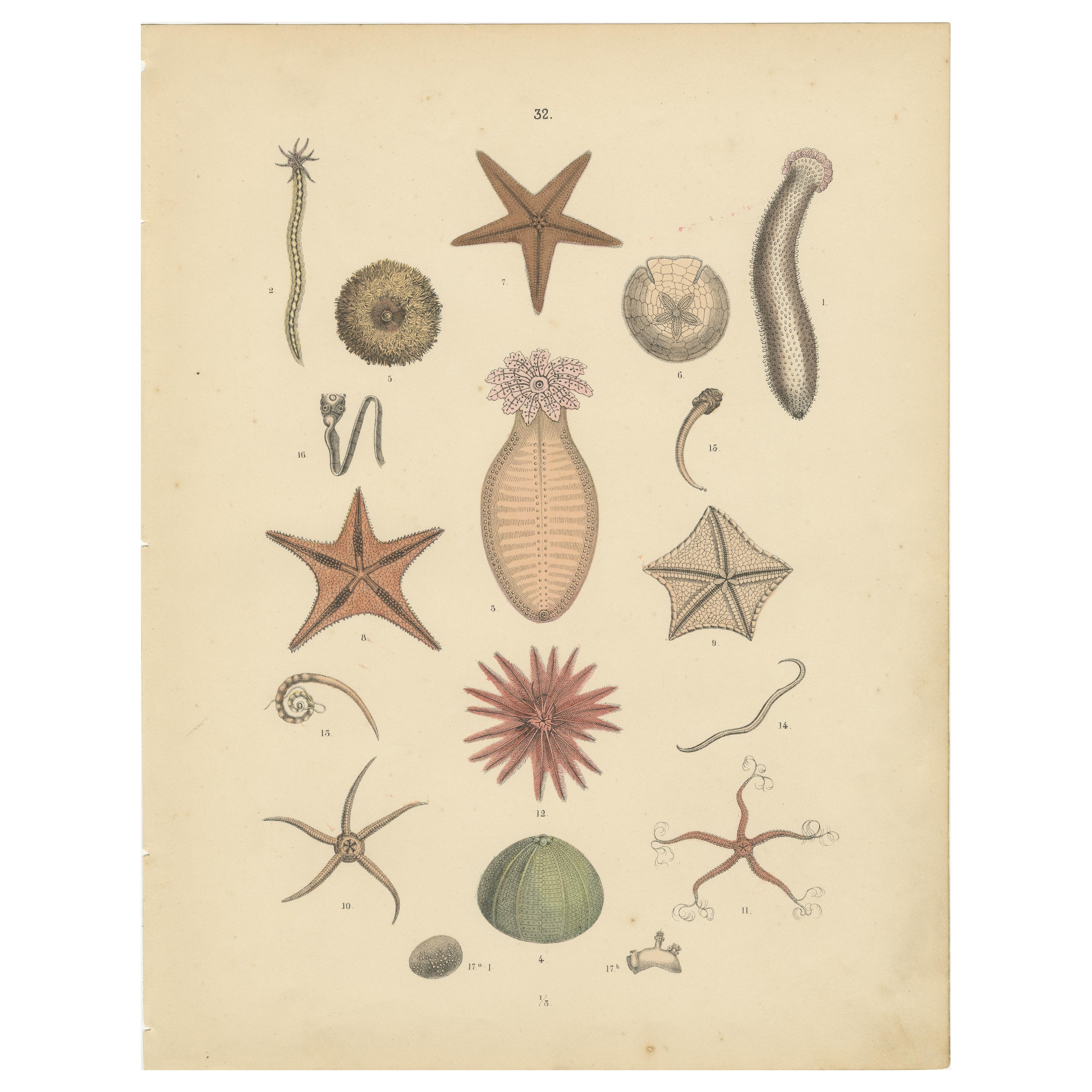
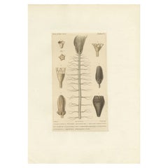
View AllEchinoderms Print: Starfish, Sea Urchins, Brittle Stars, Sea Cucumbers – 1867
Located in Langweer, NL
Echinoderms Print: Starfish, Sea Urchins, Brittle Stars, Sea Cucumbers – Antique 1867
This captivating antique print depicts a variety of echinoderms, including starfish, sea urchin...
Category
Antique 1860s German Prints
Materials
Paper
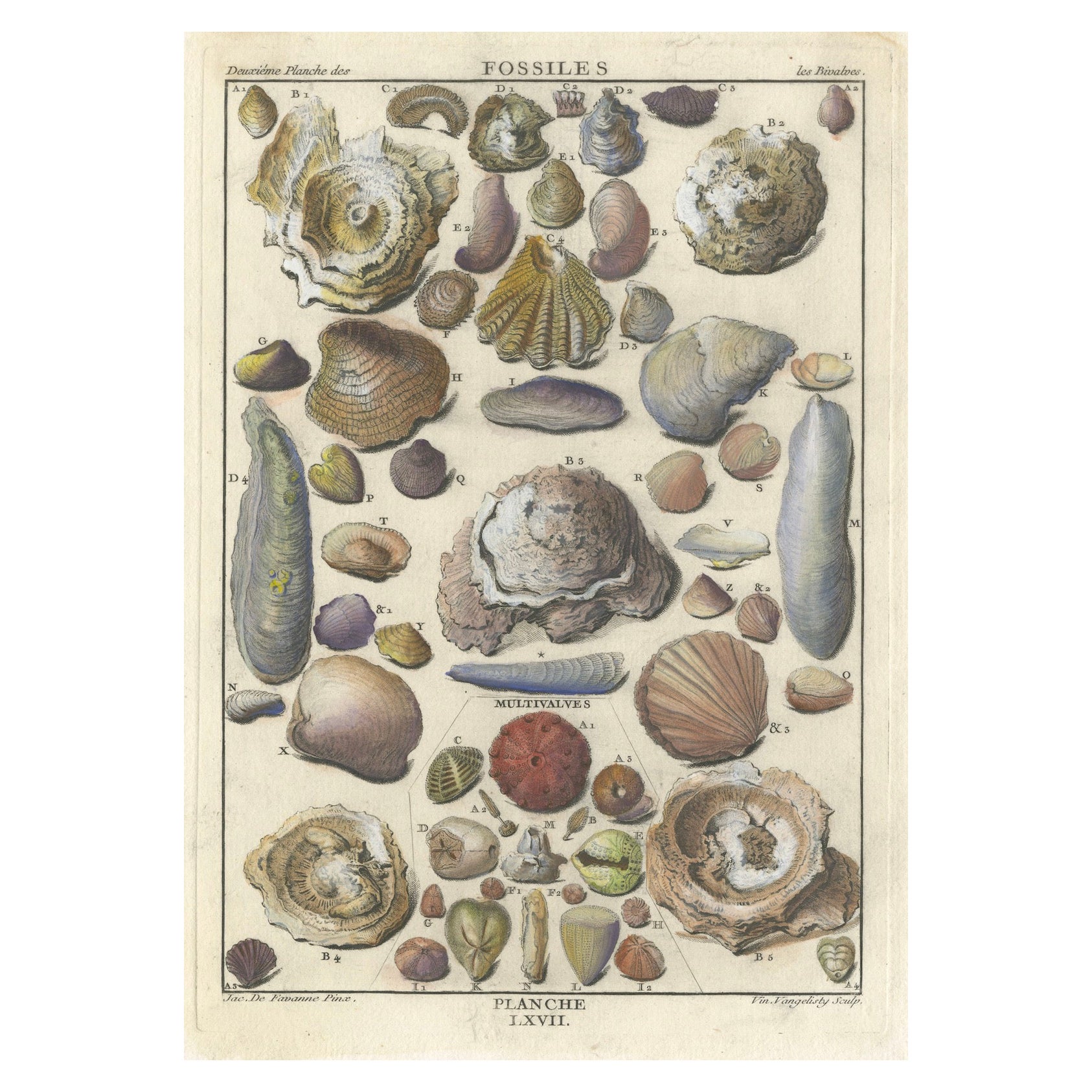
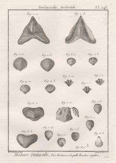
Antique Fossil Engraving - Multivalves and Marine Fossils - Plate LXVII, ca.1760
Located in Langweer, NL
Title: "Antique Fossil Engraving - Multivalves and Marine Fossils - Plate LXVII"
Description: This antique engraving is a detailed illustration o...
Category
Antique 1760s Prints
Materials
Paper

$229 Sale Price
20% Off
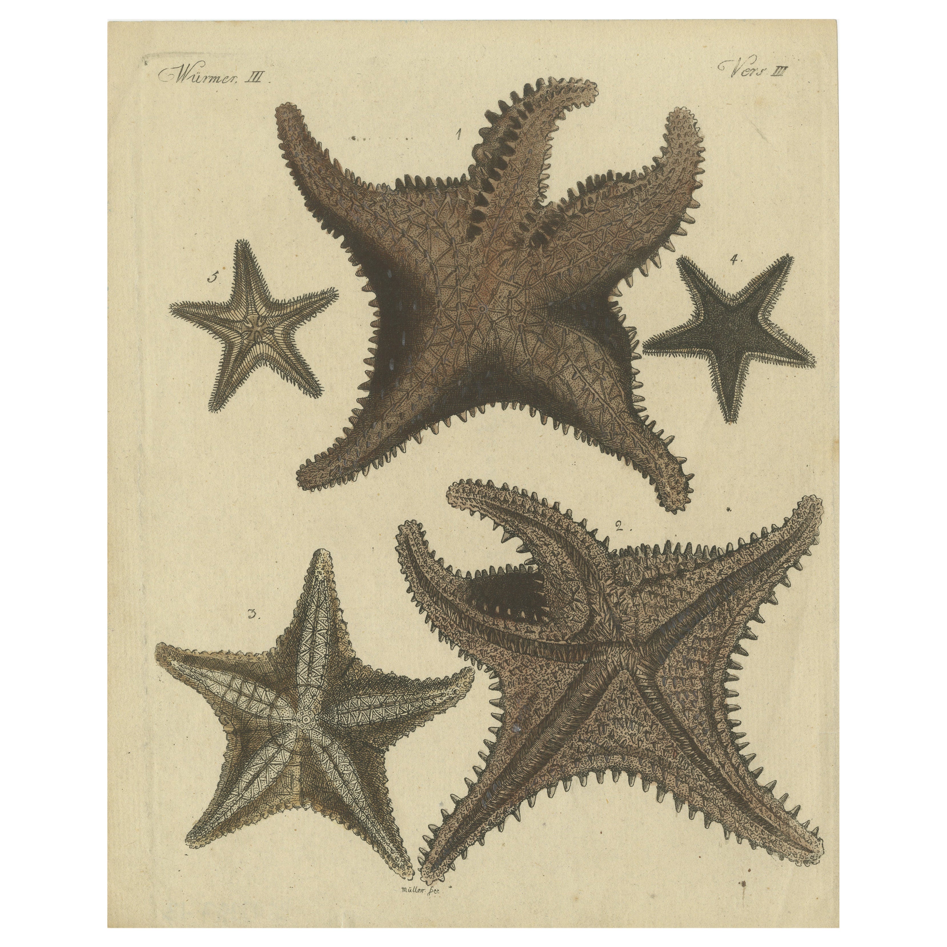
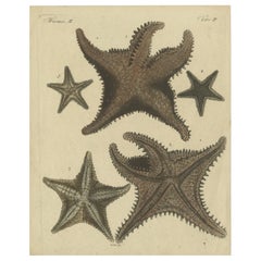
Antique Handcolored Engraving of Starfish and Marine Creatures, c.1800
Located in Langweer, NL
Antique Handcolored Engraving of Starfish and Marine Creatures, c.1800
This original handcolored copperplate engraving features various starfish and other echinoderms, emphasizing...
Category
Antique Early 1800s Prints
Materials
Paper
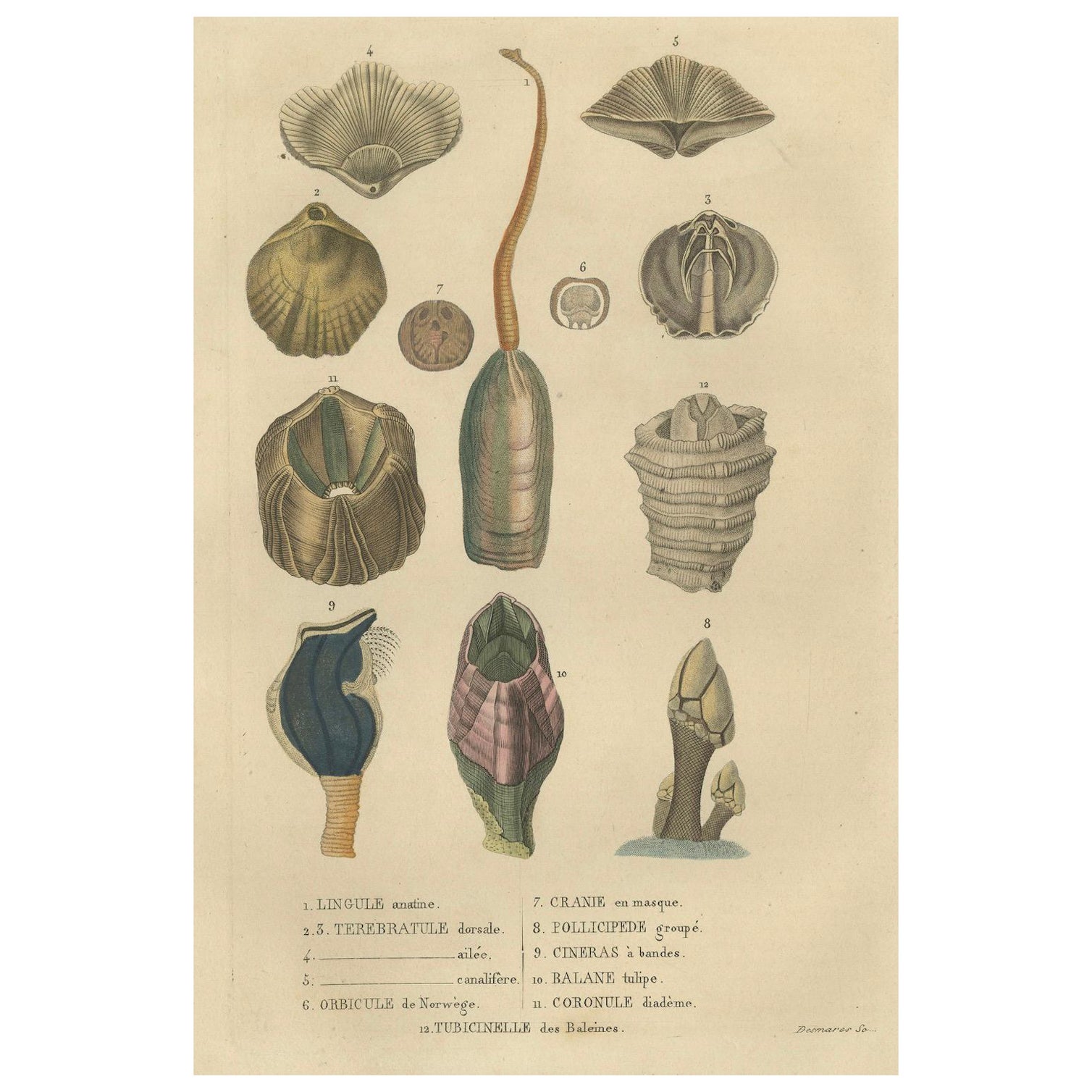
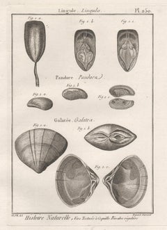
Marine Curiosities: An Assortment of Shells and Sea Life, 1845
Located in Langweer, NL
The illustration, an original hand-colored engraving, features a collection of shells and marine organisms, likely from various classes of the phylum Mollusca:
1. **Lingule anatine...
Category
Antique 1840s Prints
Materials
Paper
$267 Sale Price
20% Off
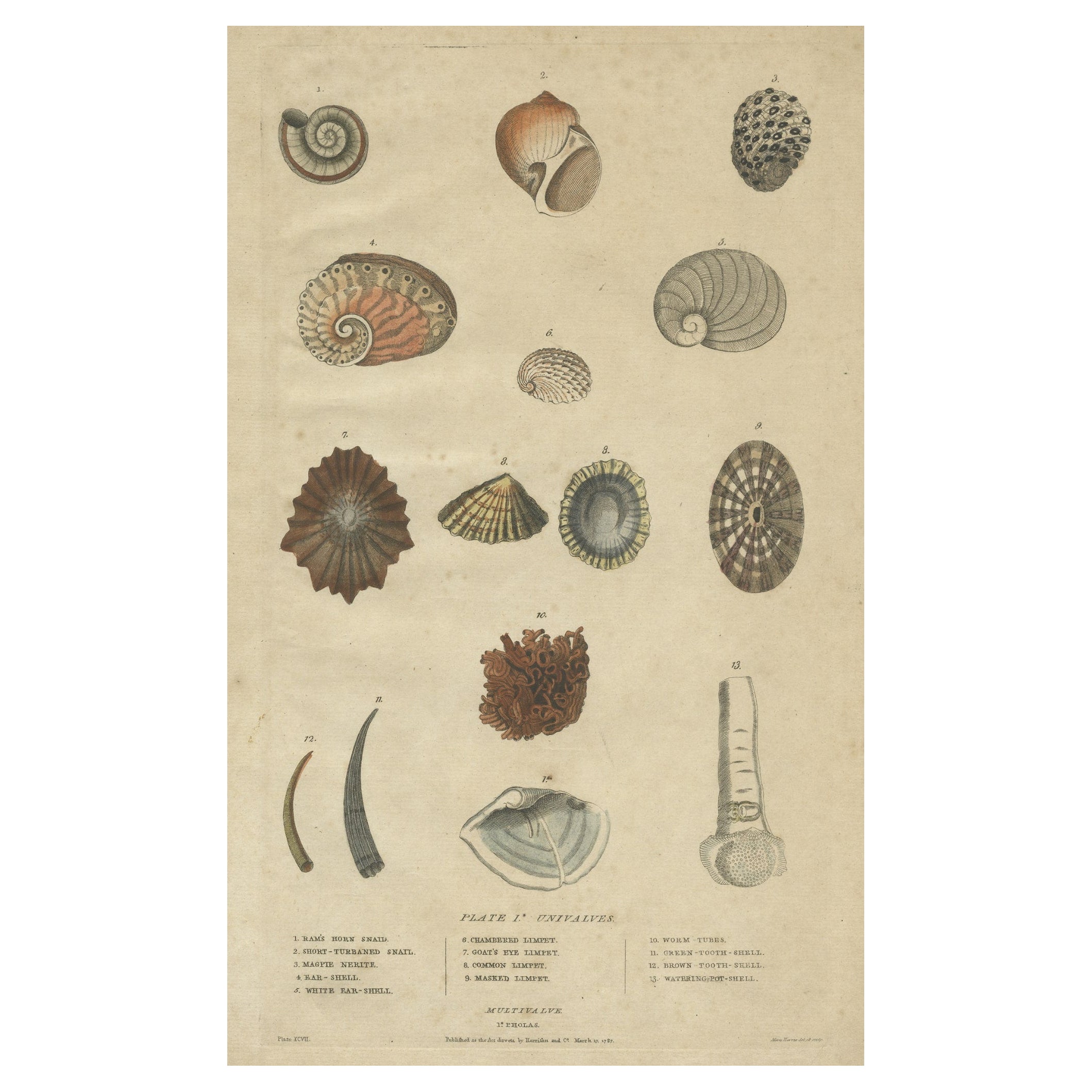
Old Print of Univalve 'Gastropod' Species; Ear Shells, Limpets, Etc., 1787
Located in Langweer, NL
Antique print titled 'Univalves'. Old print of various Univalve (Gastropod) species; Ear shells, Limpets, Tooth shells, Nerite etc.
This antique print originates from William Fre...
Category
Antique 1780s Prints
Materials
Paper

$153 Sale Price
20% Off
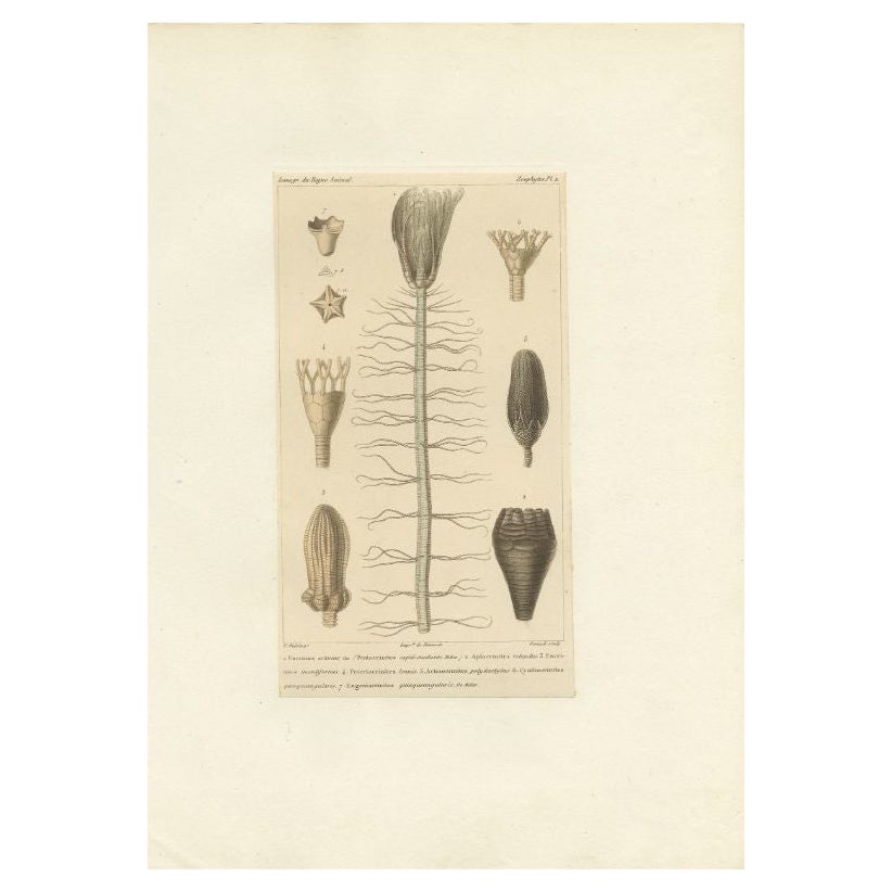
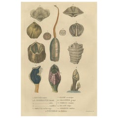
Antique Print of Fossils and Other Marine Life by Guérin, c.1829
Located in Langweer, NL
Antique print titled '1. Enerinus asterias 2. Apiocrinites rotundus (..)'. Old print of fossils and other marine life. This print originates from 'Iconographie du règne animal de G. ...
Category
Antique 19th Century Prints
Materials
Paper
$86 Sale Price
20% Off
You May Also Like
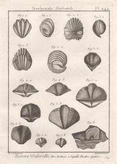
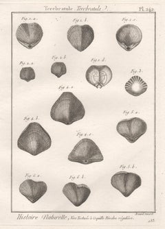
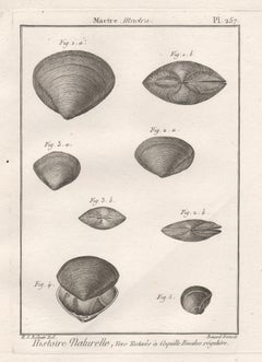
Shells, French 18th century natural history marine sea shell engraving
Located in Melbourne, Victoria
18th century natural history engraving depicting shells by Robert Benard after Henry Joseph Redoute.
Henry Redoute was the bro...
Category
Late 18th Century Victorian More Prints
Materials
Engraving
Shells, French 18th century natural history marine sea shell engraving
Located in Melbourne, Victoria
18th century natural history engraving depicting shells by Robert Benard after Henry Joseph Redoute.
Henry Redoute was the brother of the great botanical artist Pierre Joseph Redout...
Category
Late 18th Century Victorian More Prints
Materials
Engraving
Shells, French 18th century natural history marine sea shell engraving
Located in Melbourne, Victoria
18th century natural history engraving depicting shells by Robert Benard after Henry Joseph Redoute.
Henry Redoute was the brother of the great botanical artist Pierre Joseph Redout...
Category
Late 18th Century Victorian More Prints
Materials
Engraving