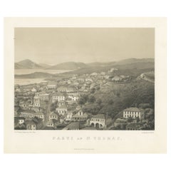
Saint Thomas of the United States Virgin Islands Original Lithograph Circa 1860
View Similar Items


Want more images or videos?
Request additional images or videos from the seller
1 of 6
Saint Thomas of the United States Virgin Islands Original Lithograph Circa 1860
Price:$450
$640.32List Price
About the Item
- Dimensions:Height: 11.42 in (29 cm)Width: 14.97 in (38 cm)Depth: 0 in (0.02 mm)
- Materials and Techniques:
- Period:
- Date of Manufacture:circa 1860
- Condition:Very good condition. Small defect in lower left corner, but outside the image, making this print ideal for framing. Study the image carefully.
- Seller Location:Langweer, NL
- Reference Number:Seller: BG-13619-61stDibs: LU3054337507552
About the Seller
5.0
Recognized Seller
These prestigious sellers are industry leaders and represent the highest echelon for item quality and design.
Platinum Seller
Premium sellers with a 4.7+ rating and 24-hour response times
Established in 2009
1stDibs seller since 2017
2,589 sales on 1stDibs
Authenticity Guarantee
In the unlikely event there’s an issue with an item’s authenticity, contact us within 1 year for a full refund. DetailsMoney-Back Guarantee
If your item is not as described, is damaged in transit, or does not arrive, contact us within 7 days for a full refund. Details24-Hour Cancellation
You have a 24-hour grace period in which to reconsider your purchase, with no questions asked.Vetted Professional Sellers
Our world-class sellers must adhere to strict standards for service and quality, maintaining the integrity of our listings.Price-Match Guarantee
If you find that a seller listed the same item for a lower price elsewhere, we’ll match it.Trusted Global Delivery
Our best-in-class carrier network provides specialized shipping options worldwide, including custom delivery.More From This Seller
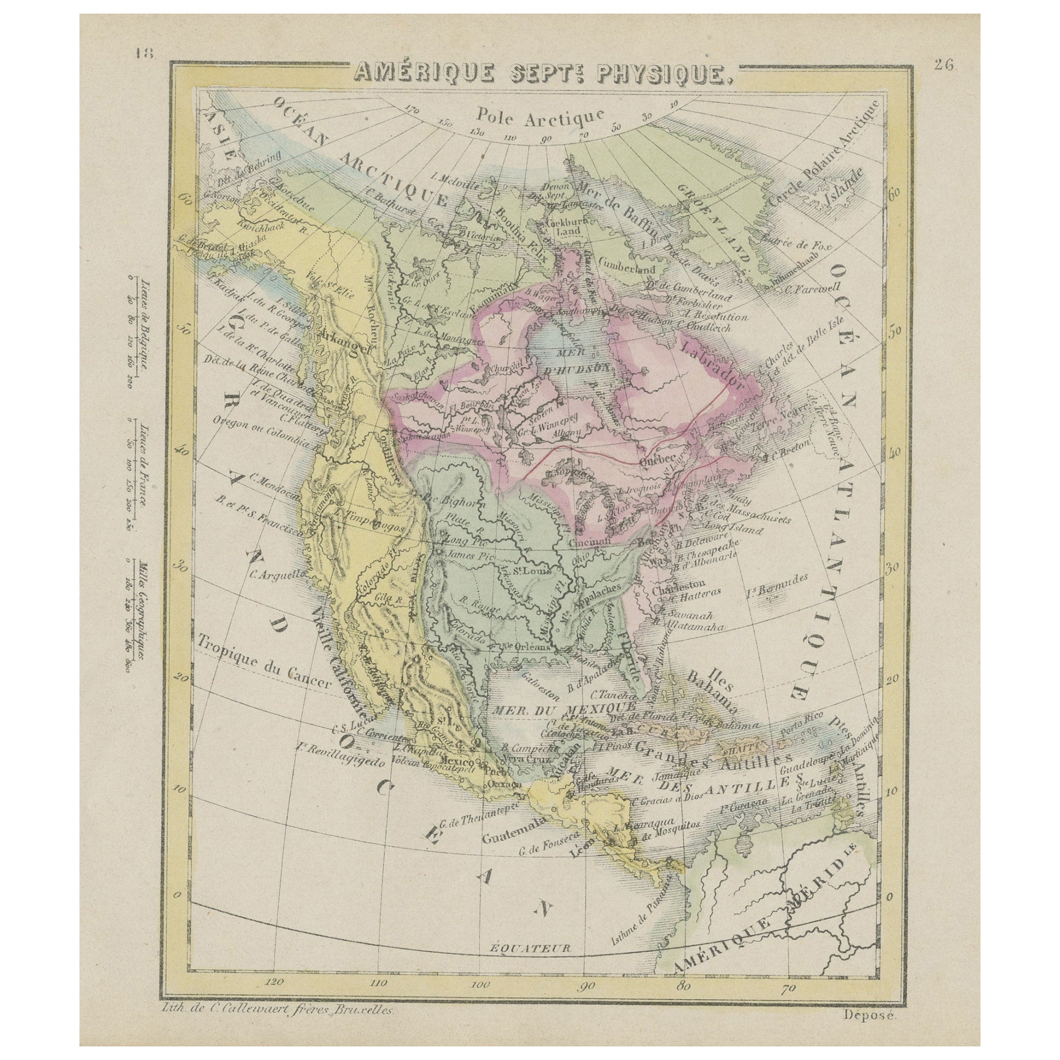
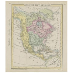
View AllSmall Map of the United States, circa 1870
Located in Langweer, NL
Antique map titled 'Amérique septe. Physique'. Small map of the United States. lithographed by C. Callewaert brothers in Brussels circa 1870.
Category
Antique Mid-19th Century Belgian Maps
Materials
Paper
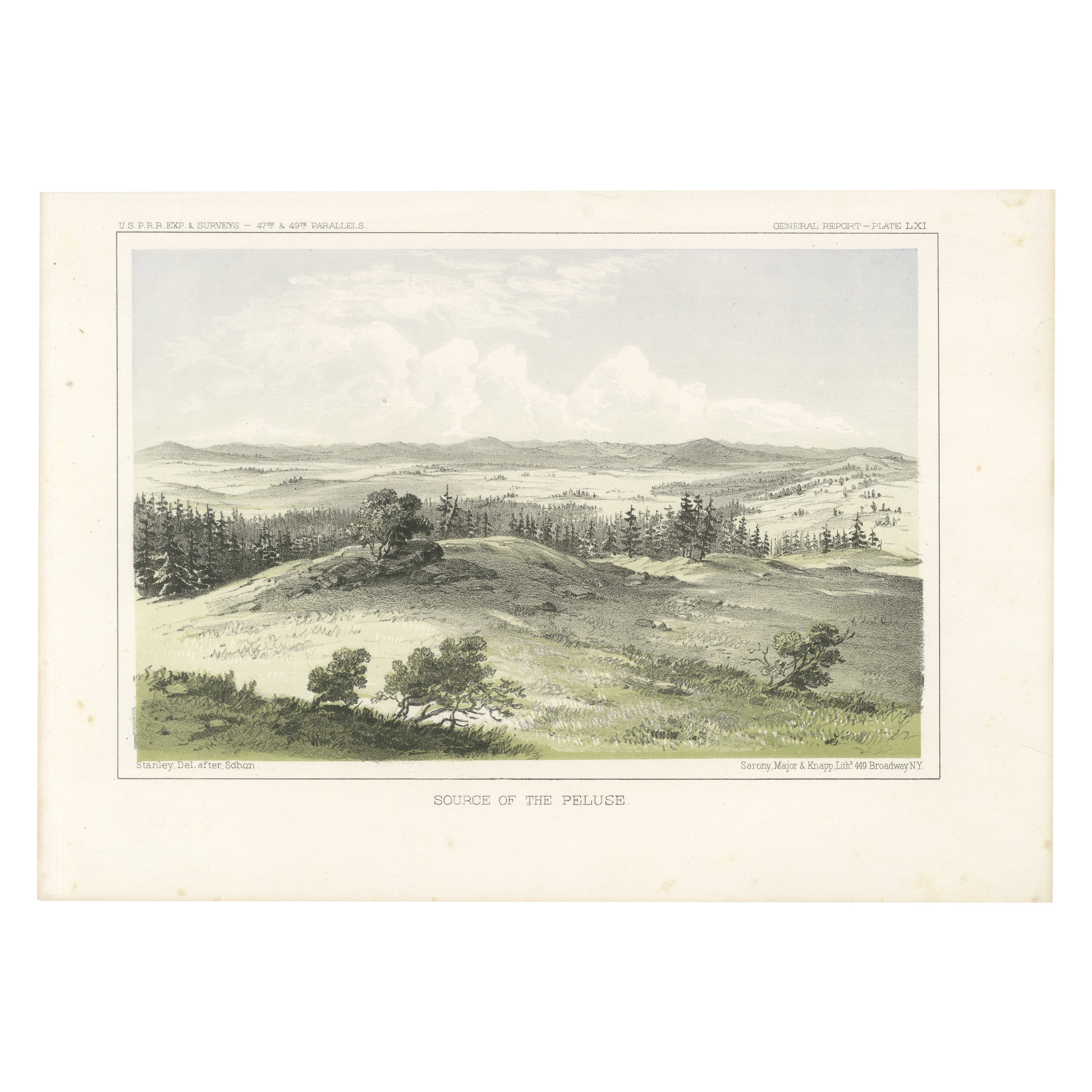
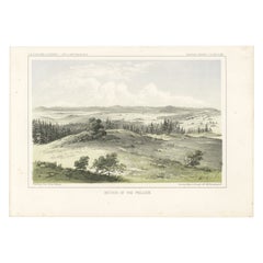
Scenic Lithograph of the Palouse Region in the Northwestern United States - 1856
Located in Langweer, NL
Title: Scenic View of the Palouse Region – A Rare 19th-Century Lithograph
This exceptional lithograph, titled "Source of the Peluse," offers a picturesque depiction of the Palouse r...
Category
Antique 1850s Prints
Materials
Paper
Old Decorative Pictorial Map of the United States, circa 1953
Located in Langweer, NL
Antique map titled 'A Pictorial Map of the United States of America Showing Principal Regional Resources, Products, and Natural Features'.
This information-packed map was create by the General Drafting Company for the New Jersey Bell Telephone Company. The main map features over 700 drawings in full color including points of interest, natural resources, and agricultural products. At bottom are inset maps showing railroad lines, air routes, telephone lines, as well as a pictorial map of New Jersey...
Category
20th Century Maps
Materials
Paper

$711 Sale Price
20% Off
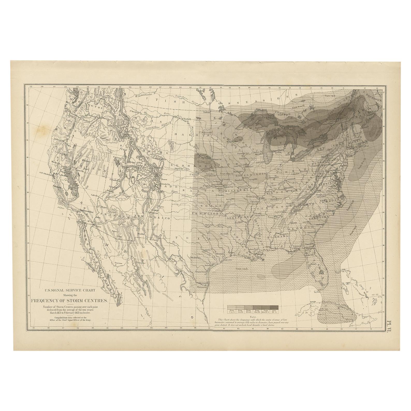
Antique Chart of the Storm Centres of the United States, 1874
Located in Langweer, NL
Antique chart titled 'U.S. Signal Service chart showing the frequency of storm centres. Number of storm centres passing over each point deduced from the average of the two years Marc...
Category
Antique Late 19th Century American Maps
Materials
Paper

$379 Sale Price
20% Off
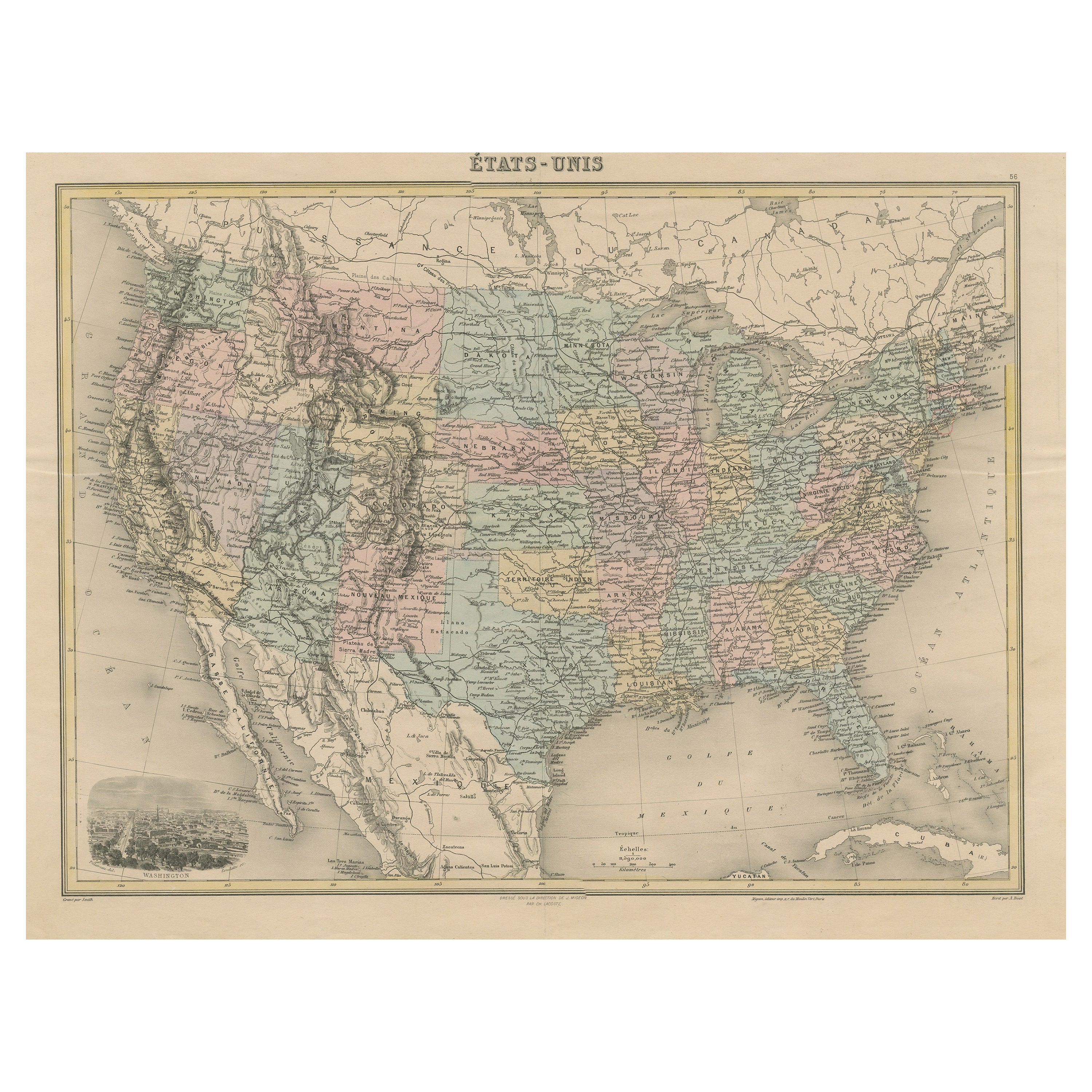
Antique Map of the United States by Balbi '1847'
Located in Langweer, NL
Antique map titled 'Etats-Unis'. Original antique map of the United States. This map originates from 'Abrégé de Géographie (..)' by Ad...
Category
Antique Mid-19th Century Maps
Materials
Paper

$189 Sale Price
20% Off
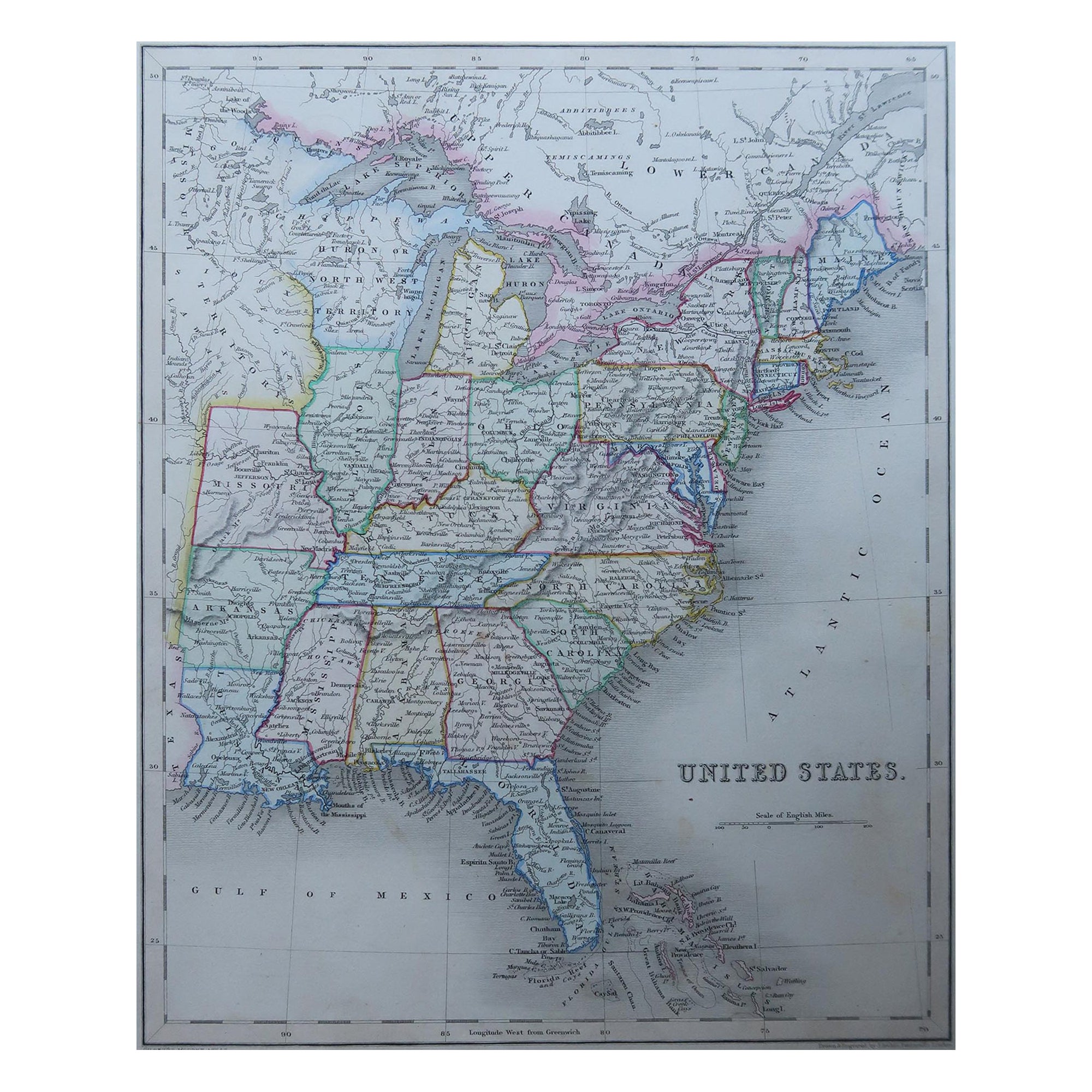
Antique Map of the United States by Titus '1871'
Located in Langweer, NL
Antique map titled 'The United States of America'. Original antique map of the United States. This map originates from 'Atlas of Prebl...
Category
Antique Late 19th Century Maps
Materials
Paper

$758 Sale Price
20% Off
You May Also Like
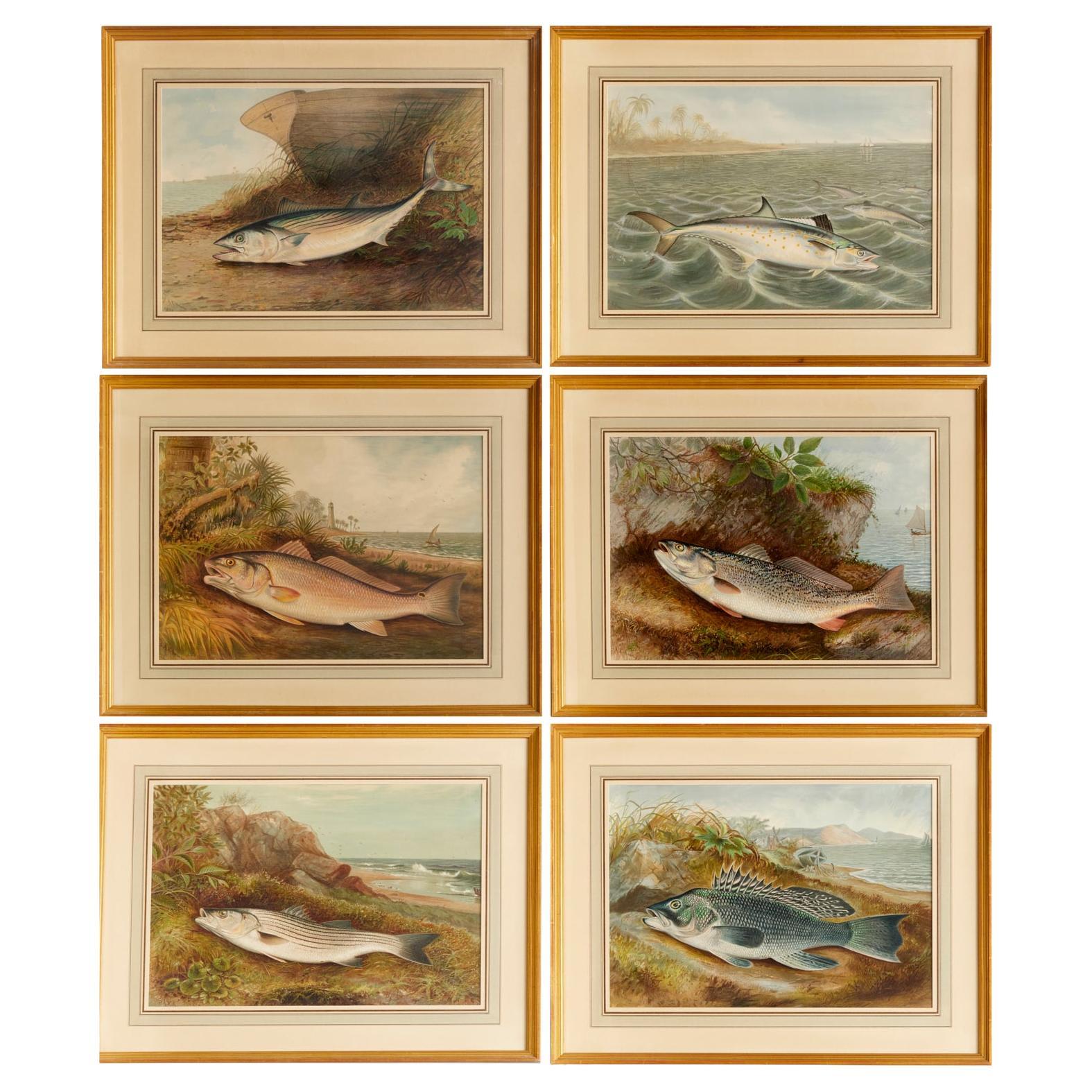
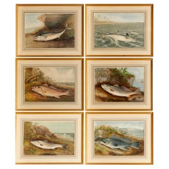
S. A. Kilbourne "Game Fishes of the United States" 6 Framed Chromolithographs
Located in Morristown, NJ
After Samuel A. Kilbourne (American, 1836-1881), "Game Fishes of the United States", uniformly matted and framed under glass.
Clockwise from upper left, The Mackerel, The Spanish Mackerel. The Weakfish, The Sea Bass...
Category
Vintage 1970s American American Classical Prints
Materials
Glass, Wood, Paper
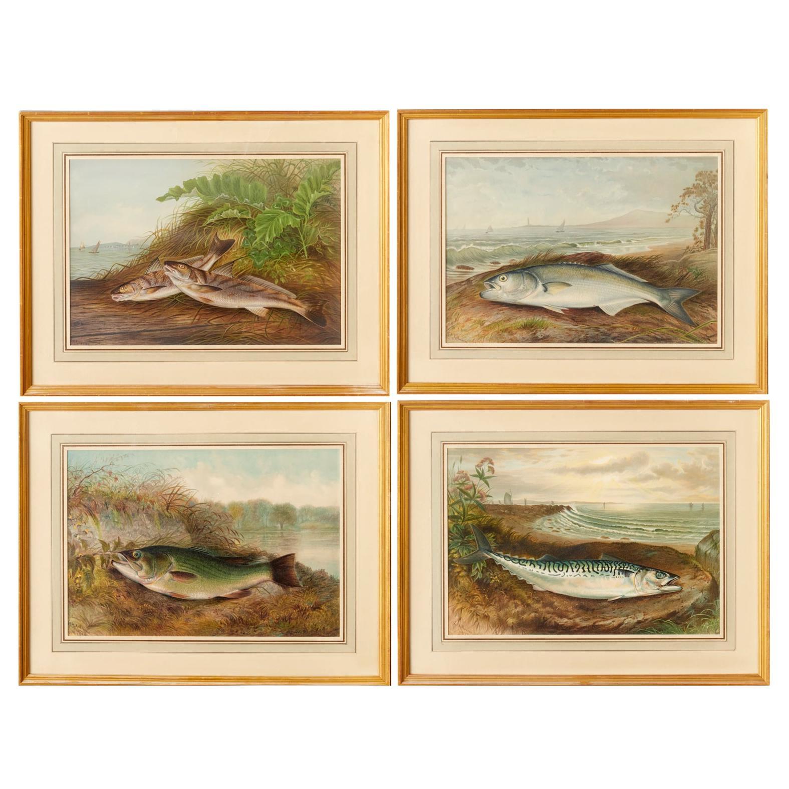
S. A. Kilbourne "Game Fishes of the United States" 4 Framed Chromolithographs
Located in Morristown, NJ
After Samuel A. Kilbourne (American, 1836-1881), "Game Fishes of the United States", uniformly matted and framed under glass.
Clockwise from upper left, The Kingfish and The Whitin...
Category
Vintage 1970s American American Classical Prints
Materials
Glass, Wood, Paper

Original Antique Map of United States, Grattan and Gilbert, 1843
Located in St Annes, Lancashire
Great map of United States
Drawn and engraved by Archer
Published by Grattan and Gilbert. 1843
Original colour
Unframed.
Category
Antique 1840s English Maps
Materials
Paper

1960 "The 50 United States of America" Pictorial Map by Lorin Thompson
Located in Colorado Springs, CO
This colorful map of the United States was drawn by Lorin Thompson and published by the General Foods Corporation in 1960. The map was issued as a promotional pamphlet in advance of the 1960 presidential election. The cover title for the pamphlet reads: "Election Map and 1960 Presidential Fact Sheet...Yours Free with Any Purchase of Gravy Train."
The map has a unique pictorial style with bright colors and dynamic illustrations celebrating key moments of American history. The map is illustrated with past presidents, Native Americans, depictions of the "Golden Spike...
Category
Vintage 1960s Mid-Century Modern Prints
Materials
Paper
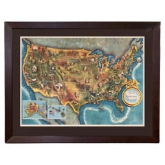
$1,750 Sale Price
22% Off
N.E. View of the United States Capitol, Washington, DC Antique Proof Print 1858
Located in Colorado Springs, CO
This engraved print shows a view of the United States Capitol Building, in Washington, D.C. The print depicts the neoclassical building from the northeast orientation, with a bustling street scene in front. The steel engraving is a proof printing, drawn and engraved by Henry Sartain and published in 1858.
Plans began in May 1854 to build a new cast-iron dome for the United States Capitol. The then-architect of the Capitol Thomas Walter and his team were sold on the aesthetics of a new dome, as well as the utility of a fire-proof one. A year later, on March 3, 1855, President Franklin Pierce...
Category
Antique 1850s American Prints
Materials
Paper

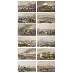
Set of 12 Original Antique Prints of the Crimean Wars, circa 1860
Located in St Annes, Lancashire
Great set of 12 military prints.
All related to the Crimean Wars.
Lithographs in original colors after William Simpson.
Published by P & D Colna...
Category
Antique 1830s English Other Prints
Materials
Paper
Recently Viewed
View AllMore Ways To Browse
Danish West Indies
French Velvet Bed
Fretwork Spandrels
Garden Tea Lantern
George Iii Teapot
Glass Haberdashery Cabinet
Greco Roman Rings
Green Bedside Cabinet
Green Italian Decanter
Hermes Horse Plate
Japanese 4 Panel Screen
King Wood Bed Frame Antique
Naga Wood
Oak Music Cabinet
Oggetti Art Glass
Old Antique Coffee Pot
Owl Figurine
Pair Of Swan Sculptures