Benelux
1
to
20
42
114
23
40,897
21,529
15,418
13,380
11,003
9,053
8,290
7,504
6,805
6,289
4,728
4,401
3,327
3,247
2,286
2,121
1,528
1,387
1,197
1,018
936
856
816
796
620
580
409
402
402
370
301
265
253
218
205
179
176
134
134
133
131
117
100
99
97
91
89
80
74
66
58
57
55
51
49
42
42
29
26
25
20
13
1
Period: 1640s
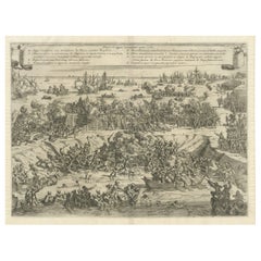
Siege and Struggle: The Kauwensteinse Dike in the Eighty Years' War, 1647
Located in Langweer, NL
Battle on the Kauwensteinse dike, 26 mai 1585, attack from the Staten army and ships from Sealand on the dike against the Spanish in the Eighty Years' War.
An original historical ar...
Category
1640s Antique Benelux
Materials
Paper
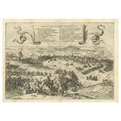
Old Engraving of The Battle of Bergen in Hainaut during the Eighty Years', 1632
Located in Langweer, NL
The print is a historical depiction of the Siege of Bergen (also known as Mons) in Hainaut in 1572, during the Eighty Years' War.
This event is significant as it involved Count Lou...
Category
1640s Antique Benelux
Materials
Paper
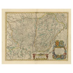
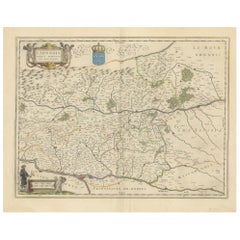
1644 Janssonius Original Wine Regions Map: The Ducal and Comital Burgundy
Located in Langweer, NL
This authentic handcolored map is a detailed 17th-century depiction of the Burgundy region, divided into the Duchy of Burgundy ("ducatus") and the County of Burgundy ("comitatus"), ...
Category
1640s Antique Benelux
Materials
Paper
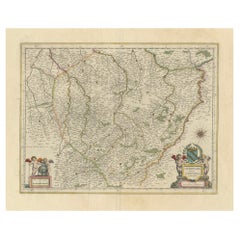
Authentic 1644 Janssonius Map of the Champagne Region (Campania) in France
Located in Langweer, NL
"1644 Janssonius Map of Champagne, France"
This meticulously detailed original antique map, engraved in 1644, is a work by the esteemed cartographer Johannes Janssonius. It depicts the historic province of Champagne, situated in the northeastern part of France. The map is notable for its high level of detail, with meticulously drawn boundaries, city markers, and river courses. It features a beautifully rendered cartouche adorned with the provincial coat of arms, flanked by classical figures, indicative of the region's cultural significance. In the lower left corner, a pair of cherubs are engaged in surveying, symbolizing the scientific endeavor of cartography. The elaborate compass rose and the scale bar further complement the map's utility and artistic merit.
Champagne is renowned globally for its viticultural heritage, being the birthplace of the eponymous Champagne sparkling wine. The region's unique terroir, with its chalky soil and cool climate, is ideal for the production of the grapes used in champagne-making. The historical significance of Champagne extends beyond winemaking; it has been the site of pivotal battles and royal coronations, which shaped the course of French and European history. This map is not only a navigational tool but also a snapshot of a region rich in history and tradition, an artifact that embodies the geographical and cultural prestige of Champagne.
This description provides a detailed visual and contextual presentation of the map, suitable for a catalog entry, emphasizing both its artistic features and the historical and cultural importance of the Champagne region.
THE WINE AREAS:
The Champagne region, known primarily for its production of the sparkling wine that bears its name, encompasses several important cities and sites of historical and cultural significance:
1. **Reims**: Often considered the unofficial capital of the Champagne region, Reims is renowned for its grand cathedral, Notre-Dame de Reims, where French kings were historically crowned...
Category
1640s Antique Benelux
Materials
Paper
Lyonnais, Beaujolais, Forez, Mâconnais: A 1644 Depiction of France's Provinces
Located in Langweer, NL
An original antique map from 1644, depicting the French provinces of Lyonnais, Beaujolais, Forez, and Mâconnais. In this map, north is oriented to the right, which is a cartographic ...
Category
1640s Antique Benelux
Materials
Paper
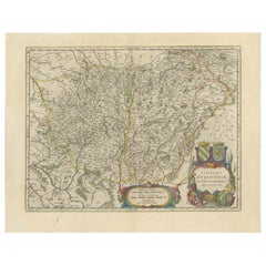
Burgundy's Viticultural Landscape: A 1640 Cartographic Engraving by Willem Blaeu
Located in Langweer, NL
An hand-colored original antique map with the title "Utriusque Burgundiae tum Ducatus tum Comitatus Descriptio," which translates to "A Description of Both Burgundies, both the Duchy...
Category
1640s Antique Benelux
Materials
Paper
Copper Engraving by Merian of The Battle Fleet off Constantinople, 1646
Located in Langweer, NL
An engraving by Matthäus Merian senior depicting the "Sea battle of the Venetians against the Turks in the Dardanelles" from 1646 . It presents a dramatic and detailed scene capturi...
Category
1640s Antique Benelux
Materials
Paper
Dutch Luther Bible with fine hand-coloured and highlighted in gold illustrations
By Claes Jansz. Visscher (II)
Located in ZWIJNDRECHT, NL
Beautifully bound mid-17th-century "Visscher edition" of the Dutch Luther Bible with expertly hand-coloured and highlighted in gold illustrations.
[BIBLE - LUTHER - DUTCH]. VISSCHER...
Category
1640s Dutch Dutch Colonial Antique Benelux
Materials
Gold
Copper Engraving of The Dutch and Austrian Netherlands Handcolored, 1772
Located in Langweer, NL
This antique map, a rare hand-colored engraved piece by E.A. Philippe de Pretot, showcases intricate detailing and vibrant colors. The dimensions of the map measure approximately 33 ...
Category
1640s Antique Benelux
Materials
Paper
1940 Art Deco Whiten Oak, Marble and Brass Sideboard
Located in Mouscron, WHT
1940 Art Deco whiten oak, marble and brass sideboard.
Finely sculpted.
Set available: One dining room table and six chairs on the sa...
Category
1640s French Art Deco Antique Benelux
Materials
Marble, Bronze
Antique Map of the French Province Maine, Showing Le Mans, Alencon Etc., Ca1640
Located in Langweer, NL
Antique map titled 'Le Maine'.
Old map of the province of Maine, France. It shows the cities of Le Mans, Alencon and others. This map originates from a composite atlas.
Artis...
Category
1640s Antique Benelux
Materials
Paper
Decorative Map of the Maluku or Moluccas or Spice Islands, Indonesia, Ca.1640
Located in Langweer, NL
Antique map titled 'Moluccae Insulae Celeberrimae'.
Decorative map of the Maluku Islands, also known as the Moluccas or the Spice Islands. Inset of the island of Bachian (Batjan) in an elaborate frame as well as a Moluccan couple in the lower right corner in Europeanized native dress.
Artists and Engravers: Willem Janszoon Blaeu (1571-1638) was a prominent Dutch geographer and publisher. Born the son of a herring merchant, Blaeu chose not fish but mathematics and astronomy for his focus. He studied with the famous Danish astronomer Tycho Brahe...
Category
1640s Antique Benelux
Materials
Paper
Detailed Regional Antique Map of Northwestern France and Catholic Belgium, 1648
Located in Langweer, NL
Antique map titled 'Picardie et les Pays Bas Catholiques (..)'.
Detailed regional map of Northwestern France and Catholic Belgium, from an early edition of Sanson's Atlas.
Art...
Category
1640s Antique Benelux
Materials
Paper
Old Handcolored Antique Map of Pays De Caux in Normandy, France, ca.1640
Located in Langweer, NL
Antique map titled 'Le Pais de Caux'.
Old map of Pays de Caux, France. Pays de Caux is an area in Normandy occupying the greater part of the French département of Seine Maritime ...
Category
1640s Antique Benelux
Materials
Paper
Engraving of Dutch Attacking the Portuguese Fleet off Bantam, Indonesia, 1644
Located in Langweer, NL
Antique print titled 'Bantam'.
Copper engraving of the Dutch attack on the Portuguese fleet off Bantam in 1601 depicted as the victory of Admiral Wolfert Harmensz and his 5 ships over 30 Portuguese ships. The ships in the battle include the Sultan of Bantam’s war galleys (ghali); ocean-going craft with sails, oars and a prow battering ram built according to Mediterranean standards learnt from Portuguese renegades and Turkish shipwrights. They were built to allow them to shoot the large cannon...
Category
1640s Antique Benelux
Materials
Paper
Beautiful Rare Antique Map of the Holy Land, 1648
Located in Langweer, NL
Antique map Holy Land titled 'Perigrinatie ofte Veertich-Iarige Reyse, der kinderen Israels uyt Egipten, door de Roode-Zee; mitsgaders de Woestyne tot int Beloofde Landt Canaan, : met groote vlyt uyt verscheryden auctoren by een gestelt, uyt de H. Schrift gecorigeert, ende int licht gegeven'.
Beautiful and rare antique map of the Holy Land...
Category
1640s Antique Benelux
Materials
Paper
Extremele Rare, Original Miniature Map of Prussia, ca.1640
Located in Langweer, NL
Antique map titled 'Prussia'. Extremele rare, original miniature map of Prussia, a historically prominent German state that originated in 1525 with a du...
Category
1640s Antique Benelux
Materials
Paper
Original Map with Bird's-Eye View of Zutphen in the Netherlands by Blaeu, 1649
Located in Langweer, NL
Antique print, titled: 'Zutphen.' - Bird's-eye view plan of Zutphen in The Netherlands, with key to locations and coats of arms. Text in Dutch on verso. This plan originates from the famous city Atlas: 'Toneel der Steeden' published by Joan Blaeu...
Category
1640s Antique Benelux
Materials
Paper
Original Old Bird's-Eye View Plan of Sint-Winoksbergen or Bergen in France, 1649
Located in Langweer, NL
Antique map titled 'Berga Sti Winoci.' - Bird's-eye view plan of Sint-Winoksbergen in France, with key to locations and coats of arms. Text in Dutch on verso. This plan originates from the famous city Atlas: 'Toneel der Steeden' published by Joan Blaeu...
Category
1640s Antique Benelux
Materials
Paper
Decorative Map of the Spice Islands in the Mollucas, Indonesia, ca.1640
Located in Langweer, NL
Antique map titled 'Moluccae Insulae Celeberrimae'.
Decorative map of the Spice Islands. Inset of the Island of Bachian (Batjan) in an elaborate frame as well as a Moluccan couple in the lower right corner in Europeanized native dress.
Artists and Engravers: Willem Janszoon Blaeu (1571-1638) was a prominent Dutch geographer and publisher. Born the son of a herring merchant, Blaeu chose not fish but mathematics and astronomy for his focus. He studied with the famous Danish astronomer Tycho...
Category
1640s Antique Benelux
Materials
Paper
Original Antique Map of the City of Stavoren, Friesland, The Netherlands, 1649
Located in Langweer, NL
Antique map titled 'Staveren'. Original antique map of the city of Stavoren, Friesland, The Netherlands. This map originates from 'Toonneel der Steden van de Vereenighde Nederlanden'...
Category
1640s Antique Benelux
Materials
Paper
Antique Bird's-eye View Plan of Zierikzee in Zeeland, The Netherlands, 1649
Located in Langweer, NL
Antique print, titled: 'Zirizea.' - A bird's-eye view plan of Zierikzee in The Netherlands, with key to locations and coats of arms. After Matheo Rollando and Stephano Bellemo. Latin tekst on verso. From the city Atlas: 'Toneel der Steeden' published by Joan Blaeu...
Category
1640s Antique Benelux
Materials
Paper
Original Map of the Military Situation After the Dutch Blockade of Antwerp, 1648
Located in Langweer, NL
Antique map titled 'Tabula Castelli ad Sandflitam (..)'.
This map depicts the complex military situation that had developed after the Dutch blockade of Antwerp. All entrenchment'...
Category
1640s Antique Benelux
Materials
Paper
Original Antique Map of the City of Stavoren, Friesland, The Netherlands, 1649
Located in Langweer, NL
Antique map titled 'Staveren'. Original antique map of the city of Stavoren, Friesland, The Netherlands. This map originates from 'Toonneel der Steden van de Vereenighde Nederlanden'...
Category
1640s Antique Benelux
Materials
Paper
Decorative Antique Map of the Dutch Province of Noord-Brabant, ca.1640
Located in Langweer, NL
Antique map titled 'Quarta pars Brabantiae cujus Sylvaducis Willebordus vanderBurgt desrib'.
Highly detailed original antique map of the province of Noord-Brabant, the Netherlands. It shows the cities of 's-Hertogenbosch, Eindhoven and surroundings. Includes a decorative cartouche, 6 coats of arms, topped by winged cherubs and two larger coats of arms...
Category
1640s Antique Benelux
Materials
Paper
Original Old Bird's-eye View plan of Sneek, Friesland, The Netherlands, 1649
Located in Langweer, NL
Antique map titled: 'Sneeck.' Bird's-eye view plan of Sneek, Friesland, The Netherlands. Text in Latin on verso. This plan originates from the famous city Atlas: 'Toneel der Steeden'...
Category
1640s Antique Benelux
Materials
Paper
Antique Print of Harmonillus Turning into a Lemon Tree, 1646
Located in Langweer, NL
Antique print of Harmonillus turning into a lemon tree. This print originates from 'Hesperides, sive, De malorvm avreorvm cvltura et vsv libri quatuor' by Giovanni Battista Ferrari, published in 1646. This print is an illustration for the introduction by G.B. Ferraris book...
Category
1640s Antique Benelux
Materials
Paper
Beautiful Birds-Eye View of Nijmegen and the Waal River, the Netherlands, 1649
Located in Langweer, NL
Antique print titled 'Novio Magum'.
Two prints on one sheet. Beautiful birds-eye view of Nijmegen, the Netherlands. Lower print depicts a view of the Waal river and fort Knodsenb...
Category
1640s Antique Benelux
Materials
Paper
Map of Southeast Asia, Extending from India to Tibet & Japan to New Guinea, 1640
Located in Langweer, NL
Antique map titled 'India quae Orientalis dicitur et Insulae adiacentes'.
Map of Southeast Asia, extending from India to Tibet to Japan to New Guinea. This map is one of the firs...
Category
1640s Antique Benelux
Materials
Paper
Old Map by Blaeu of the City of Franeker, Friesland, The Netherlands, 1649
Located in Langweer, NL
Antique map titled 'Franekera'.
Old map of the city of Franeker, Friesland. Also shows two cartouches, coats of arms and legend. This map originates from a Latin edition of the t...
Category
1640s Antique Benelux
Materials
Paper
Original Blaeu Map of Southeast Asia from India to Tibet and Japan to New Guinea
Located in Langweer, NL
Antique map titled 'India quae Orientalis dicitur et Insulae Adiacentes'.
Beautiful map of Southeast Asia, extending from India to Tibet to Japan to New Guinea. It was the first po...
Category
1640s Antique Benelux
Materials
Paper
Old Original Portrait Depicting Matthias of Austria, Holy Roman Emperor, 1645
Located in Langweer, NL
Antique portrait titled 'Mathias'.
Old portrait depicting Matthias of Austria, Holy Roman Emperor. This print originates from 'Icones Imperatorv...
Category
1640s Antique Benelux
Materials
Paper
Old Original Handcoloured Map of the Former Province of Perche, France, ca.1640
Located in Langweer, NL
Antique map titled 'Perchensis Comitatus - La Perche compte'.
Old map of the former province of Perche, France. Until the French Revolution, Perche was bounded by four ancient te...
Category
1640s Antique Benelux
Materials
Paper
Decorative Bird's-Eye View Plan of Ieper or Ypres in Belgium, 1649
Located in Langweer, NL
Antique print, titled: 'Ypra.'
Bird's-eye view plan of Ieper / Ypres in Belgium. With key to locations and coats of arms. Text in Latin on verso. This plan originates from the famous city Atlas: 'Toneel der Steeden' published by Joan Blaeu...
Category
1640s Antique Benelux
Materials
Paper
Beautiful Bird's-Eye View Plan of Enkhuizen in The Netherlands by Blaeu, 1649
Located in Langweer, NL
Antique print, titled: 'Topograhpiae Enchusae.'
Bird's-eye view plan of Enkhuizen in The Netherlands, with key to locations and coats of arms. Text in Dutch on verso. This plan o...
Category
1640s Antique Benelux
Materials
Paper
Stunning Bird's-Eye View Plan of Hasselt by Blaeu in The Netherlands, 1649
Located in Langweer, NL
Antique print, titled: 'Hasselt.'
Bird's-eye view plan of Hasselt in The Netherlands. With key to locations and coats of arms. Text in Dutch on verso. This plan originates from the famous city Atlas: 'Toneel der Steeden' published by Joan Blaeu...
Category
1640s Antique Benelux
Materials
Paper
Rare Portrait of Magdalena Moon, Heroine of The Siege of Leiden in Holland, 1649
Located in Langweer, NL
Antique print, titled: 'Domicella Magdalena Moonsia'
Very rare half length portrait of Magdalena Moons. Magdalena Moonsia is known as the heroine of the city of Leiden (seen over...
Category
1640s Antique Benelux
Materials
Paper
Great Antique Bird's-Eye View Plan of Brielle by Blaeu in The Netherlands, 1649
Located in Langweer, NL
Antique print, titled: 'Briela.'
Bird's-eye view plan of Brielle in The Netherlands. With key to locations and coats of arms. Text in Dutch on verso. This plan originates from the famous city Atlas: 'Toneel der Steeden' published by Joan Blaeu...
Category
1640s Antique Benelux
Materials
Paper
Original Old Map of Leeuwarden, European Cultural Capital 2018, Holland, 1649
Located in Langweer, NL
Antique print, titled: 'Leoverdia.'
This map shows Leoverdia (Leeuwarden). Bird's-eye view plan of Leeuwarden in The Netherlands, with key to locations and coats of arms. Text in...
Category
1640s Antique Benelux
Materials
Paper
Very Rare Print of Franciscus Valdesius, Commander of the Spanish Troops, 1649
Located in Langweer, NL
Antique print, titled: 'Franciscus Valdesius, Hispani Dux exercitus' - Very rare half length portrait of Franciscus Valdesius ( Francis Valdez, Valdes or Baldes), printed in 1649. Fr...
Category
1640s Antique Benelux
Materials
Paper
Old Antique Map of the East Indies and Southeast Asia, ca.1644
Located in Langweer, NL
Antique map titled 'India quae Orientalis dicitur, et Insulae adiacentes'.
Old map of the East Indies and Southeast Asia showing the area between India in the West and parts of Japan, the Marianas and New Guinea/Australia in the East. This map is dedicated to D. Christophorus Thisius by Henricus...
Category
1640s Antique Benelux
Materials
Paper
Original Antique Hand-Colored Map of The East Indies and Southeast Asia, c.1644
Located in Langweer, NL
Antique map titled 'India quae Orientalis dicitur, et Insulae adiacentes'.
Old map of the East Indies and Southeast Asia showing the area between India in the West and parts of J...
Category
1640s Antique Benelux
Materials
Paper
