Europe
to
410
857
379
344,823
250,348
157,871
141,020
103,856
77,196
50,735
50,110
44,000
35,268
28,315
27,354
22,600
20,015
15,983
15,567
14,754
14,179
11,694
10,737
10,459
7,580
5,840
5,749
4,976
4,407
4,314
3,594
2,817
2,608
2,117
2,112
1,939
1,552
1,468
1,277
1,188
1,135
1,005
954
931
857
715
683
523
500
393
302
281
228
221
197
195
168
165
154
115
109
99
60
45
39
54
6
4
4
4
Period: Mid-17th Century
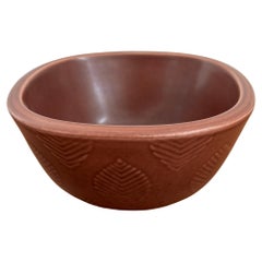
Nils Thorsson Scandinavian Marselis Ceramic Bowl for Royal Copenaghen, 1950s
By Royal Copenhagen, Nils Thorsson
Located in Reggio Emilia, IT
Danish ceramic “Marselis” vase bowl serie designed by Nils Thorsson for Royal Copenaghen, 1950s
Please note that the item is original of the period and this shows normal signs of ...
Category
1650s Danish Mid-Century Modern Antique Europe
Materials
Ceramic
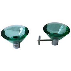
Flavio Poli Pair of Applique Murano Glass Seguso, Italy
By Seguso Vetri d'Arte, Flavio Poli
Located in Milan, Italy
A pair of applique designed by Flavio Poli for Seguso Murano, circa 1960, Italy.
Category
1660s Italian Modern Antique Europe
Materials
Murano Glass
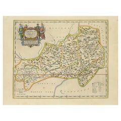
17th-Century Original Antique Map of Guangxi Province, China – Qvangsii by Blaeu
Located in Langweer, NL
Title: Antique 17th-Century Map of Guangxi Province, China – "Qvangsii" by Blaeu, Richly Illustrated and Colored
Description: This fascinating 17th-century map of Guangxi Province, historically referred to as "Qvangsii," was crafted by Johannes Blaeu and published in 1655 as part of the *Novus Atlas Sinensis*. Blaeu’s atlas, created in collaboration with Jesuit missionary Martino Martini, introduced European audiences to the geography of China in an unprecedented way. Guangxi Province, known for its striking karst landscapes and important historical trade routes, is depicted here in remarkable detail.
The map highlights the province’s topography, including mountain ranges, rivers, and towns, all meticulously engraved and labeled in Latin. It also captures key trade connections and cultural significance, as Guangxi historically served as a bridge between China and Southeast Asia. The decorative cartouche at the top left is adorned with figures in traditional Chinese costumes, symbolizing the cultural richness of the region and adding artistic elegance to the map.
This map was engraved using the copperplate technique, known for its ability to produce fine, detailed lines. The hand-coloring further enhances the visual impact, clearly distinguishing territorial divisions and natural features. Blaeu’s reputation for both accuracy and artistry is evident in this piece, making it a collector’s item of historical and aesthetic significance.
Guangxi Province, historically referred to as "Qvangsii," is renowned for its breathtaking natural beauty, unique karst landscapes, and cultural diversity. It is famous for its dramatic limestone formations, verdant hills, and picturesque rivers, making it one of the most visually striking regions in China. Guangxi has historically been a significant trade corridor between China and Southeast Asia, contributing to its cultural and economic importance. It is also home to various ethnic minority groups, including the Zhuang, Miao, and Dong, whose traditions and festivals enrich the region's cultural tapestry.
Important places in Guangxi include Guilin, known for its iconic karst mountains and the Li River, which has inspired poets and artists for centuries. Yangshuo, a town near Guilin, is celebrated for its stunning natural scenery and outdoor activities. Nanning, the provincial capital, is an important economic and cultural hub. The Longji Rice Terraces, also known as the Dragon’s Backbone, are an engineering marvel and a popular tourist destination. Beihai, a coastal city, is known for its silver beaches and maritime trade history.
Keywords for this map include 17th-century China map, Guangxi Province, Qvangsii map, antique Chinese maps...
Category
1650s Antique Europe
Materials
Paper
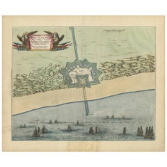
Antique Plan of Fort Mardyck Mardijk, France by S. Beaulieu, 1649
Located in Langweer, NL
Plan of Fort Mardyck (Fort Mardijk) and surroundings by Sébastian de Pontault Beaulieu. Mardyck is a former commune in the Nord department in northern France. It is an associated com...
Category
Mid-17th Century Antique Europe
Materials
Paper
Pair of Huge Original Circa 1660 Pierre Mignard '1612-1695' Copper Plate Prints
By Pierre Mignard
Located in West Sussex, Pulborough
We are delighted to offer this exquisite pair of extra large Burr Satinwood framed copper plate prints dating to circa 1660 by the genius that was Pierre Mignard...
Category
1660s English Charles II Antique Europe
Materials
Paper
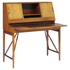
1950s Freestanding Lady's Desk, Frame with Oblique Stretchers
By Gustav Bertelsen
Located in London, GB
1950s Freestanding Lady's desk, frame with oblique stretchers. Front with two drawers, above pull-out writing leaf. Top with three drawers, room for storage and two cabinets, interi...
Category
1660s Danish Scandinavian Modern Antique Europe
Materials
Hardwood
Dutch Colonial 17th Century Ebony Center Table with Marble Top
Located in Amsterdam, NL
An Indonesian ebony centre table with marble top
Jakarta (Batavia) or Coromandel coast, 1650-1680
With shallow carvings of flowers and vi...
Category
Mid-17th Century Indian Dutch Colonial Antique Europe
Materials
Marble
1 of the 3 Murano Yellow Brown and Orange Glass Pendant Light, 1960s
By Doria Leuchten Germany
Located in Rijssen, NL
1 of the 3 Doria Leuchten globes (in collaboration with Murano) in the style of Venini, manufactured, circa 1960. Real statement piece.
High-end thick Murano crystal glass shades ma...
Category
1660s German Mid-Century Modern Antique Europe
Materials
Brass
Table Low Side Walnut Spanish Carved Flowerhead Seville Folk 19.5" high 79" long
Located in BUNGAY, SUFFOLK
- Rare small size, perfect height for sofa's and modern armchairs
- The thick single plank walnut top and crisp, stylised carving are characteristic of Spanish furniture
- This table...
Category
1660s Spanish Baroque Antique Europe
Materials
Walnut
Antique Map of the Duchy of Westphalia, Germany
Located in Langweer, NL
Original antique map titled 'Westphalia Ducatus'. Fine map of the Duchy of Westphalia, Germany. The map is centered on Meschede and includes Arensberg, Beelick, and Brilon. Published...
Category
Mid-17th Century Antique Europe
Materials
Paper
PAIR OF ANTIQUE 1640 CAQUETOIRE CARVED WALNUT POLYCHROME PAINTED ARMCHAIRs
Located in West Sussex, Pulborough
Royal House Antiques
Royal House Antiques is delighted to offer for sale this super rare pair of totally original 17th century circa 1640-1680 French Caquetoire armchairs with ornat...
Category
1640s French Charles II Antique Europe
Materials
Walnut
Portrait of a Young Woman
By Sir Peter Lely
Located in London, GB
Red chalk on paper
Image size: 7 1/2 x 9 1/4 inches (19 x 23.5 cm)
Contemporary frame
An enigmatic portrait of a young woman after Sir Peter Lely's drawing, currently shown in the B...
Category
Mid-17th Century Victorian Europe
Materials
Paper, Chalk
Pair of 17th Century Gate Finials in Limestone
Located in Wormelow, Herefordshire
Pair of limestone gate finials from Canterbury. Fine grain limestone carved belt around the middle. Well weathered, they were possibly column sections or ...
Category
Mid-17th Century Antique Europe
Materials
Limestone
Map of Le Maine by H. Hondius, 1633, Hand-Colored, Decorative and Historic
Located in Langweer, NL
Map of Le Maine by H. Hondius, 1633, Hand-Colored, Decorative and Historic
This rare and beautifully executed antique map titled 'Le Maine' was published in 1633 by Henricus Hondius...
Category
1630s Antique Europe
Materials
Paper
Italian School 17th Century Oil Painting The Musician
Located in Madrid, ES
Italian School 17th Century Oil Painting The Musician
Italian school 17th century oil painting the musician 17th century oil on canvas with a cos...
Category
Mid-17th Century Antique Europe
Materials
Wood
Large Antique Italian Gilt Frieze Mounted to Lamp or Non
Located in Alessandria, Piemonte
A large wooden frieze from 1600', arrived from who knows where, but purchased on the legal antiques market, blatanly gilded with leaf and mounted on a l...
Category
Mid-17th Century Italian Other Antique Europe
Materials
Fruitwood
Italian walnut bureau with writing surface, tuscan cabinetmaking, mid-1700s
Located in Chiavari, Liguria
A beautiful 18th-century Italian walnut bureau with writing surface, internal drawers, and hidden compartment – tuscan cabinetmaking, mid-1700s
Some pieces of furniture carry their ...
Category
Mid-17th Century Italian Directoire Antique Europe
Materials
Walnut
Nils Thorsson Scandinavian Marselis Ceramic Vase for Royal Copenaghen, 1950s
By Nils Thorsson, Royal Copenhagen
Located in Reggio Emilia, IT
Ceramic scandinavian vase serie “Marselis” designed by Danish artist Nils Thorsson for Royal Copenaghen, Denmark 1950s
Please note that the item is original of the period and this...
Category
1650s Danish Mid-Century Modern Antique Europe
Materials
Ceramic
Map of East Friesland, The Netherlands & the Area Emden & Norden, Germany, 1635
Located in Langweer, NL
Antique map titled 'Typus Frisiae Orientalis.'
Map of East Friesland and the area around Emden and Norden. Large inset map of the mouth of the Amasis River. The map is decorated with a large title cartouche and two large coats of arms...
Category
1630s Antique Europe
Materials
Paper
17th Century English School Portrait of Young Lady as Widow Jane Bromley
Located in Milano, MI
Reputed Portrait of Jane Bromley, as a Young Widow by British, English School, oil on canvas painting circa 1640/1650, in good condition, set in a modern frame. It comes from a priva...
Category
Mid-17th Century Italian Baroque Antique Europe
Materials
Canvas, Wood
The Flight of Sodom and Gomorrah - Entourage of Monsu-Desiderio
Located in Saint-Ouen, FR
Italian School 17th Century
Close to Monsu Desiderio
The Flight of Sodom and Gomorrah
Oil on canvas
Framed with Black wood and golden ornementation
Di...
Category
Mid-17th Century Academic Europe
Materials
Oil
Dutch Carved Blue and White Painted Limewood ‘Kwab’ Console or Side Table
Located in Baambrugge, NL
A Dutch carved blue and white painted limewood ‘kwab’ console or side table. Northern Netherlands, circa third quarter 17th century.
Console table with oblong white veined marble table...
Category
1660s Dutch Antique Europe
Materials
Marble
Wall rack, Czechoslovakia, 1960.
Located in Madrid, ES
Rack – wall shelf made of Formica and oak, with different accessories.
Category
1660s Czech Mid-Century Modern Antique Europe
Materials
Formica, Oak
Young Man with a Sword, a Fist on his Hip, a drawing by Cornelis Saftleven
Located in PARIS, FR
Black chalk and white highlights on paper (originally washed in blue)
Monogrammed and dated 1630 on the right
This drawing, executed in black chalk and enhanced with white brushwor...
Category
1630s Old Masters Europe
Materials
Paper, Chalk
17th Century Oil on Canvas Flemish Antique Landscape Painting Hunting Scene 1660
Located in Vicoforte, Piedmont
Flemish school of the mid-17th century. Oil on canvas artwork depicting a splendid hunting scene. On the right is a group of characters dressed in the 17th-century fashion of Norther...
Category
1660s Dutch Antique Europe
Materials
Canvas
Table Rent Low High Low Sofa Side Italian Bologna Sliding Top Walnut Baroque
Located in BUNGAY, SUFFOLK
- Rare small, low 24" high Bologna rent table with sliding top
- Stunning, finely figured 1.5inch, 4cm thick, original sliding top
- Characteristic Bologna turnings and ornamentat...
Category
1650s Italian Baroque Antique Europe
Materials
Walnut
1654 Nicolas Sanson Map of Southern India and Southeast Asia
Located in Langweer, NL
1654 Nicolas Sanson Map of Southern India and Southeast Asia - Partie Meridionale de L'Inde
This 1654 map by Nicolas Sanson, titled "Partie Meridionale de L'Inde en deux Presqu'Is...
Category
1650s Antique Europe
Materials
Paper
Original 17th-Century Antique Map of Fujian (Fokien) Province, China – by Blaeu
Located in Langweer, NL
17th-Century Antique Map of Fujian Province, China – "Fokien" by Blaeu, with Decorative Cartouches
Description: This stunning 17th-century map of Fujian Province, historically ref...
Category
1650s Antique Europe
Materials
Paper
Original Antique 17th-Century Map of Shanxi (Xansi) Province, China – by Blaeu
Located in Langweer, NL
Antique 17th-Century Map of Shanxi Province, China – "Xansi" by Blaeu, with Artistic Cartouches
Description: This beautifully engraved map of Shanxi Province, historically referred to as "Xansi," was created by Johannes Blaeu in 1655 as part of his renowned *Novus Atlas Sinensis*. This atlas was the first comprehensive Western collection focused on Chinese geography, produced with the guidance of Jesuit missionary Martino Martini. Blaeu’s attention to detail and artistic flair are evident in this representation of Shanxi, highlighting mountains, rivers, cities, towns, and key geographic features. The Great Wall of China, an iconic landmark, is also depicted.
The map includes decorative cartouches that enhance its aesthetic appeal. The upper-left corner features the map's title framed in an ornate design, while the lower-right corner showcases a seated figure in traditional Chinese attire alongside a small globe, symbolizing the merging of European cartographic expertise and Chinese knowledge. Each city and geographic feature is labeled in Latin, making it a fascinating historical artifact of cross-cultural exploration.
This map was crafted using the copperplate engraving technique, prized for its ability to produce fine, precise details. It is further embellished with hand-coloring, which brings the landscape and decorative elements to life. Blaeu’s maps are highly regarded for their accuracy, artistry, and historical significance, making this piece a valuable collectible.
Shanxi Province, historically referred to as "Xansi," is renowned for its historical significance, natural landscapes, and rich cultural heritage. The region has been a crucial center of Chinese history and culture for centuries. Its name, meaning "West of the Mountains," refers to its location west of the Taihang Mountains. Shanxi has long been known for its coal resources, which have made it an important economic hub in modern times.
Important places in Shanxi include Pingyao, a UNESCO World Heritage Site known for its well-preserved ancient city walls and traditional Chinese architecture. The Yungang Grottoes, near Datong, are another UNESCO site, famous for their intricate Buddhist carvings and statues. Mount Wutai, one of China’s Four Sacred Buddhist Mountains, is a significant religious site that attracts pilgrims and tourists alike. Taiyuan, the provincial capital, is known for its historical sites, including the Jinci Temple. Shanxi is also known for its role in the early development of Chinese banking, particularly during the Ming and Qing Dynasties.
Keywords include antique map of Shanxi, Xansi map, Pingyao, Yungang Grottoes, Mount Wutai, 17th-century China map...
Category
1650s Antique Europe
Materials
Paper
17th-Century Map of the Latin Patriarchate of Jerusalem by Melchior Tavernier
Located in Langweer, NL
Title: 17th-Century Map of the Latin Patriarchate of Jerusalem by Melchior Tavernier
Description: This rare 17th-century map by Melchior Tavernier illustrates the geographical ext...
Category
1640s Antique Europe
Materials
Paper
Antique Map of the of the Course of the Albis River 'or Elbe River'
By Johannes Janssonius
Located in Langweer, NL
Antique map titled 'Albis Fluvius Germaniae celebris A Fontiubus Ad Ostia, Cum Fluminibus ab utroque latere in illum fluenibus descriptus'. Detailed map of the course of the Albis Ri...
Category
Mid-17th Century Antique Europe
Materials
Paper
17th Century English Oak And Walnut Chest
Located in Lymington, GB
An English oak and walnut chest of drawers. Charles II period (1630-1685).
The drawer fronts with walnut inserts of superb colour. The substantial moulded top has cleated ends.
Cont...
Category
1660s English Charles II Antique Europe
Materials
Oak
17th-Century Antique Map of Jiangxi (Kiangsi) Province, China – by Blaeu
Located in Langweer, NL
Title: 17th-Century Antique Map of Jiangxi Province, China – "Kiangsi" by Blaeu, Detailed and Vibrantly Colored
Description: This detailed 17th-century map of Jiangxi Province, historically referred to as "Kiangsi," was created by Johannes Blaeu and published in 1655 as part of the *Novus Atlas Sinensis*. Jiangxi, located in southeastern China, is known for its cultural heritage, scenic landscapes, and significant contributions to Chinese history.
The map meticulously charts Jiangxi’s geography, including mountain ranges, rivers, and cities, with place names rendered in Latin. Poyang Lake, one of the largest freshwater lakes in China, is prominently depicted, emphasizing the region’s ecological and economic importance. The map also highlights key cities such as Nanchang, the provincial capital, which has long been a cultural and political center, and Jingdezhen, globally famous as the center of Chinese porcelain production.
The decorative cartouche in the lower-right corner features traditional Chinese figures, adding cultural depth to the map. Blaeu’s craftsmanship is evident in the precise copperplate engraving and the vibrant hand-coloring, which enhances the boundaries and natural features, making this map both a functional document and a work of art.
Condition: Nearly excellent. Sharp impression with vivid hand-coloring. Wide margins with minor age-toning appropriate for its age.
Framing Tips: Use a neutral double mat and an ornate gilt or dark wood frame to highlight the map’s historical and artistic value. UV-protective glass is recommended to preserve the hand-coloring and intricate details.
Jiangxi, historically referred to as "Kiangsi," is famous for its rich cultural history, stunning landscapes, and economic contributions. It has been a key region for porcelain production, with Jingdezhen renowned as the "Porcelain Capital" of the world. Poyang Lake, featured prominently on the map, is vital for fishing, transportation, and its ecological significance. The province’s location along the Gan River has historically made it an important transportation corridor. Nanchang, the provincial capital, is noted for its historical landmarks and political significance in modern Chinese history.
Keywords include: antique map of Jiangxi, Kiangsi map, Poyang Lake, Jingdezhen porcelain, 17th-century China map...
Category
1650s Antique Europe
Materials
Paper
Johannes Janssonius' 17th-Century Map of the Duchy of Bremen in Germany
Located in Langweer, NL
The map titled "Ducatus olim Episcopatus Bremensis et ostiorum Albis et Visurgis Fluviorum novissima Descriptio" by Johannes Janssonius provides a rich historical and geographical il...
Category
1650s Antique Europe
Materials
Paper
Antique 17th Century Carved Boxwood Cherub Wall Hanging
Located in Wormelow, Herefordshire
An antique carved boxwood cherub decorative wall hanging dating to circa 1650.
Crafted in boxwood, this renaissance style sculpture depicts a detailed handcarved cherub or putti bea...
Category
Mid-17th Century English Renaissance Antique Europe
Materials
Wood, Boxwood
Old Antique Map of the East Indies and Southeast Asia, ca.1644
Located in Langweer, NL
Antique map titled 'India quae Orientalis dicitur, et Insulae adiacentes'.
Old map of the East Indies and Southeast Asia showing the area between India in the West and parts of Japan, the Marianas and New Guinea/Australia in the East. This map is dedicated to D. Christophorus Thisius by Henricus...
Category
1640s Antique Europe
Materials
Paper
1960s Diamond and Yellow Gold Twist Ring
Located in Jesmond, Newcastle Upon Tyne
An impressive vintage 1960s 0.38 carat diamond and 14 karat yellow gold, 14 karat white gold set twist ring; part of our diverse diamond jewelry and estate jewelry collections.
This...
Category
1660s Unknown Antique Europe
Materials
Diamond, 14k Gold, Yellow Gold
A large wood Buddha/Guanyin with traces of pigments Ming Dynasty (1368-1644)
By Master
Located in Vienna, AT
A LARGE WOOD FIGURE OF GUANYIN WITH TRACES OF PIGMENTS
MING DYNASTY (1368-1644)
The bodhisattva is shown seated in padmasana, wearing long flowing ro...
Category
Mid-17th Century Chinese Ming Antique Europe
Materials
Hardwood
1 of the 2 Brass Wall Sconce by Holm Sorensen, Denmark 1960
By Holm Sørensen
Located in Rijssen, NL
1 of the 2 beautiful brass wall sconce by Holm Sorensen, manufactured in Denmark during the 1960s.
Please note that the price is for one piece.
Cleaned and well-wired, in full work...
Category
1660s Danish Brutalist Antique Europe
Materials
Brass
Original 17th-Century Antique Map of Henan (Honan) Province, China – by Blaeu
Located in Langweer, NL
17th-Century Antique Map of Henan Province, China – "Honan" by Blaeu, with Detailed Cartography and Artistic Cartouches
Description: This exceptional 17th-century map of Henan Province, historically referred to as "Honan," was created by Johannes Blaeu and published in 1655 as part of the *Novus Atlas Sinensis*. Henan, located in central China, is known as the cradle of Chinese...
Category
1650s Antique Europe
Materials
Paper
Antique Battle Scene of the Attack on Split on the Adriatic Coast
Located in Langweer, NL
Antique print titled 'Abbildung der Statt und Vestung Sovazchi, so von den Venetianern, durch den H. G. Lazaro Mocenigo, erobert und Demolirt worden den 18. May 1657'. Great battle scene of the attack...
Category
Mid-17th Century Antique Europe
Materials
Paper
Original Antique Engraving of a Horse Race at a Japanese Racing Track, 1669
Located in Langweer, NL
Description: Antique print, titled: 'Japansche Ren-baanen.' -
View of a race at a Japanese (horse) racing track. A man runs beside a horse (the horse's rein in his hand). A man w...
Category
1660s Antique Europe
Materials
Paper
Antique Map of India and Southeast Asia by Sanson '1654'
Located in Langweer, NL
Antique map titled 'Partie Meridionale de l'Inde'. Early map of India and Southeast Asia. The map shows most of modern India, Bangladesh and Burma, the whole of Sri Lanka, Thailand, ...
Category
Mid-17th Century Antique Europe
Materials
Paper
Ross Littell for ICF Italian Midcentury Metal Leather Armchairs model LUAR 1965
By ICF De Padova, Ross Littell
Located in Reggio Emilia, IT
Italian midcentury modern design chiar armchairs Luar model, set of two, designed by Ross Littell in 1965 and produced by ICF
with drawn steel frame in rectangular section with chro...
Category
1660s Italian Mid-Century Modern Antique Europe
Materials
Steel
Antique Map of Turkey with Cyprus and Greece Islands by N. Sanson, circa 1652
Located in Langweer, NL
Antique map of Turkey, Anatolie with Cyprus and the Greece islands. Attractive scrolled title cartouche to top right corner. Blank verso.
Category
Mid-17th Century Antique Europe
Materials
Paper
Antique Map of the Region of Oldenburg, Germany
By Willem Blaeu
Located in Langweer, NL
Antique map titled 'Oldenburg Comitatus'. Detailed old map of Oldenburg, Germany. The map also shows Bremen and the Jade Bight. Published by W. Blaeu, circa 1640. Willem Jansz. Blaeu...
Category
Mid-17th Century Antique Europe
Materials
Paper
Greece 1660 Jan Jansson Watercolour Map Peloponesus Sive Morea I Laurenbergio
Located in West Sussex, Pulborough
We are delighted to offer for sale this Jan Jansson Date: 1660 (published) Amsterdam map of Greece.
This is an authentic antique map of Peloponnese or...
Category
1660s Danish Dutch Colonial Antique Europe
Materials
Copper
Exquisite Pair of 17th Century Capriccios by Viviano Codazzi
Located in London, GB
VIVIANO CODAZZI (c. 1603-1672)
A Pair of Architectural Cappriccios
Oil on Canvas
24 x 28 7/8 inches (60.8 x 73.2 cms)
Provenance: Collection Pérez d...
Category
1640s Europe
Materials
Oil
17th Century Oil on Canvas Flemish Landscape Painting Apparition of Jesus, 1650
Located in Vicoforte, Piedmont
Antique landscape with figures from the 17th century. Oil on canvas painting depicting a splendid Flemish landscape that frames a famous episode of the New Testament, the appearance ...
Category
1650s Dutch Antique Europe
Materials
Canvas
Circa 1659 Johannes Blaeu Map: Ducatus Silesiae Ligniciensis, Legnica Region
Located in Langweer, NL
Circa 1659 Johannes Blaeu Map: Ducatus Silesiae Ligniciensis, Legnica Region
This hand-colored map from circa 1659 by Johannes Blaeu, titled "Ducatus Silesiae Ligniciensis," depicts the region centered around Legnica (Lignitz) in southwestern Poland.
It extends to include the cities of Lublin, Jawor, and Lwówek Śląski.
The map features decorative elements such as a title cartouche adorned with a putto, garlands of fruit, and birds, and a distance scale cartouche that includes a hunter with his dogs.
This map is dedicated to Georgius Rodulfus, the Duke of Silesia, by Ionas Scultetus, reflecting the map's historical context and noble patronage.
It includes Spanish text on the verso, indicating publication between 1659 and 1672. Measuring 20.9 inches wide by 16.3 inches high, the map is in excellent condition with a sharp impression, full contemporary color, and a large watermark of the god Atlas. Minor details include a bit of printer's ink residue at the right and slight marginal soiling.
Keywords:
- Johannes Blaeu map
- Silesia historical map
- Legnica (Lignitz) map
- 17th-century Poland map...
Category
1650s Antique Europe
Materials
Paper
17th Century Oil on Canvas Flemish Religious Painting Saint Jerome in his Study
Located in Vicoforte, Piedmont
Flemish painting from the first half of the 17th century. Oil on canvas artwork depicting a religious subject of great charm, Saint Jerome in his study. He lived between the fourth a...
Category
1630s Dutch Antique Europe
Materials
Canvas
Old and Interesting Rare Print of a Study of Horses, ca.1665
Located in Langweer, NL
Antique horse print titled 'Les Poulins'. This print depicts a study of young horses. Source unknown, to be determined.
Artists and Engravers: By A. Lommelin after A. van Diepenbeeck.
Category
1660s Antique Europe
Materials
Paper
Set of 3 Antique Prints of Mythological Scenes on Lemon Varieties by Ferrari
Located in Langweer, NL
Set of three antique prints depicting:
1) Leonilla turns into an orange tree.
2) Harmonillus turns into a lemon tree.
3) Tirsenia turns into a lemon tree.
These prints originate from 'Hesperides, sive, De malorvm avreorvm cvltura et vsv libri quatuor' by Giovanni Battista Ferrari, published in 1646. The prints are an illustration for the introduction by G.B. Ferraris book...
Category
Mid-17th Century Antique Europe
Materials
Paper
17th-Century Map of Sri Lanka (Ceylon) by Mercator & van den Keere, 1630
Located in Langweer, NL
This captivating 17th-century map titled "Zeilan ou Ceilon Isle" (Ceylon/Sri Lanka) was engraved by Petrus Kaerius (van den Keere) and published in Mercator's "Atlas Minor," edited b...
Category
1630s Antique Europe
Materials
Paper
Antique Map of Epirus 'Albania, Greece' by J. Janssonius, circa 1650
Located in Langweer, NL
This map covers the northwestern coast of Greece and part of present-day Albania. The map was drawn by Johannes Wilhelm Laurenberg, a mathematician and historian who produced several...
Category
Mid-17th Century Antique Europe
Materials
Paper
Antique Map of the Region of Bresse by Hondius, circa 1630
Located in Langweer, NL
Antique map titled 'Bresse'. Old map of the former region of Bresse, France. It is located in the regions of Auvergne-Rhône-Alpes and Bourgogne-Franche-Comté of eastern France. This ...
Category
Mid-17th Century Antique Europe
Materials
Paper
Circa 1659 Willem Blaeu Map: Southwestern Switzerland with Geneva & Lakes
Located in Langweer, NL
Circa 1659 Willem Blaeu Map: Southwestern Switzerland with Geneva & Lakes
This detailed map from circa 1659 by Willem Blaeu, titled "Das Wiflispurgergow," highlights the southwestern region of Switzerland.
It features significant landmarks such as Geneva, Lake Geneva (Lacus Lemannus), Lake Neuchatel, Lake Biel, Bern, Freiburg, and Lake Thuner.
Based on the work of Gerard Mercator, this map is published with Spanish text on the verso, dating from the period between 1659 and 1672.
Measuring 19.9 inches wide by 15.1 inches high, the map is rendered in full contemporary color on a bright sheet that bears a large watermark of the god Atlas.
The condition is excellent, with a sharp impression, short centerfold separations at the top and bottom margins, and an archivally repaired tear in the right margin.
Keywords:
- Willem Blaeu map
- Gerard Mercator
- 17th-century Switzerland map...
Category
1650s Antique Europe
Materials
Paper
17th Century Spanish Upper Niche Altarpiece Carved Wood
Located in Madrid, ES
Upper part of an altar niche, from the Spanish Baroque period, in the shape of a shell, which in turn would have been part of a Baroque altarpiece, characterized by profuse and exube...
Category
Mid-17th Century Spanish Baroque Antique Europe
Materials
Giltwood
Antique Map of the Course of the Rhine River by Blaeu, circa 1640
Located in Langweer, NL
Antique map titled 'Rhenus Fluviorum Europae celeberrimus, cum Mosa, Mosella, et reliquis, in illum se exonerantibus, fluminibus'. Beautiful map of the course of the Rhine River...
Category
Mid-17th Century Antique Europe
Materials
Paper
Sofa in the style of Gio Ponti, Cesare Lacca, Guglielmo Veronesi.
By Fede Cheti, Cassina, Gio Ponti, Cesare Lacca
Located in Lugo, IT
Velvet sofa in the style of Ponti, Lacca, Veronesi.
Broken leg.
Back fabric of sofa in satin with halos.
Small hole in the back fabric
This item has been treated in the gas chamber f...
Category
1640s Italian Modern Antique Europe
Materials
Fabric
