Netherlands
to
286
405
1,136
490
25,957
13,572
12,548
9,544
8,807
6,877
6,174
5,636
4,557
4,281
3,846
3,405
3,258
2,667
2,313
1,813
1,277
1,182
1,130
793
780
665
649
645
547
529
442
436
413
405
391
375
332
309
278
248
218
183
176
169
169
167
163
148
141
139
118
115
90
90
77
76
72
70
68
48
48
36
35
34
25
20
3
3
2
2
2
Period: Late 17th Century
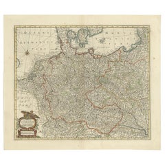
Antique Map of the German Empire, Johannes Janssonius van Waesbergen, circa 1670
Located in Langweer, NL
Antique map titled 'Nova Totius Germaniae Descriptio'. Uncommon map of the German Empire including the Netherlands, Germany, Switzerland, Austria, Bohemia,...
Category
Late 17th Century Antique Netherlands
Materials
Paper
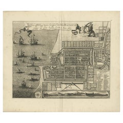
Rare 1681 Map of Batavia: Detailed Dutch Colonial Era Cartography, 1681
Located in Langweer, NL
The map of Batavia (modern-day Jakarta) from 1681, attributed to Frederick de Wit holds significant historical importance for several reasons:
Historical Context
1. Colonial Era: This map dates back to the Dutch colonial era when Batavia served as the administrative and commercial hub of the Dutch East India Company (VOC). The VOC was a powerful trading entity that played a crucial role in the global spice trade and colonization in Southeast Asia.
2. Strategic Importance: Batavia was strategically located on the northwestern coast of Java, providing the Dutch with a critical base for their maritime operations. The city became the center of Dutch political and military control in the region.
Cartographic Significance
1. Detailed Urban Layout: The map meticulously details the layout of Batavia, including its fortifications, canals, streets, and significant buildings. This level of detail provides insights into the urban planning and architectural styles of the period.
2. Military Engineering: The fortifications shown on the map illustrate the advanced military engineering techniques used by the Dutch to protect their valuable colony. The walls, bastions, and moats indicate the strategic considerations taken to defend against potential invasions.
3. Maritime Activity: The depiction of ships in the harbor highlights Batavia's role as a major maritime center. The VOC's fleets were essential for trade routes connecting Europe, Africa, and Asia, making Batavia a crucial node in global commerce.
Artistic and Cultural Value
1. Artistic Elements: The decorative elements, such as the lion holding a shield and the intricate cartouches, reflect the artistic trends of Dutch Golden Age cartography. These embellishments were not only informative but also served to display the cartographer's skill and the map's prestige.
2. Cultural Exchange: Maps like this one provide evidence of cultural exchange between the Dutch and the indigenous populations of Java. The blending of Dutch and local influences can be seen in various aspects of the map and the architecture of the city.
Rarity and Preservation
1. Rarity: Maps from the 17th century, especially those in good condition, are relatively rare and highly valued by collectors and historians. Each map provides a unique snapshot of historical geography and urban development.
2. Preservation of History: This map serves as a historical document, preserving knowledge about Batavia's cityscape, infrastructure, and colonial governance. It helps historians and scholars understand the socio-economic and political dynamics of the period.
Conclusion
The map of Batavia from 1681 is special due to its detailed depiction of one of the most important colonial cities in Southeast Asia during the Dutch Golden Age. It reflects the strategic, economic, and cultural significance of Batavia, serving as a valuable resource for understanding the history of Dutch colonialism and its global impact. The map's artistry and precision make it an important artifact in the history of cartography.
---------------
The map is an original and historical map of Batavia (present-day Jakarta) on the island of Java, dated 1681. There are several details to consider when evaluating its origins and possible authorship:
1. **Style and Detail**: The intricate details and style are reminiscent of maps created by Frederick de Wit, a prominent Dutch cartographer and engraver of the 17th century. He was known for his detailed city maps and sea charts.
2. **Lack of Signature**: The absence of "F. de Wit, Excudit" could indicate either an omission or a different engraver. However, it is essential to note that some maps from that period were reproduced or copied by other engravers and cartographers. This was not uncommon, as map-making was a collaborative effort, and copies of popular maps were frequently made.
3. **Map Characteristics**:
- The depiction of ships and the detailed fortifications are typical of Dutch cartography in the late 17th century.
- The decorative elements, such as the lion holding a shield, are also characteristic of Dutch map engravers.
4. **Other Possible Engravers**: While Frederick de Wit is a strong candidate, other notable Dutch engravers from that period include Joan Blaeu and Willem Janszoon Blaeu. They also produced highly detailed maps and could potentially be the creators or inspirers of this map.
To determine the precise authorship, you might consider:
- **Comparing** this map with other confirmed works of Frederick de Wit and his contemporaries to identify stylistic similarities and differences.
- **Historical Records**: Consulting historical records or publications related to Dutch cartography in the 17th century might provide more context or even direct references to this particular map.
If you have access to additional details or higher-resolution images of specific sections, it might help further pinpoint the map's origin and authorship.
-------------
Frederick de Wit (1629–1706) was a prominent Dutch cartographer, engraver, and publisher known for his detailed and decorative maps, atlases, and globes. He played a significant role in the Dutch Golden Age of cartography, contributing to the wealth of geographic knowledge and artistic achievement during this period. Here are key aspects of his life and work:
### Biography
- **Early Life**: Frederick de Wit was born in Gouda, Netherlands, in 1629. Little is known about his early years, but he moved to Amsterdam, the epicenter of Dutch cartography, in the mid-17th century.
- **Career Beginnings**: De Wit began his career as an engraver and publisher, initially producing maps that were reissues of earlier works by other cartographers, such as Joan Blaeu and Willem Janszoon Blaeu.
### Contributions to Cartography
- **Mapmaking**: De Wit was known for his meticulous attention to detail and artistic flair. He produced a wide range of maps, including world maps, regional maps, city plans, and maritime charts...
Category
1680s Antique Netherlands
Materials
Paper
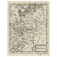
Antique Map of Modern Day Ukraine and Russia Titled Moscovie 'Moscow', Ca.1683
Located in Langweer, NL
Antique map of modern day Ukraine and Russia titled ‚Moscovie‘. Miniature map of the Moscovia region by A.M. Mallet.
Artists and Engravers: Alain Manneson Mallet (1630-1706) spent...
Category
1680s Antique Netherlands
Materials
Paper
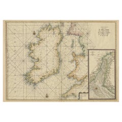
Large 1693 Maritime Map of Irish Sea, West Coasts of Ireland, England, Scotland
Located in Langweer, NL
This is a historical sea chart titled "Carte Generale des Costes d'Irlande, et des Costes Occidentales d'Angleterre avec une Partie de celles d'Ecosse," which translates to "General Map of the Coasts of Ireland and the Western Coasts of England with a Part of Scotland."
The map was first published in 1693 in the atlas "La Neptune Francois," created by Jaillot and published by Pieter Mortier in Amsterdam. This initiative was started by the French minister Colbert to improve maritime navigation.
Details of the Map:
1. **Geographical Coverage:**
- The map primarily focuses on the Irish coast.
- It also includes the west coast of England and Wales.
- Parts of the west coast of Scotland are also depicted.
2. **Inset Map:**
- There is a detailed inset map showing the area around Chester and the course of the River Dee.
3. **Features:**
- **Depth Soundings:** The Irish Sea is detailed with depth soundings to assist in navigation.
- **Coastal Towns and Islands:** Numerous coastal towns, islands, and geographical features are indicated.
- **Rhumb Lines:** The map includes extensive rhumb lines, which are lines used by navigators to plot a straight-line course.
- **Key:** There is a key describing the quality of the terrain along the coast, important for navigators to understand the nature of the coastal landscape.
4. **Labels and Annotations:**
- **Coastal Settlements:** Ports, forts, and villages along the coast are labeled.
- **Geographical Features:** Islands and other significant features are marked.
5. **Artistic and Practical Elements:**
- The map is printed on thick paper and is hand-colored, reflecting contemporary coloring techniques.
- Detailed lines and soundings are included to help ships navigate around the numerous small islands and narrow inlets safely.
6. **Historical Context:**
- The map was part of a significant French maritime project aimed at improving navigation and charting European waters more accurately.
- It reflects the high level of cartographic skill and knowledge of the late 17th century.
This map would have been a valuable tool for mariners of the time, providing them with crucial information about the coastal features, depth soundings, and safe passage routes around the complex coastlines of Ireland, England, and Scotland.
About the Makers and the Atlas
**1. Alexis-Hubert Jaillot (1632-1712):**
- **Background:** Jaillot was a prominent French cartographer and publisher in the 17th century. He was known for his detailed and accurate maps and atlases.
- **Work:** He collaborated with other notable cartographers of his time and played a key role in improving and publishing detailed maps. Jaillot's work was characterized by its precision and artistic quality.
- **Contribution:** He was instrumental in the creation of "La Neptune Francois," a maritime atlas aimed at improving French naval navigation.
**2. Pieter Mortier (1661-1711):**
- **Background:** Mortier was a Dutch engraver, publisher, and mapmaker based in Amsterdam. He was well-known for his high-quality prints and maps.
- **Work:** Mortier published several important atlases and maps, often collaborating with other cartographers and engravers. His work was recognized for its detailed craftsmanship and accuracy.
- **Contribution:** Mortier published "La Neptune Francois" in Amsterdam, making significant contributions to maritime navigation by providing highly detailed sea charts.
About the Atlas "La Neptune Francois":
**1. Purpose:**
- The atlas was created as part of an initiative led by Jean-Baptiste Colbert, the French minister of finance under King Louis XIV. The goal was to enhance the accuracy and availability of maritime charts for French naval and commercial vessels.
- "La Neptune Francois" was designed to be a comprehensive and detailed reference for navigators, covering various European waters with a focus on the French coast and adjacent regions.
**2. Content:**
- The atlas includes a series of sea charts, each providing detailed information on coastal regions, depth soundings, rhumb lines, and other navigational aids.
- The maps were printed on high-quality paper and hand-colored, reflecting the artistic standards of the time.
**3. Historical Significance:**
- "La Neptune Francois" was a landmark in the history of cartography, representing a significant advancement in the accuracy and detail of maritime maps...
Category
1690s Antique Netherlands
Materials
Paper
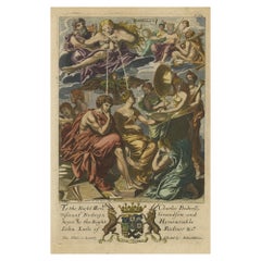
Rare Copper Engraving of Female with Five Breasts Lactating onto Others, 1686
Located in Langweer, NL
Antique print titled 'Painting'.
Rare antique print showing painters and various figures including: a female figure holding palette and brushes in centre, with another female figur...
Category
1680s Antique Netherlands
Materials
Paper
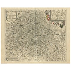
Antique Map of Southern Germany by F. de Wit, circa 1680
Located in Langweer, NL
This antique map depicts a portion of southern Germany that included the historic regions of Bavaria, the Palatinate, Prussia-Brandenburg, the Rhineland and Saxony. Regensberg, Freis...
Category
Late 17th Century Antique Netherlands
Materials
Paper
Antique Map: Carte du Détroit du Sond with Copenhagen Inset, 1693
Located in Langweer, NL
Antique Map: Carte du Détroit du Sond with Copenhagen Inset, Jaillot/Mortier, 1693
This rare and striking antique map, titled *Carte du détroit du Sond contenant les costes de l’Is...
Category
Late 17th Century Antique Netherlands
Materials
Paper
Old Map of Prussia, Embellished with a Large Cartouche and Compass Rose, ca.1680
Located in Langweer, NL
Antique map titled 'Prussiae nova Tabula'.
Later edition of Blaeu's map of Prussia, embellished with a large cartouche and compass rose. Prussia was a historically prominent Germ...
Category
1680s Antique Netherlands
Materials
Paper
Maritime Majesty: The 17th-Century Skyline of Kalmar in Sweden, 1693
Located in Langweer, NL
The engraving depicts the city of Kalmar, a historically significant city on the east coast of Sweden. This panoramic view captures the bustling port and the city's skyline during th...
Category
1690s Antique Netherlands
Materials
Paper
Early Original Antique Map of South East Asia with Large Parts Still Unknown
Located in Langweer, NL
Antique map titled 'Insulae Indiae Orientalis'. Original antique map of Southeast Asia. Shows towns, villages, landmarks, mountains, and rivers. Relief shown pictorially. This map or...
Category
Late 17th Century Antique Netherlands
Materials
Paper
Chinese Blue and White Porcelain Salt Cellars, Kangxi
Located in Delft, NL
Chinese porcelain salt cellars, Kangxi (1662-1722)
2 Chinese porcelain salt cellars with 3 rims and inside the double blue ring a scene of sever...
Category
Late 17th Century Chinese Antique Netherlands
Materials
Porcelain
The Martyrdom of Father John Forest, Burned by Order of Henry VIII in 1538
Located in Langweer, NL
Engraving of the burning at the stake of a Franciscan friar. Here is a detailed analysis, including a description and a translated version of the text:
The text at the bottom reads:...
Category
1680s Antique Netherlands
Materials
Paper
Antique Print of the Royal Flagship of the English Fleet by P. Mortier, c.1693
Located in Langweer, NL
Antique print titled 'Vaisseau Royal de l'Angleterre, Konincklyke Schip van Engeland'. Beautiful hand-coloured engraving of the Royal Flagship of the English Fleet. Originally publis...
Category
Late 17th Century Antique Netherlands
Materials
Paper
Original Antique Portrait of Charles XI of Sweden, Engraved in 1698
Located in Langweer, NL
This is an original antique print that features an intricate engraving from 1698, depicting Charles XI, the King of Sweden, titled "Carolus XI, Suecorum Gothorum Et Vandalorum Rex,"...
Category
1690s Antique Netherlands
Materials
Paper
Rare & Old Panoramic Views of Stanchio, Greece and the Island of Rhodes, 1698
Located in Langweer, NL
Antique print titled Stanchio Rhodus.
Original antique print showing panoramic views of Stanchio, Greece and the Island of Rhodes, both with ships.
First edition in French, ...
Category
1690s Antique Netherlands
Materials
Paper
Antique Map of Greece by Allard (c.1698)
Located in Langweer, NL
Antique map titled 'Hellas seu Graecia Universa' Detailed map of Greece, with Crete, the Aegean Islands, and part of Turkey. With two cartouches, compass rose and scale. Carolus Alla...
Category
Late 17th Century Antique Netherlands
Materials
Paper
Antique Map of Madagascar by N. Sanson, circa 1680
By Nicolas Sanson
Located in Langweer, NL
Antique map titled 'Isle de Madagascar ou de St. Laurens. Tiree de Sanutu &c'. Antique map of Madagascar, first published by Sanson in 1657. Sanson n...
Category
Late 17th Century Antique Netherlands
Materials
Paper
Eudamidas' Final Moments: A Scene from Lucian's 'Toxaris, or Friendship, ca.1680
Located in Langweer, NL
Title: "Testament of Eudamidas of the City of Corinth"
Description: This print depicts a scene from Lucian's 'Toxaris, or Friendship,' where Corinthian Eudamidas is seen lying in a ...
Category
Late 17th Century Antique Netherlands
Materials
Paper
Cultural Encounter in New Mexico, Copper Engraving Published in 1673
Located in Langweer, NL
This original copper engraving hails from Arnoldus Montanus' seminal work, "Die Unbekannte Neue Welt oder Beschreibung des Welt-teils Amerika und des Sud-Landes," a comprehensive depiction of the Americas published in 1673.
It presents a vivid scene set in colonial New Mexico, showcasing a moment of interaction—possibly a ceremonial or everyday event—between indigenous people and European settlers or explorers. The detailed attire and adornments of the figures suggest a narrative rich in cultural exchange and complexity. This piece is not only a reflection of the artistic style and engraving techniques of the 17th century but also serves as a historical document capturing the early encounters between different worlds.
Published in Amsterdam by Jacob Meurs, this rare German edition offers a unique glimpse into the perceptions and imaginations of European society regarding the New World during the Age of...
Category
1670s Antique Netherlands
Materials
Paper
Original Antique Map of the Road from Marlborough to Huntspil
Located in Langweer, NL
Antique map titled 'The Continuation of the Road from London to Bristol (..)'. A strip map of the continuation of the road from London to Bristol, this particular sheet showing the r...
Category
Late 17th Century Antique Netherlands
Materials
Paper
Coppeer Engraving of Henry Garnet (1555–1606), Jesuit Priest and Martyr, ca.1670
Located in Langweer, NL
Title: Portrait of Henry Garnet (1555–1606), Jesuit Priest and Martyr – 17th-Century Copper Engraving
This fine copper engraving from around 1670 depicts Henry Garnet, a Jesuit prie...
Category
1670s Antique Netherlands
Materials
Paper
Antique Map of Denmark by F. de Wit, 1680
Located in Langweer, NL
Antique map titled 'Dania Regnum'. Large, attractive map of Denmark, Sleschwig-Holstein and southern Sweden. Good detail throughout. Embellished with a title cartouche with the Danis...
Category
Late 17th Century Antique Netherlands
Materials
Paper
Antique Map of Piedmonte and Savoie 'Italy' by N. Visscher, circa 1683
Located in Langweer, NL
Antique map titled 'Regiae Celsitudinis Sabaudicae Status consistens in Sabaudiae ac Montisferrati Ducatus, Pedemontii Principatum (..). This map originates from 'Atlas Minor Sive Ge...
Category
Late 17th Century Antique Netherlands
Materials
Paper
Copper Engraving of Daily Life in New Spain in The 17th Century, 1673
Located in Langweer, NL
This original copper engraving depicts a lively scene of daily life in New Spain from Arnoldus Montanus' "Die Unbekannte Neue Welt oder Beschreibung des Welt-teils Amerika und des Su...
Category
1670s Antique Netherlands
Materials
Paper
Grand Map of Europe by Frederick de Wit, Circa 1690: A Baroque Era Masterpiece.
Located in Langweer, NL
This is an attractive historical map of Europe created by Frederick de Wit, published around 1690. Here's a detailed description of the map and additional context about its creation:...
Category
Late 17th Century Antique Netherlands
Materials
Paper
Antique Hand-Colored Map of Western Russia and Ukraine, c.1680
Located in Langweer, NL
Description: Antique map titled 'Novissima et Accuratissima Totius Russiae vulgo Muscoviae Tabula'.
Antique map of Western Russia and Ukraine, published by Justus Danckerts. The ma...
Category
1680s Antique Netherlands
Materials
Paper
Mini P&T Pendant Lamp by Michael Bang for Holmegaard, Denmark, 1970s
By Michael Bang, Holmegaard
Located in Steenwijk, NL
This mini P&T pendant lamp was designed by Michael Bang for Holmegaard in the 1970s. This Danish lamp is made of opaline glass and is black/aubergine on the outside and white on the ...
Category
1670s Danish Mid-Century Modern Antique Netherlands
Materials
Glass
Historic View of Sugar Milling in 17th Century America
Located in Langweer, NL
The print titled "AMERIKENS ENTDECKER" is a striking antique copper engraving, crafted in 1673 during the 17th century as part of the German edition of Arnoldus Montanus' influential work, "Die Unbekante Neue Welt" ("The New and Unknown World"). The engraving was executed by Jacob van Meurs, a renowned Dutch engraver and publisher known for his detailed works on geography and history, and it was published in Amsterdam.
Description of the Print:
The engraving measures 17 x 13 cm (approximately 6.6 x 4.7 inches) and is set on a page that is 31 x 19.5 cm (about 12.2 x 7.4 inches). It depicts a vivid scene that illustrates the discovery of America...
Category
1670s Antique Netherlands
Materials
Paper
Large 1695 Hand-Colored Engraved Map of Gascony (Gascogna), France
Located in Langweer, NL
This map, created by Giacomo Cantelli da Vignola in 1695, represents the "General Government of Guyenne and Gascony" in southwest France. Cantelli da Vignola was a renowned Italian c...
Category
1690s Antique Netherlands
Materials
Paper
Very Rare Antique Print of the Kings Celebrations in Pegu, Myanmar, 1682
Located in Langweer, NL
Plate: 'Konings feesten tot Pegu.' (Kings celebrations in Pegu.)
On this plate: 1. The King. 2. And the Queen, sprinkling water on each other. 3. Their children. 4. Officers. 5. ...
Category
1680s Antique Netherlands
Materials
Paper
Ritual Dance in Brazil in the 17th Century on a Copper Engraving by Montanus
Located in Langweer, NL
Title: "Ritual Dance in Brazil"
Description: This original copper engraving from Arnoldus Montanus' "Die Unbekannte Neue Welt oder Beschreibung des Welt-teils Amerika und des Sud-La...
Category
1670s Antique Netherlands
Materials
Paper
Rhine Splendor: Antique Map of the Lower Rhine Region, circa 1680
Located in Langweer, NL
The antique map titled 'Novissima et Accuratissima Archiepiscopatus et Electoratus Coloniensis Ducatuum Iuliancensis et Montensis et Meursiae Comitatus' is a handsome and detailed ma...
Category
1680s Antique Netherlands
Materials
Paper
Charming Miniature Map of Thrace or Thrake in Southeast Europe, 1685
Located in Langweer, NL
Antique map titled 'Thraciae Descriptio.'
Charming miniature map of Thrace, from the pocket atlas 'Introductionis in Universam Geographiam tam Veterem quam novam .. Acessit P. Be...
Category
1680s Antique Netherlands
Materials
Paper
Chinese Imari square-sided bottle vase, Kangxi period (1662-1722)
Located in Gorssel, GE
Chinese Imari square-sided bottle vase, Kangxi period (1662-1722), decorated in blue and rouge de fer with river landscapes, floral decor and bamboo.
High: 25 cm.
Condition: some h...
Category
Late 17th Century Chinese Antique Netherlands
Materials
Porcelain
Botanical Illustration of Large Spanish Sorrel (Acetosa Hispanica Maxima), 1696
Located in Langweer, NL
This antique print, titled "Acetosa Hispanica Maxima," depicts the Acetosa plant, commonly known as Sorrel. It belongs to the Plantago or Rumex genus, known for their edible leaves w...
Category
1690s Antique Netherlands
Materials
Paper
Antique Map of the Strait of Malacca, Malay Peninsula & Dutch Indies, c.1670
Located in Langweer, NL
Antique map titled 'Indiae Orientalis, nec non Insularum Adiacentium Nova Descriptio.'
Map of Southeast Asia. The map centers on the Strait of Malacca and Malay Peninsula. It ext...
Category
1670s Antique Netherlands
Materials
Paper
Botanical Engraving of Arrowhead from Munting’s 1696 Herbal Collection
Located in Langweer, NL
This original old hand-coloured antique print depicts Sagittaria Sagittifolia, known as "arrowhead." It originates from the botanical work "Naauwkeurige Beschryving der Aardgewassen"...
Category
1690s Antique Netherlands
Materials
Paper
Scenes from 17th Century Chile: A Glimpse of Early Indigenous Cultures, 1673
Located in Langweer, NL
The image is a historical copper engraving from 1673, taken from the German edition of Arnoldus Montanus' work, which is known for its depiction of the Americas and the Southern land...
Category
1670s Antique Netherlands
Materials
Paper
't Huys van Niel: A Flemish Residence from the Duchy of Brabant, c.1678
Located in Langweer, NL
This original engraving titled "'t Huys van Niel" (also known as "Praetorium de Niele") depicts a historic building located in the province of Antwerp, Belgium. This copperplate engr...
Category
1670s Antique Netherlands
Materials
Paper
Antique Map of the Hainaut Region 'France' by F. de Wit, circa 1680
Located in Langweer, NL
Antique map titled 'Comitatus Hannoniae et Episcopatus Cambresis Descriptio'. Large map of the Hainaut region, France. Published by F. de Wit, circa 1680.
Category
Late 17th Century Antique Netherlands
Materials
Paper
Antique Map of the Iberian Peninsula with two decorative Cartouches
Located in Langweer, NL
Antique map titled 'Hispaniae et Portugalliae Regna'. Original old map of the Iberian peninsula showing Spain, Portugal and the Balearic Islands. Two beautiful cartouches with severa...
Category
Late 17th Century Antique Netherlands
Materials
Paper
Old Portrait of Painter Gerard Seghers 'Segers', born in Antwerp, Belgium, 1694
Located in Langweer, NL
Antique print, titled: 'Gerard Segers' -
Portrait of the Flemish painter Gerard Seghers ( Segers ) 1591-1651, born in Antwerp, Belgium. Gerard Segher...
Category
1690s Antique Netherlands
Materials
Paper
1698 Mercator Ptolemaic Map of Asia East of the Ganges
Located in Langweer, NL
**Catalogue Description:**
**Title:** Tab. XI. Asiae, comprehendens Indiam extra Gangem.
**Description:**
This is an exquisite Ptolemaic map depicting Asia east of the Ganges, ti...
Category
1680s Antique Netherlands
Materials
Paper
1658 Siege of Copenhagen by Swedish Forces: A Panoramic Perspective
Located in Langweer, NL
The engraving depicts the siege of Copenhagen, the capital of Denmark, by the King of Sweden in 1658. This historical event is captured in a detailed panoramic view, showcasing the s...
Category
1670s Antique Netherlands
Materials
Paper
Bird’s-Eye View Map of Gallipoli: Fortified Ionian Gem by Mattheus Merian, 1688
Located in Langweer, NL
Bird’s-Eye View Map of Gallipoli: Fortified Ionian Gem by Mattheus Merian
Description:
This exquisitely detailed map of Gallipoli, crafted by the renowned engraver Mattheus Merian,...
Category
1680s Antique Netherlands
Materials
Paper
Gallipoli Fortifications: A 1688 Engraved Bird’s-Eye Map by Mattheus Merian
Located in Langweer, NL
Gallipoli Fortifications: A 1688 Bird’s-Eye Map by Mattheus Merian
Description: This exquisitely detailed map of Gallipoli, crafted by the renowned engraver Mattheus Merian, offers ...
Category
1680s Antique Netherlands
Materials
Paper
Cartographic Elegance: The Art and Science of 17th-Century Asian Maps, ca.1681
Located in Langweer, NL
This original antique map is an artifact from a pivotal era in cartography, reflecting not only the geographical knowledge of its time but also the intertwining of art and science in...
Category
1680s Antique Netherlands
Materials
Paper
Rare Antique Map of Southwestern Europe and West Africa by V.M. Coronelli, 1692
By Vincenzo Coronelli
Located in Langweer, NL
Antique Globe Gore: Southwestern Europe and West Africa by Vincenzo Coronelli
This exquisite, hand-colored globe gore by Vincenzo Coronelli, one of the most renowned 17th-century cartographers, represents Southwestern Europe and West Africa. A segment of Coronelli's monumental 42-inch terrestrial globe, this gore is a remarkable example of the artistry and geographical knowledge of the late 1600s. Covering France, the Iberian Peninsula, and all of Africa west of a line extending from Algeria to the Bight of Benin, it also includes the Canary Islands and Madeira.
Coronelli’s globe gores are celebrated for their exceptional engraving and accuracy, and this piece is no exception. The coastline of Africa is depicted with remarkable precision for its time, reflecting the latest geographical knowledge of European explorers. In contrast, the interior of Africa—still a mystery to European mapmakers—features mythical elements such as fantastical mountain ranges and exotic fauna. Giraffes, elephants, lions, and mysterious giant birds populate the landscape, offering a glimpse into the imagination and curiosity of the era. One notable detail is the Gambia...
Category
Late 17th Century Antique Netherlands
Materials
Paper
1692 Engraved Map: Detailed Mogul Empire, India to Afghanistan, Hand-Colored
Located in Langweer, NL
1692 Map of the Mogul Empire by Jacques Peeters
This finely engraved map, published in 1692 by Jacques Peeters, showcases the Mogul Empire region, covering areas from northern India...
Category
1690s Antique Netherlands
Materials
Paper
Noble Abode: The la Gardie Estate in Stockholm as Envisioned by Jean Marot, 1670
Located in Langweer, NL
Makalös or De la Gardieska palace, from 1643. View from Jacob's church. Later function as an arsenal and armory chamber. Rebuilt as the Dramatic Theater in 1793. Destroyed by fire on November 24, 1825. Copper engraving in Suecia antiqua et hodierna, from about 1667.
This print is from "Suecia Antiqua et Hodierna," which is a significant work depicting Sweden during its era as a great power. The collection of engravings...
Category
1670s Antique Netherlands
Materials
Paper
Engraving of Rituals and Cremation Ceremonies in New Spain by Montanus, 1673
Located in Langweer, NL
Title: "Rituals and Ceremonies in New Spain"
Description: This striking copper engraving is extracted from Arnoldus Montanus' seminal work, "Die Unbekannte Neue Welt oder Beschreibu...
Category
1670s Antique Netherlands
Materials
Paper
Large French 17th-18th Century Louis XIV Trivet
Located in Soest, NL
17th-18th century French Louis XIV period trivet.
It is used for heating up a pan or to keep it warm in front of the fire. In a good working condition.
Category
Late 17th Century French Louis XIV Antique Netherlands
Materials
Wrought Iron
Large 17th Century Colonial Japanese Porcelain VOC Charger
Located in Amsterdam, NL
A Japanese Arita blue and white porcelain VOC dish.
Arita, late 17th century
Measure: Diameter 32.1 cm
These dishes, ordered by the VOC during the second half of the 17th century, were copied after the popular Chinese Wanli ‘Kraak’ porcelain...
Category
Late 17th Century Japanese Antique Netherlands
Materials
Porcelain
Antique Print Mercury Descending to Earth Made After a Fresco by Raphael, 1693
Located in Langweer, NL
Antique print titled 'Mercurius uocalis Deus ex Louis mandato Deos omnes ad concionem conuocat de Cupidinis ac Psyches coniugio sententiam laturi'. Mercury descending to earth can be seen in a red waving coat. Garlands with flowers and fruits frame the picture. Winged figures, a lion and birds are to the right and left of Mercury. Above a wall ledge are two arched windows framed by garlands.
This print originates from a series of twelve plates engraved by Nicolas Dorigny after a fresco by Raphael which can be found in Villa Farnesina. The Villa Farnesina is a Renaissance suburban villa in the Via della Lungara, in the district of Trastevere in Rome, central Italy. The villa was built for Agostino Chigi, a rich Sienese banker and the treasurer of Pope Julius II. Chigi also commissioned the fresco decoration of the villa by artists such as Raphael, Sebastiano del Piombo...
Category
Late 17th Century Antique Netherlands
Materials
Paper
1687 Portrait of Assan Aga by E. Nessenthaler: A Glimpse into Ottoman Nobility
Located in Langweer, NL
This etching and engraving is a portrait of Assan Aga, created by Elias Nessenthaler, a German artist, in the year 1687.
The artwork features Assan Aga, identified as "Magnus Aleppo Bassa," which suggests he held a significant position in Aleppo, likely a high-ranking official or governor ("Bassa" being a variant of "Pasha", a high-ranking title). The text beneath the portrait indicates that he was a significant adversary ("Perniciem") to the emperor of the Turks, hinting at a historical narrative of conflict or betrayal ("Coniuratus hostis" suggesting a conspiratorial enemy).
The portrait shows Assan Aga adorned in elaborate attire with a turban, indicative of his status and cultural significance during that period. The detail in the etching, from the facial features to the clothing, reflects the artistic skill of Elias Nessenthaler and the styles of portraiture common in the late 17th century. The framing of the image with decorative borders adds to its formal presentation and would have likely been intended for an audience interested in the political and military figures of the time.
Assan Aga, also known as Magnus Aleppo Bassa, was likely a historical figure of significance in Aleppo, bearing the title of Pasha, which indicates a high-ranking official or governor in the Ottoman Empire. The detailed portrait by Elias Nessenthaler, housed in the Royal Collection, hints at his importance during his time. For further details on Assan Aga, you can visit the Royal Collection Trust...
Category
Late 17th Century Antique Netherlands
Materials
Paper
Antique Map of the Eastern Hemisphere in Frame, 'circa 1683'
Located in Langweer, NL
Antique map titled 'Climats selon les Anciens'. Miniature map of the Eastern Hemisphere showing the climatic regions. This map originates from 'Description de l'Univers' by A.M. Mall...
Category
Late 17th Century Antique Netherlands
Materials
Paper
Antique Print of a Beached Whale by Van der Gouwen 'c.1680'
Located in Langweer, NL
Antique print titled 'Een Walvisch lang zo voeten, gestrandt op de Hollandtse zee-kust, tusschen Schevelingen en Katwyk, in Sprokkelmaandt, 1598'. Beautiful original antique print of...
Category
Late 17th Century Antique Netherlands
Materials
Paper
Antique Miniature Map of the Old World and France by Mallet, circa 1683
Located in Langweer, NL
Antique map titled 'Planisphere du Monde - France'. Two miniature maps on one sheet. The upper map shows a hemisphere of the Old World. The lower map shows France. This map originate...
Category
Late 17th Century Antique Netherlands
Materials
Paper
Antique Map of Bavaria, Bayern, with original Hand Coloring
Located in Langweer, NL
Antique map titled 'Bavariae Circulus atq Electoratus tam cum Adiacentibus quam insertis Regionibus'. Original old map of Bavaria, Bayern, Germany. The map stretches south to Innsbru...
Category
Late 17th Century Antique Netherlands
Materials
Paper
Antique Map of the Netherlands by N. Visscher, 1684
Located in Langweer, NL
Antique map titled 'Comitatus Hollandiae Tabula Pluribus Locis Recens Emendata a Nicolao I. Visschero'. West to the top. Lower left inset of the Wadden Islands, Texel, Vlieland, Ters...
Category
Late 17th Century Antique Netherlands
Materials
Paper
