Items Similar to California: 18th Century Hand-colored Map by de Vaugondy
Want more images or videos?
Request additional images or videos from the seller
1 of 12
Didier Robert de VaugondyCalifornia: 18th Century Hand-colored Map by de Vaugondy1772
1772
$875
£662.98
€760.72
CA$1,231.27
A$1,353.50
CHF 711.34
MX$16,436.42
NOK 8,873.76
SEK 8,407.26
DKK 5,677.41
About the Item
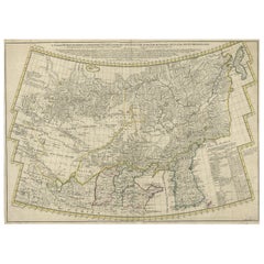
This is an 18th century hand-colored map of the western portions of North America entitled "Carte de la Californie et des Pays Nord-Ouest separés de l'Asie par le détroit d'Anian, extraite de deux cartes publiees au commencement de 17e Siecle" (Map of California and the Northwestern Countries separated from Asia by the Anian Strait, from two maps published at the beginning of the 17th century), created by Didier Robert De Vaugondy and published in Paris in 1772 in Diderot's Encyclopedie. The map and its inset are based on earlier maps from 1612 by and 1641 by the Dutch cartographers Petrus Plancius (1552-1622) and Nicolaes Visscher I (1618- 1679) relying on information included on maps by Gerardus Mercator (1512-1594).
The main portions of the map depicts the west coast of North America from Present day Alaska in the north to Baja California in the south. The map includes the Strait of Anian in the region of Alaska, which refers to the legendary but nonexistent Northwest Passage, hoped to be a link between the Atlantic and Pacific oceans and a desirable trade route from Europe to North America. Captain James Cook eventually disproved its existence during his third and final voyage in 1778.
A large inset map of the same region curiously depicts the coastline differently than in the larger portion of the map. The larger map shows Mendocino in Northern California, the Bay of San Miguel (present day San Diego) and Cabo de California (Cabo San Lucas) at the southern tip of Baja California, while the smaller inset map includes C. de San Francisco and los Farilones (the Farallon Islands) and Isle De Paxaros, possibly representing Catalina Island. The larger map shows Nova Albion, the name given to Northern California by Sir Francis Drake when he claimed the area for England in 1579. His point of landfall is now called Drake's Cove, which is part of Point Reyes National Seashore. The smaller inset map identifies the entire region as "Mexicana".
These maps are based on maps by Vischer of 1612 and 1641, and appeared in the Supplement to Denis Diderot's Encyclopedie. Both maps showing the fictitious Strait of Anian at the top; it was part of the legendary Northwest Passage, the long hoped for link of the Pacific and Atlantic Oceans, whose existence many explorers attempted to prove, and which The smaller inset map shows much more of the Strait, along with an open sea, making a suggestion of a Northwest Passage. The coastlines vary in both maps, with the smaller one listing important place names such as . Image sie: 12 3/4 x 12". Paper size: 18 1/2 x 15 1/4".
The map is printed on watermarked laid, chain-linked paper with wide margins. The sheet measures 13.75" high x 16.63" wide. The are vertical and horizontal fold, as issued, with reinforcement of a left vertical fold on the verso. There is minimal discoloration of the edges of the left and lower margins and a few faint spots on the right, but the map is otherwise in excellent condition.
Didier Robert de Vaugondy (1723-1786) was the son of Gilles Robert de Vaugondy, who was a prominent French cartographer, printmaker and publisher. The two worked together in the family business, they publishing atlases. The best know publication was the Atlas Universel (1757). Didier followed his father as the royal cartographer/hydrographer to King Louis XV of France. He held a similar position in the court of the Duke of Lorraine and King of Poland. He later became the royal censor for information published in French geography texts, sea charts and publication describing travel and exploration.
- Creator:Didier Robert de Vaugondy (1723 - 1786, French)
- Creation Year:1772
- Dimensions:Height: 13.75 in (34.93 cm)Width: 16.63 in (42.25 cm)
- Medium:
- Period:1770-1779
- Framing:Framing Options Available
- Condition:
- Gallery Location:Alamo, CA
- Reference Number:Seller: # 3391stDibs: LU117329387682
About the Seller
5.0
Gold Seller
Premium sellers maintaining a 4.3+ rating and 24-hour response times
Established in 2011
1stDibs seller since 2019
291 sales on 1stDibs
Typical response time: 1 hour
- ShippingRetrieving quote...Shipping from: Alamo, CA
- Return Policy
Authenticity Guarantee
In the unlikely event there’s an issue with an item’s authenticity, contact us within 1 year for a full refund. DetailsMoney-Back Guarantee
If your item is not as described, is damaged in transit, or does not arrive, contact us within 7 days for a full refund. Details24-Hour Cancellation
You have a 24-hour grace period in which to reconsider your purchase, with no questions asked.Vetted Professional Sellers
Our world-class sellers must adhere to strict standards for service and quality, maintaining the integrity of our listings.Price-Match Guarantee
If you find that a seller listed the same item for a lower price elsewhere, we’ll match it.Trusted Global Delivery
Our best-in-class carrier network provides specialized shipping options worldwide, including custom delivery.More From This Seller
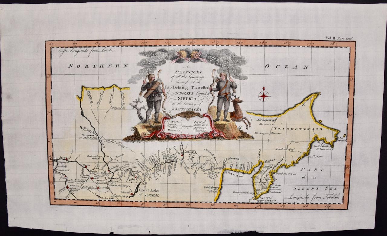
View AllSiberia as Explored by Behring: Original 18th Century Hand-colored Map by Bowen
Located in Alamo, CA
This is an original 18th century hand-colored map entitled "An Exact Chart of all the Countries through which Capt. Behring Travelled from Tobolski, Capital of Siberia to the Country...
Category
Mid-18th Century Old Masters Landscape Prints
Materials
Engraving

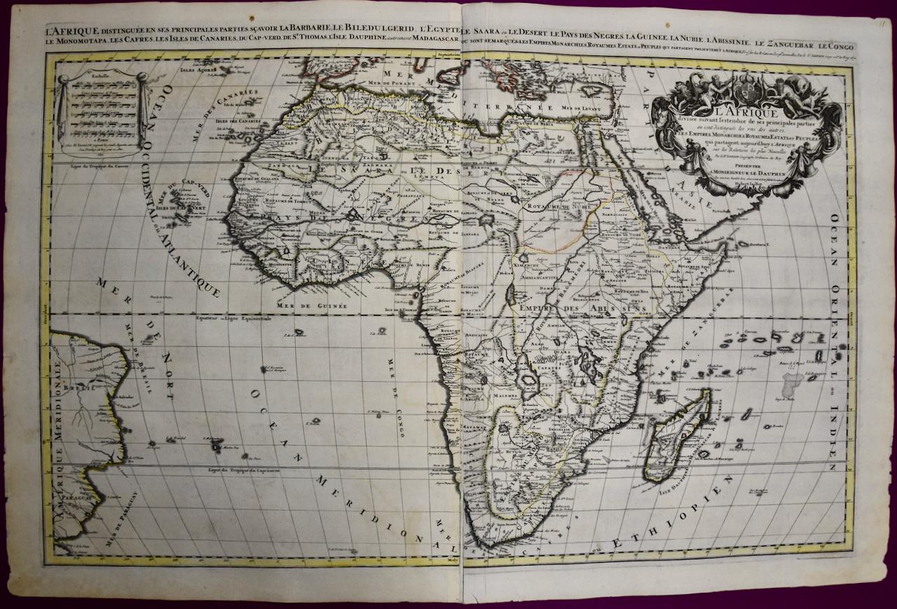
Africa: A Large 17th Century Hand-colored Map By Sanson and Jaillot
By Nicholas Sanson d'Abbeville
Located in Alamo, CA
This large original hand-colored copperplate engraved map of Africa entitled "L'Afrique divisee suivant l'estendue de ses principales parties ou sont distingues les uns des autres, L...
Category
1690s Landscape Prints
Materials
Engraving

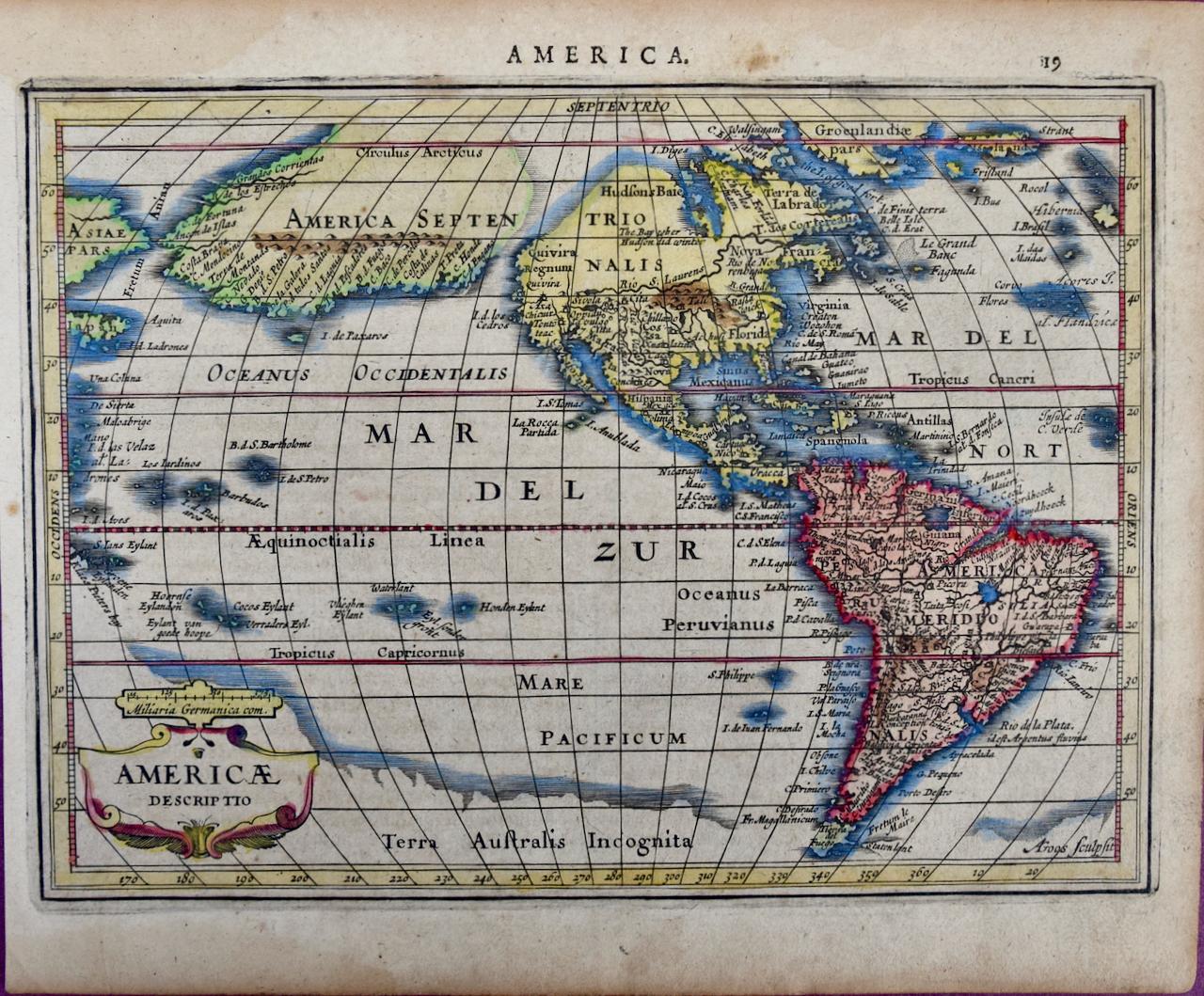
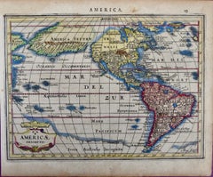
North & South America: A 17th Century Hand-colored Map by Jansson & Goos
By Johannes Jansson
Located in Alamo, CA
A 17th century hand-colored map of North & South America entitled "Americae Descriptio" by the cartographer Johannes Jansson, published in Jansson's Atlas Minor in Amsterdam in 1628....
Category
1620s Landscape Prints
Materials
Engraving
Southern Greece: A Large 17th Century Hand-colored Map By Sanson and Jaillot
By Nicholas Sanson d'Abbeville
Located in Alamo, CA
This large original hand-colored copperplate engraved map of southern Greece and the Pelopponese Peninsula entitled "La Moree Et Les Isles De Zante, Cefalonie, Ste. Marie, Cerigo & C...
Category
1690s Landscape Prints
Materials
Engraving

North and South America: An 18th Century Hand-colored Map by Johann Homann
By Johann Baptist Homann
Located in Alamo, CA
This early 18th century hand-colored copperplate map of North and South America entitled "Totius Americae Septentrionalis Et Meridionalis Novissima Repraesentatio" was created by Johann Baptist Homann and published in Nuremberg, Germany, between 1710 and 1731. The map details cities, forts, mountains, forests and lakes, as well as districts. There is a decorative cartouche in the lower left which depicts a volcano, scenes representing the people in their native costumes, as well as animals and plants of the Americas. A village is seen in the background on the left. A second smaller decorative cartouche in the upper right includes text and a series of allegorical figures. A large portion if the north central and western portions of North America is left without detail, because the region was largely unexplored at the time this map was created. The map also shows "Terra Esonis Incognita", representing a mythical continuous land bridge from North America to Asia, a northwest passage. The map preceded the French and...
Category
Early 18th Century Old Masters Landscape Prints
Materials
Engraving

Mediterranean and Adriatic Seas: Original 18th Century Hand-colored Map by Bowen
Located in Alamo, CA
This is an original 18th century hand-colored map entitled "An Accurate Chart of The Mediterranean and Adriatic Sea's; with the Archipelago & Part of the Black Sea. Exhibiting all th...
Category
Mid-18th Century Old Masters Landscape Prints
Materials
Engraving

You May Also Like
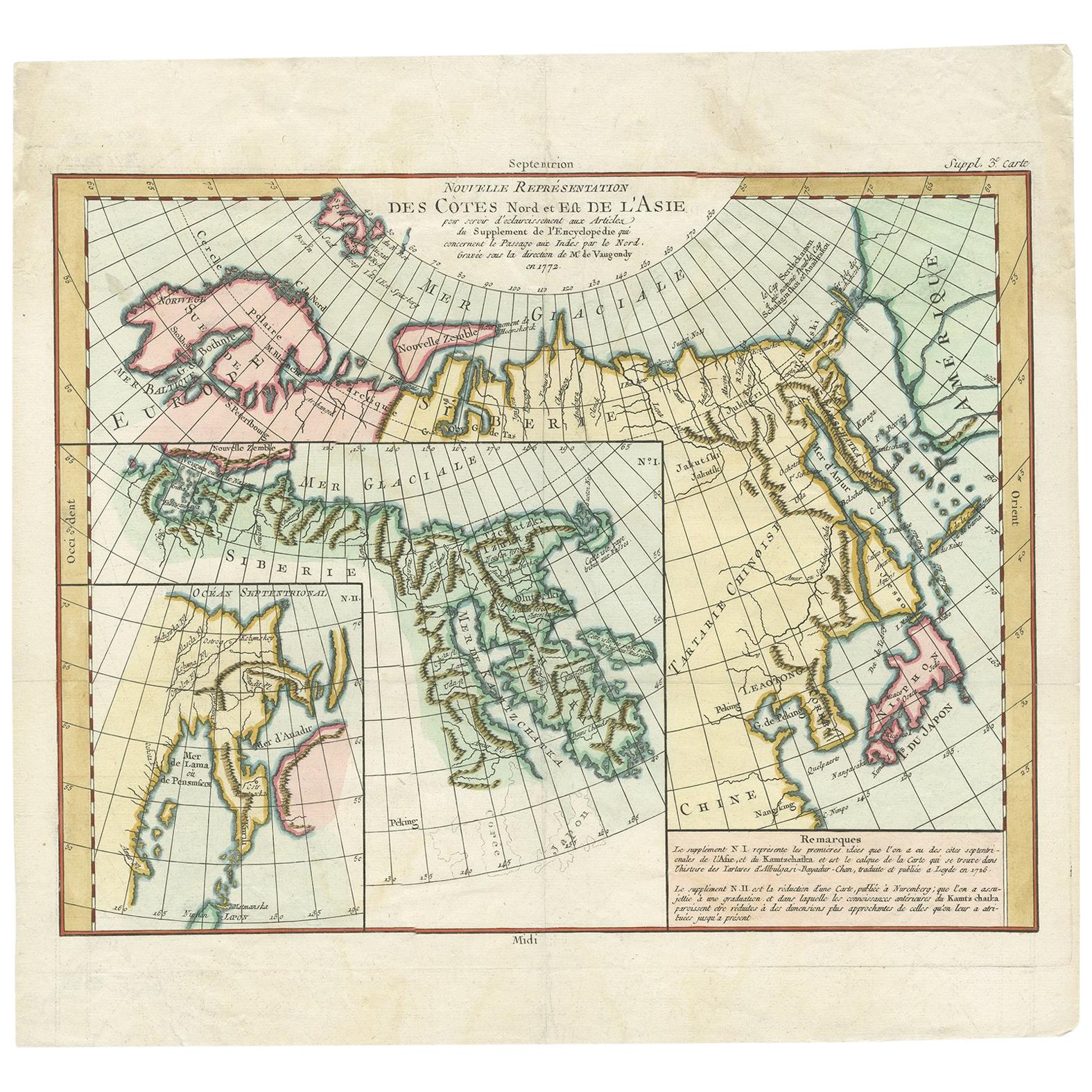
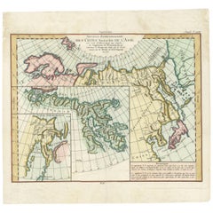
Antique Map of the North and East Coast of Asia by Vaugondy, circa 1750
Located in Langweer, NL
Antique map titled 'Nouvelle representation des Cotes Nord et Est de L'Asie.'
Map the north and east coast of Asia, showing an oddly shaped Japan and inset maps of Kamchatka. Origi...
Category
Antique Mid-18th Century French Maps
Materials
Paper
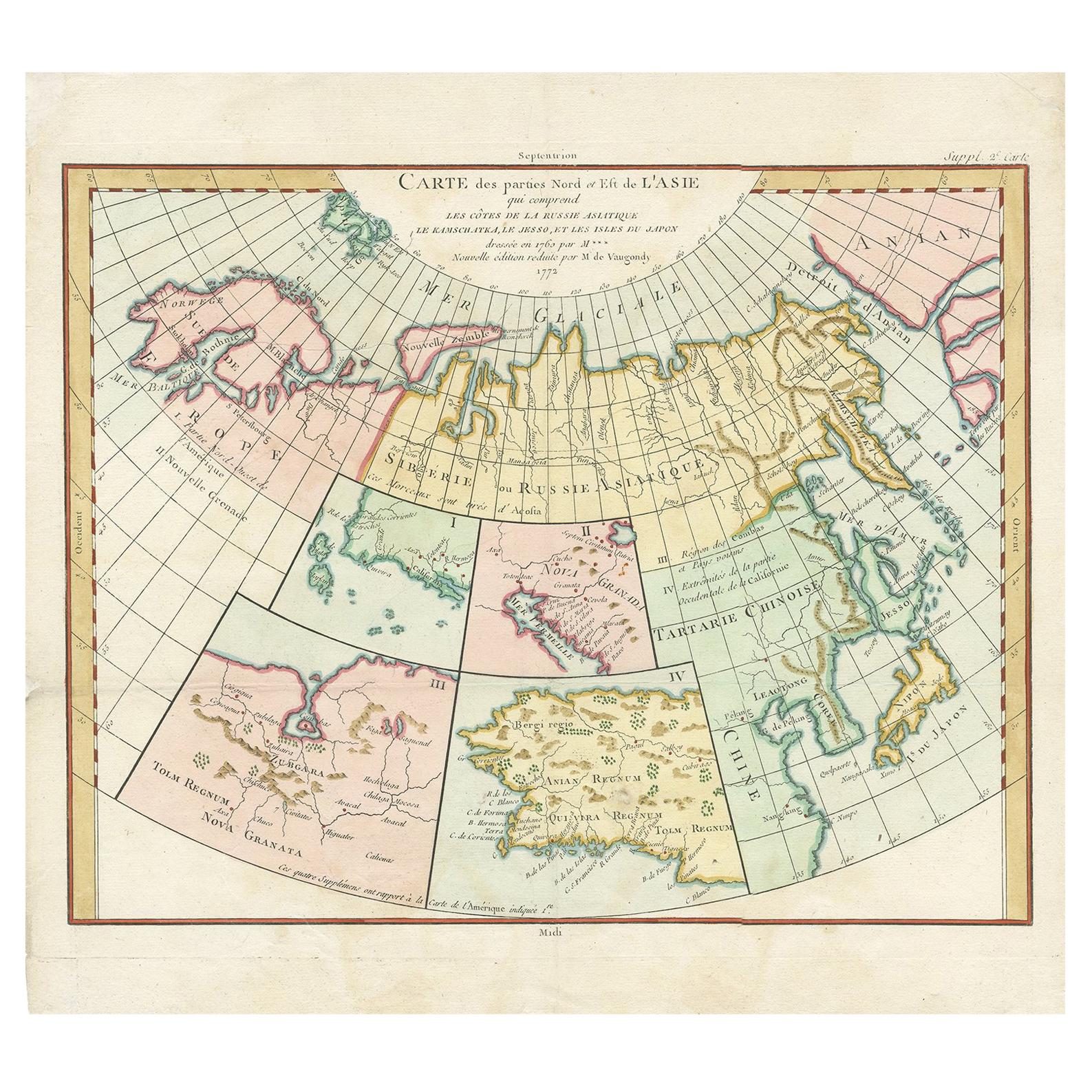
Antique Map of North Europe and East Asia by Vaugondy, circa 1750
Located in Langweer, NL
Antique map titled 'Carte des parties nord et est de L'Asie'. Map of the Northern parts and East Asia. Five maps on one sheet, showing California, Alaska and Syberia, Korea and Japan...
Category
Antique Mid-18th Century Maps

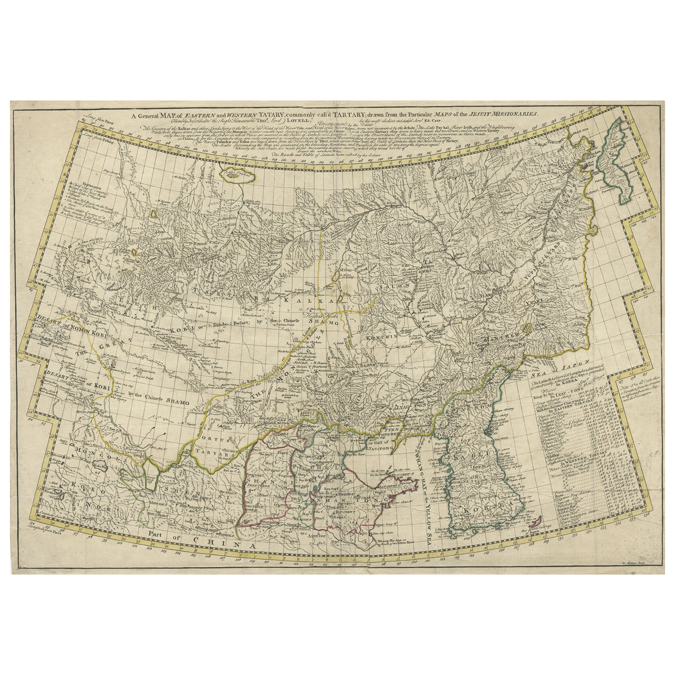
Rare Hand-Colored Antique Map of Tartary, China and Korea, ca.1741
Located in Langweer, NL
Antique map titled 'A General Map of Eastern and Western Tatary, commonly call'd Tartary; drawn from the Particular Maps of the Jesuit Missionaries'.
Rare antique map of Tartary, C...
Category
Antique 1740s Maps
Materials
Paper
$2,632 Sale Price
20% Off
Interesting Old Map of the Nw Coast of America and the Ne Coast of Asia, ca.1772
Located in Langweer, NL
Antique map titled 'Carte Generale des Decouvertes de l'Amiral de Fonte (..)'.
Original antique map of the discoveries of Admiral de Fonte, showing the possibility of a north-west passage. Interesting map of the NW Coast...
Category
Antique 1770s Maps
Materials
Paper
$567 Sale Price
35% Off
Early 19th Century Hand Coloured Map of North America by Aaron Arrowsmith
By Aaron Arrowsmith
Located in Hamilton, Ontario
Hand coloured map in French by English cartographer Aaron Arrowsmith (1750–1823) titled "Amerique Septentionale" (North America).
Map size: 9.5" x 8"
Mat size: 20.5" x 14.25".
Category
Antique Early 19th Century English Maps
Materials
Paper

$795 Sale Price
36% Off
Antique Map of America with California as an Island by Homann '1710'
Located in Langweer, NL
This antique map, titled "Totius Americae Septentrionalis et Meridionalis," represents a significant cartographic piece from 1710 by Johann Baptist Homann. Here's a description of this remarkable map:
- Title: Totius Americae Septentrionalis et Meridionalis (...)
- Date: Published in 1710 by Johann Baptist Homann.
Description:
This map is a first edition of Johann Baptiste Homann's map of America, and it is notable for several cartographic features and historical representations:
1. California as an Island...
Category
Antique Early 18th Century Maps
Materials
Paper

$2,243 Sale Price
25% Off
More Ways To Browse
Antique Maps Of North America
Mercator Map
California Map
Antique Maps California
Sir Francis Drake
Charles Cary Rumsey
Club 57
Colleen Browning
Communist Propaganda Poster
Crazy Watch
David Abelson
Dichroic Glass Sculpture
Dichroic Sculpture Art
Dick Van Dyke
Ferdinando Codognotto
Gay Bar
German U Boat
Girls And Horses