Items Similar to Persiae, Armeniae, Natoliae et Arabiae Descriptio per Frederick deWit 1666 map

Want more images or videos?
Request additional images or videos from the seller
1 of 8
Frederick DeWitPersiae, Armeniae, Natoliae et Arabiae Descriptio per Frederick deWit 1666 map1666
1666
$1,850
£1,401.73
€1,608.37
CA$2,603.25
A$2,861.69
CHF 1,503.97
MX$34,751.30
NOK 18,761.66
SEK 17,775.36
DKK 12,003.67
About the Item
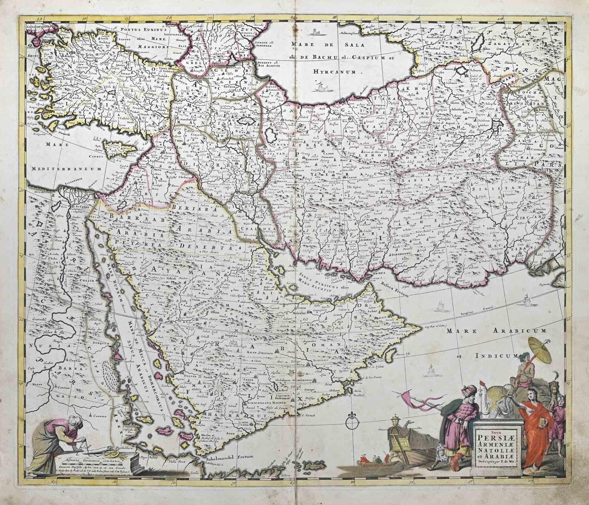
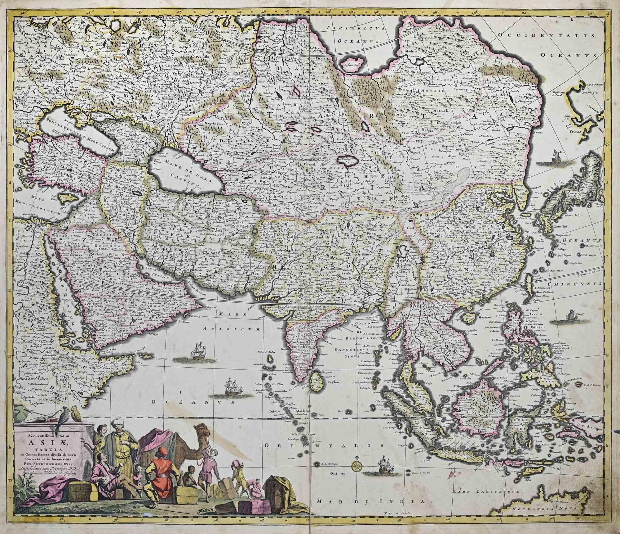
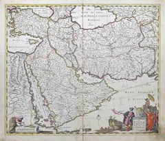
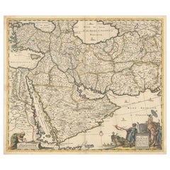
Map of Persiae, Armeniae, Natoliae et Arabiae Descriptio per F de Wit 1688 engraving from: Atlas Contractus Orbis Terrarum Praecipuas ac Novissimas Complectens Tabulas. Amsterdam, N. Visscher, 1656-77. (Koeman III, Vis5-8) This highly decorative map of the Middle East is by the Dutch engraver, publisher, and map seller Frederick de Wit (1629 or 1630-1706). It was published in Amsterdam in about 1666. The map covers the regions from present-day Turkey and Egypt to Afghanistan and the Arabian Peninsula, the Red Sea, the Nile River, Cyprus, Asia Minor, the Gulf of Aden, Armenia, the Caspian Sea, and the Indian Ocean. Unlike in many antique maps of the area, a great amount of geographic information is shown throughout the Arabian Peninsula, including the locations of cities, towns, rivers, and mountain ranges. The details in this map can be attributed to Nicolas Sanson’s map of 1654, called Carte des Trois Arabies, which is widely regarded as one of the largest-scale and most detailed maps of the region of its day. The decorative title cartouche features several exotic figures and animals and a merchant ship with its boat. De Wit was born in Gouda and moved to Amsterdam, where he maintained his shop on the Kalverstraat. His works included sea and world atlases, wall maps, and town books containing plans of Dutch and European cities. Some time after 1674 he acquired the copper plates of town books by Johannes Janssonius and Joan Blaeu. In 1688, he obtained from the States General, the Dutch government of the day, the privilege to publish his maps. De Wit’s maps were in demand throughout Europe and were sold until 1763 by the firm of Johannes Covens and Corneille Mortier.
- Creator:Frederick DeWit (1630 - 1706, Dutch)
- Creation Year:1666
- Dimensions:Height: 20 in (50.8 cm)Width: 23.25 in (59.06 cm)
- More Editions & Sizes:n/a/Price: $1,850
- Medium:
- Movement & Style:
- Period:1660-1669
- Condition:
- Gallery Location:Paonia, CO
- Reference Number:1stDibs: LU780312905542
About the Seller
4.9
Gold Seller
Premium sellers maintaining a 4.3+ rating and 24-hour response times
Established in 1978
1stDibs seller since 2017
128 sales on 1stDibs
Typical response time: 2 hours
- ShippingRetrieving quote...Shipping from: Paonia, CO
- Return Policy
Authenticity Guarantee
In the unlikely event there’s an issue with an item’s authenticity, contact us within 1 year for a full refund. DetailsMoney-Back Guarantee
If your item is not as described, is damaged in transit, or does not arrive, contact us within 7 days for a full refund. Details24-Hour Cancellation
You have a 24-hour grace period in which to reconsider your purchase, with no questions asked.Vetted Professional Sellers
Our world-class sellers must adhere to strict standards for service and quality, maintaining the integrity of our listings.Price-Match Guarantee
If you find that a seller listed the same item for a lower price elsewhere, we’ll match it.Trusted Global Delivery
Our best-in-class carrier network provides specialized shipping options worldwide, including custom delivery.More From This Seller
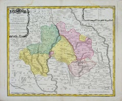
View AllMap of Tabula Geographica Territorium Civitatis Svevo=Hallensis by Homann 1762
By Homann Heirs
Located in Paonia, CO
Map of Tabula Geographica sistens Territorium Liberae Sacri Romani Imperi Civitatis Svevo=Hallensis in suas Praefecturas divisum unacum finitimis Regionibus delineata a Mattheo ...
Category
1760s Other Art Style More Prints
Materials
Engraving
Antique 1765 Wine Country Folding Map of France, Bordeau etc.
Located in Paonia, CO
Route du Carosse de Bordeaux, part de Paris tous les Mardis a 11 matin. a et pafse 1765 is a comprehensive map with two routes through the wine country of France starting in Paris going south...
Category
1760s Other Art Style Landscape Prints
Materials
Etching

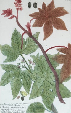
Ricinus Africanus Maximus N. 867 J.W. Weinman original engraving 1737
By Johann Wilhelm Weinmann
Located in Paonia, CO
Mezzotint Engraving with Some Hand Coloring image size 15.25 x 10 from Johan Wilhelm Weinmann’s ( 1683-1741 ) Phytanthoza Iconographia, a comprehensive scientific eight volume set w...
Category
1730s Landscape Prints
Materials
Engraving
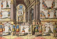
Academie de l’Espee Tabula XXI by Girard Thibault 17thc fencing engraving
By Pierre Thibault
Located in Paonia, CO
Hand colored original engraving from the Academie de l’Espee ( full title can be translated as Academy of the Sword: wherein is demonstrated by mathematical rules on the foundation of a mysterious circle the theory and practice of the true and heretofore unknown secrets of handling arms on foot and horseback ) by Girard Thibault...
Category
17th Century Other Art Style Figurative Prints
Materials
Engraving
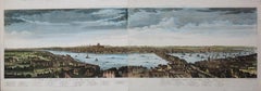
A View of London as it was in the Year 1647 pub. by Boydell 1756
Located in Paonia, CO
A View of London as it was in the Year 1647 is a hand colored copper engraving published by the well known British publisher and engraver John Boydell (1720-1804) and engraved by R.Benning sold at Cheapside London 1756. Panoramic view on two sheets conjoined as issued linen mounted. Lettered with title in French and English along the base of the image including a numbered key to the structures. In very good condition except for one 1/8 inch tear in the sky to the left of the middle seam that is barely noticeable. This is a large very detailed panorama of London...
Category
1750s Other Art Style Landscape Prints
Materials
Etching
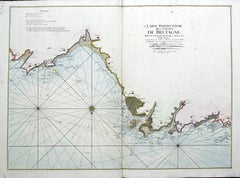
Carte Particular Des Costes De Bretagne Depuis le Cap de Frehel, Jusques a Perros
By Pierre Mortier
Located in Paonia, CO
Carte Particulaire Des Costes De Bretagne Depuis Le Cap de Frehel, Jusques a Perros, & L’Isle Tome. This large sea scale chart shows part of the northwestern co...
Category
1690s Landscape Prints
Materials
Engraving
You May Also Like
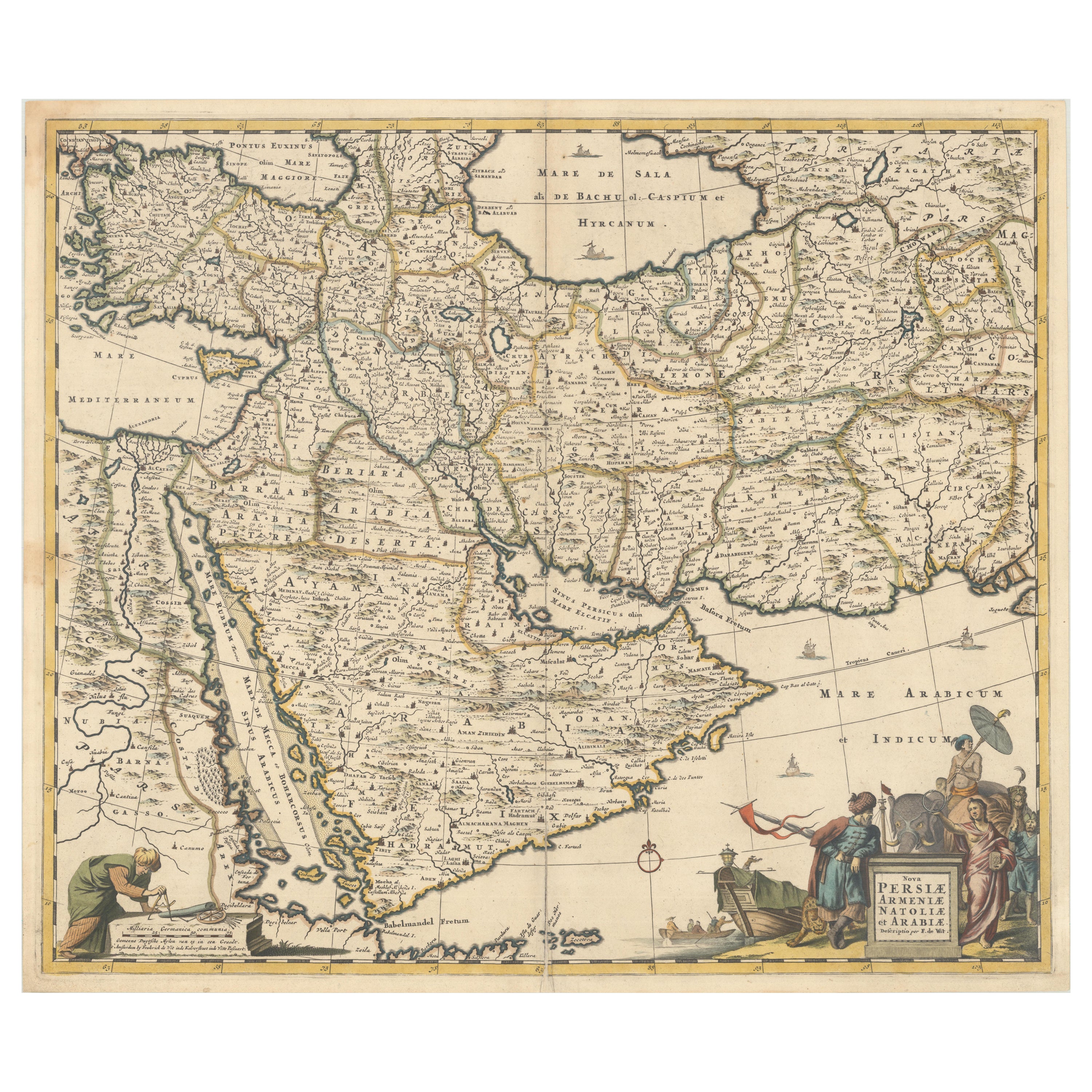
Nova Persiae, Armeniae, Natoliae et Ara.. - Etching by Frederick de Wit - 1680ca
By Frederick de Wit
Located in Roma, IT
This double-page etching with contemporary coloring, entitled Nova Persiae, Armeniae, Natoliae et Arabiae, was realized by the cartographer Frederick de Wit for the famous Atlas publ...
Category
1680s Modern Figurative Prints
Materials
Etching
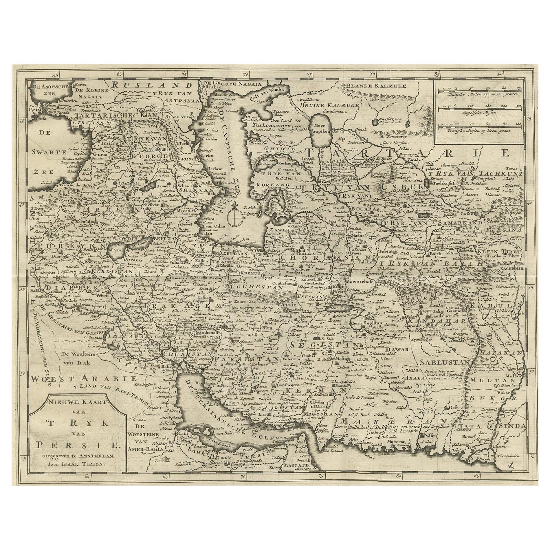
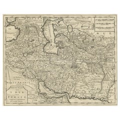
Map of Persia, the Caspian & India – Isaak Tirion, c.1730
Located in Langweer, NL
Map of Persia and Surrounding Regions – “Nieuwe Kaart van 't Ryck van Persie” by Isaak Tirion, Amsterdam, c. 1730
This finely detailed copperplate map titled “Nieuwe Kaart van 't Ry...
Category
Antique Mid-18th Century Dutch Maps
Materials
Paper
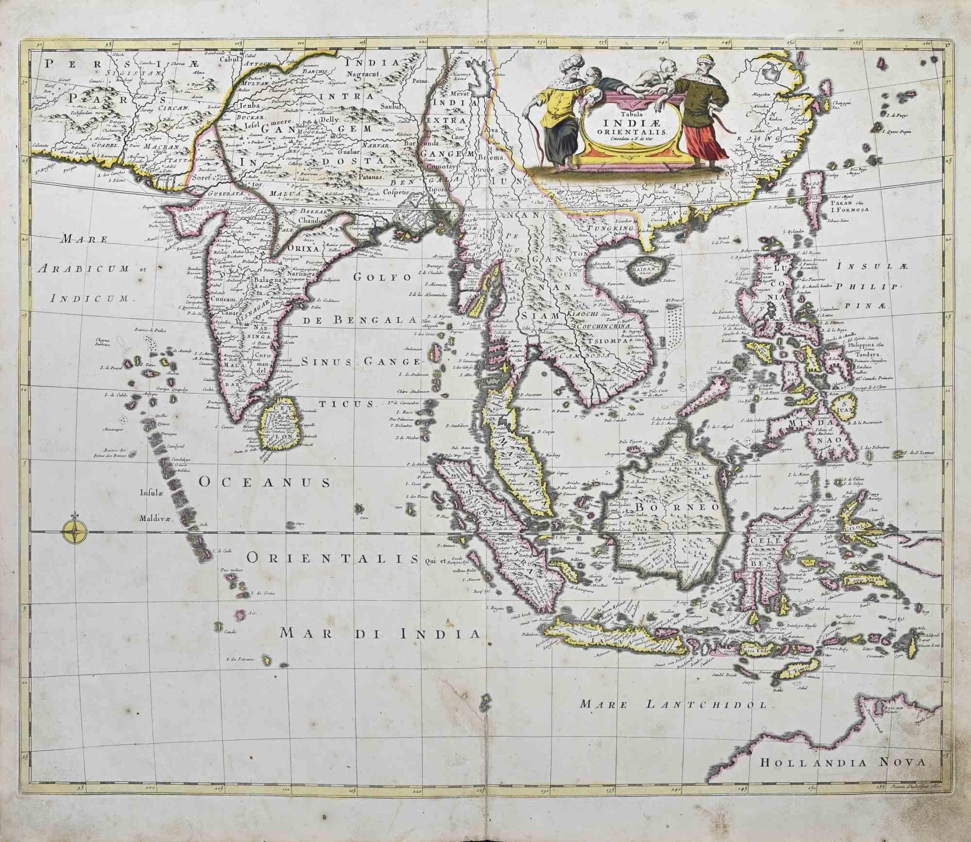
Tabula Indiae Orientalis - Etching by Frederick de Wit - 1680ca
By Frederick de Wit
Located in Roma, IT
This double-page etching with contemporary coloring, entitled Tabula Indiae orientalis, was realized by the cartographer Frederick de Wit for the famous Atlas published in Amsterdam ...
Category
1680s Modern Figurative Prints
Materials
Etching

Circa 1691 Frederick de Wit Map: Middle East with Arabia, Persia & More
Located in Langweer, NL
Circa 1691 Frederick de Wit Map: Middle East with Arabia, Persia & More
This exquisite hand-colored map, circa 1691, by Frederick de Wit, illustrates the Middle East, spanning from Turkey and Egypt to Afghanistan, with a detailed representation of the Arabian Peninsula.
The map's detailing in Arabia is based on Nicolas Sanson's influential 1654 map, which was one of the most accurate and detailed depictions of the region up to the mid-seventeenth century.
The decorative title cartouche is richly adorned with images of exotic figures, animals, and a merchant ship, symbolizing the region's historical trade importance. Additionally, a mapmaker is shown working with traditional tools, adding a touch of authenticity to the cartographic art.
This is the fourth state of the map, published between 1691 and 1696. The map measures 21.8 inches in width by 18.5 inches in height, featuring a sharp impression, with minimal staining and a carefully repaired centerfold separation at the bottom.
Keywords:
- Middle East historical map
- Frederick de Wit map
- 17th century maps
- Arabian Peninsula map
- Persia (Iran) map
- Turkey and Egypt map...
Category
Antique 1690s Maps
Materials
Paper
$2,345 Sale Price
20% Off
Accuratissima Totius Asiae Tabula - Etching by Frederick de Wit - 1680 ca
By Frederick de Wit
Located in Roma, IT
This double-page etching with contemporary coloring, entitled Accuratissima totius Asiae Tabula, was realized by the cartographer Frederick de Wit for the famous Atlas published in A...
Category
1680s Modern Figurative Prints
Materials
Etching

Finely Engraved Historical Map of Middle East and Asia, c.1745
Located in Langweer, NL
Description: Antique map titled'Theatrum Historicum pars Orientalis.'
Finely engraved historical map with a profusion of details. It shows the Middle East and Asia. Decorative ti...
Category
Antique 1740s Maps
Materials
Paper

$1,388 Sale Price
20% Off
More Ways To Browse
Merchant Ship
Antique Map Of Middle East
Joan Blaeu
African American Vintage Posters
Alex Katz Pink
Bernard Buffet Lithograph Paris
Bernard Buffet Notre Dame
California Wine Country Art
Chanel Lithograph
Dali French Railway
David Roberts Jerusalem
Ella Fort On Sale
Etchings Brooklyn Bridge
Foll Art
Giovanni Battista Piranesi On Sale
Gonville Caius
Hockney Sun
James Swann