Items Similar to Australia, Tallis antique map, 1851


Want more images or videos?
Request additional images or videos from the seller
1 of 7
John RapkinAustralia, Tallis antique map, 18511851
1851
$495
£373.56
€427.67
CA$698.11
A$766.44
CHF 399.85
MX$9,275.02
NOK 5,011.56
SEK 4,722.20
DKK 3,192.47
About the Item
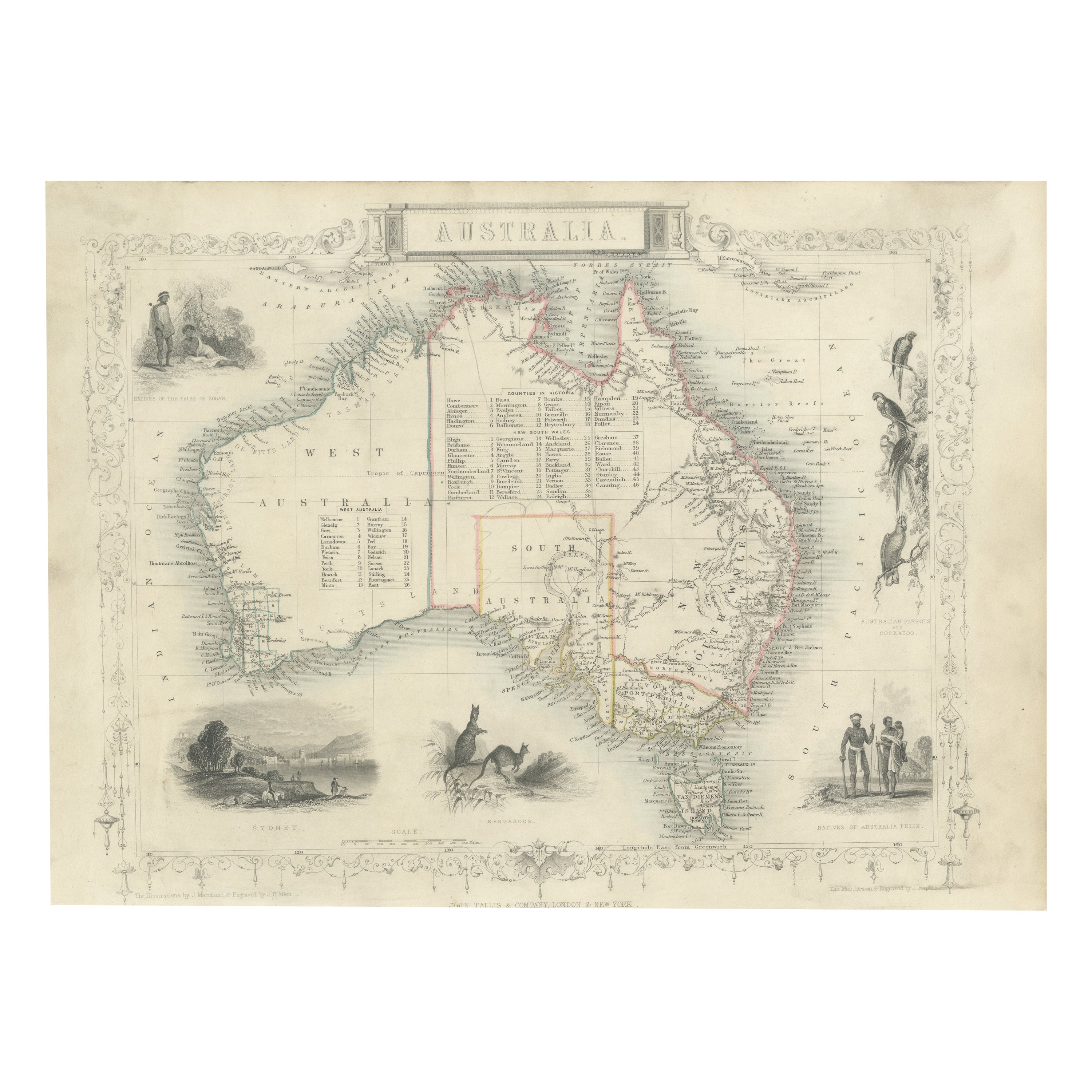
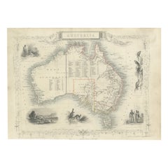
'Australia'
With decorative border surrounds and vignettes including a view of Sydney, Kangaroos, Natives of Australia Felix, Australian Parrots and Cockatoos and Natives of the Tribe of Bogan.
265mm by 325mm (sheet)
- Creator:John Rapkin (1813 - 1899, British)
- Creation Year:1851
- Dimensions:Height: 10.44 in (26.5 cm)Width: 12.8 in (32.5 cm)
- Medium:
- Movement & Style:
- Period:
- Condition:Remains of stitching holes along the bottom edge of the sheet. Slightly unevenly trimmed along left edge with very slight loss of the printed decorative border. Toning / discolouration to the reverse of the sheet.
- Gallery Location:Melbourne, AU
- Reference Number:Seller: MP96881stDibs: LU1244215629972
About the Seller
5.0
Platinum Seller
Premium sellers with a 4.7+ rating and 24-hour response times
Established in 2005
1stDibs seller since 2019
613 sales on 1stDibs
Typical response time: <1 hour
- ShippingRetrieving quote...Shipping from: Melbourne, Australia
- Return Policy
Authenticity Guarantee
In the unlikely event there’s an issue with an item’s authenticity, contact us within 1 year for a full refund. DetailsMoney-Back Guarantee
If your item is not as described, is damaged in transit, or does not arrive, contact us within 7 days for a full refund. Details24-Hour Cancellation
You have a 24-hour grace period in which to reconsider your purchase, with no questions asked.Vetted Professional Sellers
Our world-class sellers must adhere to strict standards for service and quality, maintaining the integrity of our listings.Price-Match Guarantee
If you find that a seller listed the same item for a lower price elsewhere, we’ll match it.Trusted Global Delivery
Our best-in-class carrier network provides specialized shipping options worldwide, including custom delivery.More From This Seller
View AllNew South Wales, Australia, antique mid 19th century engraved John Tallis map
Located in Melbourne, Victoria
'New South Wales'
With decorative border surrounds and vignettes of 'Sydney Cove'. 'The Murray' and 'Xanthorrhea'.
'Drawn and engraved by J Rapkin'. Published by John Tallis.
375m...
Category
1840s Victorian Landscape Prints
Materials
Engraving

Carte du Bresil, antique 1860s engraved map of Brazil
Located in Melbourne, Victoria
'Carte du Bresil'
Engraving with original outline colouring, circa 1860, by Alexandre Vuillemin, published in Paris.
31cm by 41cm (sheet)
21.5cm by 31.5cm (image)
Category
Late 19th Century Victorian More Prints
Materials
Lithograph

Africa. Southern Part. Century Atlas antique vintage map
Located in Melbourne, Victoria
'The Century Atlas. Africa. Southern Part'
Original antique map, 1903.
Inset maps of 'Cape Town', 'Johannesburg' and 'Ladysmith'.
Central fold as issued. Map name and number printe...
Category
Early 20th Century Victorian More Prints
Materials
Lithograph

South America, Eastern Part. Century Atlas antique vintage map
Located in Melbourne, Victoria
'The Century Atlas. South America. Eastern Part'
Original antique map, 1903.
Inset map 'Rio de Janeiro and Vicinity'.
Central fold as issued. Map name and number printed on the rev...
Category
Early 20th Century Victorian More Prints
Materials
Lithograph

Africa. North-East Part. Century Atlas antique vintage map
Located in Melbourne, Victoria
'The Century Atlas. Africa. North-East Part'
Original antique map, 1903.
Inset map of 'Nile Delta and Suez Canal'.
Central fold as issued. Map name and nu...
Category
Early 20th Century Victorian More Prints
Materials
Lithograph

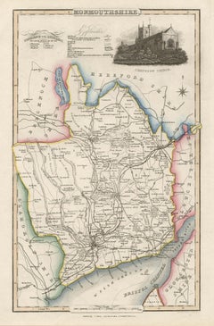
Monmouthshire, English County Antique map, 1847
By Isaac Slater
Located in Melbourne, Victoria
Steel-engraved map with original outline colouring by Isaac Slater. A detailed engraved map of the English county with title, scale, and key. Decorated with an uncoloured engraved vi...
Category
19th Century Naturalistic Landscape Prints
Materials
Engraving
You May Also Like
Original Antique Map of Australia by Dower, circa 1835
Located in St Annes, Lancashire
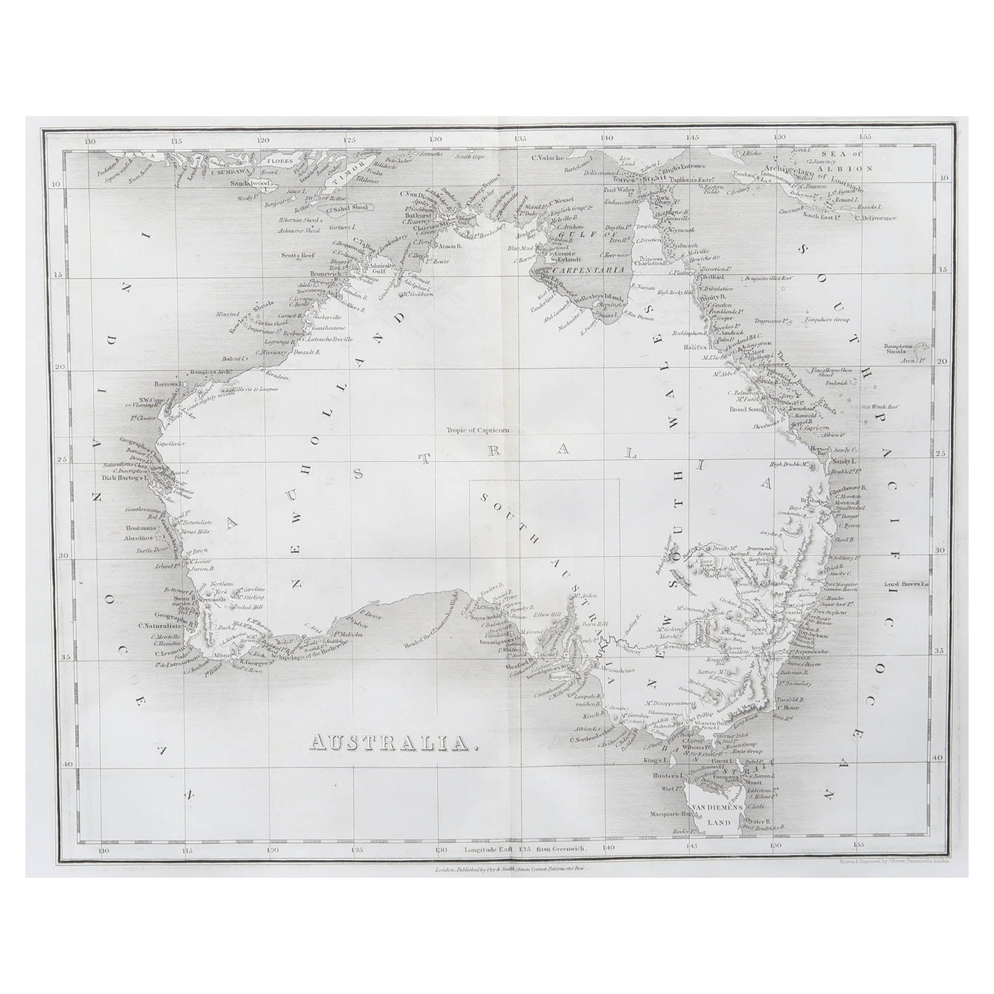
Nice map of Australia
Drawn and engraved by J.Dower
Published by Orr & Smith. C.1835
Unframed.
Free shipping
Category
Antique 1830s English Maps
Materials
Paper

Gold Rush Era Masterpiece: The Tallis & Rapkin Rare Map of Pre-Queensland, 1851
Located in Langweer, NL
The image is an original historical map of Australia from the year 1851, created by John Rapkin with illustrations by J. Marchant and engravings by J. B. Allen. The map was published...
Category
Antique 1850s Maps
Materials
Paper
$558 Sale Price
20% Off
Free Shipping
German Antique Map of Australia and New Zealand, 1857
Located in Langweer, NL
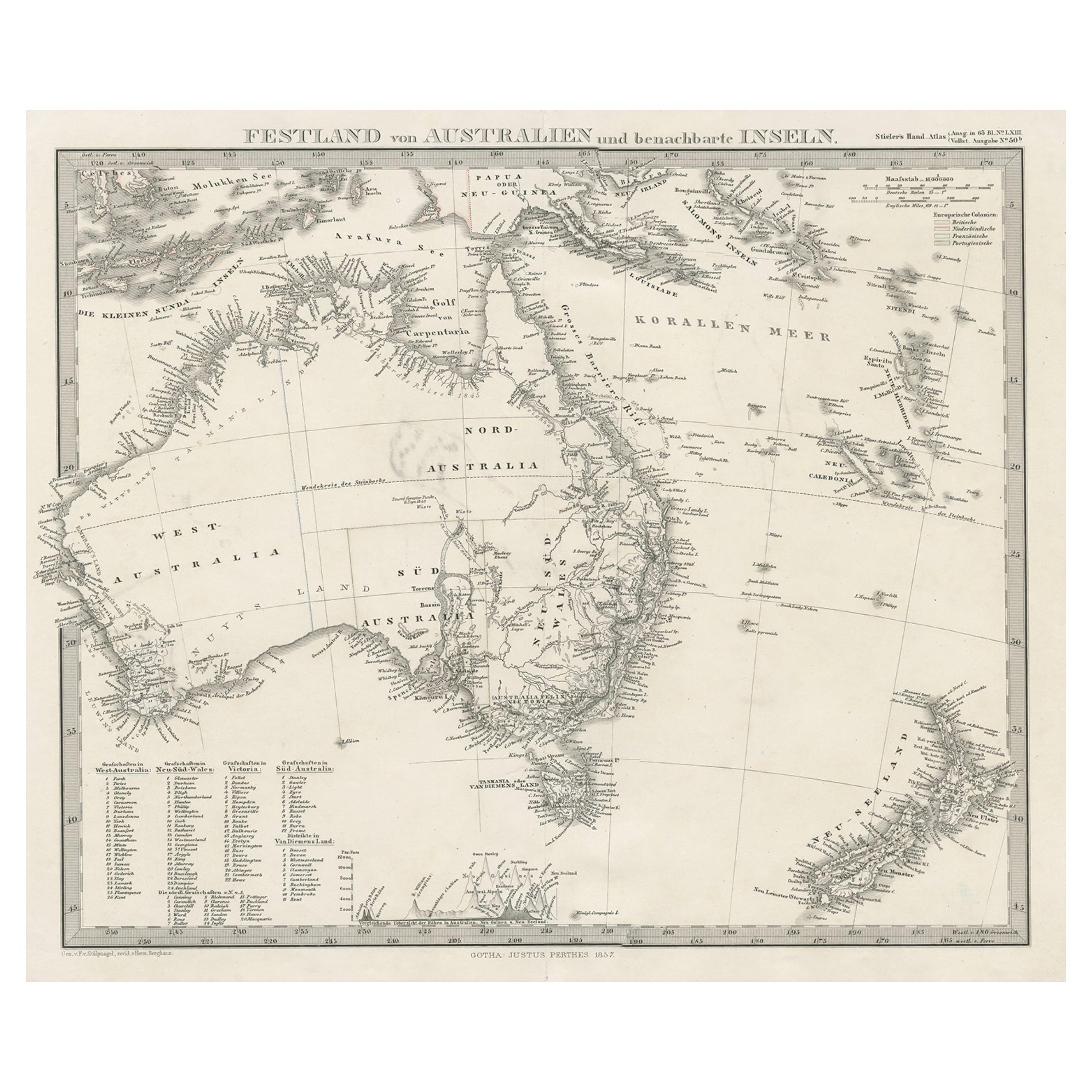
Antique map Australia titled 'Festland von Australien und benachbarte Inseln'. Detailed map of Australia and New Zealand, including excellent det...
Category
Antique 19th Century Maps
Materials
Paper

$240 Sale Price
20% Off
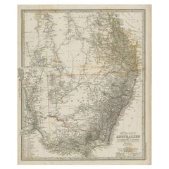
Antique Map of Australia and surrounding Islands by F. von Stülpnagel, 1850
Located in Langweer, NL
Antique map titled 'Festland von Asutralien und benachbarte Inseln'. Map showing Australia, New Zealand, Southern New-Guinea and surrounding islands. This map originates from Stieler...
Category
Antique Mid-19th Century Maps
Materials
Paper

$185 Sale Price
30% Off
Antique Map of Southeastern Australia by F. von Stülpnagel, 1850
Located in Langweer, NL
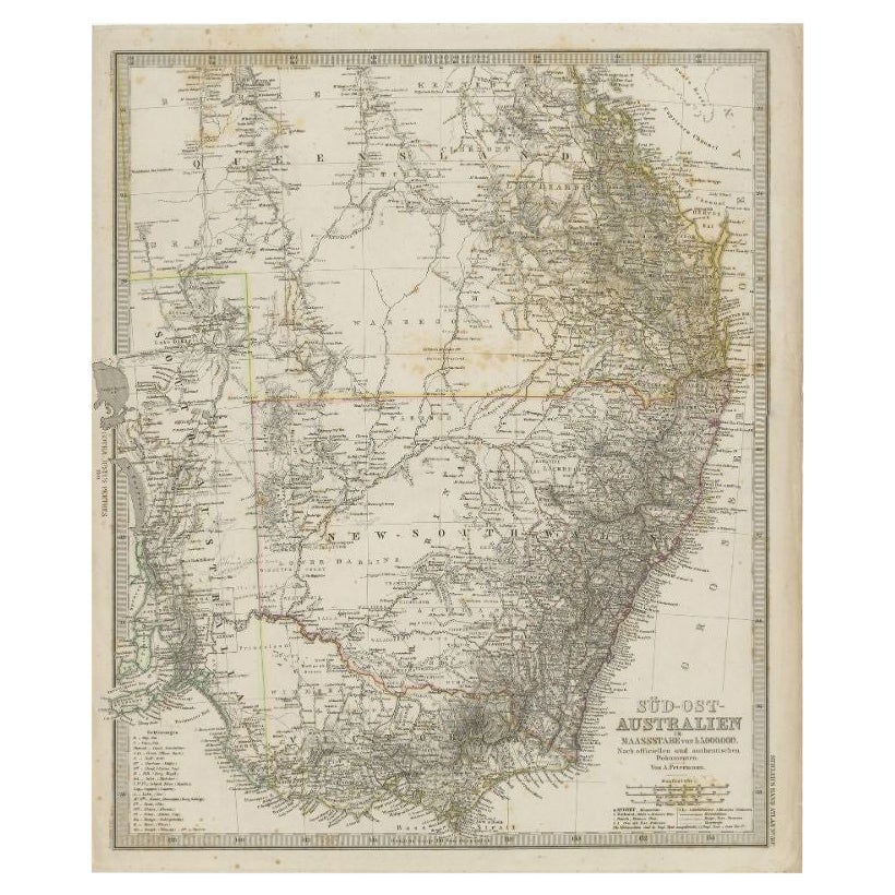
Antique map titled 'Süd-Östlichen Australien'. Map of southeastern Australia with inset maps of southwest Australia and Tasmania compiled by the military cartographer Friedrich von S...
Category
Antique Mid-19th Century Maps
Materials
Paper

$172 Sale Price
35% Off
Antique Map of South East Australia by Stieler, c.1848
By Thomas Kitchin
Located in Langweer, NL
Antique map Australia titled 'Süd-Ost Australien'. Detailed map of South East Australia. Orginates from 'Stieler's Hand Atlas', published in Germ...
Category
Antique 19th Century Maps
Materials
Paper
$57 Sale Price
20% Off