16th Century Prints and Multiples

1
to
14
128
56
24
78
134
47
3
95
77
7
2
4
Overall Height
to
Overall Width
to
57
8
1
1
117
35
33
32
28
27
24
22
22
22
20
13
13
12
11
10
9
9
8
7
4,798
8,981
52,674
29,707
730
992
2,041
2,403
2,362
4,559
7,151
12,032
6,689
3,834
3,874
88
6
4
4
4
120
48
31
17
11
Period: 16th Century
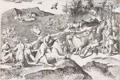
The Rape of Europa
Located in New York, NY
A very good impression of this scarce engraving with strong contrasts. Catalogue reference: Bartsch 109
Category

Italian School 16th Century Prints and Multiples

Materials

Engraving

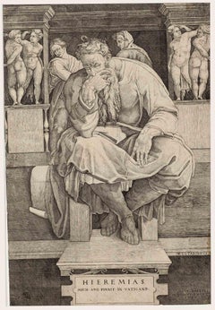
The Prophet Jeremiah - Etching by Nicolas Beatrizet - 1547
Located in Roma, IT
Rare proof engraved by the author after Michelangelo Buonarroti. Second state on two, with the excudit by Lafrefi. Paper with the ancient watermark of the anchor in the circle. Excel...
Category

Modern 16th Century Prints and Multiples

Materials

Etching

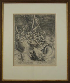
Johannes Sadeler I (Flemish 1550-1600) – Engraving 1582 - Jonah and the Whale II
Located in Meinisberg, CH
Johannes Sadeler I (Flemish, ∗ 1550 in Brussels, Belgium – † 1600 Venice, Italy) Jonah Spat Up by the Whale (Sheet II) Engraved by Sadeler after an image created by Theodor Bernard...
Category

Renaissance 16th Century Prints and Multiples

Materials

Laid Paper, Engraving

Johannes Sadeler I (Flemish 1550-1600) – Engraving 1582 - Jonah and the Whale I
Located in Meinisberg, CH
Johannes Sadeler I (Flemish, ∗ 1550 in Brussels, Belgium – † 1600 Venice, Italy) Jonah thrown to the Whale (First Sheet) Engraved by Sadeler after an image created by Theodor Berna...
Category

Renaissance 16th Century Prints and Multiples

Materials

Laid Paper, Engraving

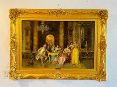
The Chess Game Texture Print By Renowned Italian Artist Francesco Beda
Located in LOS ANGELES, CA
**ANNUAL SUPER SALE UNTIL APRIL 15TH ONLY** *This Price Won't Be Repeated Again This Year-Take Advantage Of It* RESTORED, numbered and RARE Vintage Textured Print Aft...
Category

Expressionist 16th Century Prints and Multiples

Materials

Handmade Paper

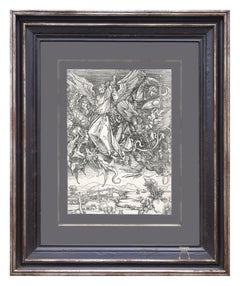
Saint Michael fighting the Dragon
Located in Zürich, CH
"Saint Michael Fighting the Dragon (B. 72; M., Holl. 174)" This engraving is a print from the Latin publication of the text of the Apocalypse of 1511. Dürer’s series dedicated to the Apocalypse comprises 15 engravings and a title sheet. The master worked on this series from 1496 to 1498. In 1511, Dürer repeated his Latin edition and provided it with a prohibition on the series being copied. The Apocalypse was intended for extremely varied levels of society. All of the sheets are united by the theme of the battle between good and evil. The work refers to a quote from the Revelation of St. John the Divine: “And there was war in heaven...
Category

16th Century Prints and Multiples

Materials

Engraving

Map of San Georgi - Etching by G. Braun/F. Hogenberg - 1575
Located in Roma, IT
Etching by Georg Braun and Frans Hogenberg, realized in 1575 and belonging to the Suite "Civitates Orbis Terrarum". The first volume of the Civitates Orbis Terrarum was published in ...
Category

Modern 16th Century Prints and Multiples

Materials

Etching

Map of Canonor - Etching by G. Braun/F. Hogenberg - 1575
Located in Roma, IT
Etching realized by Georg Braun and Franz Hogenberg, belonging to the Suite "Civitates Orbis Terrarum". The first volume of the Civitates Orbis Terrarum was published in Cologne in 1...
Category

Modern 16th Century Prints and Multiples

Materials

Etching

[Civitates Orbis Terrarum]Map of Cefal - Etching by G. Braun/F. Hogenberg - 1575
Located in Roma, IT
Etching by Georg Braun and Franz Hogenberg, belonging to the "Civitates Orbis Terrarum". Good condition. The first volume of the Civitates Orbis Terrarum was published in Cologne in ...
Category

Contemporary 16th Century Prints and Multiples

Materials

Etching

Nordlingen, Antique Map from"Civitates Orbis Terrarum"
Located in Roma, IT
Braun G. and Hogenberg F., Nordlingen from the collection "Civitates Orbis Terrarum", Cologne, T. Graminaeus, 1572-1617. Image dimensions: 10.5 x 23.5 cm; dimensions: 10.5 x 26.3 cm....
Category

16th Century Prints and Multiples

Materials

Etching

'Agony in the Garden' Renaissance woodcut print by Virgil Solis after Dürer
By Virgil Solis
Located in Milwaukee, WI
This woodcut print, depicting the 'Agony in the Garden,' is a rare image coming from a small passional. A passional is a common kind of devotional ...
Category

Northern Renaissance 16th Century Prints and Multiples

Materials

Woodcut, Paper

Siculus - from the portfolio “The Stables of Don John of Austria”
By Jan Van der Straet
Located in Chicago, IL
An Old Master print from the series of 43 engravings depicting horses of different breeds from the stables of John of Austria (1547-1578), son of Emperor Charles V. Each print shows a horse in the foreground on a hilltop overlooking a distant landscape. Each bears it's title breed, centered upper edge, with two columns of brief explanatory Latin texts in the lower margins. Published by Philips Galle...
Category

Old Masters 16th Century Prints and Multiples

Materials

Engraving

Prodigus - Original etching by Gerard de Jode - 1570
By Gerard de Jode
Located in Roma, IT
Prodigus is a beautiful black and white engraving on paper, made by Gerard de Jode around 1570. Title in Latin "Delitys fruitur veneris patrisque liei / Prodigus, the premiere mox miser ecce fame" on the plate on the lower margin and "MC" monogrammed on plate the lower left margin and inscription of the author on the plate on the lower right margin ( the name is partially readable). The parable of the son to the prodigy...
Category

Northern Renaissance 16th Century Prints and Multiples

Materials

Etching

Jan P. Saenredam ( 1565-1607 ) - Taste , The Five Senses - 16thC Dutch Engraving
Located in Meinisberg, CH
Jan Pieterszoon Saenredam (Dutch, 1565 - 1607) Taste - "Dulcia sepe nocent avido gustata palato, Votaq damnose luxurosa gule." (Translation...
Category

Dutch School 16th Century Prints and Multiples

Materials

Ink, Laid Paper, Engraving

Court wrestlers of the Sultan of Turkey-dressed for outdoors, resting and fighti
Located in Middletown, NY
Bruyn, Abraham de (after). Court wrestlers of the Sultan of Turkey-dressed for outdoors, resting and fighting. 1577. Engraving on hand made laid paper, 10 5/8 x 6 7/8 inches (268 x 1...
Category

Old Masters 16th Century Prints and Multiples

Materials

Handmade Paper, Laid Paper, Engraving

Aegidius Sadeler II (1570 1629) 16thC Engraving - Woodland Scene with Travelers
By Aegidius Sadeler II
Located in Meinisberg, CH
Aegidius Sadeler (Flemish, 1570–1629) Romantic woodland scene with traveler and his laden mule passing by a seated figure resting on the roadside • 16th, possibly early 17th century • Copper plate engraving on laid paper with circular watermark • Trimmed sheet, ca. 17 x 21 cm • No bothersome stains, damages or restorations Worldwide shipping is complimentary - There are no additional charges for handling & delivery. Aegidius Sadeler also known as Aegidius Sadeler II was a prolific Flemish engraver who was principally active at the Prague court of Rudolf II. The scene engraved is after an image created by Roelant Savery (1576 - 1639). also known as Roeland(t) Maertensz Saverij, was a Flanders-born Dutch Golden Age painter. The print was published by the Sadeler family member Marco Sadeler...
Category

Naturalistic 16th Century Prints and Multiples

Materials

Ink, Laid Paper, Engraving

View of Pisaro, Italy: A 16th Century Hand-colored Map by Braun & Hogenberg
Located in Alamo, CA
This is a 16th century original hand-colored copperplate engraved map of View of Pezaro (Pisaro), Italy entitled "Pisaurum vulgo Pezaro" by Georg Braun & Franz Hogenberg, from their famous city atlas "Civitates Orbis Terrarum", published in Augsberg, Germany in 1575. The map depicts a view of Pesaro, Italy from the west looking over the town to the Adriatic Sea. The River Foglia flows into the Adriatic in the foreground. The only identifiable building is the cathedral of San Domenico, which rises above the other roofs with its tall spire. Two women, dressed in styles of the 16th century are in conversation on a hill in the foreground on the left. Pesaro is in the province of Pesaro and Urbino and lies on the Adriatic and east of Florence. The city, which was founded by the Etruscans and named Pisaurum by the Romans, belonged from AD 754 onwards to the Papal States, and after 1285 was controlled by the princely families of Malatesta, Sforza and della Rovere. Today it is the capital of the province of Pesaro and Urbino and has a population of about 92,000. Pesaro's most famous resident, composer Gioacchino Rossini, was born here in 1792. The following is an English translation of an excerpt from Braun's description of the city: "We believe that the astonishingly short life of the inhabitants of Pesaro comes not only from the insalubrious air, but also from the great quantity of delectable and delicious fruits which they consume to excess. For this causes the production in their bodies of evil humours, which then lead to incurably fatal diseases. The area around the city is most charming and well planted with vineyards, fig trees, olive trees and other fruit-bearing trees." 
  References: Van der Krogt 4, 3369, state 1; Taschen, Braun and Hogenberg...
Category

Old Masters 16th Century Prints and Multiples

Materials

Engraving

View of Emden, Germany: A 16th Century Hand-colored Map by Braun & Hogenberg
Located in Alamo, CA
This is a 16th century original hand-colored copperplate engraved map of a bird's-eye View of Embden, Germany entitled " Emuda, vulgo Embden vrbs Frisia orientalis primaria" by Georg Braun & Franz Hogenberg, in volume II of their famous city atlas "Civitates Orbis Terrarum", published in Cologne, Germany in 1575. This is a beautifully colored and detailed map of Emden, a seaport in northwestern Germany, along the Ems River and perhaps portions of over Dollart Bay, near the border with the Netherland. The map depicts a bird's-eye view of the city from the southwest, as well as a view of the harbor and an extensive system of canals. Numerous ships of various sizes, as well as two rowboats containing numerous occupants are seen in the main waterway in the foreground and additional boats line two canals in the center of the city. Two men and two women are shown on a hill in the foreground on the right, dressed in the 16th century style of nobility. Two ornate crests are included in each corner. A title strap-work cartouche is in the upper center with the title in Latin. The crest on the right including Engelke up de Muer (The Little Angel on the Wall) was granted by Emperor Maximilian I in 1495. This is an English translation of an excerpt of Braun's description of Embden: "In Emden, the capital of East Frisia, rich merchants live in very fine houses. The city has a broad and well-situated harbour, which in my opinion is unique in Holland. Frisia and the whole of the Netherlands, for the ships can anchor here right under the city walls. They have also extended the harbour as far as the New Town, so that up to 400 ships can now find shelter here when the sea is rough." The emphasis on the harbor and waterways within the city highlights the importance of Emden's place as a seaport at this time. Embden developed from a Dutch/Flemish trading settlement in the 7th-8th centuries into a city as late as late 14th century. In 1494 it was granted staple rights, and in 1536 the harbour was extended. In the mid-16th century Emden's port was thought to have the most ships in Europe. Its population then was about 5,000, rising to 15,000 by the end of the 16th century. The Ems River flowed directly under the city walls, but its course was changed in the 17th century by the construction of a canal. Emden has canals within its city limits, a typical feature of Dutch towns, which also enabled the extension of the harbor. In 1744 Emden was annexed by Prussia and is now part of Germany. It was captured by French forces in 1757 during the Seven Years' War, but recaptured by Anglo-German forces in 1758. During the Napoleonic French era, Emden and the surrounding lands of East Frisia were part of the short-lived Kingdom of Holland. References:Van der Krogt 4, 1230, State 2; Taschen, Braun and Hogenberg...
Category

Old Masters 16th Century Prints and Multiples

Materials

Engraving

Tournai (Tournay), Belgium: A 16th Century Hand-colored Map by Braun & Hogenberg
Located in Alamo, CA
This is a 16th century original hand-colored copperplate engraved map of Tournai, Belgium, entitled "Tornacum" by Georg Braun & Franz Hogenberg, in volume IV of their famous city atlas "Civitates Orbis Terrarum", published in Cologne or Augsberg, Germany in 1575. The map provides a bird's-eye view of the walled city of Tournai, the second oldest city in Belgium. It lies approximately one hour by car southwest of Brussels or from Ghent. The names of thirty of its streets, prominent buildings, churches and squares are listed in a key within a strap-work cartouche in the lower left. These locations are numbered in the key corresponding to their locations on the map. This colorful map of Tournai (Tornacum or Tournay as it was called in the 16th century) includes the title in Latin in a cartouche in the upper center. Three crests are present across the upper map. A man and two woman are standing on a hill in the foreground in the lower right dressed in the style of 16th century upper class residents of the town. This is an English translation of an excerpt of Braun's description of Tornai: “Tornacum or Turnacum is a city in Gallia Belgica, situated on the Schelde in the territory of the Nervii, called Tournai by its French inhabitants, but Dorneck by the Germans. Tournai has always been a large and powerful city, with an abundance of goods and commercial activities and wonderfully resourceful craftsmen, who invent new articles every day, and although some of these go out of use they constantly conceive of other new things, both useful and delightful, so that they have at all times something that provides work and a means of livelihood for the poor." ReferencesVan der Krogt 4, 4435, State 1; Taschen, Braun and Hogenberg...
Category

Old Masters 16th Century Prints and Multiples

Materials

Engraving

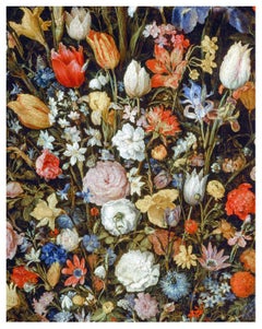
After Jan Brueghel the Elder (1568 - 1625).Flowers in a Wooden Vessel
Located in Sydney, NSW
Artist: After Jan Brueghel the Elder (Flemish 1568 - 1625). Title: Flowers in a Wooden Vessel. Limited Edition of 100 Prints. Medium: Giclée Fine Art Print on Ilford Galerie Textured...
Category

Old Masters 16th Century Prints and Multiples

Materials

Archival Ink, Rag Paper

Four chiaroscuro medallion portrait woodcuts of emperors in sepia tones c.1557
Located in Petworth, West Sussex
After Hubert Goltzius (Dutch, 1526-1583) Maximilian; Frideri; Hadrian; and Antoninus Four chiaroscuro medallion portrait woodcuts of emperors in sepia tones c.1557, the diameter of each print 18.5cm overall frame dimension approximately 54 x 54cm Provenance: Trowbridge Gallery
Category

Old Masters 16th Century Prints and Multiples

Materials

Paper

After Hans Holbein the Younger (German 1497-1543). King Henry VIII of England.
By (After) Hans Holbein The Younger
Located in Sydney, NSW
Artist: After Hans Holbein the Younger (German 1497-1543). Title: King Henry VIII of England. Limited Edition of 100. Medium: Giclée Fine Art Print on Ilford Galerie Textured Cotton Rag 310gsm paper. Sheet Size: Height 52.7 cm x Width 42 cm. About: Hans Holbein the Younger was born in Augsburg Germany in 1497, a painter and printer working in the Northern Renaissance style. Considered one of the pre-eminent portrait painters of the 16th century In 1526 Holbein travelled to England and quickly build a reputation as a fine portraitist. He then spent four years in Basel returning to England in 1532 to work for Anne Boleyn and Thomas Cromwell...
Category

Old Masters 16th Century Prints and Multiples

Materials

Archival Ink, Rag Paper

Saints Stephen, Sixtus, and Laurentius
Located in Middletown, NY
circa 1504 Woodcut on cream laid paper, 8 1/2 x 5 7/8 inches (215 x 148 mm), thread margins. Significant expert repairs to lower right sheet edge, and center right sheet edge. Mino...
Category

Old Masters 16th Century Prints and Multiples

Materials

Laid Paper, Woodcut

View of Meissen, Germany: A 16th Century Hand-colored Map by Braun & Hogenberg
Located in Alamo, CA
This is a 16th century original hand-colored copperplate engraved map of View of View of Meissen, Germany entitled "Misena Hermun Duvorum Urbs" by Georg Braun & Franz Hogenberg, from their famous city atlas "Civitates Orbis Terrarum", published in Cologne, Germany in 1575. The map depicts a side view and bird's-eye view, looking across the Elbe River (labelled Albis Fluvius on the map; White River in Latin) from the northeast. In the foreground are three women in conversation on a hill above the city, along with a man and a woman in conversation by a road, all dressed in contemporary costumes of the upper class. A coat-of-arms is present in each upper corner. A great castle sits atop a hill in the background on the left. Meissen grew up around Albrechtsburg castle, built by Emperor Henry I around AD 929, and was granted a municipal charter at the end of the 12th century. From 1471 onwards, the castle complex was reconstructed as the residence of the Saxon electors on the northeast corner of the Domberg (Cathedral Hill). Meissen cathedral is a Gothic hall church begun c. 1270; in 1413 a bolt of lightning destroyed its west towers, which were replaced only in the 20th century. Meissen lies to the northwest of Dresden, Germany in Saxony. Meissen is famous for its Meissen porcelain and the Albrechtsburg castle The following is an English translation of an excerpt from Braun's description of the city:  "This city is surrounded by very many rivers, to the east flows the Elbe, to the south the Triebisch, to the west are the mountains, to the north the Meisse, after which the city is said to be named. The city is well-situated in its surroundings, the navigable rivers, the mountains and the healthy air. Around the city there is a good land to grow grain, fertile vineyards on the hillsides and without doubt the mountains are not without ore, for one mile away, up the Elbe, is Scharfenberg, where silver and lead ore are mined.." 
  References: Van der Krogt 4, 2684; Taschen, Braun and Hogenberg...
Category

Old Masters 16th Century Prints and Multiples

Materials

Engraving

After Giuseppe Cesari (1568-1640) After St George Slaying the Dragon
Located in Sydney, NSW
About the Painting: St George Slaying the Dragon is a genre painting derived from the legend, St George, a soldier venerated in Christianity who battles and defeats a dragon. The tale recalls a dragon who extorted a village of their worldly possessions, once the villagers had depleted all their livestock, money and trinkets they began to sacrifice humans to the dragon as a tribute once a year. The villagers were content with the arrangement until a princess was chosen as the next offering. St George then rescues the princess and ultimately he slays the dragon, thus liberating the oppressed villages. A moral anecdote of good over evil and a genre work that has been explored by artists since its conception, with iconography throughout European art movements for hundreds of years and still up until this day. About the Artist: Giuseppe Cesari...
Category

Old Masters 16th Century Prints and Multiples

Materials

Metal

View of Seravalle, Italy: A 16th Century Hand-colored Map by Braun & Hogenberg
Located in Alamo, CA
This is an original 16th century copperplate originally hand-colored engraved map of View of Seravalle, Italy entitled "Seravallum Celeberrimum Marchiae Tarvisiniae in Agro Foro Juliensi Opp. - Seravalli, quam vides, Spectator, iconem, operi huic nostro suis sumptib. . . ." by Georg Braun & Franz Hogenberg, from their famous city atlas "Civitates Orbis Terrarum", published in Augsberg, Germany in 1575. The map depicts a view of Seravalle, now Vittorio Veneto, in San Marino, Italy, north of Venice, in a topographically accurate bird's-eye view from the south. A water-filled moat is seen to the south of the city walls and farmland to the east. Two men are depicted standing on a hill in the lower right in conversation next to grain sacks and a grazing horse, while a younger man behind them to the right herds a mule carrying presumably pigs. A very colorful and ornate title cartouche is in the upper center and coat-of-arms are in the right and left upper corners. Serravalle lies in an idyllic setting in the foothills and surrounded by orchards. St Mary's Cathedral with its tall bell tower is prominent in the center of the town. The marketplace and town hall with a bell tower in the square are depicted. Houses and shops are around the main square. Serravalle's importance as an agricultural centre is emphasized by the figures in the foreground. In 1337 Serravalle was conquered by the Republic of Venice. In 1866 the town was united with neighbouring Ceneda to form the town of Vittorio Veneto. The following is an English translation of an excerpt from the French description of the city on the back of the map: "Serravalle, a market town renowned for cloth, wine and grain, is in such a beautiful situation that the number of its inhabitants, attracted by the loveliness of the place, has grown so much at times that the wall encircling it has had to be enlarged for the third time. The city with the surrounding town once belonged to the Church in Ceneda as an imperial fief. It subsequently became the seat of the Da Camino family (a princely house that at that time was one of the five most noble in all Italy). Now the city is under the sway of the Venetians but is prudently governed by them. For they send only one city councillor with instructions to ensure that justice prevails and to collect duties. In all else, power lies in the hands of the noble families." This is a translation of the Latin in the title cartouche on the front: "The picture of the town of Serravalle, which you see, viewer, has been contributed to our work entirely at his own expense by Minutius, son of Hieronymus Minutius, a noble gentleman and one renowned for the far-reaching competence of his jurisdiction. We saw him sojourning in Cologne, where he was on business for Gregory XIII; while our good wishes accompany him, we should also like to accompany him on his way with this remembrance, even though it might be against his will, so that even those who have not seen him may learn of his excellence. However, those who do not yet know him will also see his excellence if God the Almighthy does not summon erring souls too soon back to the eternal seat of the Blessed." References: Van der Krogt 4, 4728, State 1; Taschen, Braun and Hogenberg, p.331; Fauser, #14960 This striking hand-colored city view is printed on laid, chain-linked paper with wide margins. The sheet measures 16" high by 21" wide. There is a central vertical fold as issued and French text on the verso, with Latin on the front. There is some discoloration in the upper and right margins which may represent some watercolor paint from the time of the original hand-coloring of the map. There is a small hole to the right of the upper portion of the vertical fold, which is only visible when held up to light and an area of reinforcement on the verso of the lower vertical fold. The map is otherwise in very good to excellent condition. Braun and Hogenberg's 'The Civitates Orbis Terrarum' was the second atlas of maps ever published and the first atlas of cities and towns of the world. It is one of the most important books published in the 16th century. Most of the maps in the atlas were engraved by Franz Hogenberg and the text, with its descriptions of the history and additional factual information of the cities, was written by a team of writers and edited by Georg Braun. The work contained 546 bird-eye views and map views of cities and towns from all over the world. It gave graphic representation of the main features of the illustrated cities and towns, including the buildings and streets. Although the ordinary buildings are stylized, the principal buildings are reproduced from actual drawings created on location. The principal landmarks and streets can still be recognized today. In addition, the maps often include the heraldic arms of the city, the nature of the surrounding countryside, the important rivers, streams and harbors, even depicting stone bridges, wooden pontoons, flat-bottomed ferries, ships and working boats, wharves and jetties, as well as land-based activities, including horsemen, pedestrians, wagons, coaches, and palanquins. Small vignettes are often included which illustrate the trade, occupations and habits of the local inhabitants, such as agriculture, paper-making and textiles, as well as local forms of punishment, such as gibbets, wheels, floggings etc. Large figures dressed in their local costume are often presented out of proportion in the foreground. The aim of the authors was to give as much information as possible in a pleasing visual form. They succeeded in creating maps that were both informative and decorative works of art. The atlas is a wonderful glimpse of life in medieval Europe. Georg Braun (1541-1622) was German Catholic...
Category

Old Masters 16th Century Prints and Multiples

Materials

Engraving

Christ on the Mount of Olives
By Albrecht Altdorfer
Located in New York, NY
A brilliant and early impression of this woodcut. Dark, well-inked, with strong contrasts and no sign of wear. From "The Fall and Salvation of Mankind Through the Life and Passion of Christ."
Category

Renaissance 16th Century Prints and Multiples

Materials

Woodcut

After Giuseppe Arcimboldo (Italian 1526-1593). After Vertumnus (1591)
Located in Sydney, NSW
Artist: After Giuseppe Arcimboldo (Italian 1526-1593). Title: Vertumnus (1591). Medium: Fine Art High Definition Fusion Metal Print. Edition: Limit...
Category

Old Masters 16th Century Prints and Multiples

Materials

Metal

Frankfort, Germany: A 16th Century Hand-colored Map by Braun & Hogenberg
Located in Alamo, CA
This is a 16th century original hand-colored copperplate engraved map of Frankfort, Germany entitled "Francenbergum, vel ut alij Francoburgum Hassiae Opp" by Georg Braun & Franz Hogenberg, from their famous city atlas "Civitates Orbis Terrarum", published in Cologne, Germany in 1595. This is an English translation of an excerpt from the original text in the atlas: "Frankenberg or, according to others, Francoburgum, a town in Hesse. Charlemagne vested the town of Frankenberg with many freedoms and privileges, which it still enjoys to this day, and on account of its valiant and victorious soldiers awarded a signet, upon which there formerly appeared a golden castle with a tower, together with the letter F and a golden crown. Frankenberg, seen here from the northeast, lies on a hill above the River Eder. The hillside is covered with fields neatly separated by bushes and fences. Soaring above the town is the massive Liebfrauenkirche, which was modelled on St Elizabeth's church in Marburg. The New Town was founded in 1335 at the foot of the hill (right) and merged with the Old Town as late as 1556. Frankenberg was founded by Conrad of Thuringia in 1233/34 to prevent the archbishops of Mainz from expanding their sphere of influence...
Category

Old Masters 16th Century Prints and Multiples

Materials

Engraving

After Giuseppe Cesari (Italian 1568-1640) St. George Slaying the Dragon
Located in Sydney, NSW
Artist: After Giuseppe Cesari (Italian 1568-1640) Title: St. George Slaying the Dragon Medium: Giclée Fine Art Print on Ilford Galerie Textured Cotton ...
Category

Old Masters 16th Century Prints and Multiples

Materials

Archival Ink, Rag Paper

After Jan Brueghel the Elder (1568 - 1625), After Flowers in a Wooden Vessel
Located in Sydney, NSW
Artist: After Jan Brueghel the Elder (Flemish 1568 - 1625). Title: Flowers in a Wooden Vessel. Medium: Fine Art High Definition Fusion Metal Print. Edition: Limited Edition of 25 Pri...
Category

Old Masters 16th Century Prints and Multiples

Materials

Metal

After Hans Holbein the Younger (German 1497-1543), King Henry VIII
Located in Sydney, NSW
Artist: After Hans Holbein the Younger (German 1497-1543). Title: King Henry VIII of England. Limited Edition of 25. Medium: Fine Art High Definition Fusion Metal Print. Edition: Limited Edition of 25 Prints Image Size: Height 35.6 cm x Width 28 cm. Framed Size: Height 44.7 cm x Width 37 cm. About: Hans Holbein the Younger was born in Augsburg Germany in 1497, a painter and printer working in the Northern Renaissance style. Considered one of the pre-eminent portrait painters of the 16th century In 1526 Holbein travelled to England and quickly build a reputation as a fine portraitist. He then spent four years in Basel returning to England in 1532 to work for Anne Boleyn and Thomas Cromwell...
Category

Old Masters 16th Century Prints and Multiples

Materials

Metal

Heinrich Ulrich after Paul Mair, Guard of Emperor Rudolph, Soldier, Landsknecht
Located in Greven, DE
Heinrich Ulrich (aka Heinrich Ullrich) (fl.1567–1621) “Soldier with Hellebarde”, 1598, out of the series, “The Guard of Emperor Rudolph” (aka “Old German Soldiers...
Category

Renaissance 16th Century Prints and Multiples

Materials

Engraving

“Ascension of Christ” Black and White Biblical Figurative Lithograph
Located in Houston, TX
Realistic lithograph by Nicholas Beatrizet depicting the ascension of Christ. Christ is depicted ascending on the 3rd day according to the bible as...
Category

Realist 16th Century Prints and Multiples

Materials

Lithograph

Venere e Amore sui Delfini (Venus and Cupid on Dolphins) /// Old Masters Raphael
Located in Saint Augustine, FL
Artist: Marco Dente da Ravenna (Italian, 1493-1527) Title: "Venere e Amore sui Delfini (Venus and Cupid on Dolphins)" *Monogram signed by Dente in the plate (printed signature) lower left Circa: 1515-1520 (second state of three) Medium: Original Engraving on laid paper Limited edition: Unknown Printer: Unknown Publisher: Antonio Salamanca, Rome, Italy Reference: Bartsch XIV, page 244, No. 324; Passavant VI, page 69, No. 32; Le Blanc, II, page 111, No. 16; Imolesi Pozzi pages 71-72, 113, No. 10 Sheet size: 10.63" x 6.94" Condition: Thread margins. A strong impression in excellent condition Extremely rare Notes: Provenance: private collection - Périgueux, France. This work is also sometimes referred to as "Venus and Cupid riding two sea monsters, Cupid raises an arrow in his right hand, two heads representing wind in the clouds above". The engraver's monogram "SR" lower left. Published by Antonio Salamanca (1478-1562) in Rome, Italy with his address printed lower right: "Ant. Sal. Exc.". No watermark found. This engraving is after a drawing by Italian artist Raphael aka Raffaello Sanzio da Urbino (1483-1520). Biography: Marco Dente da Ravenna (1493–1527), usually just called Marco Dente, was an Italian engraver born in Ravenna in the latter part of the 15th Century. He was a prominent figure within the circle of printmakers around Marcantonio Raimondi...
Category

Old Masters 16th Century Prints and Multiples

Materials

Laid Paper, Engraving, Intaglio

Heinrich Ulrich after Paul Mair, Guard of Emperor Rudolph, Soldier, Landsknecht
Located in Greven, DE
Heinrich Ulrich (aka Heinrich Ullrich) (fl.1567–1621) “Soldier with Hellebarde”, 1598, out of the series, “The Guard of Emperor Rudolph” (aka “Old German Soldiers...
Category

Renaissance 16th Century Prints and Multiples

Materials

Engraving

Canterbury: An Original 16th C. Framed Hand-colored Map by Braun & Hogenberg
Located in Alamo, CA
This is a framed 16th century map and city view of Canterbury, England entitled "Cantuarbury" by Braun & Hogenburg, from their famous landmark atlas of city views 'Civitates Orbis Terrarum' (Atlas of the Cities of the World), which was first published in Cologne, Germany in 1572. The map of Canterbury was first published in 1588. It depicts a detailed birdseye view of the completely walled and fortified city of Canterbury, with its cathedral the most prominent feature. The coat of arms of England, Canterbury, and the Archbishop of Canterbury are included. This beautifully hand-colored map is presented in a gold-colored wood frame with a beaded inner trim and a paprika-colored mat that highlights details in the map. The frame measures 18.75" high by 22.25" wide by 0.875" deep. There is a central vertical fold, as issued. The map is in excellent condition. Braun and Hogenberg's 'The Civitates Orbis Terrarum' was the second atlas of maps ever published and the first atlas of cities and towns of the world. It is one of the most important books published in the 16th century. Most of the maps in the atlas were engraved by Franz Hogenberg and the text, with its descriptions of the history and additional factual information of the cities, was written by a team of writers and edited by Georg Braun. The work contained 546 bird-eye views and map views of cities and towns from all over the world. It gave graphic representation of the main features of the illustrated cities and towns, including the buildings and streets. Although the ordinary buildings are stylized, the principal buildings are reproduced from actual drawings created on location. The principal landmarks and streets can still be recognized today. In addition, the maps often include the heraldic arms of the city, the nature of the surrounding countryside, the important rivers, streams and harbors, even depicting stone bridges, wooden pontoons, flat-bottomed ferries, ships and working boats, wharves and jetties, as well as land-based activities, including horsemen, pedestrians, wagons, coaches, and palanquins. Small vignettes are often included which illustrate the trade, occupations and habits of the local inhabitants, such as agriculture, paper-making and textiles, as well as local forms of punishment, such as gibbets, wheels, floggings etc. Large figures dressed in their local costume are often presented out of proportion in the foreground. The aim of the authors was to give as much information as possible in a pleasing visual form. They succeeded in creating maps that were both informative and decorative works of art. The atlas is a wonderful glimpse of life in medieval Europe. Georg Braun (1541-1622) was German Catholic...
Category

Old Masters 16th Century Prints and Multiples

Materials

Engraving

!6th c. VIEW OF FLORENCE
Located in Santa Monica, CA
SEBASTIAN MUNSTER (1488-1552) FLORENCZ - -- FIGUR UND GELEGENHEIT DER EDLEN UND HOCH BERHÜMPTEN STATT FLORENTZ. . c 1550 (Fauser, #3925.) Woodcut f...
Category

Old Masters 16th Century Prints and Multiples

Materials

Woodcut

Holy Family with Two Saints, after Parmigianino
Located in Middletown, NY
Chiaroscuro woodcut on cream laid paper with a partial anchor in a circle watermark, printed from two blocks in black and olive-green, 10 3/4 x 8 3...
Category

Old Masters 16th Century Prints and Multiples

Materials

Laid Paper, Ink, Woodcut

Northern Italy: A 16th Century Hand-colored Map by Abraham Ortelius
Located in Alamo, CA
This is a framed 16th century hand-colored copperplate map of northern Italy entitled "Veronae Urbis Territorium a Bernardo Bragnolo Descriptium" by Abraham Ortelius from his atlas "Theatrum Orbis Terrarum", which was the first modern atlas of the world, with the first volume published in 1570. This map was part of a subsequent volume, published in Antwerp in 1584. It was based on an earlier map by Bernardo Brognoli. This beautiful map of northern Italy is focussed on Verona and its environs, including Mantua. Lake Garda and the South Tyrol mountains are prominently depicted. There is a very large striking cartouche in the upper left and a decorative distance scale in the lower right. This striking hand-colored map of northern Italy is presented in a gold-colored wood frame and an olive green-colored mat. It is glazed with UV conservation glass. All mounting materials used are archival. The frame measures 21.5" high by 28" wide by 0.75" deep. There is a central vertical fold, as issued, with slight separation of the lower portion of the fold. There are faint spots in the upper and right margins, but the map is otherwise in very good condition. Abraham Ortelius (also known as Ortels, Orthellius, and Wortels) (1527-1598) was a Dutch cartographer, geographer, and cosmographer. He began his career as a map colorist. In 1547 he entered the Antwerp guild of St Luke as an "illuminator of maps". He had an affinity for business from an early age and most of his journeys before 1560, were for business. He was a dealer in antiques, coins, maps, and books. 
His business income allowed him to acquire an extensive collection of medals, coins, and antiques, as well as a large library of books...
Category

Old Masters 16th Century Prints and Multiples

Materials

Engraving

The Last Supper, from The Passion of Christ
Located in Middletown, NY
Engraving on cream laid paper, 8 x 5 3/8 inches (203 x 137 mm), trimmed at the platemark. A fine impression with a Coat of Arms watermark. Second state, after the addition of the Frederick de Witt...
Category

Old Masters 16th Century Prints and Multiples

Materials

Laid Paper, Engraving

Frontispiece - Civitates Orbis Terrarum - Etching - 1580
Located in Roma, IT
• Frontespizio - Civitates Orbis Terrarum From the series “Le città d'Europa” a Wonderful proof with sharp details and a very fine line, showing a Roman Antiquities. Signed on plat...
Category

Old Masters 16th Century Prints and Multiples

Materials

Etching

HERCULES FIGHTS ADRAGON center, ACHELOUS CARRYING OFF DEIANEIRA left
Located in Santa Monica, CA
GIULIO BONASONE (Italian 1500/10-1574) HERCULES FiGHTS ADRAGON center, ACHELOUS CARRYING OFF DEIANEIRA left 1531–76 (Bartsch XV.157.178; Massari 1983, no.230) Engraving. Letter...
Category

Old Masters 16th Century Prints and Multiples

Materials

Engraving

Landaw - Woodcut by Jacob Koebel - 1545
Located in Roma, IT
Landaw (Landsknecht) is an ancient woodcut print. The sheet printed on both the front and back, from the 'Wapen. Des Heyligen Römischen Reichs Teutscher nation' by Jacob Koebel (Cyri...
Category

Modern 16th Century Prints and Multiples

Materials

Woodcut

Four Engravings from 'Emblemi di Achille Bocchi" - Etching -1555
Located in Roma, IT
Four engravings from 'Emblemi di Achille Bocchi', realized in 1555, are original Engravings. Dimension: 17 x 12,5 cm each. Four sheets from Achillis Bo...
Category

Old Masters 16th Century Prints and Multiples

Materials

Etching

Basilius Besler Engraving Hand Colored
Located in Lake Worth Beach, FL
Basilius Besler Narcissus Orientalis Medio Croceus Calice Pleno Hand colored engraving 21.5"x17.5" A fine copper engraving published in the famous large flower book...
Category

Baroque 16th Century Prints and Multiples

Materials

Engraving

The Ancient View of Loeven - Etching by G. Braun and F. Hogenberg - 16th Century
Located in Roma, IT
Ancient View of Loeven is an original etching realized by George Braun and Franz Hogenberg in the Late 16th Century, as part of the famous Series "Civitates Orbis Terrarum" (Atlas of...
Category

Old Masters 16th Century Prints and Multiples

Materials

Etching

Woodblock of Karashishi Litograph by Kano Eitoku, Kano School
Located in Pasadena, CA
Karashishi was a lion protector in Japanese Buddhism and Shintoism. They originated in China, shi, meaning lion. Kano Eitoku (1543-1590) was a Japanese pai...
Category

Other Art Style 16th Century Prints and Multiples

Materials

Lithograph

Ancient View of Mons - Etching by G. Braun and F. Hogenberg - 16th Century
Located in Roma, IT
Ancient View of Mons is an original etching realized by George Braun and Franz Hogenberg in the Late 17th Century, as part of the famous Series "Civitates Orbis Terrarum" (Atlas of t...
Category

Old Masters 16th Century Prints and Multiples

Materials

Etching

Northern Scotland: 16th Century Hand-colored Map by Mercator
Located in Alamo, CA
This is a framed hand-colored 16th century map of Northern Scotland by Gerard Mercator entitled "Scotiae pars Septentrionalis", published in Amsterdam in 1636. It is a highly detailed map of the northern part of Scotland, with the northwest Highlands and the cities Inverness and Aberdeen, as well as the Orkney Islands and the Hebrides. There is a decorative title cartouche in the upper left corner. The map is presented in an antiqued brown wood...
Category

Other Art Style 16th Century Prints and Multiples

Materials

Engraving

AMERICAE - Sive Novi Orbis, Nova Descriptio
Located in Santa Monica, CA
ABRAHAM ORTELIUS (1527 - 1598) AMERICAE SIVE NOVI ORBIS, NOVA DESCRIPTIO, 1587 (1603) (Van Den Broecke 11, Burden 64; Schwartz & Ehrenberg 69) Engraving. A very good, well printed...
Category

Old Masters 16th Century Prints and Multiples

Materials

Engraving

"Pavillon with Distant Mountain" by Wang Yuan-chi, Printed in Italy.
Located in Clinton Township, MI
Published By New York Graphic Society, 1979. Printed In Italy In Good Condition Measures 19 in x 21 in.
Category

16th Century Prints and Multiples

Materials

Lithograph

Vaso Antico (Urn)
Located in Florham Park, NJ
CARLOS ANTONINI Manuale di Vari Ornamenti Rome, 1781-1790 Engraving. 100 Illustrations. Late eighteenth-century Europe was a world in revolution. People in France were losing their heads to Louis XVI and England had a mad king...
Category

16th Century Prints and Multiples

Materials

Engraving

Groeninga - Etching - Late 16th Century
Located in Roma, IT
Groeninga is is an original etching realized by George Braun and Franz Hogenberg in the Late 16th Century, as part of the famous Series "Civitates Orbis Terrarum" (Atlas of the Citie...
Category

Modern 16th Century Prints and Multiples

Materials

Etching

Framed Rubbing of 1550 Brass Monument in Grote Kerk Church, Breda, Netherlands
Located in Alamo, CA
This is an engraving of a tomb monument rubbing that has been highlighted with gold color on a dark grey to black background. The rubbing is of a brass plaque on a stone slab. It has...
Category

Northern Renaissance 16th Century Prints and Multiples

Materials

Engraving

Map of Meissen - Etching by George Braun - Late 16th Century
Located in Roma, IT
This map of Meissen is an original etching realized by George Braun and Franz Hogenberg as part of the famous Atlas "Civitates Orbis Terrarum". The s...
Category

Old Masters 16th Century Prints and Multiples

Materials

Etching

Map of Rouen - Original Etching by G.Braun and F. Hogenberg - Late 16th Century
Located in Roma, IT
This Map of Roan is an original etching realized by G. Braun and F. Hogenberg within the famous Atlas "Civitates Orbis Terrarum". The state of preservation of the artwork is aged wi...
Category

16th Century Prints and Multiples

Materials

Etching

View of Maastricht, The Netherlands -by G. Braun and F. Hogenberg - 16th Century
Located in Roma, IT
Map Traiectvm ad Mosam is original etching realized by Georg Braun and Franz Hogengerg between the end of the 16th and the first years of the 17th Century. Dimension: 40 x 54 The ...
Category

16th Century Prints and Multiples

Materials

Etching

Read More

Art Brings the Drama in These Intriguing 1stDibs 50 Spaces

The world’s top designers explain how they display art to elicit the natural (and supernatural) energy of home interiors.

Welcome (Back) to the Wild, Wonderful World of  Walasse Ting

Americans are rediscovering the globe-trotting painter and poet, who was connected to all sorts of art movements across a long and varied career.

Shapero Modern’s Director Tells Us All about 20th-Century Prints

Tabitha Philpott-Kent knows a lot of art multiples. Here, the London gallery director talks about what makes printmaking so fabulous.

Yoshitomo Nara Puts a Punk Rock Twist on the Traditional Prints of His Ancestors

The forever-rebellious Japanese artist craftily defaces famous Edo Period woodblock prints with “In the Floating World.”

Red Grooms Salutes the ‘Ninth Street Women’ Who Revolutionized Modern Art

In a new show of peppy portraits, the 85-year-old artist looks back at 1950s New York, when the Abstract Expressionists ruled the scene. Only now, the women Ab-Ex artists get more of the spotlight than the men.

Just What Is an Intaglio Print, and What Makes It a Good Investment?

Bay Area art publisher Rhea Fontaine explains the difference between intaglio and woodcut printing, how to frame fine art prints and what makes them attractive to collectors.

Andy Warhol Piles Up the Gifts in This Fanciful Christmas Print

Created in the late 1950s, it’s one of a surprising number of holiday-themed works by the prolific Pop artist.

A Derrick Adams Double Portrait Brings Out the Interior Lives of His Subjects

Adams has skyrocketed to art superstardom with his exuberant depictions of Black life. Here's what makes his work important to our times.
Recently Viewed

View All