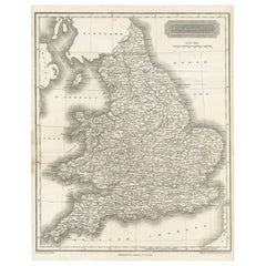
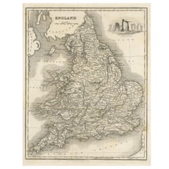
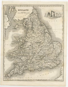
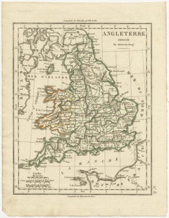
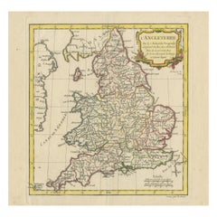
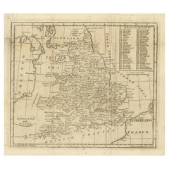
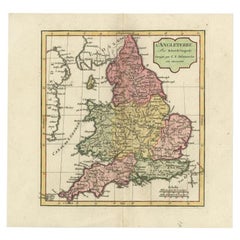
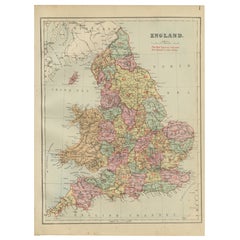
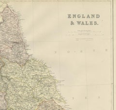
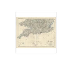
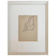
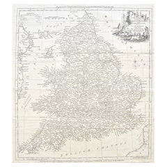
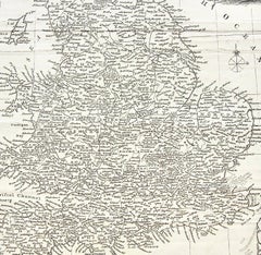
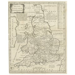
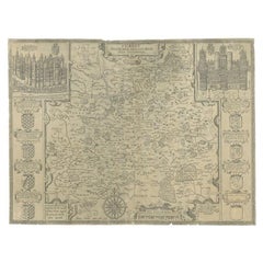
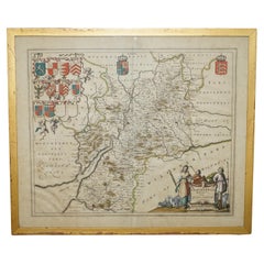
Small Steel Engraved Map of England
Located in Langweer, NL
Antique map titled 'England'. Original steel engraved map of England. Drawn by A. Arrowsmith
Category
Mid-19th Century Antique Map Of England
Materials
Paper
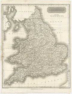
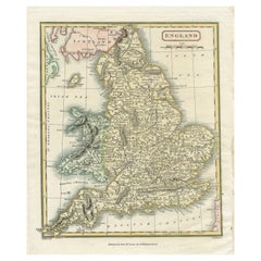
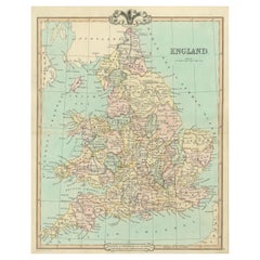
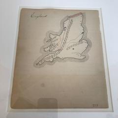
Small Steel Engraved Map of England
Located in Langweer, NL
Antique map titled 'England'. Original steel engraved map of England. Drawn by A. Arrowsmith
Paper
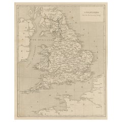
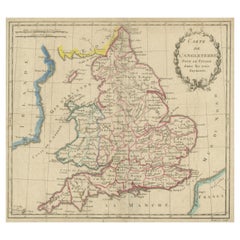
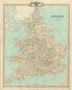
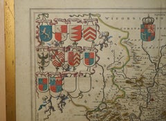
Steel Engraved Antique Map of England
Located in Langweer, NL
Antique map titled 'Angleterre'. Original antique map of England. Engraved by Th. Duvotenay
Paper

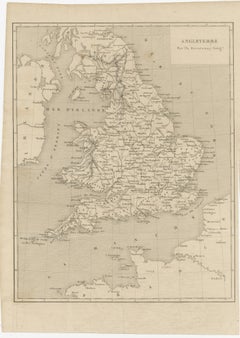
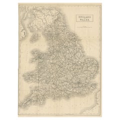
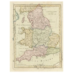
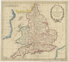
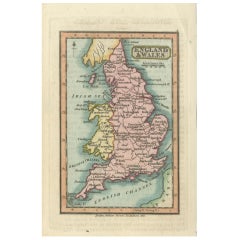
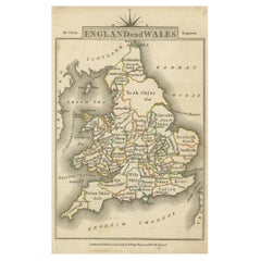
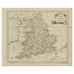
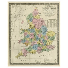
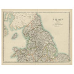
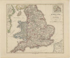
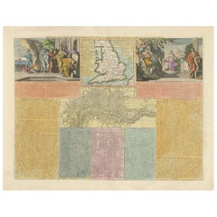
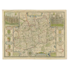
Original Antique Map of England and Wales
Located in Langweer, NL
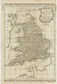
Antique map titled 'A New and Correct Map of England and Wales from the Latest and Best
Paper
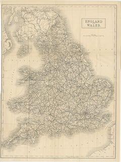
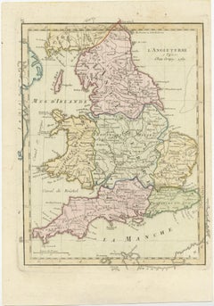
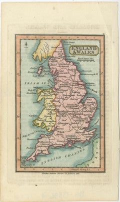
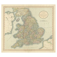
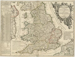
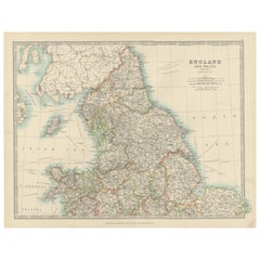
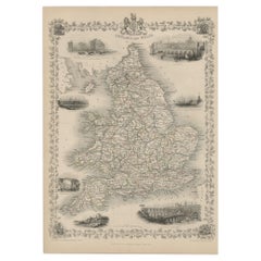
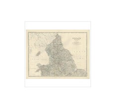
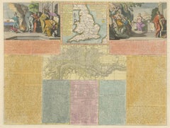
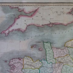
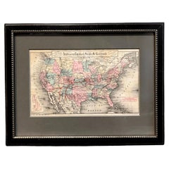
Large Antique Map of England and Wales
Located in Langweer, NL
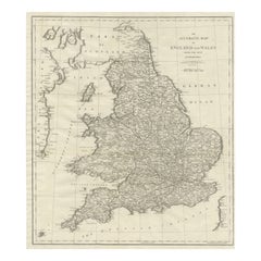
Antique map titled 'An Accurate Map of England and Wales'. Original old map of England and Wales
Paper
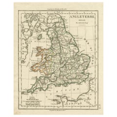
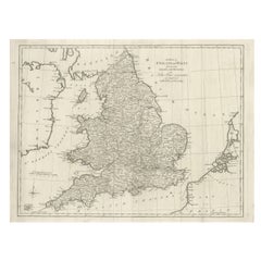
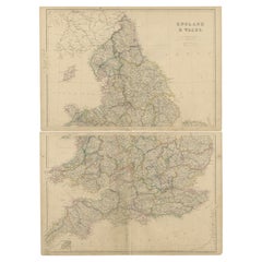
Lithographed Antique Map of England and Wales
Located in Langweer, NL
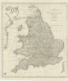
Original antique map titled 'Map XXIII England & Wales'. Lithographed map of England and Wales
Paper
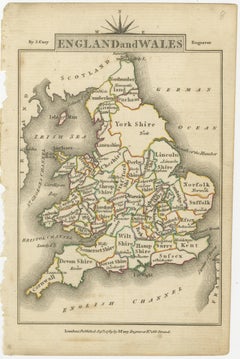
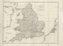
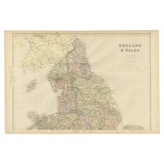
Antique Folding Map of England and Wales
Located in Langweer, NL
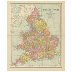
Antique map titled 'England and Wales'. Original folding map of England and Wales. Publishes by A
Paper
$173Sale Price|20% Off
H 11.23 in W 8.78 in D 0.02 in
Antique Map of England with Vignette of Stonehenge
Located in Langweer, NL
Antique map titled 'England'. Original antique map of England, with decorative vignette of
Paper
$250Sale Price|20% Off
H 13.47 in W 9.45 in D 0.02 in
Antique Map of England with Contemporary Hand Coloring
Located in Langweer, NL
Antique map titled 'l'Angleterre'. Original antique map of England, with original/contemporary hand
Paper
$250Sale Price|20% Off
H 11.58 in W 8.98 in D 0.02 in
Original Antique Map of England with Outline Coloring
Located in Langweer, NL
Antique map titled 'Angleterre'. Original old map of England with outline coloring. Source unknown
Paper

$212Sale Price|20% Off
H 10.91 in W 8.59 in D 0.02 in
Original Antique Map of England with Hand Coloring
Located in Langweer, NL
Antique map titled 'Engand'. Original old map of England. Engraved by W. Milton. Published by John
Paper
Antique Map of England, Also Showing Calais
Located in Langweer, NL
of England, also showing Calais. This map originates from 'Voyage dans les trois royaumes
Paper
Miniature Antique Map of England and Wales
Located in Langweer, NL
Miniature map titled 'England & Wales'. Original antique map of England & Wales. This map
Paper

Antique Map of England & Wales by Wyld '1845'
Located in Langweer, NL
Antique map titled 'England & Wales'. Original antique map of England & Wales. This map originates
Paper

$279Sale Price|20% Off
H 11.3 in W 16.34 in D 0.02 in
Original Antique Map of England with Decorative Cartouche
Located in Langweer, NL
Antique map titled 'l'Angleterre (..)'. Original antique map of England, with beautiful hand
Paper

$115Sale Price|20% Off
H 8.78 in W 5.52 in D 0.02 in
Antique Map of England and Wales with Roman Numerals
Located in Langweer, NL
Untitled original antique map of England and Wales. Drawn & Engraved for Cobbetts 'Geographical
Paper

$520Sale Price|20% Off
H 21.46 in W 25.67 in D 0.02 in
Large Antique Map of England Hand Colored by Counties
Located in Langweer, NL
Antique map titled 'A New Map of England from the latest Authorities'. Large map of England, hand
Paper
$250Sale Price|20% Off
H 6.38 in W 4.22 in D 0.02 in
Miniature Map of England and Wales with Hand Coloring
Located in Langweer, NL
Antique map titled 'England and Wales'. An attractive miniature map of England and Wales enhanced
Paper


$225Sale Price|25% Off
H 26.38 in W 18.12 in D 0.02 in
Antique Map of England and Wales by Johnson '1872'
Located in Langweer, NL
Antique map titled 'Johnson's England and Wales'. Original map of England and Wales. This map
Paper

$154Sale Price|20% Off
H 8.39 in W 10.63 in D 0.02 in
Original Antique Map of England and Wales, with Decorative Cartouche
Located in Langweer, NL
Antique map titled 'England and Wales from the best Authorities'. Original antique map of England
Paper

$424Sale Price|20% Off
H 18.12 in W 23.75 in D 0.02 in
Original Antique Map of England and Wales with Large Cartouche
Located in Langweer, NL
of England and Wales by J.B. Nolin after Coronelli. With decorative cartouche, table and inset map of
Paper
$614
H 18.43 in W 24.73 in D 0.02 in
Antique Map of England and Wales by J. Blair, Circa 1779, Wall Art
Located in Langweer, NL
Antique map titled 'A Map of England and Wales (..)'. Large antique map of England and Wales, with
Paper

$134Sale Price|20% Off
H 8.43 in W 9.57 in D 0.02 in
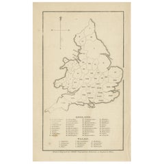
Antique Map of England and Wales, with References to the Counties
Located in Langweer, NL
Antique map titled 'England and Wales'. Original antique map of England and Wales, with references
Paper

$279Sale Price|20% Off
H 8.9 in W 12.09 in D 0.02 in
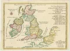
Original Antique Map of England, Ireland, Scotland and Wales
Located in Langweer, NL
Antique map titled 'Les Isles Britanniques, ou sont les Royaumes d Angleterre (..)'. Detailed map
Paper

$212Sale Price|20% Off
H 5.52 in W 5.4 in D 0.02 in
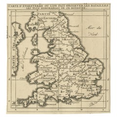
Original Antique Map of England, Showing the Most Memorable Battles
Located in Langweer, NL
Royaume'. Original antique map of England, showing the most memorable battles. This map was originally
Paper


$144Sale Price|20% Off
H 12.21 in W 9.65 in D 0.02 in
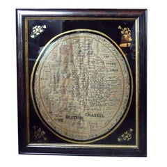
Antique Map of England and Wales, Also Showing the English Channel
Located in Langweer, NL
Antique map titled 'England and Wales'. Original antique map of England and Wales. Drawn and
Paper

Antique Map of England by Mercator/Hondius, circa 1600
Located in Langweer, NL
issulis Mania et Anglesey'. Original antique map of England. Decorative regional map of Northwestern
Paper
Antique Map of England with French Title, 1806
Located in Langweer, NL
Antique map titled 'L'Angleterre.' Map of England by Robert de Vaugondy, revised and published by
Paper


$366Sale Price|20% Off
H 17.33 in W 13.86 in D 0.02 in
Antique Map of England with Inset Maps of the Region of Liverpool and London
Located in Langweer, NL
Antique map titled 'England'. Original antique map of England, with two inset maps of the region of
Paper
$375Sale Price|20% Off
H 18.71 in W 14.97 in D 0.02 in
Antique Map of England and Wales, Also Including the Isle of Man
Located in Langweer, NL
Antique map titled 'England'. Original antique map of England and Wales from Northumberland to
Paper

$240
H 13.31 in W 9.85 in D 0.01 in
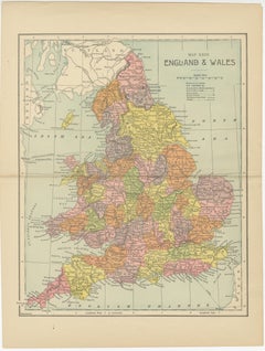
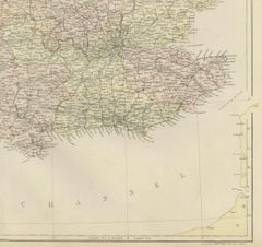
Antique Map of England, 1885 – County Colors, Railways & British Heritage
Located in Langweer, NL
Antique Map of England, 1885 – County Colors, Railways & British Heritage This attractive antique
Paper


Antique Map of England and Ireland by Lattre, 1789
Located in Langweer, NL
Antique map titled 'Les Royaumes d'Angleterre d'Ecosse et d'Irlande'. Original antique map of
Paper
$1,638Sale Price|20% Off
H 25.56 in W 20.48 in D 0.01 in
Rare 1690 Map of England by Nicolaes Visscher II – Heptarchy Depicted
Located in Langweer, NL
Map of England 1690 by Nicolaes Visscher II – Heptarchy and Counties Shown Antique 1690 map of
Paper
$409
H 13.47 in W 11.03 in D 0.01 in
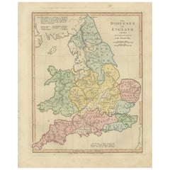
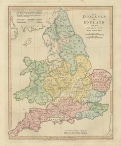
Dioceses of England — Ecclesiastical Map of England, Wilkinson 1801
Located in Langweer, NL
Dioceses of England — Ecclesiastical Map of England, Wilkinson 1801 This finely engraved and
Paper


Antique Map of England and Wales by Johnston, 1882
Located in Langweer, NL
Antique map titled 'England and Wales'. Old map of England and Wales, with an inset map of Scilly
Paper


$443Sale Price|20% Off
H 7.76 in W 10.04 in D 0.02 in
Small Antique Map of England, Wales, Scotland and Ireland with Original Coloring
Located in Langweer, NL
Scotland on the left and the kings of England on the right, ending with King George I. This map
Paper

$783
H 21.38 in W 17.64 in D 0 in
Colourful Antique Map of England and Wales Divided in Counties, 1854
Located in Langweer, NL
Antique map titled 'A Map Shewing the Places in England & Wales Sending Members to Parliament with
Paper

$385Sale Price / set|20% Off
H 14.57 in W 21.26 in D 0.02 in
1859 Vintage Maps of England and Wales: Blackie's Imperial Geographic Detail
Located in Langweer, NL
The "Antique Map of England & Wales" from 'The Imperial Atlas of Modern Geography', published by W
Paper
Pair of Road Maps of England by John Ogilby
Located in Essex, MA
The first road maps of England. London to Holyhead and London to Carlisle. Nicely framed and matted
Paper


$1,175
H 35 in W 30.5 in D 2 in
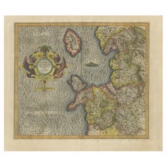
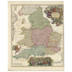
Large 17th Century Hand Colored Map of England and the British Isles by de Wit
By Frederick de Wit
Located in Alamo, CA
A large hand colored 17th century map of England and the British Isles by Frederick de Wit entitled
Paper

$337
H 14.49 in W 18.9 in D 0.01 in
Antique Map of England and Wales, 1903, with Detailed Counties and Railways
Located in Langweer, NL
Title: Antique Map of England and Wales, 1903, with Detailed Counties and Railways Description
Paper


$746
H 16.54 in W 19.69 in D 0 in
Antique Map of England and London with Two Large Allegorical Views, c.1720
Located in Langweer, NL
, with map of England and two large allegorical views. This map originates from Chatelain's 'Atlas
Paper

$240Sale Price|20% Off
H 19.49 in W 24.41 in D 0.02 in
Original Antique Map of England and Wales from the 1909 Royal Atlas
Located in Langweer, NL
The antique map titled 'England and Wales' is a historical cartographic representation of these two
Paper
$163Sale Price|20% Off
H 14.97 in W 22.45 in D 0 in
Colorful Detailed Antique Map of England and Wales, 1882
Located in Langweer, NL
Explore the Historic Splendor of 'England and Wales' with this Antique Map! Part of a distinguished
Paper


$722
H 15.75 in W 21.26 in D 0.04 in
Old Horizontal Map of England, Antique Paper Print, Early 19th Century
By Tasso
Located in Alessandria, Piemonte
ST/520 - Old rare Italian map of England, dated 1826-1827 - by Girolamo Tasso, editor in Venise
Paper
Antique Map of England and Wales with Decorative Vignettes, 1851
Located in Langweer, NL
Antique map titled ‘England and Wales’. Includes decorative vignettes titled The grand stand on the
Paper
$163Sale Price|20% Off
H 14.97 in W 22.45 in D 0 in
Colorful Detailed Antique Map of England and Wales (South Part), 1882
Located in Langweer, NL
Embark on a Journey Through the Southern Part of 'England and Wales' with this Exquisite Antique
Paper

$366Sale Price|20% Off
H 16.23 in W 22.25 in D 0.01 in
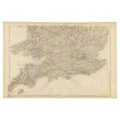
Map of England and Surrounding Regions: Early 19th Century - 1802 Tardieu Atlas
Located in Langweer, NL
focusing on England and parts of Wales, Scotland, and Ireland. **Map Features:** - **Regions Displayed
Paper

Antique Map of England and Wales 'North' by A.K. Johnston, 1865
Located in Langweer, NL
Antique map titled 'England and Wales (Northern Sheet)'. This map originates from the ‘Royal Atlas
Paper

$279Sale Price|20% Off
H 6.23 in W 7.52 in D 0.02 in
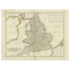
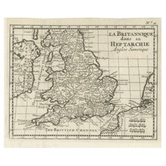
Small Antique Map of England and Wales as It Was During the Heptarchy
Located in Langweer, NL
Antique map titled 'La Britannique dans sa Heptarchie Anglois Saxonique'. This little map shows
Paper
$3,923
H 27.56 in W 22.64 in D 1.19 in
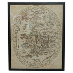
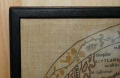
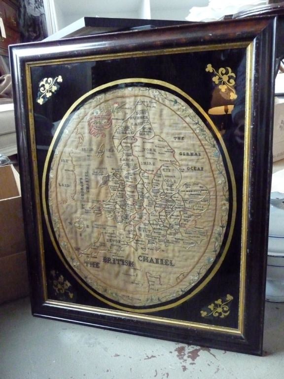
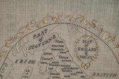
Antique Elizabeth Mason Signed 1789 George II Needlework Sampler Map of England
Located in West Sussex, Pulborough
1830, 1747 and 1888, this sale is for the only map, the others were made by children This really is
Cotton


Antique Map of, Northern England and Wales by Johnston, 1882
Located in Langweer, NL
Antique map titled 'England and Wales'. Old map of England and Wales. This map originates from
Paper
$1,054Sale Price|30% Off
H 14.89 in W 19.49 in D 0 in
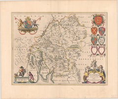
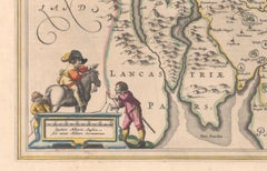
1645 Blaeu Map of Westmorland, Northern England – Hand Colored, Decorative
Located in Langweer, NL
detailed look at Westmorland, a historic county in northern England, based on John Speed’s earlier map. The
Paper
$1,376
H 14.57 in W 11.82 in D 0.79 in
Map Nottinghamshire Worksop Manor Newstead Abbey Nottingham Castle Shields H37cm
Located in BUNGAY, SUFFOLK
Map of Nottinghamshire with engravings of Worksop Manor Nottingham Castle Newstead Abbey
Paper
$505
H 14.77 in W 17.88 in D 0.01 in
England & Wales in 1857 – Decorative Antique Map with Rail Routes
Located in Langweer, NL
Antique Map of England & Wales – Hand-Colored Engraving by Stülpnagel, 1857 Fine 19th-century map
Paper

$331
H 19.1 in W 24.41 in D 0.02 in
Antique English Map – Southern England & Wales, Johnston’s Royal Atlas, 1865
Located in Langweer, NL
Antique Map of England & Wales (Southern Sheet) – Johnston’s Royal Atlas, 1865 This finely
Paper
$698
H 16.15 in W 20.67 in D 0.01 in
England and London Government Map with Allegorical Vignettes, ca. 1720
Located in Langweer, NL
England and London Government Map with Allegorical Vignettes, ca. 1720 Description: This highly
Paper
$228
H 11.11 in W 8.27 in D 0.01 in
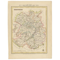
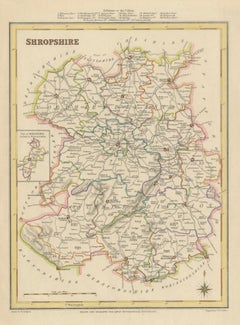
Map of Shropshire, 1844: Telford, Shrewsbury, Oswestry, Bridgnorth & Wellington
Located in Langweer, NL
, Victorian map, topographical map, Wellington, 19th-century map of England.
Paper
19th Century Schoolboy Map of England
Located in Boston, MA
19th century schoolboy Map of England. Custom framed.
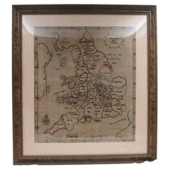
Early 19th Century Sampler Map of England and Wales
Located in Boston, MA
A rare and early sampler map of England and Wales dated and signed Sarah Goulden 1816.
Wood
Unavailable
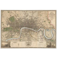
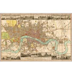
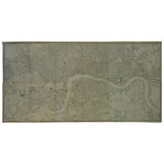
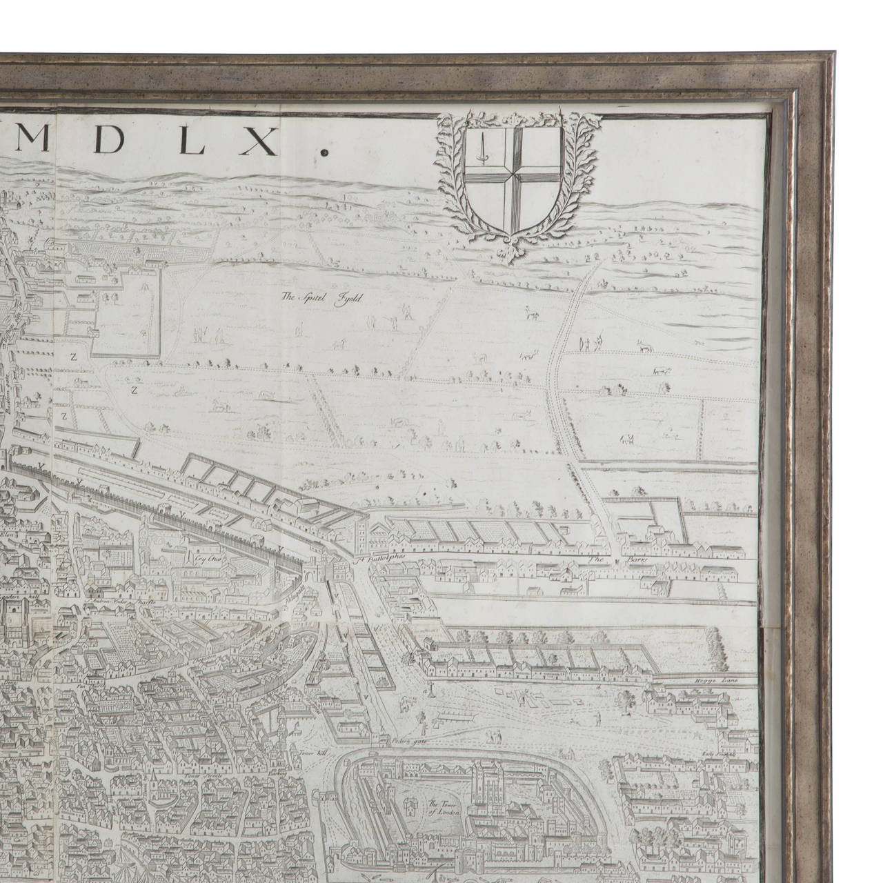
Greenwood Map of London
Located in London, GB
Map of London, published in London in 1827. Hand-coloured engraved folding map on six sheets
Paper
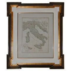
An Antique Map Of Italy
Located in Toronto, ON
AN ANTIQUE MAP OF ITALY DRAWN AND ENGRAVED FROM D'ANVILLES MAP FOR J.HARRISON,A PRINTER AND

1806 Brightly and Kinnersley Map of Euro Russia
Located in Pataskala, OH
An interesting early 19th century map of European Russia, largely prior to the imperial expansions
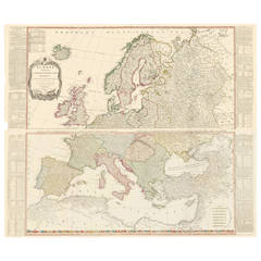
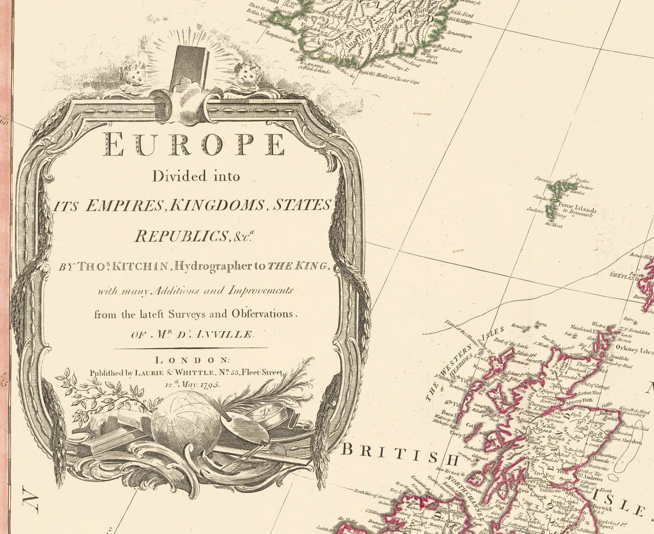
Two-Part Large Hand-Colored Map of Europe from 1798
By Thomas Kitchin
Located in New York, NY
Map of Europe printed on two separate sheets from A New Universal Atlas by Thomas Kitchin
Paper
Unavailable
H 26.75 in W 31.25 in D 1 in
Early 19th Century Map of Revolutionary France with 13 Belgian and Six Piedmont
By Kirkwood
Located in Pataskala, OH
This framed, hand colored map of France illustrates the departments during the Revolutionary period
Needlework map of English and Welsh counties dated 1787
Located in East Geelong, VIC
A lovely needlework map of England and Wales, showing the counties as they were in the late 1700's
Textile


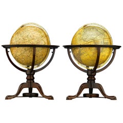
Pair of George III Globes, by J. & W. Cary
Located in London, GB
A rare, fine and particularly charming pair of 12 " J & W Cary globes on turned mahogany stands terminating in elegant cabriole legs with pad feet united by stretchers incorporating ...
Cabin or Map Table
Located in Gloucestershire, GB
This Georgian, mahogany Cabin or Map Table is unlike any other we have seen before. Like a campaign
Mahogany
Unavailable
H 41 in W 28.5 in D 32.75 in
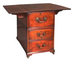
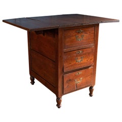
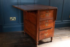
Mahogany and Pine Five Drawer Map Plan Chest of Drawers Dresser
Located in Atlanta, GA
easy! The drawers lend themselves great for maps, drawings, or a number of other applications. This
Mahogany, Pine


Unavailable
H 21.23 in W 27.84 in
Antique map of the south of England by Thomson - Handcol. engraving - 19th c.
By John Thomson
Located in Zeeland, Noord-Brabant
: Antique print, titled: 'Southern part of England.' - Detailed map that covers South England, with several
Engraving
Unavailable
H 16.13 in W 14.63 in D 0.13 in
Original 1700s Map of Great Britain, England & Wales in 1757 by Thomas Kitchin
Located in Montréal, CA
A New and Accurate Map of that District of Great Britain called England & Wales &c. from the latest
Paper
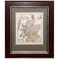
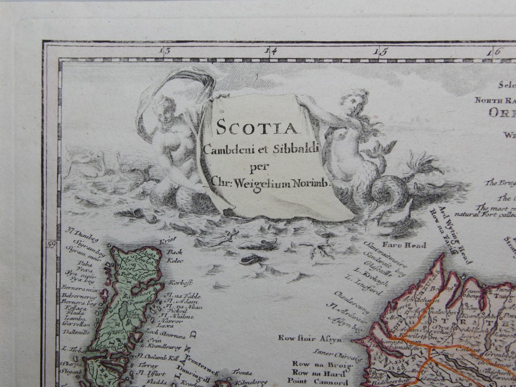
Map of Scotland - Christoper Weigel
By Christoph Weigel
Located in Toronto, ON
This is a rare and beautiful map of Scotland. Hand coloured to denote the separate Northern and
Large 1812 Antique Map of London
By Langley & Belch
Located in La Jolla, CA
of the most visually appealing maps of the London of the period. Both the West India Docks and East
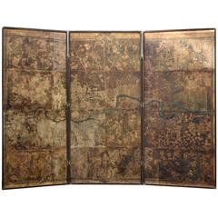
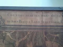
Original Map of London by John Rocque, 1741-1745
By John Roque 1
Located in Bantam, CT
A highly important map by John Rocque. An exact survey of the City of London Westminster Borough of
Unavailable
H 48 in W 59 in D 1 in
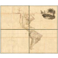
Large 1804 Hand-Colored Map of America After the Louisiana Purchase
By Aaron Arrowsmith
Located in La Jolla, CA
Fine example of Arrowsmith's map of America, in four sheets. An excellent map of America on the
Paper


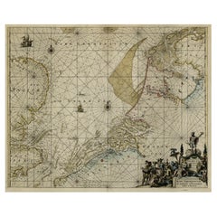
A Chart of the Sea Coast from England to the Streights.
Located in Zeeland, Noord-Brabant
A map of the European coast, with England on the left and the Straight of Gibraltar on the right
Engraving
![Petit Neptune Anglois ou Carte Marine des Cotes d'Angleterre, [...].](https://a.1stdibscdn.com/archivesE/upload/a_5923/1508754384835/IMG_0099_2_master.jpg?width=240)
![Petit Neptune Anglois ou Carte Marine des Cotes d'Angleterre, [...].](https://a.1stdibscdn.com/archivesE/upload/a_5923/a_22394931508754389906/IMG_0100_a_master.jpg?width=240)
Unavailable
H 31.3 in W 21.86 in
Petit Neptune Anglois ou Carte Marine des Cotes d'Angleterre, [...].
By Jean Lattre
Located in Zeeland, Noord-Brabant
A map of the coasts of England, Scotland and Ireland, with depth soundings and coastal towns
Engraving
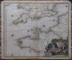

Unavailable
H 21.26 in W 25.4 in
La Manche ou le Canal, entre la France et l'Angleterre.
By Alexis Hubert Jaillot
Located in Zeeland, Noord-Brabant
A very attractive map of the Channel between England and France, and showing copious portions of
Engraving
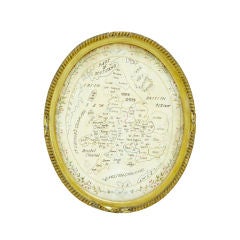
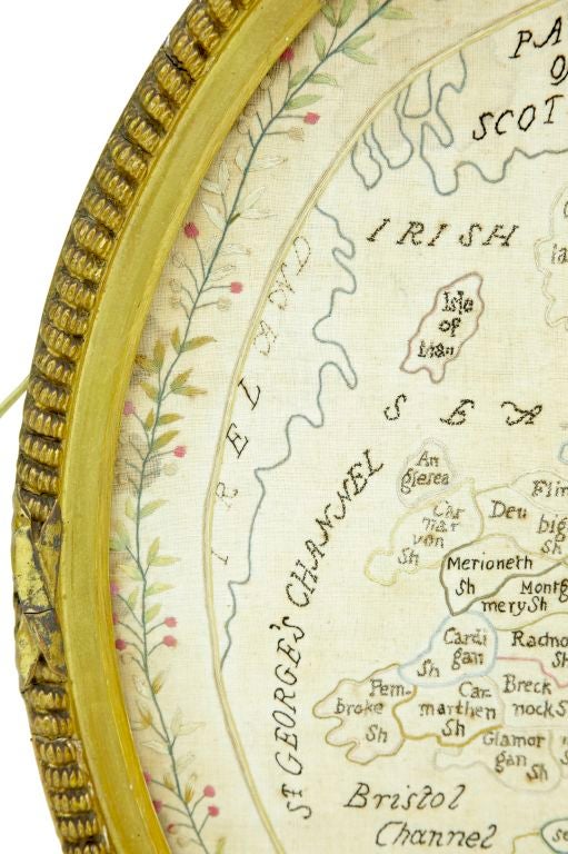
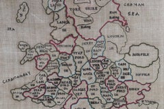
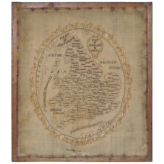
18TH CENTURY NEEDLEWORK SAMPLER MAP OF ENGLAND
Located in Debenham, Suffolk
18TH CENTURY NEEDLEWORK SAMPLER MAP OF ENGLAND
Tapestry

Sold
H 10.28 in W 8.39 in D 0.02 in
Antique Map of England and Wales Depicting the Period of the Saxon Heptarchy
Located in Langweer, NL
Compleat Chorography of England and Wales in 50 Maps'. Circa 1766-77.
Paper
Map of England and Wales Early 19th Century Sampler
Located in San Francisco, CA
Map of England and Wales early 19th century sampler Superb early to mid-19th century sampler
Silk

Sold
H 18.71 in W 13.59 in D 0 in
Antique Map of England, Wales, Scotland and Ireland, inset of Shetland Isl, 1880
Located in Langweer, NL
Antique map titled 'Iles Britanniques'. Old map of England, Wales, Scotland and Ireland. With
Paper

Leather Cased Set of Maps of England and Wales, circa 1920
By E. Stanford
Located in London, GB
miles to an inch scale, linen backed maps for England and Wales by Edward Stanford of Long ACRE, London
Metal

Sold
H 24.02 in W 21.46 in D 1.78 in
Dated 1798 George III Rare Hand-Sewn on Silk Tapestry Map of England and Wales
Located in West Sussex, Pulborough
We are delighted to offer for sale this lovely George III 1798 dated silkwork map of England and
Silk
Sold
H 21.26 in W 36.93 in D 0.79 in
World Map Published in June 1783 by Stackhouse and Engraved by S.J. Neele London
Located in Milan, IT
Thomson in 1817, "Atlas Of England And Wales" by Robin in 1819 and "Geological Map of England and Wales
Glass, Wood, Paper

Georgian Map of UK Sampler by Elizabeth Kifft, 1797
Located in Chelmsford, Essex
1797 England & Wales Map Sampler by Elizabeth Kifft, Leacock School. The sampler is worked in silk
Linen, Silk
Sold
H 17.37 in W 21.66 in D 0.02 in
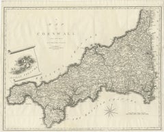
Large Antique County Map of Cornwall and the Isles of Scilly, England
Located in Langweer, NL
Cornwall, England. With inset map of the Scilly Islands. Engraved by John Cary. Originates from 'New
Paper


Sold
H 12.6 in W 14.57 in D 0 in
Original Antique Map with Rich Decorations of Gloucestershire, England, c.1637
Located in Langweer, NL
Antique map titled 'Glocestriae comitatus olim sedes Dobunorum'. Map of Gloucestershire, England
Paper
Sold
H 9.75 in W 12.88 in D 0.63 in
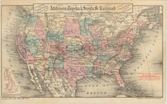
1879 Map of the United States, Showing the Santa Fe Railroad by GW & CB Colton
By G.W. & C.B. Colton
Located in Colorado Springs, CO
pink, green, yellow. With red overprinting, marking railroad routes. Small inset map of England
Paper
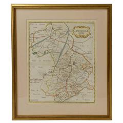
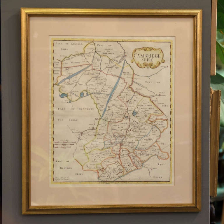
18th Century Map of Cambridgeshire
Located in Austin, TX
A handsome 18th century English map of Cambridgeshire, mounted and framed under glass. Printed in
Glass, Wood, Paper
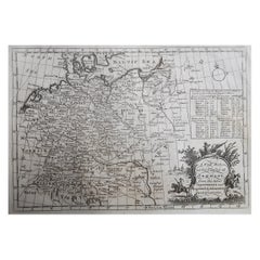

Original Antique Map of Germany. C.1780
Located in St Annes, Lancashire
Great map of Germany Copper-plate engraving Published C.1780 Crease to top left corner
Paper
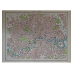

Original Vintage Map of London, circa 1900
Located in St Annes, Lancashire
Great vintage map of London. John Bartholomew and Co for the Edinburgh Geographical Institute
Paper
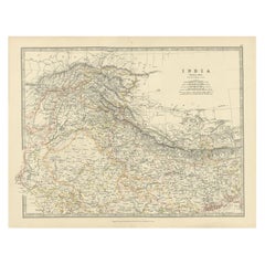

Antique Map of Northern India by Johnston, 1867
Located in Langweer, NL
Antique map titled 'India (Northern Sheet)'. Depicting Rajputana, Bombay, Nepal and more
Paper

Large Original Antique Street Map of London, 1861
By Edward Weller
Located in St Annes, Lancashire
Wonderful street map of London showing the area between Kensington in the west and Limehouse in
Paper


Antique Map of Switzerland by A & C. Black, 1870
Located in Langweer, NL
Antique map titled 'Switzerland'. Original antique map of Switzerland. This map originates from
Paper

Antique Map of Surrey by Speed, 1676
Located in Langweer, NL
Antique map titled 'Surrey described and divided into hundreds'. Map of Surrey, England. Includes
Paper
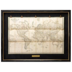
1837 "Mercator Projection" Map of the World by James Wyld
Located in Colorado Springs, CO
This Mercator style projection world map was published in London by James Wyld in 1837. Typical for

Antique Map of Surrey by Speed, 1676
Located in Langweer, NL
Antique map titled 'Surrey described and divided into hundreds'. Map of Surrey, England. Includes
Paper
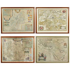
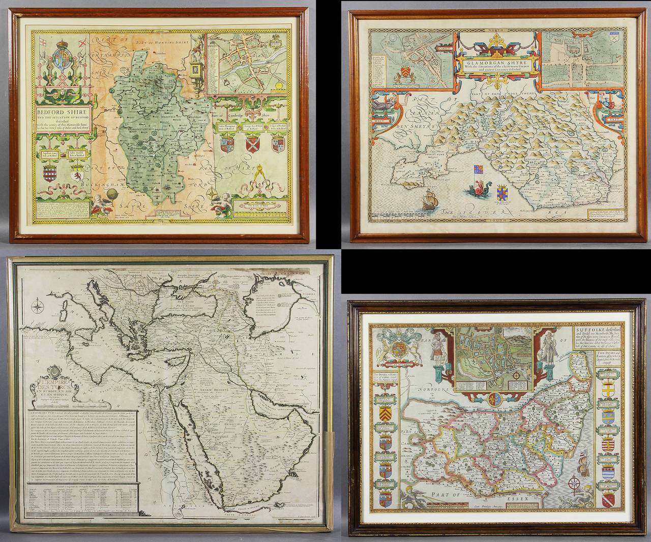
Collection of 12 Early Framed Maps Mostly by John Speed
Located in Essex, MA
In a variety of conditions. John Speed is known as Englands most famous Stuart mapmaker.
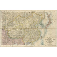
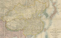
Antique Map of China and Japan by E. Stanford, 1900
By E. Stanford
Located in Langweer, NL
Antique map titled 'Stanford's Map of the Empires of China and Japan with the adjacent parts of the
Linen, Paper


Antique Map of Somerset by Camden, c.1637
Located in Langweer, NL
Antique map titled 'Somersettensis comitatus vulgo Somersett'. Map of Somerset, England. This map
Paper
Sold
H 20.08 in W 23.63 in D 0.79 in
1650 JOHANNES BLAEU WATERCOLOUR MAP OF GLOUCESTERSHIRE WiTH GOLD GILTWOOD FRAME
Located in West Sussex, Pulborough
page map of Gloucestershire by Johannes Blaeu circa 1650 in a lovely giltwood frame Please note the
Giltwood, Paper

Sold
H 13.75 in W 16.75 in D 0.75 in
English Map of West Indies with a Gilt Wood Frame Under Glass, Late 19th Cent
Located in Charleston, SC
English hand colored accurate map of the West Indies with a foliage gilt wood and gesso frame under
Gesso, Glass, Giltwood, Paint, Paper
Sold
H 52.5 in W 46.5 in D 2.5 in
1862 Colton's "New Railroad & County Map of the United States and the Canadas"
Located in Colorado Springs, CO
This expansive and impressive 19th century map depicts the eastern half of the United States, in
Paper

Sold
H 20.63 in W 24.53 in D 0 in
Antique Coastal Chart of the North Sea between England and the Netherlands, 1730
Located in Langweer, NL
Antique map titled 'Pascaert van de Noord Zee van Ameland tot de Hoofden. - Mare Germanicum ab
Paper
Sold
H 17.33 in W 19.3 in D 0.99 in
Antique Collegiate Map, Cambridge, English, Framed Cartography, Victorian, 1838
Located in Hele, Devon, GB
This is an antique collegiate map of Cambridge. An English, framed coloured lithograph of
Glass, Wood, Paper
Sold
H 47 in W 52 in L 47 in
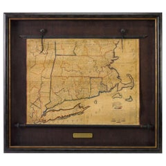
1824 Massachusetts, Connecticut and Rhode Island Antique Wall Map by E. Ruggles
Located in Colorado Springs, CO
few maps of the New England region, and was one of only a handful of cartographers operating out of
Paper

Pair of Globes by Dudley Adams
By Dudley Adams
Located in New Orleans, LA
A fine pair of George III-period, 12-inch celestial and terrestrial globes by Dudley Adams, son of the noted George Adams of London. Each bears the hallmarks of advanced mathematical...
Sold
H 30.5 in W 48.25 in D 3.5 in
1795 Two-Sheet Plan of the Cities of London & Westminster by Bowles and Carver
Located in Colorado Springs, CO
". This is a rare 1795 folding pocket map and street plan of London, England by Bowles. The map covers
Sold
H 44 in W 30 in D 1.5 in
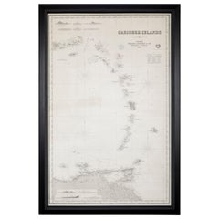
Rare Chart of the Caribbean Islands Published by James Imray & Son, London, 1866
Located in Stamford, CT
Rare chart of the Caribbean Islands published by James Imray & Son, London, 1866. FW 1370.
Paper
Sold
H 29.53 in W 36.23 in D 24.41 in
Mahogany and Teak Campaign Cabin Map Table/Chest, English, circa 1800
Located in Staffordshire, GB
Mahogany and teak campaign cabin map table/chest. English, early 19th century. The 3 slightly
Mahogany, Teak

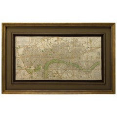
Large Map of London
Located in Gloucestershire, GB
Late Georgian/possibly early Victorian fine copy of the first large great map of London
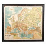
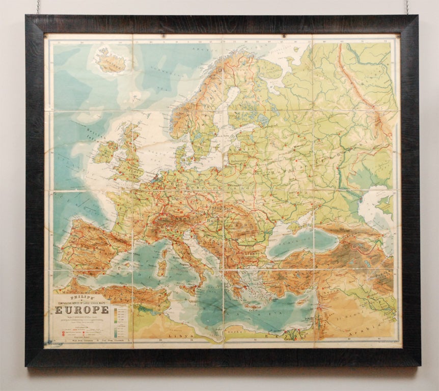
Large English Map of Europe, Circa 1920
Located in Los Angeles, CA
A Large Framed Map of Europe from the London Geographical Institute. Displaying a curvilinear

Framed Hand Colored Map of Persia by John Speed
Located in Essex, MA
Framed hand colored map of Persia by John Speed. Nicely matted.
Other

1833 Map of Eastern North & South Carolina, Printed in 1844
Located in Chapel Hill, NC
was only printed with volume II in 1844. Provenance: The Antique Map Shop, Ltd., Bath, England. Sheet
Paper
Antique and vintage collectibles and curiosities can bring whimsy and wonder to any interior.
Decorating with old scientific instruments, historical memorabilia and vintage musical instruments, as well as other authentic collectibles and curiosities that can be found on 1stDibs, presents an opportunity to create a unique, natural history museum-like atmosphere in your home that can provoke conversation as often as it pays tribute to how far we’ve come in understanding our world.
And bringing collectibles and curiosities into your space is actually on trend — Wunderkammern, or curiosity cabinets, were all the rage in Europe during the 1500s and continued to have adherents there and in the U.S. in the following centuries. Today, however, they’re experiencing a real surge in popularity and influencing how many interior designers are furnishing and decorating homes — combining contemporary with antique, scientific with tribal, earthly with extraterrestrial, Les Lalanne tables with Flemish tapestries.
The original Wunderkammern were entire rooms filled with objects demonstrating their owners’ worldly knowledge: A proper one included artificiala or preciosa (objets d’art); naturalia (such as skeletons, shells, minerals); exotica (taxidermy or dried plants); and scientifica (scientific instruments), frequently alongside religious relics and ancient artifacts.
Pay tribute to a history of rich and diverse musical traditions that have taken shape all over the world by decorating your home with a collection of antique and vintage musical instruments — with a little help from strong hanging wire or some wall hooks, vintage brass instruments such as a gong, French horn or trumpet can help elevate a home office or complement the efforts you’ve made to ensure a welcoming vibe in your home’s entryway. Bells or antique wind instruments can add provocative metallic contrasts to dark woods as tabletop decorative objects.
Create an intriguing focal point with Georgian scientific instruments, such as stick barometers with mahogany cases or lacquered brass telescopes. These items stem from an era named for the monarchies of the four King Georges, who ruled England in succession starting in 1714 (plus King William’s reign, which lasted until 1837). Just as there was beautiful jewelry produced during the period that today is coveted by collectors, there is much to be found in the collectibles and curiosities realm too.
Wanderlust, nostalgia and a shared love of good design are contributing factors to certain trends in decorating — just as vintage trunks and luggage have reappeared as furniture or home accents in a bedroom or foyer, decorating with globes, maps or nautical objects is similarly rooted in the allure of travel and a penchant for the stylish finishing touch that collectibles bring to our homes.
Find a wide range of antique and vintage collectibles and curiosities on 1stDibs.
Produced in 1843, the well-preserved volume is evidence of the author's exacting specifications.
New or old, the coverlets add old-time charm to any space.
Get into the games! These items celebrate the events, athletes, host countries and sporting spirit.
French trendsetter and serial collector Daniel Rozensztroch tells us about his obsession with objects related to seafaring men.
It's hard to resist the allure of a beautiful pool. So, go ahead and daydream about whiling away your summer in paradise.
The sought-after designer worked with the team at Hoffman Creative to produce a monograph that beautifully showcases some of Studio Shamshiri's most inspiring projects.
Italian writer and collector Umberto Pasti opens the doors to his remarkable cave of wonders in North Africa.
Hollywood A-listers, ex-pat aristocrats and art collectors and style setters of all stripes appreciate the allure of the coastal California hamlet — much on our minds after recent winter floods.