Antique Map Denmark

to
21
71
9
48
29
25
16
10
8
8
7
7
6
5
4
4
4
3
2
2
2
2
2
2
2
1
1
1
1
1
3
2
1
1
1
Sort By
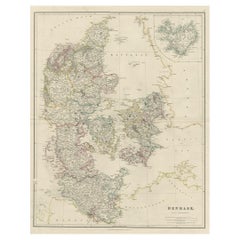
Antique Map of Denmark with an Inset Map of Iceland, 1832
Located in Langweer, NL
Antique map titled 'Denmark'. Large map of Denmark with an inset map of Iceland. Artists and
Category

19th Century Antique Map Denmark

Materials

Paper

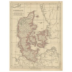
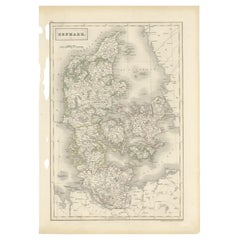
Antique Map of Denmark by Johnston '1909'
Located in Langweer, NL
Antique map titled 'Denmark'. Original antique map of Denmark. With inset maps of Iceland, Faroe
Category

Early 20th Century Antique Map Denmark

Materials

Paper

Antique Map of Denmark by Johnston '1909'
H 24.41 in W 19.49 in D 0.02 in
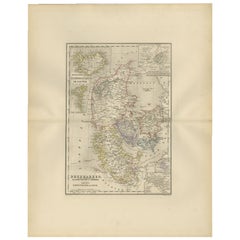
Antique Map of Denmark by Lowry, 1852
Located in Langweer, NL
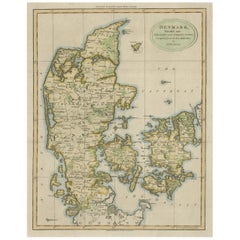
Antique map titled 'Denmark'. Original map of Denmark. This map originates from 'Lowry's Table
Category

Mid-19th Century Antique Map Denmark

Materials

Paper

Antique Map of Denmark by Lowry, 1852
H 12.21 in W 9.65 in D 0.02 in
Antique Map of Denmark by Münster '1588'
Located in Langweer, NL
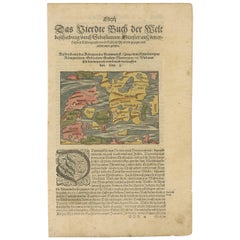
Antique map titled 'Beschreibung des Königreichs Dennmarck (..)'. Early map of Denmark. This map
Category

16th Century Antique Map Denmark

Materials

Paper

Antique Map of Denmark by Münster '1588'
H 12.6 in W 7.88 in D 0.02 in
Antique Map of Denmark with the Danish Royal Crest, c.1730
By Homann Heirs
Located in Langweer, NL
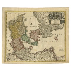
, Scania Blekingia (..).' Map of Denmark and islands, part of Sweden and Germany, drawn by Johann Huber
Category

18th Century Antique Map Denmark

Materials

Paper

Antique Map of Scandinavia: Norway, Sweden and Denmark
Located in Langweer, NL
and Denmark. With an inset map of Iceland and the Faroe Islands. This map originates from Maison
Category

Mid-19th Century Antique Map Denmark

Materials

Paper

Antique Map of Denmark by Moll 'circa 1730'
By Herman Moll
Located in Langweer, NL
Antique map titled 'Denmark, agreeable to Modern History'. Uncommon map of Denmark by Herman Moll
Category

Mid-18th Century Antique Map Denmark

Materials

Paper

Antique Map of Denmark by Moll 'circa 1730'
H 9.85 in W 13.39 in D 0.02 in
Antique Hand-Colored Engraved Map of Denmark, 1790
Located in Langweer, NL
detailed map of Denmark in the 18th century. One very small one hole in the image, although hardly visible
Category

1790s Antique Map Denmark

Materials

Paper

Antique Map of Denmark by Hall, circa 1820
Located in Langweer, NL
Antique map titled 'Denmark'. A map of Denmark and the direct surroundings (northern Germany
Category

19th Century Antique Map Denmark

Materials

Paper

Antique Map of Denmark by Hall, circa 1820
H 17.33 in W 12.13 in D 0 in
Antique Map of Denmark by Covens & Mortier, 1730
By Covens & Mortier
Located in Langweer, NL
Antique Map of Denmark from: 'Atlas Nouveau ... Par Guillaume de l'Isle' Amsterdam, Covens
Category

Mid-18th Century Antique Map Denmark

Materials

Paper

Antique Map of Denmark by Valk 'circa 1690'
Located in Langweer, NL
The map titled "Regnum Daniae, divisum in Dioeceses Arhusiam, Albergum, Viborgum, et Ripam (..)" is
Category

Late 17th Century Antique Map Denmark

Materials

Paper

Antique Map of Denmark by Valk 'circa 1690'
H 20.67 in W 24.02 in D 0.02 in
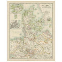
Antique Map of Denmark with Inset Maps of Iceland, Copenhagen and the Elbe, 1882
Located in Langweer, NL
Antique map titled 'Denmark with North-West portion of the German Empire comprising Schleswic
Category

19th Century Antique Map Denmark

Materials

Paper

Antique Map of Denmark by F. de Wit, 1680
Located in Langweer, NL
Antique map titled 'Dania Regnum'. Large, attractive map of Denmark, Sleschwig-Holstein and
Category

Late 17th Century Antique Map Denmark

Materials

Paper

Antique Map of Denmark by F. de Wit, 1680
H 20.99 in W 24.22 in D 0.02 in
Antique Map of Denmark, Original and Decorative, c.1846
Located in Langweer, NL
Antique map titled 'Denmark'. Old map of Denmark. This map originates from 'A New Universal Atlas
Category

19th Century Antique Map Denmark

Materials

Paper

Large Antique Map of Denmark by Bowles, c.1780
By Thomas
Located in Langweer, NL
Antique map titled 'Bowles's new pocket map of the Kingdom of Denmark (..)' Large map of Denmark
Category

18th Century Antique Map Denmark

Materials

Paper

Antique Map of Denmark by A.K. Johnston, 1865
Located in Langweer, NL
Antique map titled 'Denmark and the Duchies Schleswig, Holstein & Lauenburg; Hanover, Brunswick
Category

Mid-19th Century Antique Map Denmark

Materials

Paper

Antique Map of Denmark by A.K. Johnston, 1865
H 24.41 in W 19.1 in D 0.02 in
Antique Map of Denmark and Southern Sweden, c.1658
Located in Langweer, NL
Antique map titled 'Royaume de Danemarq.' Map centered on Sjaelland and covers all of Denmark and
Category

17th Century Antique Map Denmark

Materials

Paper

1882 Map of Denmark, Schleswig, and Holstein Highlighting Geographical Details
Located in Langweer, NL
This 1882 map of Denmark, Schleswig, and Holstein, published by Blackie and Son as part of the
Category

1880s Antique Map Denmark

Materials

Paper

Antique Map of the Kingdom of Denmark by Wyld '1845'
Located in Langweer, NL
Antique map titled 'Kingdom of Denmark'. Original antique map of the Kingdom of Denmark. This map
Category

Mid-19th Century Antique Map Denmark

Materials

Paper

Antique Map of Denmark with An Inset of Iceland, 1852
Located in Langweer, NL
Antique map titled 'Denemarken'. Map of Denmark, with a small inset map of Iceland. This map
Category

19th Century Antique Map Denmark

Materials

Paper

Antique Map of Sweden, Norway and Denmark by Johnson, 1872
Located in Langweer, NL
The image is an antique map, a two-page spread from "Johnson's New Illustrated Family Atlas of the
Category

Late 19th Century Antique Map Denmark

Materials

Paper

17th Century Map of Denmark by French Cartographer Sanson, Dated 1658
By Nicolas Sanson
Located in Copenhagen, K
17th century map of Denmark by French cartographer Sanson. Nicolas Sanson (20 December 1600-7 July
Category

17th Century French Antique Map Denmark

Materials

Paper

Antique Map of the Islands of Denmark by Homann Heirs, 1720
Located in Langweer, NL
Antique map titled 'Insula Danicae in Mari Balthico sitae (..).' - Map of the Danish islands
Category

18th Century Antique Map Denmark

Materials

Paper

Antique Map of the City of Copenhagen in Denmark c.1720
Located in Langweer, NL
Antique map titled 'Copenhagen'. Original antique map of the city of Copenhagen, Denmark. This map
Category

18th Century Antique Map Denmark

Materials

Paper

Antique Map of Denmark with Schleswig & Holstein by A & C. Black, 1870
Located in Langweer, NL
Antique map titled 'Denmark with Schleswig & Holstein'. Original antique map of Denmark with
Category

Late 19th Century Antique Map Denmark

Materials

Paper

Original Hand-colored Antique Map of Denmark by S. Neele, 1790
Located in Langweer, NL
Antique very decorative engraving of Denmark engraved by S. Neele. Published in November 1790 by
Category

Late 18th Century Antique Map Denmark

Materials

Paper

Antique Map of the Island of Zealand 'Denmark' by Thevet, circa 1590
Located in Langweer, NL
Antique map titled 'Partie de Danemarc'. Map of the island of Zealand, Denmark, including the city
Category

16th Century Antique Map Denmark

Materials

Paper

Antique Map of the Kingdom of Denmark by Keizer & de Lat, 1788
Located in Langweer, NL
Denmark. This map originates from 'Nieuwe Natuur- Geschied- en Handelkundige Zak- en Reisatlas' by Gerrit
Category

Late 18th Century Antique Map Denmark

Materials

Paper

1859 Denmark and Schleswig-Holstein Map: A Historical View from Blackie's Atlas
Located in Langweer, NL
The "Antique Map of Denmark with Schleswig & Holstein" from 'The Imperial Atlas of Modern Geography
Category

Mid-19th Century Antique Map Denmark

Materials

Paper

Antique Map of Denmark and Oldenburg ‘Germany’ by A. Ortelius, circa 1598
Located in Langweer, NL
map shows Denmark, based primarily on the work of Cornelis Anthoniszoon, who is credited in the
Category

16th Century Antique Map Denmark

Materials

Paper

19th Century Large Original Antique Map of Denmark by J. Pinkerton, 1812
By Pinkerton
Located in Langweer, NL
Highly detailed map of Denmark. One of the best large format English atlas maps of the period
Category

Early 19th Century Antique Map Denmark

Materials

Paper

Early 18th Century Map of Denmark in Old Coloring, Published in 1706
Located in Langweer, NL
Denmark. Schenk (Petrus), Dania Regnum Ducatus Holsatia. et Slesvicum Insulae Danicae et Provinciae
Category

Early 1700s Antique Map Denmark

Materials

Paper

Antique Map of Denmark, Iceland and the Faroe Islands by Migeon, 1880
Located in Langweer, NL
Antique map titled 'Danemark, Islande et Iles Faeröe'. Old map of Denmark, Iceland and the Faroe
Category

19th Century Antique Map Denmark

Materials

Paper

Antique Map of the City of Copenhagen ‘Denmark’ by J. Meyer, 1844
Located in Langweer, NL
Antique map titled 'Copenhagen (Kiöbenhaven)'. With city view and German explanation. Originates
Category

Mid-19th Century Antique Map Denmark

Materials

Paper

Map of Denmark Proper & Jutland: Early 19th Century from the 1802 Tardieu Atlas
Located in Langweer, NL
: This antique map illustrates the Kingdom of Denmark, specifically the regions of Denmark Proper
Category

Early 1800s Antique Map Denmark

Materials

Paper

Map of Denmark, Norway & Iceland: Early 19th Century from the 1802 Tardieu Atlas
Located in Langweer, NL
map illustrates the Kingdom of Denmark, including Denmark, Norway, and Iceland, as well as parts of
Category

Early 1800s Antique Map Denmark

Materials

Paper

Antique Map of Denmark with Details of Fortresses, Cities, Towns Etc, c.1680
Located in Langweer, NL
Antique map of Denmark titled 'Insularum Danicarum ut Zee-Landiae, Fioniae, Langelandiae, Lalandiae
Category

17th Century Antique Map Denmark

Materials

Paper

Attractive Antique Map showing Denmark and part of Sweden and Germany c.1750
By Isaak Tirion
Located in Langweer, NL
Antique map titled 'Nieuwe Kaart van het Koninkryk van Deenemarken (..).' Attractive detailed map
Category

18th Century Antique Map Denmark

Materials

Paper

Antique Map of Denmark with Insets of Iceland and the Faroe Islands, c.1873
Located in Langweer, NL
Antique map titled 'Denemarken, Sleeswijk-Holstein en Lauenburg'. Old map depicting Denmark, with
Category

19th Century Antique Map Denmark

Materials

Paper

Hand-Colored 18th Century Homann Map of Denmark and Islands in the Baltic Sea
By Johann Baptist Homann
Located in Alamo, CA
An 18th century copper plate hand-colored map entitled "Insulae Danicae in Mari Balthico Sitae
Category

Early 18th Century German Antique Map Denmark

Materials

Paper

Antique Map of Denmark with Schleswig-Holstein and the South of Sweden, c.1750
Located in Langweer, NL
Antique map titled 'General Charte von Konigreich Daenemark nebst dem Herzogthum Holstein.' Denmark
Category

18th Century Antique Map Denmark

Materials

Paper

Uncommon Old Map of Lapland to Russia and Denmark to Kazan in the South, 1785
Located in Langweer, NL
of Bonne's map of Northern Europe covers the region from Lapland to Russia in the north and Denmark
Category

1780s Antique Map Denmark

Materials

Paper

16th Century Antique Map of Ven Framed in Gold
Located in Haddonfield, NJ
, Sweden and Zealand and Denmark. The island was historically under Danish rule. Danish astronomer Tycho
Category

16th Century Danish Baroque Antique Map Denmark

Materials

Wood, Paper

19th Century Reprint of 16th Century Harbor Map of Copenhagen
Located in Haddonfield, NJ
This reprint of 1587 antique map of Copenhagen, Denmark retains its original mid-century mat and
Category

1880s Danish Baroque Antique Map Denmark

Materials

Wood, Paper

Antique Map of Scandinavia by Lapie, 1842
Located in Langweer, NL
Danemark'. Map of Scandinavia including Sweden, Norway and Denmark. With inset maps of Iceland and the
Category

Mid-19th Century Antique Map Denmark

Materials

Paper

Antique Map of Scandinavia by Lapie, 1842
H 26.78 in W 19.89 in D 0.02 in
Greece 1660 Jan Jansson Watercolour Map Peloponesus Sive Morea I Laurenbergio
Located in West Sussex, Pulborough
We are delighted to offer for sale this Jan Jansson Date: 1660 (published) Amsterdam map of Greece
Category

1660s Danish Dutch Colonial Antique Map Denmark

Materials

Copper

Antique Map of Northern Jutland by Kaerius, 1628
Located in Langweer, NL
Antique map titled 'Iutia Septentrionalis'. Copper engraved map of Northern Jutland (Denmark) by P
Category

Mid-17th Century Antique Map Denmark

Materials

Paper

Antique Map of Aero by Blaeu, 'circa 1670'
Located in Langweer, NL
Antique map titled 'Aroe Insulae delineatio geometrica'. Old map of Aero, a small Danish island in
Category

Mid-17th Century Antique Map Denmark

Materials

Paper

Antique Map of Aero by Blaeu, 'circa 1670'
H 21.26 in W 13.19 in D 0.02 in
Antique Map of Scandinavia by T. Jefferys, circa 1750
Located in Langweer, NL
Antique map titled 'Sweden, Denmark, Norway & Finland'. An original mid-18th century copper
Category

Mid-18th Century Antique Map Denmark

Materials

Paper

Historical Map of Holstein - Copperplate Engraving by Matthias Seutter, ca. 1730
Located in Langweer, NL
northern Germany and southern Denmark. The map impresses with its detailed and precise depiction of the
Category

1730s Antique Map Denmark

Materials

Paper

Historical Map of Northern Europe and Russia - Engraved for I. Harrison, 1788
Located in Langweer, NL
historical map titled A New Map of Europe Containing Denmark, Norway, Sweden and Russia was engraved for I
Category

1780s Antique Map Denmark

Materials

Paper

Johannes Janssonius' 17th-Century Map of the Duchy of Bremen in Germany
Located in Langweer, NL
Duchy of Bremen was formed in 1648 and this map depicts the region under Danish rule, it is likely that
Category

1650s Antique Map Denmark

Materials

Paper

Persia, Armenia & Adjacent Regions: A 17th Century Hand-colored Map by De Wit
By Frederick de Wit
Located in Alamo, CA
attractive map of Scandinavia, which includes the Baltic Sea, Norway, Sweden, Finland, Denmark and portions
Category

Late 17th Century Dutch Antique Map Denmark

Materials

Paper

Rare Engraving of Dutch and Danish Forts on the West African Gold Coast, 1744
Located in Langweer, NL
the West African Gold Coast, Ghana; a) The Dutch Fort Croevecoeur at Accra, b) The Danish Fort
Category

1740s Antique Map Denmark

Materials

Paper

17th Century Nautical Chart of Skagerrak and Øresund by Johannes van Keulen
Located in Langweer, NL
Denmark and Sweden. The regions depicted in this map—the Skagerrak, Kattegat, and Øresund straits—were
Category

Late 17th Century Antique Map Denmark

Materials

Paper

Map of Denmark, 1724
Located in Houston, TX
Extraordinary copper engraved map of Denmark by cartographer Christoph Weigel from 1724. Shows
Category

17th Century Other Art Style Antique Map Denmark

Materials

Paper, Ink, Watercolor

Map of Denmark,  1724
H 18 in W 24 in D 0.1 in
Denmark. Century Atlas antique vintage map
Located in Melbourne, Victoria
'The Century Atlas. Denmark' Original antique map, 1903. Inset maps of 'Faroe Islands', 'Iceland
Category

Early 20th Century Victorian Antique Map Denmark

Materials

Lithograph

Ancient Map of Denmark and Sweden - Original Etching - 19th Century
By Giuseppe Malandrino
Located in Roma, IT
This Map of Denmark and Sweden is an etching realized by an anonymous artist. The state of
Category

Late 19th Century Modern Antique Map Denmark

Materials

Etching

Bronze Box with a Map of Gronland ‘Greenland’ on the Lid
Located in NYC, NY
A bronze box with a map of Greenland (Cronland in Danish) incised into the top of the box lid, with
Category

Early 20th Century Danish Antique Map Denmark

Materials

Bronze

Map of Canonor - Etching by G. Braun/F. Hogenberg - 1575
Located in Roma, IT
important source for maps was the Danish cartographer Heinrich van Rantzau (1526-1599), beter known under
Category

16th Century Modern Antique Map Denmark

Materials

Etching

  • 1
Get Updated with New Arrivals
Save "Antique Map Denmark", and we’ll notify you when there are new listings in this category.

Antique Map Denmark For Sale on 1stDibs

At 1stDibs, there are many versions of the ideal antique map denmark for your home. An antique map denmark — often made from paper and glass — can elevate any home. Your living room may not be complete without an antique map denmark — find older editions for sale from the 18th Century and newer versions made as recently as the 20th Century. An antique map denmark, designed in the style, is generally a popular piece of furniture. Many designers have produced at least one well-made antique map denmark over the years, but those crafted by Covens & Mortier, Herman Moll and Pinkerton are often thought to be among the most beautiful.

How Much is a Antique Map Denmark?

Prices for an antique map denmark start at $116 and top out at $1,728 with the average selling for $325.

Read More

Medal-Worthy Memorabilia from Epic Past Olympic Games

Get into the games! These items celebrate the events, athletes, host countries and sporting spirit.

Ahoy! You’ve Never Seen a Collection of Sailor Art and Kitsch Quite Like This

French trendsetter and serial collector Daniel Rozensztroch tells us about his obsession with objects related to seafaring men.

39 Incredible Swimming Pools

It's hard to resist the allure of a beautiful pool. So, go ahead and daydream about whiling away your summer in paradise.

Pamela Shamshiri Shares the Secrets behind Her First-Ever Book and Its Effortlessly Cool Interiors

The sought-after designer worked with the team at Hoffman Creative to produce a monograph that beautifully showcases some of Studio Shamshiri's most inspiring projects.

Moroccan Artworks and Objects Take Center Stage in an Extraordinary Villa in Tangier

Italian writer and collector Umberto Pasti opens the doors to his remarkable cave of wonders in North Africa.

Montecito Has Drawn Royalty and Celebrities, and These Homes Are Proof of Its Allure

Hollywood A-listers, ex-pat aristocrats and art collectors and style setters of all stripes appreciate the allure of the coastal California hamlet — much on our minds after recent winter floods.
Whaam! Blam! Pow! — a New Book on Pop Art Packs a Punch

Publishing house Assouline and writer Julie Belcove have teamed up to trace the history of the genre, from Roy Lichtenstein, Andy Warhol and Yayoi Kusama to Mickalene Thomas and Jeff Koons.

The Sparkling Legacy of Tiffany & Co. Explained, One Jewel at a Time

A gorgeous new book celebrates — and memorializes — the iconic jeweler’s rich heritage.