Earth Map

1
to
30
554
235
579
396
176
129
49
47
36
31
29
26
20
17
16
13
12
12
12
11
10
10
9
9
7
6
6
5
5
4
3
3
3
3
2
2
2
2
2
2
2
2
1
1
1
1
1
1
1
1
1
135
76
52
42
42
Sort By
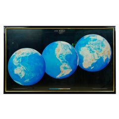
1990 Triple Perspective Planet Earth Map Framed Poster
Located in New York, NY
This decorative poster features a map of the Earth with a unique triple perspective view. It is
Category

1990s American Posters

Materials

Glass, Plastic, Paper

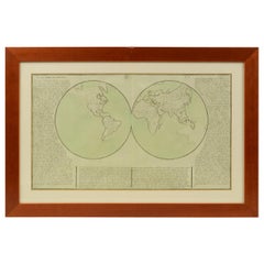
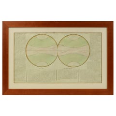
1850 Old French Map Depicting the Entire Earth's Surface Divided into Two Parts
Located in Milan, IT
Geographical map depicting the entire earth's surface divided into two parts that correspond to the
Category

Antique Mid-19th Century French Maps

Materials

Glass, Wood, Paper

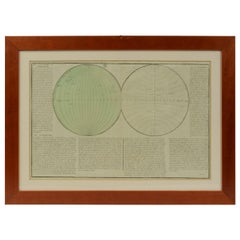
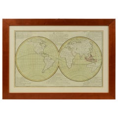
1850 Old French Map Depicting the Entire Earth's Surface Divided into Two Parts
Located in Milan, IT
Geographical map depicting the entire earth’s surface divided into two parts that correspond to the
Category

Antique Mid-19th Century French Maps

Materials

Glass, Wood, Paper

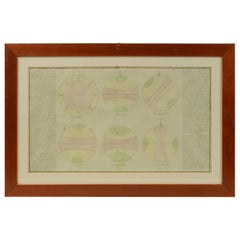
Old Map Depicting the Entire Earth's Surface Divided into Six Parts France 1850
Located in Milan, IT
Map depicting the entire earth's surface divided into six parts which depicts the position of
Category

Antique Mid-19th Century French Maps

Materials

Paper, Glass, Wood

1850 Old French Map Depicting the Entire Earth's Surface Divided into Two Parts
Located in Milan, IT
Map depicting the entire earth's surface divided into two parts corresponding to the two
Category

Antique Mid-19th Century French Maps

Materials

Glass, Wood, Paper

1850 Old French Map Depicting the Entire Earth's Surface Divided into Two Parts
Located in Milan, IT
Geographical map depicting the entire earth's surface divided into two parts that correspond to the
Category

Antique Mid-19th Century French Maps

Materials

Glass, Wood, Paper

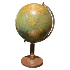
European Vintage Earth Globe on Stand with Compass
Located in Sofia, BG
Vintage handmade world globe standing on a base with small compass in the bottom. The piece is in fare condition with no restaurations ever made. France, circa 1950
Category

Mid-20th Century French Maps

Materials

Plastic, Paper

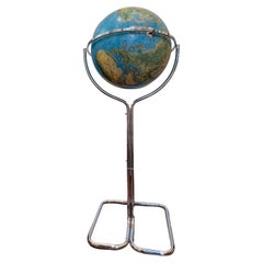
Luminous Earth Globe on a Chrome Base, Italy, 1980
Located in Paris, FR
Unusual luminous globe on a large chromed metal base, made in Italy by Ricoscope Editions in Firenze. In perfect condition, except for two very small missing pieces at the junction ...
Category

Vintage 1980s Italian Space Age Maps

Materials

Chrome

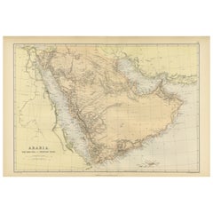
Original 1882 Map of Arabia, Red Sea & Persian Gulf
Located in Langweer, NL
This print is a historically significant map titled "Arabia, the Red Sea, and the Persian Gulf
Category

Antique 1880s Maps

Materials

Paper

Antique Map of the East Indies by Dower, 1832
Located in Langweer, NL
Antique map titled 'East India Isles'. Old map of the East Indies. This map originates from 'A
Category

Antique 19th Century Maps

Materials

Paper

Antique Map of the Koblentz Region by Moll, 1695
By Herman Moll
Located in Langweer, NL
Antique map Koblentz titled 'Coblentz'. Rare antique map of the Koblentz region in Germany. On
Category

Antique 17th Century Maps

Materials

Paper

Antique Map Illustrating Solar Eclipses by Scherer, C.1703
Located in Langweer, NL
Antique map of an hemisphere and several figures illustrating the position of the earth, moon and
Category

Antique 18th Century Maps

Materials

Paper

Antique Bible World Map by R. & J. Wetstein, 1743
Located in Langweer, NL
Antique world map titled 'De Werelt Caart'. A scarce and richly detailed double hemisphere world
Category

Antique Mid-18th Century Maps

Materials

Paper

Antique Bible World Map by R. & J. Wetstein, 1743
Free Shipping
H 15.52 in W 21.26 in D 0.02 in
Antique Map of England and Wales, Also Showing the English Channel
Located in Langweer, NL
engraved by J. Dower. Originates from 'A General Descriptive Atlas Of The Earth, Containing Separate Maps
Category

Antique Mid-19th Century Maps

Materials

Paper

Antique Map of Sweden and Norway by H. Moll, circa 1715
Located in Langweer, NL
Beautiful and rare map of Sweden and Norway including English text. This map most likely originates
Category

Antique Early 18th Century Maps

Materials

Paper

Two Impressive and Huge Midcentury World Map Wall Globes, Austria, 1950s
Located in Vienna, AT
We proudly offer this outstanding pair of very large wall-mounted modernist globes / world maps
Category

Mid-20th Century Austrian Mid-Century Modern Maps

Materials

Aluminum, Iron

Antique Double Hemisphere World Map with California as an Island, 1710
Located in Langweer, NL
Description: Antique map titled 'De Werelt Caart'. First state (out of three) antique double
Category

Antique 1710s Maps

Materials

Paper

Antique Map Depicting Sydney and Surrounding Areas, Known as Port Jackson, c1889
Located in Langweer, NL
An antique map depicting Sydney and its surrounding areas, known as Port Jackson, dating from
Category

Antique 1880s Maps

Materials

Paper

Antique Map of the Phenomena of Volcanoes and Earthquakes by Reynolds, 1852
Located in Langweer, NL
Antique world map showing the phenomena of Volcanoes and Earthquakes, showing the influence exerted
Category

Antique 19th Century Maps

Materials

Paper

Antique Map of the Banda Islands and the Route of Abel Tasman, Indonesia, 1726
Located in Langweer, NL
largest atolls on earth. On verso: antique map of the Banda Islands. With the route of Abel Tasman. This
Category

Antique 1720s Maps

Materials

Paper

Rare Antique Map with Timor and Nearby Islands Plus an Inset of Hawaii, 1825
Located in Langweer, NL
Antique map titled 'Essai sur la Geographie de l'Ile Timor.' A map showing Timor and the
Category

Antique 1820s Maps

Materials

Paper

Original Antique Map of the Peninsula of India with Part of Ceylon by Wyld, 1844
Located in Langweer, NL
the earth, Wyld would swiftly create a "Grand Map of that delightful spot, the Centre of the Earth
Category

Antique Mid-18th Century Maps

Materials

Paper

Late 20th Century Educational Geographic Map - Earths Lithosphere
Located in Hook, Hampshire
Late 20th Century Educational Geographic Map – Earths Lithosphere Late 20th Century Educational
Category

Late 20th Century Czech Posters

Materials

Cotton

Ancient engraving, map of the earth with circling zodiac
Located in Saint-Ouen, FR
Ancient engraving, map of the earth with circling zodiac "Situs Terrae Circulis Coelestibus
Category

Antique 18th Century European International Style Drawings

Materials

Paper

Southern Hemisphere of the Earth Rollable Map Vintage Wall Chart
Located in Berghuelen, DE
A great pull-down map or vintage wall chart illustrating the southern hemisphere of the earth
Category

Mid-20th Century German Country Prints

Materials

Canvas, Wood, Paper

Vintage Mural World Map Earth Poster Pull-Down Wall Chart Poster Print
Located in Berghuelen, DE
A large decorative world map – named our earth, impressive wall chart decoration, published by
Category

Vintage 1970s German Country Prints

Materials

Canvas, Wood, Paper

Northern Hemisphere of the Earth Rollable Map Vintage Wall Chart World Mural
Located in Berghuelen, DE
A great pull-down map or vintage wall chart illustrating the northern hemisphere of the earth
Category

Mid-20th Century German Country Prints

Materials

Canvas, Wood, Paper

1850 Old French Map Depicting the Entire Earth's Surface Divided into Two Parts
Located in Milan, IT
Geographical map depicting the entire earth's surface divided into two parts that correspond to the
Category

Antique Mid-19th Century French Scientific Instruments

Materials

Glass, Wood, Paper

Map, Exploring The World
Located in New York City, NY
300 stunning maps from all periods and from all around the world, exploring and revealing what maps
Category

21st Century and Contemporary Hong Kong Books

Materials

Paper

Map, Exploring The World
H 11.38 in W 9.88 in D 1.5 in
Separation of Earth and Sky (Blake)
By Laura Ball
Located in Denver, CO
represent access points and maps to the primeval places we all have in common, a familiarity outside of
Category

2010s Contemporary Paintings

Materials

Ink, Acrylic, Watercolor, Gouache, Graphite

Antique Print of 'Earth Stopper' by Scott, 1801
Located in Langweer, NL
Antique print titled 'Earth Stopper'. This print was created in 1801 in London for William Barker
Category

Antique 19th Century Prints

Materials

Paper

Helen Ficalora 14k Yellow Gold "Protect Mother Earth" Charm
Located in Sherman Oaks, CA
Gorgeous Charm/Pendant by Helen Ficalora One Side Says "Protect Mother Earth" Other Side Features
Category

21st Century and Contemporary American Modern Pendant Necklaces

Materials

14k Gold, Yellow Gold

Map of Crete - Etching by Johannes Blaeu - 1650s
Located in Roma, IT
Map of Crete (Candia olim Creta) is an etching realized by Johannes BLAEU (1596-1673) in 1650s
Category

1650s Modern Figurative Prints

Materials

Etching

John Thomson (1777-1840) - 1830 Map Engraving, Eastern Hemisphere
By John Thomson
Located in Corsham, GB
A fine engraved map of the Eastern Hemisphere of Earth, from the second edition of John Thomson's
Category

Early 19th Century More Prints

Materials

Engraving

Untitled- pastel earth color abstract geometric drawing on paper
By Abby Goldstein
Located in New York, NY
graphic quality of city maps and focuses on their 'inherent reliance to describe, where we are, where we
Category

2010s Abstract Geometric Abstract Drawings and Watercolors

Materials

Watercolor, Archival Paper, Color Pencil

Brindle, disrupted realism, fashion, feminist, cool colors earth tones
By Audrey Anastasi
Located in Brooklyn, NY
that of a map, usually serving as the background to the subjects -- taken together, the images that
Category

2010s Mixed Media

Materials

Paint, Mixed Media, Panel

Boulder Opal Earrings Middle-Earth Tolkien Lord of the Rings
By Alexey Gabilo
Located in Berlin, DE
tranquility reminiscent of the map of middle earth. These imaginative dangle earrings are designed with
Category

2010s French Art Nouveau Dangle Earrings

Materials

Opal, 18k Gold, Yellow Gold, Silver, Sterling Silver

Curtis Jere World Map / Globe Wall Sculpture 'Two Piece'
By Curtis Jeré
Located in East Hampton, NY
World Map was designed by American artist duo Curtis Jere. It is signed to base. A finely rendered
Category

Vintage 1980s American Mid-Century Modern Wall-mounted Sculptures

Materials

Brass

Abstract Landscape Indian artist Natural Pigments Australia Earth Brown Blue
By Mukesh Sharma
Located in Norfolk, GB
The National Gallery of Australia, Museum of Art & Photography (MAP), RMIT University Museum, Swiss Re
Category

Early 2000s Abstract Abstract Prints

Materials

Paper, Printer's Ink, Pigment

Abstract Landscape India Rajasthan Light Natural Mustard Earth Blue Yellow
By Mukesh Sharma
Located in Norfolk, GB
Art & Photography (MAP), RMIT University Museum, Swiss Re, Qualcomm to name a few.
Category

1990s Abstract Abstract Prints

Materials

Archival Paper, Linocut, Archival Ink

Abstract Landscape Rajasthan Print Nature Multicultural Faces Earth Orange Brown
By Mukesh Sharma
Located in Norfolk, GB
collections worldwide including The National Gallery of Australia, Museum of Art & Photography (MAP), RMIT
Category

Early 2000s Abstract Abstract Prints

Materials

Archival Ink, Archival Paper, Linocut, Archival Pigment

Abstract Landscape Rajasthan Light Viscosity Print Natural Seasons Earth Blue
By Mukesh Sharma
Located in Norfolk, GB
Art & Photography (MAP), RMIT University Museum, Swiss Re, Qualcomm to name a few.
Category

1990s Abstract Abstract Prints

Materials

Archival Ink, Archival Paper, Archival Pigment

The Way Home - Original Minimalist Scenic Warm Earth Tones Landscape Painting
By Mike Gough
Located in Los Angeles, CA
work is to create a patchwork map of memories as a guide back to the authenticity of human feeling
Category

21st Century and Contemporary Minimalist Landscape Paintings

Materials

Mixed Media, Acrylic, Wood Panel

Jewels, abstract collage, colorful black female figure gesture green earth tones
By Audrey Anastasi
Located in Brooklyn, NY
maps, providing equal presence to the figures each with their own level of dimensionality. The maps
Category

2010s Neo-Expressionist Figurative Drawings and Watercolors

Materials

Charcoal, Archival Paper, Magazine Paper

Continuum pregnancy collage female figure, ochre earth tones time clocks, hands
By Audrey Anastasi
Located in Brooklyn, NY
portraits there are ripped road maps, providing equal presence to the figures each with their own level of
Category

2010s Contemporary Figurative Drawings and Watercolors

Materials

Fabric, Charcoal, Archival Paper, Magazine Paper

FTSW 105-earth tone contemporary figurative photo transfer on paper and thread
By Michele Landel
Located in New York, NY
paper together to create bandages and veils and to transform images into fragile maps. Michele is an
Category

2010s Contemporary Figurative Photography

Materials

Fabric, Thread, Pastel, Acrylic, Archival Paper

Abstract Print India Artist Proof Linocut Nature Earth Love Red Orange
By Mukesh Sharma
Located in Norfolk, GB
Art & Photography (MAP), RMIT University Museum, Swiss Re, Qualcomm to name a few.
Category

Early 2000s Abstract Abstract Prints

Materials

Archival Ink, Archival Paper, Linocut, Archival Pigment

Abstract India Landscape Rajasthan Light Viscosity Print Natural Jali Earth Red
By Mukesh Sharma
Located in Norfolk, GB
The National Gallery of Australia, Museum of Art & Photography (MAP), RMIT University Museum, Swiss Re
Category

Early 2000s Abstract Abstract Prints

Materials

Archival Paper, Archival Ink

New France and Labrador - Graphite Drawing, Landscape, On Antiqued Map
By Don Pollack
Located in Chicago, IL
, Illinois, “between heaven and earth”, December 7, 2000 Newberry Library, Map Society, Chicago, Illinois
Category

21st Century and Contemporary Contemporary Landscape Paintings

Materials

Canvas, Oil

Map of Beijing (Peking) with Tartar and Chinese Divisions and Jesuit Missions
Located in Langweer, NL
An antique map by Jacques Nicolas Bellin titled "Plan de la Ville de Peking Capitale de l'Empire de
Category

Antique 1750s Prints

Materials

Paper

Unique Danish Søholm Stoneware Lamps in Light Glazing and Earth Colors, 1960s
By Søholm Stentøj
Located in Odense, DK
"Hjorth's Keramik", Bornholm has managed to place itself heavily on the Danish map within ceramics and
Category

Vintage 1960s Danish Scandinavian Modern Chandeliers and Pendants

Materials

Ceramic

Original Vintage Poster General Dynamics Aerodynamics UN Atomic Energy World Map
By Erik Nitsche
Located in London, GB
map diagram of the earth above a photo of a crane, set against a bold red background with stylized
Category

Vintage 1950s Swiss Posters

Materials

Paper

“The Lion Cries”, Hyper-realist Symbolist Blue and Green Map Oil Painting
By Andrée Bars
Located in Clermont-Ferrand, Auvergne-Rhône-Alpes
protective, proud and self-assured. In this painting, it is merged into a map, symbolizing the Earth, as our
Category

2010s Symbolist Figurative Paintings

Materials

Oil, Canvas

Vintage Table Globe, English, World Map, 13.5 Inch Diameter, Cartography, C.1960
Located in Hele, Devon, GB
This is a vintage table globe. An English, paper finished world map with chrome meridian, dating to
Category

Vintage 1960s British Mid-Century Modern Globes

Materials

Chrome

Map 5-Limited Edition of 10, iPad Drawing on Aluminum-12x12
By Sebastian Spreng
Located in West Palm Beach, FL
iPad drawing printed on aluminum. From the "A Song for The Earth" series inspired by Mahler's DAS
Category

2010s Abstract Abstract Prints

Materials

Metal

Theories of Planetary Orbits: A Framed 18th C. Celestial Map by Doppelmayr
By Johann Gabriel Doppelmayr 1
Located in Alamo, CA
This 18th century hand-colored copperplate celestial map by Johann Doppelmayr entitled "Astronomia
Category

Early 18th Century Landscape Prints

Materials

Engraving

Theories of Planetary Motion: An 18th C. Framed Celestial Map by Doppelmayr
By Johann Gabriel Doppelmayr 1
Located in Alamo, CA
This 18th century hand-colored copperplate celestial map by Johann Doppelmayr entitled "Theoria
Category

Early 18th Century Landscape Prints

Materials

Engraving

Wave Hill - Hand Made Paper Work With Geographical Maps From Wave Hill in NYC
By Tessa Grundon
Located in New York, NY
locations - local maps, wax from nearby beehives, pigments from the muds, earth, plants, and charcoal
Category

21st Century and Contemporary Contemporary Abstract Drawings and Waterco...

Materials

Handmade Paper, Mixed Media, Wax

The Orbits of Venus and Mercury: An 18th C. Framed Celestial Map by Doppelmayr
By Johann Gabriel Doppelmayr 1
Located in Alamo, CA
This 18th century hand-colored copperplate celestial map by Johann Doppelmayr entitled "Phænomena
Category

Early 18th Century Landscape Prints

Materials

Engraving

Map 6-Limited Edition of 10, iPad Drawing on Aluminum 12 X 12
By Sebastian Spreng
Located in West Palm Beach, FL
iPad drawing on aluminum. Printed from the original digital file. From the "A Song for The Earth
Category

2010s Abstract Abstract Prints

Materials

Metal

  • 1
  • ...
Get Updated with New Arrivals
Save "Earth Map", and we’ll notify you when there are new listings in this category.

Earth Map For Sale on 1stDibs

Choose from an assortment of styles, material and more with respect to the earth map you’re looking for at 1stDibs. Frequently made of paper, wood and glass, every earth map was constructed with great care. Your living room may not be complete without an earth map — find older editions for sale from the 19th Century and newer versions made as recently as the 20th Century. An earth map, designed in the Art Nouveau style, is generally a popular piece of furniture. Many designers have produced at least one well-made earth map over the years, but those crafted by Dietrich Reimers are often thought to be among the most beautiful.

How Much is a Earth Map?

Prices for an earth map start at $320 and top out at $8,623 with the average selling for $1,052.