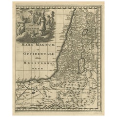
Holy Land Map
5
to
7
51
25
54
33
16
15
10
8
8
6
6
5
5
3
2
2
2
2
2
2
2
2
2
1
1
1
1
1
1
1
1
4
2
2
2
2
Sort By
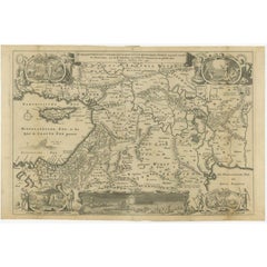
Antique Map of the Holy Land, c.1710
Located in Langweer, NL
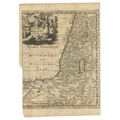
Antique map titled 'Totius Terrae Sanctae Delineatio'. Map of the Holy Land extending to Egypt and
Category
Antique 18th Century Maps
Materials
Paper
Antique Map of the Holy Land, c.1717
Located in Langweer, NL
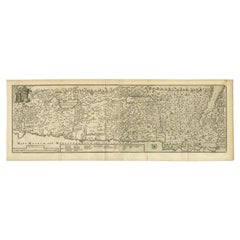
Holy Land by J. Bonfrerius. The map is oriented with north at top left and divided into the twelve
Category
Antique 18th Century Maps
Materials
Paper
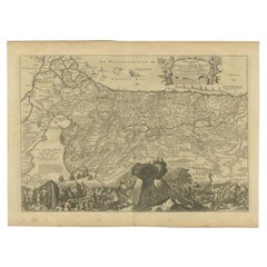
Beautiful Rare Antique Map of the Holy Land, 1648
Located in Langweer, NL
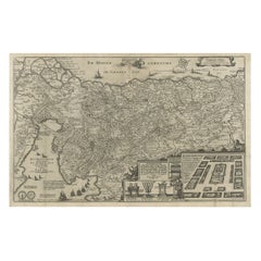
Antique map Holy Land titled 'Perigrinatie ofte Veertich-Iarige Reyse, der kinderen Israels uyt
Category
Antique 1640s Maps
Materials
Paper
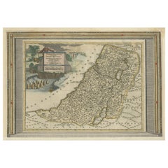
Antique Map of the Holy Land by Schut, 1710
Located in Langweer, NL
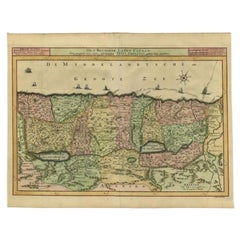
Antique map of the Holy Land titled 'Het Beloofde Landt Canaan.' Very detailed and decorative map
Category
Antique 18th Century Maps
Materials
Paper
Antique Map of the Holy Land by Keur, 1748
Located in Langweer, NL
Antique Map Holy Land titled 'De Gelegentheyd van t'Paradys ende t'Landt Canaan, Mitsgaders d'eerst
Category
Antique 18th Century Maps
Materials
Paper
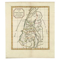
Antique Map of the Holy Land by Delamarche, 1806
By Charles Francois Delamarche
Located in Langweer, NL
Antique map titled 'Judee ou Terre Sainte sous les Turcs.' This map shows the holy land under the
Category
Antique 19th Century Maps
Materials
Paper
Antique Map of the Holy Land by Keur, 1748
Located in Langweer, NL
Antique biblical map titled 'Perigrinatie ofte veertigh-Iarige Reyse der Kinderen Israels uyt
Category
Antique 18th Century Maps
Materials
Paper
Antique Map of the Holy Land with Picture Frame Border
Located in Langweer, NL
Holy Land with the picture frame border. The term "Holy Land" usually refers to a territory roughly
Category
Antique Early 18th Century Maps
Materials
Paper
Original Antique Map of the Holy Land with Decorative Cartouche
Located in Langweer, NL
Antique map titled 'Totius Terrae Sanctae'. Original old map of the Holy Land, with a large
Category
Antique Late 17th Century Maps
Materials
Paper
Antique Map of the Holy Land by Danckerts, c.1710
Located in Langweer, NL
de Roode Zee en de Woestyne tot in 't Beloofde Landt Canaan'. Map of the Holy Land divided into the
Category
Antique 18th Century Maps
Materials
Paper
Antique Map of the Holy Land by Van Luchtenburg, c.1720
Located in Langweer, NL
Antique map titled 'Heylige Land verdeeld in de Twaalf Stammen Israels (..).' Highly detailed map
Category
Antique 18th Century Maps
Materials
Paper
Mercator's Ptolemaic Map of the Holy Land, Cyprus and Syria, circa 1580
Located in Langweer, NL
Antique map titled 'Asiae IIII Tab'. Beautiful map of Mercator's Ptolemaic map of the Holy Land
Category
Antique 16th Century Maps
Materials
Paper
No Reserve
H 15.63 in W 19.77 in D 0.02 in
Map Holy Promise Land Canaan Richard Palmer Richard Blome 1687 Joseph Moxon
Located in BUNGAY, SUFFOLK
Canaan comonly called the Holy Land or the Land of Promise, being the Possesion of the Israelites
Category
Antique 17th Century British Baroque Maps
Materials
Paper
H 12.21 in W 19.69 in D 0.4 in
Antique Map of the Holy Land, with vignette of the Garden of Eden
Located in Langweer, NL
Antique map titled 'Hondius his Map of Paradise'. Beautiful map of the region bounded by the Holy
Category
Antique Mid-17th Century Maps
Materials
Paper
Antique Map of the Holy Land, Showing the Location of the Various Tribes
Located in Langweer, NL
Holy Land, showing the location of the various tribes, in two kingdoms, Judah and Israel as well as in
Category
Antique Early 18th Century Maps
Materials
Paper
Free Shipping
H 20.48 in W 23.82 in D 0.02 in
Antique Map of the Holy Land, showing the travels of Abraham, Isaac and Jacob
Located in Langweer, NL
regional map of the Holy Land, showing the travels of Abraham, Isaac and Jacob. Published by J. Janssonius
Category
Antique Mid-17th Century Maps
Materials
Paper
No Reserve
H 20.2 in W 23.9 in D 0.02 in
Original Rare Map of the Holy Land Showing the Twelve Tribes of Israel's, 1782
Located in Langweer, NL
Antique map titled 'Carte des Douze Tribus D'Israel (..).'
Map of the Holy Land showing the
Category
Antique 1780s Maps
Materials
Paper
H 14.77 in W 21.58 in D 0 in
Detailed Map of the Holy Land, Showing the Travels of Christ & Apostles, ca.1650
Located in Langweer, NL
neffens syne Apostelen.'
Detailed map of the Holy Land, showing the travels of Christ and the Apostles
Category
Antique 1650s Maps
Materials
Paper
H 44.2 in W 52.3 in D 0.002 in
Rare Map of Rama or Ramma 'Ramallah?' in Palestine or the Holy Land, ca.1730
Located in Langweer, NL
Antique map titled 'Rama'.
This maps shows a view of Ramma (Ramallah?) in Palestine or the Holy
Category
Antique 1730s Maps
Materials
Paper
H 7.49 in W 5.83 in D 0 in
Map Holy Land La Terre Sainte Engraved van Loon Published N de Fer 1703 French
Located in BUNGAY, SUFFOLK
Majeste Catoliq et de Monseigneur le Dauphin. Avec Privil du Roi 1703
Detailed map of the Holy Land
Category
Antique Early 1700s French Louis XIV Maps
Materials
Paper
H 11.03 in W 13.78 in D 0.4 in
The Holy Land at the Time of Jesus: A 17th Century Dutch Map by Visscher
By Nicolaes Visscher II
Located in Alamo, CA
discoloration. The map is otherwise in excellent condition.
Another map of the "Holy Land" (a city view of
Category
Antique Mid-17th Century Dutch Maps
Materials
Paper
H 22.75 in W 28.5 in D 1.13 in
Highly Detailed Antique Map of the Holy Land Showing 12 Tribes of Israel, c.1720
Located in Langweer, NL
map of the Holy Land divided into 12 tribes of Israel. With beautiful large title cartouche, vignette
Category
Antique 1720s Maps
Materials
Paper
Free Shipping
H 17.72 in W 20.28 in D 0 in
Map of the Holy Land Divided into 12 Tribes, the Travels of Jesus Christ, 1700
Located in Langweer, NL
and detailed map of the Holy Land divided into 12 Tribes, showing the travels of Jesus Christ. Fully
Category
Antique Early 1700s Maps
Materials
Paper
H 17.72 in W 20.28 in D 0 in
Antique Map of the Holy Land Described in the Old and New Testament, ca.1660
Located in Langweer, NL
Antique map titled 'Geographiae Sacrae ex Veteri et Novo Testamento Desumptae Tabula Prima quae
Category
Antique 1660s Maps
Materials
Paper
No Reserve
H 16.15 in W 21.46 in D 0 in
Map of the Holy Land "Carte de la Syrie et de l'Egypte" by Pierre M. Lapie
By Pierre M. Lapie
Located in Alamo, CA
engraved by Armand Joseph Lellemand (1810-1871). The map depicts the Holy Land and Egypt as it existed at
Category
Antique Early 19th Century French Maps
Materials
Paper
H 27 in W 21.38 in D 0.75 in
Original Antique Map of the Duchy of Holstein
By Willem Blaeu
Located in Langweer, NL
Antique map titled 'Ducatus Holsatiae Nova Tabula'. Original old map of the Duchy of Holstein, the
Category
Antique Mid-17th Century Maps
Materials
Paper
Antique Map of the Middle East by Mortier, 1700
Located in Langweer, NL
Antique map titled 'Carte de la Situation du Paradis Terrestre (..)'. Detailed map of the Holy Land
Category
Antique 18th Century Maps
Materials
Paper
Religious Antique Map of the Twelve Tribes of Israel, circa 1750
Located in Langweer, NL
Antique map titled 'Palaestina in XII. Tribus (..)'. Large map of the Holy Land, published by the
Category
Antique Mid-18th Century Maps
Materials
Paper
Free Shipping
H 20.32 in W 25.04 in D 0.02 in
Antique Map of Israel Filled with Biblical Scenes, Published in 1748
Located in Langweer, NL
Antique map Holy Land titled 'Het beloofde landt Canaan doorwandelt van onsen Saligmaker Jesu
Category
Antique 1740s Maps
Materials
Paper
Antique Map of Western and Eastern Barbary in Africa, c.1744
Located in Langweer, NL
Nile Delta, Red Sea and Holy Land.
Artists and Engravers: The map was made by Emmanuel Bowen (ca
Category
Antique 18th Century Maps
Materials
Paper
Scarce Map of the Mediterranean and Parts of Europe, Africa & Middle East, 1725
Located in Langweer, NL
, Africa and the Middle East, illustrating the travels of Paul between the Holy Land and Rome, through the
Category
Antique 1720s Maps
Materials
Paper
H 15.75 in W 18.51 in D 0 in
18th Century French Map and City View of Joppe/Jaffa 'Tel Aviv' by Sanson
By Nicolas Sanson
Located in Alamo, CA
condition.
Another map of the "Holy Land" (by Claes Visscher in 1663), with an identical style frame and
Category
Antique Early 18th Century French Maps
Materials
Paper
H 18.88 in W 23 in D 1.13 in
17th Century Dutch Map of the Holy Land at the Time of Jesus by Visscher
By Nicolaus Visscher
Located in Alamo, CA
. The map depicts the Holy Land from the Mediterranean Sea to just beyond the Jordan River as it
Category
1660s Prints and Multiples
Materials
Engraving
H 22.75 in W 28.5 in D 1.13 in
Map of the Holy Land "Carte de la Syrie et de l'Egypte" by Pierre Lapie
By Pierre M. Lapie
Located in Alamo, CA
map was engraved by Armand Joseph Lellemand (1810-1871). The map depicts the Holy Land and Egypt as it
Category
1830s Landscape Prints
Materials
Engraving
H 27 in W 21.38 in D 0.75 in
The Holy Bible, Standard Edition, Illustrated Family Bible, 1885
Located in Colorado Springs, CO
from Genesis to Revelation, natural history, and several maps of the Holy Land engraved by L.B Folger
Category
Antique 1880s American Late Victorian Books
Materials
Leather, Paper
Map of Palestine - Original Etching - 19th Century
Located in Roma, IT
condition except for some traces of time and folding.
Historical, documentary map of Holy Land, illustrated
Category
19th Century Modern Figurative Drawings and Watercolors
Materials
Etching, Paper
John Speede Map The Countye of Monmouth
By John Speed
Located in London, GB
, later becoming a Fellow of the Society of Antiquaries. His first maps were historical, of the Holy Land
Category
17th Century Realist Landscape Prints
Materials
Engraving
Antique Print of a Monk of the Order of the Holy Sepulchre (Rome), 1845
Located in Langweer, NL
"canons" as well as knights, with the primary mission to "support the Christian presence in the Holy Land
Category
Antique 19th Century Prints
Materials
Paper
Northern Italy: A 16th Century Hand-colored Map by Abraham Ortelius
By Abraham Ortelius
Located in Alamo, CA
of the world in 1564. Ortelius also published a map of Egypt in 1565, a map of the Holy Land, a plan
Category
16th Century Old Masters Landscape Prints
Materials
Engraving
H 21.5 in W 28 in D 0.75 in
Mediterranean and Adriatic Seas: Original 18th Century Hand-colored Map by Bowen
Located in Alamo, CA
Morocco, Algeria, Tunisia, Libya (Kingdom of Tripoli), as well as Egypt and the Holy Land in the south
Category
Mid-18th Century Old Masters Landscape Prints
Materials
Engraving
(Holyland-Canaan) A New Map Shewing...Places Mentioned in the New Testament.
By Edward Wells
Located in Florham Park, NJ
Edward Wells (1667-1727)
A New Map Shewing…Places mentioned in the New Testament.
The Land of
Category
18th Century and Earlier Academic More Art
Materials
Engraving
North and South America: An 18th Century Hand-colored Map by Johann Homann
By Johann Baptist Homann
Located in Alamo, CA
continuous land bridge from North America to Asia, a northwest passage. The map preceded the French and
Category
Early 18th Century Old Masters Landscape Prints
Materials
Engraving
John Speede Map The Countye Palatine of Chester with that most ancient citie
By John Speed
Located in London, GB
first maps were historical, of the Holy Land 'Canaan as it was Possessed both in Abraham and Israels
Category
17th Century Realist Landscape Prints
Materials
Engraving
18th Century French Map and City View of Joppe/Jaffa (Tel Aviv) by Sanson
By Nicholas Sanson d'Abbeville
Located in Alamo, CA
.
Another map of the "Holy Land" (by Claes Visscher in 1663), with an identical style frame and mat is
Category
Early 1700s Prints and Multiples
Materials
Engraving
H 18.88 in W 23 in D 1.13 in
Antique Print of a Burial at Sea, circa 1870
Located in Langweer, NL
from the Holy Land in 1841. The Governor of Gibraltar refused to allow the body ashore and Wilkie was
Category
Antique 19th Century Prints
Materials
Paper
Rare Palestine Antique Hebrew Judaica Yahrzeit Synagogue Sign Memorial Plaque
Located in Surfside, FL
tourists included collections of Flowers of the Holy Land (c. 1910–1918)—pressed local flowers accompanied
Category
Early 20th Century Aesthetic Movement More Art
Materials
Lithograph
'Mount Taranaki, New Zealand' — from the series 'Axis Mundi', Contemporary
Located in Myrtle Beach, SC
clothed with wood and verdure’.
It appeared as Mount Egmont on maps until 29 May 1986, when the name
Category
21st Century and Contemporary Contemporary Landscape Prints
Materials
Etching, Photogravure
Map of Palestine or Judea, Illustrating the History of the New Testament
By Rev. Nathan B. Rogers
Located in New York, NY
rendering of the Holy Land, Rogers has located and inscribed significant locales mentioned in the Gospels
Category
19th Century More Art
Materials
Canvas, Paper, Ink, Pen
Superb 16th Century Map of Jerusalem
By Georg Braun and Frans Hogenberg
Located in La Jolla, CA
made him the acknowledged expert on Holy Land geography. Josephus was a Jewish historian who was
Category
Antique 16th Century German Northern Renaissance Prints
Materials
Paper
Map of Syria, Libanon, Palestine, Iraq, Israel by Mercator - Engraving - 17th c.
By Gerard Mercator
Located in Zeeland, Noord-Brabant
, including the Holy Land, present day Syria, Libanon, Palestine, Iraq and Israel. A ship sails just below
Category
1690s Old Masters More Prints
Materials
Engraving
Gedaante van Palestine […].
By Jan Luyken
Located in Zeeland, Noord-Brabant
Engraving on hand laid paper.
A map of the Holy Land, showing the Biblical names for the various
Category
1730s Landscape Prints
Materials
Engraving
Kaart van de reis-tochten en verblyf-plaatsen der Heilige apostelen Petrus [...]
By Nicholas Sanson d'Abbeville
Located in Zeeland, Noord-Brabant
Journeys and Residences of the Holy Apostles Peter and Paul through Galilee, Samaria, Jewish Land, Egypt
Category
Early 18th Century More Prints
Materials
Engraving, Etching
Antique Map of the Holy Land, Divided into 12 Tribes of Israel, C.1720
Located in Langweer, NL
Antique map titled 'Heylige Land verdeeld in de Twaalf Stammen Israels (..).' Highly detailed map
Category
Antique 18th Century Maps
Materials
Paper
No Reserve
H 17.72 in W 20.28 in D 0 in
Antique Map of the Ottoman Empire by Wyld, c.1840
Located in Langweer, NL
to include Cyprus, the Holy Land, and the northeastern tip of Africa. Several routes are marked along
Category
Antique 19th Century Maps
Materials
Paper
Antique Map of the Journey by Paul the Apostle by Mortier, 1700
Located in Langweer, NL
'. Old map of the Middle East/Holy Land depicting the route to Rome by Paul the Apostle. This map
Category
Antique 18th Century Maps
Materials
Paper
Abraham Ortelius (1527-1598) - 17th Century Engraving, Map of the Holy Land
By Abraham Ortelius
Located in Corsham, GB
An early 17th or late 16th century map showing the land of Canaan with an inset map depicting the
Category
18th Century More Prints
Materials
Engraving
The Holy Bible, Containing the Old and New Testaments, Illustrated, 1885
Located in Colorado Springs, CO
, births, deaths, marriages, and temperance. Three maps, “A New Map of Palestine or the Holy Land
Category
Antique 1880s American Gothic Revival Religious Items
Materials
Leather, Paper
H 13.75 in W 11.25 in D 3.75 in
Early 20th Century Silver Mezuzah by Avraham Moshe Sokolka, Jerusalem
Located in New York, NY
the Bible as indigent to the Holy Land — such as the dates, grapevine, pomegranate and palm tree
Category
Early 20th Century Israeli Art Deco Religious Items
Materials
Silver
Oil Painting Portrait of Lord Edward Grenfell, 1st Baron St Just (1870-1941)
By Oswald Birley
Located in London, GB
, Elizabeth McCorquodale (1856–1928), was a Scot from the north-eastern Highlands. Her family owned land in
Category
Early 20th Century Victorian Portrait Paintings
Materials
Oil
Palestine, antique Holy Land map print by Alexander Keith Johnston, 1901
Located in Melbourne, Victoria
'Palestine', antique lithographic map by Keith Johnston.
Inset map of 'Jerusalem' top right corner
Category
Early 20th Century Victorian More Prints
Materials
Lithograph
- 1
Get Updated with New Arrivals
Save "Holy Land Map", and we’ll notify you when there are new listings in this category.
Holy Land Map For Sale on 1stDibs
At 1stDibs, there are many versions of the ideal holy land map for your home. Each holy land map for sale was constructed with extraordinary care, often using paper, animal skin and leather. Your living room may not be complete without a holy land map — find older editions for sale from the 18th Century and newer versions made as recently as the 20th Century. When you’re browsing for the right holy land map, those designed in Art Deco and Baroque styles are of considerable interest. A well-made holy land map has long been a part of the offerings for many furniture designers and manufacturers, but those produced by Charles Francois Delamarche, Georg Braun and Frans Hogenberg and Johann Baptist Homann are consistently popular.
How Much is a Holy Land Map?
The average selling price for a holy land map at 1stDibs is $749, while they’re typically $94 on the low end and $75,000 for the highest priced.
More Ways To Browse
Tank Black Womens
United States Naval Gun
Red King Bed
Oversized Map
Antique Safe Herring
Irish Georgian Bed
Safe Herring
Antique Folding Sink
Antique Printing Press Machine
Arabian Dagger
Blue Dog Looking For A Beach House
Yacht Master 2 White Gold
Arabic Cigarette Case
Saudi Arabia Dagger
Yacht Master 40 Blue
Yacht Master Blue Face
Gold Antique Signed
Antique Religious Carved Wood Plaque
