Map Of Korea
4
to
18
110
46
102
64
38
38
26
21
19
18
13
11
10
10
7
5
5
4
4
4
3
2
2
2
2
2
2
2
2
1
1
1
1
1
1
1
1
1
54
10
7
3
2
Sort By
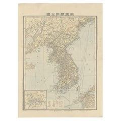
Antique Map of Korea by Kozaki, 1903
Located in Langweer, NL
Old map of Korea by S. Kozaki. Restored and mounted.
Category
20th Century Maps
Materials
Paper
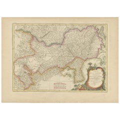
Antique Map of Korea and Southern China by Bonne '1771'
Located in Langweer, NL
Antique map titled 'Carte de la Tartarie Chinoise'. Original antique map of Korea and Southern
Category
Antique Mid-18th Century Maps
Materials
Paper
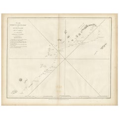
Antique Map of Part of the Korean Archipelago, 1798
Located in Langweer, NL
Antique map titled 'Plan of Part of the Islands or Archipellago of Corea'. This map depicts part of
Category
Antique Late 18th Century Maps
Materials
Paper
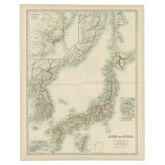
Antique Map of Japan and Korea by Johnston '1909'
Located in Langweer, NL
Antique map titled 'Japan and Korea'. Original antique map of Japan and Korea. With inset maps of
Category
Early 20th Century Maps
Materials
Paper
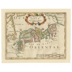
Antique Map of Japan and Korea by Sanson, 'c.1690'
Located in Langweer, NL
Antique map titled 'Les Iles du Iapon (..)'. Original antique map, with beautiful (later) hand
Category
Antique Late 17th Century Maps
Materials
Paper
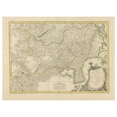
Original Old Map of Present-Day Mongolia, Northeast China and Korea
Located in Langweer, NL
Antique map titled 'Carte de la Tartarie Chinoise. Projettee et assujettie aux observations
Category
Antique Late 18th Century Maps
Materials
Paper
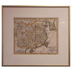
Antique Map of China Including Korea and Taiwan by Vaugondy, 1749
Located in Langweer, NL
Antique map titled 'Empire de la Chine'. Beautiful map of China including Korea and Taiwan (Formosa
Category
Antique Mid-18th Century Maps
Materials
Paper
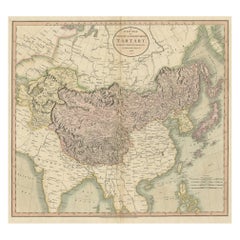
Antique Map of Chinese and Independent Tartary, Korea and Japan, 1806
Located in Langweer, NL
Antique map titled 'A New Map of Chinese & Independent Tartary'. Beautiful map of Chinese Tartary
Category
Antique 19th Century Maps
Materials
Paper
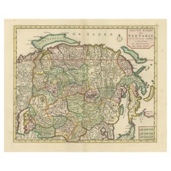
Antique Map of Northern Asia, with Russia, Korea and Northern Japan
Located in Langweer, NL
Antique map titled 'Nieuwe Kaart van Tartarie'. Map op Siberia and Chinese tartary. In the north
Category
Antique Mid-18th Century Maps
Materials
Paper
Decorative Map of the Empire of China, Korea, Japan, Taiwan, Lucon, Macau, 1780
Located in Langweer, NL
Antique map titled 'Carte de L'Empire de la Chine.'
Decorative map of the Empire of China
Category
Antique 1780s Maps
Materials
Paper
H 14.97 in W 10.24 in D 0 in
Rare Hand-Colored Antique Map of Tartary, China and Korea, ca.1741
Located in Langweer, NL
from the Particular Maps of the Jesuit Missionaries'.
Rare antique map of Tartary, China and Korea
Category
Antique 1740s Maps
Materials
Paper
No Reserve
H 16.15 in W 21.66 in D 0 in
Antique Map of China, Korea, Japan and the Northern Philippines, circa 1780
Located in Langweer, NL
'. Interesting and detailed map of China, Korea, Japan and the Northern Philippines. Published circa 1780.
Category
Antique Late 18th Century Maps
Materials
Paper
H 15.56 in W 9.85 in D 0.02 in
Antique Map of China, Also Depicting Formosa 'Taiwan' and Part of Korea, c.1840
Located in Langweer, NL
Antique map titled 'China'. Old map of China, also depicting Formosa (Taiwan) and part of Korea
Category
Antique 19th Century Maps
Materials
Paper
H 13.59 in W 16.15 in D 0 in
Beautiful Antique Map of China and Korea by Famous Mapmaker Janssonius, c.1660
Located in Langweer, NL
Antique map titled 'Imperii Sinarum Nova Descriptio'. Beautiful map of China and Korea. This map
Category
Antique 17th Century Maps
Materials
Paper
H 20.48 in W 24.22 in D 0 in
Antique Map of China and Korea incl Formosa and Hainan, by Janssonius, ca.1650
Located in Langweer, NL
Antique map titled 'Imperii Sinarum Nova Descriptio'. Beautiful map of China and Korea, much detail
Category
Antique 17th Century Maps
Materials
Paper
H 20.48 in W 24.02 in D 0 in
Rare Unusual Antique Map of Asia with a Landbridge from Korea to America, 1717
Located in Langweer, NL
Antique map titled 'L'Asie Suivant les Nouvelles Decouvertes (..).' Interesting and very unusual
Category
Antique 18th Century Maps
Materials
Paper
H 9.65 in W 13.94 in D 0 in
Original Old China Map, From Korea and the Sea of Japan to Teypin Island, 1803
Located in Langweer, NL
and the Tributary Kingdoms of Corea, Tonkin'.
Old map depicting China, extending from Korea and
Category
Antique Early 1800s Maps
Materials
Paper
H 10.63 in W 12.01 in D 0 in
Antique Map of Asia and the East Indies and Korea as a Peninsula, ca.1660
Located in Langweer, NL
Antique map titled 'Asiae nova delineatio'. Decorative map of Asia and the East Indies. The map
Category
Antique 17th Century Maps
Materials
Paper
Free Shipping
H 19.69 in W 24.02 in D 0 in
Antique Map of China by Wilkinson '1803'
Located in Langweer, NL
and the Tributary Kingdoms of Korea, Tonkin'. Old map depicting China, extending from Korea and the
Category
Antique Early 19th Century Maps
Materials
Paper
1814 Map of "Russian Empire" Ric.r032
Located in Norton, MA
1814 Map of
"Russian Empire"
Ric.r032
Russian Empire. Description: This is an 1814 John
Category
Antique 19th Century Unknown Maps
Materials
Paper
Antique Political Map of the Japanese Empire, 1922
Located in Langweer, NL
, Korea and surroundings. This map originates from 'The Times' atlas.
Artists and Engravers: John
Category
20th Century Maps
Materials
Paper
Antique Map of Siberia and Russia, c.1885
Located in Langweer, NL
Antique map titled 'Siberie ou Russie d?Asie'. This is a fine example of J. Migeon's map of Russia
Category
Antique 19th Century Maps
Materials
Paper
Antique Map of North and East Asia, 1751
Located in Langweer, NL
maps on one sheet, showing California, Alaska and Siberia, Korea and Japan. South to Korea the island
Category
Antique 18th Century Maps
Materials
Paper
Antique Map of Tartary, Also Showing the Great Wall of China
Located in Langweer, NL
Russia, Central Asia, China and Korea, first published by Guillaume De L'Isle in 1706. The map extends
Category
Antique Early 18th Century Maps
Materials
Paper
Old Map of the Chinese Empire and Japan, 1882
Located in Langweer, NL
An original antique map titled "The Chinese Empire and Japan," dating from an 1882 atlas by Blackie
Category
Antique 1880s Maps
Materials
Paper
Antique Map of China and Japan by Tardieu, 1821
Located in Langweer, NL
Antique map titled 'Carte de la Chine et du Japon'. Detailed map of China, showing Korea, Japan and
Category
Antique Early 19th Century Maps
Materials
Paper
Antique Map of the Bay of Terney by La Pérouse, 1797
Located in Langweer, NL
Antique map titled 'Plan de la Baie de Ternai'. Old map of the north eastern coast of Russia. This
Category
Antique 18th Century Maps
Materials
Paper
Antique Map of Asia by Pierre du Val, '1663'
Located in Langweer, NL
Antique map titled 'L'Asie'. Antique map of the Asian continent by Pierre Duval, dated 1663. Most
Category
Antique Mid-17th Century Maps
Materials
Paper
Antique Map of the Empire of China by Bonne, c.1780
By Rigobert Bonne
Located in Langweer, NL
Antique map titled 'Carte de L'Empire de la Chine.' Decorative map of the Empire of China
Category
Antique 18th Century Maps
Materials
Paper
Antique Map of Asia by A. Blondeau, circa 1800
Located in Langweer, NL
This is a fine circa 1800 map of Asia by Alexandre Blondeau. It covers the entire continent from
Category
Antique Early 19th Century Maps
Materials
Paper
Antique Map of Russia and Siberia by Migeon, 1880
Located in Langweer, NL
Antique map titled 'Sibérie ou Russie d'Asie'. Migeon's map covers the Russian empire in Asia from
Category
Antique 19th Century Maps
Materials
Paper
Large Antique Map of Asia including All of Southeast Asia, c.1792
Located in Langweer, NL
Antique map titled 'L' Asie Divisee en ses Empires, Royaumes, et Etats'. Attractive, large map of
Category
Antique 18th Century Maps
Materials
Paper
No Reserve
H 20.67 in W 25.4 in D 0 in
Antique Map of the Philippines and Guam by Scherer, circa 1702
Located in Langweer, NL
attractive map of the Mariana Islands, Philippines, Korea, Japan and Indonesia with an inset of the island
Category
Antique Early 18th Century Maps
Materials
Paper
Antique Map of North Europe and East Asia by Vaugondy, circa 1750
Located in Langweer, NL
Asia. Five maps on one sheet, showing California, Alaska and Syberia, Korea and Japan. South to Korea
Category
Antique Mid-18th Century Maps
Antique Map of China with insets the Island of Chusan and Canton River, c.1860
Located in Langweer, NL
Antique map titled 'China'. Large map of China, with insets the Island of Chusan, and the Estuary
Category
Antique 19th Century Maps
Materials
Paper
H 18.9 in W 23.63 in D 0 in
Decorative Ancient World Map with Large Parts of the World Still Unknown, c 1731
Located in Langweer, NL
Interesting ancient map of the world, based upon Strabo. The Southern tip of Africa is undiscovered
Category
Antique 1730s Maps
Materials
Paper
H 9.45 in W 14.57 in D 0 in
Original Antique Map Covering the Russian Empire in Asia, 1880
Located in Langweer, NL
Antique map titled 'Sibérie ou Russie d'Asie'.
Migeon's map covers the Russian empire in Asia
Category
Antique 1880s Maps
Materials
Paper
Original Antique Engrving of Chinese Tartary in the 18th Century, 1737
Located in Langweer, NL
The antique map titled " Ozieme feuille particuls de la Tartarie Chinoise, qui contient un pays
Category
Antique 1730s Maps
Materials
Paper
No Reserve
H 11.42 in W 18.9 in D 0 in
China with Hainan and Formosa Islands and the Kingdoms Corea and Tonkin, 1802
Located in Langweer, NL
and the Tributary Kingdoms of Korea, Tonkin'.
Old map depicting China, extending from Korea and
Category
Antique Early 1800s Maps
Materials
Paper
H 10.04 in W 12.21 in D 0 in
Late 20th Century Educational Geographic Map - Japan - Korea
Located in Hook, Hampshire
Late 20th Century Educational Geographic Map – Japan – Korea
Late 20th Century Educational
Category
Late 20th Century Czech Posters
Materials
Cotton
Vintage Rollable Map Asia Japan Korea Wall Chart Poster Countrycore Decoration
Located in Berghuelen, DE
A decorative country core pull-down map depicting Japan and Korea. Published by Haack-Paincke
Category
Late 20th Century German Country Prints
Materials
Canvas, Wood, Paper
H 76.38 in W 78.75 in D 0.79 in
"Choke II: Korean Strait (Tsushima Strait & Western Channel - Korea & Japan)"
By Gregor Turk
Located in Atlanta, GA
This ceramic wall sculpture features a topographic map in black and white.
Gregor is inspired by
Category
2010s Abstract Sculptures
Materials
Ceramic
Map of the Russian Empire: An Original 18th Century Hand-colored Map by E. Bowen
Located in Alamo, CA
This is an original 18th century hand-colored map entitled "A New & Accurate Map of The Whole
Category
Mid-18th Century Old Masters Landscape Prints
Materials
Engraving
China: An Original 18th Century Hand-colored Map by E. Bowen
Located in Alamo, CA
detailed and colorful map depicts China, Korea, Taiwan (Formosa), the Yangtze and Yellow Rivers, the great
Category
Mid-18th Century Old Masters Landscape Prints
Materials
Engraving
H 15.75 in W 19.75 in
Just Keep Going Until You Find me - British Abstract oil painting city map red
By Stanza
Located in London, GB
created by our living actions or agency. They all have in common that they depict maps with layers of data
Category
21st Century and Contemporary Abstract Abstract Paintings
Materials
Canvas, Paint, Acrylic, Oil
Memoirs: Year of Decisions and Years of Trial and Hope, Signed by Harry Truman
Located in Colorado Springs, CO
dated by Truman. In publisher's original silver embossed black boards with Missouri map endpapers
Category
Vintage 1950s American Mid-Century Modern Books
Materials
Paper
H 9 in W 6 in D 3.88 in
Antique Print of Two Japanese Vessels, 1799
Located in Langweer, NL
map of the Bay Area, Plan du Port du St. Francois, which was reproduced as Map 33 in L. Aubert's 1797
Category
Antique 1790s Prints
Materials
Paper
Antique Mycology Print of the Suillus Luteus, C.1860
By Elias Magnus Fries
Located in Langweer, NL
the British Isles to Korea, it has been introduced widely elsewhere, including North and South America
Category
Antique 19th Century Prints
Materials
Paper
Systems Of Interference - Contemporary Abstract Art Digital Painting
By Stanza
Located in London, GB
common that they depict maps with layers of data and mixed information, and they juxtapose various
Category
2010s Abstract Abstract Paintings
Materials
Canvas, Digital
H 47.25 in W 39.38 in D 1.58 in
Landscape Of Desires- Contemporary Abstract Art Oil Painting
By Stanza
Located in London, GB
created by our living actions or agency. They all have in common that they depict maps with layers of data
Category
2010s Abstract Abstract Paintings
Materials
Oil
H 39.38 in W 27.56 in D 1.97 in
Suzanne Benton, Child of Fortune, 2017, Monoprint
By Suzanne Benton
Located in Darien, CT
miniature painting, South Asian Folk Art, Korean Lore and Legend, Hebrew illuminated manuscripts, Medieval
Category
2010s Symbolist Portrait Prints
Materials
Monoprint
Landscape Of History - Contemporary Abstract Art Digital Painting Monochrome
By Stanza
Located in London, GB
common that they depict maps with layers of data and mixed information, and they juxtapose various
Category
2010s Abstract Abstract Paintings
Materials
Digital, Canvas
H 47.25 in W 39.38 in D 1.58 in
The Complexity of Living - Contemporary Abstract Art Oil Painting
By Stanza
Located in London, GB
created by our living actions or agency. They all have in common that they depict maps with layers of data
Category
2010s Abstract Abstract Paintings
Materials
Oil
H 39.38 in W 78.75 in D 1.58 in
The Diversity of Agreements - Contemporary Abstract Art Oil Painting
By Stanza
Located in London, GB
they depict maps with layers of data and mixed information, and they juxtapose various systems of the
Category
2010s Abstract Abstract Paintings
Materials
Oil
H 39.38 in W 78.75 in D 1.58 in
Summer Of Love - Contemporary Abstract Art Oil Painting Yellow
By Stanza
Located in London, GB
common that they depict maps with layers of data and mixed information, and they juxtapose various
Category
2010s Abstract Abstract Paintings
Materials
Oil
H 39.38 in W 27.56 in D 1.97 in
The Age Of Consent - Contemporary Abstract Art Digital Painting Blue
By Stanza
Located in London, GB
common that they depict maps with layers of data and mixed information, and they juxtapose various
Category
2010s Abstract Abstract Paintings
Materials
Canvas, Digital
H 47.25 in W 39.38 in D 1.58 in
Heart Of The Matter - Contemporary Abstract Art Digital Painting Green
By Stanza
Located in London, GB
by our living actions or agency. They all have in common that they depict maps with layers of data
Category
2010s Abstract Abstract Paintings
Materials
Canvas, Oil, Digital
H 47.25 in W 39.38 in D 1.58 in
Inversion of Direction - British Abstract Art Oil Painting Cityscape Mapping
By Stanza
Located in London, GB
common that they depict maps with layers of data and mixed information, and they juxtapose various
Category
21st Century and Contemporary Abstract Abstract Paintings
Materials
Oil, Canvas
City of Hope - British Abstract oil painting cityscape mapping green
By Stanza
Located in London, GB
created by our living actions or agency. They all have in common that they depict maps with layers of data
Category
21st Century and Contemporary Abstract Abstract Paintings
Materials
Canvas, Oil
H 47 in W 39 in D 2 in
The Seasons Of Our Last Redemption - Contemporary Abstract Art Digital Painting
By Stanza
Located in London, GB
common that they depict maps with layers of data and mixed information, and they juxtapose various
Category
2010s Abstract Abstract Paintings
Materials
Canvas, Digital
H 47.25 in W 39.38 in D 1.58 in
- 1
Get Updated with New Arrivals
Save "Map Of Korea", and we’ll notify you when there are new listings in this category.
Map Of Korea For Sale on 1stDibs
Choose from an assortment of styles, material and more with respect to the map of korea you’re looking for at 1stDibs. Each map of korea for sale was constructed with extraordinary care, often using paper. Your living room may not be complete without a map of korea — find older editions for sale from the 18th Century and newer versions made as recently as the 20th Century.
How Much is a Map Of Korea?
The average selling price for a map of korea at 1stDibs is $741, while they’re typically $252 on the low end and $3,094 for the highest priced.
More Ways To Browse
Vintage German Record Player
Tom Thomson
Mens Vintage Military Jacket
Vintage Wooden Drafting Table
18k Atlas Watch
Los Leones
18k Atlas Watches
Framed Map Asia
Antique Firewood Box
President Polk
Map Of Jamaica
Antique Firewood Boxes
Ruth Porcelain
Forth Bridge
Indian Sculpture Krishna
Sleeping Robe
Antique Map Of Ohio
Greg Smith
