Sailing Charts
to
7
46
13
30
21
16
14
9
9
8
8
6
6
6
6
4
4
2
2
2
2
2
1
1
1
1
1
1
1
1
1
1
1
1
1
6
5
2
1
1
Sort By
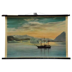
Vintage Mural Pull Down Wall Chart Landscape Sailing Ship the Coast of Greenland
Located in Berghuelen, DE
Vintage Mural Pull Down Wall Chart Landscape Sailing Ship the Coast of Greenland
The wall chart
Category
Mid-20th Century German Country Prints
Materials
Canvas, Wood, Paper
H 24.02 in W 35.04 in D 0.79 in
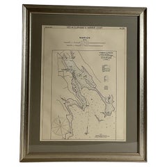
Mariners Chart of Marion Massachussets by George Eldridge 1901
Located in Norwell, MA
) were leading sea chart and sailing guide publishers from the mid 19th to the early twentieth century
Category
Antique Early 1900s North American Prints
Materials
Paper
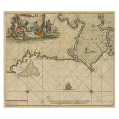
Antique Sea Chart of the Western Coast of Africa
Located in Langweer, NL
Antique map titled 'Nieuwe Paskaert van de Kust van Genehoa (..)'. This attractive sea chart covers
Category
Antique Late 17th Century Maps
Materials
Paper
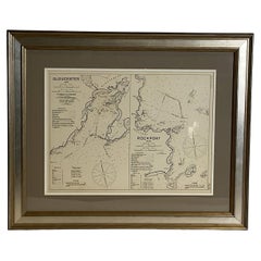
Mariners Chart of Gloucester and Rockport by George Eldridge 1910
Located in Norwell, MA
Nautical chart showing the harbor and local water. The chart display depths buoys, lighthouses, etc
Category
Vintage 1910s North American Prints
Materials
Paper
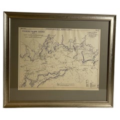
Mariners Chart of Fishers Island Sound by George Eldridge 1901
Located in Norwell, MA
son George Washington Eldridge (1845-1912) were leading sea chart and sailing guide publishers from
Category
Antique Early 1900s North American Prints
Materials
Paper
Mariners charts of Massachusett Long Island by George Eldridge 1901
Located in Norwell, MA
Eldridge and his son George Washington Eldridge (1845-1912) were leading sea chart and sailing guide
Category
Antique Early 1900s North American Prints
Materials
Paper
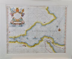
Edinburgh, Scotland: An Original 17th C. Hand-Colored Engraved Sea Chart
By Captain Greenvile Collins
Located in Alamo, CA
This hand-colored sea chart is entitled "Edinburgh Firth" from "Great Britain's Coasting Pilot
Category
Late 17th Century Landscape Prints
Materials
Engraving
H 23 in W 27.75 in D 0.5 in
Flanders, Holland & Norfolk: Hand-Colored 17th Century Sea Chart by Collins
By Captain Greenvile Collins
Located in Alamo, CA
This hand-colored chart of the seas about Flanders, Holland, Frisia, and Norfolk is from "Great
Category
Antique Late 17th Century English Maps
Materials
Paper
H 23 in W 27.75 in D 0.5 in
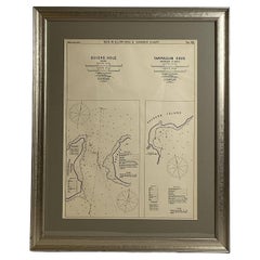
Mariners Chart of Quicks Hole and Tarpaulin Cove by George Eldridge 1901
Located in Norwell, MA
Washington Eldridge (1845-1912) were leading sea chart and sailing guide publishers from the mid 19th to the
Category
Antique Early 1900s North American Maps
Materials
Paper
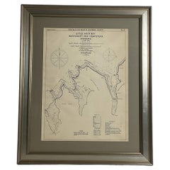
Mariners Chart of Westport Mass and Narraganset Pier by George Eldridge 1901
Located in Norwell, MA
Eldridge (1845-1912) were leading sea chart and sailing guide publishers from the mid 19th to the early
Category
Antique Early 1900s North American Prints
Materials
Paper
Plymouth, England: A Hand-Colored 17th Century Sea Chart by Captain Collins
By Captain Greenvile Collins
Located in Alamo, CA
depicts Plymouth Sound and Harbor, as well as Pline River. The chart is adorned with four sailing ships
Category
Antique Late 17th Century English Maps
Materials
Paper
H 23 in W 27.75 in D 0.5 in
Edinburgh, Scotland Coast: A 17th Century Hand-Colored Sea Chart by Collins
By Captain Greenvile Collins
Located in Alamo, CA
This hand-colored sea chart is entitled "Edinburgh Firth" from "Great Britain's Coasting Pilot
Category
Antique Late 17th Century English Maps
Materials
Paper
H 23 in W 27.75 in D 0.5 in
Dartmouth, England: A Hand-Colored 17th Century Sea Chart by Captain Collins
By Captain Greenvile Collins
Located in Alamo, CA
This hand-colored sea chart of the area around Dartmouth, England is from "Great Britain's Coasting
Category
Antique Late 17th Century English Maps
Materials
Paper
H 23 in W 27.75 in D 0.5 in
Antique Chart of the Straits of Makassar, Indonesia with Borneo and Celebes-1820
Located in Langweer, NL
hydrographer, chart publisher and author of navigation textbooks and pilots (sailing directions). The first
Category
Antique 1820s Maps
Materials
Paper
H 37.8 in W 25.99 in D 0 in
Emile Galle-The Bretton Fishing Fleet-Exceptionally Rare Cameo glass signed vase
By Emile Gallé
Located in Worcester Park, GB
rigging. Signed, intaglio cut, Provost MkVI c1925-36 -see 4th image and chart at end for dating. This an
Category
Vintage 1920s French Art Deco Glass
Materials
Art Glass
H 7.25 in W 6 in D 4 in
Original Blueprint Of Yacht Venture III By Olin Stevens
Located in Norwell, MA
, sail locker, chart table, etc.. Still afloat sailing as "Bounty".
Category
Vintage 1940s North American Prints
Materials
Paper
Hermes Paris Silk 18th Century Style Nautical Exploration Blouse cira 1990s
By Hermès
Located in University City, MO
is illustrated with a harbor scene of 18th century
style sailing ships set to explore the new world
Category
Late 20th Century French Blouses
Indiarum Occidentalium Tractus Littorales cum Insulis Caribicis / Pascaert van W
By Louis Renard
Located in New York, NY
19 x 22 " (48.3 x 55.9 cm) plus margins.
A beautifully engraved Dutch sea chart. Shown is the
Category
18th Century Other Art Style More Prints
Materials
Engraving
Old Original Engraving of Prussia on the Southeast Coast of the Baltic Sea, 1632
Located in Langweer, NL
projection which represented sailing courses of constant bearing (rhumb lines) as straight lines—an
Category
Antique 1630s Maps
Materials
Paper
H 8.47 in W 11.03 in D 0 in
A Group of Four 18th Century Engravings from Captain Cook's 3rd Voyage Journal
By John Webber
Located in Alamo, CA
Bligh, Cook's sailing master, who would later go down in history as captain of the mutinous crew of the
Category
1780s Other Art Style Landscape Prints
Materials
Engraving
H 20.75 in W 26.75 in D 0.88 in
"Canoe of the Sandwich Islands" (Hawaii), Engraving of Captain Cook's 3rd Voyage
By John Webber
Located in Alamo, CA
expedition included Captain William Bligh, Cook's sailing master, who would later go down in history as
Category
1780s Landscape Prints
Materials
Engraving
H 20.75 in W 26.75 in D 0.88 in
Firenze
Located in San Francisco, CA
depicting sailing ships at sea, as well as see in the distance the coast and some fishing village, from
Category
Late 20th Century Impressionist Figurative Paintings
Materials
Oil
Amalfi
Located in San Francisco, CA
depicting sailing ships at sea, as well as see in the distance the coast and some fishing village, from
Category
Late 20th Century Impressionist Figurative Paintings
Materials
Oil
Isla d'Alba
Located in San Francisco, CA
depicting sailing ships at sea, as well as see in the distance the coast and some fishing village, from
Category
Late 20th Century Impressionist Figurative Paintings
Materials
Oil
Vele
Located in San Francisco, CA
depicting sailing ships at sea, as well as see in the distance the coast and some fishing village, from
Category
Late 20th Century Impressionist Figurative Paintings
Materials
Oil
Cahro Di Gnano
Located in San Francisco, CA
he loves to paint seascapes, often depicting sailing ships at sea, as well as see in the distance the
Category
Late 20th Century Impressionist Figurative Paintings
Materials
Oil
Ponte Vecchio
Located in San Francisco, CA
. Also he loves to paint seascapes, often depicting sailing ships at sea, as well as see in the distance
Category
Late 20th Century Impressionist Figurative Paintings
Materials
Oil
Map of East Friesland, The Netherlands & the Area Emden & Norden, Germany, 1635
Located in Langweer, NL
cartouche and two large coats of arms, plus elegant border details around the inset, sailing ships and a
Category
Antique 1630s Maps
Materials
Paper
H 20.48 in W 24.34 in D 0 in
Le Coste Nord Ovest Dell' America E Nord Est Dell' Asia Delineate Sulle Ultime O
Located in Bristol, CT
discoveries made by James Cook. Cook was the first to accurately chart the Alaskan coastline and provide a
Category
1790s Prints and Multiples
Materials
Paper
Persia, Armenia & Adjacent Regions: A Hand-colored 17th Century Map by De Wit
By Frederick de Wit
Located in Alamo, CA
elephant riden by an umbrella holding man. The map is embellished with five sailing ships. A cartouche
Category
Late 17th Century Old Masters More Prints
Materials
Engraving
Frederick de WitPersia, Armenia & Adjacent Regions: A Hand-colored 17th Century Map by De Wit , 1680
H 23.5 in W 27 in D 1.325 in
Antique Map of Guinea in West Africa by Blaeu, c.1638
Located in Langweer, NL
interior, sailing ships and several elegant cartouches. Both the map and the sea are shown with Rhumb lines
Category
Antique 17th Century Maps
Materials
Paper
"Inside of a House in Nootka Sound" (Canada) from Captain Cook's 3rd Voyage
By John Webber
Located in Alamo, CA
Captain William Bligh, Cook's sailing master, who would later go down in history as captain of the
Category
1780s Realist Interior Prints
Materials
Engraving
H 18.25 in W 24 in D 0.88 in
Map of the North of Scotland 17th century hand-coloured map by Gerardus Mercator
Located in London, GB
sailing courses of constant bearing (rhumb lines) as straight lines - an innovation that is still employed
Category
1680s Prints and Multiples
Materials
Engraving
Cadiz Island: A Framed 17th Century Hand-colored Map from Blaeu's Atlas Major
By Joan (Johannes) Blaeu
Located in Alamo, CA
surrounding salt processing areas. Numerous sailing ships of various sizes are included in and around the
Category
Mid-17th Century Old Masters Landscape Prints
Materials
Engraving
H 20 in W 24.88 in D 1.13 in
"King of the Friendly Islands" (Tonga); Engraving from Captain Cook's 3rd Voyage
By John Webber
Located in Alamo, CA
Captain William Bligh, Cook's sailing master, who would later go down in history as captain of the
Category
1780s Realist Figurative Prints
Materials
Engraving
H 18.25 in W 23.5 in D 0.88 in
"A Dance in Otaheite" (Tahiti), Engraving from Captain Cook's 3rd Voyage
By John Webber
Located in Alamo, CA
Captain William Bligh, Cook's sailing master, who would later go down in history as captain of the
Category
1780s Realist Landscape Prints
Materials
Engraving
H 21.75 in W 23.75 in D 0.88 in
Herzogin Cecilie, signed oil painting
By Louis Letouche
Located in Cirencester, Gloucestershire
German merchant sailing ships, the black Flying-P-Liners or the green ships of Rickmers, she was painted
Category
1990s Realist Portrait Paintings
Materials
Oil
The River of Thames from London to the Buoy of the Noure.
Located in Zeeland, Noord-Brabant
sheet with several sailing ships. Originally printed in two separate sheets, here joined together
Category
17th Century More Prints
Materials
Engraving
Plan of the City of New York by John Montresor 1775
By George Hayward
Located in New York, NY
Chart of the Entrance to New York from Sandy Hook, shewing the properest Channel for Sailing
Category
19th Century Realist More Prints
Materials
Lithograph
Compass Rose
By Keith Reynolds
Located in Stonington, CT
This painting by Keith Reynolds combines the beauty and intrinsic nature between the Sailing Ship
Category
21st Century and Contemporary American Realist Landscape Paintings
Materials
Acrylic
Antique Coastal Chart of the North Sea between England and the Netherlands, 1730
Located in Langweer, NL
Amelandia ad Promontoria Caleti et Doverae.'
Coastal chart taken from plates engraved for Frederick de
Category
Antique 1730s Maps
Materials
Paper
H 20.63 in W 24.53 in D 0 in
Large Brandywine School Style Painting
Located in San Francisco, CA
Large oil on canvas of men in a chart room on a sailing ship.
Category
Vintage 1930s American Paintings
Materials
Canvas
Rare United States Coastal Survey Office Map
Located in San Francisco, CA
, dated 1856; lithograph on tissue; the large-scaled map charting the waters of the San Francisco Bay area
Category
Antique 19th Century American Maps
Portrait of Admiral Philip Affleck
Located in London, GB
including a globe and dividers, his hand resting upon charts. Through a window a ship is depicted sailing
Category
Antique Late 18th Century English Paintings
Bellin 18th Century Hand Colored Map of "L'isle de Sainte Lucie" 'St. Lucia'
By Jacques-Nicolas Bellin
Located in Alamo, CA
largest privately owned sailing yacht in the world, the Maltese Falcon. He undoubtedly sailed the West
Category
Antique Mid-18th Century French Maps
Materials
Paper
H 13.13 in W 17 in D 0.75 in
Bellin 18th Century Hand Colored Map of St. Christophe (St. Kitts)
By Jacques-Nicolas Bellin
Located in Alamo, CA
Glass. He was a devoted sailor, having owned the largest privately owned sailing yacht in the world, the
Category
Antique Mid-18th Century French Maps
Materials
Paper
1854 "New Map of That Portion of North America" Published by Jacob Monk
Located in Colorado Springs, CO
proposed railroads, as well as springs, mountain passes, forests, swamps, and deserts. Numerous sailing
Category
Antique 1850s American Maps
Materials
Paper
1854 Map of Partial North America, Antique Wall Map by Jacob Monk
Located in Colorado Springs, CO
springs, mountain passes, forests, swamps, and deserts. Numerous sailing ships illustrate the shipping
Category
Antique 1850s American Maps
Materials
Paper
Pair of Midcentury Iron Ship Chain Converted to Table Lamps
Located in Nantucket, MA
individually 3 inches long. Height below harp is 24 inches. I have drum lamp shades being made from old sailing
Category
Vintage 1960s Nautical Objects
Materials
Brass, Iron
Mariners Chart of Greenport, and Sag Harbor by George Eldridge 1901
Located in Norwell, MA
-1912) were leading sea chart and sailing guide publishers from the mid 19th to the early twentieth
Category
Antique Early 1900s North American Maps
Materials
Paper
Hand-Colored 18th Century Sea Chart of Cork, Ireland by Reverend J. Lindsay
By Reverend J. Lindsay
Located in Alamo, CA
This hand-colored sea chart is entitled "A New and Correct Chart of the Harbour of Corke by the
Category
Antique Mid-18th Century English Maps
Materials
Paper
H 23 in W 27.75 in D 0.5 in
The Old Man
By Arthur John Trevor Briscoe
Located in Storrs, CT
line on the chart. His sextant still lies on the chart table, so it is probably near dawn and he may
Category
1920s Modern Landscape Prints
Materials
Drypoint, Etching
Antique Map by Mapmaker Blaeu of Northern India and Central Asia, c.1650
Located in Langweer, NL
. Elephants shown roaming in the Ganges and Camels east of Kabul. Decorative cartouches and sailing ships
Category
Antique Mid-17th Century Maps
Materials
Paper
H 17.72 in W 21.66 in D 0 in
Bellin 18th Century Hand Colored Map of "L'isle de Sainte Lucie" (St. Lucia)
Located in Alamo, CA
cartographers of the 18th century. He served for a number of years as map and chart maker, as well hydrographer
Category
Mid-18th Century Other Art Style Landscape Prints
Materials
Engraving
H 13.13 in W 17 in D 0.75 in
Bellin 18th Century Hand Colored Map of St. Christophe (St. Kitts)
Located in Alamo, CA
devoted sailor, having owned the largest privately owned sailing yacht in the world, the Maltese Falcon
Category
Late 18th Century Other Art Style Landscape Prints
Materials
Engraving
H 13.13 in W 17 in D 0.75 in
"A Boxing Match Hapaee" (Tonga) Engraving of Captain Cook's 3rd Voyage by Webber
By John Webber
Located in Alamo, CA
expedition included Captain William Bligh, Cook's sailing master, who would later go down in history as
Category
1780s Naturalistic Landscape Prints
Materials
Engraving
H 22.13 in W 17.63 in D 0.75 in
The Atlantic Ocean, Americas, Africa and Europe: Hand-colored 18th C. Bowen Map
Located in Alamo, CA
This is an original 18th century hand-colored map entitled "A New & Accurate Chart of the The
Category
Mid-18th Century Old Masters Landscape Prints
Materials
Engraving
1889 Sea Chart Map of Delaware Bay by George Eldridge, Chart No. 11
Located in Colorado Springs, CO
directions and notes on tides and currents. Dotted lines on the chart give sailors the distance and sailing
Category
Antique 1880s Maps
Materials
Paper
Abstract Geometric Oil on Wood Panel, "Primary Color Composition"
By Rex Lau
Located in Providence, RI
, inspired by his life living and sailing in and around Montauk, Long Island.
The catalog published by The
Category
2010s Abstract Abstract Paintings
Materials
Oil, Wood Panel
H 21.5 in W 19.5 in D 1.5 in
Get Updated with New Arrivals
Save "Sailing Charts", and we’ll notify you when there are new listings in this category.
