Vintage Chart Map

to
6
120
93
215
143
47
40
27
19
18
17
3
2
7
3
3
2
2
Sort By
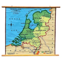
School Chart or Pull Down Map of Geography of the Netherlands, 1950s
Located in Hemiksem, VAN
A beautiful old school map of the Netherlands, painted on linen. The map shows the 3 different
Category

1950s Belgian Mid-Century Modern Vintage Chart Map

Materials

Linen, Paint

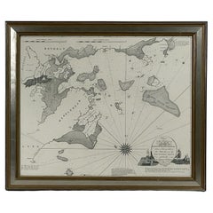
Chart of Boston's North Shore
Located in Norwell, MA
Rarely found restrike of an 1804 chart by Nathanael Bowditch of the Harbors of Salem, Marblehead
Category

1980s North American Vintage Chart Map

Materials

Paper

Vintage Chart of Boston's North Shore
Chart of Boston's North Shore
H 26 in W 30 in D 2 in
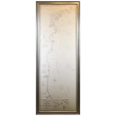
Original 1910 George Eldridge Chart
Located in Norwell, MA
Original framed 1910 George Eldridge chart "E" showing Gloucester to the Kennebec river. Showing
Category

20th Century Unknown Vintage Chart Map

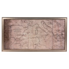
Large Framed Map of the Mediterranean
Located in New York, NY
Large map/chart chart of The Mediterranean and the Grecian Archipelago showing Italy, Sardinia
Category

20th Century French Mid-Century Modern Vintage Chart Map

Vintage Large Framed Map of the Mediterranean
Large Framed Map of the Mediterranean
H 36 in W 67 in D 0.75 in
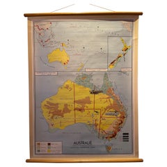
Decorative Vintage Print, Dutch Chart of Australia, 1st Edition, 1952
Located in Langweer, NL
The vintage school chart of Australia titled "Australië," created by W. Bakker & H. Rush and
Category

Mid-20th Century European Vintage Chart Map

Materials

Canvas

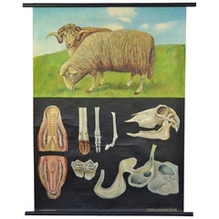
1960s Canvas Wall School Chart with Sheep by Jung-Koch-Quentell
By Jung Koch Quentell 1
Located in Antwerp, BE
Vintage school wall chart, pull down chart with beautiful illustrated lithograph of Sheep. It shows
Category

Mid-20th Century German Mid-Century Modern Vintage Chart Map

Materials

Wood, Canvas, Paper

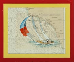
Catalina Island Sailboat
Located in Bristol, CT
Colorful Catalina Island sailboat (in gouache) by Renner (LR) painted over a chart map of the
Category

20th Century Vintage Chart Map

Materials

Gouache

Vintage Catalina Island Sailboat
Catalina Island Sailboat
H 18.75 in W 22.25 in
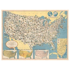
Old Decorative Pictorial Map of the United States, circa 1953
Located in Langweer, NL
road map of the United States with both a mileage chart and a telephone long distance pricing chart
Category

20th Century Vintage Chart Map

Materials

Paper

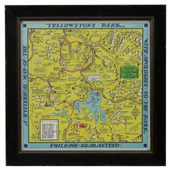
1948 "A Hysterical Map of Yellowstone National Park" by Jolly Lindgren, 2nd Ed.
Located in Colorado Springs, CO
Presented is a second edition printing of Jolly Lindgren’s “Hysterical Map of Yellowstone National
Category

1940s American Vintage Chart Map

Materials

Paper

Vintage Mural Rollable Map Wall Chart France Benelux Countries South England
Located in Berghuelen, DE
A cottagecore pull-down wall chart map illustrating France and the Benelux countries (the
Category

Mid-20th Century German Country Vintage Chart Map

Materials

Canvas, Wood, Paper

Hermes Paris Silk 18th Century Style Nautical Exploration Blouse cira 1990s
By Hermès
Located in University City, MO
. Concealed within the golden silk graphics are nautical instruments with longitude and latitude chart maps
Category

Late 20th Century French Vintage Chart Map

Europe Map Vintage Rollable Mural Countrystyle Wall Chart Decoration
Located in Berghuelen, DE
The vintage pull-down map shows the European continent / Europe. Published by Haack-Painke, Justus
Category

1970s German Country Vintage Chart Map

Materials

Canvas, Wood, Paper

Vintage Rollable Map Mediterranean Countries Wall Chart Mural Poster
Located in Berghuelen, DE
A decorative countrycore pull-down map depiciting countries surrounding the Mediterranean sea
Category

1970s German Country Vintage Chart Map

Materials

Canvas, Wood, Paper

Vintage German Map Rhineland Rollable Wall Chart Poster Print
Located in Berghuelen, DE
A country core vintage pull-down map illustrating the popular German region of the Rhineland
Category

1960s German Country Vintage Chart Map

Materials

Canvas, Wood, Paper

Vintage Rollable Map Southeast Asia China Japan Wall Chart
Located in Berghuelen, DE
A classical pull-down school map showing the popular region of Southeast Asia with China and Japan
Category

Late 20th Century German Country Vintage Chart Map

Materials

Canvas, Wood, Paper

Southern Hemisphere of the Earth Rollable Map Vintage Wall Chart
Located in Berghuelen, DE
A great pull-down map or vintage wall chart illustrating the southern hemisphere of the earth
Category

Mid-20th Century German Country Vintage Chart Map

Materials

Canvas, Wood, Paper

North America Map Economy Wall Chart Rollable Poster Vintage Mural
Located in Berghuelen, DE
A vintage pull-down map showing the economy of North America, published by Harms. Colorful print on
Category

Late 20th Century German Country Vintage Chart Map

Materials

Canvas, Wood, Paper

Cottagecore Wall Chart Spain Landscape Culture Souvenir Rollable Map Poster
Located in Berghuelen, DE
A countrycore vintage pull-down wall chart depicting Spain with a map and coloful pictures of
Category

1960s German Country Vintage Chart Map

Materials

Canvas, Wood, Paper

Vintage Pull-Down Map Germany BRD / DDR History Wall Chart
Located in Berghuelen, DE
A classical rollable vintage wall chart illustrating a map of Germany (Federal Republic of Germany
Category

Mid-20th Century German Country Vintage Chart Map

Materials

Canvas, Wood, Paper

Vintage Anatomical Schoolmap, Skeleton School Chart, Vintage German School Map
Located in ROTTERDAM, ZH
What an eyecatcher. This beautiful linen anatomical map is a must have for everybody who loves
Category

1950s German Bohemian Vintage Chart Map

Materials

Linen

Vintage Wall Chart of a Landscape and Geographic Map, circa 1955
Located in Langweer, NL
Vintage wall chart titled 'Kaart en Landschap'. This wall chart shows a mountain range and
Category

Mid-20th Century Vintage Chart Map

Materials

Paper

Countrycore Mural Vintage Map Wall Chart Rollable Poster Central South Africa
Located in Berghuelen, DE
The cottagecore pull-down mural map depicts Middle and South Africa. Published by Westermann
Category

1970s German Country Vintage Chart Map

Materials

Canvas, Wood, Paper

Australia and Oceania Vintage Art Map Poster Rollable Wall Chart Mural
Located in Berghuelen, DE
Australia and Oceania Vintage Art Map Poster Rollable Wall Chart Mural The classical geographical
Category

1970s German Country Vintage Chart Map

Materials

Canvas, Wood, Paper

Map Mural Rollable Poster Vintage Wall Chart Australia New Zealand Polynesia
Located in Berghuelen, DE
Map Mural Rollable Poster Vintage Wall Chart Australia New Zealand Polynesia A beautiful vintage
Category

1970s German Country Vintage Chart Map

Materials

Canvas, Wood, Paper

Vintage Mural Map Rollable Wall Chart Poster Australia New Zealand Indonesia
Located in Berghuelen, DE
Vintage Mural Map Rollable Wall Chart Poster Australia New Zealand Indonesia The vintage pull-down
Category

1970s German Country Vintage Chart Map

Materials

Canvas, Wood, Paper

Vintage Mural Map Mediterranean Sea Near East Countries Rollable Wall Chart
Located in Berghuelen, DE
A large countrycore pull-down map showing the countries surrounding the Mediterranean Sea
Category

1970s German Country Vintage Chart Map

Materials

Canvas, Wood, Paper

Old Vintage Look Pull Down Map Wall Chart Poster South America
Located in Berghuelen, DE
The wall map shows South America in a combination of physical and political map with the emphasis
Category

Mid-20th Century German Country Vintage Chart Map

Materials

Canvas, Wood, Paper

Canada Greenland North America Map Vintage Mural Rollable Wall Chart Countrycore
Located in Berghuelen, DE
A classical pull-down map of Canada and Greenland (North American Continent). Used as teaching
Category

1970s German Country Vintage Chart Map

Materials

Canvas, Wood

Vintage Map Wall Chart Countries of North America Rollable Mural Poster
Located in Berghuelen, DE
The vintage pull-down school map illustrates the countries / states of North America. Published by
Category

Late 20th Century German Country Vintage Chart Map

Materials

Canvas, Wood, Paper

Large Rollable Map Central America Northern South America Wall Chart Poster
Located in Berghuelen, DE
A fantastic pull-down wall chart depicting a map of Central America and Northern South America
Category

Mid-20th Century German Country Vintage Chart Map

Materials

Canvas, Wood, Paper

Vintage Mural Pull Down Map South America American Continent Wall Chart
Located in Berghuelen, DE
The wall map shows South America. It was published by Haack Paincke, Justus Perthes Darmstadt. Used
Category

Late 20th Century German Country Vintage Chart Map

Materials

Canvas, Wood, Paper

North America Vintage Map Pull-Down Wall Chart Poster Countrycore Print
Located in Berghuelen, DE
A traditional vintage pull-down school map illustrating North America, published by Westermann
Category

Late 20th Century German Country Vintage Chart Map

Materials

Wood, Paper, Canvas

Vintage Rollable Mural Map Wall Chart Print Scandinavia Norway Sweden Finland
Located in Berghuelen, DE
A great impressive cottagecore map illustrating Scandinavia (Norway, Sweden, Finland, Denmark and
Category

Mid-20th Century German Country Vintage Chart Map

Materials

Canvas, Wood, Paper

Vintage Mural Map of North Africa Countrycore African Wall Chart Decoration
Located in Berghuelen, DE
The wall map shows North Africa. It was published by Westermann-Schulwandkarten. Used as teaching
Category

Late 20th Century German Country Vintage Chart Map

Materials

Canvas, Wood, Paper

Vintage Rollable Map Wall Chart South America Brasilia and Neighbour States
Located in Berghuelen, DE
A classical pull-down school map showing South America with Brasilia and its neighbor states
Category

Mid-20th Century German Country Vintage Chart Map

Materials

Canvas, Wood, Paper

Vintage Rollable Map Asia Japan Korea Wall Chart Poster Countrycore Decoration
Located in Berghuelen, DE
A decorative country core pull-down map depicting Japan and Korea. Published by Haack-Paincke
Category

Late 20th Century German Country Vintage Chart Map

Materials

Canvas, Wood, Paper

Vintage Wall Chart or Pull-Down Map of Male Anatomy, 1950s
Located in Hemiksem, VAN
An original vintage pull-down chart of the male anatomy. This poster shows the different parts of
Category

1950s German Mid-Century Modern Vintage Chart Map

Materials

Wood, Paper

Picture Poster Old Testament Rollable Wall Chart Religious Mural Israel Map
Located in Berghuelen, DE
A traditional pull-down wall chart illustrating picutres of the old testament, published by Ewald
Category

Mid-20th Century German Country Vintage Chart Map

Materials

Canvas, Wood, Paper

Vintage Mural Map Pull Down Wall Chart North America Economy Finances
Located in Berghuelen, DE
A classical rollable wall chart showing the economy of North America. Publishd by the Paul List
Category

Mid-20th Century German Country Vintage Chart Map

Materials

Canvas, Wood, Paper

Denmark Greenland Faroe Islands the North Atlantic Vintage Mural Map Wall Chart
Located in Berghuelen, DE
The vintage pull-down mural map illustrates Denmark with Greenland, the Faroe Islands and the North
Category

1970s German Country Vintage Chart Map

Materials

Canvas, Wood, Paper

Vintage Mural World Map Earth Poster Pull-Down Wall Chart Poster Print
Located in Berghuelen, DE
A large decorative world map – named our earth, impressive wall chart decoration, published by
Category

1970s German Country Vintage Chart Map

Materials

Canvas, Wood, Paper

Land Use and Livestock North America Picture Map Wall Chart Poster Mural
Located in Berghuelen, DE
The vintage rollable picture map of North- and Middle America shows land use and livestock
Category

Late 20th Century German Country Vintage Chart Map

Materials

Canvas, Wood, Paper

Middle East Saudia Arabia Israel India Map Rollable Mural Vintage Wall Chart
Located in Berghuelen, DE
The pull-down school map is depicting the region of the Middle East (Turkey, Israel, Egypt, Saudi
Category

Late 20th Century German Country Vintage Chart Map

Materials

Canvas, Wood, Paper

Vintage Picture Poster Wall Chart Rollable Large Map Peoples Republic of China
Located in Berghuelen, DE
A vintage wall chart illustrating a map of people's republic of china. Used as teaching material in
Category

Late 20th Century German Country Vintage Chart Map

Materials

Canvas, Wood, Paper

Northern Hemisphere of the Earth Rollable Map Vintage Wall Chart World Mural
Located in Berghuelen, DE
A great pull-down map or vintage wall chart illustrating the northern hemisphere of the earth
Category

Mid-20th Century German Country Vintage Chart Map

Materials

Canvas, Wood, Paper

Religious Bible Mural Journey of Apostle Paul Rollable Vintage Map Wall Chart
Located in Berghuelen, DE
A colorful picturous map showing the journey of the apostle Paul, published by Becker´s Hamburg
Category

Late 20th Century German Country Vintage Chart Map

Materials

Paper, Canvas, Wood

Vintage Mural Pull Down Wall Chart City Map of Moscow Russia Poster
Located in Berghuelen, DE
A classical rollabe vintage wall chart showing an aerial view of the city of Moscow, Russia. It was
Category

Mid-20th Century German Country Vintage Chart Map

Materials

Canvas, Wood, Paper

Vintage Mural Pull-Down Map Asia China Japan India Russia Wall Chart Poster
Located in Berghuelen, DE
The impressive rollable wall map shows the continent of Asia (among others China, Japan, India and
Category

Late 20th Century German Country Vintage Chart Map

Materials

Canvas, Wood, Paper

Vintage Wall Chart 'Crusades of the Early Middle Ages'
Located in Hemiksem, VAN
A beautiful, original vintage map of the crusades ('Les Croisades') in the early Middle Ages in
Category

1960s French Mid-Century Modern Vintage Chart Map

Materials

Wood, Paper

Mushrooms of Middle Europe Print Cardboard Wall Chart, Germany 1930s
Located in Nuernberg, DE
This rare vintage wall chart shows different types of mushrooms, which are native to middle europe
Category

1930s German Mid-Century Modern Vintage Chart Map

Materials

Paper

Mushrooms of Middle Europe Print Cardboard Wall Chart, Germany 1930s
Located in Nuernberg, DE
This rare vintage wall chart shows different types of mushrooms, which are native to middle europe
Category

1930s German Mid-Century Modern Vintage Chart Map

Materials

Paper

Mushrooms of Middle Europe Print Cardboard Wall Chart, Germany 1930s
Located in Nuernberg, DE
This rare vintage wall chart shows different types of mushrooms, which are native to middle europe
Category

1930s German Mid-Century Modern Vintage Chart Map

Materials

Paper

Mushrooms of Middle Europe Print Cardboard Wall Chart, Germany 1930s
Located in Nuernberg, DE
This rare vintage wall chart shows different types of mushrooms, which are native to middle europe
Category

1930s German Mid-Century Modern Vintage Chart Map

Materials

Paper

Mushrooms of Middle Europe Print Cardboard Wall Chart, Germany 1930s
Located in Nuernberg, DE
This rare vintage wall chart shows different types of mushrooms, which are native to middle europe
Category

1930s German Mid-Century Modern Vintage Chart Map

Materials

Paper

Vintage Wall Chart Countrycore Poster Igloo with Eskimo Arctic Winter Lifestyle
Located in Berghuelen, DE
The school wall map shows an igloo with Eskimos. Colorful print on paper reinforced with canvas
Category

1970s German Country Vintage Chart Map

Materials

Canvas, Wood, Paper

"Chart Of The Aintree Race Course" 1930 Hand-Coloured & Signed By The Artist
Located in Bristol, CT
thereafter, in 1836. This map, published nearly 100 years later, shows little has changed in the intervening
Category

1930s Vintage Chart Map

Materials

Paper, Lithograph

Great Britain Scandinavia Northern France Netherland Germany Mural Map
Located in Berghuelen, DE
The vintage pull-down cottagecore mural map illustrates the North Sea countries with Great Britain
Category

1970s German Country Vintage Chart Map

Materials

Canvas, Wood, Paper

Vintage Rollable Map Northern Germany Poland Seaside Wallchart Baltic Sea
Located in Berghuelen, DE
The large impressive cottagecore pull-down map illustrates Northern Germany, Poland and parts of
Category

Late 20th Century German Country Vintage Chart Map

Materials

Canvas, Wood, Paper

Vintage Mural Map United States Development in the 19th and 20th centuries
Located in Berghuelen, DE
A fantastic pull-down wall chart depicting a map of the development of the United States in the
Category

1970s German Country Vintage Chart Map

Materials

Canvas, Wood, Paper

A Map Of Western Long Island Sound Showing Yacht Clubs, Aids To Navigation...
Located in Bristol, CT
Classic color map/ nautical chart (by Nolf Klep '39) of the North Shore of Long Island Sound for
Category

1930s Vintage Chart Map

Materials

Paper

  • 1
Get Updated with New Arrivals
Save "Vintage Chart Map", and we’ll notify you when there are new listings in this category.

Vintage Chart Map For Sale on 1stDibs

With a vast inventory of beautiful furniture at 1stDibs, we’ve got just the vintage chart map you’re looking for. Frequently made of fabric, paper and canvas, every vintage chart map was constructed with great care. There are many kinds of the vintage chart map you’re looking for, from those produced as long ago as the 20th Century to those made as recently as the 20th Century. When you’re browsing for the right vintage chart map, those designed in Mid-Century Modern, Hollywood Regency and Neoclassical styles are of considerable interest. Many designers have produced at least one well-made vintage chart map over the years, but those crafted by Jung Koch Quentell, Dr. Friedrich Quentell and Gottlieb von Koch are often thought to be among the most beautiful.

How Much is a Vintage Chart Map?

Prices for a vintage chart map can differ depending upon size, time period and other attributes — at 1stDibs, they begin at $204 and can go as high as $4,500, while the average can fetch as much as $420.