Vintage Us Wall Map

to
4
157
32
192
119
68
34
26
21
15
8
5
4
40
40
4
3
2
Sort By
Two Impressive and Huge Midcentury World Map Wall Globes, Austria, 1950s
Located in Vienna, AT
We proudly offer this outstanding pair of very large wall-mounted modernist globes / world maps
Category

Mid-20th Century Austrian Mid-Century Modern Vintage Us Wall Map

Materials

Aluminum, Iron

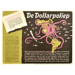
Original Vintage WWII Poster De Dollarpoliep The US Dollar Polyp Octopus War Map
Located in London, GB
Dollarpoliep / The Dollar Polyp or The Dollar Octopus - featuring an image of a US dollar sign with octopus
Category

1940s Dutch Vintage Us Wall Map

Materials

Paper

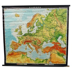
Europe Map Vintage Rollable Mural Countrystyle Wall Chart Decoration
Located in Berghuelen, DE
The vintage pull-down map shows the European continent / Europe. Published by Haack-Painke, Justus
Category

1970s German Country Vintage Us Wall Map

Materials

Canvas, Wood, Paper

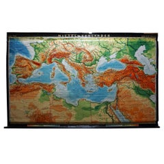
Vintage Rollable Map Mediterranean Countries Wall Chart Mural Poster
Located in Berghuelen, DE
A decorative countrycore pull-down map depiciting countries surrounding the Mediterranean sea
Category

1970s German Country Vintage Us Wall Map

Materials

Canvas, Wood, Paper

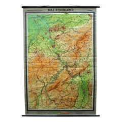
Vintage German Map Rhineland Rollable Wall Chart Poster Print
Located in Berghuelen, DE
A country core vintage pull-down map illustrating the popular German region of the Rhineland
Category

1960s German Country Vintage Us Wall Map

Materials

Canvas, Wood, Paper

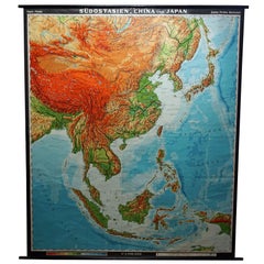
Vintage Rollable Map Southeast Asia China Japan Wall Chart
Located in Berghuelen, DE
A classical pull-down school map showing the popular region of Southeast Asia with China and Japan
Category

Late 20th Century German Country Vintage Us Wall Map

Materials

Canvas, Wood, Paper

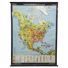
North America Map Economy Wall Chart Rollable Poster Vintage Mural
Located in Berghuelen, DE
A vintage pull-down map showing the economy of North America, published by Harms. Colorful print on
Category

Late 20th Century German Country Vintage Us Wall Map

Materials

Canvas, Wood, Paper

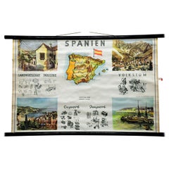
Cottagecore Wall Chart Spain Landscape Culture Souvenir Rollable Map Poster
Located in Berghuelen, DE
A countrycore vintage pull-down wall chart depicting Spain with a map and coloful pictures of
Category

1960s German Country Vintage Us Wall Map

Materials

Canvas, Wood, Paper

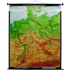
Vintage Pull-Down Map Germany BRD / DDR History Wall Chart
Located in Berghuelen, DE
A classical rollable vintage wall chart illustrating a map of Germany (Federal Republic of Germany
Category

Mid-20th Century German Country Vintage Us Wall Map

Materials

Canvas, Wood, Paper

Countrycore Mural Vintage Map Wall Chart Rollable Poster Central South Africa
Located in Berghuelen, DE
The cottagecore pull-down mural map depicts Middle and South Africa. Published by Westermann
Category

1970s German Country Vintage Us Wall Map

Materials

Canvas, Wood, Paper

Map Mural Rollable Poster Vintage Wall Chart Australia New Zealand Polynesia
Located in Berghuelen, DE
Map Mural Rollable Poster Vintage Wall Chart Australia New Zealand Polynesia A beautiful vintage
Category

1970s German Country Vintage Us Wall Map

Materials

Canvas, Wood, Paper

Australia and Oceania Vintage Art Map Poster Rollable Wall Chart Mural
Located in Berghuelen, DE
Australia and Oceania Vintage Art Map Poster Rollable Wall Chart Mural The classical geographical
Category

1970s German Country Vintage Us Wall Map

Materials

Canvas, Wood, Paper

Vintage Mural Map Rollable Wall Chart Poster Australia New Zealand Indonesia
Located in Berghuelen, DE
Vintage Mural Map Rollable Wall Chart Poster Australia New Zealand Indonesia The vintage pull-down
Category

1970s German Country Vintage Us Wall Map

Materials

Canvas, Wood, Paper

Vintage Mural Map Mediterranean Sea Near East Countries Rollable Wall Chart
Located in Berghuelen, DE
A large countrycore pull-down map showing the countries surrounding the Mediterranean Sea
Category

1970s German Country Vintage Us Wall Map

Materials

Canvas, Wood, Paper

Old Vintage Look Pull Down Map Wall Chart Poster South America
Located in Berghuelen, DE
The wall map shows South America in a combination of physical and political map with the emphasis
Category

Mid-20th Century German Country Vintage Us Wall Map

Materials

Canvas, Wood, Paper

Canada Greenland North America Map Vintage Mural Rollable Wall Chart Countrycore
Located in Berghuelen, DE
A classical pull-down map of Canada and Greenland (North American Continent). Used as teaching
Category

1970s German Country Vintage Us Wall Map

Materials

Canvas, Wood

Vintage Map Wall Chart Countries of North America Rollable Mural Poster
Located in Berghuelen, DE
The vintage pull-down school map illustrates the countries / states of North America. Published by
Category

Late 20th Century German Country Vintage Us Wall Map

Materials

Canvas, Wood, Paper

Vintage Mural Map of North Africa Countrycore African Wall Chart Decoration
Located in Berghuelen, DE
The wall map shows North Africa. It was published by Westermann-Schulwandkarten. Used as teaching
Category

Late 20th Century German Country Vintage Us Wall Map

Materials

Canvas, Wood, Paper

Large Rollable Map Central America Northern South America Wall Chart Poster
Located in Berghuelen, DE
A fantastic pull-down wall chart depicting a map of Central America and Northern South America
Category

Mid-20th Century German Country Vintage Us Wall Map

Materials

Canvas, Wood, Paper

Vintage Mural Rollable Map Wall Chart France Benelux Countries South England
Located in Berghuelen, DE
A cottagecore pull-down wall chart map illustrating France and the Benelux countries (the
Category

Mid-20th Century German Country Vintage Us Wall Map

Materials

Canvas, Wood, Paper

North America Vintage Map Pull-Down Wall Chart Poster Countrycore Print
Located in Berghuelen, DE
A traditional vintage pull-down school map illustrating North America, published by Westermann
Category

Late 20th Century German Country Vintage Us Wall Map

Materials

Wood, Paper, Canvas

Vintage Mural Pull Down Map South America American Continent Wall Chart
Located in Berghuelen, DE
The wall map shows South America. It was published by Haack Paincke, Justus Perthes Darmstadt. Used
Category

Late 20th Century German Country Vintage Us Wall Map

Materials

Canvas, Wood, Paper

Vintage Rollable Mural Map Wall Chart Print Scandinavia Norway Sweden Finland
Located in Berghuelen, DE
A great impressive cottagecore map illustrating Scandinavia (Norway, Sweden, Finland, Denmark and
Category

Mid-20th Century German Country Vintage Us Wall Map

Materials

Canvas, Wood, Paper

Vintage Rollable Map Wall Chart South America Brasilia and Neighbour States
Located in Berghuelen, DE
A classical pull-down school map showing South America with Brasilia and its neighbor states
Category

Mid-20th Century German Country Vintage Us Wall Map

Materials

Canvas, Wood, Paper

Vintage Rollable Map Asia Japan Korea Wall Chart Poster Countrycore Decoration
Located in Berghuelen, DE
A decorative country core pull-down map depicting Japan and Korea. Published by Haack-Paincke
Category

Late 20th Century German Country Vintage Us Wall Map

Materials

Canvas, Wood, Paper

Picture Poster Old Testament Rollable Wall Chart Religious Mural Israel Map
Located in Berghuelen, DE
A traditional pull-down wall chart illustrating picutres of the old testament, published by Ewald
Category

Mid-20th Century German Country Vintage Us Wall Map

Materials

Canvas, Wood, Paper

Vintage Mural Map Pull Down Wall Chart North America Economy Finances
Located in Berghuelen, DE
A classical rollable wall chart showing the economy of North America. Publishd by the Paul List
Category

Mid-20th Century German Country Vintage Us Wall Map

Materials

Canvas, Wood, Paper

Denmark Greenland Faroe Islands the North Atlantic Vintage Mural Map Wall Chart
Located in Berghuelen, DE
The vintage pull-down mural map illustrates Denmark with Greenland, the Faroe Islands and the North
Category

1970s German Country Vintage Us Wall Map

Materials

Canvas, Wood, Paper

Land Use and Livestock North America Picture Map Wall Chart Poster Mural
Located in Berghuelen, DE
The vintage rollable picture map of North- and Middle America shows land use and livestock
Category

Late 20th Century German Country Vintage Us Wall Map

Materials

Canvas, Wood, Paper

Middle East Saudia Arabia Israel India Map Rollable Mural Vintage Wall Chart
Located in Berghuelen, DE
The pull-down school map is depicting the region of the Middle East (Turkey, Israel, Egypt, Saudi
Category

Late 20th Century German Country Vintage Us Wall Map

Materials

Canvas, Wood, Paper

Vintage Picture Poster Wall Chart Rollable Large Map Peoples Republic of China
Located in Berghuelen, DE
A vintage wall chart illustrating a map of people's republic of china. Used as teaching material in
Category

Late 20th Century German Country Vintage Us Wall Map

Materials

Canvas, Wood, Paper

Religious Bible Mural Journey of Apostle Paul Rollable Vintage Map Wall Chart
Located in Berghuelen, DE
A colorful picturous map showing the journey of the apostle Paul, published by Becker´s Hamburg
Category

Late 20th Century German Country Vintage Us Wall Map

Materials

Paper, Canvas, Wood

Northern Hemisphere of the Earth Rollable Map Vintage Wall Chart World Mural
Located in Berghuelen, DE
A great pull-down map or vintage wall chart illustrating the northern hemisphere of the earth
Category

Mid-20th Century German Country Vintage Us Wall Map

Materials

Canvas, Wood, Paper

Vintage Mural Pull Down Wall Chart City Map of Moscow Russia Poster
Located in Berghuelen, DE
A classical rollabe vintage wall chart showing an aerial view of the city of Moscow, Russia. It was
Category

Mid-20th Century German Country Vintage Us Wall Map

Materials

Canvas, Wood, Paper

Vintage Mural Pull-Down Map Asia China Japan India Russia Wall Chart Poster
Located in Berghuelen, DE
The impressive rollable wall map shows the continent of Asia (among others China, Japan, India and
Category

Late 20th Century German Country Vintage Us Wall Map

Materials

Canvas, Wood, Paper

Vintage US Map American Flag Wall Art
Located in San Diego, CA
Beautiful and original wall art in the shape of the US depicting the American Flag along with all
Category

1990s American Folk Art Vintage Us Wall Map

Materials

Canvas

Large French Paris Metro Map 1960s
Located in North Hollywood, CA
Large French Paris Metro Map 1960s. A large Vintage French framed map of the Parisian Metro from
Category

Mid-20th Century French Industrial Vintage Us Wall Map

Materials

Wood, Paper

Large French Paris Metro Map 1960s
H 30.5 in W 37.75 in D 1 in
Original WWII Illustrated Map Poster - Time And Tide Map Of The Atlantic Charter
By "Leslie MacDonald ""Max"" Gill"
Located in London, GB
Original vintage illustrated map poster in Spanish by the notable graphic designer, cartographer
Category

1940s British Vintage Us Wall Map

Materials

Paper

Late 20th Century Educational Geographic Map - Australasia
Located in Hook, Hampshire
Late 20th Century Educational Geographic Map – Australasia Late 20th Century Educational Geographic
Category

Late 20th Century Czech Vintage Us Wall Map

Materials

Cotton

Late 20th Century Educational Geographic Map - Hemispheres
Located in Hook, Hampshire
Late 20th Century Educational Geographic Map – Hemispheres Late 20th Century Educational Geographic
Category

Late 20th Century Czech Vintage Us Wall Map

Materials

Cotton

Late 20th Century Educational Geographic Map - USA Topography
Located in Hook, Hampshire
Late 20th Century Educational Geographic Map – USA Topography Late 20th Century Educational
Category

Late 20th Century Czech Vintage Us Wall Map

Materials

Cotton

Late 20th Century Educational Geographic Map - African Climate
Located in Hook, Hampshire
Late 20th Century Educational Geographic Map – African Climate Late 20th Century Educational
Category

Late 20th Century Czech Vintage Us Wall Map

Materials

Cotton

Late 20th Century Educational Geographic Map - Worlds Resources
Located in Hook, Hampshire
Late 20th Century Educational Geographic Map – Worlds Resources Late 20th Century Educational
Category

Late 20th Century Czech Vintage Us Wall Map

Materials

Cotton

Late 20th Century Educational Geographic Map - Worlds Oceans
Located in Hook, Hampshire
Late 20th Century Educational Geographic Map – Worlds Oceans Late 20th Century Educational
Category

Late 20th Century Czech Vintage Us Wall Map

Materials

Cotton

Late 20th Century Educational Geographic Map - World Atlas
Located in Hook, Hampshire
Late 20th Century Educational Geographic Map – World Atlas Late 20th Century Educational Geographic
Category

Late 20th Century Czech Vintage Us Wall Map

Materials

Cotton

Late 20th Century Educational Geographic Map - Scandinavian Topography
Located in Hook, Hampshire
Late 20th Century Educational Geographic Map – Scandinavian Topography Late 20th Century
Category

Late 20th Century Czech Vintage Us Wall Map

Materials

Cotton

Late 20th Century Educational Geographic Map - Japan - Korea
Located in Hook, Hampshire
Late 20th Century Educational Geographic Map – Japan – Korea Late 20th Century Educational
Category

Late 20th Century Czech Vintage Us Wall Map

Materials

Cotton

Late 20th Century Educational Geographic Map - European Countries
Located in Hook, Hampshire
Late 20th Century Educational Geographic Map – European Countries Late 20th Century Educational
Category

Late 20th Century Czech Vintage Us Wall Map

Materials

Cotton

Late 20th Century Educational Geographic Map - Earths Lithosphere
Located in Hook, Hampshire
Late 20th Century Educational Geographic Map – Earths Lithosphere Late 20th Century Educational
Category

Late 20th Century Czech Vintage Us Wall Map

Materials

Cotton

Late 20th Century Educational Geographic Map - Atlantic Currents
Located in Hook, Hampshire
Late 20th Century Educational Geographic Map – Atlantic Currents Late 20th Century Educational
Category

Late 20th Century Czech Vintage Us Wall Map

Materials

Cotton

Late 20th Century Educational Geographic Map - South Asia Topography
Located in Hook, Hampshire
Late 20th Century Educational Geographic Map – South Asia Topography Late 20th Century Educational
Category

Late 20th Century Czech Vintage Us Wall Map

Materials

Cotton

Late 20th Century Educational Geographic Map - African Industry (1728.2)
Located in Hook, Hampshire
Late 20th Century Educational Geographic Map – African Industry (1728.2) Late 20th Century
Category

Late 20th Century Czech Vintage Us Wall Map

Materials

Cotton

Late 20th Century Educational Geographic Map - European Countries (1728.14)
Located in Hook, Hampshire
Late 20th Century Educational Geographic Map – European Countries (1728.14) Late 20th Century
Category

Late 20th Century Czech Vintage Us Wall Map

Materials

Cotton

Late 20th Century Educational Geographic Map - African Industry (1728.1)
Located in Hook, Hampshire
Late 20th Century Educational Geographic Map – African Industry (1728.1) Late 20th Century
Category

Late 20th Century Czech Vintage Us Wall Map

Materials

Cotton

Great Britain Scandinavia Northern France Netherland Germany Mural Map
Located in Berghuelen, DE
The vintage pull-down cottagecore mural map illustrates the North Sea countries with Great Britain
Category

1970s German Country Vintage Us Wall Map

Materials

Canvas, Wood, Paper

Late 20th Century Educational Geographic Map - Continent Of Americas Industry
Located in Hook, Hampshire
Late 20th Century Educational Geographic Map – Continent Of Americas Industry Late 20th Century
Category

Late 20th Century Czech Vintage Us Wall Map

Materials

Cotton

Late 20th Century Educational Geographic Map - Australia Topography And Economy
Located in Hook, Hampshire
Late 20th Century Educational Geographic Map – Australia Topography And Economy Late 20th Century
Category

Late 20th Century Czech Vintage Us Wall Map

Materials

Cotton

Late 20th Century Educational Geographic Map - South African Topography (1728.4)
Located in Hook, Hampshire
Late 20th Century Educational Geographic Map – South African Topography (1728.4) Late 20th Century
Category

Late 20th Century Czech Vintage Us Wall Map

Materials

Cotton

Late 20th Century Educational Geographic Map - South African Topography (1728.5)
Located in Hook, Hampshire
Late 20th Century Educational Geographic Map – South African Topography (1728.5) Late 20th Century
Category

Late 20th Century Czech Vintage Us Wall Map

Materials

Cotton

Vintage Rollable Map Northern Germany Poland Seaside Wallchart Baltic Sea
Located in Berghuelen, DE
The large impressive cottagecore pull-down map illustrates Northern Germany, Poland and parts of
Category

Late 20th Century German Country Vintage Us Wall Map

Materials

Canvas, Wood, Paper

  • 1
Get Updated with New Arrivals
Save "Vintage Us Wall Map", and we’ll notify you when there are new listings in this category.

Vintage Us Wall Map For Sale on 1stDibs

Find the exact vintage us wall map you’re shopping for in the variety available on 1stDibs. There are many modern and contemporary versions of these works for sale. Making the right choice when shopping for a vintage us wall map may mean carefully reviewing examples of this item dating from different eras — you can find an early iteration of this piece from the 20th Century and a newer version made as recently as the 20th Century. If you’re looking to add a vintage us wall map to create new energy in an otherwise neutral space in your home, you can find a work on 1stDibs that features elements of gray, white, beige, yellow and more. Creating a vintage us wall map has been a part of the legacy of many artists, but those crafted by (after) Henri Matisse, Henri Matisse and Thomas Pradzynski are consistently popular. Frequently made by artists working in lithograph, linocut and canvas, these artworks are unique and have attracted attention over the years.

How Much is a Vintage Us Wall Map?

The price for an artwork of this kind can differ depending upon size, time period and other attributes — a vintage us wall map in our inventory may begin at $350 and can go as high as $35,000, while the average can fetch as much as $1,642.