Antonio Zatta Furniture
to
1
1
1
1
1
1
1
1
8,866
3,914
2,538
2,229
Creator: Antonio Zatta
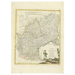
Antique Map of the Region of Languedoc, Foix, Roussillon and Rouergue by Zatta
By Antonio Zatta
Located in Langweer, NL
Antique map titled 'Li Governi di Linguadoca, di Foix e di Rossiglione con il Rouergue'. Old map of France showing the regions of Languedoc, Foix, Roussillon and Rouergue. This map o...
Category
18th Century Antique Antonio Zatta Furniture
Materials
Paper
Related Items
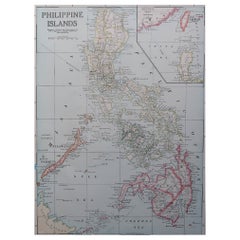
Original Antique Map of The Philippines. C.1900
Located in St Annes, Lancashire
Fabulous map of The Philippines
Original color.
Engraved and printed by the George F. Cram Company, Indianapolis.
Published, C.1900.
Unframed.
Free shipping.
Category
1890s American Antique Antonio Zatta Furniture
Materials
Paper
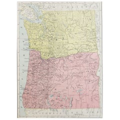
Original Antique Map of the American State of Washington, 1889
Located in St Annes, Lancashire
Great map of Washington
Drawn and Engraved by W. & A.K. Johnston
Published By A & C Black, Edinburgh.
Original colour
Unframed.
Category
1880s Scottish Victorian Antique Antonio Zatta Furniture
Materials
Paper
Original Antique Map of the American State of Pennsylvania, 1889
Located in St Annes, Lancashire
Great map of Pennsylvania
Drawn and Engraved by W. & A.K. Johnston
Published By A & C Black, Edinburgh.
Original colour
Unframed.
Repair to a minor tear on bottom edge.
Category
1880s Scottish Victorian Antique Antonio Zatta Furniture
Materials
Paper
Original Antique Map of the American State of Colorado, 1903
Located in St Annes, Lancashire
Antique map of Colorado
Published By A & C Black. 1903
Original colour
Good condition
Unframed.
Free shipping
Category
Early 1900s English Antique Antonio Zatta Furniture
Materials
Paper
Original Antique Map of the American State of Kansas, 1903
Located in St Annes, Lancashire
Antique map of Kansas
Published By A & C Black. 1903
Original colour
Good condition
Unframed.
Free shipping
Category
Early 1900s English Antique Antonio Zatta Furniture
Materials
Paper
Original Antique Map of The World by Thomas Clerk, 1817
Located in St Annes, Lancashire
Great map of The Eastern and Western Hemispheres
On 2 sheets
Copper-plate engraving
Drawn and engraved by Thomas Clerk, Edinburgh.
Published by Mackenzie And Dent, 1817
...
Category
1810s English Antique Antonio Zatta Furniture
Materials
Paper
Original Antique Map of the American State of Oregon, 1889
Located in St Annes, Lancashire
Great map of Oregon
Drawn and Engraved by W. & A.K. Johnston
Published By A & C Black, Edinburgh.
Original colour
Unframed.
Category
1880s Scottish Victorian Antique Antonio Zatta Furniture
Materials
Paper
The Normandy Region of France: A 17th C. Hand-colored Map by Sanson and Jaillot
By Nicolas Sanson
Located in Alamo, CA
This large hand-colored map entitled "Le Duché et Gouvernement de Normandie divisée en Haute et Basse Normandie en divers Pays; et par evêchez, avec le Gouvernement General du Havre ...
Category
1690s French Antique Antonio Zatta Furniture
Materials
Paper
$2,375
H 24.88 in W 38 in D 0.13 in
Original Antique Map of the American State of Maine, 1903
Located in St Annes, Lancashire
Antique map of Maine
Published By A & C Black. 1903
Original colour
Good condition
Unframed.
Free shipping
Category
Early 1900s English Antique Antonio Zatta Furniture
Materials
Paper
Original Antique Map of the American State of Wisconsin, 1903
Located in St Annes, Lancashire
Antique map of Wisconsin
Published By A & C Black. 1903
Original colour
Good condition
Unframed.
Free shipping
Category
Early 1900s English Antique Antonio Zatta Furniture
Materials
Paper
Original Antique Map of the American State of Virginia, 1903
Located in St Annes, Lancashire
Antique map of West Virginia
Published By A & C Black. 1903
Original colour
Good condition
Unframed.
Free shipping
Category
Early 1900s English Antique Antonio Zatta Furniture
Materials
Paper
Original Antique Map of the American State of Iowa, 1903
Located in St Annes, Lancashire
Antique map of Iowa
Published By A & C Black. 1903
Original colour
Good condition
Unframed.
Free shipping
Category
Early 1900s English Antique Antonio Zatta Furniture
Materials
Paper
Previously Available Items
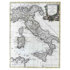
18th Century Map of Italy by Antonio Zatta 1782 Original Hand-Colored Etching
By Antonio Zatta
Located in Milano, MI
A rare map of Italy, an 18th century Italian etching and burin engraving set in a modern walnut frame within a passe-partout and glass. A hand colored map by Antonio Zatta entitled l...
Category
Late 18th Century Italian Neoclassical Antique Antonio Zatta Furniture
Materials
Walnut, Paper
H 24.02 in W 20.08 in D 0.79 in
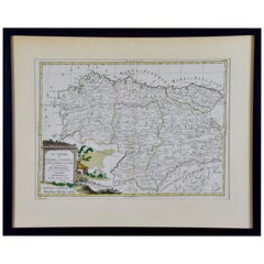
1779 Zatta Hand Colored Map of Northwestern Spain, Including Bilbao & Orviedo
By Antonio Zatta
Located in Alamo, CA
A hand colored map by Antonio Zatta entitled "Li Regni di Galizia, Asturies, Leon, Castiglia Vecchia con la Signoria di Bascaglia di nuova Projezione" from Zatta's "Atlas Atlante Nov...
Category
Late 18th Century Italian Antique Antonio Zatta Furniture
Materials
Paper
H 17.25 in W 21.25 in D 0.75 in
Antique Map of the Northern Hemisphere by A. Zatta, 1779
By Antonio Zatta
Located in Langweer, NL
Antique map of the northern hemisphere based largely on the work of De Vaugondy in 1774. This map is especially interesting for its treatment of the Polar regions and West Coast of North America. Zatta includes most of the mythical/conjectural Northwest Passage...
Category
Late 18th Century Antique Antonio Zatta Furniture
Antonio Zatta furniture for sale on 1stDibs.
Antonio Zatta furniture are available for sale on 1stDibs. These distinctive items are frequently made of paper and are designed with extraordinary care. There are many options to choose from in our collection of Antonio Zatta furniture, although brown editions of this piece are particularly popular. Many of the original furniture by Antonio Zatta were created in the neoclassical style in italy during the 18th century and earlier. If you’re looking for additional options, many customers also consider furniture by and Giovanni Battista Piranesi. Prices for Antonio Zatta furniture can differ depending upon size, time period and other attributes — on 1stDibs, these items begin at $388 and can go as high as $534, while a piece like these, on average, fetch $461.
