Bartele Gallery
to
8,278
9,918
6,305
4,741
3,929
2,640
1,445
1,438
1,346
1,196
1,131
850
617
560
474
388
380
371
350
311
302
289
275
195
190
176
167
161
160
151
145
138
136
130
124
111
105
90
64
62
62
60
59
57
48
43
33
32
19
18
16
13
12
11
10
8
7
4
2
1
102
93
81
76
60
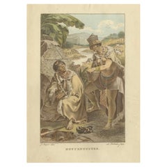
Khoikhoi Figures of Southern Africa – Antique Ethnographic Engraving. c.1803
Located in Langweer, NL
Khoikhoi Figures of Southern Africa – Antique Hand-Colored Ethnographic Engraving (c.1800)
Description:
An early 19th-century hand-colored ethnographic engraving depicting two Indig...
Category
Antique Early 19th Century Dutch Prints
Materials
Paper
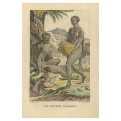
Van Diemen Landers – Antique Handcolored Engraving of Aboriginal Tasmanians 1803
Located in Langweer, NL
Van Diemen Landers – Antique Hand-Colored Engraving of Aboriginal Tasmanians (c.1800)
Description:
An early 19th-century hand-colored ethnographic engraving featuring a family group...
Category
Antique Early 19th Century Dutch Prints
Materials
Paper
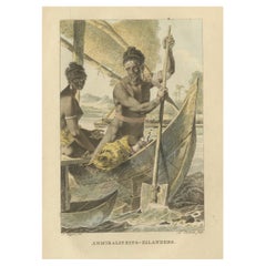
Antique Hand-Colored Engraving of Admiralty Islands, Papua New Guinea (c.1800)
Located in Langweer, NL
Admiraliteit-Eilanders – Antique Hand-Colored Engraving of Admiralty Islands, Papua New Guinea (c.1800)
Description:
A dynamic early 19th-century hand-colored ethnographic engraving...
Category
Antique Early 19th Century Dutch Prints
Materials
Paper
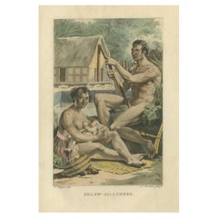
Pelew-Eilanders – Antique Hand-Colored Engraving of Palau (c.1800)
Located in Langweer, NL
Pelew-Eilanders – Antique Hand-Colored Engraving of Palau (c.1800)
A finely hand-colored early 19th-century ethnographic engraving titled “Pelew-Eilanders,” depicting two Indigenous...
Category
Antique Early 19th Century Dutch Prints
Materials
Paper
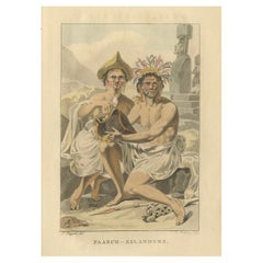
Paasch-Eilanders – Antique Engraving of Easter Island / Rapa Nui Figures, c.1800
Located in Langweer, NL
Paasch-Eilanders – Antique Hand-Colored Engraving of Easter Island / Rapa Nui Figures (c.1800)
A striking early 19th-century hand-colored ethnographic engraving titled “Paasch-Eilan...
Category
Antique Early 19th Century Dutch Prints
Materials
Paper
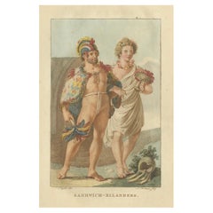
Hawaii Islanders – Antique Hand-Colored Ethnographic Engraving (c.1800)
Located in Langweer, NL
Sandwich-Eilanders – Antique Hand-Colored Engraving of Hawaiian Figures (c.1800)
Description:
An early 19th-century hand-colored ethnographic engraving titled “Sandwich-Eilanders,” ...
Category
Antique Early 19th Century Dutch Prints
Materials
Paper
Ulieteërs - Old Handcolored Ethnographic Engraving of Raiatea, Polynesia 1803
Located in Langweer, NL
Ulieteërs – Antique Hand-Colored Ethnographic Engraving of Raiatea, Polynesia (c.1800)
An elegant early 19th-century ethnographic engraving titled “Ulieteërs,” depicting two figures...
Category
Antique Early 19th Century Dutch Prints
Materials
Paper
Allegory of the Arts – Antique Hand-Colored Stipple Engraving by J. Allart, 1803
Located in Langweer, NL
Allegory of the Arts – Antique Hand-Colored Stipple Engraving by J. Allart (c.1800)
A beautifully hand-colored stipple engraving published by J. Allart around 1800, depicting an all...
Category
Antique Early 19th Century Dutch Prints
Materials
Paper
Set of Two Anatomical Engravings of Human Skulls – Comparative Craniology, 1803
Located in Langweer, NL
Early 19th Century Anatomical Engravings of Human Skulls – Comparative Craniology (Set of 2)
A rare pair of early 19th-century anatomical engravings documenting comparative craniolo...
Category
Antique Early 19th Century Dutch Prints
Materials
Paper
Maori Traditional Dress – Antique Hand-Colored Engraving, New Zealand, 1803
Located in Langweer, NL
Antique Hand-Colored Engraving “Nieuw-Zeelanders” (Maori), Early 19th Century
A beautifully hand-colored ethnographic engraving depicting three Māori figures of New Zealand, titled ...
Category
Antique Early 19th Century Dutch Prints
Materials
Paper
New Hebrides (Vanuatu) Indigenous Family – Antique Hand-Colored Engraving, 1803
Located in Langweer, NL
New Hebrides (Vanuatu) Indigenous Family – Antique Hand-Colored Engraving
Original hand-colored engraving of the people of the New Hebrides (today known as Vanuatu), taken from the ...
Category
Antique Early 19th Century Dutch Prints
Materials
Paper
Marquisen-Eilanders – Antique Hand-Colored Ethnographic Engraving (early 1800s)
Located in Langweer, NL
Marquisen-Eilanders – Antique Hand-Colored Ethnographic Engraving (early 1800s)
Fine original hand-colored engraving depicting inhabitants of the Marquesas Islands in Polynesia. Pub...
Category
Antique Early 19th Century Dutch Prints
Materials
Paper
Nieuw Caledoniers – Antique Hand-Colored Ethnographic Engraving (1800s)
Located in Langweer, NL
Nieuw Caledoniers – Antique Hand-Colored Ethnographic Engraving (1800s)
A beautifully hand-colored antique engraving depicting inhabitants of New Caledonia (present-day French terri...
Category
Antique Early 19th Century Dutch Prints
Materials
Paper
Friendly Islands, Antique Hand-Colored Print by Kuyper & Portman, 1803
Located in Langweer, NL
Vrienden-Eilanden (Friendly Islands), Antique Hand-Colored Print by Kuyper & Portman, 1803
This original early-19th century hand-colored anthropological print depicts the Indigenous...
Category
Antique Early 19th Century Dutch Prints
Materials
Paper
Antique Hand-Colored Print, North American Indigenous People, ca.1805
Located in Langweer, NL
Antique Hand-Colored Print “Noord-Indianen”, North American Indigenous People, ca. 1803–1808
A beautifully hand-colored original print showing Indigenous people of North America, pu...
Category
Antique Early 19th Century Dutch Prints
Materials
Paper
Dakota (Sioux) People – Antique Hand-Colored Ethnographic Print c.1805
Located in Langweer, NL
Dakota (Sioux) People – Antique Hand-Colored Ethnographic Print c.1805
This finely hand-colored ethnographic print titled “Naudowessies” depicts Indigenous Dakota (Sioux) people of ...
Category
Antique Early 19th Century Dutch Prints
Materials
Paper
Inhabitants of Nootka Sound (Vancouver Island) – Antique Ethnograph Print, 1805
Located in Langweer, NL
Inhabitants of Nootka Sound (Vancouver Island) – Antique Hand-Colored Ethnographic Print c.1805
This finely hand-colored ethnographic print titled “Inwooners van Nootka” (“Inhabitan...
Category
Antique Early 19th Century Dutch Prints
Materials
Paper
Inhabitants of Unalaska, Alaska – Antique Hand-Colored Ethnographic Print c.1805
Located in Langweer, NL
Inhabitants of Unalaska, Alaska – Antique Hand-Colored Ethnographic Print c.1805
This finely hand-colored ethnographic print titled “Inwooners van Oonolaska” (“Inhabitants of Unalas...
Category
Antique Early 19th Century Dutch Prints
Materials
Paper
Inhabitants of French Harbour – Antique Hand-Colored Ethnographic Print c.1805
Located in Langweer, NL
Inhabitants of French Harbour – Antique Hand-Colored Ethnographic Print c.1805
This expressive and beautifully hand-colored ethnographic print titled “Bewooners van de Haven der Fra...
Category
Antique Early 19th Century Dutch Prints
Materials
Paper
Inhabitants of Prince William’s Bay, Alaska – Antique Ethnographic Print, 1805
Located in Langweer, NL
Inhabitants of Prince William’s Bay, Alaska – Antique Hand-Colored Ethnographic Print c.1805
This finely hand-colored ethnographic print titled “Bewooners van de Prins Willems-Baai”...
Category
Antique Early 19th Century Dutch Prints
Materials
Paper
Inhabitants of Norton Bay, Alaska – Antique Hand-Colored Ethnographic Print 1805
Located in Langweer, NL
Inhabitants of Norton Bay, Alaska – Antique Hand-Colored Ethnographic Print c.1805
This rare and beautifully hand-colored ethnographic print titled “Bewooners van de Nortons-Baai” (...
Category
Antique Early 19th Century Dutch Prints
Materials
Paper
Indigenous Australians – Antique Hand-Colored Ethnographic Print c.1805
Located in Langweer, NL
Indigenous Australians – Antique Hand-Colored Ethnographic Print c.1805
This striking hand-colored ethnographic print titled “Nieuw-Hollanders” (N...
Category
Antique Early 19th Century Dutch Prints
Materials
Paper
Greenlanders (Inuit Family) – Antique Hand-Colored Ethnographic Print c.1805
Located in Langweer, NL
Greenlanders (Inuit Family) – Antique Hand-Colored Ethnographic Print c.1805
This finely hand-colored ethnographic print titled “Groenlanders” depicts Inuit (Greenlandic) people in ...
Category
Antique Early 19th Century Dutch Prints
Materials
Paper
Esquimaux (Inuit) Hunters – Antique Hand-Colored Ethnographic Print c.1805
Located in Langweer, NL
Esquimaux (Inuit) Hunters – Antique Hand-Colored Ethnographic Print c.1805
This dramatic and finely hand-colored ethnographic print titled “Esquimoos” depicts Inuit (historically ca...
Category
Antique Early 19th Century Dutch Prints
Materials
Paper
Creek People of North America – Antique Hand-Colored Ethnographic Print c.1805
Located in Langweer, NL
Creek People of North America – Antique Hand-Colored Ethnographic Print c.1805
This detailed and beautifully hand-colored ethnographic print titled “Creeks” depicts members of the I...
Category
Antique Early 19th Century Dutch Prints
Materials
Paper
Mexican Indigenous People – Antique Hand-Colored Ethnographic Print c.1805
Located in Langweer, NL
Mexican Indigenous People – Antique Hand-Colored Ethnographic Print c.1805
This richly hand-colored ethnographic print titled “Mexicanen” depicts Indigenous people from Mexico in a ...
Category
Antique Early 19th Century Dutch Prints
Materials
Paper
Guiana Indigenous People – Antique Hand-Colored Ethnographic Print c.1805
Located in Langweer, NL
Guiana Indigenous People – Antique Hand-Colored Ethnographic Print c.1805
A striking and beautifully hand-colored ethnographic print titled “Guianers,” depicting Indigenous people f...
Category
Antique Early 19th Century Dutch Prints
Materials
Paper
Residents of Quito, Ecuador – Antique Hand-Colored Ethnographic Print c.1805
Located in Langweer, NL
Residents of Quito, Ecuador – Antique Hand-Colored Ethnographic Print c.1805
This engaging and finely hand-colored ethnographic print titled “Inwoners van Quito” (“Residents of Quit...
Category
Antique Early 19th Century Dutch Prints
Materials
Paper
Patagonians of Southern Argentina – Antique Hand-Colored Print c.1805
Located in Langweer, NL
Patagonians of Southern Argentina – Antique Hand-Colored Ethnographic Print c.1805
This expressive and beautifully hand-colored ethnographic print titled “Patagoners” represents the...
Category
Antique Early 19th Century Dutch Prints
Materials
Paper
Fuegians of Tierra del Fuego – Antique Hand-Colored Ethnographic Print c.1805
Located in Langweer, NL
Fuegians of Tierra del Fuego – Antique Hand-Colored Ethnographic Print c.1805
This rare and beautifully hand-colored ethnographic print titled “Vuurlanders” (“Fire-landers”) portray...
Category
Antique Early 19th Century Prints
Materials
Paper
Medan Hotel, Antique Photogravure of Colonial Indonesia, c.1900
Located in Langweer, NL
Medan Hotel, Antique Photogravure of Colonial Indonesia, c.1900
A rare and elegant early twentieth century photogravure depicting the Medan Hotel...
Category
Early 20th Century Dutch Maps
Materials
Paper
Coffee Establishment Girsahan & Sorting Coffee – Antique Photos Sumatra, c.1900
Located in Langweer, NL
Coffee Establishment Girsahan & Sorting Coffee – Antique Photogravures Sumatra c.1900
A rare and visually engaging original photogravure plate published circa 1900, documenting the ...
Category
Early 20th Century Dutch Maps
Materials
Paper
Antique Photogravures of Medan’s White Club & Restaurant de Boer, Sumatra c.1900
Located in Langweer, NL
Antique Photogravures of Medan’s White Club & Restaurant de Boer, Sumatra (c.1900)
A beautiful original pair of early 20th-century photogravures ...
Category
Early 20th Century Dutch Maps
Materials
Paper
Kesawan Street from North, Medan, Dutch East Indies— Antique Photogravure c.1900
Located in Langweer, NL
Kesawan Street from North, Medan — Kleingrothe Photogravure c.1900
A rare original photogravure by pioneering Sumatran photographer C.J. Kleingrothe, depicting the historic commerci...
Category
Early 20th Century Dutch Maps
Materials
Paper
Medan Race-Course, Colonial Era Horse Racing Scene, Antique Photogravure c.1900
Located in Langweer, NL
Medan Race-Course, Colonial Era Horse Racing Scene, Kleingrothe Photogravure c.1900
Historic photogravure depicting the race-course in Medan, Sumatra, around 1900, produced by celeb...
Category
Early 20th Century Dutch Maps
Materials
Paper
Pepper Plantation & Timber, Sumatra — Antique Kleingrothe Photogravure c.1900
Located in Langweer, NL
Pepper Plantation & Timber, Sumatra — Antique Kleingrothe Photogravure c.1900
This original photogravure by C.J. Kleingrothe offers a rare documentar...
Category
Early 20th Century Dutch Maps
Materials
Paper
Batik, Sifting Rice & Women Working – Antique Photogravure of Batak People 1900
Located in Langweer, NL
Batik, Sifting Rice & Women Working – Antique Photogravure of Batak People c.1900
An exceptional original photogravure from circa 1900, published...
Category
Early 20th Century Dutch Maps
Materials
Paper
Sorting Tobacco in Lengths and Colors, Sumatra — Kleingrothe Photogravure c.1900
Located in Langweer, NL
Sorting Tobacco in Lengths and Colors, Sumatra — Kleingrothe Photogravure c.1900
This original early 20th-century photogravure captures tobacco workers inside a large sorting facili...
Category
Early 20th Century Dutch Maps
Materials
Paper
Batak Kampong Village, Sumatra Dutch East Indies - Kleingrothe Photogravure 1900
Located in Langweer, NL
Batak Kampong Village, Sumatra — Kleingrothe Photogravure c.1900
Original photogravure showing a Batak kampong (village) in the highlands of North Sumatra, photographed by C. J. Kle...
Category
Early 20th Century Dutch Maps
Materials
Paper
Laut Tador Lake, Sumatra — Antique Kleingrothe Photogravure c.1900
Located in Langweer, NL
Laut Tador Lake, Sumatra — Antique Kleingrothe Photogravure c.1900
A beautifully composed original photogravure by C.J. Kleingrothe, featuring the tr...
Category
Early 20th Century Dutch Maps
Materials
Paper
Canal at Loeboe Dalam, Sumatra, C J Kleingrothe, Dutch East Indies c1910
Located in Langweer, NL
Loeboe Dalam Canal, Sumatra – Kleingrothe Photogravure c.1900
An original early 20th-century photogravure by renowned photographer C.J. Kleingrothe, showcasing the tranquil Loeboe D...
Category
Early 20th Century Dutch Maps
Materials
Paper
Aboeng Jungle, Sumatra — Antique Photogravure by C.J. Kleingrothe c.1900
Located in Langweer, NL
Aboeng Jungle, Sumatra — Antique Photogravure by C.J. Kleingrothe c.1900
This original photogravure by renowned photographer C.J. Kleingrothe capture...
Category
Early 20th Century Dutch Maps
Materials
Paper
Soengei Serpa, Sumatra — Antique Photogravure by C.J. Kleingrothe, c.1900
Located in Langweer, NL
Soengei Serpa, Sumatra — Antique Photogravure by C.J. Kleingrothe, c.1900
Description:
A striking original photogravure by renowned photographer C.J....
Category
Early 20th Century Dutch Maps
Materials
Paper
Belawan Harbour & Labourers – Sumatra, Indonesia - Kleingrothe Photogravure 1900
Located in Langweer, NL
Belawan Harbour & Labourers – Sumatra (Kleingrothe Photogravure, c.1900)
A powerful original photogravure by C.J. Kleingrothe, capturing the bustling colonial port of Belawan near M...
Category
Early 20th Century Dutch Maps
Materials
Paper
Coolie Dwellings – Tandjong-Morawa, Sumatra, Indonesia (Kleingrothe, c.1900)
Located in Langweer, NL
Coolie Dwellings – Tandjong-Morawa, Sumatra (Kleingrothe, c.1900)
A striking and historically significant original photogravure by C.J. Kleingrothe, documenting the workers’ barrack...
Category
Early 20th Century Dutch Maps
Materials
Paper
Tobacco Fermentation & Packing – Deli, Sumatra, Kleingrothe, c.1900
Located in Langweer, NL
Tobacco Fermentation & Packing – Deli, Sumatra (Kleingrothe, c.1900)
A rare and highly detailed original photogravure depicting the industrial tobacco production process on the Deli...
Category
Early 20th Century Dutch Maps
Materials
Paper
Set of 3 Antique Photogravures of Sumatra Plantations — Deli, Medan Region, 1900
Located in Langweer, NL
Set of 3 Antique Photogravures of Sumatra Plantations — Deli, Medan Region (c.1900)
A fine set of three original photogravures documenting planta...
Category
Early 20th Century Dutch Maps
Materials
Paper
Medan Resident’s Palace, East Coast of Sumatra – Kleingrothe Photogravure c.1900
Located in Langweer, NL
Medan – Residence of the Resident of East Coast Sumatra, c.1900 — Kleingrothe Photogravure
This rare original photogravure captures the impressive official residence of the Dutch co...
Category
Early 20th Century Dutch Maps
Materials
Paper
Sultan of Deli Palace and Esplanade, Medan, Sumatra, Dutch East Indies, c1910
Located in Langweer, NL
Medan Esplanade & Sultan Deli Palace, Antique Photogravure Pair by C.J. Kleingrothe, Sumatra c.1900
This original early 20th-century photogravure features two historic views of Meda...
Category
Early 20th Century Dutch Maps
Materials
Paper
Railway Station Medan, Sumatra, C J Kleingrothe, Dutch East Indies c1910
Located in Langweer, NL
Medan Station, Antique Photogravure by C.J. Kleingrothe, Sumatra c.1900
This original early 20th-century photogravure depicts Medan Station in No...
Category
Early 20th Century Dutch Maps
Materials
Paper
Petroleum Tin Factory & Filling Operations — Photogravure, Sumatra ca.1900
Located in Langweer, NL
Petroleum Tin Factory & Filling Operations — Kleingrothe Photogravure, Sumatra c.1900
This original photogravure by Carl Josef Kleingrothe presents a rare and highly atmospheric vie...
Category
Early 20th Century Dutch Maps
Materials
Paper
Malay Mosque Tandjong Poera – Original 1900s Photogravure, Sumatra Indonesia
Located in Langweer, NL
Title: Malay Mosque Tandjong Poera – Original 1890s Photogravure, Sumatra Indonesia
Description:
Original late-19th century photogravure showing the Malay Mosque of Tandjong Poera i...
Category
Early 20th Century Dutch Maps
Materials
Paper
Belawan Railway Station & Soengei Deli River, Sumatra – Antique Photo, c.1910
Located in Langweer, NL
Belawan Railway Station & Soengei Deli River, Sumatra – Antique Photo, c.1910
This striking antique photogravure sheet presents two evocative views o...
Category
Early 20th Century Dutch Maps
Materials
Paper
Avenue of Trees, Tandjong Poera, Sumatra, Kleingrothe, Dutch East Indies c1910
Located in Langweer, NL
Tandjong-Poera Sennah-Laan, Sumatra (c.1895)
This original late-19th-century photogravure by G.R. Kleingrothe (Medan) depicts the Sennah-Laan at Tandjong-Poera (Tanjung Pura), a his...
Category
Early 20th Century Dutch Maps
Materials
Paper
Chinese Temple Interior, Medan, Sumatra, C J Kleingrothe, Dutch East Indies 1910
Located in Langweer, NL
Chinese Temple Interior — Medan, Sumatra (c.1910)
An exceptional original photogravure by G.R. Kleingrothe, Medan, capturing the richly decorated interior of a Chinese temple in Nor...
Category
Early 20th Century Dutch Maps
Materials
Paper
Chinese Temple by the River — Medan, Sumatra (c.1910)
Located in Langweer, NL
Chinese Temple by the River — Medan, Sumatra (c.1910)
A beautiful original photogravure produced circa 1910 by G.R. Kleingrothe in Medan, Sumatra, showing a peaceful riverbank frame...
Category
Early 20th Century Dutch Maps
Materials
Paper
Batak Warrior Portrait, Sumatra, C J Kleingrothe, Dutch East Indies c1910
Located in Langweer, NL
Batak Warrior Portrait, Sumatra, C J Kleingrothe, Dutch East Indies c1910
This compelling antique photogravure features a striking portrait of a Batak man from North Sumatra, produc...
Category
Early 20th Century Dutch Maps
Materials
Paper
Antique Photo Gravure of Soengei Boewaya River, Sumatra, Indonesia, 1910
Located in Langweer, NL
Antique Photo Gravure of Soengei Boewaya River, Sumatra by C.J. Kleingrothe, 1890s
Description:
A striking and atmospheric antique photo gravure of th...
Category
Early 20th Century Dutch Maps
Materials
Paper
Coffee Fermentation Sheds and Harvest, Padang Roetan, Sumatra, c.1910
Located in Langweer, NL
Padang “Roetan” Fermentation Sheds & Coffee Harvest – Kleingrothe Photogravures c.1900
This original pair of early 20th-century photogravures documents both the processing and h...
Category
Early 20th Century Dutch Maps
Materials
Paper
Coffee Picker Portrait, Deli Plantations, Sumatra, Dutch East Indies, c.1900
Located in Langweer, NL
Coffee Picker – Kleingrothe Photogravure of Deli Plantations, Sumatra c.1900
This original early 20th-century photogravure printed by J.B. Obernetter in Munich features a coffee har...
Category
Early 20th Century Dutch Maps
Materials
Paper
