Bartele Gallery
to
8,297
9,873
6,298
4,738
3,930
2,598
1,447
1,434
1,339
1,191
1,133
852
617
562
475
389
379
374
347
311
294
290
245
194
190
176
162
161
157
151
145
138
136
132
124
111
105
90
64
62
62
60
59
58
48
43
33
32
19
18
16
13
12
11
10
8
7
4
2
1
102
93
81
76
60
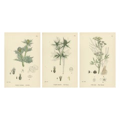
Botanical Engravings of Sea-Holly, Field Eryngo, and Water Hemlock, 1902
Located in Langweer, NL
Hand-Colored Botanical Engravings of Sea-Holly, Field Eryngo, and Water Hemlock, 1902
Description:
This striking trio of hand-colored botanical engravings from 1902 presents three r...
Category
Antique Early 1900s British Prints
Materials
Paper
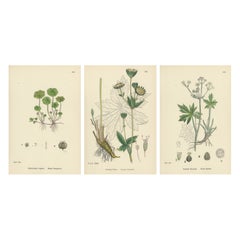
Hand-Colored Botanical Engravings of Marsh Pennywort, Astrantia & Sanicle, 1902
Located in Langweer, NL
Hand-Colored Botanical Engravings of Marsh Pennywort, Astrantia, and Sanicle, 1902
Description:
This elegant set of three hand-colored botanical engravings from 1902 features *Hydro...
Category
Antique Early 1900s British Prints
Materials
Paper
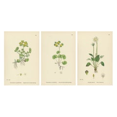
Hand-Colored Botanical Engravings of Golden Saxifrage & Grass-of-Parnassus, 1902
Located in Langweer, NL
Hand-Colored Botanical Engravings of Golden Saxifrage and Grass-of-Parnassus, 1902
This refined trio of hand-colored botanical engravings from 1902 illustrates Chrysosplenium opposi...
Category
Antique Early 1900s British Prints
Materials
Paper
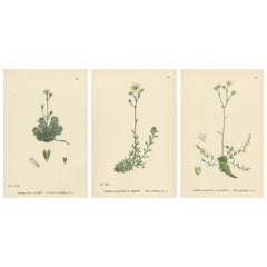
Hand-Colored Botanical Engravings of Irish and Mossy Saxifrages, 1902
Located in Langweer, NL
Title: Hand-Colored Botanical Engravings of Irish and Mossy Saxifrages, 1902
Description:
This delicate set of three hand-colored botanical engravings from 1902 beautifully depicts ...
Category
Antique Early 1900s British Prints
Materials
Paper
Hand-Colored Botanical Engravings of Palmate and Mossy Saxifrages, 1902
Located in Langweer, NL
Hand-Colored Botanical Engravings of Palmate and Mossy Saxifrages, 1902
This charming trio of hand-colored botanical engravings from 1902 presents Saxifraga decipiens (Palmate-leave...
Category
Antique Early 1900s British Prints
Materials
Paper
Hand-Colored Botanical Engravings of Alpine and Meadow Saxifrages, 1902
Located in Langweer, NL
Title: Hand-Colored Botanical Engravings of Alpine and Meadow Saxifrages, 1902
Description:
This graceful trio of hand-colored botanical engravings from 1902 showcases three distinc...
Category
Antique Early 1900s British Prints
Materials
Paper
Hand-Colored Botanical Engravings of Yellow and Alpine Saxifrages, 1902
Located in Langweer, NL
Hand-Colored Botanical Engravings of Yellow and Alpine Saxifrages, 1902
Description:
This fine trio of hand-colored botanical engravings from 1902 features Saxifraga aizoides (Yello...
Category
Antique Early 1900s British Prints
Materials
Paper
Botanical Engravings of London-Pride Varieties and Yellow Marsh Saxifrage, 1902
Located in Langweer, NL
Hand-Colored Botanical Engravings of London-Pride Varieties and Yellow Marsh Saxifrage, 1902
Description:
This elegant trio of hand-colored botani...
Category
Antique Early 1900s British Prints
Materials
Paper
Hand-Colored Botanical Engravings of London-Pride and Its Varieties, 1902
Located in Langweer, NL
Title: Hand-Colored Botanical Engravings of London-Pride and Its Varieties, 1902
Description:
This elegant set of hand-colored botanical engraving...
Category
Antique Early 1900s British Prints
Materials
Paper
Hand-Colored Botanical Engravings of Naval-wort and Mountain Saxifrages, 1902
Located in Langweer, NL
Title: Hand-Colored Botanical Engravings of Naval-wort and Mountain Saxifrages, 1902
Description:
This refined trio of hand-colored botanical engravings from 1902 illustrates Cotyle...
Category
Antique Early 1900s British Prints
Materials
Paper
Botanical Engravings of Rock and Forster’s Stone-Crop with House-Leek, 1902
Located in Langweer, NL
Title: Hand-Colored Botanical Engravings of Rock and Forster’s Stone-Crop with House-Leek, 1902
Description:
This striking set of three hand-colored botanical engravings from 1902 s...
Category
Antique Early 1900s British Prints
Materials
Paper
Hand-Colored Engravings of Insipid, Yellow, and Glaucous Stone-Crops, 1902
Located in Langweer, NL
Title: Hand-Colored Botanical Engravings of Insipid, Yellow, and Glaucous Stone-Crops, 1902
Description:
This elegant trio of hand-colored botanical engravings from 1902 portrays th...
Category
Antique Early 1900s British Prints
Materials
Paper
Botanical Engravings of Thick-Leaved, English, and Biting Stone-Crops, 1902
Located in Langweer, NL
Title: Hand-Colored Botanical Engravings of Thick-Leaved, English, and Biting Stone-Crops, 1902
Description:
This beautiful trio of hand-colored botanical engravings from 1902 portr...
Category
Antique Early 1900s British Prints
Materials
Paper
Hand-Colored Botanical Engravings of Narrow-Leaved Orpine and Stone-Crops, 1902
Located in Langweer, NL
Title: Hand-Colored Botanical Engravings of Mossy Tillaea, Rose-root, and Broad-leaved Orpine, 1902
Description:
This elegant set of three hand-colored botanical engravings from 190...
Category
Antique Early 1900s British Prints
Materials
Paper
Botanical Engravings of Mossy Tillaea, Rose-root, and Broad-leaved Orpine, 1902
Located in Langweer, NL
Title: Hand-Colored Botanical Engravings of Mossy Tillaea, Rose-root, and Broad-leaved Orpine, 1902
Description:
This elegant set of three hand-colored botanical engravings from 190...
Category
Antique Early 1900s British Prints
Materials
Paper
Hand-Colored Botanical Engravings of Red and Black Currant Varieties, 1902
Located in Langweer, NL
Title: Hand-Colored Botanical Engravings of Red and Black Currant Varieties, 1902
Description:
This exquisite trio of hand-colored botanical engravings from 1902 showcases three ref...
Category
Antique Early 1900s British Prints
Materials
Paper
Hand-Colored Botanical Engravings of Gooseberry and Currant Varieties, 1902
Located in Langweer, NL
Title: Hand-Colored Botanical Engravings of Gooseberry and Currant Varieties, 1902
Description:
This charming trio of hand-colored botanical engravings from 1902 portrays three spec...
Category
Antique Early 1900s British Prints
Materials
Paper
Botanical Engravings of Water-Milfoil, Mare’s-tail, and Red-Berried Bryony, 1902
Located in Langweer, NL
Title: Hand-Colored Botanical Engravings of Water-Milfoil, Mare’s-tail, and Red-Berried Bryony, 1902
Description:
This elegant trio of hand-colored botanical engravings from 1902 pr...
Category
Antique Early 1900s British Prints
Materials
Paper
Botanical Engravings of Enchanter’s Nightshade and Water-Milfoil Species, 1902
Located in Langweer, NL
Title: Hand-Colored Botanical Engravings of Enchanter’s Nightshade and Water-Milfoil Species, 1902
Description:
This elegant botanical set from 1902 features three beautifully hand-...
Category
Antique Early 1900s British Prints
Materials
Paper
Engravings of Evening-Primrose, Marsh Isnardia, and Enchanter’s Nights, 1902
Located in Langweer, NL
Title: Hand-Colored Botanical Engravings of Evening-Primrose, Marsh Isnardia, and Enchanter’s Nightshade, 1902
Description:
This graceful botanical trio from 1902 showcases three fi...
Category
Antique Early 1900s British Prints
Materials
Paper
Hand-Colored Engravings of Alpine Willow-Herbs and Evening Primrose, 1902
Located in Langweer, NL
Title: Hand-Colored Botanical Engravings of Alpine Willow-Herbs and Evening Primrose, 1902
Description:
This refined set of three hand-colored botanical engravings from 1902 present...
Category
Antique Early 1900s British Prints
Materials
Paper
Hand-Colored Botanical Engravings of Marsh and Square-Stalked Willow-Herbs, 1902
Located in Langweer, NL
Title: Hand-Colored Botanical Engravings of Marsh and Square-Stalked Willow-Herbs, 1902
Description:
This delicate botanical trio from 1902 features three beautifully hand-colored e...
Category
Antique Early 1900s British Prints
Materials
Paper
Hand-Colored Botanical Engravings of Willow-Herb Varieties, 1902
Located in Langweer, NL
Title: Hand-Colored Botanical Engravings of Willow-Herb Varieties, 1902
Description:
This elegant trio of hand-colored botanical engravings from 1902 features three related species ...
Category
Antique Early 1900s British Prints
Materials
Paper
Hand-Colored Botanical Engravings of Hairy and Broad-Leaved Willow-Herbs, 1902
Located in Langweer, NL
Title: Hand-Colored Botanical Engravings of Hairy and Broad-Leaved Willow-Herbs, 1902
Description:
This fine trio of antique hand-colored engravings from 1902 illustrates three dist...
Category
Antique Early 1900s British Prints
Materials
Paper
Hand-Colored Botanical Engravings of French-Willow Species, 1902
Located in Langweer, NL
Title: Hand-Colored Botanical Engravings of French-Willow Species, 1902
Description:
This graceful botanical set from 1902 features three detailed engravings of the French-Willow or...
Category
Antique Early 1900s British Prints
Materials
Paper
Botanical Engravings of Purple Loosestrife, Grass-Poly and Water-Purselane, 1902
Located in Langweer, NL
Hand-Colored Botanical Engravings of Purple Loosestrife, Grass-Poly, and Water-Purslane, 1902
Description:
This beautiful set of three antique botanical engravings, dating from 1902...
Category
Antique Early 1900s British Prints
Materials
Paper
Map of Belgium and the Grand Duchy of Luxembourg, Leiden 1876
Located in Langweer, NL
Title: Map of Belgium and the Grand Duchy of Luxembourg, Leiden 1876
Description:
This elegant 19th-century Dutch map, titled “België en het Groot Hertogdom Luxemburg,” was publishe...
Category
Antique 1870s Dutch Maps
Materials
Paper
Historical Map of the Netherlands in the 16th and 17th Centuries, Leiden 1876
Located in Langweer, NL
Historical Map of the Netherlands in the 16th and 17th Centuries, Leiden 1876
This 19th-century Dutch historical map, titled “De Nederlanden in het begin der 16de eeuw en in het beg...
Category
Antique 1870s Dutch Maps
Materials
Paper
Map of the Netherlands with Insets of Amsterdam and Arnhem, Leiden 1876
Located in Langweer, NL
Map of the Netherlands with Insets of Amsterdam and Arnhem, Leiden 1876
This detailed 19th-century Dutch map, titled “De Nederlanden,” was published in 1876 in the Nieuwe Hand-Atlas...
Category
Antique 1870s Dutch Maps
Materials
Paper
Map of Sweden and Norway with Inset of Stockholm, Leiden 1876
Located in Langweer, NL
Title: Map of Sweden and Norway with Inset of Stockholm, Leiden 1876
Description:
This fine 19th-century Dutch map, titled “Zweden en Noorwegen,” was published in 1876 in the Nieuwe...
Category
Antique 1870s Dutch Maps
Materials
Paper
Map of Denmark, Schleswig, Holstein and Lauenburg – Leiden 1876
Located in Langweer, NL
Title: Map of Denmark, Schleswig, Holstein and Lauenburg – Leiden 1876
Description:
This 19th-century Dutch map, titled “Denemarken, Sleeswijk, Holstein en Lauenburg,” was published...
Category
Antique 1870s Dutch Maps
Materials
Paper
Map of the British Isles with Insets of London and Dublin, Leiden 1876
Located in Langweer, NL
Title: Map of the British Isles with Insets of London and Dublin, Leiden 1876
This detailed 19th-century Dutch map, titled “Het Britsche Rijk,” was published in 1876 in the Nieuwe H...
Category
Antique 1870s Dutch Maps
Materials
Paper
Map of France with Corsica and Paris Inset – Nieuwe Hand-Atlas, 1876
Located in Langweer, NL
Title: Map of France with Corsica and Paris Inset – Nieuwe Hand-Atlas, 1876
Description:
This detailed 19th-century map, titled “Frankrijk,” was published in 1876 in the *Nieuwe Han...
Category
Antique 1870s Dutch Maps
Materials
Paper
Map of Spain and Portugal – Nieuwe Hand-Atlas by Frijlink & van Otterloo, 1876
Located in Langweer, NL
Title: Map of Spain and Portugal – Nieuwe Hand-Atlas by Frijlink & van Otterloo, 1876
Description:
This detailed 19th-century map, titled “Spanje en Portugal,” was published in 1876...
Category
Antique 1870s Dutch Maps
Materials
Paper
Political Map of Europe – Nieuwe Hand-Atlas by Frijlink & van Otterloo, 1876
Located in Langweer, NL
Title: Political Map of Europe – Nieuwe Hand-Atlas by Frijlink & van Otterloo, 1876
Description:
This 19th-century Dutch map titled “Europa” was published in 1876 in the Nieuwe Hand...
Category
Antique 1870s Dutch Maps
Materials
Paper
Physical Map of Europe – Nieuwe Hand-Atlas by Frijlink & van Otterloo, 1876
Located in Langweer, NL
Title: Northern Hemisphere Map Centered on the North Pole, Leiden 1876
Description:
This 19th-century Dutch map titled “Noordpoolkaart” (Map of the North Pole) was published in 1876...
Category
Antique 1870s Dutch Maps
Materials
Paper
Northern Hemisphere Map Centered on the North Pole, Leiden 1876
Located in Langweer, NL
Title: Northern Hemisphere Map Centered on the North Pole, Leiden 1876
Description:
This 19th-century Dutch map titled “Noordpoolkaart” (Map of the North Pole) was published in 1876...
Category
Antique 1870s Dutch Maps
Materials
Paper
World Map in Mercator’s Projection – Nieuwe Hand-Atlas, Leiden 1876
Located in Langweer, NL
World Map in Mercator’s Projection – Nieuwe Hand-Atlas, Leiden 1876
This 19th-century Dutch world map, titled “Wereld-Kaart in Mercator’s Projectie,” was published in 1876 in the Ni...
Category
Antique 1870s Dutch Maps
Materials
Paper
Double Hemisphere World Map from the Nieuwe Hand-Atlas, Leiden 1876
Located in Langweer, NL
Title: Double Hemisphere World Map from the Nieuwe Hand-Atlas, Leiden 1876
Description:
This 19th-century double-hemisphere world map, titled “Wereldkaart volgens gewone projectie v...
Category
Antique 1870s Dutch Maps
Materials
Paper
The Solar System – Astronomical Lithograph - The Nieuwe Hand-Atlas, Leiden 1876
Located in Langweer, NL
The Solar System – Astronomical Lithograph from the Nieuwe Hand-Atlas, Leiden 1876
This detailed 19th-century Dutch astronomical lithograph, titled “Het Planeten-Stelsel” (The Plane...
Category
Antique 1870s Dutch Maps
Materials
Paper
The Lady’s Magazine 1784 Frontispiece: Allegorical Temple of Learning and Virtue
Located in Langweer, NL
The Lady’s Magazine 1784 Frontispiece: Allegorical Temple of Learning and Virtue
Description:
This finely engraved frontispiece features three classical draped figures approaching a...
Category
Antique 1780s British Prints
Materials
Paper
Pair of Hand-Colored Botanical Engravings of Roses & Spring Flowers, London 1828
Located in Langweer, NL
Pair of Hand-Colored Botanical Engravings of Roses and Spring Flowers, London 1828
This charming pair of early 19th-century botanical engravings exemplifies the grace and precision ...
Category
Antique 1820s British Prints
Materials
Paper
Pair of Hand-Colored Botanical Engravings of Spring Flowers, London 1828
Located in Langweer, NL
Pair of Hand-Colored Botanical Engravings of Spring Flowers, London 1828
This elegant pair of early 19th-century botanical engravings captures the charm and precision of British bot...
Category
Antique 1820s British Prints
Materials
Paper
Beautiful Pair of Vintage Botanical Flower Prints, incl a Flame Tulip, 1828
Located in Langweer, NL
Pair of Hand-Colored Botanical Engravings of Garden Flowers, London 1828
This exquisite pair of early 19th-century botanical engravings exemplifies the precision and grace of Englis...
Category
Antique 1820s British Prints
Materials
Paper
Pair of Hand-Colored Botanical Engravings of Wild and Cultivated Flowers, 1828
Located in Langweer, NL
Title: Pair of Hand-Colored Botanical Engravings of Wild and Cultivated Flowers, London 1828
Description:
This vibrant pair of early 19th-century botanical engravings exemplifies th...
Category
Antique 1820s British Prints
Materials
Paper
Pair of Hand-Colored Botanical Engravings of Decorative Garden Flowers, 1828
Located in Langweer, NL
Pair of Hand-Colored Botanical Engravings of Decorative Garden Flowers, London 1828
Description:
This exquisite pair of early 19th-century botanical engravings showcases the grace a...
Category
Antique 1820s British Prints
Materials
Paper
Pair of Hand-Colored Botanical Engravings of Wild & Garden Flowers, London 1828
Located in Langweer, NL
Title: Pair of Hand-Colored Botanical Engravings of Wild and Garden Flowers, London 1828
Description:
This charming pair of early 19th-century botanical engravings reflects the refi...
Category
Antique 1820s British Prints
Materials
Paper
Charming Pair of Antique Floral Engravings for Wall Décor, 1828
Located in Langweer, NL
Pair of Hand-Colored Botanical Engravings of Garden Flowers, London 1828
This refined pair of early 19th-century botanical engravings represents the artistic and scientific excellen...
Category
Antique 1820s British Prints
Materials
Paper
Pair of Elegant Hand-Colored Botanical Flower Prints, London 1828
Located in Langweer, NL
Pair of Hand-Colored Botanical Engravings of Flowering Plants, London 1828
This graceful pair of early 19th-century botanical engravings captures the refinement and scientific curio...
Category
Antique 1820s British Prints
Materials
Paper
Pair of Hand-Colored Botanical Engravings of Ornamental Flowers, London 1828
Located in Langweer, NL
Title: Pair of Hand-Colored Botanical Engravings of Ornamental Flowers, London 1828
Description:
This striking pair of early 19th-century botanical engravings offers a vivid glimpse...
Category
Antique 1820s British Prints
Materials
Paper
Hand-Colored Floral Engravings, Pair of 1828 Botanical Prints, London
Located in Langweer, NL
Pair of Hand-Colored Botanical Engravings of Garden Flowers, London 1828
Description:
This beautifully preserved pair of early 19th-century botanical engravings exemplifies the arti...
Category
Antique 1820s British Prints
Materials
Paper
Elegant Garden Flower Engravings – Antique Botanical Prints, London 1828
Located in Langweer, NL
Pair of Hand-Colored Botanical Engravings of Garden Flowers, London 1828
Description:
This beautifully preserved pair of early 19th-century botanical engravings exemplifies the arti...
Category
Antique 1820s British Prints
Materials
Paper
Pair of Hand-Colored Botanical Engravings of Garden Flowers, London 1828
Located in Langweer, NL
Pair of Hand-Colored Botanical Engravings of Garden Flowers, London 1828
Description:
This elegant pair of early 19th-century botanical engravings beautifully illustrates the spirit...
Category
Antique 1820s British Prints
Materials
Paper
Shipwreck Scene in Melanesia – Islanders Salvaging Wreckage, c.1845
Located in Langweer, NL
Shipwreck Scene in Melanesia – Islanders Salvaging Wreckage, c.1845
This powerful hand-colored lithograph, titled “Océanie – Mélanésie,” is taken from Le Monde en Estampes: Types et...
Category
Antique 1840s French Prints
Materials
Paper
Polynesian and Maori Figures – Inhabitants of Nuku Hiva & New Zealand Canoe 1845
Located in Langweer, NL
Polynesian and Maori Figures – Inhabitants of Nuku Hiva and New Zealand Canoe, c.1845
This beautifully hand-colored lithograph, titled “Océanie – Polynésie,” originates from Le Mond...
Category
Antique 1840s French Prints
Materials
Paper
Javanese Court Scene – Musician, Dancer, and Sultan’s Guard, c.1845
Located in Langweer, NL
Title: Javanese Court Scene – Musician, Dancer, and Sultan’s Guard, c.1845
Description:
This vibrant hand-colored lithograph, titled “Océanie – Îles de la Sonde,” is from Le Monde e...
Category
Antique 1840s French Prints
Materials
Paper
Brazilian Market Scene – Poultry Seller and Maize Vendor, c.1845
Located in Langweer, NL
Brazilian Market Scene – Poultry Seller and Maize Vendor, c.1845
This lively hand-colored lithograph, titled “Amérique du Sud – Brésil,” is from Le Monde en Estampes: Types et Costu...
Category
Antique 1840s French Prints
Materials
Paper
Mexican Street Scene – Ranchero, Cavalier, and Poblana Women, c.1845
Located in Langweer, NL
Title: Mexican Street Scene – Ranchero, Cavalier, and Poblana Women, c.1845
Description:
This elegant hand-colored lithograph, titled “Amérique du Nord – Mexique,” is from Le Monde ...
Category
Antique 1840s French Prints
Materials
Paper
Native American Camp Scene – Trapper and Buffalo Hunters, c.1845
Located in Langweer, NL
Title: Native American Camp Scene – Trapper and Buffalo Hunters, c.1845
Description:
This finely hand-colored lithograph, titled “Amérique du Nord – États-Unis,” originates from Le ...
Category
Antique 1840s French Prints
Materials
Paper
South African Costumes – Hottentots, Sudanese Women, and Chief Moussaou, c.1845
Located in Langweer, NL
South African Costumes – Hottentots, Sudanese Women, and Chief Moussaou, c.1845
Description:
This striking hand-colored lithograph, titled “Afrique Méridionale,” originates from Le ...
Category
Antique 1840s French Prints
Materials
Paper
