Bartele Gallery
to
12,321
9,557
6,224
4,658
3,801
2,469
1,437
1,355
1,269
1,167
1,096
759
587
492
421
389
379
368
344
309
275
263
189
176
162
156
153
149
145
144
140
140
135
129
127
111
106
87
63
61
60
59
59
55
48
43
33
33
20
19
16
13
12
11
10
8
7
4
2
1
104
94
81
76
60
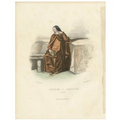
Capucine - 1862 Hand-Colored Lithograph of a Capuchin Nun
Located in Langweer, NL
Capucine - 1862 Hand-Colored Lithograph of a Capuchin Nun
This 1862 hand-colored lithograph portrays a Capucine, or Capuchin nun, seated serenely by a stone bench. She is dressed ...
Category
Antique 1860s Prints
Materials
Paper
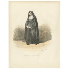
Ursuline - 1862 Hand-Colored Lithograph of an Ursuline Nun
Located in Langweer, NL
Ursuline - 1862 Hand-Colored Lithograph of an Ursuline Nun
This 1862 hand-colored lithograph features an Ursuline nun, a serene representation of devotion and education. She is dr...
Category
Antique 1860s Prints
Materials
Paper
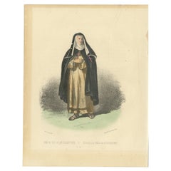
Sister of Redemption in Traditional Habit – Vibrant Handcolored 1862 Lithograph
Located in Langweer, NL
Soeur de la Rédemption Handcolored Antique Print, Plate 76, 1862
This remarkable handcolored lithograph, titled Soeur de la Rédemption (Sister of Redemption), is Plate 76 from the 1862 second edition of Album ou Collection Complète, et Historique des Costumes de la Cour de Rome. Illustrated by the skilled artist G. Perugini and published in Paris by Maison Silvestre, this print portrays a member of the Sisters of Redemption, an order known for its charitable work and dedication to aiding those in need.
The nun is depicted standing with a serene yet resolute expression, dressed in the traditional habit of her order. The costume features a white tunic, symbolizing purity, a black mantle signifying humility, and a headdress covering her hair as a sign of modesty. She holds a cross, reflecting her spiritual dedication and mission. This attire was specifically worn by members of this religious community, who were historically involved in assisting prisoners and the impoverished, embodying the virtue of redemption through service.
The Sisters of Redemption were particularly active during the 17th and 18th centuries in Europe. Their mission continues today in various forms through modern charitable and religious organizations...
Category
Antique 1860s Prints
Materials
Paper
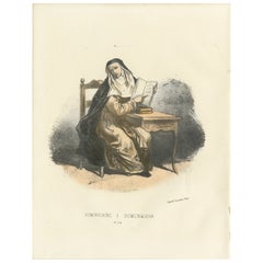
Dominicaine Religious Order Portrait – Handcolored Antique Print, 1862
Located in Langweer, NL
Dominicaine Religious Order Portrait – Handcolored Antique Print, 1862
This captivating handcolored lithograph, titled Dominicaine, is Plate 74 from the second edition of the renown...
Category
Antique 1860s Prints
Materials
Paper
Meditative Serenity: Handcolored Print of a Benedictine Nun, 1862
Located in Langweer, NL
Meditative Serenity: Handcolored Print of a Benedictine Nun, 1862
This serene handcolored lithograph, Meditative Serenity, is Plate 78 from the second edition of Album ou Collecti...
Category
Antique 1860s Prints
Materials
Paper
Eternal Devotion in Prayer: Handcolored Religious Adorer Print, Plate 77, 1862
Located in Langweer, NL
Eternal Devotion in Prayer: Handcolored Religious Adorer Print, Plate 77, 1862
This poignant handcolored lithograph, Eternal Devotion in Prayer, is Plate 77 from the 1862 second e...
Category
Antique 1860s Prints
Materials
Paper
Graceful Simplicity: Handcolored Print of a Zocolette Nun, Plate 79, 1862
Located in Langweer, NL
Graceful Simplicity: Handcolored Print of a Zocolette Nun, Plate 79, 1862
This charming hand-colored lithograph, Graceful Simplicity, is Plate 79 from the 1862 second edition of ...
Category
Antique 1860s Prints
Materials
Paper
Elegance of Authority: Handcolored Print of a Senator and Pages, Plate 25, 1862
Located in Langweer, NL
Elegance of Authority: Handcolored Print of a Senator and Pages, Plate 25, 1862
This striking handcolored lithograph, Elegance of Authority, is Plate 25 from the 1862 second edi...
Category
Antique 1860s Prints
Materials
Paper
Majestic Steward: Handcolored Print of the Dean of Palfreniers, Plate 94, 1862
Located in Langweer, NL
Majestic Steward: Handcolored Print of the Dean of Palfreniers, Plate 94, 1862
This elegant handcolored lithograph, Majestic Steward, is Plate 94 from the 1862 second edition of A...
Category
Antique 1860s Prints
Materials
Paper
Elegance and Duty: Handcolored Print of the Secret Chamberlain, Plate 26, 1862
Located in Langweer, NL
Elegance and Duty: Handcolored Print of the Secret Chamberlain, Plate 26, 1862
This refined handcolored lithograph, Elegance and Duty, is Plate 26 from the 1862 second edition of ...
Category
Antique 1860s Prints
Materials
Paper
Dignity in Ceremony: Handcolored Print of a Papal Caudataire, Plate 27, 1862
Located in Langweer, NL
Dignity in Ceremony: Handcolored Print of a Papal Caudataire, Plate 27, 1862
This exquisite handcolored lithograph, Dignity in Ceremony, is Plate 27 from the 1862 second edition ...
Category
Antique 1860s Prints
Materials
Paper
Ceremonial Prestige: Handcolored Print of a Massier, Plate 23, 1862
Located in Langweer, NL
Ceremonial Prestige: Handcolored Print of a Massier, Plate 23, 1862
This captivating handcolored lithograph, Ceremonial Prestige, is Plate 23 from the 1862 second edition of Album...
Category
Antique 1860s Prints
Materials
Paper
Honor and Elegance: Handcolored Print of a Noble Guard, Plate 32, 1862
Located in Langweer, NL
Honor and Elegance: Handcolored Print of a Noble Guard, Plate 32, 1862
This regal handcolored lithograph, Honor and Elegance, is Plate 32 from the 1862 second edition of Album ou ...
Category
Antique 1860s Prints
Materials
Paper
Symbol of Service: Handcolored Print of a Sedia Chair Bearer, Plate 29, 1862
Located in Langweer, NL
Symbol of Service: Handcolored Print of a Sedia Chair Bearer, Plate 29, 1862
This vibrant handcolored lithograph, Symbol of Service, is Plate 29 from the 1862 second edition of Al...
Category
Antique 1860s Prints
Materials
Paper
Authority in Tradition: Litho of the Dean of Cardinals’ Servants, 1862
Located in Langweer, NL
Authority in Tradition: Handcolored Print of the Dean of Cardinals’ Servants, Plate 30, 1862
This striking handcolored lithograph, Authority in Tradition, is Plate 30 from the 186...
Category
Antique 1860s Prints
Materials
Paper
Vibrant Tradition: Handcolored Print of the Capitoline Estafier, Plate 31, 1862
Located in Langweer, NL
Vibrant Tradition: Handcolored Print of the Capitoline Estafier, Plate 31, 1862
This striking handcolored lithograph, Vibrant Tradition, is Plate 31 from the 1862 second edition...
Category
Antique 1860s Prints
Materials
Paper
Officer of the Line: Old Print of a Military Official in the Papal Court , 1862
Located in Langweer, NL
Officer of the Line: Handcolored Print of a Military Official, Plate 34, 1862
This distinguished handcolored lithograph, Officer of the Line, is Plate 34 from the 1862 second edit...
Category
Antique 1860s Prints
Materials
Paper
Civic Pride in Uniform: Handcolored Print of a Garde Civique Officer, 1862
Located in Langweer, NL
Civic Pride in Uniform: Handcolored Print of a Garde Civique Officer, Plate 33, 1862
This vibrant handcolored lithograph, Civic Pride in Uniform, is Plate 33 from the 1862 secon...
Category
Antique 1860s Prints
Materials
Paper
Timeless Authority: Handcolored Print of a Swiss Guard Officer, Plate 39, 1862
Located in Langweer, NL
Timeless Authority: Handcolored Print of a Swiss Guard Officer, Plate 39, 1862
This elegant handcolored lithograph, Timeless Authority, is Plate 39 f...
Category
Antique 1860s Prints
Materials
Paper
Resolute Protector: Handcolored Print of a Senate Guard, Plate 35, 1862
Located in Langweer, NL
Resolute Protector: Handcolored Print of a Senate Guard, Plate 35, 1862
This impressive handcolored lithograph, Resolute Protector, is Plate 35 from the 1862 second edition of Alb...
Category
Antique 1860s Prints
Materials
Paper
Commanding Tradition: Handcolored Print of the Swiss Guard General, 1862
Located in Langweer, NL
Commanding Tradition: Handcolored Print of the Swiss Guard General, Plate 38, 1862
This stunning handcolored lithograph, Commanding Tradition, is Plate 38 from the 1862 second edi...
Category
Antique 1860s Prints
Materials
Paper
Guardian of Order: Handcolored Print of a National Guard, Plate 37, 1862
Located in Langweer, NL
Guardian of Order: Handcolored Print of a National Guard, Plate 37, 1862
This finely detailed handcolored lithograph, Guardian of Order, is Plate 37 from the 1862 second edition o...
Category
Antique 1860s Prints
Materials
Paper
Elegance in Duty: Handcolored Print of a Carabinier, Plate 36, 1862
Located in Langweer, NL
Elegance in Duty: Handcolored Print of a Carabinier, Plate 36, 1862
This stunning handcolored lithograph, Elegance in Duty, is Plate 36 from the 1862 second edition of Album ou Co...
Category
Antique 1860s Prints
Materials
Paper
Distinguished Duty: Handcolored Print of a Swiss Guard Sergeant, 1862
Located in Langweer, NL
Distinguished Duty: Handcolored Print of a Swiss Guard Sergeant, Plate 40, 1862
This striking handcolored lithograph, Distinguished Duty, is Plate 40 from the 1862 second edition...
Category
Antique 1860s Italian Prints
Materials
Paper
Swiss Guard in Petite Uniform: Handcolored Print, Plate 43, 1862
Located in Langweer, NL
Swiss Guard in Petite Uniform: Handcolored Print, Plate 43, 1862
This vivid handcolored lithograph, Swiss Guard in Petite Uniform, is Plate 43 from the 1862 second edition of Alb...
Category
Antique 1860s Prints
Materials
Paper
Swiss Guard in Cuirass: Handcolored Print of Ceremonial Armor, Plate 42, 1862
Located in Langweer, NL
Swiss Guard in Cuirass: Handcolored Print of Ceremonial Armor, Plate 42, 1862
This majestic handcolored lithograph, Swiss Guard in Cuirass, is Plate 42 from the 1862 second editio...
Category
Antique 1860s Prints
Materials
Paper
The Piper of the Swiss Guard: Handcolored Print, Plate 41, 1862
Located in Langweer, NL
The Piper of the Swiss Guard: Handcolored Print, Plate 41, 1862
This elegant handcolored lithograph, The Piper of the Swiss Guard, is Plate 41 from the 1862 second edition of Albu...
Category
Antique 1860s Prints
Materials
Paper
The Prince Assistant at the Throne: Handcolored Print, Plate 23, 1862
Located in Langweer, NL
The Prince Assistant at the Throne: Handcolored Print, Plate 23, 1862
This exquisite handcolored lithograph, The Prince Assistant at the Throne, is Plate 23 from the 1862 second e...
Category
Antique 1860s Prints
Materials
Paper
Cameriere d'Onore: Handcolored Print of Vatican Honor Chamberlain, 1862
Located in Langweer, NL
Cameriere d'Onore: Handcolored Print of Vatican Honor Chamberlain, Plate 21, 1862
This distinguished handcolored lithograph, Cameriere d'Onore (Honor Chamberlain), is Plate 21 fr...
Category
Antique 1860s Prints
Materials
Paper
The Interior Valet: Handcolored Print, Plate 22, 1862
Located in Langweer, NL
The Interior Valet: Handcolored Print, Plate 22, 1862
This finely detailed handcolored lithograph, The Interior Valet, is Plate 22 from the 1862 second edition of Album ou Collect...
Category
Antique 1860s Prints
Materials
Paper
Master of Ceremonies: Handcolored Lithograph, Plate 20, 1862
Located in Langweer, NL
Master of Ceremonies: Handcolored Lithograph, Plate 20, 1862
This handcolored lithograph, Master of Ceremonies (Maître des Cérémonies), is Plate 20 from the 1862 second edition of Album ou Collection Complète, et Historique des Costumes de la Cour de Rome, created by G. Perugini. The image highlights the attire of a key figure responsible for orchestrating the intricate rituals and formal events within the papal court.
The figure is elegantly dressed in a detailed lace-trimmed white surplice over a violet gown...
Category
Antique 1860s Prints
Materials
Paper
Pénitencier: Handcolored Print of a Confessor with Acolyte, Plate 18, 1862
Located in Langweer, NL
Pénitencier: Handcolored Print of a Confessor with Acolyte, Plate 18, 1862
This beautifully handcolored lithograph, Pénitencier (Confessor), is Plate 18 from the 1862 second edit...
Category
Antique 1860s Prints
Materials
Paper
Cameriere Segreto: Handcolored Lithograph of the Secret Chamberlain, 1862
Located in Langweer, NL
Cameriere Segreto: Handcolored Lithograph of the Secret Chamberlain, Plate 19, 1862
This elegant handcolored lithograph, Cameriere Segreto (Secret Chamberlain), is Plate 19 from t...
Category
Antique 1860s Prints
Materials
Paper
Handcolored Lithograph of Prélat de Grand Manteau (High-Ranking Prelate), 1862
Located in Langweer, NL
Handcolored Lithograph of Prélat de Grand Manteau (High-Ranking Prelate), Plate 16, 1862
This handcolored lithograph, Prélat de Grand Manteau (High-Ranking Prelate), is Plate 16 f...
Category
Antique 1860s Prints
Materials
Paper
Handcolored Lithograph of Prélat de Petit Manteau (Prelate in Mantelletta), 1862
Located in Langweer, NL
Handcolored Lithograph of Prélat de Petit Manteau (Prelate in Mantelletta), Plate 15, 1862
This handcolored lithograph of the Prélat de Petit Manteau (Prelate in Mantelletta) is P...
Category
Antique 1860s Prints
Materials
Paper
Handcolored Lithograph of Conservateur des Reliques (Custodian of Relics), 1862
Located in Langweer, NL
Handcolored Lithograph of Conservateur des Reliques (Custodian of Relics), Plate 14, 1862
This exquisite handcolored lithograph, titled Conservateur des Reliques (Custodian of Rel...
Category
Antique 1860s Prints
Materials
Paper
Antique Lithograph of a Maronite Priest: Custodian of Tradition and Faith, 1862
Located in Langweer, NL
Maronite Priest: Custodian of Tradition and Faith, Plate 54
This vibrant lithograph portrays a Maronite priest, garbed in traditional black robes, emblematic of his solemn devotio...
Category
Antique 1860s Prints
Materials
Paper
Dominican Friar: A Portrait of Scholarly Devotion and Preaching, 1862 Lithograph
Located in Langweer, NL
Dominican Friar: A Portrait of Scholarly Devotion and Preaching, Plate 53
This finely detailed lithograph illustrates a Dominican friar, clad in the traditional black cappa and wh...
Category
Antique 1860s Prints
Materials
Paper
Benedictine Camaldolese Monk: A Reflection of Solitude and Contemplation, 1862
Located in Langweer, NL
Benedictine Camaldolese Monk: A Reflection of Solitude and Contemplation, Plate 52
This exquisite lithograph captures a Benedictine Camaldolese monk, a member of the unique branch...
Category
Antique 1860s Prints
Materials
Paper
1862 Litho of Guardian of the Afflicted: A Symbol of Compassion and Service
Located in Langweer, NL
Caregiver of the Sick: Compassion in Action, Plate 60
*
This striking lithograph features a caregiver of the sick, clad in solemn black robes adorned with vivid red crosses on th...
Category
Antique 1860s Prints
Materials
Paper
Print of The Priest of the Minims Order: A Glimpse into Monastic Devotion, 1862
Located in Langweer, NL
Priest of the Minims Order: A Glimpse into Monastic Devotion, Plate 51
This finely detailed 19th-century lithograph showcases a priest of the Order of Minims, an austere religious...
Category
Antique 1860s Prints
Materials
Paper
Journey of Devotion: Capuchin Lay Brother in Action, Lithograph, Published 1862
Located in Langweer, NL
Journey of Devotion: Capuchin Lay Brother in Action, Plate 47
This captivating 19th-century lithograph from *Album ou Collection Complète, et Historique des Costumes de la Cour de...
Category
Antique 1860s Prints
Materials
Paper
The Shadow of Devotion: Jesuit Priest in Reflection, Plate 48, 1862
Located in Langweer, NL
The Shadow of Devotion: Jesuit Priest in Reflection, Plate 48, 1862
This solemn and evocative hand-colored lithograph, *The Shadow of Devotion: Jesuit Priest in Reflection,* Plate...
Category
Antique 1860s Prints
Materials
Paper
The Contemplative Silence: Chartreux Monk in Reverie, Plate 46, 1862
Located in Langweer, NL
The Contemplative Silence: Chartreux Monk in Reverie, Plate 46, 1862
This evocative hand-colored lithograph, 'The Contemplative Silence: Chartreux Monk in Reverie,' Plate 46 from...
Category
Antique 1860s Prints
Materials
Paper
The Humble Path: Portrait of a Franciscan Monk, Plate 45, 1862
Located in Langweer, NL
The Humble Path: Portrait of a Franciscan Monk, Plate 45, 1862
This beautifully hand-colored lithograph, 'The Humble Path: Portrait of a Franciscan Monk,' Plate 45 from *Album ou ...
Category
Antique 1860s Prints
Materials
Paper
Tambour de la Garde Suisse (Drummer of the Swiss Guard), 1862
Located in Langweer, NL
Tambour de la Garde Suisse (Drummer of the Swiss Guard), Plate 44, 1862
This vibrant hand-colored lithograph, Tambour de la Garde Suisse (Drummer of the Swiss Guard), Plate 44 fro...
Category
Antique 1860s Italian Prints
Materials
Paper
Antique Hand-Coloured Print of the Supreme Pontiff Celebrating High Mass, 1862
Located in Langweer, NL
Souverain Pontife Célébrant la Grand’ Messe (Supreme Pontiff Celebrating High Mass), Plate 2, 1862
This hand-colored lithograph, titled *Souverain Pontife Célébrant la Grand’ Mess...
Category
Antique 1860s Prints
Materials
Paper
Hand-colored Lithograph, Sa Sainteté Recevant (His Holiness Receiving), 1862
Located in Langweer, NL
Sa Sainteté Recevant (His Holiness Receiving), Plate 3, 1862
This hand-colored lithograph, 'Sa Sainteté Recevant' (His Holiness Receiving), Plate 3 from *Album ou Collection Compl...
Category
Antique 1860s Prints
Materials
Paper
Cardinal de l'Ordre des Évêques (Cardinal of the Order of Bishops), 1862
Located in Langweer, NL
Cardinal de l'Ordre des Évêques (Cardinal of the Order of Bishops), Plate 4, 1862
This intricately hand-colored lithograph, *Cardinal de l'Ordre des Évêques* (Cardinal of the Orde...
Category
Antique 1860s Prints
Materials
Paper
Litho of the Cardinal Prêtre (Cardinal Priest) in Full Ceremonial Regalia, 1862
Located in Langweer, NL
Cardinal Prêtre (Cardinal Priest), Plate 5, 1862
This beautifully handcolored lithograph, *Cardinal Prêtre* (Cardinal Priest), Plate 5 from *Album ou Collection Complète, et Histo...
Category
Antique 1860s Prints
Materials
Paper
Exquisite Handcolored Lithograph, Cardinal Diacre (Cardinal Deacon), 1862
Located in Langweer, NL
Cardinal Diacre (Cardinal Deacon), Plate 6, 1862
This exquisite handcolored lithograph, *Cardinal Diacre* (Cardinal Deacon), Plate 6 from *Album ou Collection Complète, et Histori...
Category
Antique 1860s Prints
Materials
Paper
Cardinal en Habit de Chœur (Cardinal in Choir Dress), Plate 7, 1862
Located in Langweer, NL
Cardinal en Habit de Chœur (Cardinal in Choir Dress), Plate 7, 1862
This richly detailed handcolored lithograph, *Cardinal en Habit de Chœur* (Cardinal in Choir Dress), Plate 7 fr...
Category
Antique 1860s Prints
Materials
Paper
Cardinal en Habit de Ville (Cardinal in City Attire), Plate 13, 1862
Located in Langweer, NL
Cardinal en Habit de Ville (Cardinal in City Attire), Plate 13, 1862
This elegant handcolored lithograph, *Cardinal en Habit de Ville* (Cardinal in City Attire), Plate 13 from *Al...
Category
Antique 1860s Prints
Materials
Paper
Lithograph of Évêque en Costume Pontifical (Bishop in Pontifical Robes), 1862
Located in Langweer, NL
Handcolored Lithograph of Évêque en Costume Pontifical (Bishop in Pontifical Robes), Plate 10, 1862
A stunning handcolored lithograph portraying an Évêque en Costume Pontifical (...
Category
Antique 1860s Prints
Materials
Paper
Handcolored Lithograph of Évêque Grec Latin (Greek Latin Bishop), Plate 11, 1862
Located in Langweer, NL
Handcolored Lithograph of Évêque Grec Latin (Greek Latin Bishop), Plate 11, 1862
A magnificent handcolored lithograph showcasing an Évêque Grec Latin (Greek Latin Bishop) in full...
Category
Antique 1860s Prints
Materials
Paper
Handcolored Lithograph of Évêque Syrien (Syrian Bishop), Plate 12, 1862
Located in Langweer, NL
Handcolored Lithograph of Évêque Syrien (Syrian Bishop), Plate 12, 1862
This richly detailed handcolored lithograph depicts an Évêque Syrien (Syrian Bishop) in ceremonial vestment...
Category
Antique 1860s Prints
Materials
Paper
Handcolored Lithograph of Évêque Arménien (Armenian Bishop), Plate 15, 1862
Located in Langweer, NL
Handcolored Lithograph of Évêque Arménien (Armenian Bishop), Plate 15, 1862
This exquisite handcolored lithograph depicts an Évêque Arménien (Armenian Bishop) and is Plate 15 fr...
Category
Antique 1860s Prints
Materials
Paper
Handcolored Lithograph of Chanoine Ordinaire (Ordinary Canon), Plate 17, 1862
Located in Langweer, NL
Handcolored Lithograph of Chanoine Ordinaire (Ordinary Canon), Plate 17, 1862
This beautifully handcolored lithograph depicts a Chanoine Ordinaire (Ordinary Canon) and is Plate 17 from the 1862 edition of *Album ou Collection Complète, et Historique des Costumes de la Cour de Rome*, by G. Perugini. The figure is shown in traditional attire, including a white surplice with lace trim, a fur shoulder cape...
Category
Antique 1860s Prints
Materials
Paper
Frère des Écoles Pies - 1862 Hand-Colored Lithograph of a Piarist Brother
Located in Langweer, NL
Frère des Écoles Pies - 1862 Hand-Colored Lithograph of a Piarist Brother
This 1862 hand-colored lithograph depicts a Frère des Écoles Pies, or Piarist Brother, a member of the O...
Category
Antique 1860s Prints
Materials
Paper
Augustin - 1862 Hand-Colored Lithograph of an Augustinian Monk
Located in Langweer, NL
Augustin - 1862 Hand-Colored Lithograph of an Augustinian Monk
This beautiful 1862 hand-colored lithograph portrays an Augustinian monk, showcasing the characteristic simplicity ...
Category
Antique 1860s Prints
Materials
Paper
