Items Similar to Large Antique Map of Asia including All of Southeast Asia, c.1792


Want more images or videos?
Request additional images or videos from the seller
1 of 7
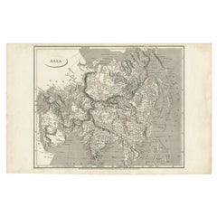
Large Antique Map of Asia including All of Southeast Asia, c.1792
About the Item
Antique map titled 'L' Asie Divisee en ses Empires, Royaumes, et Etats'. Attractive, large map of Asia including all of Southeast Asia. The cartography is archaic for the period with the continental outline following the Sanson-Jaillot model. Shows cities, towns, rivers, mountain ranges etc. Covers the area from the East African coast to New Guinea and from the Artic to Northern Australia. The island of Hokkaido is attached to the mainland as part of the Yupi peninsula and Korea is a long skinny peninsula. The decorative title and distance scale cartouches are also very similar to Jaillot's map of 1692. Source unknown, to be determined.
Artists and Engravers: Jan Barend Elwe, Amsterdam bookseller and publisher.
We sell original antique maps to collectors, historians, educators and interior decorators all over the world. Our collection includes a wide range of authentic antique maps from the 16th to the 20th centuries. Buying and collecting antique maps is a tradition that goes back hundreds of years. Antique maps have proved a richly rewarding investment over the past decade, thanks to a growing appreciation of their unique historical appeal. Today the decorative qualities of antique maps are widely recognized by interior designers who appreciate their beauty and design flexibility. Depending on the individual map, presentation, and context, a rare or antique map can be modern, traditional, abstract, figurative, serious or whimsical. We offer a wide range of authentic antique maps for any budget.
- Dimensions:Height: 20.67 in (52.5 cm)Width: 25.4 in (64.5 cm)Depth: 0 in (0.01 mm)
- Materials and Techniques:
- Period:
- Date of Manufacture:circa 1792
- Condition:Condition: Good, given age. Original/contemporary hand coloring. Edges on verso with remnants of tape from former framing. Light scattered foxing. Damp stain lower right corner. Original middle fold as issued. General age-related toning.
- Seller Location:Langweer, NL
- Reference Number:
About the Seller
5.0
Platinum Seller
These expertly vetted sellers are 1stDibs' most experienced sellers and are rated highest by our customers.
Established in 2009
1stDibs seller since 2017
1,946 sales on 1stDibs
Typical response time: <1 hour
- ShippingRetrieving quote...Ships From: Langweer, Netherlands
- Return PolicyA return for this item may be initiated within 14 days of delivery.
More From This SellerView All
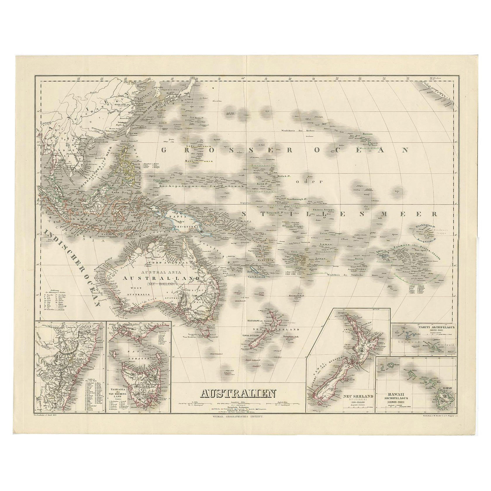
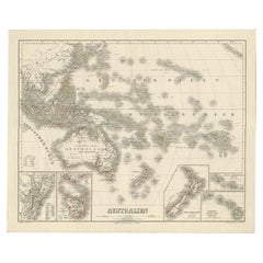
- Map of Australia, New Zealand, Part of China, Japan and Southeast Asia, 1857Located in Langweer, NLGerman Antique map titled 'Australien'. Map of Australia, New Zealand, part of China, Japan and Southeast Asia. In the upper right is a bit of the California coast by San Francisco. ...Category
Antique 19th Century Maps
MaterialsPaper
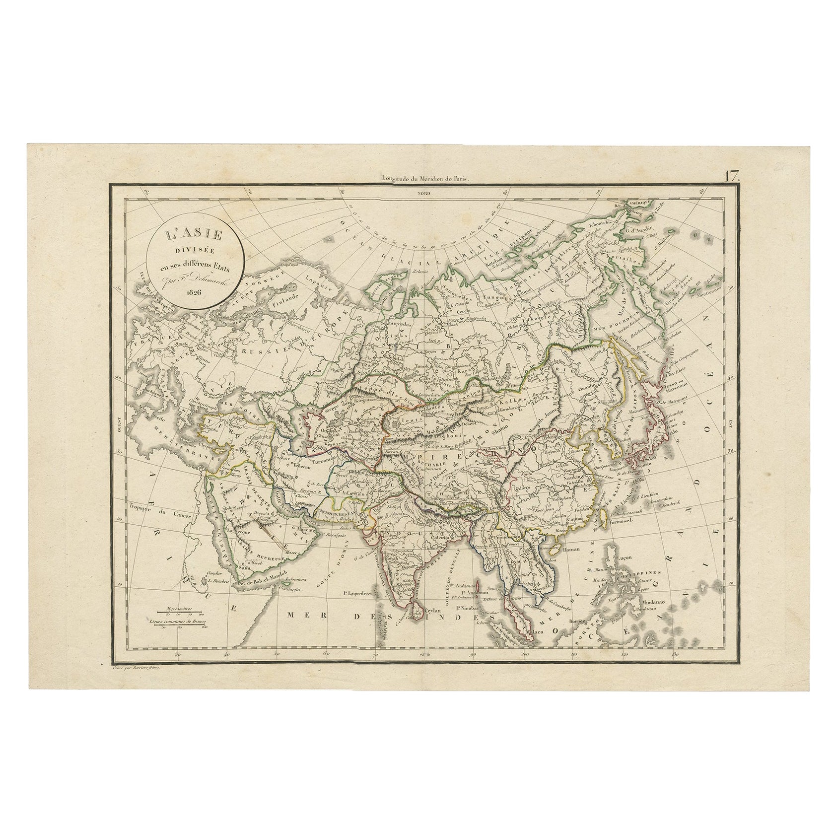
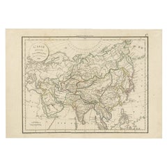
- Antique Map of Asia by Delamarche, 1826Located in Langweer, NLVaugondy's map plates and copyrights and later addes many plates from other sources as well. Charles Delamarche eventually passed control of the firm to his son Felix Delamarche (18t...Category
Antique 19th Century Maps
MaterialsPaper
- Antique Map of India to Southeast AsiaLocated in Langweer, NLAntique map titled 'Indes en-decà et au-delà du Gange'. Original old map of India to Southeast Asia, showing India, Nepal, Bhutan, Sri Lanka (Ceylon), Myanmar (Birma), part of Indone...Category
Antique Mid-19th Century Maps
MaterialsPaper
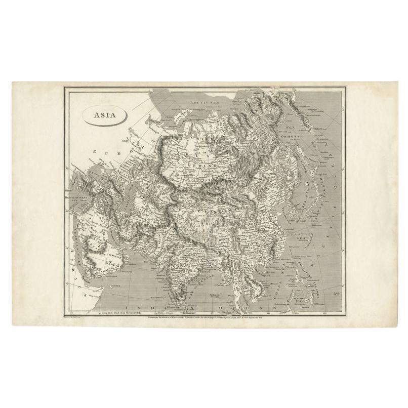
- Antique Map of Asia including Arabia, 1806Located in Langweer, NLAntique map titled 'Asia'. Original antique map of the Asian continent engraved by E. Jones. Artists and Engravers: Drawn under the direction of Mr. Arrowsmith. Published in 1806...Category
Antique 19th Century Maps
MaterialsPaper
- Antique Map of Southeast Asia by Ortelius '1587'By Abraham OrteliusLocated in Langweer, NLAntique map titled 'Indiae Orientalis Insularumque Adiacientium Typus'. Ortelius includes early European depictions of both Japan and China and is the first to name Formosa (Taiwan). The Philippines and East Indies or Spice Islands are shown based upon Portuguese and Spanish sources, and before their penetration by the Dutch. Japan is shown in kite form, as a large oval island...Category
Antique 16th Century Maps
MaterialsPaper

- Antique Map of Southeast Asia by J. Ottens, 1710Located in Langweer, NLAntique map titled 'Le Royaume de Siam avec Les Royaumes Qui Luy sont Tributaries'. Influential map of Southeast Asia. Ottens incorporated information provided by the French Jesuits ...Category
Antique Early 18th Century Maps
MaterialsPaper


You May Also Like
- Antique French Map of Asia Including China Indoneseia India, 1783Located in Amsterdam, Noord HollandVery nice map of Asia. 1783 Dedie au Roy. Additional information: Country of Manufacturing: Europe Period: 18th century Qing (1661 - 1912) Condition: Overall Condition B (Good Used)...Category
Antique 18th Century European Maps
MaterialsPaper
- Antique 1803 Italian Map of Asia Including China Indoneseia IndiaLocated in Amsterdam, Noord HollandAntique 1803 Italian Map of Asia Including China Indoneseia India Very nice map of Asia. 1803. Additional information: Type: Map Country of Manufacturing: Europe Period: 19th centu...Category
Antique 19th Century European Maps
MaterialsPaper
- Large University Chart “Physical Map of Africa” by BaconLocated in Chillerton, Isle of WightLarge university chart “Physical Map of Africa” by Bacon W&A K Johnston’s Charts of Physical Maps By G W Bacon, This is colorful Physical map of North America, it is large lithograph set...Category
Early 20th Century Folk Art Posters
MaterialsLinen
- Large University Chart “Political Map of North America” by BaconLocated in Chillerton, Isle of WightLarge University Chart “Political Map of North America” by Bacon W&A K Johnston’s Charts of Physical Maps By G W Bacon, This is colourful Physical map ...Category
Early 20th Century American Empire Posters
MaterialsLinen
- Large University Chart “Political Map of North America” by BaconLocated in Chillerton, Isle of WightLarge University chart “Political Map of North America” by Bacon W&A K Johnston’s Charts of Political Maps by G W Bacon, This is colorful Physical ...Category
Early 20th Century American Empire Posters
MaterialsLinen
- Set of 10 Large Scale Vintage Maps of The United Kingdom, circa 1900Located in St Annes, LancashireGreat set of maps of the UK Lithographs. By John Bartholomew & Co. Published by The Edinburgh Geographical Institute Unframed. The measurement ...Category
Antique Early 1900s English Maps
MaterialsPaper