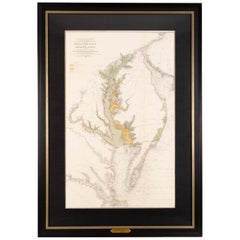
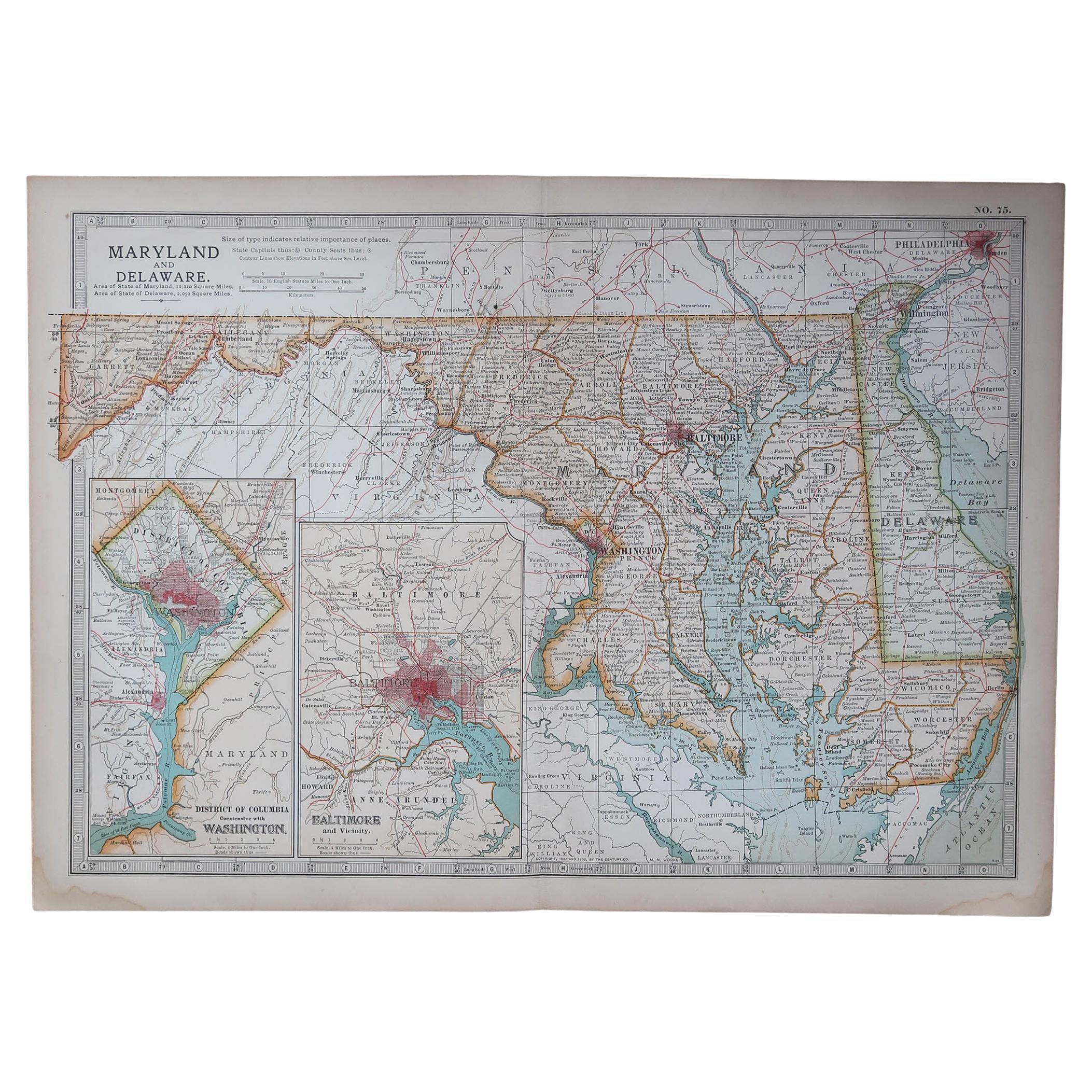
1893 Antique Map Showing the Location of the Natural Oyster Grounds of Maryland
View Similar Items


Want more images or videos?
Request additional images or videos from the seller
1 of 6
1893 Antique Map Showing the Location of the Natural Oyster Grounds of Maryland
About the Item
- Dimensions:Height: 46.5 in (118.11 cm)Width: 32.75 in (83.19 cm)Depth: 1.5 in (3.81 cm)
- Materials and Techniques:
- Place of Origin:
- Period:
- Date of Manufacture:1893
- Condition:Wear consistent with age and use.
- Seller Location:Colorado Springs, CO
- Reference Number:Seller: M1951stDibs: LU909717756592
About the Seller
4.9
Platinum Seller
Premium sellers with a 4.7+ rating and 24-hour response times
Established in 2010
1stDibs seller since 2011
452 sales on 1stDibs
Authenticity Guarantee
In the unlikely event there’s an issue with an item’s authenticity, contact us within 1 year for a full refund. DetailsMoney-Back Guarantee
If your item is not as described, is damaged in transit, or does not arrive, contact us within 7 days for a full refund. Details24-Hour Cancellation
You have a 24-hour grace period in which to reconsider your purchase, with no questions asked.Vetted Professional Sellers
Our world-class sellers must adhere to strict standards for service and quality, maintaining the integrity of our listings.Price-Match Guarantee
If you find that a seller listed the same item for a lower price elsewhere, we’ll match it.Trusted Global Delivery
Our best-in-class carrier network provides specialized shipping options worldwide, including custom delivery.More From This Seller
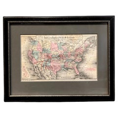
View All1879 Map of the United States, Showing the Santa Fe Railroad by GW & CB Colton
By G.W. & C.B. Colton
Located in Colorado Springs, CO
Presented is an original "General Map of the United States Showing the Lines of the Atchison, Topeka & Santa Fe Railroad and Its Connections with the Sea Ports". Undated, this map wa...
Category
Antique 1870s American High Victorian Maps
Materials
Paper
1899 Poole Brothers Antique Railroad Map of the Illinois Central Railroad
Located in Colorado Springs, CO
This is an 1899 railroad map of the Illinois Central and Yazoo and Mississippi Valley Railroads, published by the Poole Brothers. The map focuses on the continuous United States from the Atlantic to the Pacific Oceans, the Gulf of Mexico, and the Antilles. Remarkably detailed, the rail routes of the Illinois Central RR are marked in red, which each stop labeled. Major stops are overprinted in red, bold letters, with the short rail distances to New York listed above the stop and short rail distances to New Orleans listed below the name.
In addition to the Illinois Central network, numerous different rail lines are illustrated and the company running that line is noted along with many stops along each route. Sea routes from New Orleans to locations in Central America, the Caribbean, and Europe are marked and labeled with destination and distance, along with routes originating from Havana. Inset at bottom left is a map of Cuba; an inset map of Puerto Rico...
Category
Antique 1890s American Maps
Materials
Paper

1812 United States Map, by Pierre Tardieu, Antique French Map Depicting the U.S.
By Pierre François Tardieu
Located in Colorado Springs, CO
1812 "United States of Nth America -- Carte des Etats-Unis De L'Amerique Septentrionale" Two-Sheet Map by Tardieu
This attractive map, published in Paris in 1812, is one of the most rare large format maps from the period. It features a view of the East Coast of the U.S. from Maryland to just below South Carolina. Additionally, Ellicott’s plan for the City of Washington D.C. is included at the top right and an illustration of Niagara Falls is shown at the bottom right with a description in both French and English. This extremely detailed map not only depicts the mountainous regions of the southeastern U.S., but also includes names of regions, rivers, and towns.
Based on the first state of Arrowsmith’s 4-sheet map of the United States, this map is completely engraved by Tardieu in Paris and showcases high quality engravings. This detailed map of the recently independent United States includes one of the largest and earliest examples of the Ellicott plan of Washington DC.
The artist, Pierre François Tardieu (PF Tardieu) was a very well-known map engraver, geographer, and illustrator. Awarded a bronze medal by King Louis-Phillipe for the accuracy and beauty of his map-making, Tardieu produced many fine works including maps of Louisiana...
Category
Antique 1810s French Maps
Materials
Paper

1854 Map of Massachusetts, Connecticut and Rhode Island, Antique Wall Map
Located in Colorado Springs, CO
This striking wall map was published in 1854 by Ensign, Bridgman & Fanning and has both full original hand-coloring and original hardware. This impression is both informative and highly decorative.
The states are divided into counties, outlined in red, green, and black, and subdivided into towns. Roads, canals, and railroad lines are prominently depicted, although they are not all labeled. The mapmakers also marked lighthouses, banks, churches, and prominent buildings, with a key at right. The map is an informative and comprehensive overview of the infrastructural development of New England prior to the Civil War. Physical geographies depicted include elevation, conveyed with hachure marks, rivers and lakes. The impression features an inset map of Boston...
Category
Antique 19th Century American Maps
Materials
Paper

"The United States from the Latest Authorities" Antique Wall Map, 1835
Located in Colorado Springs, CO
This is a 1835 map of “The United States from the Latest Authorities” by Ezra Strong. A hand-colored engraved wall map of the eastern half of the United States, this map has a large inset of the "Oregon District" and several engraved city views and two portraits.
The primary map extends to Mexico Texas and the Missouri Territory, showing the course of the Missouri River to Ft. Mandan and Old Ft. Mandan, and noting many forts along the river. The territories to the east of Missouri Territory are separately delineated as Sioux District and Huron District. The western details of the map are very good for a map of this time period, with many Native American settlements, villages, forts and other details noted.
The map is bordered with vignettes of Boston, New York, Philadelphia, Hartford, Cincinnati, and Baltimore. Each vignette notes the date settled, primary settler, and the population as of 1830. Two portraits of LaFayette and George Washington are presented in full length with related biographical information.
A large inset map at lower right shows the Oregon District, centered on the Columbia River and extending to the Rocky Mountains. This is one of the earliest commercial appearances of a separate map of Oregon...
Category
Antique 1830s American Maps
Materials
Paper

1904 "Nell's Topographical Map of the State of Colorado"
Located in Colorado Springs, CO
This highly detailed pocket map is a topographical map of the state of Colorado by Louis Nell from 1904. The map "has been compiled from all available...
Category
Antique Early 1900s American Maps
Materials
Leather, Paper

You May Also Like
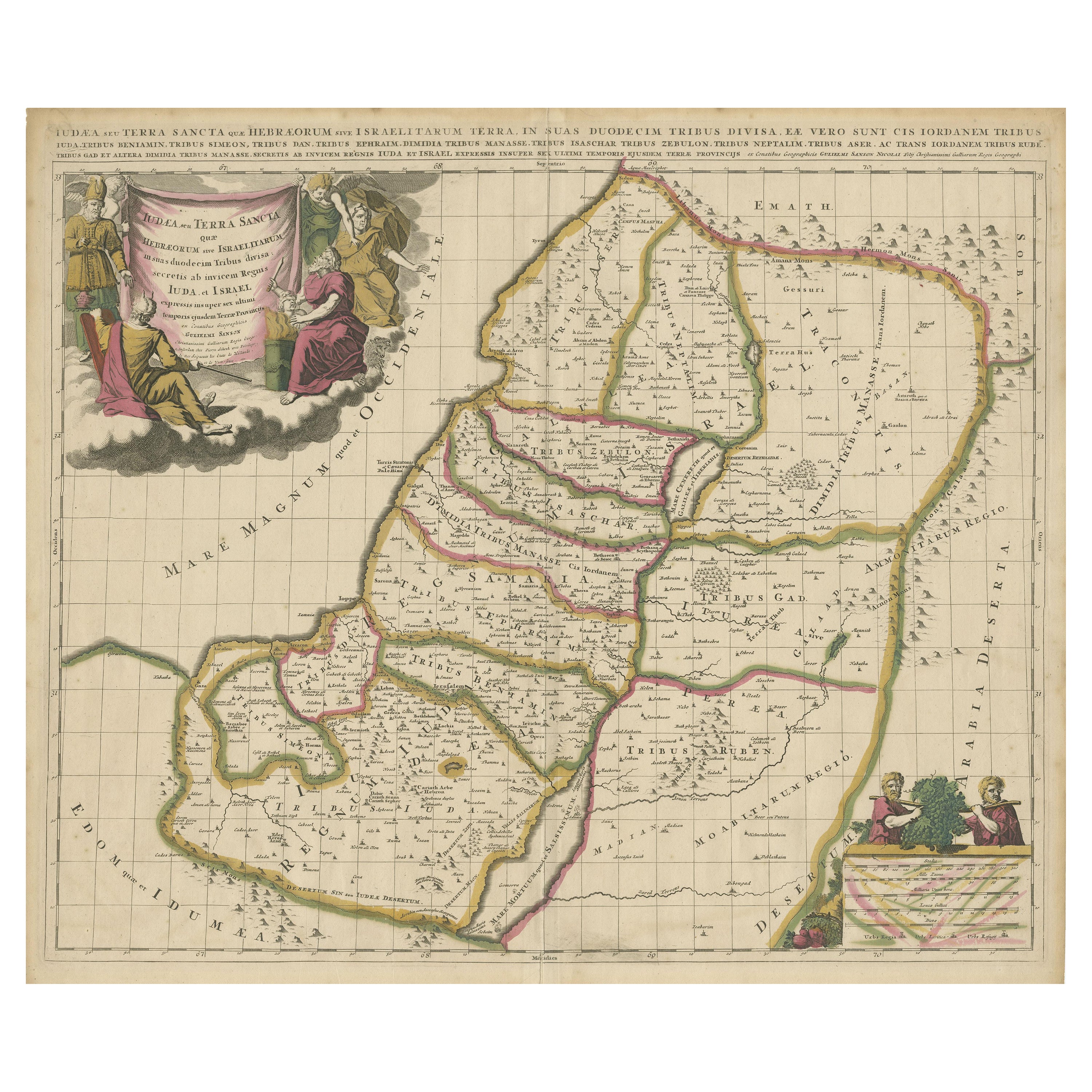
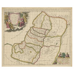
Antique Map of the Holy Land, Showing the Location of the Various Tribes
Located in Langweer, NL
Antique map titled 'Judaea seu Terra Sancta quae Hebraeorum sive Israelitarum (..)'. Map of The Holy Land, showing the location of the various tribes, in two kingdoms, Judah and Isra...
Category
Antique Early 18th Century Maps
Materials
Paper
$1,107 Sale Price
20% Off
Free Shipping
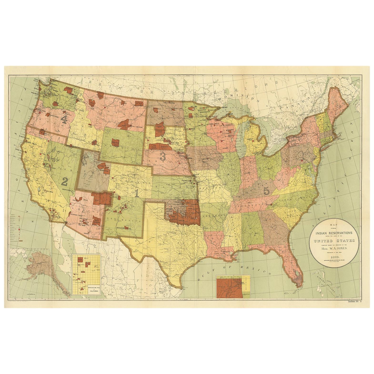
Antique Map Showing the Locations of Native American Tribes in 1899
Located in Langweer, NL
Antique map titled 'Map showing the Indian Reservations within the Limits of the United States'. Large folding map of the United States showing the Indian Reservations. The present m...
Category
Antique Late 19th Century Maps
Materials
Paper
$599 Sale Price
20% Off
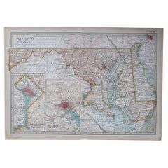
Original Antique Map of the American State of Maryland & Delaware, 1903
Located in St Annes, Lancashire
Antique map of Maryland And Delaware
Published By A & C Black. 1903
Original colour
Good condition
Unframed.
Free shipping
Category
Antique Early 1900s English Maps
Materials
Paper
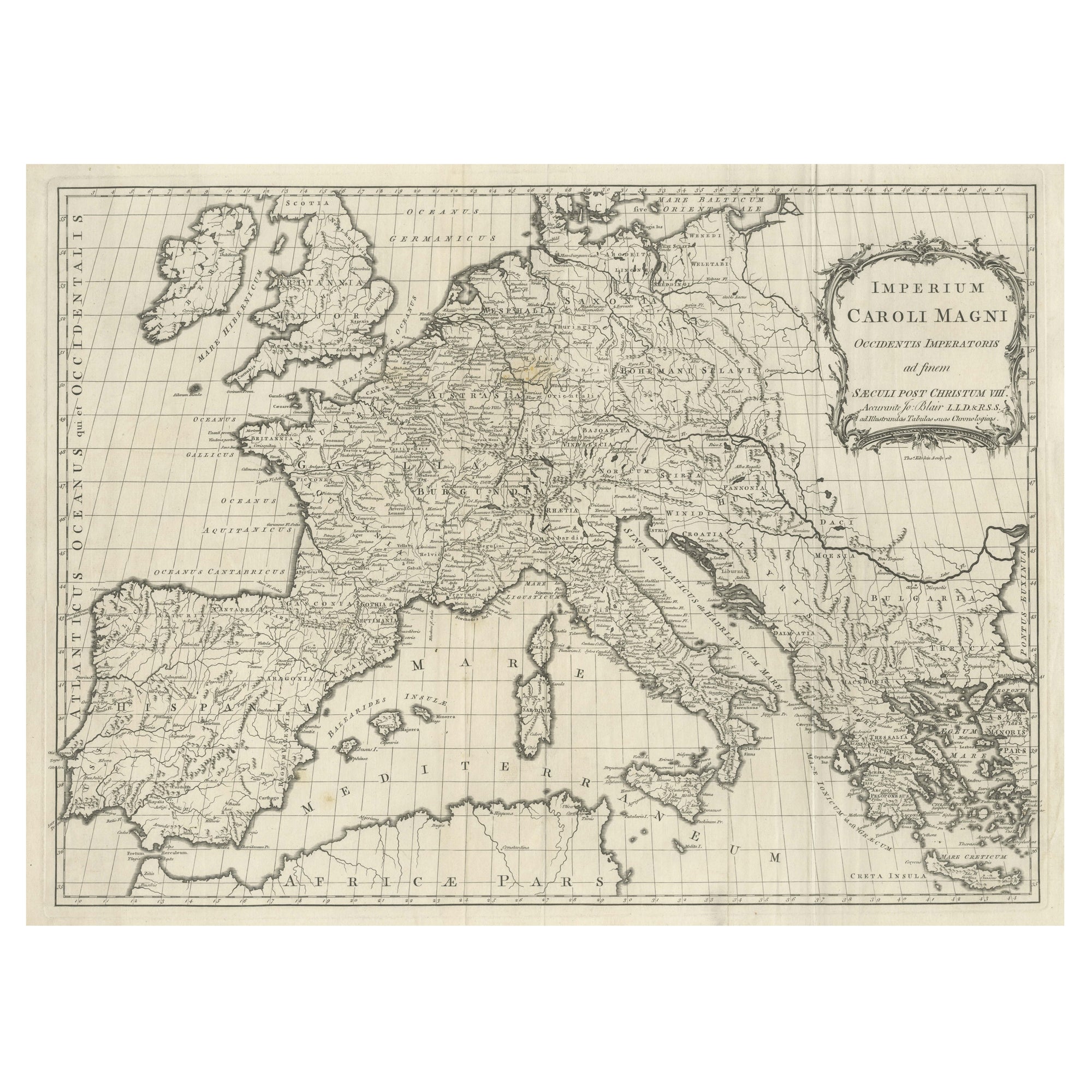
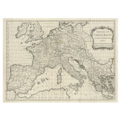
Large Antique Map of Europe, Showing the Empire of Charlemagne
Located in Langweer, NL
Antique map titled 'Imperium Caroli Magni (..)'. Large antique map of Europe, showing the Empire of Charlemagne in the 8th Century. Engraved by T. Kitchin. Published J. Blair, circa ...
Category
Antique Late 18th Century Maps
Materials
Paper
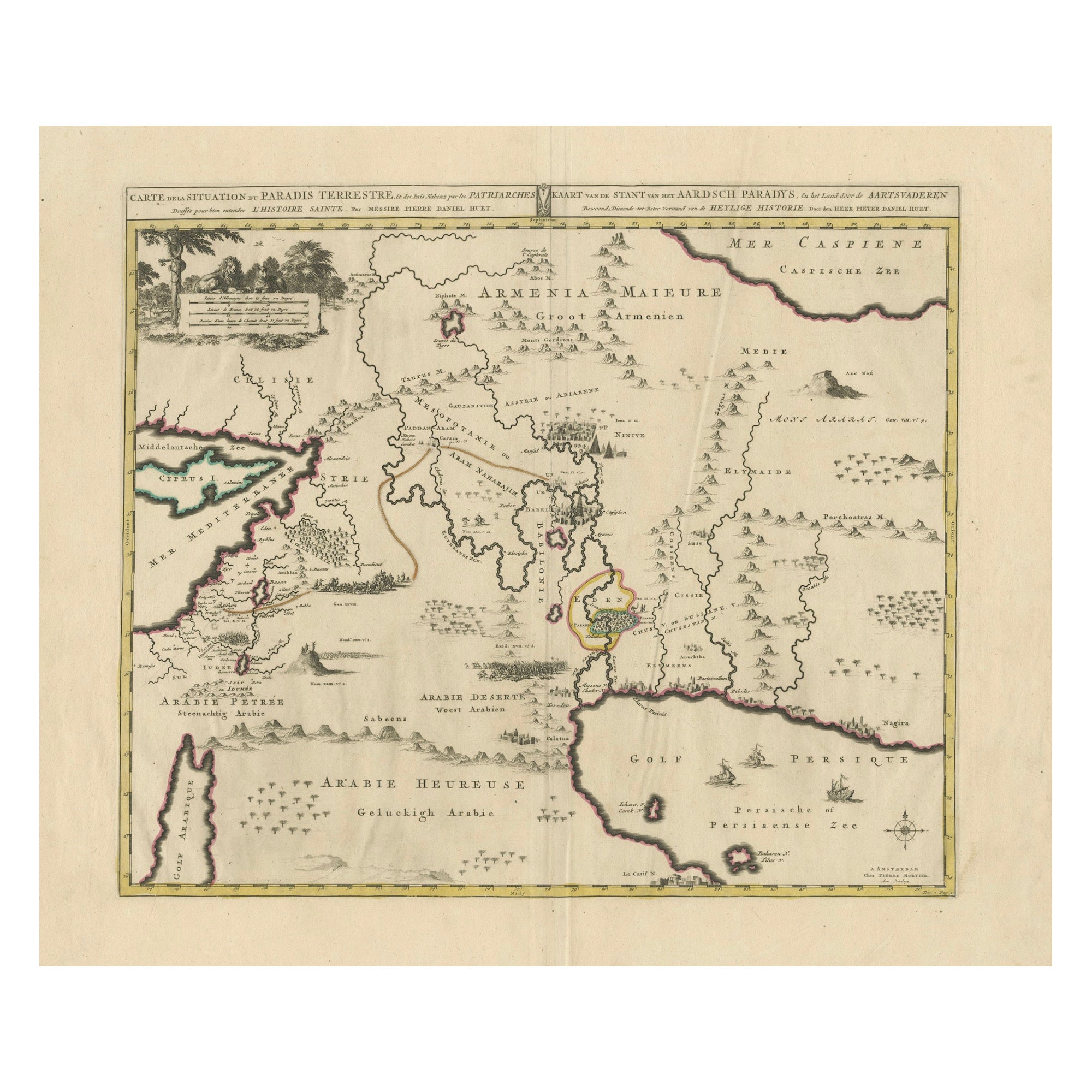
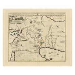
Antique Map of the Location of the Garden of Eden and Travels of the Patriarchs
Located in Langweer, NL
Title: Map of the Location of the Garden of Eden and Travels of the Patriarchs
Cartographer/Publisher:
Pieter Mortier (1661–1711), published by Covens & Mortier (Amsterdam, 1725)...
Category
Antique 1720s Maps
Materials
Paper
Antique Map of the United States of America, also showing the Caribbean
Located in Langweer, NL
Antique map titled 'Verein-Staaten von Nord-America, Mexico, Yucatan u.a.'. Very detailed map of the United States of America showing the ...
Category
Antique Mid-19th Century Maps
Materials
Paper

Recently Viewed
View AllMore Ways To Browse
English Prints 1800s
English Country Bed
Antique Maps Virginia
Long Tong
Antique Maps Of Maryland
Washington Dc Map
Antique Chesapeake Bay Map
Chesapeake Bay Map
Antique Maps Washington Dc
Sri Lanka Map
Used Marine Compass
Antique Furniture Columbus
Antique Map Ceylon
Antique Pamphlets
Philippines Map
Antique German Compass
Antique Maps Of New York City
Antique Sri Lanka Map