Maps
to
1,936
2,521
131
2,657
79
18
9
6
5
4
4
4
3
1
1
2,936
2,181
476
3
289
34
10
127
7
35
9
2
5
4
4
2
2,579
92
35
30
30
329
228
143
126
112
2,657
2,657
2,657
104
29
9
8
7
Maps For Sale
Period: 20th Century
Period: 19th Century
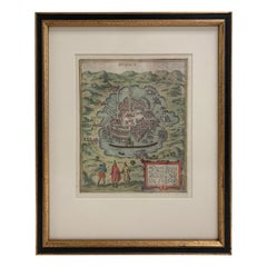
Mexico City by Braun & Hogenberg c. 1590
Located in Stamford, CT
Mexico by Braun & Hogenberg c. 1590
Category
Mid-19th Century European Spanish Colonial Antique Maps
Materials
Glass, Wood, Paper
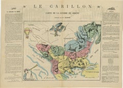
1877 Satirical Map of the Eastern War: Europe's Powers as Caricatured Characters
Located in Langweer, NL
Title: 1877 Caricature Map of the Eastern War - "Carte de la Guerre en Orient" by H. Demare
Description: This 1877 satirical map, titled "Carte de la Guerre en Orient," was publis...
Category
1870s Antique Maps
Materials
Paper
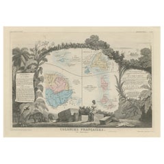
Map of French Colonies in the Americas: St. Martin, French Guiana and St. Pierre
Located in Langweer, NL
This is an intricately detailed map from 1852 titled *Colonies Françaises en Amérique*, depicting several key French colonies in the Americas.
The map focuses on regions such as Fr...
Category
1850s Antique Maps
Materials
Paper
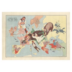
WWI Satirical Cartoon Map: 'Kill That Eagle' by J.H. Amschewitz, 1914
Located in Langweer, NL
This fascinating serio-comic map was created by John Henry Amschewitz and published in December 1914, at the beginning of WWI.
Amschewitz was a British born artist who was unable to enlist for war service due to an injury he sustained while working on a mural project in Liverpool. Instead Amschewitz focused on his interests in art and theater, themes which are apparent in this map and even the title itself: European Revue.
The eagle refers of course to Germany, which has its claw on Marianne's bayonet, while its other claw is being pulled by the Russian bear...
Category
1910s Vintage Maps
Materials
Paper
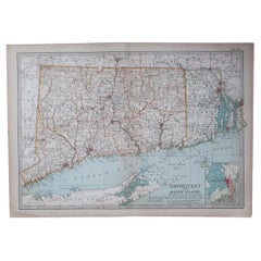
Original Antique Map of the American State of Connecticut & Rhode Island, 1903
Located in St Annes, Lancashire
Antique map of Connecticut and Rhode Island
Published By A & C Black. 1903
Original colour
Good condition
Unframed.
Free shipping
Category
Early 1900s English Antique Maps
Materials
Paper
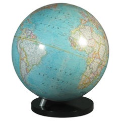
16-Inch Terrestrial Globe 1986 National Geographic
Located in Ottawa, Ontario
A 16-INCH TERRESTRIAL GLOBE 1986
NATIONAL GEOGRAPHIC
Large terrestrial globe with paper gores
on a stylish black lucite base
scale 1: 31,350,000
18" inches, (45.5cm.) high.
16" in...
Category
Late 20th Century American Modern Maps
Materials
Metal
Antique Map of Ireland, 1903, with Intricate County Boundaries & Coastal Details
Located in Langweer, NL
Title: Antique Map of Ireland, 1903, with Intricate County Boundaries and Coastal Detail
Description:
This antique map of Ireland, engraved and published in 1903 by the esteemed W. ...
Category
Early 20th Century Maps
Materials
Paper
Antique Map of The United States of North America, Pacific States, 1882
Located in Langweer, NL
The map is from the same 1882 Blackie Atlas and focuses on the Pacific States of the United States of America during that period. Here are some details and historical context about t...
Category
1880s Antique Maps
Materials
Paper
Large Antique County Map of Cornwall and the Isles of Scilly, England
Located in Langweer, NL
Antique map titled 'A Map of Cornwall from the best Authorities'. Original old county map of Cornwall, England. With inset map of the Scilly Islands. Engraved by John Cary. Originate...
Category
Early 19th Century Antique Maps
Materials
Paper
1930s AM Radio Map of US, Canada, Cuba, Mexico – Stations & Frequencies
Located in Langweer, NL
Title: 1930s Lewis Bros. Limited Detailed Radio Station Map of the United States and Canada – AM Stations, Call Signs, Frequencies, Vintage Advertising
Detailed Description: This v...
Category
1930s Vintage Maps
Materials
Paper
18th-Century Dutch Garden Design by Gijsbert van Laar, Published in 1802
Located in Langweer, NL
18th-Century Dutch Garden Design by Gijsbert van Laar – Magazijn van tuin-sieraaden, 1802
This exquisite hand-colored engraving is from the renowned work 'Magazijn van tuin-sieraa...
Category
Early 1800s Antique Maps
Materials
Paper
Antique Map of The Regions of Italy and Sicily during the Roman Empire, 1880
Located in Langweer, NL
This map is an original antique engraving titled "ITALIAE REGIONES IIII SICILIA," which translates to "The Regions of Italy and Sicily." This detailed historical map portrays the reg...
Category
1880s Antique Maps
Materials
Paper
Original Antique Map of the American State of Colorado, 1903
Located in St Annes, Lancashire
Antique map of Colorado
Published By A & C Black. 1903
Original colour
Good condition
Unframed.
Free shipping
Category
Early 1900s English Antique Maps
Materials
Paper
Monumental Framed Medieval Facsimile Map Of The World Fra Mauro Wood Wall Panel
Located in Forney, TX
A remarkable palatial nearly 7.5ft x 7.5ft facsimile of the important Map of the World (circa 1450) by Fra MauroFra Mauro (Italian; circa 1400–1464), featuring a solid wood framed hi...
Category
Early 20th Century Medieval Maps
Materials
Linen, Wood, Paper
Majestic Map of Europe by Andriveau-Goujon - Complete Continental View - ca.1849
Located in Langweer, NL
Majestic 19th Century Map of Europe by Andriveau-Goujon - Complete Continental View - Circa 1849
This magnificent and intricately detailed map of Europe, titled "Carte Physique et...
Category
1840s Antique Maps
Materials
Paper
An Ornate and Historical Tallis Map of Jamaica with Decorative Vignettes, 1851
Located in Langweer, NL
This original antique map of Jamaica is part of the renowned series created by the Tallis Company, known for their detailed and decorative maps ...
Category
1850s Antique Maps
Materials
Paper
Antique 1830 Map of Southern Scotland with Edinburgh, Berwick, Ayr, and Dumfries
Located in Langweer, NL
Title: Antique 1830 Map of Southern Scotland with Edinburgh, Berwick, Ayr, and Dumfries
Description: This 1830 German-language map, titled Britisches Reich – B. Kon Scotland, fo...
Category
1830s Antique Maps
Materials
Paper
Antique Map of Austria- Hungary by Johnston '1909'
Located in Langweer, NL
Antique map titled 'Austria- Hungary'. Original antique map of Austria- Hungary. With inset maps of Vienna, Dalmatia and Herzegovina. This map o...
Category
Early 20th Century Maps
Materials
Paper
Old World Map Featuring Captain Cook's Exploration Routes and Polar Views, 1787
Located in Langweer, NL
1786 World Map with Polar Projections - "Globo Terrestre" by Giovanni Maria Cassini
This 1786 map titled "Globo Terrestre" by Giovanni Maria Cassini offers a fascinating and detai...
Category
1860s Antique Maps
Materials
Paper
Antique Map of North America by Lowry '1852'
Located in Langweer, NL
Antique map titled 'North America'. Original map of North America. This map originates from 'Lowry's Table Atlas constructed and engraved from the...
Category
Mid-19th Century Antique Maps
Materials
Paper
Decorative 1864 Civil War Era Map of Indiana with Lake Michigan Detail
Located in Langweer, NL
Title: Rare 1864 Civil War Era Map of Indiana with Lake Michigan Detail
Description: This finely detailed antique map, titled "Johnson's Indiana," was published in 1864 by Johnson a...
Category
1860s Antique Maps
Materials
Paper
Rare 1864 Civil War Era Map of Illinois with Lake Michigan Detail
Located in Langweer, NL
Title: Rare 1864 Civil War Era Map of Illinois with Lake Michigan Detail
Description: This intricately detailed antique map, titled "Johnson's Illinois," was published in 1864 by Jo...
Category
1860s Antique Maps
Materials
Paper
The Highlands and Lowlands of Scotland as Mapped in 1882
Located in Langweer, NL
Title: 1882 Blackie Atlas Maps of Scotland: Northern and Southern Regions
Description: These two maps from the 1882 Blackie Atlas provide a detailed representation of Scotland, spli...
Category
1880s Antique Maps
Materials
Paper
Original Antique Map of the American State of Maine, 1903
Located in St Annes, Lancashire
Antique map of Maine
Published By A & C Black. 1903
Original colour
Good condition
Unframed.
Free shipping
Category
Early 1900s English Antique Maps
Materials
Paper
1850-1960 Cram's Superior Latest Federal Census Texas Map
By G. F. Cram Company
Located in New York, NY
The 1850-1960 Cram's Superior Latest Federal Census Texas Map, crafted from pine wood, steel, and canvas, is a valuable historical cartographic piece. Publi...
Category
1910s American Vintage Maps
Materials
Canvas
Original Antique Map of the American State of Washington, 1889
Located in St Annes, Lancashire
Great map of Washington
Drawn and Engraved by W. & A.K. Johnston
Published By A & C Black, Edinburgh.
Original colour
Unframed.
Category
1880s Scottish Victorian Antique Maps
Materials
Paper
Pl. 89 Antique Print of Decorative Art in the 18th Century by Racinet, 1869
Located in Langweer, NL
Old print of decorative art in the 18th century. This print originates from 'L'Ornement polychrome'. A beautiful work containing about 2000 patterns of all the styles of Art old and ...
Category
19th Century Antique Maps
Materials
Paper
Original Antique Map of the American State of California ( Southern Part ), 1903
Located in St Annes, Lancashire
Antique map of California ( Southern part )
Published By A & C Black. 1903
Original colour
Good condition
Unframed.
Free shipping
Category
Early 1900s English Antique Maps
Materials
Paper
Plan of Paris, France, by A. Vuillemin, Antique Map, 1845
Located in Colorado Springs, CO
This large and detailed plan of Paris was published by Alexandre Vuillemin in 1845. The map conveys a wonderful amount of information and is decorated throughout with pictorial vigne...
Category
1840s American Antique Maps
Materials
Paper
Large Original Antique Map of The Canary Islands. 1894
Located in St Annes, Lancashire
Superb Antique map of The Canary Islands
Published Edward Stanford, Charing Cross, London 1894
Original colour
Good condition
Unframed.
Free shipping
Category
1890s English Antique Maps
Materials
Paper
Antique Map of the Gulf of Mexico and Caribbean Islands by Tardieu, 1802
Located in Langweer, NL
This is an original antique map titled "Carte du Golfe du Mexique et des Isles Antilles," depicting the Gulf of Mexico and the Caribbean islands. Created by Pierre Antoine Tardieu, t...
Category
Early 1800s Antique Maps
Materials
Paper
1847 Amerique Septentrionale Framed Map
Located in Stamford, CT
1847 Amerique Septentrionale Framed Map Illustrated by Raimond Bonheur. As found framed condition.
Category
1840s American American Classical Antique Maps
Materials
Glass, Wood, Paper
Antique Map of the Antilles in the Caribbean, '1875'
Located in Langweer, NL
Antique map titled 'Carte des Iles Antilles'. Large map of the Antilles. This map originates from 'Atlas de Géographie Moderne Physique et Politique' by A. Levasseur. Published, 1875.
Category
Late 19th Century Antique Maps
Materials
Paper
Gold Rush Era Masterpiece: The Tallis & Rapkin Rare Map of Pre-Queensland, 1851
Located in Langweer, NL
The image is an original historical map of Australia from the year 1851, created by John Rapkin with illustrations by J. Marchant and engravings by J. B. Allen. The map was published...
Category
1850s Antique Maps
Materials
Paper
Original Antique Map of the American State of Illinois ( Northern Part ), 1903
Located in St Annes, Lancashire
Antique map of Illinois ( Northern part )
Published By A & C Black. 1903
Original colour
Good condition
Unframed.
Free shipping
Category
Early 1900s English Antique Maps
Materials
Paper
Large European 1930's Nautical Map Reader Magnifying Glass
Located in Haddonfield, NJ
This European set of two nautical magnifying glass map-readers are quite unusual and rarely found. It is fully encased in it's heavy wooden and metal enforced box. Hailing from betwe...
Category
1930s German Industrial Vintage Maps
Materials
Metal
Original Antique Map of the American State of Michigan ( Northern Part ), 1903
Located in St Annes, Lancashire
Antique map of Michigan ( Northern part )
Published By A & C Black. 1903
Original colour
Good condition
Unframed.
Free shipping
Category
Early 1900s English Antique Maps
Materials
Paper
Original Antique Map of the American State of Kansas, 1903
Located in St Annes, Lancashire
Antique map of Kansas
Published By A & C Black. 1903
Original colour
Good condition
Unframed.
Free shipping
Category
Early 1900s English Antique Maps
Materials
Paper
European Vintage Earth Globe on Stand with Compass
Located in Sofia, BG
Vintage handmade world globe standing on a base with small compass in the bottom. The piece is in fare condition with no restaurations ever made.
France, circa 1950
Category
Mid-20th Century French Maps
Materials
Plastic, Paper
Original Antique Map of the American State of New Jersey, 1903
Located in St Annes, Lancashire
Antique map of New Jersey
Published By A & C Black. 1903
Original colour
Good condition
Unframed.
Free shipping
Category
Early 1900s English Antique Maps
Materials
Paper
Map of New Zealand Showing Maori Culture and Early Colonial Settlements, 1851
Located in Langweer, NL
John Tallis & Company were renowned for their ornate and detailed maps in the mid-19th century. Their works often featured elaborate borders, decorative motifs, and insets of vignett...
Category
1850s Antique Maps
Materials
Paper
Original Antique Map of the American State of Ohio ( Northern Part ), 1903
Located in St Annes, Lancashire
Antique map of Ohio ( Northern part )
Published By A & C Black. 1903
Original colour
Good condition
Unframed.
Free shipping
Category
Early 1900s English Antique Maps
Materials
Paper
Gateway to the Steppes: Tallis's Masterpiece Map of Indepent Tartary, 1851
Located in Langweer, NL
The map is of "Independent Tartary," a historical region in Central Asia that covered parts of what are now Kazakhstan, Uzbekistan, Turkmenistan, and surrounding areas. The map was p...
Category
1850s Antique Maps
Materials
Paper
Levasseur's 1852 Cartographic Portrait of Gironde: Celebrating the Bordeaux Wine
Located in Langweer, NL
This original hand-colored map is from the "Atlas National Illustré," a work by Victor Levasseur, a French geographer and cartographer known for his richly illustrated maps.
The map is a steel engraving, which was a common and precise method for creating maps at the time. The inclusion of the publisher's name, A. Combette from Paris, and the addresses of the various contributors to the map's creation, like the engravers Laguillermie and Rainaud, adds to the historical context of the piece.
The margins of the map are adorned with detailed illustrations that serve as a visual encyclopedic reference to the region's geography, economy, and notable figures. The use of color along the boundaries makes the map not only a tool for navigation but also an educational resource, providing insights into the department's landscape, economy, and cultural significance.
The text included in the map's design provides statistical information, a map legend, and discussions about the land, local curiosities, notable personalities, products, and commerce, which would have been invaluable for education and reference at the time.
The 'Atlas National Illustré' is celebrated for its combination of cartographic detail and artistic embellishment, making it a valuable cultural artifact. It represents the height of decorative map-making in the 19th century, alongside the works of John Tallis and Archibald Fullarton.
This uploaded image is a detailed and colored map of the Département de la Gironde from Victor Levasseur's "Atlas National Illustré." Similar to the other maps from this series, it features a central map with the title 'Dépt. de la Gironde' at the bottom.
Surrounding the map are decorative vignettes and elements that bring to life the cultural and economic aspects of the Gironde department. On the left, there is likely statistical information about the department and its subdivisions, reflecting the population and administrative details. This is framed by images that may represent the local industries and natural resources, such as wine, which is a central feature of the Bordeaux region located within Gironde.
The right side of the map contains a textual history and descriptions of the region, coupled with portraits of notable figures, possibly historic personages or contributors to the region's cultural and economic development. The illustrations often include agricultural products, symbols of commerce, and scenes of daily life, as well as architectural landmarks.
The presence of wine bottles, barrels, and vineyards in the illustrations would be indicative of the Gironde's prominence in wine production, particularly Bordeaux wines, which are esteemed worldwide. These engravings serve to emphasize the richness of the land and the sophistication of its products.
Maps from this era, especially those by Levasseur, are notable for their combination of art and education, providing a snapshot not only of the geography but also of the societal and economic conditions of the time. The detailed engravings also suggest that this map was as much a decorative piece as it was a functional one, intended for display and reference by those interested in the illustrated region.
The Gironde department in France is renowned for its significant contribution to the wine industry, particularly through the Bordeaux wine region. A bit more about the important places within Gironde and the types of wine the area is known for:
1. **Bordeaux**: The capital city of the department and the heart of the wine region. It's not only an urban center but also a hub for the wine trade.
2. **Médoc**: North of Bordeaux, known for prestigious châteaux and wines like Margaux, Saint-Julien, Pauillac, and Saint-Estèphe.
3. **Saint-Émilion**: East of Bordeaux, recognized for its full-bodied red wines and the picturesque medieval town.
4. **Pomerol**: Also near Saint-Émilion, smaller than its neighbor but equally renowned, particularly for Château Pétrus...
Category
1850s Antique Maps
Materials
Paper
Antique Map of Cuba, Haiti and Porto Rico by W. G. Blackie, 1859
Located in Langweer, NL
Antique map titled 'The Leeward or North Caribbean Islands'. Original antique map of Cuba, Haiti and Porto Rico. This map originates from ‘The Imperial Atla...
Category
Mid-19th Century Antique Maps
Materials
Paper
Set of 5 Antique Prints of Ancient Buildings in Rome and its Vicinity, 1844
Located in Langweer, NL
Beautiful set off of 5 aquatint prints of old Rome, Italy, including the popular view of the Coliseum.
Matthew Dubourg (active 1786 – 1838)
From "Views of the Remains of Ancient Bu...
Category
Mid-19th Century European Antique Maps
Materials
Paper
Ancient Italy: Regions and Rome in the Roman Empire, Published in 1880
Located in Langweer, NL
This print is an original detailed map titled "ITALIAE REGIONES I VII VIII IX XI," representing the regions of ancient Italy.
Key Features of the Print:
1. **Regional Demarcations...
Category
1880s Antique Maps
Materials
Paper
Framed Mid-19th Century Wall Map of Long Island, the Hamptons
Located in Sag Harbor, NY
A Framed museum quality find. This large wall map dates to the mid-1800s. Detailed inset maps of, Sag Harbor, East Hampton, Amagansett, Shelter Island and most villages in Long Island. It also has agriculture stats for 1855. Detailed prints of homes on Scuttle Hole in Bridgehampton as well as several other detailed prints. Lists of businesses, distance tables and railroad schedules and stops. The total amount of detailed information about Suffolk County Long Island is staggering. A unique rare New York map...
Category
Mid-19th Century American Antique Maps
Materials
Linen, Paper
Original Antique Map of the American State of Ohio ( Southern Part ), 1903
Located in St Annes, Lancashire
Antique map of Ohio ( Southern part )
Published By A & C Black. 1903
Original colour
Good condition
Unframed.
Free shipping
Category
Early 1900s English Antique Maps
Materials
Paper
1821 Thomson Map of Guadeloupe, Marie-Galante and Antigua in the West Indies
Located in Langweer, NL
This map, published in 1821 by John Thomson, showcases Guadeloupe, Marie-Galante, and Antigua from the *West India Islands* collection. Part of Thomson's *New General Atlas*, it prov...
Category
1820s Antique Maps
Materials
Paper
Terrestrial Table Globe by Félix Delamarche, Paris, 1821
Located in Milano, IT
Terrestrial table globe
Félix Delamarche
Paris, 1821
It measures 20.47 in height, Ø max 14.17 in; the sphere Ø 9.44 in (h 52 cm x Ø max 36.5 cm; the sphere Ø 24 cm)
Wood, printed...
Category
1820s French Restauration Antique Maps
Materials
Metal
Original Antique Map of the American State of Michigan ( Southern Part ), 1903
Located in St Annes, Lancashire
Antique map of Michigan ( Southern part )
Published By A & C Black. 1903
Original colour
Good condition
Unframed.
Free shipping
Category
Early 1900s English Antique Maps
Materials
Paper
Original Antique Map of the American State of New York ( Western Part ) 1903
Located in St Annes, Lancashire
Antique map of New York ( Western Part )
Published By A & C Black. 1903
Original colour
Good condition
Unframed.
Free shipping
Category
Early 1900s English Antique Maps
Materials
Paper
Antique North America Map, USA, Canada, Mexico, Cartography, Colton, Victorian
Located in Hele, Devon, GB
This is an antique North America map. A USA, framed lithography atlas engraving of the continent by JH Colton, dating to the Victorian period and later, circa 1860.
Fascinating, large framed map...
Category
Mid-19th Century American Victorian Antique Maps
Materials
Paper
Antique 1830 Map of Scotland with Counties Renfrew, Stirling, Dumbarton and Bute
Located in Langweer, NL
Title: Antique 1830 Map of Scotland with Counties Renfrew, Stirling, Dumbarton, and Bute
Description:
This 1830 German-language map, titled Britisches Reich – B. Kon Scotland, ...
Category
1830s Antique Maps
Materials
Paper
World Globe With Wooden Foot, and Brass 20th Century
Located in Mombuey, Zamora
Beautiful and elegant ball of the world to decorate any studio, living room or bedroom, it is small, with the base about 26 cm high and 10 wide.
Category
20th Century Italian Other Maps
Materials
Brass
Antique Map of the Antilles and Central America – 1872
Located in Langweer, NL
Title: Antique Map of the Antilles and Central America – 1872
Description:
This finely detailed antique map, titled Antilles et Amérique Centrale, was published in 1872 under t...
Category
1870s Antique Maps
Materials
Paper
1847 Antique Map of Mexico, Texas and California by Samuel Augustus Mitchell
Located in Colorado Springs, CO
Presented is the second edition of Samuel Augustus Mitchell's Map of Mexico, Including Yucatan & Upper California, an important map showing the progress of the Mexican-American War. ...
Category
1840s American Antique Maps
Materials
Paper
