Maps
to
415
666
36
702
12
3
3
1
1
2,923
2,186
476
3
289
34
10
127
7
35
9
2
5
3
4
2
688
17
13
13
4
117
101
77
72
67
702
702
702
29
6
1
1
1
Maps For Sale
Period: Early 20th Century
Period: Late 19th Century
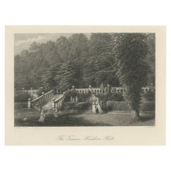
Steel Engraving of Haddon Hall, River Wye, Bakewell, Derbyshire, England, 1875
Located in Langweer, NL
Antique print titled 'The Terrace, Haddon Hall'.
Steel engraving of the terrace of Haddon Hall. Haddon Hall is an English country house on the River Wye ...
Category
1870s Antique Maps
Materials
Paper
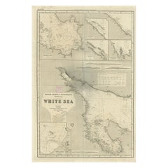
Uncommon, Large Map of the British Islands to Petshora Bay, 1891
Located in Langweer, NL
Antique map titled 'British Islands to Petshora Bay - White Sea'. Uncommon, large map of the British Islands to Petshora Bay. It shows the White Sea and inse...
Category
1890s Antique Maps
Materials
Paper
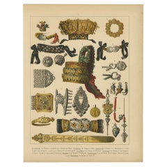
The Costumes of Germany, Bohemia & Austria; Wedding Crowns, Jewellery etc., 1870
Located in Langweer, NL
Antique print, titled: 'Brautkronen, Rosenkranz (..).'
This original antique print shows the costumes of Germany, Bohemia and Austria; wedding crowns, jewellery etc . This origin...
Category
1870s Antique Maps
Materials
Paper
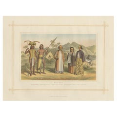
Antique Chromolithograph Depicting Native Malays, Incl Dayaks of Borneo, 1882
Located in Langweer, NL
Antique print titled 'Malay Race'. Depicts 1. Saghai Dyak N.E. Coast. 2. Loondoo Dyak. S.W. Coast. Natives of Java- 3. Priest. 4. Lady. 5. Gentleman.
Antique chromolithograph...
Category
1880s Antique Maps
Materials
Paper
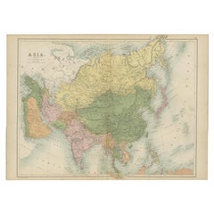
Antique Map of Asia by A & C, Black, 1870
Located in Langweer, NL
Antique map titled 'Asia'. Original antique map of Asia. This map originates from ‘Black's General Atlas of The World’. Published by A & C. Black, 1870.
Category
Late 19th Century Antique Maps
Materials
Paper
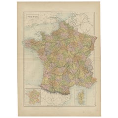
Antique Map of France by A & C. Black, 1870
Located in Langweer, NL
Antique map titled 'France'. Original antique map of France with inset map of France as divided into provinces, before the revolution of 1789 and map of Corsica...
Category
Late 19th Century Antique Maps
Materials
Paper
Antique Map of The United States and Canada by A & C. Black, 1870
Located in Langweer, NL
Antique map titled 'United States North Eastern Section and Canada'. Original antique map of Map of The United States North Eastern Section and Canada. This map originates from ‘Blac...
Category
Late 19th Century Antique Maps
Materials
Paper
Antique Map of Turkey in Asia by A & C. Black, 1870
Located in Langweer, NL
Antique map titled 'Turkey in Asia'. Original antique map of Turkey in Asia with inset Ruins of Babylon. This map originates from ‘Black's General Atlas of The World’. Published by A...
Category
Late 19th Century Antique Maps
Materials
Paper
Antique Map of Austrian Dominions by A & C. Black, 1870
Located in Langweer, NL
Antique map titled 'Austrian Dominions'. Original antique map of Austrian Dominions. This map originates from ‘Black's General Atlas of The Worl...
Category
Late 19th Century Antique Maps
Materials
Paper
Antique Map of New Zealand by A & C. Black, 1870
Located in Langweer, NL
Antique map titled 'New Zealand'. Original antique map of New Zealand with inset Maps of Australia, New Zealand and Tasmania. This map origi...
Category
Late 19th Century Antique Maps
Materials
Paper
Antique Map of India ( Southern ) by Johnston (1909)
Located in Langweer, NL
Antique map titled 'India'. Original antique map of India Southern sheet. With inset maps of south eastern provinces of India. This map originates from the ‘Royal Atlas of Modern Geo...
Category
Early 20th Century Maps
Materials
Paper
Antique Map of Spain and Portugal by Johnston, '1909'
Located in Langweer, NL
Antique map titled 'Spain and Portugal'. Original antique map of Spain and Portugal. With inset maps of the Canary Islands, Madeira, Lisbon and Ma...
Category
Early 20th Century Maps
Materials
Paper
Antique Map of the United States 'North West' by Johnston, '1909'
Located in Langweer, NL
Antique map titled 'United States of North America'. Original antique map of the United States of North America ( North West ). This map originates from the ‘Royal Atlas of Modern Ge...
Category
Early 20th Century Maps
Materials
Paper
Antique Map of India 'Northern' by Johnston '1909'
Located in Langweer, NL
Antique map titled 'India'. Original antique map of India, Northern sheet. This map originates from the ‘Royal Atlas of Modern Geography’. Published by W. & A.K. Johnston, 1909.
Category
Early 20th Century Maps
Materials
Paper
Antique Map of Belgium and the Netherlands by Johnston '1909'
Located in Langweer, NL
Antique map titled 'Belgium and The Netherlands'. Original antique map of Belgium and the Netherlands. With inset maps of Amsterdam and Brussels. This m...
Category
Early 20th Century Maps
Materials
Paper
Antique Map of Sweden and Norway by Johnston (1909)
Located in Langweer, NL
Antique map titled 'Sweden and Norway'. Original antique map of Sweden and Norway. With inset maps of Christiania and Stockholm. This map originates from...
Category
Early 20th Century Maps
Materials
Paper
Antique Map of Scotland 'Northern' by Johnston, '1909'
Located in Langweer, NL
Antique map titled 'Scotland'. Original antique map of Scotland. With inset map of the Shetland Islands. This map originates from the ‘Royal Atlas of M...
Category
Early 20th Century Maps
Materials
Paper
Antique Map of South-West Russia by Johnston (1909)
Located in Langweer, NL
Antique map titled 'South-West Russia'. Original antique map of South-West Russia. With inset map of Odessa. This map originates from the ‘Royal Atlas of Modern Geography’. Published...
Category
Early 20th Century Maps
Materials
Paper
Antique Map of South America by Johnston '1909'
Located in Langweer, NL
Antique map titled 'South America, Southern Sheet'. Depicting Chile, Argentina, Brazil, Patagonia, the Falkland Island and more. With inset maps of Valparaiso, Rio de Janeiro and Bue...
Category
Early 20th Century Maps
Materials
Paper
Antique Map of the Somers Township of Ohio by Titus, 1871
Located in Langweer, NL
Antique map titled 'Somers'. Original antique map of Somers, Ohio. This map originates from 'Atlas of Preble County Ohio' by C.O. Titus. Published, 1871.
Category
Late 19th Century Antique Maps
Materials
Paper
Antique Map of the Lanier Township of Ohio by Titus, 1871
Located in Langweer, NL
Antique map titled 'Lanier'. Original antique map of Lanier, Ohio. This map originates from 'Atlas of Preble County Ohio' by C.O. Titus. Published, 1871.
Category
Late 19th Century Antique Maps
Materials
Paper
Antique Map of the Dixon Township of Ohio by Titus, 1871
Located in Langweer, NL
Antique map titled 'Dixon'. Original antique map of Dixon, Ohio. This map originates from 'Atlas of Preble County Ohio' by C.O. Titus. Published 1871.
Category
Late 19th Century Antique Maps
Materials
Paper
Antique Map of West Alexandria, Manchester & Enterprise, 1871
Located in Langweer, NL
Antique map titled 'West Alexandria, Manchester, Enterprise'. Original antique map of villages and communities of Ohio. This map originates from 'Atlas of Preble County Ohio' by C.O....
Category
Late 19th Century Antique Maps
Materials
Paper
Antique Map of Illinois by Johnson, 1872
Located in Langweer, NL
Antique map titled 'Johnson's Illinois'. Original map of Illinois. This map originates from 'Johnson's New Illustrated Family Atlas of the World' by A....
Category
Late 19th Century Antique Maps
Materials
Paper
Four Physical Maps of the World on One Sheet , 1872
Located in Langweer, NL
Four physical maps of the world on one sheet. The upper map shows lowlands, highlands and highest lands. The other maps show world's races, ocean current and volcanoes, and magnetic ...
Category
Late 19th Century Antique Maps
Materials
Paper
Antique Map of the East Indies by Brouwer, 1917
Located in Langweer, NL
Antique map titled 'Geotektonische Schetskaart van het Oostelijk Gedeelte van den Oost-Indischen Archipel':
**Title**: Geotektonische Schetskaart van het Oostelijk Gedeelte van den ...
Category
Early 20th Century Maps
Materials
Canvas, Paper
Antique Plan of Paramaribo 'Suriname' Published 1920
Located in Langweer, NL
Large lithographed plan of Paramaribo, capital city of Suriname, showing the situation, circa 1916-1917. With small inset plan. Published in 1920.
Category
Early 20th Century Maps
Materials
Paper
Antique Hemisphere Map of the World 'Two on One Sheet' by Levasseur, '1875'
Located in Langweer, NL
Antique map titled 'Mappemonde projetée sur l'Horizon de Paris et de son Antipode - Mappemonde sur la projection polaire'. Large map with two hemisphere world maps...
Category
Late 19th Century Antique Maps
Materials
Paper
Decorative Antique Map of the Netherlands and Belgium, ca.1875
Located in Langweer, NL
Antique map titled 'Pays-Bas Belgique (..)'. Large map of the Netherlands and Belgium. This map originates from 'Atlas de Géographie Moder...
Category
Late 19th Century Antique Maps
Materials
Paper
Antique Map of the Asian Continent by Levasseur, '1875'
Located in Langweer, NL
Antique map titled 'Carte générale de l'Asie'. Large map of the Asian Continent. This map originates from 'Atlas de Géographie Moderne Physique et Politique' by A. Levasseur. Publish...
Category
Late 19th Century Antique Maps
Materials
Paper
Antique Map of Western Africa by Levasseur '1875'
Located in Langweer, NL
Antique map titled 'Carte de la Senegambie Soudan et Guinée'. Large map of Western Africa. This map originates from 'Atlas de Géographie Moderne Physique et Politique' by A. Levasseu...
Category
Late 19th Century Antique Maps
Materials
Paper
Antique Map of the Eastern United States by Levasseur '1875'
Located in Langweer, NL
Antique map titled 'Carte de la Region orientale des États-Unis et de la dominion du Canada'. Large map of the Eastern United States. This map originates from 'Atlas de Géographie Mo...
Category
Late 19th Century Antique Maps
Materials
Paper
Pl. 40 Antique Chart of the US Birth Rate, 1874
Located in Langweer, NL
Antique chart titled 'Map showing, in five degrees of density, the birth rate prevailing in the territory of the United States east of the 100th Meridian, so far as the same is indic...
Category
Late 19th Century Antique Maps
Materials
Paper
Pl. 36 Antique Chart of US Crops, Wheat, Rice, Tobacco, Hops, Oats '1874'
Located in Langweer, NL
Antique chart titled 'Maps showing the range, and within the range, the degree of cultivation of certain principal crops. Compiled from the statistics of agriculture, ninth census 18...
Category
Late 19th Century Antique Maps
Materials
Paper
Pl. 36A Antique Chart of US Farms, Agriculture and Crops '1874'
Located in Langweer, NL
Antique chart titled 'Improved land in farms. Total agricultural production. Corn. Dairy products.. Chart of US crops, farms and total agricultural production. Originates from 'Stati...
Category
Late 19th Century Antique Maps
Materials
Paper
Pl. 21 Antique Chart of the US Colored Population Density in 1870, '1874'
Located in Langweer, NL
Antique chart titled 'Map showing in five degrees of density the distribution of the colored population within the territory of the United States east of the 100th Meridian. Compiled...
Category
Late 19th Century Antique Maps
Materials
Paper
Pl. 26 Antique Chart of the US Foreign Population Proportion in 1870, '1874'
Located in Langweer, NL
Antique chart titled 'Map showing the proportion of the foreign to the aggregate population. Compiled from the returns of population at the ninth census of the United States 1870'. C...
Category
Late 19th Century Antique Maps
Materials
Paper
Pl. 27 Antique Chart of the US Irish and German Population in 1870, '1874'
Located in Langweer, NL
Antique chart titled 'Maps showing the distribution, within the territory of the United States, east of the 100th Meridian, of certain foreign elements of the population. I. accordin...
Category
Late 19th Century Antique Maps
Materials
Paper
Antique Chart of the US Foreign Parentage Proportion in 1870, '1874'
Located in Langweer, NL
Antique chart titled 'Map showing the proportion to the aggregate population, of persons having one or both parents of foreign birth. Compiled from the returns of population at the n...
Category
Late 19th Century Antique Maps
Materials
Paper
Pl. 23 Antique Chart of the US Foreign Parentage in 1870, '1874'
Located in Langweer, NL
Antique chart titled 'Map showing, in five degrees of density, the distribution, within the territory of the United States east of the 100th Meridian, of that portion of the populati...
Category
Late 19th Century Antique Maps
Materials
Paper
Antique Chart of the US Adult Male Illiteracy in 1870, '1874'
Located in Langweer, NL
Antique chart titled 'Map showing the illiteracy of the adult white male population. Compiled from the returns of population at the ninth census of the United States 1870'. Chart of the US adult male...
Category
Late 19th Century Antique Maps
Materials
Paper
Pl. 22 Antique Chart of the US Colored Population Proportion in 1870, '1874'
Located in Langweer, NL
Antique chart titled 'Map showing the proportion of the colored to the aggregate population. Compiled from the returns of population at the ninth census of the United States, 1870'. ...
Category
Late 19th Century Antique Maps
Materials
Paper
Pl. 28 Antique Chart of British American, English (..) US Population, 1874
Located in Langweer, NL
Antique chart titled 'Maps showing the distribution, within the territory of the United States, east of the 100th Meridian, of certain foreign elements of the population. I. accordin...
Category
Late 19th Century Antique Maps
Materials
Paper
Pl. 17 Antique Chart of the US Population 1850 by Walker, 1874
Located in Langweer, NL
Antique chart titled 'Map showing in five degrees of density, the distribution, within the territory east of the 100th Meridian, of the population of the United States, excluding Ind...
Category
Late 19th Century Antique Maps
Materials
Paper
Pl. 7 Antique Temperature Chart of the United States by Walker, 1874
Located in Langweer, NL
Antique chart titled 'Temperature chart of the United States. Showing the distribution by isothermal lines of the mean temperature for the year. Constructed under the direction of Pr...
Category
Late 19th Century Antique Maps
Materials
Paper
Antique Map of Northern Natal by Stanford, 1900
Located in Langweer, NL
Antique map titled 'Northern Natal'. Lithograph of Northern Natal. The Colony of Natal was a British colony in south-eastern Africa. It was proclaimed a British colony on 4 May 1843 ...
Category
Early 20th Century Maps
Materials
Paper
Antique Map of the British Islands to the White Sea by J. Imray
Located in Langweer, NL
Antique large nautical chart of the British Islands to the White Sea. With insets of Veshnyak Channel, Sosnovets and the Bay of Arkhangel. Published by James Irmay and Son, circa 1875.
Category
Late 19th Century Antique Maps
Materials
Paper
1918 American Frohse Anatomical Chart, A. J. Nystrom, Max Brodel Illustrator
By A.J. Nystrom & Co, Max Brödel
Located in Buffalo, NY
Antique American Frohse Anatomical pull down chart, by A. J. Nystrom, ,revised and augmented by Max Brodel illustrator... Amazing color, patina, age appropriate wear. dated 1918..
Max (Paul Heinrich) Brödel
1870-1941
Brödel, an illustrator and the first director of the Art as Applied to Medicine program at Johns Hopkins...
Category
1910s American Steampunk Vintage Maps
Materials
Wood, Paper
Mamaroneck New York Harbor Chart from 1901
Located in Norwell, MA
Original harbor chart by George Eldridge in 1801 of Mamaroneck New York. Showing Oriental Hen Island, Rye Point, Scotch Caps, Crane Island, Decency Point, etc.. Showing local water d...
Category
Early 1900s North American Antique Maps
Materials
Paper
1912 "Panoramic View of New York City and Vicinity" by Jacob Ruppert
Located in Colorado Springs, CO
This is an attractive and very scarce map of New York, published by the Yorkville brewer Jacob Ruppert in 1912. The map shows an expansive view of the region reaching from Sandy Hook in the south and Yonkers to the north, to Hicksville in the east and past Newark to the west. This beautifully colored birds eye view shows waterways with all shipping traffic, boroughs, and clearly labeled railroad routes. It is presented on period dowels and backed on its original linen.
Jacob Ruppert was born in New York City in 1842 to Bavarian immigrants. His father owned a brewery in Manhattan where young Jacob learned the business of brewing. In 1862, Jacob established the Jacob...
Category
1910s American Vintage Maps
Materials
Paper
1896 "Territory of Arizona" Map, Published by the General Land Office
Located in Colorado Springs, CO
Presented is an attractive "Territory of Arizona” map, from the “Report of the Governor of Arizona to the Secretary of the Interior." First published in 1894, this 1896 edition was r...
Category
1890s Antique Maps
Materials
Paper
Vintage Swedish School Map of Vastergötland, Made in Sweden 1920
Located in Los Angeles, CA
Vintage Swedish School Map of Vastergötland, Made in Sweden 1920
Västergötland also known as West Gothland or the Latinized version Westrogothia in older literature, is one of the...
Category
1920s Swedish Vintage Maps
Materials
Linen, Wood, Paper
1889 Sea Chart Map of Delaware Bay by George Eldridge, Chart No. 11
Located in Colorado Springs, CO
Presented is an original Eldridge's Chart No. 11, Delaware Bay and River, from The United States Coast and George Eldridge's Surveys, published in 1889. The sea chart shows the Delaw...
Category
1880s Antique Maps
Materials
Paper
Northwest Coast and Isle of Man Map
Located in Cheshire, GB
Greenville Collins Northwest Coast and Isle of Man. hand coloured chart, encased in an ebonised frame.
Dimensions
Height 26.5 Inches
Width 30 Inches
Depth 1 Inches
Category
Early 20th Century British Maps
Materials
Paper
Map of Essex by Emanuel Bowen
Located in Cheshire, GB
Map of part of Essex and part of Kent, hand-coloured. Encased in an ebonized and gilded frame.
Dimensions
Height 25.5 Inches
Length 32.5 Inches
width 1 Inches.
Category
Late 19th Century British Antique Maps
Materials
Paper
Mariners Chart of Quicks Hole and Tarpaulin Cove by George Eldridge 1901
Located in Norwell, MA
Nautical chart showing the harbor and local waters of Naushon Island Quick Holes. The chart display depths buoys, lightness, etc., The chart shows the cove in Naushon with ships stor...
Category
Early 1900s North American Antique Maps
Materials
Paper
Wychmere Harbor Allens Harbor Map Circa 1890
Located in Norwell, MA
Map of Harwich Mass showing Wychmere Harbor, Doane's Creek, Allens Harbor, Herring River, Pleasant Lake, Grassy Pond, Paddocks Pond, Hinkleys Pond, etc., This is an original period m...
Category
1890s North American Antique Maps
Materials
Paper
University Chart “Black Map of North America
Located in Godshill, Isle of Wight
University Chart “Black Map of North America
W&A K Johnston’s Charts of Physical Maps By G W Bacon,
This is a Black Physical map of North A...
Category
Early 20th Century Industrial Maps
Materials
Linen
