Maps
to
1,543
1,819
41
1,862
26
2
1
1
1
2,926
2,181
476
3
289
34
10
127
7
35
9
2
5
3
4
2
1,847
20
12
3
3
97
34
20
17
17
1,862
1,862
1,862
24
16
13
12
12
Maps For Sale
Period: 18th Century
Period: 1930s
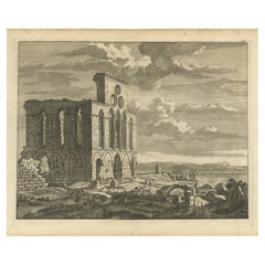
Untitled Print of a Ruin, De Bruyn, c.1700
Located in Langweer, NL
This plate shows a ruin near the water. Source unknown, to be determined. Most likely engraved by C. de Bruijn, c.1700. Artists and Engravers: Cornelis de Bruijn (also spelled Cornel...
Category
18th Century Antique Maps
Materials
Paper
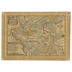
Antique Map of the Region of Grossenhain by Schreiber, 1749
Located in Langweer, NL
Antique map titled 'Das Amt Grossen-Hayn mit Zabeltitz'. Map of the region of Großenhain, Germany. This map originates from 'Atlas Selectus von allen Konigre...
Category
18th Century Antique Maps
Materials
Paper
Antique Map of the Danube River and Surroundings by Homann Heirs, c.1730
By Homann Heirs
Located in Langweer, NL
Antique map titled 'Danubii Fluminus (a fontibus prope Doneschingam usq Posonium urbem defignati) Pars Superior, in qua Suevia, Bavaria, Asutria, Stiria, Carinthia, Carniola, Tyrolis...
Category
18th Century Antique Maps
Materials
Paper
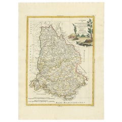
Antique Map of the Region of Dauphiné by Zatta, 1779
Located in Langweer, NL
Antique map titled 'Li Governi del Delfinato e di Provenza la Contea Venaissin ed il Princie d'Orange'. Old map of France showing the province of Dauphiné. This map originates from '...
Category
18th Century Antique Maps
Materials
Paper
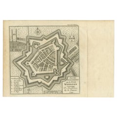
Antique Map of the City of Woerden by Tirion, c.1750
Located in Langweer, NL
Antique map titled 'Nieuwe Grondtekening van de Stad Woerden'. Plan of the city of Woerden, the Netherlands. Published circa 1750.
Artists and Engravers: Published by I. Tirion. ...
Category
18th Century Antique Maps
Materials
Paper
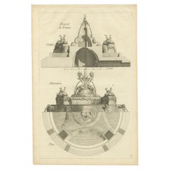
Pl. 11 Antique Print of Garden Fountains by Le Rouge, c.1785
Located in Langweer, NL
Antique print titled 'Projet de Fontaine (..)'. Copper engraving of fountain designs. This print originates from 'Jardins Anglo-Chinois à la Mode' by Georg Louis le Rouge. Artists an...
Category
18th Century Antique Maps
Materials
Paper
Antique Print of Palazzo Della Sapienza by De Rossi, c.1710
Located in Langweer, NL
Antique print titled 'Porta nel Portico Superiore nel Palazzo (..)'. Old print of a portico of the Palazzo della Sapienza, Rome. This print originates from 'Studio d'architettura civ...
Category
18th Century Antique Maps
Materials
Paper
Antique Print of Palazzo Chigi by De Rossi, c.1710
Located in Langweer, NL
Antique print titled 'Finestrone di mezzo che conduce nella Ringhiera (..)'. Old print of a window of Palazzo Chigi, Rome. This print originates from 'Studio d'architettura civile so...
Category
18th Century Antique Maps
Materials
Paper
Antique Print of Palazzo Chigi by De Rossi, c.1710
Located in Langweer, NL
Antique print titled 'Finestra del medesimo piano Nobile (..)'. Old print of a window of Palazzo Chigi, Rome. This print originates from 'Studio d'archite...
Category
18th Century Antique Maps
Materials
Paper
Antique Print of Palazzo Barberino by De Rossi, c.1710
Located in Langweer, NL
Antique print titled 'Finestra del Palazzo Barberino della facciata che guarda il Giardino (..)'. Old print of a window overlooking the garden of Palazzo Barberino, Rome. This print ...
Category
18th Century Antique Maps
Materials
Paper
Antique Map of France under the Reign of Philip II by Zannoni, 1765
Located in Langweer, NL
Antique map France titled 'Carte de l'accroissement du Domaine sous Philippe Auguste (..)'. Beautiful old map of France. This map originates from 'Atlas Historique de la France Ancie...
Category
18th Century Antique Maps
Materials
Paper
Antique Map of the Maluku Islands by Van der Aa, 1714
Located in Langweer, NL
Antique Map Moluccas titled 'Les Isles Moluques'. Rare map of the Spice Islands made after a map engraved by Pieter van den Keere and published in the 1628 edition of the Mercator At...
Category
18th Century Antique Maps
Materials
Paper
Pl. 40 Antique Print of Charlottenborg Palace, c.1790
Located in Langweer, NL
Antique print titled 'Facade du Château de Charlottenbourg'. Architecture print of Charlottenborg Palace, a large town mansion located on the corner of Kongens Nytorv and Nyhavn in C...
Category
18th Century Antique Maps
Materials
Paper
Antique Map of Seram Island by Keizer & De Lat, c.1747
Located in Langweer, NL
Antique map titled 'Kaart van het eiland Ceram'. Rare and uncommon map of Seram Island, Indonesia. One of the earliest separately printed maps of the island. Artists and Engravers: P...
Category
18th Century Antique Maps
Materials
Paper
Antique Map of the Circle of Bavaria by Vaugondy, 1757
Located in Langweer, NL
Antique map titled 'Le Cercle de Baviere (..)'. Map of the Circle of Bavaria, Germany. Extends from Bamberg to Innsbruck. This map originates from 'Atlas Universel (..)'. Artists and Engravers: Gilles Robert de Vaugondy (1688 - 1766), also known as Le Sieur or Monsieur Robert, and his son, Didier Robert de Vaugondy (c.1723 - 1786), were leading mapmakers in France during the 18th century. In 1757, they published The Atlas Universel, one of the most important atlases of the 18th century. To produce the atlas, the Vaugondys integrated older sources with more modern surveyed maps...
Category
18th Century Antique Maps
Materials
Paper
Pl. 1 Antique Print of an English Pavilion by Schübler, c.1724
Located in Langweer, NL
Antique print titled 'Ein neue Faconirtes Englisches Lust Haus (..)'. Copper engraving showing an English garden pavilion. This print originates from a series of garden elements by J...
Category
18th Century Antique Maps
Materials
Paper
Antique Map of the Region of Paris by Homann Heirs, c.1720
By Homann Heirs
Located in Langweer, NL
Antique map titled 'Agri Parisiensis Tabula particularis, qua maxima Pars Insulae Franciae (..).' Incredibly detailed map showing everything from tiny villages to forests, farmland, ...
Category
18th Century Antique Maps
Materials
Paper
Old Map Guiana, Columbia Venezuela, Andalusia in South America by Bonne, c.1780
Located in Langweer, NL
Antique map titled 'Carte du Nouv. Rme. de Grenade, de la Nou'le Andalousie, et de la Guyane, avec les pays Limitrophes qui en sont au sud'.
Detailed map covering part of South Ame...
Category
18th Century Antique Maps
Materials
Paper
Antique Map of the Mouth of the Chiang River by Bellin, 1764
Located in Langweer, NL
Antique map titled ‘Carte de la Baye d'Hocsieu et des Entrees de la Riviere de Chang, Dans la Province de Fokyen en Chine’. This impressive map or sea chart d...
Category
18th Century Antique Maps
Materials
Paper
Antique Print of the Duke of York's Palace by Woolfe, c.1770
Located in Langweer, NL
Antique print titled 'Elevation of his Royal Highness the Duke of York's Palace in Pall Mall (..)'. View of the Duke of York's Palace in Pall Mall, London. This print originates from...
Category
18th Century Antique Maps
Materials
Paper
Antique Map of the Region of Meissen by Schreiber, 1749
Located in Langweer, NL
Antique map titled 'Der Ertz-Gebürgische Creis in Meissen (..)'. Map of the region of Meissen, Germany. This map originates from 'Atlas Selectus von allen Ko...
Category
18th Century Antique Maps
Materials
Paper
Antique Map of the Pacific Ocean by Anson, 1765
Located in Langweer, NL
Antique map titled 'Carte de la Mer du Sud ou Mer Pacifique - Kaart van de Zuyd-Zee of stille oceaan (..)'. Nautical chart of the Pacific Ocean depicting the trade routes used by Spanish Galleons from Acapulco in Mexico to Manila in the Philippines. In particular this chart depicts the voyages of the Spanish Nostra Seigniora de Cabadonga and the British Navy Commodore George Anson. Anson succeed in capturing the Spanish treasure...
Category
18th Century Antique Maps
Materials
Paper
Pl. 15 Antique Print of the Garden of Maupertuis and Chaville by Le Rouge
Located in Langweer, NL
Antique print titled 'Tour dans les Jardins de Maupertuis (..)'. Copper engraving with a view of the garden of Maupertuis and Chaville. This print originates from 'Jardins Anglo-Chin...
Category
18th Century Antique Maps
Materials
Paper
Remarkable Decorative Rare Antique Print of Figures and Vases, c.1780
Located in Langweer, NL
Antique print with two small views of a figure reaching for a vase. Source unknown, to be determined. Artists and Engravers: Anonymous.
Artist: Anonymous.
Condition: Good, general ...
Category
18th Century Antique Maps
Materials
Paper
Antique Map of the Region of Mühlberg by Schreiber, 1749
Located in Langweer, NL
Antique map titled 'Das Amt Muhlberg'. Map of the region of Mühlberg, Germany. This map originates from 'Atlas Selectus von allen Konigreichen und Landern de...
Category
18th Century Antique Maps
Materials
Paper
Antique Map of the Region of Dölitzsch by Schreiber, 1749
By Schreiber
Located in Langweer, NL
Antique map titled 'Die Aemter Doelitsch, Bitterfeld und Zörbig'. Map of the region of Dölitzsch, Germany. This map originates from 'Atlas Selectus von allen Konigreichen und Landern...
Category
18th Century Antique Maps
Materials
Paper
Antique Map of the Region Between the Black and Caspian Sea by Cellarius, 1731
Located in Langweer, NL
Antique map titled 'Bosporus, Maeotis, Iberia, Albania, et Sarmatia Asiatica.' Map of the region between the Black and Caspian Seas in early Sarmatian time...
Category
18th Century Antique Maps
Materials
Paper
Antique Map of Northern Europe by Bonne, c.1780
Located in Langweer, NL
Antique map titled 'Le Nord de L'Europe, Contenant Le Danemark, La Norwege; La Suede et La Laponie avec la Majeure Partie de al Russie Europeenne.' Map of Northern Europe and Europea...
Category
18th Century Antique Maps
Materials
Paper
Antique Map of the Region of Schwarzburg by Schreiber, 1749
By Schreiber
Located in Langweer, NL
Antique map titled 'Die Südliche Fürstenthum Schwartzburg (..)'. Map of the region of Schwarzburg, Germany. This map originates from 'Atlas Selectus von allen Konigreichen und Lander...
Category
18th Century Antique Maps
Materials
Paper
Antique Map of the Caspian Sea and Surroundings by Bellin, 1764
Located in Langweer, NL
Antique map titled 'Carte de la Mer Caspienne et ses Environs'. Old map depicting the region of the Caspian Sea. This map originates from 'Le Petit Atlas M...
Category
18th Century Antique Maps
Materials
Paper
Antique Print of a New Design for Sir Paul Methuen by Campbell, 1725
Located in Langweer, NL
Antique print titled 'This New Design of my Invention in the Theatrical Style, is most humbly inscrib'd to the Rt. Honble Paul Methuen (..)'.
Sir Paul Methuen PC KB (c. 1672 – 11...
Category
18th Century Antique Maps
Materials
Paper
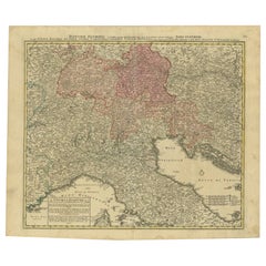
Antique Map of Northern Italy by Homann Heirs, c.1730
Located in Langweer, NL
Antique map titled 'Domini Veneti cum vicinis Parmae Mutinae, Matuae et Mirandol (..).' Detailed map of northern Italy by J. B. Homann. This map shows Venice and its adjacent states ...
Category
18th Century Antique Maps
Materials
Paper
Antique Map of the Haskerland Township 'Friesland' by Halma, 1718
Located in Langweer, NL
Antique map Friesland titled 'Haskerland, de vierde Grietenije van de Zevenwolden (..)'. Old map of Friesland, the Netherlands. This map depicts the region of Haskerland and includes...
Category
18th Century Antique Maps
Materials
Paper
Pl. 3 Antique Print of a Winter Garden by Le Rouge, c.1785
Located in Langweer, NL
Antique print titled 'Coupe du nouveau Berceau ou Jardin d'Hiver (..)'. Copper engraving showing a winter garden. This print originates from 'Jardins Anglo-Chinois à la Mode' by Geor...
Category
18th Century Antique Maps
Materials
Paper
Antique Map of the Region of Pasuruan, Java, Indonesia, 1726
Located in Langweer, NL
"Map of the region around Pasuruan. It shows the location of rice fields, the village Bangil, as well as three places named Pagger (also Pagar), a cluster of buildings surrounded by a bamboo fence. The location of a earthen wall with pallisade and small cannons...
Category
18th Century Antique Maps
Materials
Paper
Antique Map of the German Empire by Le Rouge, 1743
Located in Langweer, NL
Antique map Germany titled 'L'Empire d'Allemagne dedie a Monseigneur Amelot (..)'. Antique map of the German Empire, with outline coloring.
Art...
Category
18th Century Antique Maps
Materials
Paper
Antique Map of the Expedition of Govert Knol by Van Schley, 1765
Located in Langweer, NL
Antique map titled 'Plan de l' expédition de Mr. le Commiss. re Govert Knol, forti de Soerabaja, pour aller recévoir Pangerang Depati Anom. / Aftékening der Expeditie van de H. r Commiss. is Govert Knol , uyt Soerabaya , tot afhaalinge van Pangerang Depati Anom'. Map showing the expedition...
Category
18th Century Antique Maps
Materials
Paper
Pl. 5 Antique Print of a Garden Pavilion by Schübler, c.1724
Located in Langweer, NL
Antique print titled 'Ein ansehliches neu Invertirtes Lust und Somer Haus (..)'. Copper engraving showing a garden pavilion. This print originates from...
Category
18th Century Antique Maps
Materials
Paper
Pl. 2 Antique Print of a Waterfall and Garden Swing by Le Rouge, c.1785
Located in Langweer, NL
Antique print titled 'Balancoire a Rambouillet - Cascade a Dampiere'. Copper engraving showing a swing at Rambouillet and the waterfall of Dampiere. This print originates from 'Jardi...
Category
18th Century Antique Maps
Materials
Paper
Pl. 20 Antique Print of a Garden Planted by Louis XV by Le Rouge, c.1785
Located in Langweer, NL
Antique print titled 'Nouveau Trianon planté par Louis XV'. Copper engraving showing a garden planted by Louis XV. This print originates from 'Jardins Anglo-Chinois à la Mode' by Geo...
Category
18th Century Antique Maps
Materials
Paper
Rare Antique Print of a Fountain by Delsenbach, c.1730
Located in Langweer, NL
Antique print titled 'Veue de la grotte de Thetis et de la haute gerbe (..)'. View of a fountain, most likely in the Gardens of Versailles. Source unknown, to be determined. Artists ...
Category
18th Century Antique Maps
Materials
Paper
Copper Engraving Showing the Neptune Fountain of Versailles, Paris, France, 1785
Located in Langweer, NL
Antique print titled 'Plan de la décoration du Bassin de Neptune à Versailles'.
Copper engraving showing parts of the Neptune fountain of Versaill...
Category
1780s Antique Maps
Materials
Paper
Antique Map of the Auvergne-Rhône-Alpes region of France by Valk, circa 1730
Located in Langweer, NL
Antique map titled 'Praefectura Lugdunensis Generalis'. Detailed map of the Auvergne-Rhône-Alpes region in the southeast of France. To the east the Rhône from Chalon-sur-Saône, Mâcon...
Category
Mid-18th Century Antique Maps
Materials
Paper
Antique Map of Switzerland by Keizer & de Lat, 1788
Located in Langweer, NL
Antique map titled 'La Suisse (..)'. Uncommon original antique map of Switzerland. This map originates from 'Nieuwe Natuur- Geschied- en Handelkundige Zak- en Reisatlas' by Gerrit Br...
Category
Late 18th Century Antique Maps
Materials
Paper
Antique Print of a Design for The Great Temple in Eastbury Park, England, 1725
Located in Langweer, NL
Antique print titled 'Plan and Elevation of the great Temple in the garden at Eastbury'.
Design for Eastbury Park, England. This print originates from 'Vitruvius Britannicus' by ...
Category
18th Century Antique Maps
Materials
Paper
Antique Map of the Languedoc Region 'France' by D. Weege, 1753
Located in Langweer, NL
Antique map titled 'Caart van Languedoc'. Map of the Languedoc-Rousillion region in Southern France. Flanked by miniature plans and views of cities of the region like Montpellier, N...
Category
Mid-18th Century Antique Maps
Materials
Paper
Beautiful Antique Map of Southeastern France with Decorative Cartouche, ca.1790
Located in Langweer, NL
Antique map titled 'Languedoc, Dauphiné, Province'.
Beautiful antique map of Southeastern France with decorative cartouche. Map includes topographical detail as well as a referen...
Category
1790s Antique Maps
Materials
Paper
Antique Map of the Cape of Good Hope by J.N. Bellin, 1748
Located in Langweer, NL
Early plan of the Cape of Good Hope, includng a town plan and illustrations of the fortificatons. This map originates from Tome V of Abbe Prevost's Histoire generale du voyages.
Category
Mid-18th Century Antique Maps
Materials
Paper
Decorative Original Old Map of Nova Zembla and the Russian Mainland, ca.1760
Located in Langweer, NL
Antique map titled 'Carte Des Pais Habites par les Samojedes et Ostiacs.'
Map of Novaya Zemlya and the Russian mainland. Source unknown, to be determined.
Artists and Engraver...
Category
1760s Antique Maps
Materials
Paper
Antique Map of Denmark by Moll 'circa 1730'
By Herman Moll
Located in Langweer, NL
Antique map titled 'Denmark, agreeable to Modern History'. Uncommon map of Denmark by Herman Moll, published, circa 1730.
Category
Mid-18th Century Antique Maps
Materials
Paper
Large Sea Chart of the Zuyder Zee & The Northsea with the Wadden Islands, 1773
By H. van Loon
Located in Langweer, NL
The copper engraving by Herman van Loon, published by Pieter Mortier in 'Le Neptune François' in Amsterdam, is a remarkable piece within the realm of seventeenth-century cartography....
Category
Late 18th Century Antique Maps
Materials
Paper
Rare Engraving of New Caledonia & New Hebrides from Capt. Cook's Travels, 1777
Located in Langweer, NL
Antique map titled 'Chart of Discoveries made in the South Pacific Ocean'.
Rare engraving from the official British Admiralty sanctioned edition of the accounts of Cook’s second voyage. All other later copies made of this image by other publishers were unauthorised, usually smaller and inferior in quality. Made after Cook's discovery of the island group on 4 September 1774, which he named New Caledonia...
Category
1770s Antique Maps
Materials
Paper
Interesting Antique Map of Tartary and Northeast Asia, 1749
Located in Langweer, NL
Condition: Good, given age. Original folds, as issued. Some small water stains above image and top-right. Please study scan carefully.
Category
1740s Antique Maps
Materials
Paper
Intriguing Antique Map of Europe, Asia and Africa by Scherer, c.1703
Located in Langweer, NL
Two maps on a single sheet showing Europe, Asia and Africa, each depicting nearly the same area. On close examination there are slight differences. Major cities are located. Printed ...
Category
18th Century Antique Maps
Materials
Paper
Original Antique Map of the Northwestern Part of Russia in Europe, 1753
Located in Langweer, NL
Antique map titled 'Partie septentrionale de la Russie Européenne'.
Detailed map of the Northwestern part of Russia, from the Gulf of Finland and Poland, to the western part of Asian Russia.
Artists and Engravers: Gilles Robert de Vaugondy (1688-1766) was the head of a leading family of geographers in eighteenth century France. Gilles got his start when he jointly inherited the shop of Pierre-Moullart Sanson, grandson of the famous geographer Nicholas Sanson. The inheritance included the business, its stock of plates, and a roller press...
Category
1750s Antique Maps
Materials
Paper
Antique Detailed Map of Papua New Guinea and the Regions to the West, ca.1780
Located in Langweer, NL
Antique map titled 'Carte des Decouvertes du Capite. Carteret dans La Nlle. Bretagne avec une parte du passage du Capite. Cook Par Le Detroit De L'Endeavor ...
Category
1780s Antique Maps
Materials
Paper
Prince of Orange, First King of the Netherlands & Grand Duke of Luxembourg, 1750
Located in Langweer, NL
Antique portrait titled 'Willem de I. Prins van Oranje enz. enz. enz'.
Portrait of William I, Prince of Orange. William I Frederick, born Willem Frederik Prins van Oranje-Nassau ...
Category
1750s Antique Maps
Materials
Paper
Antique Map of West Russia, with Title a New Map of Moskovy, 1741
Located in Langweer, NL
Antique map Russia titled 'A New Map of Moscovy from the latest observations'.
Muscovy is an alternative name for the Grand Duchy of Moscow (126...
Category
1740s Antique Maps
Materials
Paper
