Maps
to
590
744
35
776
3
58
4
2
2,926
2,181
476
3
289
34
10
127
7
35
9
2
5
3
4
2
755
51
24
4
4
134
84
44
34
26
779
779
779
104
4
2
1
1
Maps For Sale
Period: 21st Century and Contemporary
Period: Mid-19th Century
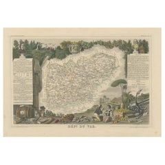
The Illustrated Map of the Var Department from the Atlas National Illustré, 1856
Located in Langweer, NL
This original hand-colored map is from the "Atlas National Illustré," a work by Victor Levasseur, a French geographer and cartographer known for his richly illustrated maps.
The map...
Category
1850s Antique Maps
Materials
Paper
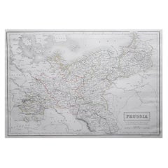
Large Original Antique Map of Poland by Sidney Hall, 1847
Located in St Annes, Lancashire
Great map of Poland
Drawn and engraved by Sidney Hall
Steel engraving
Original colour outline
Published by A & C Black. 1847
Unframed
...
Category
1840s Scottish Antique Maps
Materials
Paper
Antique Map of the Northern Hemisphere by Lowry, '1852'
Located in Langweer, NL
Antique map titled 'Perspective Projection of the World on the horizon of London'. Original map of the northern hemisphere. This map originates fro...
Category
Mid-19th Century Antique Maps
Materials
Paper
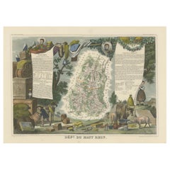
1852 Map of Haut-Rhin: An Illustrated Gateway to Alsace's Viticultural Splendors
Located in Langweer, NL
This original hand-colored map is from the "Atlas National Illustré," a work by Victor Levasseur, a French geographer and cartographer known for his richly illustrated maps.
The map...
Category
1850s Antique Maps
Materials
Paper
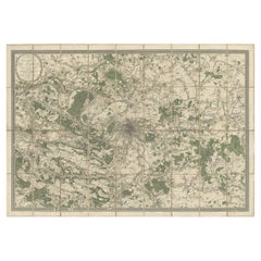
Large Folding Map of Paris, France, on Linen, 36 Segments, Published in 1836
Located in Langweer, NL
Antique map Paris titled 'Carte Topographique des Environs de Paris Nouvelle edition rectifié d'apres les travaux de la Nouvelle Carte De France'.
...
Category
1830s Antique Maps
Materials
Paper
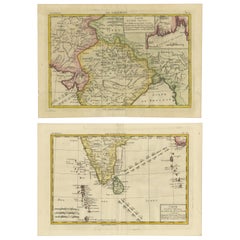
18th Century Cartographic Depiction of Upper India and Ceylon, 1835
Located in Langweer, NL
An exquisite set of two maps, 'Carte de la Partie Superieure De L'Inde en de Cadu Gange,' masterfully crafted by the renowned 18th-century French cartographer, Charles Marie Rigobert...
Category
1830s Antique Maps
Materials
Paper
Antique Map of Tennessee, Kentucky, Virginia, Alabama, Georgia and Surroundings
Located in Langweer, NL
Antique map of part of the United States showing Alabama, Georgia, North Carolina, South Carolina, Tennessee, Kentucky, Virginia and part of Florida. With inset maps of the southern ...
Category
Mid-19th Century Antique Maps
Materials
Paper
Map of Rhône: Culture and Commerce in Lyon's Silk and Wine Legacy, 1852
Located in Langweer, NL
This original hand-colored map is from the "Atlas National Illustré," a work by Victor Levasseur, a French geographer and cartographer known for his richly illustrated maps.
The map...
Category
1850s Antique Maps
Materials
Paper
Antique Map of the East Indies by W. G. Blackie, 1859
Located in Langweer, NL
Antique map titled 'The Indian Archipelago'. Original antique map of the East Indies. This map originates from ‘The Imperial Atlas of Modern Geography’. Published by W. G. Blackie, 1...
Category
Mid-19th Century Antique Maps
Materials
Paper
Antique Map of the Western Hemisphere by Wyld '1845'
Located in Langweer, NL
Antique map titled 'Western Hemisphere'. Original antique map of the western hemisphere. This map originates from 'An Atlas of the World, Comprehending Separate Maps of its...
Category
Mid-19th Century Antique Maps
Materials
Paper
Rare Print of The Factories in Guangzhou, China, 1835
Located in Langweer, NL
Antique print titled 'Factoreries a Canton'.
This print (on india paper) depicts factories in Guangzhou, China. Originates from 'Voyage Autour du Monde par les Mers...
Category
1830s Antique Maps
Materials
Paper
Antique Map of Scotland With an Inset Map of the Shetland Islands, 1854
Located in Langweer, NL
Stunning Map of Scotland that will look beautiful in any setting framed on the wall.
Description: Large Antique map titled 'Scotland with its Islands, drawn from the Topographical surveys...
Category
1850s Antique Maps
Materials
Paper
Antique Map of the West Indies and Central America by Lowry '1852'
Located in Langweer, NL
Antique map titled 'West Indies and Central America'. Original map of the West Indies and Central America. This map originates from 'Lowry's Table Atlas constructed and engraved from...
Category
Mid-19th Century Antique Maps
Materials
Paper
1863 "Lloyd's New Map of the United States, the Canadas, and New Brunswick"
Located in Colorado Springs, CO
Presented is “Lloyd's New Map of the United States, the Canadas and New Brunswick, From the latest Surveys, Showing Every Railroad & Station Finished to June 1863, and the Atlantic and Gulf Coasts.” A large, Civil War-era hanging map of the United States and adjacent territories, this map covers the area from the Atlantic Ocean and extends as far west as the 103 meridian, to “Dacotah,” Nebraska, Kansas, "Indian Territory," and Texas. The southern continuation of Florida is shown in an inset map along the right margin. This map was published by J. T. Lloyd, in New York, in 1863. According to the publisher’s marking at lower right, this map was originally issued in two states: "in Sheets, Colored" for 50 cents, and "Varnished nicely, with Rollers" for $1.
Throughout the map, the counties are colored and the towns and cities well labeled. A reference key in the bottom margin provides symbols for railroads, turnpikes and wagon roads, state capitals, cities and towns, and village post offices. As emphasized in the map’s title, this map is especially notable for the countless railway lines and stations depicted, with distances noted between points, listing “every railroad and finished station to June 1863.” Additionally, two shipping agents and their routes are drawn out of New York City. The map includes details of the steamship routes into New York and Philadelphia from Liverpool and on to California and Oregon via an overland Nicaraguan trek, presumably to assist gold rush emigrants.
This expansive and impressive map depicts the eastern half of the United States in the third year of the Civil War. In order not to recognize the legitimacy of the Confederate States of America, each state is shown in the same manner as the Union states. The only indication that the American Civil War was in progress when this map was published is a printed notice that Gideon Wells, Secretary of the Navy, wishes to acquire a quote on 100 copies of Lloyd’s Mississippi River map...
Category
1860s American Antique Maps
Materials
Linen, Wood, Paper
Antique Map of Eastern Persia, 1852
Located in Langweer, NL
Antique map titled 'Eastern Persia'. Original map of Eastern Persia. This map originates from 'Lowry's Table Atlas constructed and engraved from the most recent Authorities' by J.W. ...
Category
Mid-19th Century Antique Maps
Materials
Paper
The Travel Sale: Natural History and Maps. November 2001: Sotheby's London
By Sotheby's
Located in valatie, NY
The Travel Sale: Natural History and Maps. November 2001: Sotheby's London. 1st Ed softcover. Lots 1-16; New Zealand 17-22; China Trade and Far East Asia 23-51; India 52-74; Africa 7...
Category
21st Century and Contemporary English Maps
Materials
Paper
Facsimile with 30 VOC Nautical Charts, the Treasure of Corpus Christi
Located in Langweer, NL
Facsimile with 30 large format VOC nautical charts in limited and numbered edition. Sjoerd de Meer, Frits Loomeijer (The Treasure of Corpus Christi) - ...
Category
21st Century and Contemporary Maps
Materials
Paper
Antique Lithography Map, Shropshire, English, Framed, Cartography, Victorian
Located in Hele, Devon, GB
This is an antique lithography map of Shropshire. An English, framed atlas engraving of cartographic interest, dating to the mid 19th century and later.
Superb lithography of Shrop...
Category
Mid-19th Century British Victorian Antique Maps
Materials
Wood
Old Print Depicting Various Inhabitants of Tonga Tabu, ca.1836
Located in Langweer, NL
Antique print titled 'Tonga-Tabu'.
Old print depicting various inhabitants of Tonga Tabu. This print originates from 'Entdeckungs, Reise der Franzosischen Corvette Astrolabe Unternomen auf Befehl Konig Karls...
Category
1830s Antique Maps
Materials
Paper
Antique Map of South America by Lowry, 1852
Located in Langweer, NL
Antique map titled 'South America'. Original map of South America. This map originates from 'Lowry's Table Atlas constructed and engraved from the most recent authorities' by J.W. Lo...
Category
Mid-19th Century Antique Maps
Materials
Paper
Antique Map of St. Louis and Chicago
Located in Langweer, NL
Antique map titled 'The City of St. Louis Missouri - The City of Chicago Illinois'. Dual map on single page showing St. Louis and Chicago. Finely produ...
Category
Mid-19th Century Antique Maps
Materials
Paper
Antique Map of the Eastern United States with Inset Map of Texas
Located in Langweer, NL
Antique map titled 'Verein-Staaten von Nord-America mit Ausnahme Florida's und der Westlichen Territorien'. This map extends as far west as Louisiana and only includes the northern p...
Category
Mid-19th Century Antique Maps
Materials
Paper
Old Hand-Colored Print of Officers and Horses of the Belgium Army, 1833
Located in Langweer, NL
One nicely hand coloured print of an original serie of 23 plates, showing officers and soldiers discussing matters. published in 1833. Rare.
From a serie of beautiful lithographed...
Category
1830s Antique Maps
Materials
Paper
Antique Map of the Antilles by Lapie, '1842'
Located in Langweer, NL
Antique map titled 'Carte des Antilles du Golfe du Méxique'. Map of the Antilles. This map originates from 'Atlas universel de géographie ancienne et moderne (..)' by Pierre M. Lapie...
Category
Mid-19th Century Antique Maps
Materials
Paper
Nice Antique Print of a Breton Cow, a French Cattle Breed from Brittany, 1862
Located in Langweer, NL
Antique print titled 'Vache Bretonne' - This rare plate shows a Breton Cow, a French cattle breed from Brittany. From: 'Les Races bovines au concours universel agricole de Paris en 1...
Category
1860s Antique Maps
Materials
Paper
Antique Map of Southern Italy by J. Tallis, circa 1851
Located in Langweer, NL
Decorative and detailed mid-19th century map of Southern Italy which was drawn and engraved by John Rapkin (vignettes by A. H. Wray and J. Rogers...
Category
Mid-19th Century Antique Maps
Materials
Paper
Steel Engraved Map of Part of the Bengal Presidency 'India & Bangladesh', 1831
Located in Langweer, NL
Antique map titled 'India Bengal Presidency'. Old steel engraved map of part of the Bengal Presidency. The Bengal Presidency (1757–1912), later reorganized as the Bengal Province (19...
Category
1830s Antique Maps
Materials
Paper
Old Hand-Colored Print with a View of Marseille, France, ca.1885
Located in Langweer, NL
Antique print titled 'Marseille aus der Vogelschau'.
Old print with a view of Marseille, France. This print originates from a German illustrated newsletter, published circa 1885.
...
Category
1850s Antique Maps
Materials
Paper
Antique Map of Persia and Tartary by Lowry, '1852'
Located in Langweer, NL
Antique map titled 'Persia and Tartary'. Original map of Persia and Tartary. This map originates from 'Lowry's Table Atlas constructed and engraved from the most recent Authorities' ...
Category
Mid-19th Century Antique Maps
Materials
Paper
Antique Map of The World in Hemispheres by W. G. Blackie, 1859
Located in Langweer, NL
Antique map titled 'The World in Hemispheres with other projections'. Original antique map of The World. This map originates from ‘The Imperial Atlas of Modern Geography’. Published ...
Category
Mid-19th Century Antique Maps
Materials
Paper
Original Antique Print of a Castle in Madrid, Spain, 1833
Located in Langweer, NL
Antique print titled 'Schloss zu Madrid'.
Lithograph of a castle in Madrid, Spain. This print originates from 'Neuen Bildergalerie für die Jugend'.
Artists and Engravers: Ano...
Category
1830s Antique Maps
Materials
Paper
Antique Map of Landes ‘France’ by V. Levasseur, 1854
Located in Langweer, NL
Antique map titled 'Dépt. des Landes'. Map of the French department Landes, France. This area is known for its production of Chalossais, a white cow cheese with a gentle, acidic edge...
Category
Mid-19th Century Antique Maps
Materials
Paper
Antique Map of Arabia by Tardieu '1843'
Located in Langweer, NL
Antique map titled 'Arabie'. Attractive small map of Arabia. This map originates from 'Dictionnaire Universel de Geographie Moderne' 4th Edition, by A.Pe...
Category
Mid-19th Century Antique Maps
Materials
Paper
The Empires of Mauritania, Carthage & Numidia 'Barbary Coast', Africa, 1842
Located in Langweer, NL
Antique map titled 'Carte de l'Afrique Propre de la Numidie (..)'.
Map of the empires of Mauritania, Carthage and Numidia (Barbary Coast). This map originates from 'Atlas univers...
Category
1840s Antique Maps
Materials
Paper
Antique Map of the Kingdoms of Sweden and Norway by Wyld '1845'
Located in Langweer, NL
Antique map titled 'Kingdoms of Sweden and Norway'. Original antique map of the Kingdoms of Sweden and Norway. This map originates from 'An Atlas of the World, Comprehending Separate...
Category
Mid-19th Century Antique Maps
Materials
Paper
Antique Map of Australia, New Zealand and Oceania by F. von Stülpnagel, 1850
Located in Langweer, NL
Antique map titled 'Australien und Polynesien in Mercators Projection'. A map of Australia, New Zealand and Oceania. This includes Fiji, Tahiti and several other island groups in the...
Category
Mid-19th Century Antique Maps
Materials
Paper
Antique Map of the French Colony Guadeloupe by V. Levasseur, 1854
Located in Langweer, NL
Antique map titled 'Colonies Françaises (en Amerique). Detailed map of the island of Guadeloupe in the Caribbean Sea, with decorative frame containing views of the island. This map o...
Category
Mid-19th Century Antique Maps
Materials
Paper
Antique Map of Greece by Lapie, 1842
Located in Langweer, NL
Antique map titled 'Carte de la Grèce Ancienne'. Map of Greece. This map originates from 'Atlas universel de géographie ancienne et moderne (..)' by Pier...
Category
Mid-19th Century Antique Maps
Materials
Paper
Antique Map of the Hautes Pyrenees 'France' by V. Levasseur, 1854
Located in Langweer, NL
Antique map titled 'Dépt. des Htes. Pyrénées'. Map of the French department of Hautes Pyrenees, France. This area is home to the wine producing region, Madiran. Madrian is best known...
Category
Mid-19th Century Antique Maps
Materials
Paper
Large and Extremely Rare Terrestrial Globe by Newton
By Newton Globes - Planer & Newton
Located in Lymington, Hampshire
A large and extremely rare 24-inch terrestrial globe by Newton
Our most magnificent and rare globes were a pair of 24-inch Newton globes.
These too were updated in 1852 (terre...
Category
Mid-19th Century English Antique Maps
Materials
Mahogany
Antique Map of the French Colonies in Senegal and Madagascar by V. Levasseur
Located in Langweer, NL
The antique map titled 'Colonies Françaises (en Afrique)' presents a decorative depiction of the French colonies located in Senegal and Madagascar within Africa. Surrounding the map ...
Category
Mid-19th Century Antique Maps
Materials
Paper
Antique Map of the East Indies by Wyld '1845'
Located in Langweer, NL
Antique map titled 'Archipelago of the Indian Ocean'. Original antique map of the East Indies. This map originates from 'An Atlas of the World, Comprehending Separate Maps of its Var...
Category
Mid-19th Century Antique Maps
Materials
Paper
Antique Map of Côtes du Nord ‘France’ by V. Levasseur, 1854
Located in Langweer, NL
Antique map titled 'Dépt. des Côtes du Nord'. Map of the French department of Cotes du Nord, a maritime region in Brittany, France. The whole is surrounded by elaborate decorative en...
Category
Mid-19th Century Antique Maps
Materials
Paper
Antique Nautical Portolano of Isle De Poro by Antoine Roux, France, 1844
By Antoine Roux
Located in Milan, IT
Antique portolano, nautical map of Isle De Poro engraved on a copper plate by Antoine Roux, Marseille France 1844, from his work Recueil des principaux plans des ports et de Rades de...
Category
1840s French Antique Maps
Materials
Paper
Antique Map of Seine et Oise 'France' by V. Levasseur, 1854
Located in Langweer, NL
Antique map titled 'Dépt. de Seine et Oise'. Map of the French department of Seine-et-Oise. Centred on Versailles, its administrative centre, Seine-et-Oise extends from Espernon to M...
Category
Mid-19th Century Antique Maps
Materials
Paper
Antique Map of Basses-Alpes ‘France’ by V. Levasseur, 1854
Located in Langweer, NL
Antique map titled 'Dépt. des Basses-Alpes'. Map of the French department of Basses-Alpes, France. The whole is surrounded by elaborate decorative engravings designed to illustrate b...
Category
Mid-19th Century Antique Maps
Materials
Paper
Antique Map of Sweden & Norway by A.K. Johnston '1865'
Located in Langweer, NL
Antique map titled 'Sweden & Norway (Scandinavia)'. With an inset map of Stockholm and environments. This map originates from the ‘Royal Atlas of Modern Geography’ by Alexander Keith...
Category
Mid-19th Century Antique Maps
Materials
Paper
Antique Map of Belgium by J. Tallis, circa 1851
Located in Langweer, NL
A highly decorative and detailed mid-19th century map of Belgium which was drawn and engraved by J. Rapkin (vignettes by J. Marchant and J. B. Allen) an...
Category
Mid-19th Century Antique Maps
Materials
Paper
Antique Lithography Map, Western Russia, English, Framed, Cartography, Victorian
Located in Hele, Devon, GB
This is an antique lithography map of Western Russia. An English, framed atlas engraving of cartographic interest by John Rapkin, dating to the early Victorian period and later, circ...
Category
Mid-19th Century British Early Victorian Antique Maps
Materials
Wood
Antique Map of South America by Wyld, circa 1850
By J. Wyld
Located in Langweer, NL
Beautiful folding map of South America titled 'Colombia Prima or South America Drawn from the Large Map in Eight Sheets by Louis Stanislas D ' Arcy Delarochette'. Three insets in the...
Category
Mid-19th Century British Antique Maps
Materials
Paper
19th Century Chart of New England Coast, 1847
By U.S. Government
Located in Nantucket, MA
19th Century Chart of New England Coast: the U.S. Coast Survey Sketch A - Section 1, a triangulation chart showing the progress of the survey and details along the New England coas...
Category
1840s American Other Antique Maps
Materials
Paper
America "Amérique Septentrionale": A 19th Century French Map by Delamarche
By Maison Delamarche 1
Located in Alamo, CA
This framed mid 19th century map of North America entitled "Amérique Septentrionale" by Felix Delamarche was published in Paris in 1854 by Quay de l'Horloge du Palais, avec les Carte...
Category
Mid-19th Century American Other Antique Maps
Materials
Paper
Miniature Terrestrial Globe Newton & Son London, Post 1833, Ante 1858
Located in Milano, IT
Miniature Terrestrial Globe
Newton & Son
London, post 1833, ante 1858
Paper, papier-mâché, bronze and wood
It measures: sphere diameter 2.95 in (7.6 cm); diameter of the wooden base 6.02 in (15.3 cm); height 8.36 in (21.24 cm).
Weight: 2,067 lb.
State of conservation: the globe still bears its original paint, but has various small gaps, abrasions and stains on the surface.
The globe is hinged with two pins at the meridian circle, which is in turn inserted perpendicular to the horizon circle; this is supported by four semi-arches connected at the bottom by a small goblet-shaped foot, resting on a wooden bell-shaped base.
Apart from the wooden base, the entire support structure is made of bronze; on the foot there are the scale reproductions of a compass, a telescope and an open book.
The sphere is made of papier-mâché and is covered with twelve printed paper gores.
In the North Pacific Ocean the globe bears a cartouche with the inscription (about 30% of the writing is illegible, but the missing parts can be easily integrated based on the rest):
NEWTON’S
New & Improved
TERRESTRIAL
Globe
Published by Newton & Son
66 Chancery Lane
LONDON
On the globe, much of central Africa is empty and the great lakes Tanganyika and Victoria are not marked (Europeans would begin to explore the area after 1858). Canada is called "British Territory" and Alaska "Russian Territory" (it would become part of the United States in 1867). Australia already bears its modern name (until 1829 it had been called New Holland) and its coasts are completely designed; Tasmania is listed as an island (Matthew Flinders circumnavigated it in 1798). The routes of Cook's various voyages are plotted; both the route followed by Biscoe in 1831 and the "Land of Enderby" which he discovered on the coast of Antarctica, south of Africa, are marked.
Bibliography
P. Van der Krogt, Old Globes...
Category
1840s English Early Victorian Antique Maps
Materials
Bronze
Fine French Antique 1856 Hand Watercolour Map of Dept Des Hautes Pyrenees
Located in West Sussex, Pulborough
We are delighted to offer for sale this stunning 1856 hand watercolour map of the Austrian Alps titled Dept Des Hautes Pyrenees taken from the Atlas Nat...
Category
1850s French Early Victorian Antique Maps
Materials
Paper
1852 Geometrical Constructions Chart by C. W. Knudsen
Located in Garnerville, NY
Twenty two (22) meticulously rendered hand written and drawn geometrical constructions by C. W. Knudsen, circa 1952. The piece is inscribed in red lower left, C. W. Knudsen, August 1...
Category
1850s American Schoolhouse Antique Maps
Materials
Glass, Wood, Paper, Parchment Paper
Rare 1864 Civil War Era Map of Arkansas, Mississippi, and Louisiana
Located in Langweer, NL
Title: Rare 1864 Civil War Era Map of Arkansas, Mississippi, and Louisiana
Description: This captivating antique map, titled "Johnson's Arkansas, Mississippi, and Louisiana," was pu...
Category
1860s Antique Maps
Materials
Paper
Victorian Visions of the New World: A Detailed Tallis Map of North America, 1851
Located in Langweer, NL
The map presented here is an intricate example from the series of maps produced by John Tallis & Company. Tallis maps are known for their detailed and elaborate style, often includin...
Category
1850s Antique Maps
Materials
Paper
Rare 1864 Civil War Era Map of Massachusetts, Connecticut, and Rhode Island
Located in Langweer, NL
Title: Rare 1864 Civil War Era Map of Massachusetts, Connecticut, and Rhode Island
Description: This exquisite antique map, titled "Johnson's Massachusetts, Connecticut, and Rhode I...
Category
1860s Antique Maps
Materials
Paper
