Maps
to
1,667
2,084
56
2,142
26
3
3
2
1
1
1
2,923
2,186
476
3
289
34
10
127
7
35
9
2
5
3
4
2
2,119
28
15
11
10
175
110
80
23
20
2,142
2,142
2,142
24
16
13
12
12
Maps For Sale
Period: Early 20th Century
Period: 18th Century
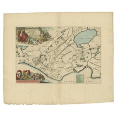
Antique Map of the Gaasterland Township 'Friesland' by Halma, 1718
Located in Langweer, NL
Antique map Friesland titled 'Gaasterland de Zevende Grietenije van de Zevenwolden (..)'. Old map of Friesland, the Netherlands. This map depicts the region of Gaasterland and includ...
Category
18th Century Antique Maps
Materials
Paper
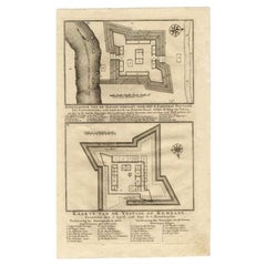
Antique Map of the Fortress of Captain E. Bintang by Valentijn, 1726
Located in Langweer, NL
Antique print titled 'Kaarte van de Schans gemaakt door den E. Capitein Bintang. Kaarte van de Vesting op Rembang.' A plan of the fort constructed by the Captain E. Bintang, in the B...
Category
18th Century Antique Maps
Materials
Paper
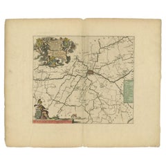
Antique Map of the Franekeradeel Township 'Friesland' by Halma, 1718
Located in Langweer, NL
Antique map Friesland titled 'De Grietenije van Franeker Deel (..) '. Old map of Friesland, the Netherlands. This map depicts the region of Franekeradeel and includes cities and vill...
Category
18th Century Antique Maps
Materials
Paper
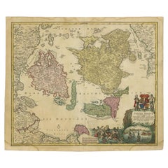
Antique Map of the Islands of Denmark by Homann Heirs, 1720
Located in Langweer, NL
Antique map titled 'Insula Danicae in Mari Balthico sitae (..).' - Map of the Danish islands situated in the Baltic Sea by J. B. Homann, (after J. Hübner's map of the region ) with g...
Category
18th Century Antique Maps
Materials
Paper
Antique Map of the Bukhari and Surroundings by Bellin, 1749
Located in Langweer, NL
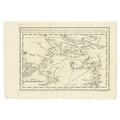
Antique map titled 'Carte de la Petite Bukharie et Pays Voisins'. Old map of the Bukhari (Sinkiang in north-western China) and neighboring countries. Artists and Engravers: Jacques-N...
Category
18th Century Antique Maps
Materials
Paper
Antique Map of the Cities of the Province of Hu-Quang by Basire, 1738
Located in Langweer, NL
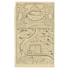
Antique print titled 'Cities of the Province of Hu-Quang'. Old map depicting four walled cities of the Chinese Qing dynasty province of Hu-Quang (modern day HUNAN and part of surroun...
Category
18th Century Antique Maps
Materials
Paper
Antique Map of Part of Germany by Moll, c.1740
Located in Langweer, NL
Antique map Germany titled 'The North West Part of Germany; Containing ye Dominions of ye Arch: and El: of Cologne, Westphalia, / Juliers, Cleeves,...
Category
18th Century Antique Maps
Materials
Paper
Antique Map of Oostergo by Tirion, 1744
Located in Langweer, NL
Antique map titled 'Oostergo'. Original antique map of Oostergo, part of the province of Friesland, the Netherlands. Published 1744. Artists and Engravers: Isaak Tirion (1705 in Utre...
Category
18th Century Antique Maps
Materials
Paper
Antique Map of South America by Tirion, c.1765
Located in Langweer, NL
Antique map titled 'Kaart van het Onderkoningschap van Peru zig uitstrekkende: over Chile, Paraguay en andere Spaansche Landen als ook van Brazil en verdere Bezittingen van Portugal ...
Category
18th Century Antique Maps
Materials
Paper
Antique Map of Spain and Portugal by Bowles, c.1780
Located in Langweer, NL
"Antique map titled 'Bowles's New Pocket Map of the Kingdom of Spain and Portugal according to De Lisle'. Large and detailed map of Spain and Portugal. Artists and Engravers: Made by 'Thomas & Carington Bowles' after an anonymous artist. Thomas Bowles, born around 1712, was map publisher and seller in London...
Category
18th Century Antique Maps
Materials
Paper
Antique Map of Overijssel by Van Jagen, 1771
Located in Langweer, NL
Antique map titled 'L'Over-Issel'. This map depicts the Dutch province Overijssel. This map originates from 'Nouvel Atlas, très exact et fort commode pour toutes sortes de personnes,...
Category
18th Century Antique Maps
Materials
Paper
Antique Map of Oostergo, Friesland by Tirion, 1785
Located in Langweer, NL
Antique map Friesland titled 'Oostergo'. Antique map of part of Friesland depicting the 'Oostergo' region. Decorative titled cartouche with horse and plough. Originates from 'Tegenwo...
Category
18th Century Antique Maps
Materials
Paper
Antique Map of Part of Groningen by Von Reilly, 1792
Located in Langweer, NL
Antique map titled 'Oldambt oder die Alten Aemter'. This map depicts part of the Dutch province Groningen. This map originates from 'Schauplatz der fünf Theile der Welt' published in...
Category
18th Century Antique Maps
Materials
Paper
Antique Map of Part of Overijssel by Von Reilly, 1792
Located in Langweer, NL
Antique map titled 'Das Drostamt Twenthe und Haarbergen'. This map depicts part of The Netherlands (Overijssel). This map originates from 'Schauplatz der fünf Theile der Welt' publis...
Category
18th Century Antique Maps
Materials
Paper
Antique Map of Southeast Asia by Dussy, 1778
Located in Langweer, NL
"Antique map titled 'Indostan presqu'isles de l'Inde, Chine, Tartarie Independante.' - A map of Asia: Hindustan, India and China. This map originates from 'Nouvel Atlas Portatif dest...
Category
18th Century Antique Maps
Materials
Paper
Antique Map of Southern Brazil and Uruguay by Bonne, c.1780
Located in Langweer, NL
"Antique map titled 'Carte de la Partie Meridional du Bresil avec les Possessions Espagnoles Voisines Qui en Sont a l'Ouest.' Map of southern Brazil and present-day Uruguay from Port...
Category
18th Century Antique Maps
Materials
Paper
Antique Map of Oostergo, Friesland by Tirion, 1785
Located in Langweer, NL
Antique map Friesland titled 'Oostergo'. Antique map of part of Friesland depicting the 'Oostergo' region. Decorative titled cartouche with horse and plough. Originates from 'Tegenwo...
Category
18th Century Antique Maps
Materials
Paper
Antique Map of Oostergo by Von Reilly, 1791
Located in Langweer, NL
Antique map titled 'Der Provinz Oostergo sechs südliche Grietenyen'. Map of the Oostergo region, Friesland, the Netherlands. This map orginates from 'Schauplatz der fünf Theile der W...
Category
18th Century Antique Maps
Materials
Paper
Antique Map of Overijssel and Drenthe by Von Reilly, c.1795
Located in Langweer, NL
Antique map titled 'Overyssel und Drenthe'. Decorative map of Overijssel and Drenthe, The Netherlands. From 'Schauplatz Der Funf Theile der Welt' (Wien: Reilly, 1791-1806), a world a...
Category
18th Century Antique Maps
Materials
Paper
Antique Map of Part of Russia by Spyk, c.1740
Located in Langweer, NL
Antique map titled 'Mappa Geogr: Continens partem Russici Imperii (..)'. Old map of part of Russia including the city of Moscow, Vologda, Tobolsk and others. Source unknown, to be de...
Category
18th Century Antique Maps
Materials
Paper
Antique Map of Southeastern France by Vaugondy, c.1790
Located in Langweer, NL
"Antique map titled 'Languedoc, Dauphiné, Province'. Beautiful antique map of Southeastern France with decorative cartouche. Map includes topographical detail as well as a reference ...
Category
18th Century Antique Maps
Materials
Paper
Antique Map of Novaya Zemlya and the Russian Mainland by Bellin, c.1760
Located in Langweer, NL
Antique map titled 'Carte Des Pais Habites par les Samojedes et Ostiacs.' Map of Novaya Zemlya and the Russian mainland. Source unknown, to be determined. Artists and Engravers: Made...
Category
18th Century Antique Maps
Materials
Paper
Rare Antique Map of Part of Europe and Africa by Scherer, C.1703
Located in Langweer, NL
Antique map with two figures. The upper figures showing part of Europe and Africa. Below a chart. Printed for Scherer's 'Atlas Novus' (1702-1710). Artists and Engravers: Heinrich Sch...
Category
18th Century Antique Maps
Materials
Paper
Antique Map of Part of Southern Asia by Bonne, c.1780
Located in Langweer, NL
Antique map titled 'Carte de la Partie Superieure de l'Inde en deca du Gange. Comprise entre la Cote du Concan et celle d'Orixa, avec l'Empire du Mogol, le Bengale, le R. d'Asham, pa...
Category
18th Century Antique Maps
Materials
Paper
Antique Map of Oostergo by Tirion, 1744
Located in Langweer, NL
Antique map titled 'Oostergo'. Original antique map of Oostergo, part of the province of Friesland, the Netherlands. Published 1744. Artists and Engravers: Isaak Tirion (1705 in Utre...
Category
18th Century Antique Maps
Materials
Paper
Antique Map of Overijssel and Drenthe by Von Reilly, c.1795
Located in Langweer, NL
Antique map titled 'Overyssel und Drenthe'. Decorative map of Overijssel and Drenthe, The Netherlands. This map originates from 'Schauplatz Der Funf Theile der Welt' (Wien: Reilly, 1...
Category
18th Century Antique Maps
Materials
Paper
Antique Map of the Aengwirden Township, Friesland, the Netherlands, 1718
Located in Langweer, NL
Antique map titled 'De Grietenije van Aengwerden, de Tweede van de Zevenwolden (..)'. Old map of Friesland, the Netherlands. This map depicts the region of Aengwirden and includes ci...
Category
18th Century Antique Maps
Materials
Paper
Antique Map of the Baarderadeel Township, 1718
Located in Langweer, NL
Antique map Friesland titled 'Baardera Deel de Vierde Grietenije van Wester Goo (..)'. Old map of Friesland, the Netherlands. This map depicts the region of B...
Category
18th Century Antique Maps
Materials
Paper
Antique Map of St. Jago, St Mayo and Praya Harbour, Mauritania, Africa, c.1750
Located in Langweer, NL
Antique map Africa titled 'Gezigt van 't Eiland St. Jago en de Stad St. Jago of Ribeyro Grande, Haven van Praya in 't Eiland St. Jago'. To the left,...
Category
18th Century Antique Maps
Materials
Paper
Antique Map of Spain and Portugal by Kitchin, 1770
Located in Langweer, NL
Antique map titled 'Spain and Portugal by Tho. Kitchin'. Rare detailed map of Spain and Portugal, with decorative title cartouche in the lower right...
Category
18th Century Antique Maps
Materials
Paper
Antique Map of the Bay and Rocks of Petatlan by Anson, 1749
Located in Langweer, NL
Antique map titled 'Baye et Rochers de Petaplan (..) - De Baay en de Rotsen van Petaplan (..)'. Original antique map of the bay and rocks of Petatlan, Mexico. This map originates fro...
Category
18th Century Antique Maps
Materials
Paper
Antique Map of the Aengwirden Township 'Friesland' by Halma, 1718
Located in Langweer, NL
Antique map titled 'De Grietenije van Aengwerden, de Tweede van de Zevenwolden (..)'. Old map of Friesland, the Netherlands. This map depicts the region of Aengwirden and includes ci...
Category
18th Century Antique Maps
Materials
Paper
Antique Map of Sumatra by Bellin, 1764
Located in Langweer, NL
Antique map Sumatra titled 'Carte de l'Isle de Sumatra'. Old map of Sumatra, Malaysia and the Straits of Malacca, including Singapore. This map originates ...
Category
18th Century Antique Maps
Materials
Paper
Antique Map of the Bay of Batavia by Van der Aa, c.1720
Located in Langweer, NL
Antique map titled 'La Rade de Batavia'. A small early 18th century black and white map of the Bay of Batavia (Jakarta), Indonesia. Published by P....
Category
18th Century Antique Maps
Materials
Paper
Antique Map of the Bay of Bantam, c.1720
Located in Langweer, NL
Rare, untitled miniature map of the Bay of Bantam with various Islands including Pulo Dua and Pulo Batto. This map originates from a small travelogue and may originate from an editio...
Category
18th Century Antique Maps
Materials
Paper
Antique Map of the Baarderadeel Township, 1718
Located in Langweer, NL
Antique map Friesland titled 'Baardera Deel de Vierde Grietenije van Wester Goo (..)'. Old map of Friesland, the Netherlands. This map depicts the region of B...
Category
18th Century Antique Maps
Materials
Paper
Antique Map of the Bay Near Huchou Island by Van Schley, 1758
Located in Langweer, NL
Antique map titled 'Carte de la Baye d' Hocsieu et des entrees de la Riviere de Chang situees dans la Province de Foyken.' Original antique map of the bay nea...
Category
18th Century Antique Maps
Materials
Paper
Antique Map of Northern England and Wales by Zatta, 1784
Located in Langweer, NL
Antique map titled 'Parte Settentrionale dell' Inghilterra e del Principato di Galles'. Engraved map of the northern part of England and Wales, with title cartouche. Shows political and administrative divisions, towns, villages, forests, mountains and rivers. This print originates from 'Atlante Novissimo, illustrato ed accresciuto sulle osservazioni, e scoperte fatte dai piu' celebri e piu' recenti geografi' by A. Zatta. Artists and Engravers: Antonio Zatta (active 1757-1797) was the most prominent Italian map...
Category
18th Century Antique Maps
Materials
Paper
Antique Map of Northern China and Eastern Russia by Bellin, 1757
Located in Langweer, NL
Antique map titled 'Carte de la Tartarie Orientale (..)'. Original antique map of what is present day northern China and far eastern Russia. Centered on...
Category
18th Century Antique Maps
Materials
Paper
Antique Print of a Cross-Section of a Building in Rome by De Rossi, C.1710
Located in Langweer, NL
Antique print titled 'Spaccato della Palazzina'. Old print showing a cross-section of a building in Rome. This print originates from 'Studio d'architettura civile sopra gli ornamenti...
Category
18th Century Antique Maps
Materials
Paper
Fonts in Suffolk - Basire, 1791
Located in Langweer, NL
Antique print titled 'Fonts in Suffolk'. Antique print depicting fonts of Ufford Church and St. Gregorys Church Sudburg. Artists and Engravers: Made by J. B...
Category
18th Century Antique Maps
Materials
Paper
Pl. 3 Antique Print of a Dutch Pavilion by Schübler, c.1724
Located in Langweer, NL
Antique print titled 'Prospect eines nah Holländischer art neu Invertirten Lust Hausses (..)'. Copper engraving showing a Dutch garden pavilion. This print originates from a series o...
Category
18th Century Antique Maps
Materials
Paper
Figures & Ornaments on Geddington Cross, Basire, 1791
Located in Langweer, NL
Antique print titled 'Figures & Ornaments on Geddington Cross'. Antique print depicting the Eleanor cross at Geddington. Artists and Engravers: Made by J. Basire after Schnebbelie.
...
Category
18th Century Antique Maps
Materials
Paper
South View of Cowdray, Basire, 1796
Located in Langweer, NL
Antique print titled 'South View of Cowdray from the Cottage; North View of Cowdray House'. Antique print with two views of Cowdray, Sussex. Artists and Engravers: Made by J. Basire ...
Category
18th Century Antique Maps
Materials
Paper
Antique Print of Palazzo Chigi in Rome, Italay, by De Rossi, c.1710
Located in Langweer, NL
Antique print titled 'Altra Finestra del terzo piano parimente (..)'. Old print of a third floor window of Palazzo Chigi, Rome. This print originates from 'Studio d'architettura civi...
Category
18th Century Antique Maps
Materials
Paper
Antique Print of Palazzo di Propaganda Fide by De Rossi, c.1710
Located in Langweer, NL
Antique print titled 'Porta del Collegio di Propaganda Fide (..)'. Old print of the door of Palazzo di Propaganda Fide, Rome. This print originates from 'Studio d'architettura civile...
Category
18th Century Antique Maps
Materials
Paper
Original Antique Print of the Magdalen Chapel Near Winchester, England, 1790
Located in Langweer, NL
Antique print titled 'Magdalen Chapel near Winchester'. Magdalen Chapel near Winchester, Site of the Corporation or the Master, Brethren and Sisters of the Blessed Mary...
Category
18th Century Antique Maps
Materials
Paper
Antique Print of Palazzo Barberino by De Rossi, c.1710
Located in Langweer, NL
Antique print titled 'Camino nella sala del Palazzo Barberino (..)'. Old print of a fireplace in the hall of Palazzo Barberino, Rome. This print originates from 'Studio d'architettur...
Category
18th Century Antique Maps
Materials
Paper
Antique Print of Palazzo Chigi by De Rossi, c.1710
Located in Langweer, NL
Antique print titled 'Altra Finestra del piano terreno (..)'. Old print of a ground floor window of Palazzo Chigi, Rome. This print originates from 'Studio d'architettura civile sopr...
Category
18th Century Antique Maps
Materials
Paper
Untitled Print of the Tomb of Edward iv, Basire, 1790
Located in Langweer, NL
Untitled Print of the Tomb of Edward IV. Antique print depicting words engraved on the arch of the vault, a skeleton lying in tomb and a vault. Artists and E...
Category
18th Century Antique Maps
Materials
Paper
Inner Front of Basire (..) - Basire, 1796
Located in Langweer, NL
Antique print titled 'Innter front of Cowdray house taken from the Gateway'. Antique print with a view of Cowdray, Sussex. Artists and Engravers: Made by J. Basire after S.H. Grimm.
...
Category
18th Century Antique Maps
Materials
Paper
Pl. 27 Antique Print of Château De Bonnelles by Le Rouge, c.1785
Located in Langweer, NL
Antique print titled 'Plan du chateau et parc de Bonnelles (..)'. Copper engraving showing a plan of the garden and Château de Bonnelles. This print originates from 'Jardins Anglo-Ch...
Category
18th Century Antique Maps
Materials
Paper
Pl. 41 Antique Print of Charlottenborg Palace, c.1790
Located in Langweer, NL
Antique print titled 'Facade du Bâtiment situé dans la Cour du Chateau'. Architecture print of Charlottenborg Palace, a large town mansion located on the corner of Kongens Nytorv and...
Category
18th Century Antique Maps
Materials
Paper
Pl. 15 Antique Print of Various Views of Rambouillet by Le Rouge, c.1785
Located in Langweer, NL
Antique print titled 'Vue d'un Pont à Rambouillet (..)'. Copper engraving showing the bridges of Rambouillet and a monument of Chaville gardens. This print originates from 'Jardins A...
Category
18th Century Antique Maps
Materials
Paper
Pl. 11 Antique Print of the Mansion of Viscount Charlemont by Le Rouge, c.1785
Located in Langweer, NL
Antique print titled 'Plan de la Casine du Vicomte Charlemont a Marino'. Copper engraving showing the mansion of Viscount Charlemont in Marino. This print originates from 'Jardins An...
Category
18th Century Antique Maps
Materials
Paper
Pl. 5 Antique Print of the Hydraulic Machine of the Kew Gardens by Le Rouge, c.1
Located in Langweer, NL
Antique print titled 'Machine Hydraulique dans les Jardins de Kew (..)'. Copper engraving showing the hydraulic system of the Kew gardens and the cave of Chiswick. This print origina...
Category
18th Century Antique Maps
Materials
Paper
Pl. 7 Antique Print of the Rock Formation of Saint-Leu by Le Rouge, c.1785
Located in Langweer, NL
Antique print titled 'Plan du Rocher et de la grande cascade de St. Leu'. Copper engraving showing the rock formation of Saint-Leu. This print originates from 'Jardins Anglo-Chinois ...
Category
18th Century Antique Maps
Materials
Paper
Pl. 22 Antique Print of Various Rock Formations by Le Rouge, c.1785
Located in Langweer, NL
Antique print titled 'Idées pour la construction des Rochers dans les Jardins Anglais'. Copper engraving showing various rock formations for English gar...
Category
18th Century Antique Maps
Materials
Paper
