Maps
to
1,831
2,372
95
2,470
78
9
5
4
3
3
2
2
1
1
2,926
2,181
476
3
289
34
10
127
7
35
9
2
5
3
4
2
2,422
74
28
24
19
301
219
137
106
95
2,470
2,470
2,470
104
29
9
8
7
Maps For Sale
Period: 19th Century
Period: Early 20th Century
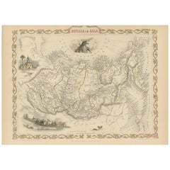
Antique Map of Russia in Asia by Tallis, '1851'
Located in Langweer, NL
Antique map titled 'Russia in Asia'. Map of Russia in Asia. Showing vignettes of a polar hunting scene, Skorskarskoi Pagost, Troitsk and Kamchatkan Dogs. Originates from 'The Illustr...
Category
Mid-19th Century Antique Maps
Materials
Paper
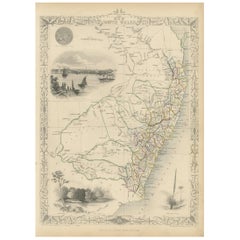
Antique Map of New South Wales by Tallis, circa 1851
Located in Langweer, NL
Antique map titled 'New South Wales'. Decorative and detailed map of New South Wales which was drawn and engraved by J. Rapkin (vignettes by H. Warren ...
Category
Mid-19th Century Antique Maps
Materials
Paper
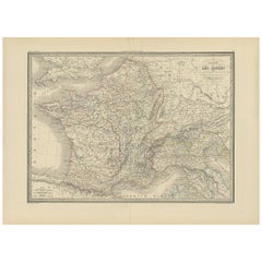
Antique Map of France by Lapie, 1842
Located in Langweer, NL
Antique map titled 'Carte des Gaules'. Map of France. This map originates from 'Atlas universel de géographie ancienne et moderne (..)' by Pierre M. Lapie and Alexandre E. Lapie. Pie...
Category
Mid-19th Century Antique Maps
Materials
Paper
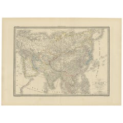
Antique Map of Asia by Lapie, 1842
Located in Langweer, NL
Antique map titled 'Carte de l'Asie'. Map of Asia. This map originates from 'Atlas universel de géographie ancienne et moderne (..)' by Pierre M. Lapie and...
Category
Mid-19th Century Antique Maps
Materials
Paper
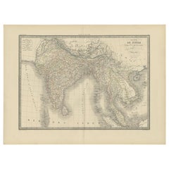
Antique Map of India and Ceylon by Lapie, 1842
Located in Langweer, NL
Antique map titled 'Carte de l'Inde en deca et au dela du Gange'. Map of India and Ceylon (Sri Lanka). This map originates from 'Atlas universel de géographie ancienne et moderne (.....
Category
Mid-19th Century Antique Maps
Materials
Paper
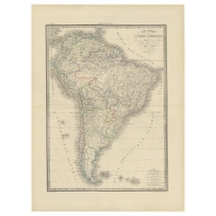
Antique Map of South America by Lapie '1842'
Located in Langweer, NL
Antique map titled 'Carte Générale de l'Amérique Meridionale'. Map of South America. This map originates from 'Atlas universel de géographie ancienne et moderne (..)' by Pierre M. La...
Category
Mid-19th Century Antique Maps
Materials
Paper
Antique Map of the region near Annesley Bay by Wagner, 1870
Located in Langweer, NL
Antique print titled 'Map of the Country between Annesley Bay and Senafe'. Map of the region near Annesley Bay (Gulf of Zula, Bay of Arafali), Eritrea, Africa. The bay is located abo...
Category
Mid-19th Century Antique Maps
Materials
Paper
Antique Map of Northern Natal by Stanford, 1900
Located in Langweer, NL
Antique map titled 'Northern Natal'. Lithograph of Northern Natal. The Colony of Natal was a British colony in south-eastern Africa. It was proclaimed a British colony on 4 May 1843 ...
Category
Early 20th Century Maps
Materials
Paper
Antique Map of Indonesia by C.F. Beautemps-Beaupre, circa 1807
Located in Langweer, NL
Antique map titled 'Carte de la partie du grand archipel d'Asie'. Map of Indonesia showing tracks of Recherche and Esperance in 1792-1793. This map is...
Category
Early 19th Century Antique Maps
Materials
Paper
Antique Map of Nièvre ‘France’ by V. Levasseur, 1854
Located in Langweer, NL
Antique map titled 'Dépt. de la Nièvre'. Map of the French department of Nievre, France. Part of the prestiegous Burgundy or Bourgogne wine region this area is known for its producti...
Category
Mid-19th Century Antique Maps
Materials
Paper
Antique Map of Du Nord ‘France’ by V. Levasseur, 1854
Located in Langweer, NL
Antique map titled 'Dépt. du Nord'. Map of the French department of Nord, France. This area is known for its production of Maroilles, a cow's milk cheese. This cheese is produced in ...
Category
Mid-19th Century Antique Maps
Materials
Paper
Antique Map of Drôme ‘France’ by V. Levasseur, 1854
Located in Langweer, NL
Antique map titled 'Dépt. de la Drôme'. Map of the French department of Drome, France. This area is known for its production of Picodon, a spicy goats-milk ch...
Category
Mid-19th Century Antique Maps
Materials
Paper
Antique Map of Ariège ‘France’ by V. Levasseur, 1854
Located in Langweer, NL
Antique map titled 'Dépt. de l'Ariège'. Map of the French department of Ariege, France. This area of France is known for its production of semi-soft and mild cheeses, such as Bethmal...
Category
Mid-19th Century Antique Maps
Materials
Paper
Antique Map of Haute Loire ‘France’ by V. Levasseur, 1854
Located in Langweer, NL
Antique map titled 'Dépt. de la Haute Loire'. Map of the French department of Haute Loire, France. This area of France is part of the Loire Valley wine gro...
Category
Mid-19th Century Antique Maps
Materials
Paper
Antique Map of Moselle ‘France’ by V. Levasseur, 1854
Located in Langweer, NL
Antique map titled 'Dépt. de la Moselle'. Map of the French department of Moselle, France. This area, part of the Alcase-Lorraine wine region, is known for its production of wines by...
Category
Mid-19th Century Antique Maps
Materials
Paper
Antique Map of Morbihan ‘France’ by V. Levasseur, 1854
Located in Langweer, NL
Antique map titled 'Dépt. du Morbihan'. Map of the French department of Morbihan, France. This map originates from ‘Atlas National de la France Illustré’. Published by A. Combette, P...
Category
Mid-19th Century Antique Maps
Materials
Paper
Antique Map of Lozère ‘France’ by V. Levasseur, 1854
Located in Langweer, NL
Antique map titled 'Dépt. de la Lozère'. Map of the French department of Lozere, France. This remote mountainous part of Languedoc is rural, sparcely populated, and extremely beautif...
Category
Mid-19th Century Antique Maps
Materials
Paper
Antique Map of Meurthe ‘France’ by V. Levasseur, 1854
Located in Langweer, NL
Antique map titled 'Dépt. de la Meurthe'. Map of the French department of Meurthe, France. Part of Lorraine and the Alsace-Lorraine wine region. This map originates from ‘Atlas Natio...
Category
Mid-19th Century Antique Maps
Materials
Paper
Antique Map of Meuse ‘France’ by V. Levasseur, 1854
Located in Langweer, NL
Antique map titled 'Dépt. de la Meuse'. Map of the French department of Meuse, France. This area part of the Lorraine or Alsace-Lorraine wine regions. It is also known for its produc...
Category
Mid-19th Century Antique Maps
Materials
Paper
Antique Map of Loiret ‘France’ by V. Levasseur, 1854
Located in Langweer, NL
Antique map titled 'Dépt. du Loiret'. Map of the French department of Loiret, France. Surrounding the city of Orleans, Loiret is considered the heart of France and is a registered Unesco World Heritage Site. This area of France is also part of the Loire Valley wine region, and is especially known for its production of Pinot Noirs...
Category
Mid-19th Century Antique Maps
Materials
Paper
Antique Map of Mayenne ‘France’ by V. Levasseur, 1854
Located in Langweer, NL
Antique map titled 'Dépt. de la Mayenne'. Map of the French department of Mayenne, France. This area is part of the Loire Valley wine region. The map is surrounded by elaborate decor...
Category
Mid-19th Century Antique Maps
Materials
Paper
Antique Map of Marne ‘France’ by V. Levasseur, 1854
Located in Langweer, NL
Antique map titled 'Dépt. de la Marne'. Map of the French department of Marne, France. This department is home to the Champagne region where the world's finest sparkling wine is prod...
Category
Mid-19th Century Antique Maps
Materials
Paper
Antique Map of Gironde ‘France’ by V. Levasseur, 1854
Located in Langweer, NL
Antique map titled 'Dépt. de la Gironde'. Map of the French department of Gironde. This coastal department is the seat of the Bordeaux wine region and produces many of the world's fi...
Category
Mid-19th Century Antique Maps
Materials
Paper
Antique Map of Creuse ‘France’ by V. Levasseur, 1854
Located in Langweer, NL
Antique map titled 'Dépt. de la Creuse'. Map of the French department of Creuse, France. This region is well known for its apple cider made from Limousin apples and its international...
Category
Mid-19th Century Antique Maps
Materials
Paper
Antique Map of Ain ‘France’ by V. Levasseur, 1854
Located in Langweer, NL
Antique map titled 'Dépt. de l'Ain'. Map of the French department of l'Ain, France. This area of France is known for its Bugey wines, which are generally aromatic and white. It is al...
Category
Mid-19th Century Antique Maps
Materials
Paper
Antique Map of Orne ‘France’ by V. Levasseur, 1854
Located in Langweer, NL
Antique map titled 'Dépt. de l'Orne'. Map of the French department of Orne, France. This area, part of Normandy, includes the village of Camembert, where the famous Camembert cheese ...
Category
Mid-19th Century Antique Maps
Materials
Paper
Antique Map of Aude ‘France’ by V. Levasseur, 1854
Located in Langweer, NL
Antique map titled 'Dépt. de 'l'Aude'. Map of the French department of Aude, France. This area of France is famous for its wide variety of vineyards and wine production. In the east ...
Category
Mid-19th Century Antique Maps
Materials
Paper
Antique Map of Gard ‘France’ by V. Levasseur, 1854
Located in Langweer, NL
Antique map titled 'Dépt. du Gard'. Map of the French department of Gard, France. This area of France is known mainly for its red wine and production of Bleu des Causses, a soft and ...
Category
Mid-19th Century Antique Maps
Materials
Paper
Antique Map of Cantal ‘France’ by V. Levasseur, 1854
Located in Langweer, NL
Antique map titled 'Dépt. du Cantal'. Map of the French department of Cantal, France. This area of France is known for its production of Cantal, a firm cheese, named after the region...
Category
Mid-19th Century Antique Maps
Materials
Paper
Antique Map of Aveyron ‘France’ by v. Levasseur, 1854
Located in Langweer, NL
Antique map titled 'Dépt. de 'l'Aveyron'. Map of the French department of Aveyron, France. This area of France, centred on Rodez, is famous for its production of Roquefort, a flavorf...
Category
Mid-19th Century Antique Maps
Materials
Paper
Antique Map of Tarn 'France' by V. Levasseur, 1854
Located in Langweer, NL
Antique map titled 'Dépt. du Tarn'. Map of the French department of Tarn, France. This area produces a variety of traditional wines, including Cahors, Mauzac, Loin de l'Oeil and Onde...
Category
Mid-19th Century Antique Maps
Materials
Paper
Antique Map of Somme ‘France’ by V. Levasseur, 1854
Located in Langweer, NL
Antique map titled 'Dépt. de la Somme'. Map of the French department of Somme, France. This area is home to the region of Picardy, which produces Maroilles, a popular French cheese. ...
Category
Mid-19th Century Antique Maps
Materials
Paper
Antique Map of Tarn and Garonne in France, 1854
Located in Langweer, NL
Antique map titled 'Dépt. de Tarn et Garonne'. Map of the French department of Tarn et Garonne, France. This map is centered around the city of Moissac, which is known for its fine d...
Category
Mid-19th Century Antique Maps
Materials
Paper
Antique Map of Sarthe 'France' by V. Levasseur, 1854
Located in Langweer, NL
Antique map titled 'Dépt. de la Sarthe'. The north-west France Department of Sarthe is in the Pays de la Loire region of Le Mans, the location of the great endurance sports car road-...
Category
Mid-19th Century Antique Maps
Materials
Paper
Antique Map of Vienne 'France' by V. Levasseur, 1854
Located in Langweer, NL
Antique map titled 'Dépt. de la Vienne'. Decorative antique map of the French Department of Vienne, with its capital of Poitiers and small engraved vignette of the battle of Poitiers...
Category
Mid-19th Century Antique Maps
Materials
Paper
Antique Map of Haute-Saone, France by V. Levasseur, 1854
Located in Langweer, NL
Antique map titled 'Dépt. de la Hte. Saône'. Map of the French department of Haute-Saone, France. Part of France's important Burgundy or Bourgogne Wine Region. This area is home to t...
Category
Mid-19th Century Antique Maps
Materials
Paper
Antique Map of Upper Vienne ‘France’ by V. Levasseur, 1854
Located in Langweer, NL
Antique map titled 'Dépt. de La Hte. Vienne'. Antique map of Department of Upper Vienne with capital city Limoges, in the region of Limousin. This map originates from ‘Atlas National...
Category
Mid-19th Century Antique Maps
Materials
Paper
Antique Map of Vosges ‘France’ by V. Levasseur, 1854
Located in Langweer, NL
Antique map titled 'Dépt. des Vosges'. Map of the Vosges region in France, centred on Epinal. This map originates from ‘Atlas National de la France Illustré’. Published by A. Combett...
Category
Mid-19th Century Antique Maps
Materials
Paper
Antique Map of Denmark by A.K. Johnston, 1865
Located in Langweer, NL
Antique map titled 'Denmark and the Duchies Schleswig, Holstein & Lauenburg; Hanover, Brunswick, Mecklenburg, Oldenburg, Anhalt and Lippe'. With an inset map of Iceland, Copenhagen a...
Category
Mid-19th Century Antique Maps
Materials
Paper
Antique Map of Belgium and The Netherlands by A.K. Johnston, 1865
Located in Langweer, NL
Antique map titled 'Belgium and The Netherlands'. This map originates from the ‘Royal Atlas of Modern Geography’ by Alexander Keith Johnston. Published by William Blackwood and Sons,...
Category
Mid-19th Century Antique Maps
Materials
Paper
Antique Map of South-West Russia by A.K. Johnston, 1865
Located in Langweer, NL
Antique map titled 'South-West Russia showing the extent of the Kingdom of Poland previous to its partition in 1772'. This map originates from the ‘Royal Atlas of Modern Geography’ b...
Category
Mid-19th Century Antique Maps
Materials
Paper
Antique Map of Upper Nubia and Abyssinia by A.K. Johnston, 1865
Located in Langweer, NL
Antique map titled 'Upper Nubia and Abyssinia'. Depicting Habesh (or Abyssinia), Arabia, Upper Nubia and more. This map originates from the ‘Royal Atlas of Modern Geography’ by Alexa...
Category
Mid-19th Century Antique Maps
Materials
Paper
Antique Map of the British Islands to the White Sea by J. Imray
Located in Langweer, NL
Antique large nautical chart of the British Islands to the White Sea. With insets of Veshnyak Channel, Sosnovets and the Bay of Arkhangel. Published by James Irmay and Son, circa 1875.
Category
Late 19th Century Antique Maps
Materials
Paper
Antique Map of Borneo and Malaysia by P.M.G. Vandermaelen, 1827
Located in Langweer, NL
A chart of the north western part of Borneo and Malaysia (Sarawak). Published by P.M.G. Vandermaelen, 1827.
Category
Early 19th Century Antique Maps
Materials
Paper
Antique Map of South Sumatra by P.M.G. Vandermaelen, 1827
Located in Langweer, NL
A chart showing the southern part of Sumatra, the island of Belitung and southern Borneo, published in the "Atlas Universel de Géographie".
Category
Early 19th Century Antique Maps
Materials
Paper
Antique Map of West Sumatra by P.M.G. Vandermaelen, 1827
Located in Langweer, NL
A chart showing the western part of Sumatra, published in the "Atlas Universel de Géographie".
Category
Early 19th Century Antique Maps
Materials
Paper
Antique Map of France by Van Baarsel (c.1820)
Located in Langweer, NL
'Frankrijk naar de nieuwste bepalingen meerendeels gevolgd naar Lapie'. Beautiful map of France with an inset map of the island of Corsica. Includes a table with reference to the dep...
Category
Early 19th Century Antique Maps
Materials
Paper
Mamaroneck New York Harbor Chart from 1901
Located in Norwell, MA
Original harbor chart by George Eldridge in 1801 of Mamaroneck New York. Showing Oriental Hen Island, Rye Point, Scotch Caps, Crane Island, Decency Point, etc.. Showing local water d...
Category
Early 1900s North American Antique Maps
Materials
Paper
1912 "Panoramic View of New York City and Vicinity" by Jacob Ruppert
Located in Colorado Springs, CO
This is an attractive and very scarce map of New York, published by the Yorkville brewer Jacob Ruppert in 1912. The map shows an expansive view of the region reaching from Sandy Hook in the south and Yonkers to the north, to Hicksville in the east and past Newark to the west. This beautifully colored birds eye view shows waterways with all shipping traffic, boroughs, and clearly labeled railroad routes. It is presented on period dowels and backed on its original linen.
Jacob Ruppert was born in New York City in 1842 to Bavarian immigrants. His father owned a brewery in Manhattan where young Jacob learned the business of brewing. In 1862, Jacob established the Jacob...
Category
1910s American Vintage Maps
Materials
Paper
Antique Lithography Map, Northamptonshire, English, Framed Cartography, C.1860
Located in Hele, Devon, GB
This is an antique lithography map of Northamptonshire. An English, framed atlas engraving of cartographic interest, dating to the mid 19th century...
Category
Mid-19th Century British Victorian Antique Maps
Materials
Wood
Antique Lithography Map, West Africa, English, Framed, Cartography, Victorian
Located in Hele, Devon, GB
This is an antique lithography map of Western Africa. An English, framed atlas engraving of cartographic interest by John Rapkin, dating to the early Victorian period and later, circ...
Category
Mid-19th Century British Early Victorian Antique Maps
Materials
Wood
Extremely Large Hand-Drawn Manuscript Map of Surinam, 1830, History of Slavery
Located in Amsterdam, NL
A unique large hand-drawn map of Surinam by Albrecht Helmut Hiemcke (German, 1760-1839)
?
'Colonie Surinaame', 1830
A large hand-drawn and coloured map of the colony of Suri...
Category
Mid-19th Century Surinamer Antique Maps
Materials
Paper
Original 1891 Walker Map
Located in Norwell, MA
Original 1891 map of Massachusetts by Walker. Towns include Cambridge, Boston, Dedham, Ashland, Brookline, Newton etc... burl wood frame. Measures...
Category
19th Century Antique Maps
Antique 1803 Italian Map of Asia Including China Indoneseia India
Located in Amsterdam, Noord Holland
Antique 1803 Italian Map of Asia Including China Indoneseia India
Very nice map of Asia. 1803.
Additional information:
Type: Map
Country of Manufacturing: Europe
Period: 19th centu...
Category
19th Century European Antique Maps
Materials
Paper
1844 Map "Russia in Eurpoe, Part II to Part VIII", 7 Maps Ric.r023
Located in Norton, MA
1844 Map "Russia in Eurpoe, Part II to Part VIII"
7 Maps
Ric.r023
Fine, original, steel-engraved Map of Russia in Europe Part II t oPart VIII, by the Society for the Diffusion of Useful Knowledge. Detailed map of the regions to the northeast of Moscow. Including Arkhangel, Vologda, Viatka, Perm, Olonetz, Iaroslavl. The SDUK began its map publishing project under the leadership of Captain Francis Beaufort R.N. in 1829, and published the maps in parts, haltingly, over the next 15 years, completing the series in 1844, finally permitting the publication of a whole atlas. Many of the maps were actually drawn by Beaufort, who at the time was the Hydrographer to the Royal Navy, and all were closely supervised by him. J. & C. Walker worked closely with Beaufort in engraving the maps. Finely engraved, carefully researched, the maps set...
Category
19th Century Unknown Antique Maps
Materials
Paper
1860 Large Map "Carte De La Siberie Russie D'asie, " Ric.R0001
Located in Norton, MA
Large 1860 map "Carte De La Siberie Russie D'Asie," R-0001
" Authentic" - 1860 map "Carte De La Siberie Russie D'Asie,"
Dimension: Paper: 68 cm W x 51 cm H ; Sight: 51cm W x 4...
Category
19th Century Unknown Antique Maps
Materials
Paper
1896 "Territory of Arizona" Map, Published by the General Land Office
Located in Colorado Springs, CO
Presented is an attractive "Territory of Arizona” map, from the “Report of the Governor of Arizona to the Secretary of the Interior." First published in 1894, this 1896 edition was r...
Category
1890s Antique Maps
Materials
Paper
Vintage Swedish School Map of Vastergötland, Made in Sweden 1920
Located in Los Angeles, CA
Vintage Swedish School Map of Vastergötland, Made in Sweden 1920
Västergötland also known as West Gothland or the Latinized version Westrogothia in older literature, is one of the...
Category
1920s Swedish Vintage Maps
Materials
Linen, Wood, Paper
