Maps
to
1,770
2,224
81
2,308
76
9
5
4
2
1
1
1
2,926
2,181
476
3
289
34
10
127
7
35
9
2
5
3
4
2
2,270
65
28
13
10
267
189
120
97
88
2,308
2,308
2,308
104
29
9
8
7
Maps For Sale
Period: 19th Century
Period: Early 1900s
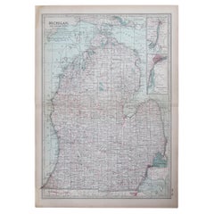
Original Antique Map of the American State of Michigan ( Southern Part ), 1903
Located in St Annes, Lancashire
Antique map of Michigan ( Southern part )
Published By A & C Black. 1903
Original colour
Good condition
Unframed.
Free shipping
Category
Early 1900s English Antique Maps
Materials
Paper
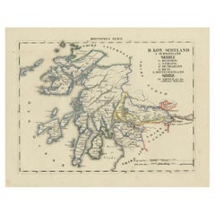
Antique 1830 Map of Scotland with Counties Renfrew, Stirling, Dumbarton and Bute
Located in Langweer, NL
Title: Antique 1830 Map of Scotland with Counties Renfrew, Stirling, Dumbarton, and Bute
Description:
This 1830 German-language map, titled Britisches Reich – B. Kon Scotland, ...
Category
1830s Antique Maps
Materials
Paper
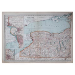
Original Antique Map of the American State of New York ( Western Part ) 1903
Located in St Annes, Lancashire
Antique map of New York ( Western Part )
Published By A & C Black. 1903
Original colour
Good condition
Unframed.
Free shipping
Category
Early 1900s English Antique Maps
Materials
Paper
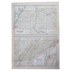
Original Antique Map of the American State of Tennessee, 1903
Located in St Annes, Lancashire
Antique map of Tennessee
Published By A & C Black. 1903
Original colour
Good condition
Unframed.
Free shipping
Category
Early 1900s English Antique Maps
Materials
Paper
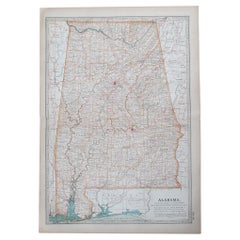
Original Antique Map of the American State of Alabama, 1903
Located in St Annes, Lancashire
Antique map of Alabama
Published By A & C Black. 1903
Original colour
Good condition
Unframed.
Free shipping
Category
Early 1900s English Antique Maps
Materials
Paper
Original Antique Map of South America. C.1780
Located in St Annes, Lancashire
Great map of South America
Copper-plate engraving
Published C.1780
Two small worm holes to left side of map
Unframed.
Category
Early 1800s English Georgian Antique Maps
Materials
Paper
Interesting Original Antique Map of South America, 1822
Located in Langweer, NL
Antique map titled 'South America'.
Map of South America with attractive topography, surrounded on three sides by text on the history, geography, and economy of the continent. Sh...
Category
19th Century Antique Maps
Materials
Paper
Original Antique Map of the American State of Idaho & Wyoming, 1903
Located in St Annes, Lancashire
Antique map of Idaho and Wyoming
Published By A & C Black. 1903
Original colour
Good condition
Unframed.
Free shipping
Category
Early 1900s English Antique Maps
Materials
Paper
Antique Map of the Antilles and Central America – 1872
Located in Langweer, NL
Title: Antique Map of the Antilles and Central America – 1872
Description:
This finely detailed antique map, titled Antilles et Amérique Centrale, was published in 1872 under t...
Category
1870s Antique Maps
Materials
Paper
Large Original Antique Map of The Leeward Islands. 1894
Located in St Annes, Lancashire
Superb Antique map of The Leeward Islands
Published Edward Stanford, Charing Cross, London 1894
Original colour
Good condition
Unframed.
Free shipping
Category
1890s English Antique Maps
Materials
Paper
Original Antique Map of the American State of Alaska, 1903
Located in St Annes, Lancashire
Antique map of Alaska
Published By A & C Black. 1903
Original colour
Good condition
Unframed.
Free shipping
Category
Early 1900s English Antique Maps
Materials
Paper
Ancient World Map: Europe, Africa & Asia - 1802 Tardieu Atlas
Located in Langweer, NL
Antique Map Description with title: "Monde Connu Des Anciens"
Publication Details:
- Atlas Title: Nouvel Atlas Universel de Géographie Ancienne et Moderne
- Purpose: For the Nouvel...
Category
Early 1800s Antique Maps
Materials
Paper
Antique Map of Guadeloupe and Dependencies – France Pittoresque, c. 19th Century
Located in Langweer, NL
Antique Map of Guadeloupe and Dependencies – France Pittoresque, c. 19th Century
This finely engraved antique map of Guadeloupe and its dependencies originates from France Pittore...
Category
1830s Antique Maps
Materials
Paper
Large Antique Map of New York State with Inset Maps
Located in Langweer, NL
Antique map titled 'Johnson's New York' Large map of New York State. With insets of Albany, Oswego, Buffalo, Rochester, Syracuse, Troy and NYC. Published by Johnson and Browning, 186...
Category
Mid-19th Century Antique Maps
Materials
Paper
1864 Johnson's Map of Virginia, Delaware, and Maryland with Fort Monroe Inset
Located in Langweer, NL
Title: 1864 Johnson's Map of Virginia, Delaware, and Maryland with Fort Monroe Inset
Description: This 1864 map titled "Johnson's Virginia, Delaware, and ...
Category
1860s Antique Maps
Materials
Paper
Antique Map of Africa by Homann Heirs, '1804'
Located in Langweer, NL
Antique map titled 'Charte von Africa'. Large, original antique map of Africa by Franz Ludwig Güssefeld. Published by Homann Heirs, 1804.
Category
Early 19th Century Antique Maps
Materials
Paper
Antique Print of Persian Decorative Art by Racinet, 1869
Located in Langweer, NL
Old print of Persian decorative art. This print originates from 'L'Ornement polychrome'. A beautiful work containing about 2000 patterns of all the styles of Art old and Asian, middl...
Category
19th Century Antique Maps
Materials
Paper
Large Original Antique Map of Ohio, Usa, C.1900
Located in St Annes, Lancashire
Fabulous map of Ohio
Original color.
Engraved and printed by the George F. Cram Company, Indianapolis.
Published, C.1900.
Unframed.
Free shipping.
Category
1890s American Antique Maps
Materials
Paper
Large Original Antique Map of The Falkland Islands. 1894
Located in St Annes, Lancashire
Superb Antique map of The Falkland Islands
Published Edward Stanford, Charing Cross, London 1894
Original colour
Good condition
Unframed.
Free shipping
Category
1890s English Antique Maps
Materials
Paper
Large Original Antique Map of Madagascar. 1894
Located in St Annes, Lancashire
Superb Antique map of Madagascar
Published Edward Stanford, Charing Cross, London 1894
Original colour
Good condition
Unframed.
Free shipping
Category
1890s English Antique Maps
Materials
Paper
Antique Decorative Coloured Map Marocco, Algeria and Tunis, 1882
Located in Langweer, NL
The maps is from the 1882 atlas by Blackie & Son and offers a detailed view of the North African regions as understood in the late 19th century.
**Map of Morocco, Algeria, and Tun...
Category
1880s Antique Maps
Materials
Paper
Original Antique Map of Hawaii And Adjacent Islands. C.1900
Located in St Annes, Lancashire
Fabulous map of Hawaii. With a vignette of Honolulu
Original color.
Engraved and printed by the George F. Cram Company, Indianapolis.
Published, C.1900.
Unframed.
Free shipping.
Category
1890s American Antique Maps
Materials
Paper
Antique Lithography Map, Monmouthshire, Framed, Welsh Cartography, Victorian
Located in Hele, Devon, GB
This is an antique lithography map of Monmouthshire. An English, framed atlas engraving of cartographic interest, dating to the mid 19th century and later.
Superb lithography of Mo...
Category
Mid-19th Century British Victorian Antique Maps
Materials
Glass, Wood, Paper
Original Antique Map of Ireland- Kerry. C.1840
Located in St Annes, Lancashire
Great map of Kerry
Steel engraving
Drawn under the direction of A.Adlard
Published by How and Parsons, C.1840
Unframed.
Category
1840s English Antique Maps
Materials
Paper
Beira Alta: A Cartographic Journey Through Portugal's Heartland in 1903
Located in Langweer, NL
The uploaded image is a historical map of the Beira Alta region in Portugal. The map is detailed, showing the topography, hydrography, and transportation networks of the region, incl...
Category
Early 1900s Antique Maps
Materials
Paper
1826 Antigo Impero Messicano Mexico Hand Colored Framed Map
Located in Stamford, CT
1826 Antigo Impero Messicano Mexico Hand Colored Framed Map. As found black wood frame.
Category
1820s Mexican Spanish Colonial Antique Maps
Materials
Glass, Wood, Paper
Antique Map of Spain and Portugal by Barlow, 1809
Located in Langweer, NL
"Antique map titled 'Spain and Portugal from the best Authorities'. Detailed antique map of Spain and Portugal. This map originates from 'The Gen...
Category
19th Century Antique Maps
Materials
Paper
Original Antique Map of the American State of North Carolina, 1903
Located in St Annes, Lancashire
Antique map of North Carolina
Published By A & C Black. 1903
Original colour
Good condition
Unframed.
Free shipping
Category
Early 1900s English Antique Maps
Materials
Paper
Original Antique Map of the American State of Wisconsin, 1903
Located in St Annes, Lancashire
Antique map of Wisconsin
Published By A & C Black. 1903
Original colour
Good condition
Unframed.
Free shipping
Category
Early 1900s English Antique Maps
Materials
Paper
Small Map of St. Anna Bay and Willemstad, Curaçao – Dutch Colonial View, c. 1880
Located in Langweer, NL
Map of St. Anna Bay and Willemstad, Curaçao – Dutch Colonial View, c. 1880
This attractive late 19th-century map titled “De St. Anna-baai en de hoofdstad van Curaçao” offers a detai...
Category
1880s Antique Maps
Materials
Paper
Map of French Colonies in the Americas: St. Martin, French Guiana and St. Pierre
Located in Langweer, NL
This is an intricately detailed map from 1852 titled *Colonies Françaises en Amérique*, depicting several key French colonies in the Americas.
The map focuses on regions such as Fr...
Category
1850s Antique Maps
Materials
Paper
Original Antique Map of the American State of Iowa, 1903
Located in St Annes, Lancashire
Antique map of Iowa
Published By A & C Black. 1903
Original colour
Good condition
Unframed.
Free shipping
Category
Early 1900s English Antique Maps
Materials
Paper
Original Antique Map of the American State of Washington, 1903
Located in St Annes, Lancashire
Antique map of Washington
Published By A & C Black. 1903
Original colour
Good condition
Unframed.
Free shipping
Category
Early 1900s English Antique Maps
Materials
Paper
Original Antique Map of the American State of Nevada & Utah, 1903
Located in St Annes, Lancashire
Antique map of Nevada and Utah
Published By A & C Black. 1903
Original colour
Good condition
Unframed.
Free shipping
Category
Early 1900s English Antique Maps
Materials
Paper
Original Antique Map of the American State of Illinois ( Southern Part ), 1903
Located in St Annes, Lancashire
Antique map of Illinois ( Southern part )
Published By A & C Black. 1903
Original colour
Good condition
Unframed.
Free shipping
Category
Early 1900s English Antique Maps
Materials
Paper
Antique Map of French Colonies – La France, 19th Century
Located in Langweer, NL
Title: Antique Map of French Colonies – La France, 19th Century
Description: This antique 19th-century map, titled La France, presents a detailed depiction of France’s overseas c...
Category
1870s Antique Maps
Materials
Paper
Antique 1830 Map of Ulster, Ireland with Armagh, Down, Antrim, Donegal, Tyrone
Located in Langweer, NL
Title: Antique 1830 Map of Ulster, Ireland with Armagh, Down, Antrim, Donegal, and Tyrone
Description: This 1830 German-language map, titled Britisches Reich – C. Kon: Ireland, ...
Category
1830s Antique Maps
Materials
Paper
Antique Map of Northern Germany and the Netherlands – circa 1806
Located in Langweer, NL
Title: Antique Map of Northern Germany and the Netherlands – circa 1806
Description: This finely engraved antique map, titled L'Allemagne 1re Feuille, depicts the northern regions...
Category
Early 1800s Antique Maps
Materials
Paper
Antique 1830 Map of Eastern England with Suffolk, Norfolk Cambridge, Huntingdon
Located in Langweer, NL
Title: Antique 1830 Map of Eastern England with Suffolk, Norfolk, Cambridge, and Huntingdon
Description: This 1830 German-language map, titled Britisches Reich – A. Kon: England,...
Category
1830s Antique Maps
Materials
Paper
Antique Map Depicting Burma, Siam, Annam (Vietnam) and Japan, 1882
Located in Langweer, NL
The image shows two maps side by side from the 1882 atlas by Blackie & Son. On the left, the map is titled "BURMAH SIAM AND ANAM," while the one on the right is labeled "JAPAN."
**B...
Category
1880s Antique Maps
Materials
Paper
Antique Decorative Coloured Map of South Africa and Madagascar, 1882
Located in Langweer, NL
The map of South Africa is from the Blackie & Son Atlas, published in 1882. This historical map is quite interesting for several reasons:
1. **Historical Period**: This map was crea...
Category
1880s Antique Maps
Materials
Paper
Antique Mercator Projection World Map by Petri, c.1873
Located in Langweer, NL
Antique world map titled 'Wereldkaart naar Mercator's Projectie'. Old map of the world. This map originates from 'School-Atlas van alle Deelen der Aarde'.
Artists and engravers: ...
Category
19th Century Antique Maps
Materials
Paper
Antique 1844 J Calvin Smith JH Colton Midwest United States Survey Map 27"
By J.H. Colton
Located in Dayton, OH
Antique framed black and white map of seven Midwestern American states. Guide Through Ohio, Michigan, Indiana, Illinois, Missouri, Wisco...
Category
1840s Antique Maps
Materials
Paper
World Map in Two Hemispheres: Eastern & Western - 1802 Tardieu Atlas
Located in Langweer, NL
Antique Map with Title: "Mappemonde en Deux Hémisphères"
Publication Details:
- **Atlas Title:** Nouvel Atlas Universel de Géographie Ancienne et Moderne
- **Purpose:** For the Nouvelle Edition de la Géographie de Guthrie
- **Mapmakers:** P. F. Tardieu, with contributions from various geographical works
- **Publisher:** Chez Hyacinthe Langlois, Libraire, quai des Augustins, n° 45
- **Year:** An X - 1802 (French Revolutionary Calendar)
**Geographical Scope:**
This antique map illustrates a double-hemisphere world map, showing both the Eastern (Old World) and Western (New World) hemispheres. It provides a global perspective, capturing the entire known world as understood in the early 19th century.
**Map Features:**
- **Hemispheres Displayed:**
- **Western Hemisphere:** The Americas, labeled as "Hémisphère Occidental ou Nouveau Monde...
Category
Early 1800s Antique Maps
Materials
Paper
Antique Geological Map of the World by Johnston '1850'
Located in Langweer, NL
Antique map titled 'The Geological Structure of the Globe'. Original antique geological map of the world. This map originates from 'The Physica...
Category
Mid-19th Century Antique Maps
Materials
Paper
Antique Detailed Map of New South Wales, Queensland & Victoria, Australia, 1865
Located in Langweer, NL
Antique map Australia titled 'South Australia, New South Wales, Victoria & Queensland'. Old map depicting South Australia including New South Wal...
Category
19th Century Antique Maps
Materials
Paper
Antique Map of Kollumerland, a Township in Friesland, The Netherlands, 1868
Located in Langweer, NL
Antique map titled 'Provincie Friesland - Gemeente Kollumerland en Nieuw-Kruisland'.
Map of the township of Kollumerland including Kollum, Westergeest, Burum and many other villa...
Category
19th Century Antique Maps
Materials
Paper
Mapping History: The Decorative Cartography of Indre-et-Loire by Levasseur, 1856
Located in Langweer, NL
An original hand-colored map of the Département d'Indre-et-Loire created by Victor Levasseur in 1856. As an antique steel engraved map, it showcases the detailed craftsmanship and technology of mid-19th century map making. The method of steel engraving allowed for precise and intricate details to be captured, making this map not only a navigational tool but also a work of art.
The addition of outline hand colouring is particularly noteworthy. This technique, where colours are applied by hand to the engraved map, was a common practice at the time to highlight certain features such as boundaries, rivers, and cities. The hand colouring on this map would have been done meticulously, adding vibrancy and clarity to the engraved lines and making it easier to differentiate various geographical and political demarcations.
The map's wide margins are characteristic of the period's presentation style, offering space for additional annotations or simply serving to frame the map aesthetically when displayed. Such margins also suggest that the map was intended for a discerning audience, possibly for educational or decorative purposes in a library or study.
Victor Levasseur was renowned for his decorative maps, often embellished with artistic elements that went beyond mere geographical information. These elements could include vignettes, allegorical figures, and detailed illustrations surrounding the map itself, reflecting the cultural, historical, and economic aspects of the depicted area. While the description does not detail these decorative aspects, it's common for Levasseur's works to feature such embellishments, making his maps highly prized among collectors and historians for both their artistic value and cartographic accuracy.
This map of Département d'Indre-et-Loire, with its combination of technical precision in steel engraving and the beauty of hand colouring, represents a fascinating intersection of art and science in the 19th century. It is a testament to the era's dedication to detail, craftsmanship, and the aesthetic presentation of information.
The Département d'Indre-et-Loire, located in the central part of France within the region known as the Centre-Val de Loire, is rich in historical and cultural significance, with numerous important places highlighted on a map from 1856 by Victor Levasseur. Based on the region's known historical sites and cities, the following places are likely to be featured or of importance:
1. **Tours**: As the capital city of the Département d'Indre-et-Loire, Tours is a central hub of history, culture, and architecture. It is known for its old town, the Place Plumereau, Tours Cathedral, and its proximity to the Loire River, making it a likely focal point on the map.
2. **Amboise**: This town is famous for the Château d'Amboise, which is closely linked to French royal history and offers panoramic views of the Loire River. Leonardo da Vinci is buried here in the Chapel of Saint-Hubert, associated with the château.
3. **Chinon**: Known for its medieval fortress, the Château de Chinon, this town has deep historical roots, including connections to Joan of Arc and King Charles VII. The fortress and town would be significant landmarks.
4. **Villandry**: The Château de Villandry is renowned for its beautiful Renaissance gardens, which are some of the most impressive in France. While the château might be less emphasized in an 1856 map compared to cities and towns, it's an important site in the region.
5. **Loches**: This town features the Château de Loches, a medieval castle, and the Royal Lodge, noted for its Renaissance architecture. The town's history and architectural landmarks make it a place of interest.
6. **Azay-le-Rideau**: The Château d'Azay-le-Rideau is set on an island in the middle of the Indre River, showcasing the French Renaissance architectural...
Category
1850s Antique Maps
Materials
Paper
Antique 19th Century Map of Ancient Syria & Assyria - Historical Regions, c.1802
Located in Langweer, NL
19th Century Map of Ancient Syria and Assyria: 'Tabula Regiones inter Syriam et Assyriam continens'"*
This beautifully detailed 18th-century map, titled...
Category
Early 1800s Antique Maps
Materials
Paper
Decorative 1850s Map of Eastern Canada and New Brunswick with Historic Vignettes
Located in Langweer, NL
Decorative 1850s Map of Eastern Canada and New Brunswick with Historic Vignettes
This beautifully crafted 19th-century map of Eastern Canada and New Brunswick, drawn and engrave...
Category
1850s Antique Maps
Materials
Paper
Empire of the Parthians: Historical Cartographic Masterpiece by d'Anville, 1819
Located in Langweer, NL
Description:
Ancient map of the Parthian Empire (19th century), original engraving extracted from the atlas of the history of the emperors from 1819, based on the history of the Rom...
Category
1810s Antique Maps
Materials
Paper
Ornate 1850s Map of the United States: Featuring Iconic Landmarks and Portrets
Located in Langweer, NL
Ornate 1850s Map of the United States: Featuring Iconic Landmarks and Historical Portraits
This decorative 19th-century map of the United States, created by J. Rapkin and publishe...
Category
1850s Antique Maps
Materials
Paper
1882 Map of Australia and New Zealand with Regional and Geographical Features
Located in Langweer, NL
This 1882 map of Australia and New Zealand, published by Blackie and Son as part of the 'Comprehensive Atlas and Geography of the World,' provides a detailed and insightful look at t...
Category
1880s Antique Maps
Materials
Paper
Antique Print of a Jacobite Pincushion and a Silk Purse by Gibb, 1890
Located in Langweer, NL
Antique print titled 'Jacobite Pincushion - Silk Purse'. Chromolithographic plate originating from 'The Royal House of Stuart. Illustrated By a Series of Forty Plates in Colours Draw...
Category
19th Century Antique Maps
Materials
Paper
Original Antique Decorative Map of Iceland & Faroe, Fullarton, C.1870
Located in St Annes, Lancashire
Great map of Iceland and The Faroe Islands
Wonderful figural border
From the celebrated Royal Illustrated Atlas
Lithograph. Original color.
Published by Fullarton, Edinb...
Category
1870s Scottish Antique Maps
Materials
Paper
1859 "Map of the United States of America..." by J. H. Colton
By J.H. Colton
Located in Colorado Springs, CO
Presented is an 1859 “Map of the United States of America, the British Provinces, Mexico, the West Indies and Central America with Part of...
Category
1850s American Antique Maps
Materials
Paper
Map of Independent Tartary with Vignettes of the Region's Culture, 1851
Located in Langweer, NL
The map of Independent Tartary is part of the collection by John Tallis & Company, which were unique for their elaborate decorative elements and detailed illustrations.
**The Maker ...
Category
1850s Antique Maps
Materials
Paper
Antique Map of Northern India, Bengal, and Surrounding Regions by Tardieu, 1802
Located in Langweer, NL
This is an original antique map titled "Inde, Indostan Bengale &c. et Partie Septentrionale de la Presqu'isle en deça du Gange," depicting the northern part of the Indian subcontinen...
Category
Early 1800s Antique Maps
Materials
Paper
