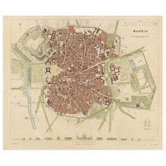
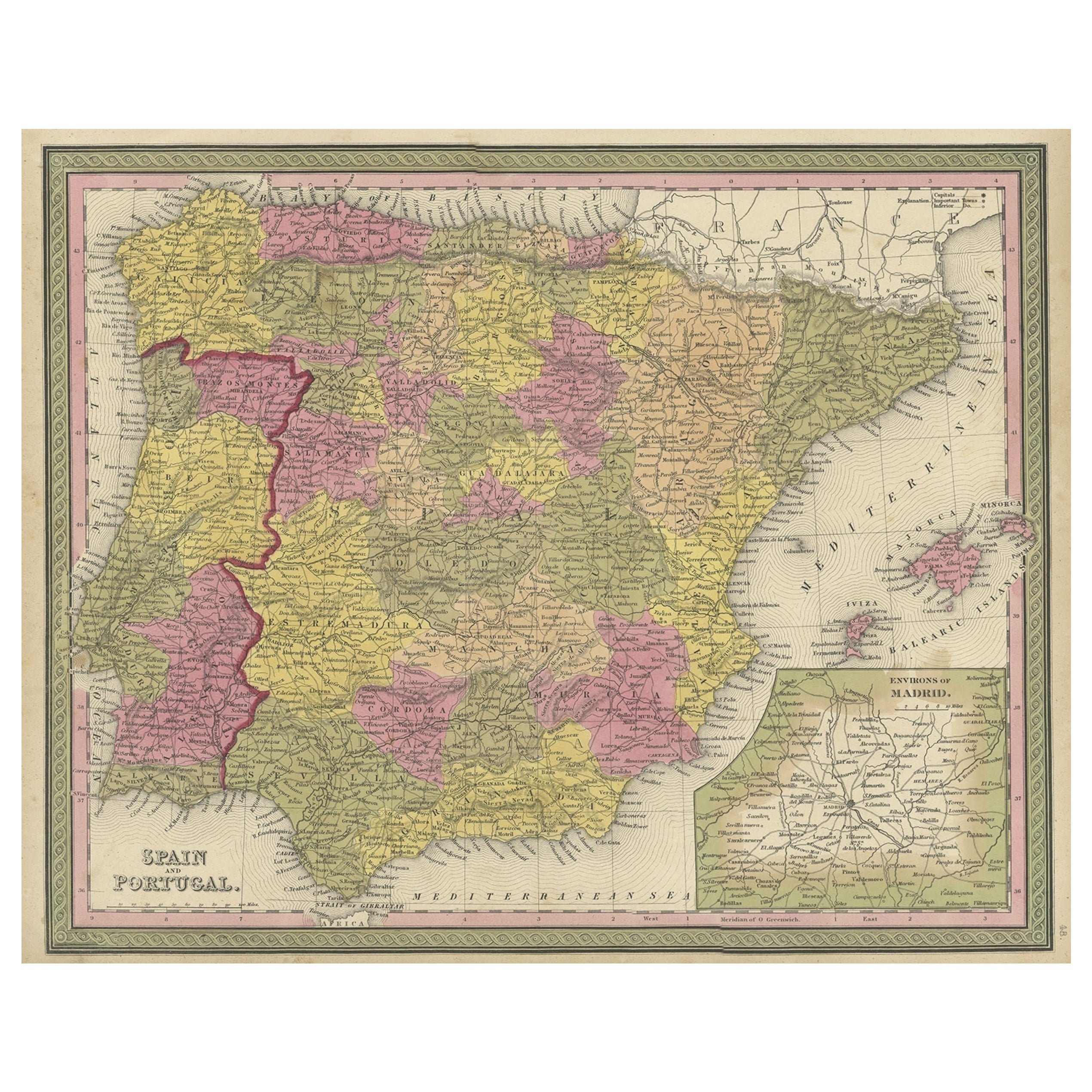
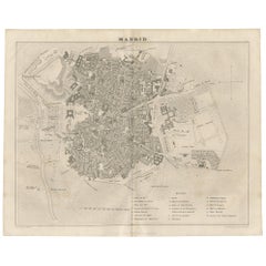
Antique Map of the City of Madrid 'Spain' by Henshall, 1831
View Similar Items


Want more images or videos?
Request additional images or videos from the seller
1 of 5
Antique Map of the City of Madrid 'Spain' by Henshall, 1831
About the Item
- Dimensions:Height: 13.39 in (34 cm)Width: 16.15 in (41 cm)Depth: 0.02 in (0.5 mm)
- Materials and Techniques:
- Period:
- Date of Manufacture:1831
- Condition:General age-related toning, please study image carefully.
- Seller Location:Langweer, NL
- Reference Number:Seller: BG-005131stDibs: LU3054311601041
About the Seller
5.0
Platinum Seller
These expertly vetted sellers are 1stDibs' most experienced sellers and are rated highest by our customers.
Established in 2009
1stDibs seller since 2017
1,933 sales on 1stDibs
More From This SellerView All
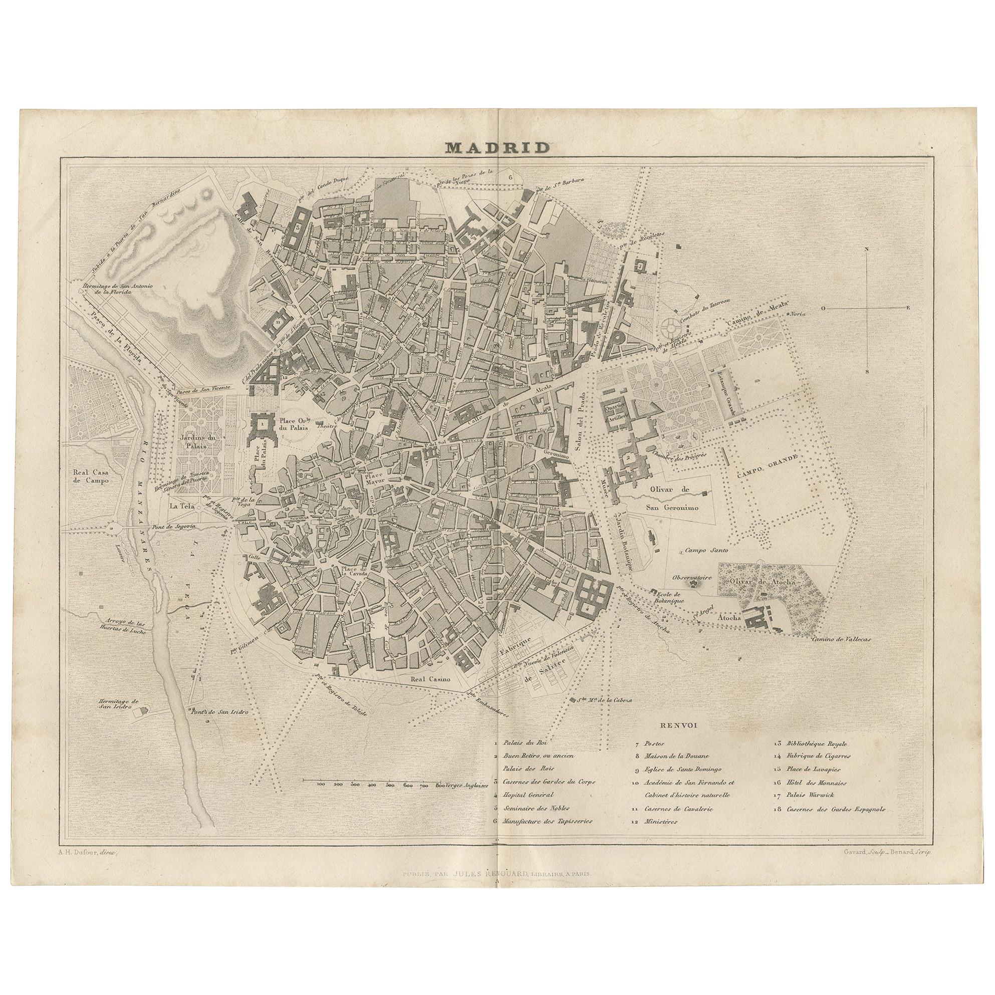
- Antique Map of the City of Madrid by Balbi '1847'Located in Langweer, NLAntique map titled 'Madrid'. Original antique map of the city of Madrid, Spain. This map originates from 'Abrégé de Géographie (..)' by Adrien Balbi. Published 1847.Category
Antique Mid-19th Century Maps
MaterialsPaper
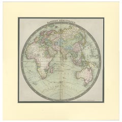
- Antique Map of the World by Ferrario '1831'Located in Langweer, NLOriginal antique map of the world. This print originates from 'Costume Antico e Moderno: Palestine, China, India, Oceania' by Ferrario. Publis...Category
Antique Mid-19th Century Prints
MaterialsPaper
 $175 Sale Price20% Off
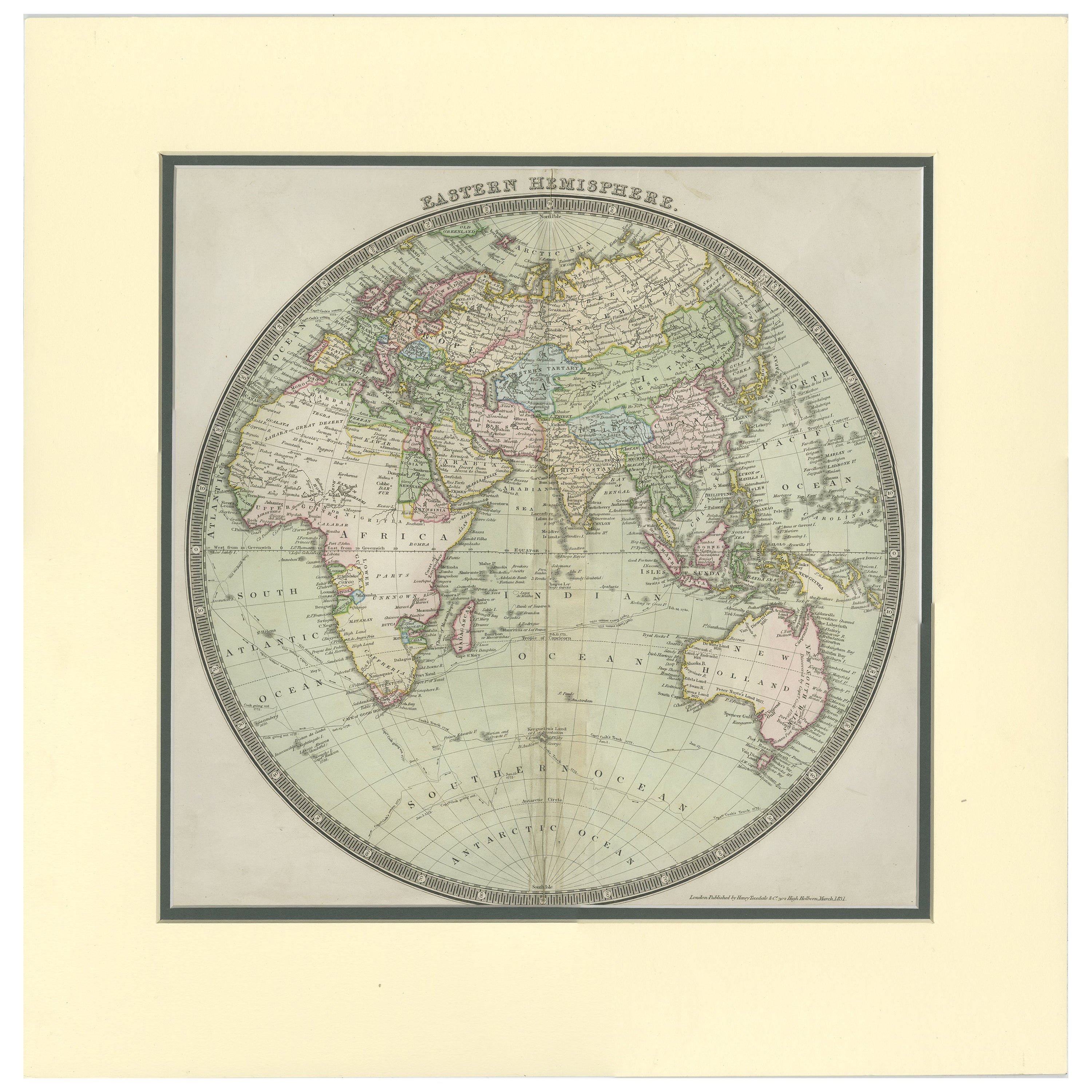
 - Antique Map of the Eastern Hemisphere by Teesdale, '1831'Located in Langweer, NLAntique map titled 'Eastern Hemisphere'. Hemispherical map of eastern hemisphere showing tracks of the navigators James Cook and John Gore. Plate 1 fro...Category
Antique Mid-19th Century Maps
MaterialsPaper
 $219 Sale Price20% Off
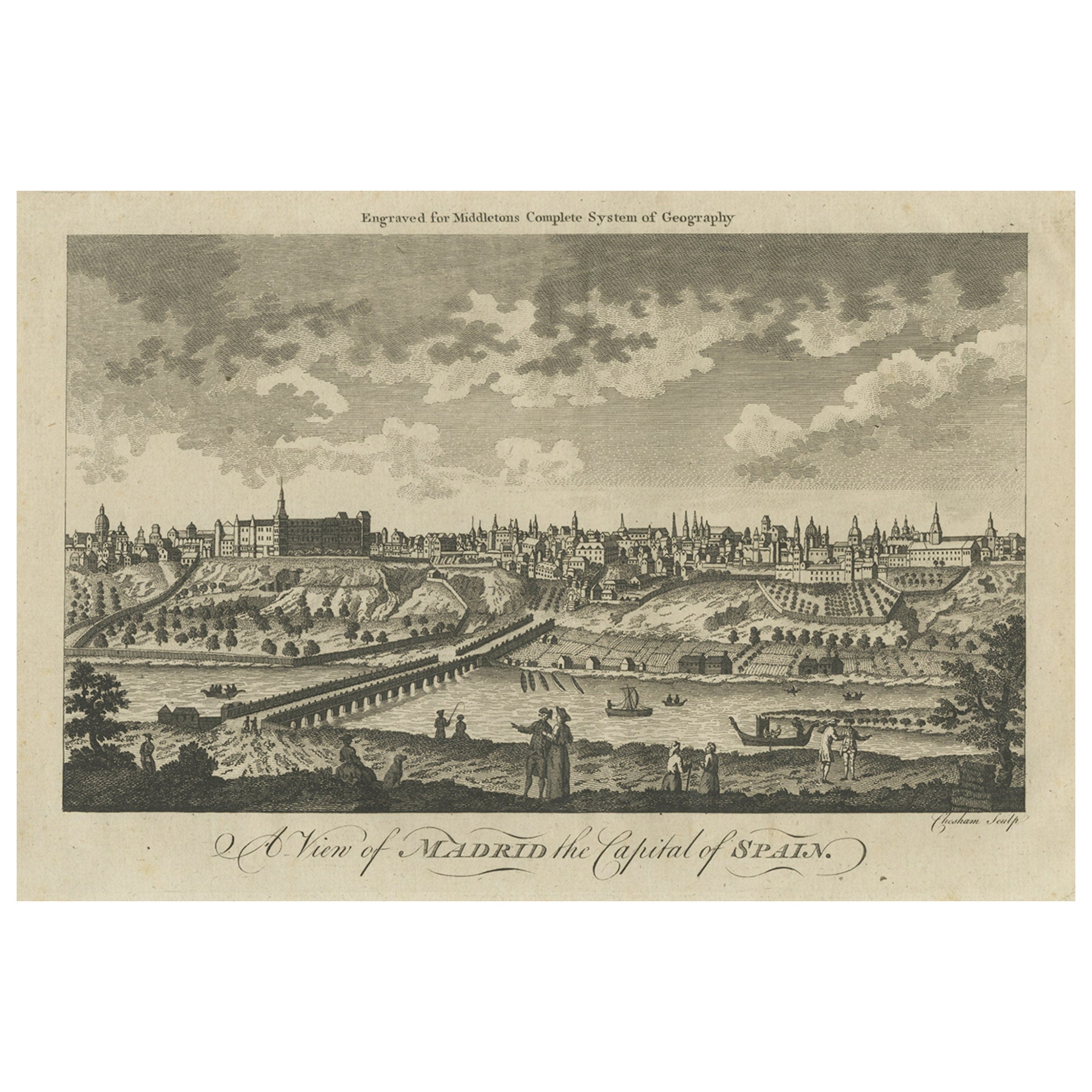
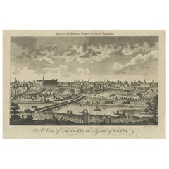
 - Antique Engraved Print of the City of Madrid, Capital of Spain, c.1780Located in Langweer, NLAntique print titled 'A View of Madrid the Capital of Spain'. View of the city of Madrid, Spain. Shows figures in the foreground, pleasure boats, a bridge, the Royal Palace, parkland...Category
Antique 18th Century Prints
MaterialsPaper
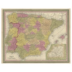
- Old Map of Spain and Portugal, with an Inset Map of the Region of Madrid, 1846Located in Langweer, NLAntique map titled 'Kingdom of Spain and Portugal'. Old map of Spain and Portugal, with an inset map of the region of Madrid. This map originates from 'A New Universal Atlas Cont...Category
Antique 1840s Maps
MaterialsPaper
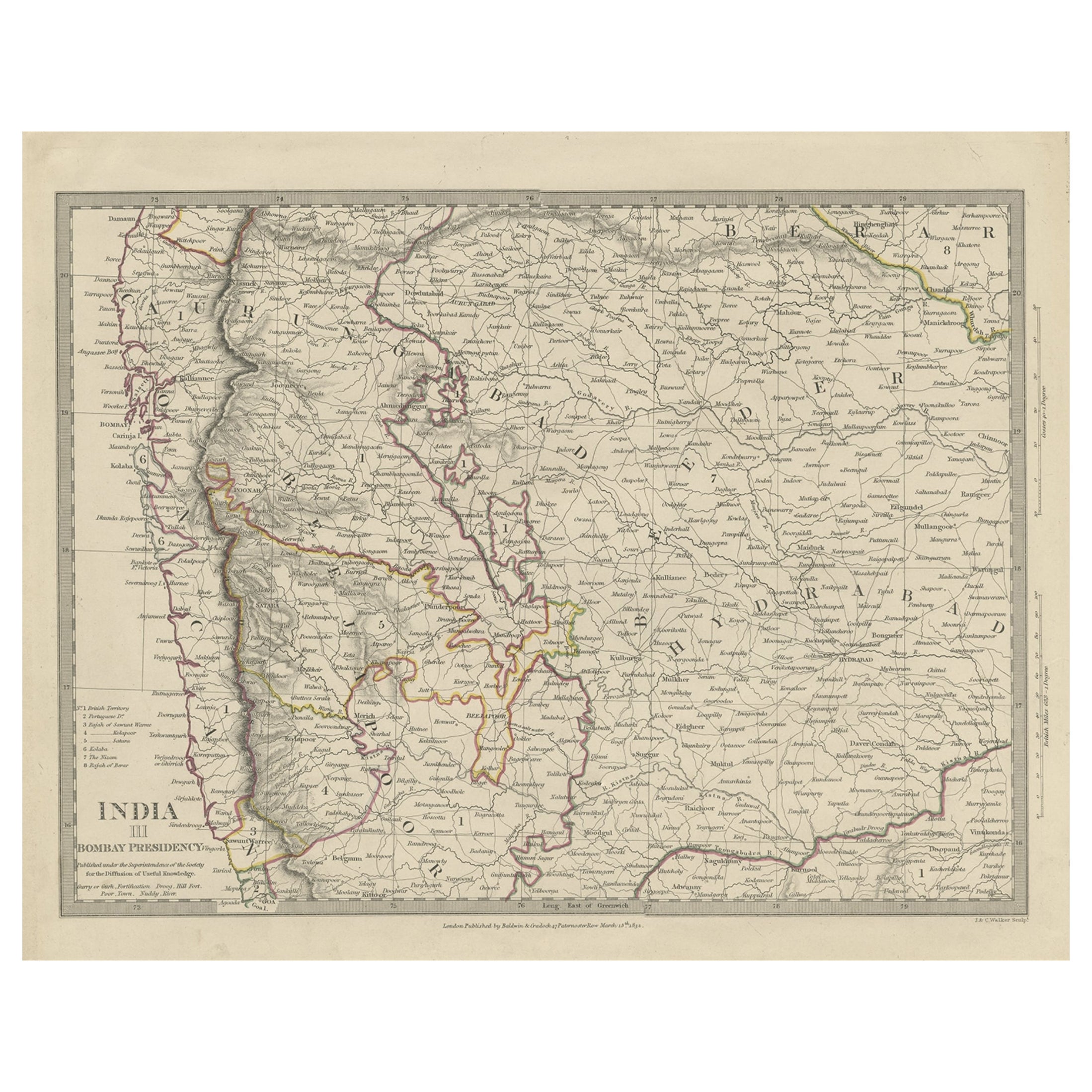
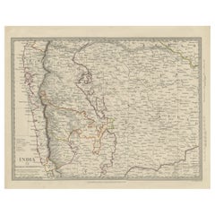
- Antique Map of Part of the Bombay Presidency in India, 1831Located in Langweer, NLAntique map titled 'India III Bombay Presidency'. Old steel engraved map of part of the Bombay Presidency. The Bombay Presidency, also known as Bombay and Sind from 1843 to 1936 and ...Category
Antique 19th Century Maps
MaterialsPaper
You May Also Like
- Original Antique Map / City Plan of Brussels by Tallis, circa 1850Located in St Annes, LancashireGreat map of Brussels. Steel engraving. Published by London Printing & Publishing Co. (Formerly Tallis), C.1850 Free shipping.Category
Antique 1850s English Maps
MaterialsPaper
- Original Antique Map of Spain and Portugal, Engraved By Barlow, 1806Located in St Annes, LancashireGreat map of Spain And Portugal Copper-plate engraving by Barlow Published by Brightly & Kinnersly, Bungay, Suffolk. 1806 Unframed.Category
Antique Early 1800s English Maps
MaterialsPaper
- Original Antique Map of Spain and Portugal, circa 1790Located in St Annes, LancashireSuper map of Spain and Portugal Copper plate engraving by A. Bell Published, circa 1790. Unframed.Category
Antique 1790s English Other Maps
MaterialsPaper
- Original Antique Map of The World by Thomas Clerk, 1817Located in St Annes, LancashireGreat map of The Eastern and Western Hemispheres On 2 sheets Copper-plate engraving Drawn and engraved by Thomas Clerk, Edinburgh. Published by Mackenzie And Dent, 1817 ...Category
Antique 1810s English Maps
MaterialsPaper
- Original Antique Map of The Netherlands, Engraved by Barlow, Dated 1807Located in St Annes, LancashireGreat map of Netherlands Copper-plate engraving by Barlow Published by Brightly & Kinnersly, Bungay, Suffolk. Dated 1807 Unframed.Category
Antique Early 1800s English Maps
MaterialsPaper
- Map of the Republic of GenoaLocated in New York, NYFramed antique hand-coloured map of the Republic of Genoa including the duchies of Mantua, Modena, and Parma. Europe, late 18th century. Dimension: 25...Category
Antique Late 18th Century European Maps


Recently Viewed
View AllMore Ways To Browse
Madrid Map
Antique Prints Maps
Antique Map Prints
Antique Maps And Prints
Antique Prints And Maps
Map 19th Century
Antique Atlas Furniture
Map Of France
Large Map
Large Maps
Antique German Collectibles
Original World Map
World Atlas
Map Of Itsly
Antique Map World
Antique Maps World
Antique World Map World Maps
Antique World Maps