
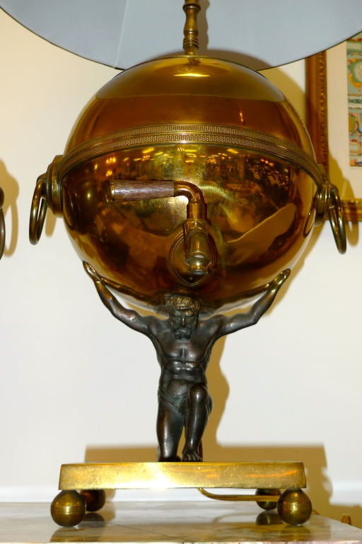
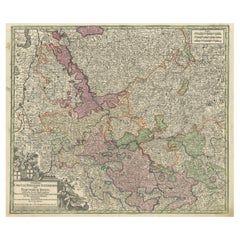
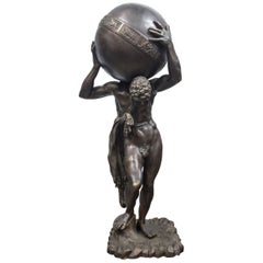
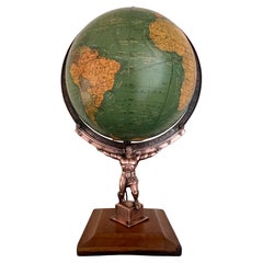
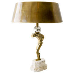
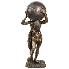
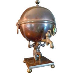
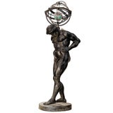
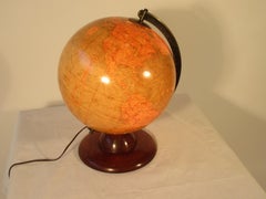
Atlas Globe Samovar Table Lamp
Located in Hanover, MA
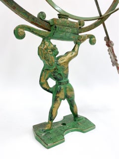
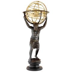
An impressive table lamp conversion of a 19th century brass & copper samovar urn in the Regency style with delicately cast figure of Atlas holding the globe. Supported on square...
Category
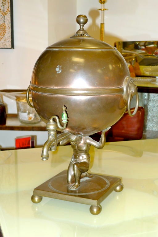
Atlas Globe Samovar Table Lamp
Located in Hanover, MA
An impressive table lamp conversion of a 19th century brass & copper samovar urn in the Regency style with delicately cast figure of Atlas holding the globe. Supported on square...
$1,629Sale Price / set|25% Off
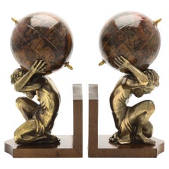
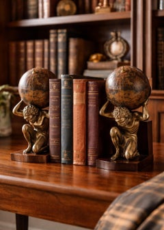
Pair of 20th Century Atlas Globe Bookends Bronze & Wood Figurine of Book Holders
Located in Wembley, GB
Pair of 20th-Century Atlas Globe Bookends Bronze & Wood Sculpture Set A striking and sculptural pair of 20th-century Atlas bookends, masterfully crafted in a rich bronze-tone fi...
Acrylic, Wood, Fruitwood, Driftwood, Pine, Bog Wood
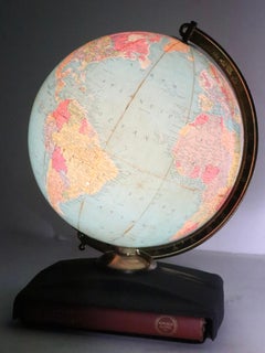
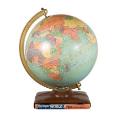
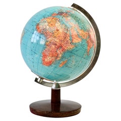
Vintage Light Up Replogle Globe on Stand with Original Atlas Book
By Replogle Globes
Located in New York, NY
The globe is mounted on a stylized metal stand, which houses the original atlas, and misc maps, a pamphlet, instructions, and the remains of the dust jacket.
Metal
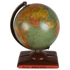

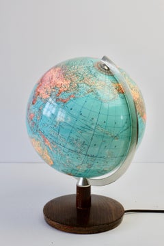
1950s Replogle Mid-Century Modern Illuminated 10" Glass Globe with Atlas
By Replogle Globes
Located in St. Louis, MO
Replogle (Chicago, IL) 10" 'Precision' Globe was manufactured in the early 1950s by and edited by cartographer, Gustav Brueckmann.
Brass
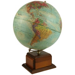
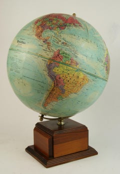
Large French Terrestrial Globe or World Atlas by Girard Et Barrère
Located in Godshill, Isle of Wight
A large French terrestrial globe or world atlas by Girard et Barrère. This is a very large stylish French terrestrial globe from the 1930s by Girard et Barrère it has territoria...
Beech
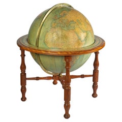

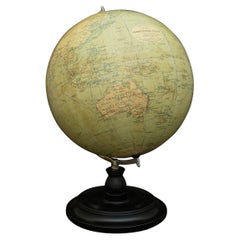
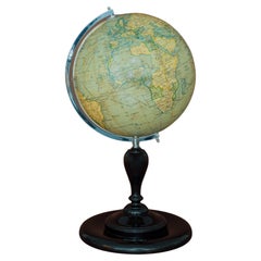
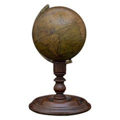
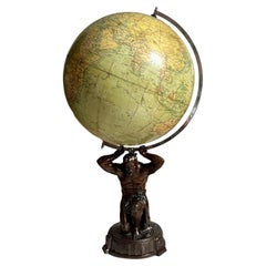
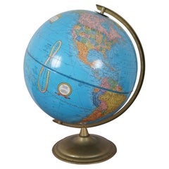
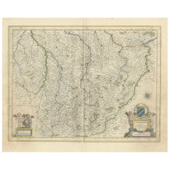
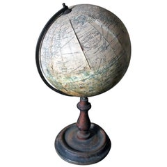
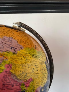
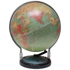
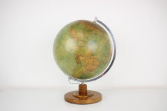
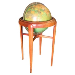
A large 30 inch W. & . A. K. Johnston library globe
Located in Lymington, Hampshire
Setting out on their own, they acquired the established publishing house of William Lizars and began printing maps, atlases, gazetteers, guide books, globes and much more.
Brass

Northern Italian Carved Wood & Gessoed Atlas with Celestial Globe Circa 1800
Located in Palm Springs, CA
This beautifully modeled figure is carved in wood with its original gesso, polychrome, and parcel-gilt surface. Atlas stands balanced on a small globe while holding an exceptional pa...
Wood
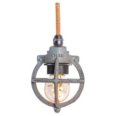
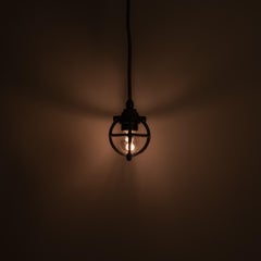
Set of Three Atlas Cast Iron Globe Cage Pendants — Industrial Bulb Guards
By Benjamin Electrical Company 1
Located in Nottingham, GB
Set of Three Atlas Cast Iron Globe Cage Pendants — Industrial Bulb Guards IG221817 A highly characterful set of three cast iron globe cage pendants by Atlas, designed originally to...
Steel
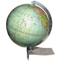
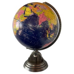
Phillips Terrestrial Slate Globe, Brass Stand, Educational, 1950s
Located in Godshill, Isle of Wight
Phillips Terrestrial Slate Globe or World Atlas This is a rare Educational Terrestrial Globe from the 1950s by Phillips it has territorial maps, but the unusual thing is the colour,...
Brass
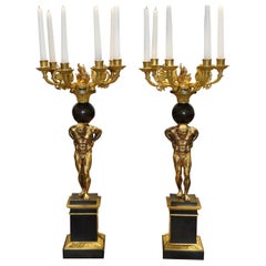
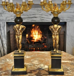
Pair of Regency Gilt and Patinated Bronze Atlas Figural Candelabra
By Messenger & Phipson
Located in Essex, MA
Pair of Regency or William IV figural candelabra in form of Atlas and a globe. Six arms issuing from top. Patinated bronze, gilded bronze and bronze.
Bronze
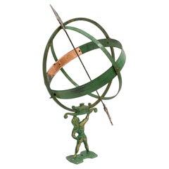
Attr. Sune Rooth Swedish Iron & Copper Armillary 'Atlas' Sundial 20th C.
By Sune Rooth
Located in Norwalk, CT
Rendered in a robust and dynamic form, Atlas supports an openwork globe, its meridians and parallels meticulously delineated.
Copper, Iron
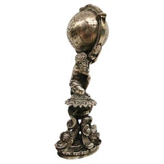
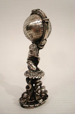
Antique God Atlas Sterling Silver Figural Wax Seal Stamper. German 19-Century.
Located in Buenos Aires, Olivos
Moldelled as the God Atlas (Greek Mythology). The globe rotates. Museum quality.
Silver, Sterling Silver
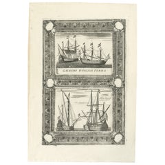
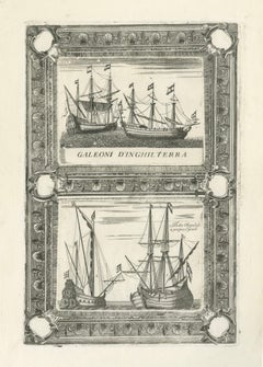
Dutch Inland Sailing Boats, Amsterdam–Haarlem & Delft–Rotterdam, Coronelli 1690
Located in Langweer, NL
While Coronelli is best known for his monumental globes and world atlases, the Atlante Veneto also included detailed and finely engraved plates devoted to maritime subjects, reflecti...
Paper
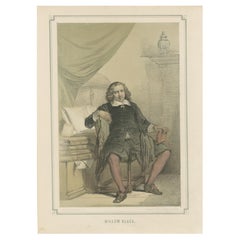
Willem Blaeu – Dutch Cartographer and Publisher, 19th-Century Lithograph
Located in Langweer, NL
Born in 1571, Blaeu was a student of the famous Danish astronomer Tycho Brahe and became renowned for his beautifully engraved maps, atlases, and globes. He founded the Blaeu publish...
Paper


Antique Map of the Cape Verde Islands and Part of Senegal, West Africa, 1690
Located in Langweer, NL
This map originates from Coronelli's rare atlas 'Atlante Veneto'. Artists and Engravers: Vincenzo Coronelli (1650-1718), a Franciscan friar, cosmographer, cartographer, publisher, an...
Paper

$417Sale Price|20% Off
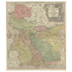
Antique Map of Western Germany with part of the Netherlands
Located in Langweer, NL
In 1707 he founded his own successful publishing company and produced maps, atlases and globes. Seutter died in 1757. The company went over to his son Albrecht Carl and his stepsons G.
Paper

$501Sale Price|20% Off
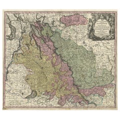
Antique Map of both sides of the Central Rhine River, Germany
Located in Langweer, NL
In 1707 he founded his own successful publishing company and produced maps, atlases and globes. Seutter died in 1757. The company went over to his son Albrecht Carl and his stepsons G.
Paper
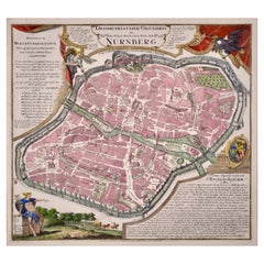
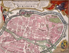
City View of Nuremberg, Germany: An 18th Century Hand-Colored Map by M. Seutter
By Matthew Seutter
Located in Alamo, CA
Upon returning to Augsburg, he started his own publishing firm in 1710, creating maps, atlases, and globes. By 1732, Seutter was one of the most prolific publishers of his era and wa...
Paper
$5,479Sale Price|20% Off
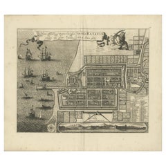
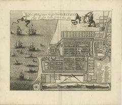
Rare 1681 Map of Batavia: Detailed Dutch Colonial Era Cartography, 1681
Located in Langweer, NL
. ------------- Frederick de Wit (1629–1706) was a prominent Dutch cartographer, engraver, and publisher known for his detailed and decorative maps, atlases, and globes. He played ...
Paper
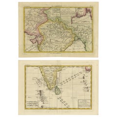
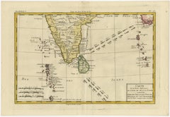
18th Century Cartographic Depiction of Upper India and Ceylon, 1835
Located in Langweer, NL
The artist, Charles Marie Rigobert Bonne, was a significant French cartographer of the 18th century, known for his work in the 'Atlas de Toutes les Parties Connues du Globe Terrestre.'
Paper

$520Sale Price|20% Off
Antique Map of the Course of the Rhine from Philippsburg to Duisburg, Germany
Located in Langweer, NL
In 1707 he founded his own successful publishing company and produced maps, atlases and globes. Seutter died in 1757. The company went over to his son Albrecht Carl and his stepsons G.
Paper
$352Sale Price|20% Off
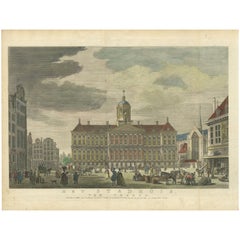
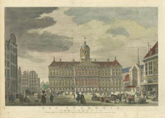
Hand-Colored 1765 Engraving of Amsterdam Royal Palace and Dam Square, 1765
Located in Langweer, NL
The building has since served as a residence for the Dutch royal family and is still used for official state functions today. 6. **Statue of Atlas**: One of the distinctive features...
Paper
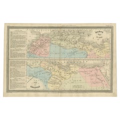

French Antique Map of Northern Africa and Libya, c.1840
Located in Langweer, NL
This map originates from 'Le globe Atlas classique Universel de géographie ancienne et moderne, pour servir a l'étude de la géographie et de l'histoire dressé par M.
Paper
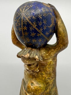
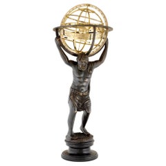
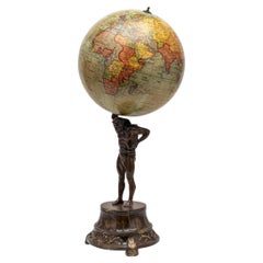
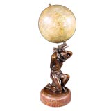
Bronze Atlas Holding the Globe of the Zodiac
Located in Woodbury, CT
The bronze having a golden brown patina. The draped figure of Atlas holds the globe of the zodiac on his shoulders, his head bent forward.
Bronze
Unavailable
H 53.15 in W 19.69 in D 5.12 in
An imposing pair of bronze high relief wall decorations, circa 1925
Located in Amsterdam, Noord Holland
An imposing and finely detailed pair of bronze high relief wall decorations each displaying ‘Atlas’ carrying the globe, one showing the American continents and the other the Euro-Asi...
Bronze
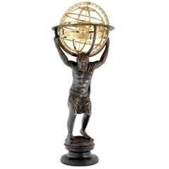
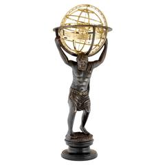
Figural Atlas & Globe Light by George F. Cram Co., c. 1940's
By George F. Cram
Located in Ross, CA
The base is a copper metal alloy figure of Atlas holding up the globe on a wooden platform.
Copper
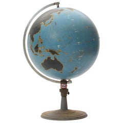
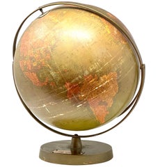
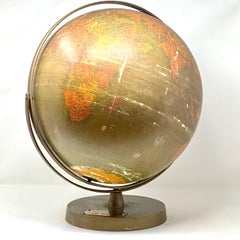
20thC British "Geographica" Globe Held By Bronze Atlas Statue c.1920
By George Philip & Son
Located in Royal Tunbridge Wells, Kent
Antique 20th Century British "Geographica" terrestrial globe. Made by Geographica of Fleet St, London. The globe dates to around 1920 and is in superb condition.
Bronze

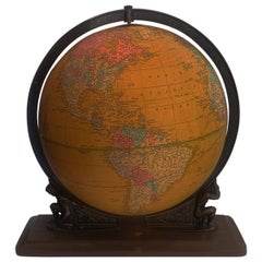
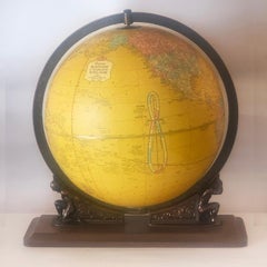
Distressed Earth Atlas
By Rand McNally & Co.
Located in Brooklyn, NY
Cold War era, institutional, telescopic iron pedestal, hidden casters, manufactured by Rand McNally, nicely oxidized. 16" Physical-Political Globe. 20" diameter base. 51" - 71" ...
Metal

Philips' Terrestrial Globe, circa 1925
By George Philip & Son
Located in London, GB
The demand from board schools, established after 1870, enabled further expansion in the market for globes, atlases and wall maps.
Gesso, Wood, Paper
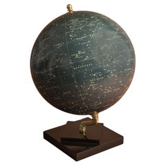
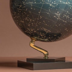
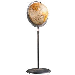
Philips' Celestial Globe, circa 1935
By George Philip & Son
Located in London, GB
Philips’ production of globes in the 19th century was mainly limited to associations with other British globe makers, including Smith & Sons, London, but in 1902 Philip ventured into...
Brass

Geographia 10 Inch Globe, circa 1955
By Geographia, Ltd.
Located in London, GB
Geographia was a London based publisher of globes, maps and atlases founded in the early 1900s by Alexander Gross (1879-1958).
Chrome

Pair of Philip & Son Globes, circa 1946
By George Philip & Son
Located in London, GB
Philips’ production of globes in the 19th century was mainly limited to associations with other British globe makers, including Smith & Sons, London, but in 1902 Philip ventured into...
Brass
A Desk Top Terrestrial Globe by Geographica Ltd
Located in London, GB
Literature: Geographia Ltd was a prolific London-based publisher of globes, maps and atlases from the early 1900s to the late 1980s.
Wood, Paper
Desk Globe by Smith and Son, circa 1860
By Charles Smith & Son
Located in London, GB
Smith and Son produced a number of well engraved maps and several fine atlases. Their globes and maps are very distinctive, characterised by their lucid, fine engraving and vibrant c...
Brass

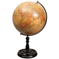
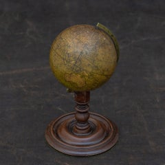
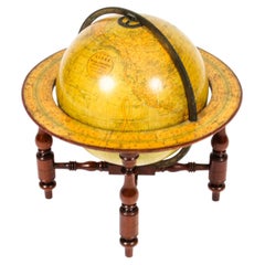
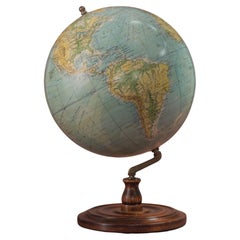
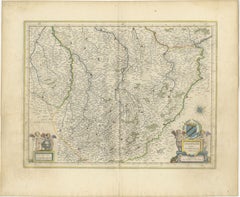
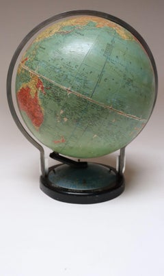
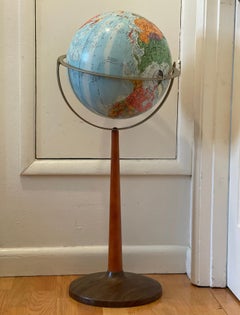
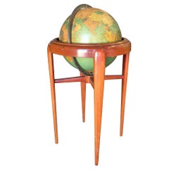
Walnut Terrestrial Globe by W & AK Johnston of Edinburgh & London
Located in Lymington, Hampshire
Setting out on their own, they acquired the established publishing house of William Lizars and began printing maps, atlases, gazetteers, guide books, globes and much more.
Walnut

19th Century Table Top Globe by George Philip & Son, London, circa 1890
By George Philip & Son
Located in Lichtenberg, AT
Philip & Sons and produced a number of well engraved cooper plate maps and several Fine atlases. Their globes and maps are very distinctive, characterized by their Lucid, great engra...
Brass
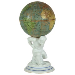

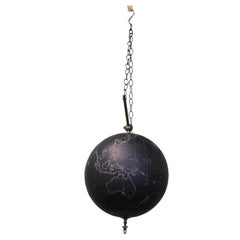
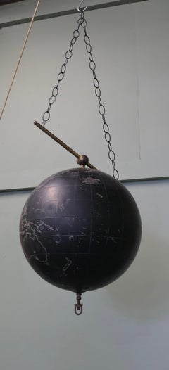
Atlas with Globe
Located in Praha, CZ
The globe is loosely placed on the pin. Glob can be opened, there is space inside.
Porcelain, Paper
Atlas Sculpture with Globe
Located in Paris, FR
Sculpture Atlas in solid bronze in old finish with globe in solid polished brass finish.
Brass, Bronze
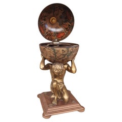
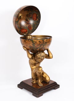
Globe Drinks Trolley Atlas Decorative Cocktail Bar
Located in Buxton, GB
The trolley has four wheels and is perfect for those who love world globe themes, as this is designed with Atlas holding a globe with beautiful prints inside the globe.
Plastic
Sold
H 18.9 in W 13.78 in L 18.9 in
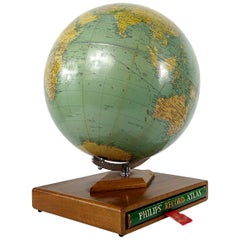
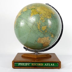
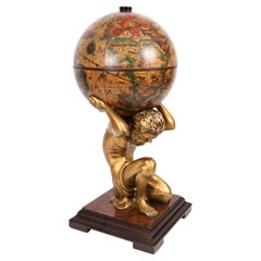
Philips' Challenge Globe on Mahogany Stand with Original Philips' Record Atlas
Located in Doornspijk, NL
Midcentury Philips' challenge globe on a mahogany stand fitted with the original Philips' Record Atlas published in 1961.
Mahogany

Sold
H 37.01 in W 14.18 in D 14.18 in
Antique Bronze Sculpture Atlas with Globe in Brass Finish on Marble Base
Located in Paris, FR
Antique bronze sculpture atlas with globe in brass finish on marble base.
Marble, Brass, Bronze

Sold
H 37.01 in W 14.18 in D 14.18 in
Antique Bronze Sculpture Atlas with Globe in Brass Finish on Marble Base
Located in Paris, FR
Antique bronze sculpture atlas with globe in brass finish on marble base.
Marble, Bronze, Brass
Sold
H 43.31 in W 21.66 in D 21.66 in
Vintage Modernist Atlas holding the Globe Cocktail Cabinet Dry Bar Mid Century
Located in London, GB
This is a spectacular Italian Mid Century Modernist Globe Cocktail drinks cabinet in the form of Atlas holding the globe by UGC, circa 1960 in date.
Ormolu
Sold
H 27.25 in W 27 in D 16.5 in
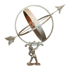
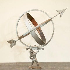
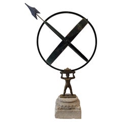
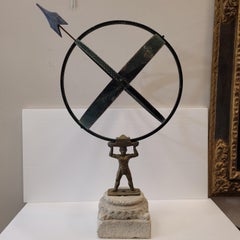
Sun Clock or Armillary from Denmark with Figure of Atlas Holding the Globe
Located in Round Top, TX
This vintage silver painted globe shaped garden ornament, called an armillary, is made up of metal bands, pierced by an arrow and supported by a mounting bracket. This has a favored ...
Metal, Copper

Art Deco Atlas Chandelier
Located in New York, NY
Chromed with stylized Atlas Men holding Hand Blown Globes
Sold
H 21.66 in Dm 15.36 in
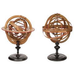
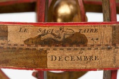
18th Century French Planetarium and Armillary Sphere by L.-C. Desnos, 1754
By Louis Charles Desnos
Located in Milano, IT
Indeed, he was paid each year to send copious quantities of atlases, globes, and maps to Christian VII of Denmark.
Paper, Wood

Cast Brass and Marble Atlas Lamp
By C. S. Arte
Located in Palm Desert, CA
This stylish table lamp features a deco style cast brass figure of Atlas with a chrome globe on his shoulders supporting a lacquered brass shade with a white acrylic diffuser.
Marble, Brass
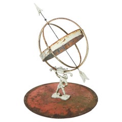

Antique Neoclassical Figural Atlas Armillary, 19th C
Located in Big Flats, NY
An antique Neoclassical figural armillary offers Atlas holding the globe which has embossed Arabic numbers and arrow as the dial, seated on circular base, 19th century.
Metal

Sold
H 18.12 in W 18.12 in D 18.12 in
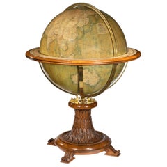
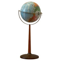
Antique Victorian Terrestrial Library Table Globe by W & A. K. Johnston, 19th C
Located in London, GB
Setting out on their own, they acquired the established publishing house of William Lizars and began printing maps, atlases, gazetteers, guide books, globes and much more.
Brass

18th Century Map of French Pyrenees Region of France
Located in Haddonfield, NJ
Willem Janszoon Blaeu was a leading Dutch cartographer of the 17th century, known for his high-quality atlases and globes. His works, including this map, are highly regarded for thei...
Wood, Paper
Sold
H 39.38 in W 24.41 in D 0.04 in
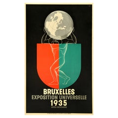
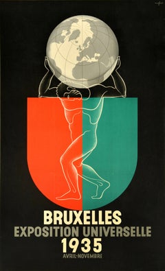
Original Vintage Advertising Poster Brussels Exposition Universelle Art Deco
By Léo Marfurt 1
Located in London, GB
Original vintage advertising poster for the Brussels World Fair / Universal Exposition - Bruxelles Exposition Universelle 1935 - held in Heysel near Brussels from 27 April to 6 Novem...
Paper

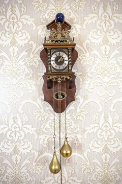
Wall Clock from the Late 20th Century in Oak Case
Located in Opole, PL
Above the clock face, there is a brass crown. The figurine of Atlas carrying the globe can be seen in the upper section.
Brass
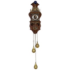
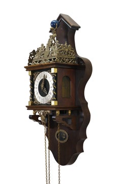
Wuba Wall Clock from the Mid. 20th Century in Oak Case
Located in Opole, PL
Above the clock face, there is a brass crown with the maxim “Nu elck syn sin” which freely translates to “Now each to their own.” The figurine of Atlas carrying the globe can be see...
Brass
Sold
H 6.75 in W 8.63 in D 0.13 in
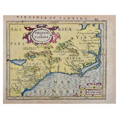
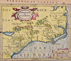
Florida and Virginia: A 17th Century Hand-colored Map by Hondius after Mercator
By Gerard Mercator
Located in Alamo, CA
Mercator modernized map making in the 16th century, based on mathematical and geographical calculations, some which became known as Mercator Projections, and are still in use today. ...
Paper
Sold
H 34.26 in W 18.9 in D 18.9 in
Sculpture French “Armillary sundial”, Bronze and stone, midcentury
By French House & Garden
Located in Valladolid, ES
It is a piece in good condition featuring a bronze figure holding the sundial like an atlas, holding the globe, thus raising it towards the sky.
Stone, Bronze

Original 1930s Art Deco Atlas Globe by Paul Oestergaard K.G
By Paul Oestergaard
Located in Devon, England
Charming and totally authentic and original Art Deco 1930s Atlas globe by Paul Oestergaard K.G. Berlin and Stuttgart Edited by Kartograph W.Kaden of Germany.
Chrome
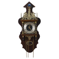
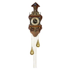
1970 Dutch Zaanse Warmink Wuba Brass Atlas Globe 8 Day Wall Clock 25"
Located in Dayton, OH
Nestled at the center of the top is Atlas carrying a wooden world globe, painted blue with gold stars and a crescent moon, standing above the clock's chime.
Brass

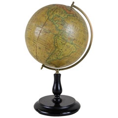
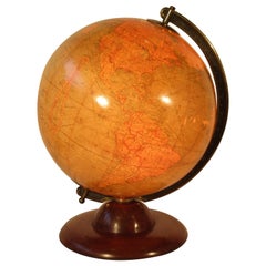
Replogle Standard Globe with Atlas, C.1950
By Replogle Globes
Located in San Francisco, CA
The original atlas slides into the base. CREATOR Replogle.
Metal

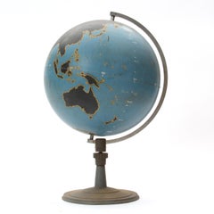
20thC British "Geographica" Globe Held By Bronze Atlas Statue c.1920
By George Philip & Son
Located in Royal Tunbridge Wells, Kent
Antique 20th Century British "Geographica" terrestrial globe. Made by Geographica of Fleet St, London. The globe dates to around 1920 and is in superb condition.
Bronze
20thC British "Geographica" Globe Held By Bronze Atlas Statue c.1920
By George Philip & Son
Located in Royal Tunbridge Wells, Kent
Antique 20th Century British "Geographica" terrestrial globe. Made by Geographica of Fleet St, London. The globe dates to around 1920 and is in superb condition.
Bronze

Sold
H 17 in W 11 in D 14.5 in
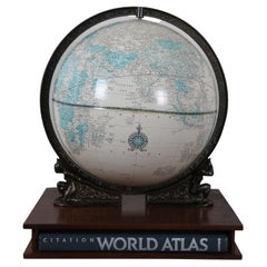
Crams Imperial Library Globe w Stand & Hammond Citation World Atlas Book
By George F. Cram
Located in Dayton, OH
Cram Company, Inc. 12" Imperial World Globe, featuring off white coloring with blue accents, suspended in a metal ring balanced on the shoulders of two Art Deco style figures of Atla...
Metal

Sold
H 16 in W 15 in D 12 in
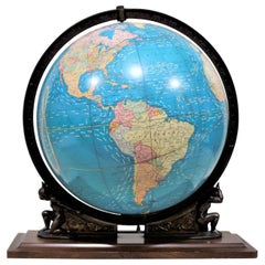
Vintage George F. Cram Co. Figural Brass Atlas Illuminated Terrestrial Globe
By George F. Cram
Located in Hamilton, Ontario
The globe itself sits on a cast base and axis with a brass patina, and portrays two stylized figures of Atlas holding up the planet.
Brass

Sold
H 16 in W 15 in D 12 in
Vintage George F. Cram Co. Figural Brass Atlas Illuminated Terrestrial Globe
By George F. Cram
Located in Hamilton, Ontario
The globe itself sits on a cast base and axis with a brass patina, and portrays two stylized figures of Atlas holding up the planet.
Brass

Sold
H 22 in W 14 in D 11.5 in
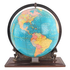
Vintage George F. Cram Co. Figural Brass Atlas Illuminated Terrestrial Globe
By George F. Cram
Located in Hamilton, Ontario
The globe itself sits on a cast base and axis with a brass patina, and portrays a stylized figure of Atlas holding up the planet.
Brass

1970s Vintage George Crams Imperial World Globe & Stand USSR Atlas Map
By Crams
Located in Dayton, OH
Vintage mid to late 20th century George Crams Imperial World Globe with multicolored countries, set on a brass / gold metal stand.
Brass

Philips 14 Inch Globe, circa 1940
By Philips
Located in London, GB
Philips' production of globes in the 19th century was mainly limited to associations with other British globe makers, including Smith & Sons, London, but in 1902 Philip ventured into...
Gesso, Wood, Paper

British Empire Educational Globe, circa 1890
By Charles Smith & Son
Located in London, GB
Smith and Sons produced a number of well engraved maps and several Fine atlases. Their globes and maps are very distinctive, characterized by their Lucid, Fine engraving and vibrant ...
Wood, Paper

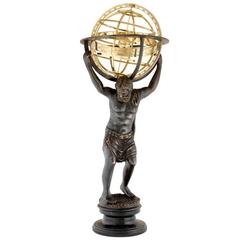
Large Bronze Globe Stand "Atlas"
Located in Rochester, NY
Globe stand bronze figure of atlas mounted on Italian tooled leather base, circa 1960s.
Metal, Bronze

Sold
H 35 in W 10.5 in D 10.5 in
Midcentury Bronze Sculpture of Atlas Holding Globe Banded with Zodiac Symbols
Located in New York, NY
The lithe and muscular figure, with curly locks, has a sash draped around his neck flowing off to one side, and a giant globe (an atlas) weighing upon his neck. The globe offers a ba...
Bronze

Sold
H 37.01 in W 14.18 in D 14.18 in
Antique Bronze Sculpture Atlas with Globe in Brass Finish on Marble Base
Located in Paris, FR
Antique bronze sculpture atlas with globe in brass finish on marble base.
Brass, Bronze

Sold
H 37.01 in W 14.18 in D 14.18 in
Antique Bronze Sculpture Atlas with Globe in Brass Finish on Marble Base
Located in Paris, FR
Antique Bronze Sculpture Atlas with Globe in Brass Finish on Marble Base.
Bronze
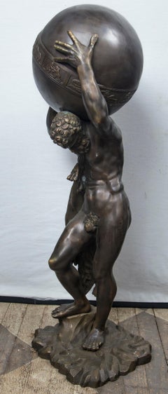
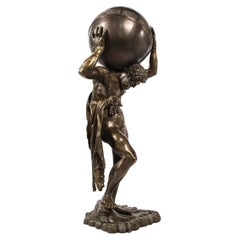
Atlas Samovar
Located in Hanover, MA
Brass & copper Regency style samovar urn with figure of Atlas holding the globe, on square platform with four ball feet.
Brass, Copper

Sold
H 29 in W 39 in D 0.75 in
1955 "Quaternary: Ice-Age Landscape" Woolly Mammoth Vintage Wall Hanging
Located in Colorado Springs, CO
., an American company specializing in maps, atlases, globes, and models. Fritz Zerritsch was an Austrian painter and graphic artist based in Vienna.
Metal

Antique Map of Trier, Mainz, Cologne and surroundings, Germany
Located in Langweer, NL
In 1707 he founded his own successful publishing company and produced maps, atlases and globes. Seutter died in 1757. The company went over to his son Albrecht Carl and his stepsons G.
Paper
Sold
H 20.08 in W 23.82 in D 0 in
Champagne: The Sparkling Heart of France - A Blaeu Cartographic Engraving, c1650
Located in Langweer, NL
The Blaeu family was a prominent Dutch cartographic family known for their detailed and decorative maps, atlases, and globes during the 17th century. Willem Blaeu founded the family ...
Paper
Sold
H 15.75 in W 14.97 in D 14.97 in
Crams Illuminated World Terrestrial Globe sitting on the shoulders of Atlas
By Crams
Located in Daylesford, Victoria
Crams World Globe, internally Illuminated, Resting on Atlas’s shoulders.
Wood
Early 20th Century 8” Terrestrial Table Globe ‘Geographia’, circa 1920-1925
By Geographia, Ltd.
Located in Bedford, Bedfordshire
Geographia Ltd was a prolific London-based publisher of globes, maps and atlases from the early 1900s to the late 1980s.
Wood, Paper
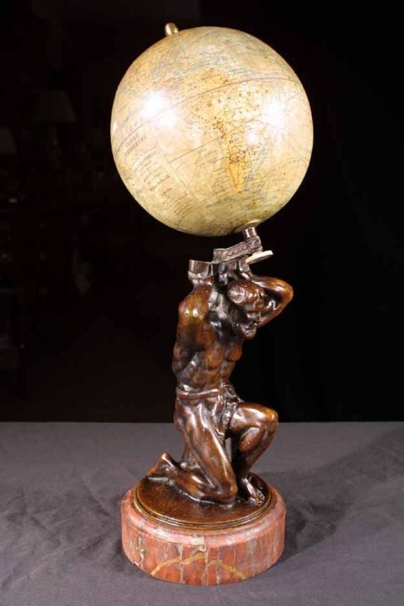
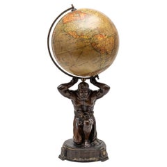
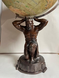
Terrestial Globe on Bronze Atlas Stand. French 19th C
Located in New York, NY
Rare bronze figure of atlas holding a terrestrial globe by J. Forest, on a red marble round plinth base and surmounted by a brass acorn finial.
Bronze

Large Bronze Atlas
Located in London, GB
Broze Statue of Atlas bearing a globe, attributed to Chiurazzi.
$458
H 14.57 in Dm 9.85 in
Vintage Mid-Century World Map Globe Lamp Light by JRO Verlag Munich circa 1970s
By JRO-Verlag 1
Located in Landau an der Isar, Bayern
Wonderful vintage Mid-Century fun world map globe table lamp or desk light by JRO-Verlag München. Made in Germany circa 1970, this whimsical lamp would make a great child's bedside t...
Metal
Vintage Reploge Terrestrial Globe on Walnut Base, Circa 1960
Located in Douglas Manor, NY
2-309 vintage world globe with raised surfaces set on a custom walnut wood stepped base, circa 1960.
Metal
$2,400
H 26.5 in W 22.5 in D 21.5 in
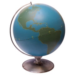
Large-Scale Vintage Military Globe / Activity Globe by A.J. Nystrom
By A.J. Nystrom & Co
Located in Brooklyn, NY
Machine Age-style A.J. Nystrom of Chicago Military or Activity Globe composed of a spun metal blue orb with green slated land masses outlined in yellow. These globes were used by the...
Metal
Vintage Art Deco Style 12" Reploge Globemaster World Globe
By Replogle Globes
Located in San Diego, CA
Beautiful 12" fiberglass and metal earth globe by Globemaster Reploge Globes Inc. Chicago. Incredibly stylish piece that stands on a metal base with full detail. This whimsical pi...
Metal
$300
H 15.25 in W 13 in D 12 in
Vintage Replogle Precision Globe with Rotating Zodiac Constellation Base
By Replogle Globes
Located in Brooklyn, NY
Replogle 12" Precision Globe showing the relation of the Sun to the Earth, given the month of the year, and displaying day and nighttime periods. Features a pasteboard globe with bod...
Metal
Vintage Mid Century Modern Globe Stand Decor Retro Wood Petal Map World Seattle
Located in Seattle, WA
World Ocean globe rising on a Mid-Century Modern Art deco stand, 14in Diameter 33" tall. Some light scuffing/scratchings from age appropriate wear.
Wood
Globe by Denoyer Geppert Company
By Denoyer-Geppert
Located in Sagaponack, NY
A graphic and finely fabricated spun steel teaching globe mounted on a weighted stand.
Steel
1940s Replogle Light Up Library Glass Globe On Wood Base
By Replogle Globes
Located in Tarrytown, NY
1940s Replogle Light Up Library Glass Globe On Wood Base Needs Rewiring
Metal

$705Sale Price|20% Off
H 18.12 in W 13 in D 13 in
Mid-Century Light Glass Globe with Wooden Base by Paul Rath, 1950s
Located in Praha, CZ
-Fully functional -Photo surface defects -Made of glass, metal and wood.
Glass, Wood, Paper
Late 1950s Replogle Large Library Globe
By Replogle Globes
Located in Sacramento, CA
Large 16-inch Repogle Library Globe, late 1950s. The globe has a metal frame and sits on a wooden base with a plaque marked "Presented to the Library by C.S.F." The globe has some we...
Metal
Midcentury Mahogany Floor Globe by Replogle
By Replogle Globes
Located in Van Nuys, CA
Mid-century era floor globe featuring a steel globe suspended by a mahogany stand. The globe rotates 360 degrees on two point axis comprised of metal ball bearings. Manufactured by ...
Steel