
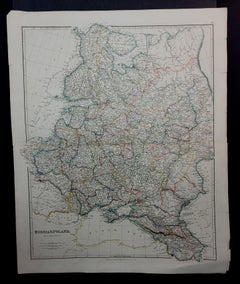
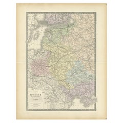
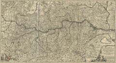
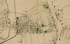
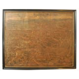
1832 Large Map "Russian & Poland" Ric. R0012
Located in Norton, MA
Large map 1832 "Russian & Poland" Ric.r0012 Russia & Poland, by J.
Category
19th Century Unknown Large Antique Maps
Materials
Paper
1832 Large Map "Russian & Poland" Ric. R0012
Located in Norton, MA
Large map 1832 "Russian & Poland" Ric.r0012 Russia & Poland, by J.
Paper
$1,077Sale Price|20% Off
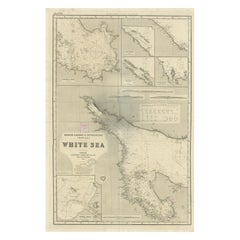
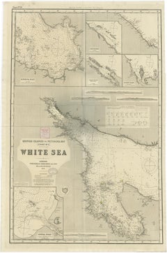
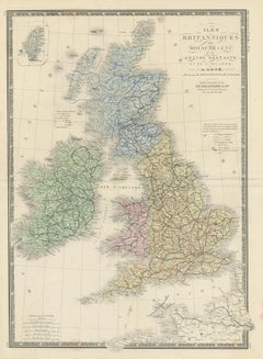
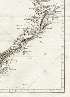
Uncommon, Large Map of the British Islands to Petshora Bay, 1891
Located in Langweer, NL
Uncommon, large map of the British Islands to Petshora Bay.
Paper
$957Sale Price|25% Off
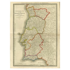
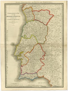
Engraved Large Map of The Kingdom of Portugal Original Handcolored, 1854
Located in Langweer, NL
Large map of the Kingdom of Portugal. From James Wyld's 'A New General Atlas of Modern Geography
Paper
$1,524Sale Price|24% Off
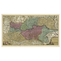
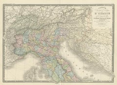
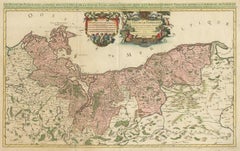
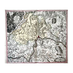
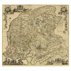
Spectacular Large Map of Upper and Lower Austria between Passau and Wien, c.1700
Located in Langweer, NL
Spectacular large map of Upper and Lower Austria between Passau and Wien with figurative cartouche and armorial vignette.
Paper
$1,625Sale Price|20% Off
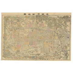
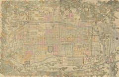
Historical Large Map of Kyoto, Japan (1905) - Published by Kobayashi
Located in Langweer, NL
Old map of Kyoto, Japan. Published by Kobayashi, 1905. This is an old map of Kyoto, Japan, published by Kobayashi in 1905. The map showcases a detailed layout of Kyoto during the ea...
Paper
$445Sale Price|20% Off
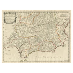
Large Map of Castile's Southern Realms - Granada, Andalusia, and Murcia, 1652
Located in Langweer, NL
This antique map, titled 'Les Etats de la Couronne de Castille', represents the southern regions of the Crown of Castile, specifically the territories of Andalusia, Granada, and Murc...
Paper
$2,275Sale Price|20% Off
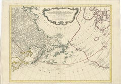
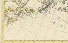
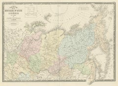
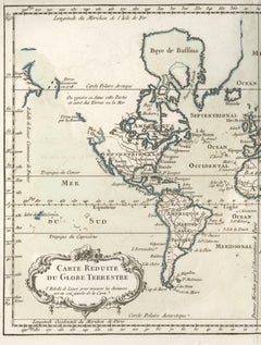
Large Map of Russian Discoveries in Siberia, Alaska & the Bering Strait, 1784
Located in Langweer, NL
1784 Russian Discoveries in Siberia, Alaska & the Bering Strait - Gerhard Friedrich Muller "Nouvelle Carte des Decouvertes Faites par des Vaisseaux Russiens Aux Cotes Inconnues de L...
Paper

1860 Large Map "Carte De La Siberie Russie D'asie, " Ric.R0001
Located in Norton, MA
Large 1860 map "Carte De La Siberie Russie D'Asie," R-0001 " Authentic" - 1860 map "Carte De La Siberie Russie D'Asie," Dimension: Paper: 68 cm W x 51 cm H ; Sight: 51cm W x 4...
Paper
$3,436Sale Price / set|20% Off
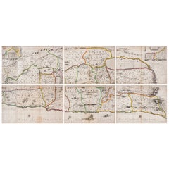
1658 Large Map of the Holy Land by Jansson – Twelve Tribes of Israel in 6 Sheets
Located in Langweer, NL
Holy Land Divided Among the Twelve Tribes – Six-Part Map by Jan Jansson and Georgius Hornius, circa 1658 This rare and impressive six-sheet engraved map of the Holy Land was publish...
Paper

$455Sale Price|20% Off
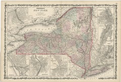
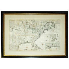
Large Antique Map of New York State with Inset Maps
Located in Langweer, NL
Antique map titled 'Johnson's New York' Large map of New York State.
Paper


$232Sale Price|60% Off
Antique Map of Oceania by Levasseur, '1875'
Located in Langweer, NL
Antique map titled 'Carte générale de l'Océanie'. Large map of Oceania.
Paper

$406Sale Price|30% Off
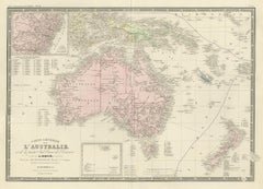
Antique Map of Australia by Levasseur, '1875'
Located in Langweer, NL
Antique map titled 'Carte générale de l'Australie'. Large map of Australia.
Paper

$348Sale Price|40% Off
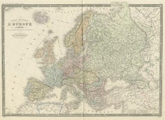
Antique Map of Europe by Levasseur, '1875'
Located in Langweer, NL
Antique map titled 'Carte générale de l'Europe'. Large map of Europe.
Paper


Antique Map of Southern Africa by Levasseur, 1875
Located in Langweer, NL
Antique map titled 'Afrique Méridionale'. Large map of Southern Africa.
Paper

$371Sale Price|20% Off
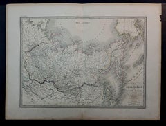
Antique Map of Siberia by Levasseur '1875'
Located in Langweer, NL
Large map of Siberia. This map originates from 'Atlas de Géographie Moderne Physique et Politique' by A.
Paper

$371Sale Price|20% Off
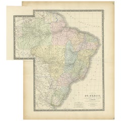
Antique Map of Brazil by Levasseur '1875'
Located in Langweer, NL
Antique map titled 'Carte du Brésil'. Large map of Brazil, with small fold out.
Paper
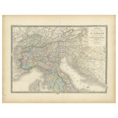
Antique Map of Northern Italy by Levasseur, 1875
Located in Langweer, NL
Antique map titled 'Carte l'Italie (..)'. Large map of Northern Italy.
Paper

$733Sale Price|20% Off
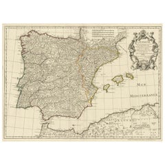
Large Decorative Map of the Iberian Peninsula
Located in Langweer, NL
Antique map titled 'L'Espagne (..)'. Large map of the Iberian Peninsula, including the Balearic Islands and part of the north coast of Africa.
Paper
$371Sale Price|20% Off
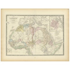
Antique Map of Northern Africa by Levasseur, '1875'
Located in Langweer, NL
Large map of Northern Africa. This map originates from 'Atlas de Géographie Moderne Physique et Politique' by A.
Paper
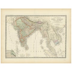
Authentic Antique Map of India and Ceylon, 1875
Located in Langweer, NL
Antique map titled 'Carte générale des Indes'. Large map of India and Ceylon.
Paper
$325Sale Price|20% Off
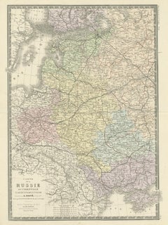
Antique Map of Western Russia by Levasseur, '1875'
Located in Langweer, NL
Large map of Western Russia. This map originates from 'Atlas de Géographie Moderne Physique et Politique' by A.
Paper


$557Sale Price|20% Off
Antique Map of Flanders 'Belgium' by F. de Wit, circa 1680
Located in Langweer, NL
Large map of Flanders, Belgium. Published by F. de Wit, circa 1680.
Paper

$325Sale Price|20% Off
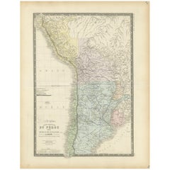
Original Antique Map of Peru in South America, 1875
Located in Langweer, NL
Antique map titled 'Carte générale du Pérou'. Large map of Peru.
Paper

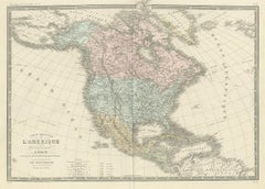
Antique Map of North America by Levasseur, 1875
Located in Langweer, NL
Large map of North America. This map originates from 'Atlas de Géographie Moderne Physique et Politique' by A.
Paper
$301Sale Price|35% Off
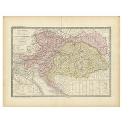
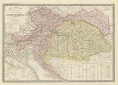
Antique Map of Austria-Hungary by Levasseur, '1875'
Located in Langweer, NL
Large map of Austria-Hungary. This map originates from 'Atlas de Géographie Moderne Physique et Politique' by A.
Paper

$371Sale Price|20% Off
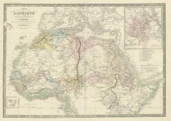
Antique Map of Western Africa by Levasseur '1875'
Located in Langweer, NL
Large map of Western Africa. This map originates from 'Atlas de Géographie Moderne Physique et Politique' by A.
Paper

$319Sale Price|44% Off
Antique Map of the Antilles in the Caribbean, '1875'
Located in Langweer, NL
Antique map titled 'Carte des Iles Antilles'. Large map of the Antilles.
Paper


Antique Map of the East Indies by Levasseur, 1875
Located in Langweer, NL
Antique map titled 'Carte de la Malaisie'. Large map of the East Indies.
Paper

$406Sale Price|30% Off
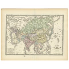
Antique Map of the Asian Continent by Levasseur, '1875'
Located in Langweer, NL
Antique map titled 'Carte générale de l'Asie'. Large map of the Asian Continent.
Paper


$500Sale Price|25% Off
Antique Map of the Artois Region 'France' by F. de Wit, circa 1680
Located in Langweer, NL
Large map of the Artois region, France. Published by F. de Wit, circa 1680.
Paper


Antique Map of Oceania by Levasseur, circa 1860
Located in Langweer, NL
Antique map titled 'Carte générale de l'Océanie'. Large map of Oceania including New Zealand, Australia, Polynesia, Micronesia and the East Indies.
Paper
$371Sale Price|20% Off
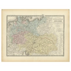
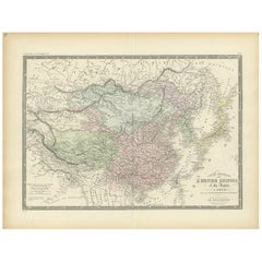
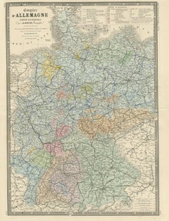
Antique Map of the German Empire by Levasseur, '1875'
Located in Langweer, NL
Large map of the German Empire. This map originates from 'Atlas de Géographie Moderne Physique et Politique' by A.
Paper

$325Sale Price|30% Off
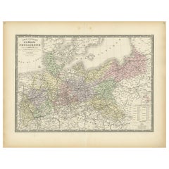
Antique Map of the Prussian Monarchy by Levasseur, '1875'
Located in Langweer, NL
Large map of the Prussian Monarchy. This map originates from 'Atlas de Géographie Moderne Physique et Politique' by A.
Paper


$301Sale Price|35% Off
Antique Map of Algeria and the French Colonies, 1875
Located in Langweer, NL
Antique map titled 'Algérie et Colonies Francaises'. Large map of Algeria and the French Colonies.
Paper

$371Sale Price|20% Off
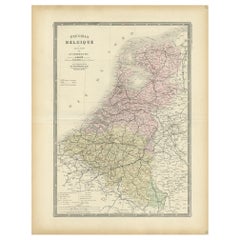
Decorative Antique Map of the Netherlands and Belgium, ca.1875
Located in Langweer, NL
Antique map titled 'Pays-Bas Belgique (..)'. Large map of the Netherlands and Belgium.
Paper

$325Sale Price|20% Off
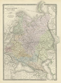
Antique Map of Russia in Europe by Levasseur, '1875'
Located in Langweer, NL
Large map of Russia in Europe. This map originates from 'Atlas de Géographie Moderne Physique et Politique' by A.
Paper


$534Sale Price|20% Off
Antique Map of the Hainaut Region 'France' by F. de Wit, circa 1680
Located in Langweer, NL
Large map of the Hainaut region, France. Published by F. de Wit, circa 1680.
Paper

$534Sale Price|20% Off
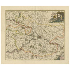
Antique Map of the Namur Region 'France' by F. de Wit, circa 1680
Located in Langweer, NL
Large map of the Namur region, France. Published by F. de Wit, circa 1680.
Paper

$348Sale Price|40% Off
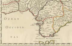
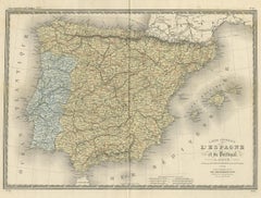
Antique Map of Spain and Portugal by Levasseur, '1875'
Located in Langweer, NL
Large map of Spain and Portugal. This map originates from 'Atlas de Géographie Moderne Physique et Politique' by A.
Paper

$863Sale Price|20% Off
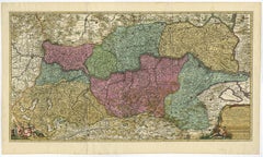
Antique Map of Austria by N. Visscher, circa 1690
Located in Langweer, NL
Spectacular large map of Upper and Lower Austria between Passau and Wien with figurative cartouche and armorial vignette.
Paper

$501Sale Price|20% Off
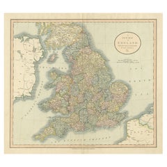
Large Antique Map of England Hand Colored by Counties
Located in Langweer, NL
Large map of England, hand colored by counties. Published by John Cary, 1821.
Paper


$603Sale Price|20% Off
Antique Map of Belgium and Northern France by F. de Wit, circa 1680
Located in Langweer, NL
Large map of Belgium and Northern France. Published by F. de Wit, circa 1680.
Paper
$362Sale Price|20% Off
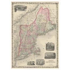
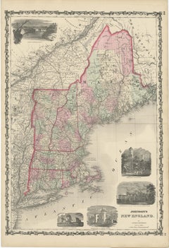
Large Antique Map of New England with decorative Vignettes
Located in Langweer, NL
Antique map titled 'Johnson's New England'. Large map of New England, comprising the states Connecticut, Maine, Massachusetts, New Hampshire, Rhode Island, and Vermont.
Paper

$371Sale Price|20% Off
Antique Map of the Chinese Empire and Japan, 1875
Located in Langweer, NL
Large map of the Chinese Empire and Japan. This map originates from 'Atlas de Géographie Moderne Physique et Politique' by A.
Paper

$1,131Sale Price|35% Off
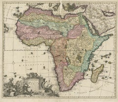
Original Antique Hand- Map of Africa by Allard '1697'
Located in Langweer, NL
Beautiful large map of Africa. This is the 3rd state of the map, with climate notation added in border (1697, Betz 162, Norwich 54).
Paper
$232Sale Price|50% Off
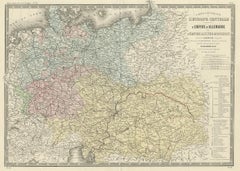
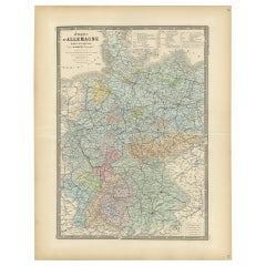
Antique Map of the Western Part of the German Empire by Levasseur, '1875'
Located in Langweer, NL
Antique map titled 'Empire d'Allemagne (..)'. Large map of the western part of the German Empire.
Paper


$278Sale Price|40% Off
Antique Map of the Eastern United States by Levasseur '1875'
Located in Langweer, NL
Large map of the Eastern United States. This map originates from 'Atlas de Géographie Moderne Physique et Politique' by A.
Paper

$284Sale Price|30% Off
Original Antique Map of the United Kingdom and Ireland, Published in 1875
Located in Langweer, NL
Large map of the United Kingdom and Ireland. This map originates from 'Atlas de Géographie Moderne Physique et Politique' by A.
Paper
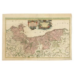
Original Hand-coloured Antique Map of Pomerania by Sanson '1684'
By Nicolas Sanson
Located in Langweer, NL
Large map of Pomerania. Pomerania is a historical region on the southern shore of the Baltic Sea in Central Europe, split between Poland and Germany.
Paper


$417Sale Price|20% Off
Antique Map of the Atlantic Islands, 1817
Located in Langweer, NL
Antique map titled 'Atlantic Islands'. Large map of the Atlantic Islands include the Cape Verde islands, Canary islands, Azore islands and Madeira islands.
Paper

$445Sale Price|40% Off
Antique Map of the Coast of Guinea and the Cape Verde Islands
Located in Langweer, NL
Antique map titled 'Carte de la Guinée (..)'. This map was originally part of a 2 sheet larger map of Eastern Africa, showing the Cape Verde Islands and Senegal.
Paper

$319Sale Price|44% Off
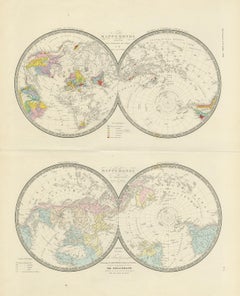
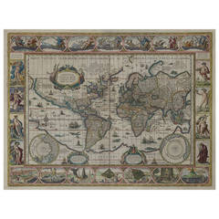
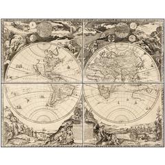
Antique Hemisphere Map of the World 'Two on One Sheet' by Levasseur, '1875'
Located in Langweer, NL
Large map with two hemisphere world maps on one sheet.
Paper

Antique Map of the Limoges Region in France, c.1690
Located in Langweer, NL
Antique map titled 'Le Diocèse de Limoges'. Large map of the Limoges region, France.
Paper

$650Sale Price|30% Off
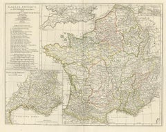
Antique Map of France in Ancient Roman Times by d'Anville, c.1795
Located in Langweer, NL
Original, large, map of France in ancient Roman times. Bottom left, a large inset shows Gallia's southern most Roman Provinces.
Paper


$743Sale Price|20% Off
Antique Map of Leicester and Rutland by Tinney & Sayer, 'circa 1756'
Located in Langweer, NL
Large map of Leicester and Rutland with dedications to the Most Noble John Duke of Rutland, and to the Rt.
Paper
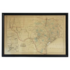
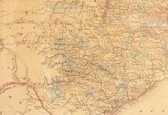
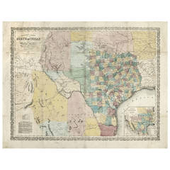
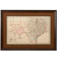
Circa 1853 "New Map of the State of Texas" in Frame
Located in Chapel Hill, NC
Circa 1853 "New Map of the State of Texas" in frame. Compiled from DeCordova's large map & published 1853(?)
Glass, Wood, Paper
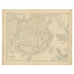

Antique Map of China with insets the Island of Chusan and Canton River, c.1860
Located in Langweer, NL
Antique map titled 'China'. Large map of China, with insets the Island of Chusan, and the Estuary of the Canton River from Hong Kong to Canton.
Paper
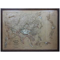
Large 1900s Relief Map of Asia
Located in Chicago, IL
Large 1900s relief map of Asia in original oak frame.
Oak, Paper
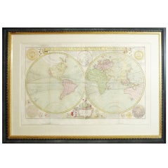
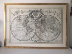
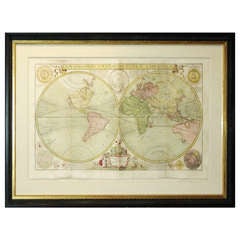
Large Framed Eighteenth Century World Map
By Herman Moll
Located in New York, NY
Herman Moll (1654-1732) A New and Correct Map of the World London, c. 1730 Engraving with hand-coloring Excellent condition Framed to full museum specifications (framed size - 3...
Paper, Watercolor
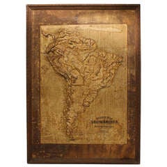
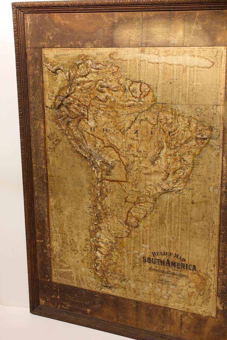
Large Late 1800's Raised Relief Map Of South America
Located in Chicago, IL
Large Late 1800's raised Relief Map of South America by Central School Supply House in Chicago.
Paper, Wood
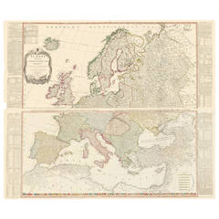
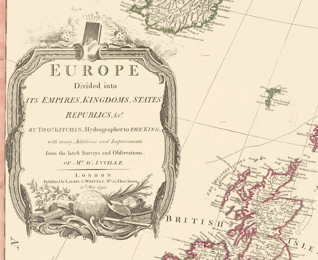
Two-Part Large Hand-Colored Map of Europe from 1798
By Thomas Kitchin
Located in New York, NY
Map of Europe printed on two separate sheets from A New Universal Atlas by Thomas Kitchin. Published in London by Laurie & Whittle, 1798. Original engravings hand-colored at publicat...
Paper
Unavailable
H 137.8 in W 208.67 in D 0.08 in
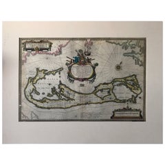
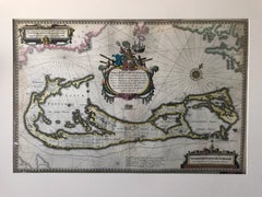
Map of Bermuda. Guiljelm Blaeuw, Mappa Aestivarum Insularum, Amsterdam 1640
Located in Drottningholm, SE
Amsterdam, circa 1640. Colored engraved map with large figurative cartouche and compass rose.
Paper
Unavailable
H 22.45 in W 31.5 in D 0.79 in
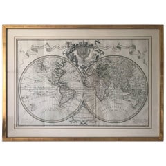
Extremely Rare Mappemonde a l'usage World Map Delisle, Guillaume Buache, 1730
Located in Drottningholm, SE
Amsterdam (Covens - Mortier), circa 1730. Engraved large double-hemisphere map with outline colour, title above the map with the large French coat-of-arms in the middle, surrounde...
Paper
Unavailable
H 23 in W 27 in D 1 in
Group of Four 18thC German Maps by Johann Baptist Homann Dated from 1720-1757
By Johann Baptist Homann
Located in Bedford, Bedfordshire
The firm remained in being until the next century and had a wide influence on map publishing in Germany. Apart from the atlases the firm published a very large number of individual m...
Parchment Paper
Unavailable
H 19 in W 24 in D 0.2 in
Nova Totius Terrarum Orbis Geographica Ac Hydrographica Tabula, 1638
By Willem Blaeu
Located in Houston, TX
This is a particularly fine copy of Blaeu's world map based on Mercator's projection first published on its own in 1606 as a reduced version of his large world map of 1605.
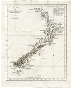
Map of New Zealand - Etching / engraving - 18th Century
Located in Zeeland, Noord-Brabant
Cook with the ship the Endeavour.) Famous large map and first map showing all of New Zealand.
Engraving
Richardson's New Map of the State of Texas
By Charles Desilver, Willard Richardson 1
Located in Houston, TX
The 1859 almanac had a large map, but the present 1860 map is substantially larger than its predecessors.
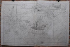
Carte Marine de la Mer Caspienne.
By Guillaume De L'Isle
Located in Zeeland, Noord-Brabant
A large map (in two sheets) of the Caspian sea, with the Wilgo delta and the cities Astrakhan and Derbent identified.
Engraving
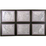
Set of 6 Maps the United States
By A. Steiler
Located in Florham Park, NJ
When laid side-by-side they create one large and heavily detailed map. Each map has a large concentration of city names.
Large Scale Double-Hemisphere World Map; Wall Map
By Herman Moll
Located in New York, NY
Herman Moll A New and Correct Map of the World... Published, London c. 1709 Engraving with original hand-coloring. Ptinted for H. Moll, D. Midwinter and T. Bowles, Printsellers...
Unavailable
H 25.79 in W 38.98 in
The River of Thames from London to the Buoy of the Noure.
Located in Zeeland, Noord-Brabant
A very large map of the English coast, from Dover and Ramsgate/Margate north to the mouth of River Humber, around Grimsby.
Engraving
Large 1812 Antique Map of London
By Langley & Belch
Located in La Jolla, CA
Scarce decorative plan of London, featuring 24 vignettes of major landmarks around the City. One of the most visually appealing maps of the London of the period. Both the West Ind...
Interesting Large Victorian Relief Map of Africa
Located in Stamford, CT
Good relief map with a great patina and original oak frame
Wood
Unavailable
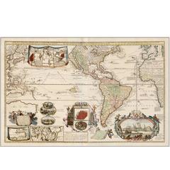
Rare Large Scale Wall Map of the Americas
By Nicolas Joannes Piscator
Located in New York, NY
Nicholas Visscher Nova totius Americae tabula. Wall map on 2 engraved sheets with additional banner title across the top and five engraved views across the bottom. Published: ...

Unavailable
H 14.57 in W 16.93 in D 0.04 in
1750 Schaffhausen, Seutter, Large and Detailed Map Switzerland
By Matthew Seutter
Located in Norwich, GB
Sandrart Joachim, von (1606-1688) Effigies antiquae Romae. redacta a Pyrrho Ligorio Romano, per XIIII Regiones, in quas Urbem divisit Imp. Caesar August. Nuremberg, Germany, pu...
Paper
A Rare Large Scale Eighteenth Century Wall Map of North America
By Gerard van Keulen
Located in New York, NY
Gerard Van Keulen Carte de la Nouvelle France (A Rare Large Scale Eighteenth Century Land Map of North America) Published, Amsterdam 1720 Copperplate engraving with original out...
Unavailable
H 48 in W 59 in D 1 in
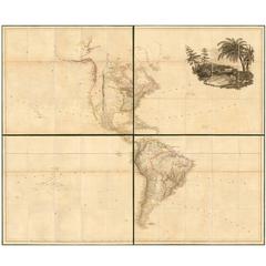
Large 1804 Hand-Colored Map of America After the Louisiana Purchase
By Aaron Arrowsmith
Located in La Jolla, CA
Fine example of Arrowsmith's map of America, in four sheets. An excellent map of America on the eve of the explorations of Lewis & Clark, Humbolt. Pike, Long and others. The map r...
Paper
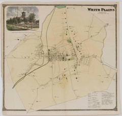
Map of White Plains, New York
Located in New York, NY
This authentic large vintage map of White Plains New York comes from F.W.
Lithograph


Map of White Plains, New York
Located in New York, NY
This authentic large vintage map of White Plains New York comes from F.W.
Lithograph
Unavailable
H 8.5 in W 13.5 in
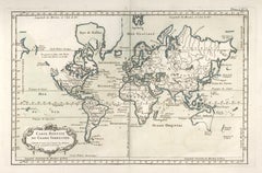
1764 Map "Carte Reduite Du Globe Terrestre"
By Jacques-Nicolas Bellin
Located in New York, NY
Over a 50-year career, he produced a large number of maps of particular interest to the Ministère de la Marine.
Engraving
1730 Hand-Colored Antique Map of the Americas
Located in La Jolla, CA
As a large, separately issued map, subject to the fate of any document unprotected by a binding, it is seldom found in excellent condition.
Paper
Highly Decorative Italian Wall Map of the World
By Paolo Petrini
Located in La Jolla, CA
This large-scale double-hemisphere world map represents the high point of geographic printing in Naples at the end of the 17th century.
Paper
1774 Map of Lower Hudson Bay by Nicolas Bellin
By Jacques-Nicolas Bellin
Located in New York, NY
Over a 50-year career, he produced a large number of maps of particular interest to the Ministère de la Marine.
Engraving
Unavailable
H 23 in W 52 in
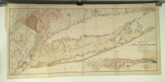
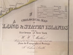
Geological Map of Long & Staten Islands with the Environs of New York
By William W. Mather
Located in New York, NY
Published in 1842 prior to the American Civil War and the subsequent Long Island land rush, this is one of the most detailed and attractive large format maps of Long Island to appear...
Lithograph
![Carte du detroit du Sond contenant les costes de l'Isle de Zelande [...].](https://a.1stdibscdn.com/archivesE/upload/a_5923/1508835598151/cb3806_master.jpg?width=240)
Unavailable
H 24.41 in W 36.03 in
Carte du detroit du Sond contenant les costes de l'Isle de Zelande [...].
By Alexis Hubert Jaillot
Located in Zeeland, Noord-Brabant
He re-published many of Sanson's maps on a larger scale. His maps were admired for their beautiful cartouches.
Engraving
![No.22. 2me. Carte Particuliere des Costes de Bretagne depuis le Cap [...].](https://a.1stdibscdn.com/archivesE/upload/a_5923/1509452006028/IMG_0035_2_master.jpg?width=240)
![No.22. 2me. Carte Particuliere des Costes de Bretagne depuis le Cap [...].](https://a.1stdibscdn.com/archivesE/upload/a_5923/a_22614531509452016750/IMG_0036_a_master.jpg?width=240)
Unavailable
H 25.2 in W 36.62 in
No.22. 2me. Carte Particuliere des Costes de Bretagne depuis le Cap [...].
By Alexis Hubert Jaillot
Located in Zeeland, Noord-Brabant
Fine large overview coastal map / seachart of parts of Brittany, France.
Engraving
![No.26. 6me. Carte Particuliere des Costes de Bretagne depuis la Baye [...].](https://a.1stdibscdn.com/archivesE/upload/a_5923/1509452335067/IMG_0039_2_master.jpg?width=240)
![No.26. 6me. Carte Particuliere des Costes de Bretagne depuis la Baye [...].](https://a.1stdibscdn.com/archivesE/upload/a_5923/a_22615131509452345277/IMG_0040_a_master.jpg?width=240)
Unavailable
H 25.2 in W 36.42 in
No.26. 6me. Carte Particuliere des Costes de Bretagne depuis la Baye [...].
By Alexis Hubert Jaillot
Located in Zeeland, Noord-Brabant
Fine large overview coastal map / seachart of parts of Brittany, France.
Engraving
![No.24. 4me. Carte Particuliere des Costes de Bretagne depuis l'Anse [...].](https://a.1stdibscdn.com/archivesE/upload/a_5923/1509451292282/IMG_0033_2_master.jpg?width=240)
![No.24. 4me. Carte Particuliere des Costes de Bretagne depuis l'Anse [...].](https://a.1stdibscdn.com/archivesE/upload/a_5923/a_22613831509451303982/IMG_0034_a_master.jpg?width=240)
Unavailable
H 25.2 in W 36.62 in
No.24. 4me. Carte Particuliere des Costes de Bretagne depuis l'Anse [...].
By Alexis Hubert Jaillot
Located in Zeeland, Noord-Brabant
Fine large overview coastal map / seachart of parts of Brittany, France.
Engraving
![7me. Carte Particuliere des Costes de Bretagne [...].](https://a.1stdibscdn.com/archivesE/upload/a_5923/1508762650438/IMG_0043_2_master.jpg?width=240)
Unavailable
H 25.01 in W 36.62 in
7me. Carte Particuliere des Costes de Bretagne [...].
By Alexis Hubert Jaillot
Located in Zeeland, Noord-Brabant
Fine large overview coastal map / seachart of parts of Brittany, France.
Engraving
![No.21. Carte Particuliere des Costes de Bretagne [...].](https://a.1stdibscdn.com/archivesE/upload/a_5923/1508761305532/IMG_0029_2_master.jpg?width=240)
Unavailable
H 25.2 in W 36.62 in
No.21. Carte Particuliere des Costes de Bretagne [...].
By Alexis Hubert Jaillot
Located in Zeeland, Noord-Brabant
Fine large overview coastal map / seachart of parts of Normandy and Brittany, France.
Engraving
Planiglobii Terrestris.
By Johann Baptist Homann
Located in Zeeland, Noord-Brabant
The firm remained in being until the next century and had a wide influence on map publishing in Germany. Apart from the atlases the firm published a very large number of individual m...
Engraving, Etching
![Carte de l'entree de la Tamise avec les bancs, passes, isles et costes [...].](https://a.1stdibscdn.com/archivesE/upload/a_5923/1508836574945/cb3808_master.jpg?width=240)
Unavailable
H 21.66 in W 36.23 in
Carte de l'entree de la Tamise avec les bancs, passes, isles et costes [...].
By Alexis Hubert Jaillot
Located in Zeeland, Noord-Brabant
Fine large overview coastal map / seachart of the mouth of the river Thames.
Engraving
Unavailable
H 36.23 in W 24.41 in
Sea chart of Galway Bay and Limerick river in Ireland - Engraving - 18th century
By Alexis Hubert Jaillot
Located in Zeeland, Noord-Brabant
Fine large overview coastal map / seachart of parts of Ireland.
Engraving
![No.25. Carte Particuliere des Costes de Bretagne [...].](https://a.1stdibscdn.com/archivesE/upload/a_5923/1508761693106/IMG_0031_2_master.jpg?width=240)
Unavailable
H 25.2 in W 36.62 in
No.25. Carte Particuliere des Costes de Bretagne [...].
By Alexis Hubert Jaillot
Located in Zeeland, Noord-Brabant
Fine large overview coastal map / seachart of parts of Brittany, France.
Engraving
![No.20. Carte Generale des Costes de Bretagne […].](https://a.1stdibscdn.com/archivesE/upload/a_5923/1509450882426/IMG_0027_2_master.jpg?width=240)
![No.20. Carte Generale des Costes de Bretagne […].](https://a.1stdibscdn.com/archivesE/upload/a_5923/a_22613531509450894251/IMG_0028_a_master.jpg?width=240)
Unavailable
H 25.2 in W 36.82 in
No.20. Carte Generale des Costes de Bretagne […].
By Alexis Hubert Jaillot
Located in Zeeland, Noord-Brabant
General map of the Brittany coasts. Fine large overview coastal map / seachart of Brittany, France.
Engraving
![Carte De La Mer De Dannemark Et Des Entrees Dans La Mer Baltique [...].](https://a.1stdibscdn.com/archivesE/upload/a_5923/1508836131958/cb3807_master.jpg?width=240)
Unavailable
H 24.41 in W 36.03 in
Carte De La Mer De Dannemark Et Des Entrees Dans La Mer Baltique [...].
By Alexis Hubert Jaillot
Located in Zeeland, Noord-Brabant
Fine large overview coastal map / seachart of Denmark and parts of Norway, Sweden and Germany.
Engraving
Unavailable
H 22.75 in W 16.5 in
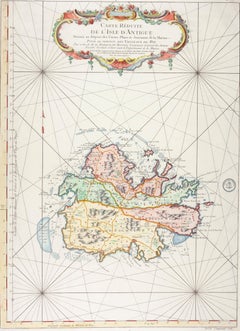
Carte Reduite de l'Isle d'Antigue (Antigua)
Located in New York, NY
Large, beautifully hand-colored engraved map of Antigua by Jacques Nicolas Bellin showing parishes, towns, villages and windmills.
Engraving
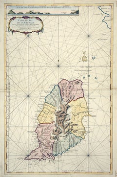
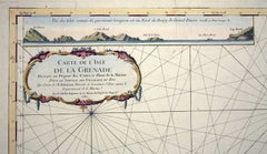
Unavailable
H 22.75 in W 16.5 in
Carte Reduite de l'Isle de la Grenade (Grenada)
Located in New York, NY
Large, beautifully hand-colored engraved map of Antigua by Jacques Nicolas Bellin showing parishes, towns, villages and windmills.
Engraving
![No.27. Carte reduite des Passage de l'Iroise du Four et du Raz [...].](https://a.1stdibscdn.com/archivesE/upload/a_5923/1508763082730/IMG_0045_2_master.jpg?width=240)
Unavailable
H 25.4 in W 37.21 in
No.27. Carte reduite des Passage de l'Iroise du Four et du Raz [...].
By Jacques-Nicolas Bellin
Located in Zeeland, Noord-Brabant
With: Isle d'Ouessan, Brest, Glenan islands. With a large decorative cartouche. Map orientation is north.
Engraving
![Carte generale des costes de l'Europe sur l'ocean [...].](https://a.1stdibscdn.com/archivesE/upload/a_5923/1508837429054/cb3798_master.jpg?width=240)
Unavailable
H 24.41 in W 36.03 in
Carte generale des costes de l'Europe sur l'ocean [...].
By Alexis Hubert Jaillot
Located in Zeeland, Noord-Brabant
He re-published many of Sanson's maps on a larger scale. His maps were admired for their beautiful cartouches.
Engraving
![Carte du Brabant [...].](https://a.1stdibscdn.com/archivesE/upload/a_5923/1508842334968/cb3794_master.jpg?width=240)
Carte du Brabant [...].
By Guillaume De L'Isle
Located in Zeeland, Noord-Brabant
Map of Brabant. Large overview map of the Province of Brabant, part of present day Belgium and The Netherlands.
Engraving
Unavailable
H 5.13 in W 8.32 in D 3 in
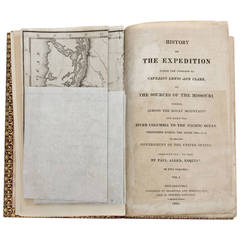
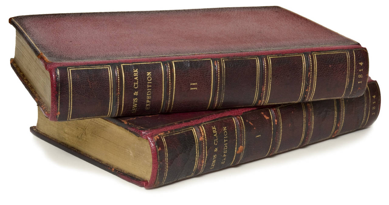
"History of The Expedition Under the Command of Captains Lewis and Clark" Books
By Paul Allen
Located in Houston, TX
Includes the highly desirable large folding map of the expedition from Lewis and Clark's surveys.
![Brabantiae ducatus S.R. Imperii Marchionatus Mechliniae dominii [...].](https://a.1stdibscdn.com/archivesE/upload/a_5923/1509092085137/cb3404_master.jpg?width=240)
Unavailable
H 24.73 in W 21.03 in
Brabantiae ducatus S.R. Imperii Marchionatus Mechliniae dominii [...].
Located in Zeeland, Noord-Brabant
Covens & C. Mortier. - Large overview map of the Province of Brabant, part of present day Belgium and The Netherlands.
Engraving, Etching
![Carte du Brabant [...].](https://a.1stdibscdn.com/archivesE/upload/a_5923/1509092402242/cb3403_master.jpg?width=240)
Carte du Brabant [...].
By Liebaux le fils & Guillaume de l'Isle
Located in Zeeland, Noord-Brabant
Etching / engraving with hand colouring on hand laid paper. Large overview map of the Province of Brabant, part of present day Belgium and The Netherlands.
Engraving, Etching
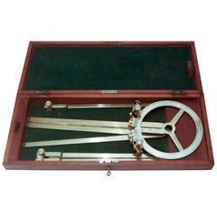
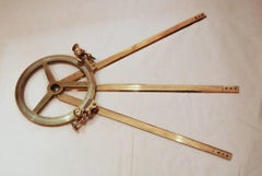
Cased Station Pointer
Located in Salisbury, GB
This quality example has the addition of two beautifully engineered drum micrometers for adjusting the angle of the outer arms and three brass extending arms which may be screwed to ...

Unavailable
H 7.09 in W 9.73 in
T Admiraliteytshof - View of the Admiralty-Court in Rotterdam.
By Johannes de Vou
Located in Zeeland, Noord-Brabant
He is known for decorative borders on large-scale city maps. His pupils were Filibert Bouttats (1654-after 1731), Filibertus Bouttats (1635-1707), Frans Decker, Francois Harrewijn, J...
Etching

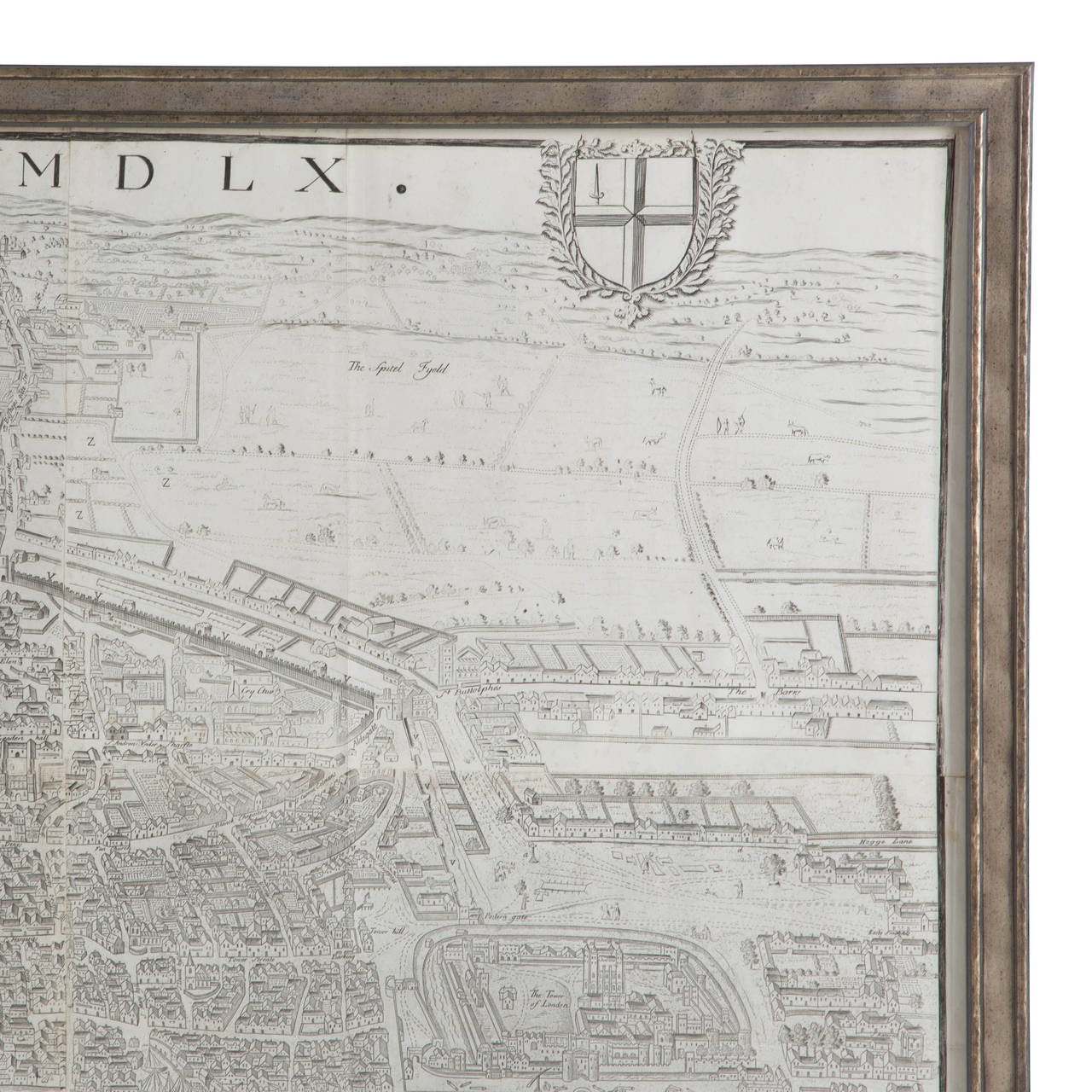
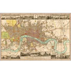
Large Map of London
Located in Gloucestershire, GB
Late Georgian/possibly early Victorian fine copy of the first large great map of London, Westminster and river Thames.

Map
Located in Los Angeles, CA
A Large Map of Gent in Frame
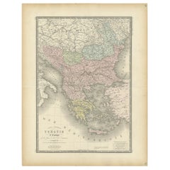
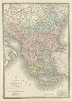
Antique Map of Turkey in Europe by Levasseur, '1875'
Located in Langweer, NL
Large map of Turkey in Europe. This map originates from 'Atlas de Géographie Moderne Physique et Politique' by A.
Paper


Original Antique Map of the Picardy Region in Northern France, 1694
Located in Langweer, NL
Antique map titled 'La Province de Picardie (..)'. Large map of the Picardy region of France.
Paper
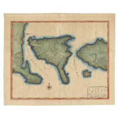
Antique Map of the 'Island of Gods' Bali, Indonesia, 1726
Located in Langweer, NL
Antique map titled 'Kaart van het Eyland Bali'. Large map of the island of Bali, Indonesia.
Paper

Sold
H 46.07 in W 50.01 in D 0 in
Large Antique Wall Map of Friesland by Vegelin van Claerbergen, 1739
Located in Langweer, NL
Heeren Gedeputeerde Staeten'. Rare and large attractive wall map of Friesland, the so-called 'Vegelin-map'.
Paper
1856 Map of the State of Texas by J. H. Colton
Located in Colorado Springs, CO
The map, titled “Colton’s New Map of the State of Texas," was compiled from the famous De Cordova’s large map of the state.
Paper


Sold
H 27.75 in W 38.5 in D 1.38 in
1859 "Colton's New Map of the State of Texas..." by Johnson & Browning
Located in Colorado Springs, CO
Presented is "Colton's New Map of the State of Texas Compiled from De Cordova's Large Map", published in Alivin J.
Paper
Antique and vintage collectibles and curiosities can bring whimsy and wonder to any interior.
Decorating with old scientific instruments, historical memorabilia and vintage musical instruments, as well as other authentic collectibles and curiosities that can be found on 1stDibs, presents an opportunity to create a unique, natural history museum-like atmosphere in your home that can provoke conversation as often as it pays tribute to how far we’ve come in understanding our world.
And bringing collectibles and curiosities into your space is actually on trend — Wunderkammern, or curiosity cabinets, were all the rage in Europe during the 1500s and continued to have adherents there and in the U.S. in the following centuries. Today, however, they’re experiencing a real surge in popularity and influencing how many interior designers are furnishing and decorating homes — combining contemporary with antique, scientific with tribal, earthly with extraterrestrial, Les Lalanne tables with Flemish tapestries.
The original Wunderkammern were entire rooms filled with objects demonstrating their owners’ worldly knowledge: A proper one included artificiala or preciosa (objets d’art); naturalia (such as skeletons, shells, minerals); exotica (taxidermy or dried plants); and scientifica (scientific instruments), frequently alongside religious relics and ancient artifacts.
Pay tribute to a history of rich and diverse musical traditions that have taken shape all over the world by decorating your home with a collection of antique and vintage musical instruments — with a little help from strong hanging wire or some wall hooks, vintage brass instruments such as a gong, French horn or trumpet can help elevate a home office or complement the efforts you’ve made to ensure a welcoming vibe in your home’s entryway. Bells or antique wind instruments can add provocative metallic contrasts to dark woods as tabletop decorative objects.
Create an intriguing focal point with Georgian scientific instruments, such as stick barometers with mahogany cases or lacquered brass telescopes. These items stem from an era named for the monarchies of the four King Georges, who ruled England in succession starting in 1714 (plus King William’s reign, which lasted until 1837). Just as there was beautiful jewelry produced during the period that today is coveted by collectors, there is much to be found in the collectibles and curiosities realm too.
Wanderlust, nostalgia and a shared love of good design are contributing factors to certain trends in decorating — just as vintage trunks and luggage have reappeared as furniture or home accents in a bedroom or foyer, decorating with globes, maps or nautical objects is similarly rooted in the allure of travel and a penchant for the stylish finishing touch that collectibles bring to our homes.
Find a wide range of antique and vintage collectibles and curiosities on 1stDibs.
It's hard to resist the allure of a beautiful pool. So, go ahead and daydream about whiling away your summer in paradise.
It’s never too early for good design. These interiors combine elevated furnishings and a youthful spirit, resulting in spaces that are at once elegant and whimsical.
Produced in 1843, the well-preserved volume is evidence of the author's exacting specifications.
New or old, the coverlets add old-time charm to any space.
Get into the games! These items celebrate the events, athletes, host countries and sporting spirit.
French trendsetter and serial collector Daniel Rozensztroch tells us about his obsession with objects related to seafaring men.
The sought-after designer worked with the team at Hoffman Creative to produce a monograph that beautifully showcases some of Studio Shamshiri's most inspiring projects.
Italian writer and collector Umberto Pasti opens the doors to his remarkable cave of wonders in North Africa.