Map 19th Century
72
to
464
2,900
645
3,280
870
575
224
148
109
101
101
93
79
71
60
30
27
27
22
20
20
20
17
15
15
12
12
12
12
11
9
9
9
8
6
6
5
4
3
3
3
3
3
3
2
2
2
1
1
1
1
1
1
143
42
42
31
19
Sort By
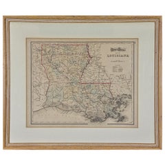
Louisiana: A Framed 19th Century Map by O. W. Gray
By Gray and Co
Located in Alamo, CA
This framed 19th century map of the Louisiana territory was published in "Gray's Atlas of the
Category
Antique Mid-19th Century American Other Maps
Materials
Paper
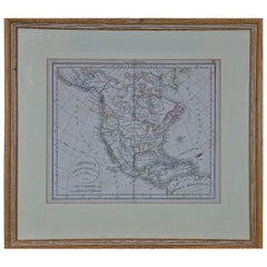
America "Amérique Septentrionale": A 19th Century French Map by Delamarche
By Maison Delamarche 1
Located in Alamo, CA
This framed mid 19th century map of North America entitled "Amérique Septentrionale" by Felix
Category
Antique Mid-19th Century American Other Maps
Materials
Paper
H 20 in W 22.63 in D 0.88 in
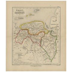
Antique Map of Groningen from a 19th Century Dutch Atlas, 1864
Located in Langweer, NL
the 16th to the 20th centuries. Buying and collecting antique maps is a tradition that goes back
Category
Antique 19th Century Maps
Materials
Paper
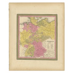
Antique Map of Germany from an American 19th Century Atlas, 1846
Located in Langweer, NL
collection includes a wide range of authentic antique maps from the 16th to the 20th centuries. Buying and
Category
Antique 19th Century Maps
Materials
Paper
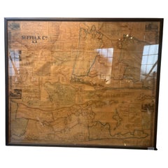
Framed Mid-19th Century Wall Map of Long Island, the Hamptons
Located in Sag Harbor, NY
A Framed museum quality find. This large wall map dates to the mid-1800s. Detailed inset maps of
Category
Antique Mid-19th Century American Maps
Materials
Linen, Paper
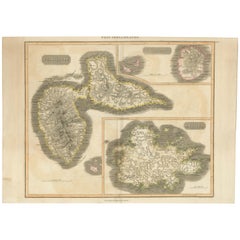
Large Antique Map of Guadeloupe and Antigua with Adjacent Isles, 19th Century
Located in Langweer, NL
Title: "Antique Map of Guadeloupe and Antigua with Adjacent Isles, 19th Century"
Source: New
Category
Antique Early 19th Century Maps
Materials
Paper
No Reserve
H 21.07 in W 29.34 in D 0 in
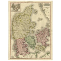
19th Century Large Original Antique Map of Denmark by J. Pinkerton, 1812
By Pinkerton
Located in Langweer, NL
19th century, with remarkable detail and a 3 dimensional feeling.
Category
Antique Early 19th Century Maps
Materials
Paper
Free Shipping
H 28.75 in W 21.26 in D 0.02 in
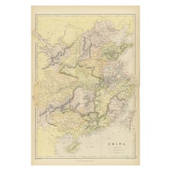
Antique 19th Century Map of China by Blackie & Son, 1882
Located in Langweer, NL
understanding the regional division of 19th-century China. The cartography reflects the style and knowledge of
Category
Antique 1880s Maps
Materials
Paper
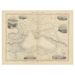
Mid 19th Century Map of the Black Sea with Decorative Vignettes, 1851
Located in Langweer, NL
Map of the Black Sea and contingent lands, including Turkey, Russia, Georgia, Azerbaijan, Bulgaria
Category
Antique Mid-19th Century Maps
Materials
Paper
Early 19th Century Hand Coloured Map of North America by Aaron Arrowsmith
By Aaron Arrowsmith
Located in Hamilton, Ontario
Hand coloured map in French by English cartographer Aaron Arrowsmith (1750–1823) titled "Amerique
Category
Antique Early 19th Century English Maps
Materials
Paper
H 20.5 in W 14.25 in D 0.1 in
Early 19th Century Hand Colored Map of the United States and Caribbean Islands
Located in Hamilton, Ontario
Hand coloured early 19th century map by Giraldon of France titled "Etats Unis et Grandes Antilles
Category
Antique Early 19th Century French Maps
Materials
Paper
H 13.5 in W 10 in D 0.975 in
Title: Mid-19th Century Map of Australasia by Carl Flemming - 1855
Located in Langweer, NL
Title: "Mid-19th Century Map of Australasia by Carl Flemming - 1855"
Description: This original
Category
Antique 1850s Maps
Materials
Paper
No Reserve
H 14.06 in W 17.52 in D 0 in
19th Century Illustrated Map of Ceylon (Sri Lanka) with Notable Landmarks
Located in Langweer, NL
John Tallis & Company is known for producing maps and atlases that were highly regarded for their
Category
Antique 1850s Maps
Materials
Paper
H 14.26 in W 10.71 in D 0 in
Mediterranean Tapestry: A 19th Century Map of the Mediterranean Shores, 1882
Located in Langweer, NL
This map, titled "The Shores of the Mediterranean," is part of the 1882 atlas by Blackie & Son, and
Category
Antique 1880s Maps
Materials
Paper
H 11.03 in W 14.97 in D 0 in
Mid-19th Century Decorative Map of India with Cultural and Natural Vignettes
Located in Langweer, NL
. They were produced during the mid-19th century, a time when cartographic publishing became as much an
Category
Antique 1850s Maps
Materials
Paper
H 14.26 in W 10.71 in D 0 in
Map Sussex
Located in BUNGAY, SUFFOLK
Map of Sussex with explanation
Maker unknown.
Category
Antique 19th Century English Victorian Maps
Materials
Paper
Mid-19th Century Decorative Map of Asia with Cultural and Natural Vignettes
Located in Langweer, NL
John Tallis & Company, known for their decorative mid-19th-century maps, created this map of Asia
Category
Antique 1850s Maps
Materials
Paper
H 10.71 in W 14.26 in D 0 in
An Insightful 19th Century Map of Syria and the Surrounding Regions, 1882
Located in Langweer, NL
cartographic work from the late 19th century, specifically from the 1882 atlas by Blackie and Son. It depicts
Category
Antique 1880s Maps
Materials
Paper
No Reserve
H 14.97 in W 11.03 in D 0 in
19th Century John Cary Map of South Part of West Riding of Yorkshire, circa 1805
By John Cary
Located in Royal Tunbridge Wells, Kent
Antique 19th century British original John Cary sr (1755-1835) map of South part of the West Riding
Category
Antique 19th Century British Maps
Materials
Paper
H 18.12 in W 25.6 in D 0.4 in
19th Century John Cary Map of North Part of West Riding of Yorkshire, C.1805
By John Cary
Located in Royal Tunbridge Wells, Kent
Antique 19th century British original John Cary sr (1755-1835) map of North part of the West Riding
Category
Antique 19th Century British Maps
Materials
Paper
Free Shipping
H 21.26 in W 26.19 in D 0.79 in
Untitled (XXVI)
By Robert Flynt
Located in New York, NY
imagery (with source material as diverse as anatomy charts, first aid text books, astronomical maps, 19th
Category
2010s Contemporary Figurative Photography
Materials
Black and White
Imperial Frontiers: A 19th Century Map of Southern Russia and the Caucasus, 1882
Located in Langweer, NL
the area as known in the late 19th century.
The map extends from the Black Sea to the west, across
Category
Antique 1880s Maps
Materials
Paper
No Reserve
H 14.97 in W 22.45 in D 0 in
Large Antique Map of New York State with Inset Maps
Located in Langweer, NL
was one of the better American mapmakers of the 19th century, and were known for keeping current with
Category
Antique Mid-19th Century Maps
Materials
Paper
Antique Zoological Map, 1843
Located in Langweer, NL
to the 20th centuries. Buying and collecting antique maps is a tradition that goes back hundreds of
Category
Antique 19th Century Maps
Materials
Paper
Antique Map of Wisconsin with Inset Geological Map of Wisconsin
Located in Langweer, NL
Antique map titled 'Wisconsin'. Original antique map of Wisconsin, United States. With inset
Category
Antique Late 19th Century Maps
Materials
Paper
Antique Map of Greece with an Inset Map of Corfu, 1854
Located in Langweer, NL
the 16th to the 20th centuries. Buying and collecting antique maps is a tradition that goes back
Category
Antique 19th Century Maps
Materials
Paper
Antique Map of Denmark with an Inset Map of Iceland, 1832
Located in Langweer, NL
the 16th to the 20th centuries. Buying and collecting antique maps is a tradition that goes back
Category
Antique 19th Century Maps
Materials
Paper
Original 1891 Walker Map
Located in Norwell, MA
Original 1891 map of Massachusetts by Walker. Towns include Cambridge, Boston, Dedham, Ashland
Category
Antique 19th Century Maps
Antique Map of Nebraska
Located in Langweer, NL
Antique map titled 'Nebraska'. Original antique map of Nebraska, United States. This print
Category
Antique Late 19th Century Maps
Materials
Paper
Antique Map of Oregon
Located in Langweer, NL
Antique map titled 'Oregon'. Original antique map of Oregon, United States. This print originates
Category
Antique Late 19th Century Maps
Materials
Paper
Antique Map of Alabama
Located in Langweer, NL
Antique map titled 'Alabama'. Original antique map of Alabama, United States. This print originates
Category
Antique Late 19th Century Maps
Materials
Paper
Antique Map of Vermont
Located in Langweer, NL
Antique map titled 'Vermont'. Original antique map of Vermont, United States. This print originates
Category
Antique Late 19th Century Maps
Materials
Paper
Antique Map of Arkansas
Located in Langweer, NL
Antique map titled 'Arkansas'. Original antique map of Arkansas, United States. This print
Category
Antique Late 19th Century Maps
Materials
Paper
Antique Map of Iowa
Located in Langweer, NL
Antique map titled 'Iowa'. Original antique map of Iowa, United States. This print originates from
Category
Antique Late 19th Century Maps
Materials
Paper
Antique Map of Kentucky
Located in Langweer, NL
Antique map titled 'Kentucky'. Original antique map of Kentucky, United States. This print
Category
Antique Late 19th Century Maps
Materials
Paper
Antique Map of the Eastern United States with Inset Map of Texas
Located in Langweer, NL
last three decades of the 19th and the first half of the 20th century. Published by Justus Perthes of
Category
Antique Mid-19th Century Maps
Materials
Paper
1854 Map of Massachusetts, Connecticut and Rhode Island, Antique Wall Map
Located in Colorado Springs, CO
map and print publisher based in New York during the middle part of the 19th century. Ensign was born
Category
Antique 19th Century American Maps
Materials
Paper
H 38.13 in W 45 in D 3.5 in
Antique Map of New Jersey
Located in Langweer, NL
plate engraving dating to 1855. Produced by the important mid 19th century American map publisher J. H
Category
Antique Mid-19th Century Maps
Materials
Paper
Steel Engraved Map of the United States with Inset Map of Florida
Located in Langweer, NL
Antique map titled 'United States'. Steel engraved map of the United States. With small inset map
Category
Antique Mid-19th Century Maps
Materials
Paper
Antique Map of Eastern Canada with an inset Map of Newfoundland, 1882
Located in Langweer, NL
the 16th to the 20th centuries. Buying and collecting antique maps is a tradition that goes back
Category
Antique 19th Century Maps
Materials
Paper
Antique 1803 Italian Map of Asia Including China Indoneseia India
Located in Amsterdam, Noord Holland
.
Additional information:
Type: Map
Country of Manufacturing: Europe
Period: 19th century Qing (1661 - 1912
Category
Antique 19th Century European Maps
Materials
Paper
Antique Map of Virginia, with Inset Map of the South Western Continuation
Located in Langweer, NL
Antique map titled 'Virginia'. Original antique map of Virginia, United States. With inset map of
Category
Antique Late 19th Century Maps
Materials
Paper
H 8.27 in W 10.63 in D 0.02 in
Antique Map of Ohio, with Inset Maps of Cleveland, Columbus and Cincinnati
Located in Langweer, NL
Antique map titled 'Ohio'. Original antique map of Ohio, United States. With inset maps of
Category
Antique Late 19th Century Maps
Materials
Paper
H 8.27 in W 10.63 in D 0.02 in
Antique Map of North Carolina, with inset map of the western part
Located in Langweer, NL
Antique map titled 'North Carolina'. Original antique map of North Carolina, United States. With
Category
Antique Late 19th Century Maps
Materials
Paper
Original Antique Map of Asia
Located in Langweer, NL
Antique map titled 'Asien'. Original old map of Asia. Published in Berlin by Simon Schropp et Comp
Category
Antique Early 19th Century Maps
Materials
Paper
Antique Hand Colored Framed Map of Europe
Located in West Palm Beach, FL
Antique reproduction copied from an edition dated 1595 by Ortelius.
Category
Antique Late 19th Century Maps
Antique Map of China, 1874
Located in Langweer, NL
the 16th to the 20th centuries. Buying and collecting antique maps is a tradition that goes back
Category
Antique 19th Century Maps
Materials
Paper
Antique Map of Asia, 1846
Located in Langweer, NL
to the 20th centuries. Buying and collecting antique maps is a tradition that goes back hundreds of
Category
Antique 19th Century Maps
Materials
Paper
1849 Map of "Europaische Russland", 'Meyer Map of European Russia', Ric. R017
Located in Norton, MA
1849 Map of
"Europaische Russland"
( Meyer Map of European Russia)
Ric.r017
A lovely map of
Category
Antique 19th Century Unknown Maps
Materials
Paper
H 11.82 in W 9.06 in D 0.4 in
Original Antique Map of Africa
Located in Langweer, NL
Antique map titled 'Afrika'. Original antique map of Africa, drawn by Van Beusekom. Published by
Category
Antique Late 19th Century Maps
Materials
Paper
Antique Map of Greece with Two Small Inset Maps of Athens, c.1870
Located in Langweer, NL
collection includes a wide range of authentic antique maps from the 16th to the 20th centuries. Buying and
Category
Antique 19th Century Maps
Materials
Paper
Antique Map of Algeria, 1880
Located in Langweer, NL
Antique map titled 'Algérie. Old map of Algeria. This map originates from 'Géographie Universelle
Category
Antique 19th Century Maps
Materials
Paper
Antique Map of France with Inset Map of the Island of Corsica, 1820
Located in Langweer, NL
authentic antique maps from the 16th to the 20th centuries. Buying and collecting antique maps is a
Category
Antique 19th Century Maps
Materials
Paper
Antique Map of New Hampshire
Located in Langweer, NL
Antique map titled 'New Hampshire'. Original antique map of New Hampshire, United States. This
Category
Antique Late 19th Century Maps
Materials
Paper
Antique Map of Egypt, '1875'
Located in Langweer, NL
Antique map titled 'Carte des l'Égypte'. Large map of Egypt. This map originates from 'Atlas de
Category
Antique Late 19th Century Maps
Materials
Paper
Antique Map of the Region of Georgia with Inset Maps of Florida and Texas
Located in Langweer, NL
world atlas of the last three decades of the 19th and the first half of the 20th century. Published by
Category
Antique Late 19th Century Maps
Materials
Paper
H 15.04 in W 18.63 in D 0.02 in
Antique Map of England with Inset Maps of the Region of Liverpool and London
Located in Langweer, NL
Antique map titled 'England'. Original antique map of England, with two inset maps of the region of
Category
Antique Mid-19th Century Maps
Materials
Paper
H 17.33 in W 13.86 in D 0.02 in
Antique Map of Asia in the 12th, 13th and 14th Century, 1877
Located in Langweer, NL
Antique map titled 'Azie in de 12de, 13de en 14de eeuw.' (Asia in the 12th, 13th and 14th century
Category
Antique 19th Century Maps
Materials
Paper
Attractive Antique Map of Italy with Inset of Maps Showing The Regions, c.1870
Located in Langweer, NL
20th centuries. Buying and collecting antique maps is a tradition that goes back hundreds of years
Category
Antique 19th Century Maps
Materials
Paper
H 13.78 in W 17.76 in D 0 in
Antique Map of Asia by with an Inset Map of Turkey in Asia, 1868
Located in Langweer, NL
authentic antique maps from the 16th to the 20th centuries. Buying and collecting antique maps is a
Category
Antique 19th Century Maps
Materials
Paper
- 1
- ...
Get Updated with New Arrivals
Save "Map 19 Th Century", and we’ll notify you when there are new listings in this category.
Map 19th Century For Sale on 1stDibs
Find many varieties of an authentic map 19th century available at 1stDibs. Each map 19th century for sale was constructed with extraordinary care, often using paper, wood and metal. There are 2291 variations of the antique or vintage map 19th century you’re looking for, while we also have 5 modern editions of this piece to choose from as well. Your living room may not be complete without a map 19th century — find older editions for sale from the 18th Century and newer versions made as recently as the 21st Century. Each map 19th century bearing Victorian, Georgian or Baroque hallmarks is very popular. A well-made map 19th century has long been a part of the offerings for many furniture designers and manufacturers, but those produced by Victor Levasseur, Schreiber and Jacques-Nicolas Bellin are consistently popular.
How Much is a Map 19th Century?
The average selling price for a map 19th century at 1stDibs is $274, while they’re typically $50 on the low end and $425,000 for the highest priced.
More Ways To Browse
Antique Vermont Maps
Antique Maps Of Tennessee
Antique Map Of New Hampshire
Native American Tribes Map
Antique Maps Of Lithuania
Antique Alabama Map
Antique Wisconsin Maps
Map Of Native American Tribes
New Delisle
Alabama Map
Alabama Antique Map
Antique Map Of Alabama
Antique Map Kentucky
Tennessee Map
Cincinnati Map
Antique Map Connecticut
Carte Egypte Antique
Maison Delisle
