Antique Prints Maps
73
to
340
2,841
824
2,130
1,410
1,238
647
288
288
240
224
221
202
168
155
143
138
99
73
64
63
56
51
50
49
48
46
45
45
41
39
38
34
32
30
28
28
28
27
26
25
23
22
22
20
20
17
15
15
15
11
6
3
104
66
44
36
33
Sort By
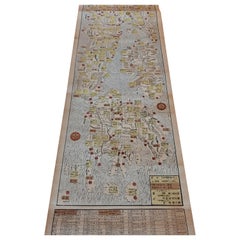
Antique Woodblock Print Map of Japan 'circa 1860'
Located in Langweer, NL
Original Japanese woodblock print map of Japan. Very large and fascinating map, rebacking with
Category
Late 19th Century Antique Prints Maps
Materials
Paper
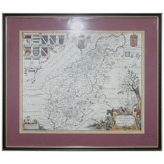
Double Sided Northamptonshire 1645 Hand Colored Antique Print Map Rare Find
Located in GB
We are delighted to this lovely antique Atlas page map of Northamptonshire printed in 1645
Category
Early 1800s English Georgian Antique Prints Maps
Materials
Paper
H 22.25 in W 25.6 in D 0.79 in
Double Sided and Glazed Cheshire 1645 Hand Colored Antique Print Map Rare Find
Located in GB
We are delighted to offer for sale this lovely antique Atlas page map of Cheshire printed in 1645
Category
Early 1800s English Georgian Antique Prints Maps
Materials
Paper
H 21.46 in W 25.6 in D 0.79 in
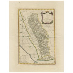
Antique Map of Yemen by Schraembl, 1789
Located in Langweer, NL
map is the first printed map specifically of Yemen, and the earliest map based on actual exploration
Category
Late 18th Century Antique Prints Maps
Materials
Paper
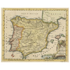
Antique Map of Spain & Portugal 'Iberian Peninsula', Decorative Cartouche, c1755
Located in Langweer, NL
engraved and printed maps for government and other official bodies and produced a wide range of commercial
Category
1750s Antique Prints Maps
Materials
Paper
H 7.88 in W 9.85 in D 0 in
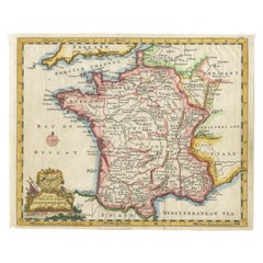
Antique Map of France with a Nice Cartouche of a Distance Scale, c.1756
Located in Langweer, NL
printed maps for government and other official bodies and produced a wide range of commercial maps and
Category
18th Century Antique Prints Maps
Materials
Paper
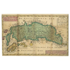
Antique Map of Seram Island by Keizer & De Lat, c.1747
Located in Langweer, NL
. One of the earliest separately printed maps of the island. Artists and Engravers: Published by Keizer
Category
18th Century Antique Prints Maps
Materials
Paper
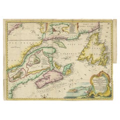
Antique Map Dedicated to British Merchants Trading to North America, ca.1746
Located in Langweer, NL
printed maps for government and other official bodies and produced a wide range of commercial maps and
Category
1740s Antique Prints Maps
Materials
Paper
H 13.98 in W 19.69 in D 0 in
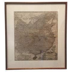
Framed Map of China
Located in Greenwich, CT
Map of China, 19th century. European print map of China
Conservation frame with walnut frame
Category
19th Century European Qing Antique Prints Maps
Materials
Paper
Antique Map of the Islands of Banda, Indonesia from a Very Rare Edition, 1725
Located in Langweer, NL
published in 66 parts and is the biggest print / map book ever published. Van der Aa incorporated plates by
Category
1720s Antique Prints Maps
Materials
Paper
H 14.97 in W 19.3 in D 0 in
Extremely Rare Map of the East-Indies towards the South-East 'Indonesia', 1725
Located in Langweer, NL
66 parts and is the biggest print / map book ever published. Van der Aa incorporated plates by other
Category
1720s Antique Prints Maps
Materials
Paper
H 14.97 in W 19.3 in D 0 in
Original Map of the Kingdom of Bohemia, with Silesia, Moravia and Lusatia, 1804
Located in Langweer, NL
English cartographer who was the leading map supplier of his day. He engraved and printed maps for
Category
Early 1800s Antique Prints Maps
Materials
Paper
H 21.38 in W 27.37 in D 0 in
Rare Antique Map of the Moghul Empire, ca.1725
Located in Langweer, NL
print / map book ever published. Van der Aa incorporated plates by other publishers such as Blaeu
Category
1720s Antique Prints Maps
Materials
Paper
Antique Map of the Spice Islands by Van Linschoten, 1598
Located in Langweer, NL
, is the rarest and most valuable of the printed maps of the Spice Islands. It is estimated that only
Category
16th Century Antique Prints Maps
Materials
Paper
Antique Map of the Maluku Islands by Van der Aa, 1725
By Pieter Van Der Aa
Located in Langweer, NL
. This famous work was published in 66 parts and is the biggest print / map book ever published. Van der
Category
18th Century Antique Prints Maps
Materials
Paper
1875 "North America" Map by J. Bartholomew
Located in Colorado Springs, CO
.
CONDITION:
Very good condition. Color printed map. Color is original to the map and still vibrant. Minor
Category
1870s Scottish Antique Prints Maps
Materials
Paper
Decorative Original Antique Map of Valencia in Southern Spain, circa 1601
Located in Langweer, NL
published around 1601, which would place it relatively early in the history of printed maps. The map
Category
Early 17th Century Antique Prints Maps
Materials
Paper
Free Shipping
H 17.52 in W 22.45 in D 0.02 in
Antique Map of the Island of Java by Van Der Aa, 1725
By Pieter Van Der Aa
Located in Langweer, NL
famous work was published in 66 parts and is the biggest print / map book ever published. Van der Aa
Category
18th Century Antique Prints Maps
Materials
Paper
Antique Map of the Roadstead of Batavia by Van der Aa, 1725
By Pieter Van Der Aa
Located in Langweer, NL
. 1725. This famous work was published in 66 parts and is the biggest print / map book ever published
Category
18th Century Antique Prints Maps
Materials
Paper
Antique Map of the Roadstead of Bantam by Van der Aa, 1725
By Pieter Van Der Aa
Located in Langweer, NL
print / map book ever published. Van der Aa incorporated plates by other publishers such as Blaeu
Category
18th Century Antique Prints Maps
Materials
Paper
Rare Engraved Antique Map of India with Elephants in the Cartouche, c.1725
Located in Langweer, NL
print / map book ever published. Van der Aa incorporated plates by other publishers such as Blaeu
Category
18th Century Antique Prints Maps
Materials
Paper
H 19.1 in W 14.57 in D 0 in
Extremely Rare Map of The land of Eso or Hokkaido in Japan, 1725
Located in Langweer, NL
the biggest print / map book ever published. Van der Aa incorporated plates by other publishers such
Category
18th Century Antique Prints Maps
Materials
Paper
Antique Map of the Gulf of Cambay, Gujarat, India, 1725
By Pieter Van Der Aa
Located in Langweer, NL
the biggest print / map book ever published. Van der Aa incorporated plates by other publishers such
Category
18th Century Antique Prints Maps
Materials
Paper
Antique Map of the Mughal Empire by Van der Aa, C.1725
By Pieter Van Der Aa
Located in Langweer, NL
. van der Aa, Leyden, c. 1725. This famous work was published in 66 parts and is the biggest print / map
Category
18th Century Antique Prints Maps
Materials
Paper
Extremely Scarce Antique Map of The Island of Borneo, Indonesia, c. 1725
Located in Langweer, NL
, Leyden, c. 1725. This famous work was published in 66 parts and is the biggest print / map book ever
Category
18th Century Antique Prints Maps
Materials
Paper
H 10.44 in W 16.15 in D 0 in
Antique Map of the Region of Osaka and Hirado Island in Japan, 1725
By Pieter Van Der Aa
Located in Langweer, NL
parts and is the biggest print / map book ever published. Van der Aa incorporated plates by other
Category
18th Century Antique Prints Maps
Materials
Paper
Antique Map with Details of Berings' Expedition into Russians' Far East, 1737
Located in Langweer, NL
jusqua'a Kamtschatka'.
This is the first printed map to illustrate Vitus Bering's first voyage
Category
1730s Antique Prints Maps
Materials
Paper
H 12.96 in W 22.64 in D 0 in
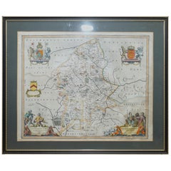
Staffordshire 1645 Hand Colored Antique Print Staffordiensis Comitatvs Map
Located in GB
We are delighted to offer for sale this lovely antique Atlas page map of Staffordshire printed in
Category
Early 1800s English Georgian Antique Prints Maps
Materials
Paper
H 22.45 in W 25.32 in D 0.99 in
Interesting Old Map of the Nw Coast of America and the Ne Coast of Asia, ca.1772
Located in Langweer, NL
English cartographer who was the leading map supplier of his day. He engraved and printed maps for
Category
1770s Antique Prints Maps
Materials
Paper
H 13.78 in W 17.13 in D 0 in
Bird's Eye View of Dabhol as Seen from the Sea, North of Goa, India, 1727
Located in Langweer, NL
parts and is the biggest print / map book ever published. Van der Aa incorporated plates by other
Category
1720s Antique Prints Maps
Materials
Paper
Free Shipping
H 11.82 in W 16.15 in D 0 in
Antique Map of the Bay of Bengal Printed for Robert Sayer, 1787
Located in Langweer, NL
Antique map titled 'A Chart of the Eastern Coast of the Gulf of Bengal'. Original antique map of
Category
Late 18th Century Antique Prints Maps
Materials
Paper
Antique Map of Wisconsin with Inset Geological Map of Wisconsin
Located in Langweer, NL
geological map of Wisconsin. This print originates from 'Encyclopaedia Britannica', Ninth Edition. Published
Category
Late 19th Century Antique Prints Maps
Materials
Paper
17th Century Map of Cumberland County in Northwest England Printed by John Speed
By John Speed
Located in Middleburg, VA
Rare extremely early map of the county of Cumberland in the Northwest of England. Printed by John
Category
Early 17th Century English Antique Prints Maps
Materials
Paper
H 23 in W 27 in D 1 in
1907 Map of Colorado, Antique Topographical Map, by Louis Nell
Located in Colorado Springs, CO
along fold lines. Printed color is bold. Paper is healthy, with no tears.
The map has been framed
Category
Early 1900s American Antique Prints Maps
Materials
Paper
Antique Map of Nebraska
Located in Langweer, NL
Antique map titled 'Nebraska'. Original antique map of Nebraska, United States. This print
Category
Late 19th Century Antique Prints Maps
Materials
Paper
Antique Map of Oregon
Located in Langweer, NL
Antique map titled 'Oregon'. Original antique map of Oregon, United States. This print originates
Category
Late 19th Century Antique Prints Maps
Materials
Paper
Antique Map of Alabama
Located in Langweer, NL
Antique map titled 'Alabama'. Original antique map of Alabama, United States. This print originates
Category
Late 19th Century Antique Prints Maps
Materials
Paper
Antique Map of Vermont
Located in Langweer, NL
Antique map titled 'Vermont'. Original antique map of Vermont, United States. This print originates
Category
Late 19th Century Antique Prints Maps
Materials
Paper
Antique Map of Arkansas
Located in Langweer, NL
Antique map titled 'Arkansas'. Original antique map of Arkansas, United States. This print
Category
Late 19th Century Antique Prints Maps
Materials
Paper
Antique Map of Iowa
Located in Langweer, NL
Antique map titled 'Iowa'. Original antique map of Iowa, United States. This print originates from
Category
Late 19th Century Antique Prints Maps
Materials
Paper
Antique Map of Kentucky
Located in Langweer, NL
Antique map titled 'Kentucky'. Original antique map of Kentucky, United States. This print
Category
Late 19th Century Antique Prints Maps
Materials
Paper
Set of 2 Costume Prints and a Map of Spain and Portugal, circa 1720
Located in Langweer, NL
Set of two costume prints and a map of Spain and Portugal. The costume prints show costumes of
Category
Early 18th Century Antique Prints Maps
Materials
Paper
"Clason's Guide Map of Montana" by The Clason Map Company, Circa 1920s
Located in Colorado Springs, CO
condition overall, with only slight marginal wear and creases present. Color map, color is printed and
Category
1920s American Art Deco Antique Prints Maps
Materials
Paper
H 23.13 in W 33.88 in D 1.5 in
1854 Map of Massachusetts, Connecticut and Rhode Island, Antique Wall Map
Located in Colorado Springs, CO
map and print publisher based in New York during the middle part of the 19th century. Ensign was born
Category
19th Century American Antique Prints Maps
Materials
Paper
H 38.13 in W 45 in D 3.5 in
Print of Maps of Islands of the South Pacific, Incl. Pitcairn & Dusky Bay, 1788
Located in Langweer, NL
Antique map titled 'Esquisse de la Bay Dusky, Dans La Nouvelle Zeelande / I. Pitcairn / Isles de
Category
1780s Antique Prints Maps
Materials
Paper
No Reserve
H 12.21 in W 18.31 in D 0 in
Antique Map of Friesland Also Know as the Peacock Map, C.1580
Located in Langweer, NL
Antique map titled ?Frisia Occidentalis?. Original antique map of the province of Friesland, the
Category
18th Century Antique Prints Maps
Materials
Paper
Antique Map of Virginia, with Inset Map of the South Western Continuation
Located in Langweer, NL
Antique map titled 'Virginia'. Original antique map of Virginia, United States. With inset map of
Category
Late 19th Century Antique Prints Maps
Materials
Paper
H 8.27 in W 10.63 in D 0.02 in
Antique Map of Ohio, with Inset Maps of Cleveland, Columbus and Cincinnati
Located in Langweer, NL
Antique map titled 'Ohio'. Original antique map of Ohio, United States. With inset maps of
Category
Late 19th Century Antique Prints Maps
Materials
Paper
H 8.27 in W 10.63 in D 0.02 in
Antique Map of North Carolina, with inset map of the western part
Located in Langweer, NL
inset map of the western part of North Carolina. This print originates from 'Encyclopaedia Britannica
Category
Late 19th Century Antique Prints Maps
Materials
Paper
Antique Map of New Hampshire
Located in Langweer, NL
Antique map titled 'New Hampshire'. Original antique map of New Hampshire, United States. This
Category
Late 19th Century Antique Prints Maps
Materials
Paper
Antique Map of Swabia, 1685
Located in Langweer, NL
Antique map titled 'Sueviae quae cis Codanum fuit finum Antiqua defcriptio.' Miniature map of
Category
17th Century Antique Prints Maps
Materials
Paper
Antique Map of Virginia, with Inset Map of the Northern Part of West Viriginia
Located in Langweer, NL
Antique map titled 'West Virginia'. Original antique map of Virginia, United States. With inset map
Category
Late 19th Century Antique Prints Maps
Materials
Paper
H 8.27 in W 10.63 in D 0.02 in
Antique Plan of Batavia, Capital of the Dutch East Indies, by Van Der Aa, 1725
By Pieter Van Der Aa
Located in Langweer, NL
. van der Aa, Leyden, c. 1725. This famous work was published in 66 parts and is the biggest print / map
Category
18th Century Antique Prints Maps
Materials
Paper
H 14.97 in W 19.3 in D 0 in
Antique Map of New Zealand, 1895
Located in Langweer, NL
attractive original old antique print / plate / map originates from 1885-1907 editions of a famous German
Category
19th Century Antique Prints Maps
Materials
Paper
German Antique Map of Oceania, 1895
Located in Langweer, NL
Antique map titled 'Oceanie.' Map of Oceania. This attractive original old antique print / plate
Category
19th Century Antique Prints Maps
Materials
Paper
Antique Map of New Ireland, 1774
Located in Langweer, NL
Antique print titled 'Neu Irrland (..)'. Antique map of New Ireland with 7 coastal profiles, Papua
Category
18th Century Antique Prints Maps
Materials
Paper
Colored wall map of the WORLD
By Chambon
Located in ZWIJNDRECHT, NL
huge wall map of the world in two hemispheres printed on two sheets, depicting the Eastern and Western
Category
Mid-18th Century French French Provincial Antique Prints Maps
Materials
Wood, Paper
Pictorial Map of Chicago, circa 1926
Located in Colorado Springs, CO
architecture in the 1920s.
On the "Pictorial Map of Chicago" side, a declaration is printed from the
Category
1920s American Antique Prints Maps
Materials
Paper
Map of North and East coast of Asia with Japan & inset maps of Kamchatka, c1750
Located in Langweer, NL
east coast of Asia, showing an oddly shaped Japan and inset maps of Kamchatka. This old antique print
Category
1750s Antique Prints Maps
Materials
Paper
H 14.77 in W 17.45 in D 0 in
Framed 1838 Mexico & Gulf of Mexico Map
Located in Stamford, CT
Framed 1838 Mexico & Gulf of Mexico map. Printed by Fisher, Son & Co. of London in 1838. As found
Category
1830s English American Classical Antique Prints Maps
Materials
Glass, Wood, Paper
- 1
- ...
Get Updated with New Arrivals
Save "Antique Prints Maps", and we’ll notify you when there are new listings in this category.
Antique Prints Maps For Sale on 1stDibs
An assortment of antique prints maps is available on 1stDibs. Finding the ideal Old Masters, Modern or Surrealist examples of these works for your living room, whether you’re looking for small- or large-size pieces, is no easy task — start by shopping our selection today. There are many variations of these items available, from those made as long ago as the 18th Century to those made as recently as the 20th Century. If you’re looking to add antique prints maps that pop against an otherwise neutral space in your home, the works available on 1stDibs include that feature elements of beige, gray, brown, black and more. Many versions of these artworks are appealing in their rich colors and composition, but Frans Hogenberg, Gerard Mercator, Victor Levasseur, Nicholas Sanson d'Abbeville and Isaac Slater produced especially popular works that are worth a look. Each of these unique pieces was handmade with extraordinary care, with artists most often working in engraving, etching and lithograph.
How Much are Antique Prints Maps?
The average selling price for antique prints maps we offer is $625, while they’re typically $78 on the low end and $250,000 for the highest priced.
More Ways To Browse
Turtle Bay
Surrey Map
Original Map Of Connecticut
Antique Maps Singapore
Arkansas Map
Map Of Arkansas
North Carolina Map
Map Of North Carolina
Scan Globe
Greenland Map
Antique Map Singapore
Map Of New Orleans
Antique Maps Of Kentucky
Nevada Antique Map
New Orleans Maps
Alexandre Antique Prints Maps
Antique Arkansas Maps
Jeffery Brown
