Items Similar to Antique Map of the Congo, Gabon and Angola by N. Sanson, circa 1700
Want more images or videos?
Request additional images or videos from the seller
1 of 5
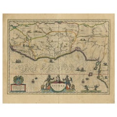
Antique Map of the Congo, Gabon and Angola by N. Sanson, circa 1700
$265.57
$331.9720% Off
£198.75
£248.4420% Off
€224
€28020% Off
CA$366.38
CA$457.9820% Off
A$407.43
A$509.2920% Off
CHF 213.99
CHF 267.4920% Off
MX$4,981.26
MX$6,226.5820% Off
NOK 2,666.54
NOK 3,333.1820% Off
SEK 2,513.83
SEK 3,142.2920% Off
DKK 1,705.20
DKK 2,131.5020% Off
About the Item
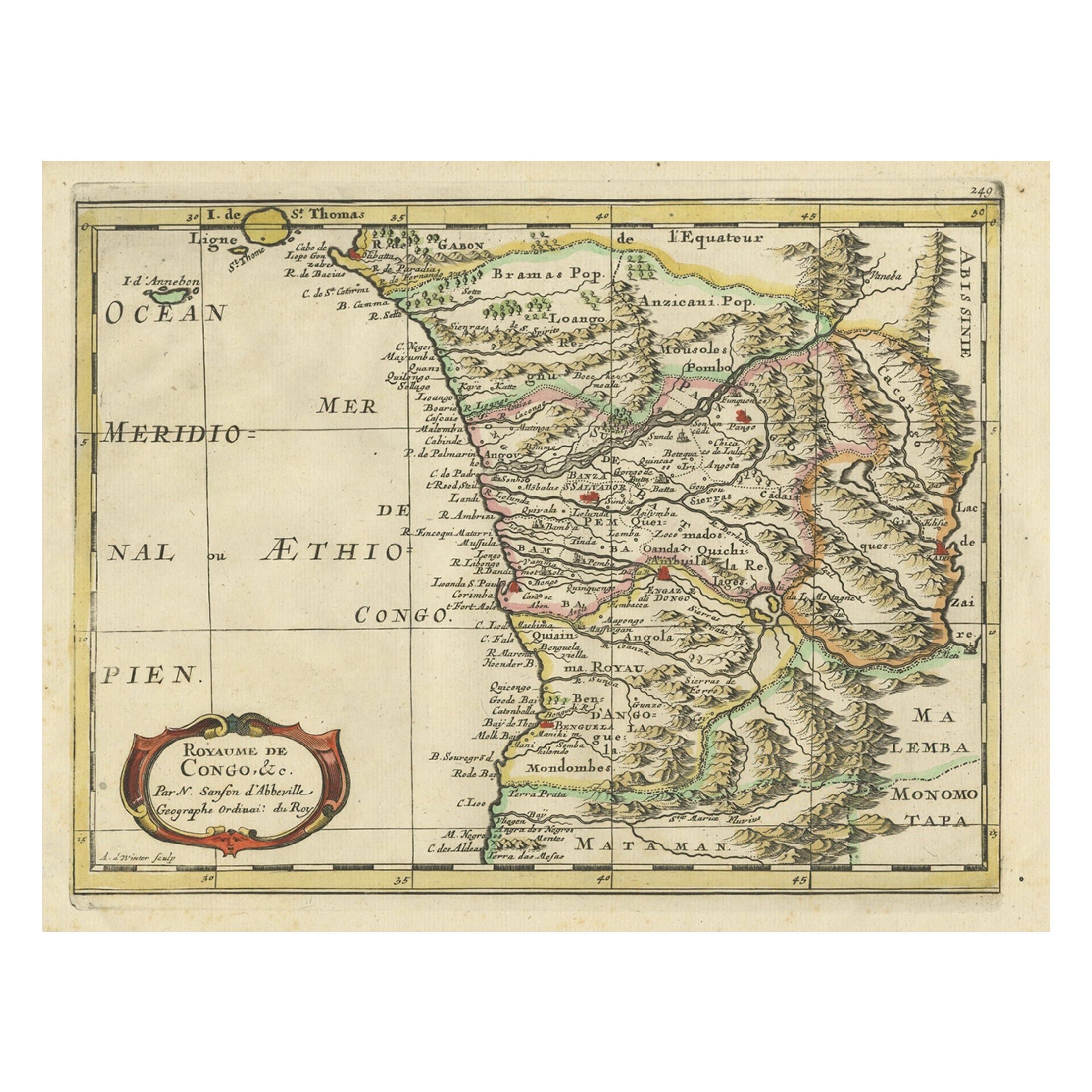
Attractive map of Gabon, the Congo and Angola from Cape Lopez and Sao Tomé to approximately the border with present-day Namibia. The map is fully engraved with mountains, rivers, forests and trails and decorated with a strapwork title cartouche. Engraved by Antoine d'Winter for a Dutch edition of Sanson's pocket atlas.
- Dimensions:Height: 8.43 in (21.4 cm)Width: 11.62 in (29.5 cm)Depth: 0.02 in (0.5 mm)
- Materials and Techniques:
- Period:
- Date of Manufacture:circa 1700
- Condition:Please study image carefully.
- Seller Location:Langweer, NL
- Reference Number:Seller: BG-093961stDibs: LU3054310015633
About the Seller
5.0
Recognized Seller
These prestigious sellers are industry leaders and represent the highest echelon for item quality and design.
Platinum Seller
Premium sellers with a 4.7+ rating and 24-hour response times
Established in 2009
1stDibs seller since 2017
2,607 sales on 1stDibs
Typical response time: <1 hour
- ShippingRetrieving quote...Shipping from: Langweer, Netherlands
- Return Policy
Authenticity Guarantee
In the unlikely event there’s an issue with an item’s authenticity, contact us within 1 year for a full refund. DetailsMoney-Back Guarantee
If your item is not as described, is damaged in transit, or does not arrive, contact us within 7 days for a full refund. Details24-Hour Cancellation
You have a 24-hour grace period in which to reconsider your purchase, with no questions asked.Vetted Professional Sellers
Our world-class sellers must adhere to strict standards for service and quality, maintaining the integrity of our listings.Price-Match Guarantee
If you find that a seller listed the same item for a lower price elsewhere, we’ll match it.Trusted Global Delivery
Our best-in-class carrier network provides specialized shipping options worldwide, including custom delivery.More From This Seller
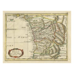
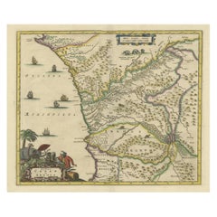
View AllAntique Map of Gabon, Angola and the Congo Region in Africa c.1680
Located in Langweer, NL
Antique map titled 'Royaume de Congo'.
Map of Gabon, the Congo and Angola from Cape Lopez and Sao Tomé to approximately the border with present-day Namibia. The map is fully engrav...
Category
Antique 17th Century Maps
Materials
Paper
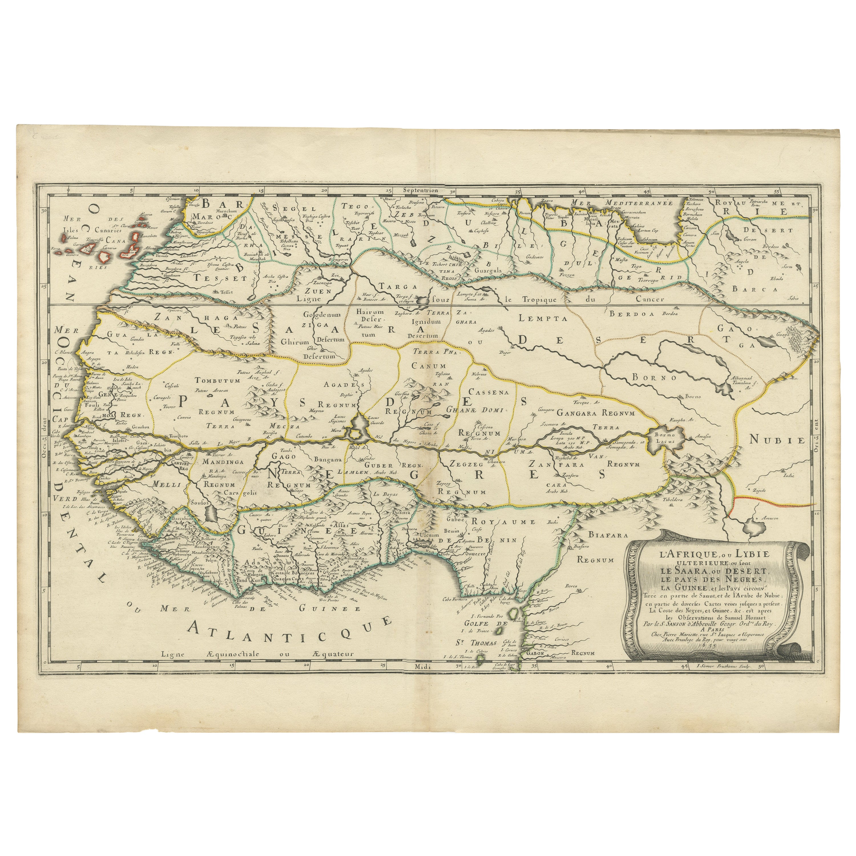
Attractive Antique Map of Western Africa with Lots of Details on the Coast, 1655
Located in Langweer, NL
Title: "L'Afrique, ou Lybie ulterieure ou sont le Saara, ou Desert, le pays des negres, la Guinee, et les Pays circonv. Tirée en partie de Sanut, et de l'Arabe de Nubie; en partie de diverses Cartes veües jusques a present".
Handsome map of Western Africa filled with information, much of it spurious, in the Sahara Desert, the Niger River and the coast of Guinea. Of particular interest are several incomplete rivers in the desert regions that appear and then disappear. The map is beautifully engraved with a title cartouche fashioned in the form of an oriental carpet.
The map shows a fantastic level of detail near the coastlines, which extends into legend and Ptolemaic myth in the interior of the continent. Detail is particularly extensive in Guinea and the Gold and Ivory Coasts. The Niger River is traced to its Malian lakes. The Mediterranean is barely visible in the northern part of the map. This map incorporates the discoveries made by Samuel Blommaert, who was director of the Dutch West Indies Company, in addition to traveling extensively to Africa and settling the oldest land deed...
Category
Antique 1650s Maps
Materials
Paper
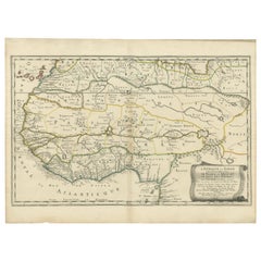
$616 Sale Price
20% Off
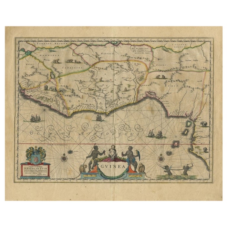
Antique Map of Guinea in West Africa by Blaeu, c.1638
Located in Langweer, NL
Antique map titled 'Guinea'.
Decorative map of West Africa, including numerous animals in the interior, sailing ships and several elegant cartouches. Both the map and the sea are s...
Category
Antique 17th Century Maps
Materials
Paper
$521 Sale Price
20% Off
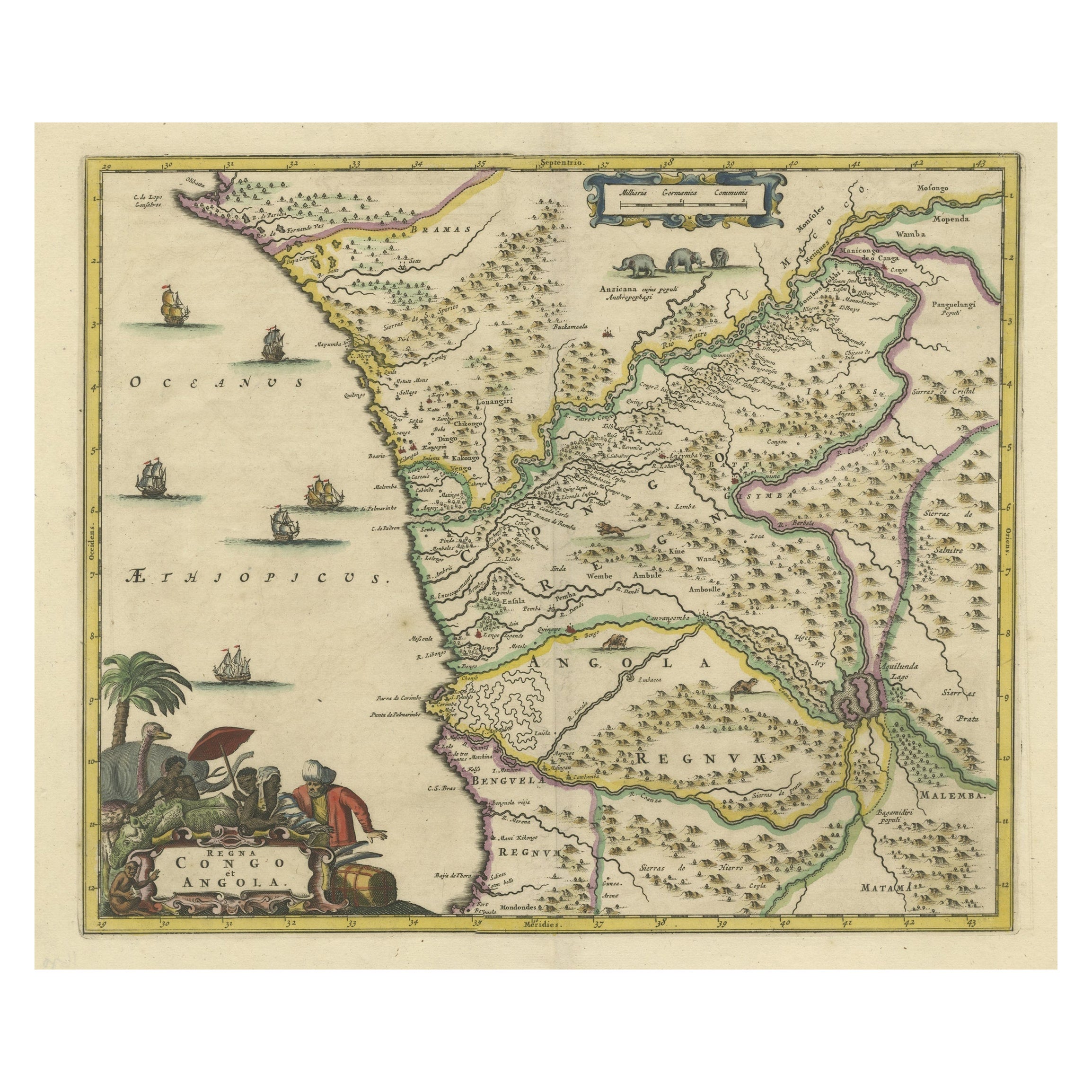
Antique Map of West Africa, focused on the Congo and Angola
Located in Langweer, NL
Original antique map titled 'Regna Congo et Angola'. Decorative 17th Century English map of a portion of West Africa, focused on the Congo and Angola. The map is centered on the Zair...
Category
Antique Late 17th Century Maps
Materials
Paper
$806 Sale Price
20% Off
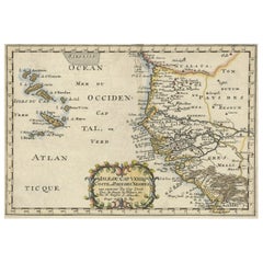
Antique Map of the West African Coast and the Cape Verde Islands, c.1680
Located in Langweer, NL
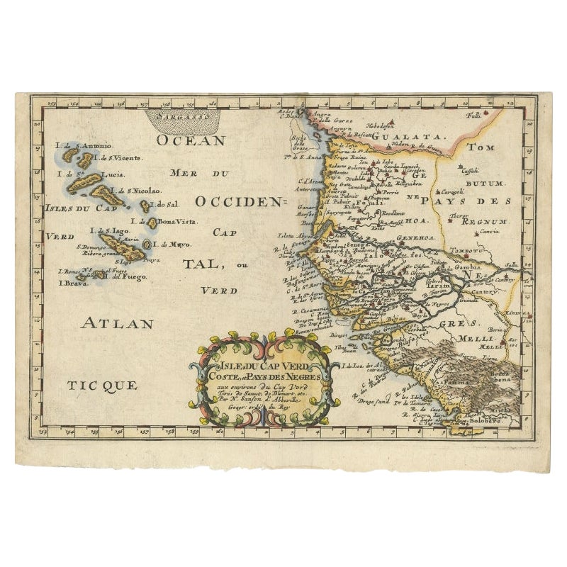
Antique map Africa titled 'Isles du Cap Verd Coste et Pays des Negres'. Antique map of the coast of Africa and the Cape Verde islands.
Artists and...
Category
Antique 17th Century Maps
Materials
Paper

$341 Sale Price
20% Off
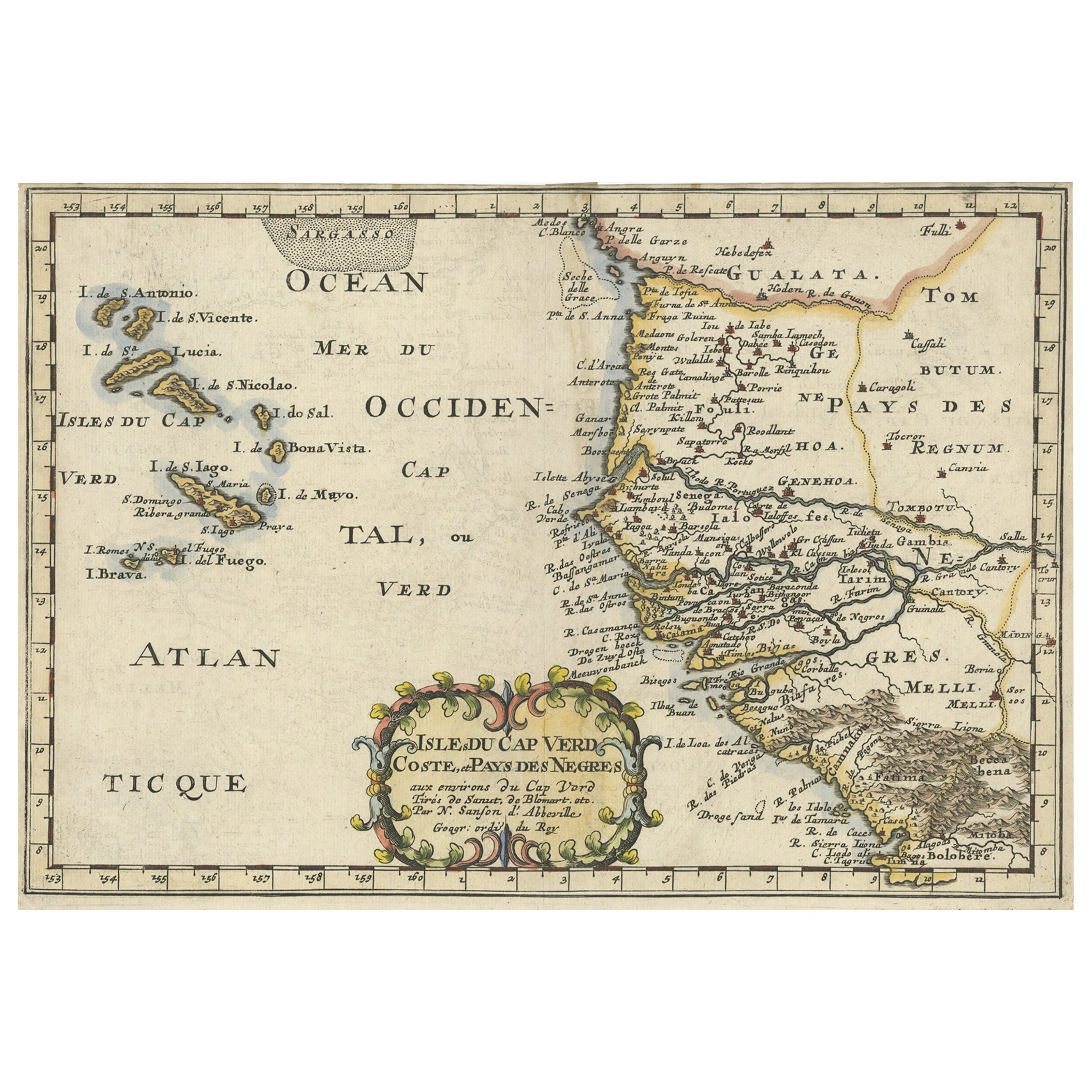
Antique Map of the Coast of Africa and the Cape Verde Islands, ca.1680
Located in Langweer, NL
Antique map Africa titled 'Isles du Cap Verd Coste et Pays des Negres'.
Antique map of the coast of Africa and the Cape Verde islands.
Artis...
Category
Antique 1680s Maps
Materials
Paper
$331 Sale Price
20% Off
You May Also Like
West Africa: A 17th Century Hand-Colored Map by Mercator/Hondius
By Gerard Mercator
Located in Alamo, CA
A 17th century hand-colored map entitled "Guineae Nova Descriptio" by Gerard Mercator and Jodocus Hondius, published in their 'Atlas Minor' in Amsterdam in 1635. It is focused on the...
Category
1630s Landscape Prints
Materials
Engraving

West Africa: 18th Century Hand-colored Homann Map Entitled "Guinea Propria"
By Johann Baptist Homann
Located in Alamo, CA
This is a scarce richly hand colored copper plate engraved map of Africa entitled "Guinea Propria, nec non Nigritiae vel Terrae Nigrorum Maxima Pars" by Johann Baptist Homann (1664-1...
Category
1740s Other Art Style Prints and Multiples
Materials
Engraving

Map Holy Land La Terre Sainte Engraved van Loon Published N de Fer 1703 French
Located in BUNGAY, SUFFOLK
La Terre Sainte, The Holy Land, Tiree Des Memoires De M.De.La Rue. Par N. de Fer. Geographe de Sa Majeste Catoliq et de Monseigneur le Dauphin. Avec Privil du Roi 1703
Detailed map of the Holy Land from Nicholas de Fer's L'Atlas Curieux ou le Monde. East is oriented at the top.
MAKER Nicolas de Fer 1646-1720
The French cartographer and engraver, Nicolas de Fer, was a master at creating maps that were works of art. The maps that he published were printed during the Baroque period when the decorative arts were characterized by ornate detail. De Fer’s detailed maps and atlases were valued more for their decorative content than their geographical accuracy.
Nicolas de Fer was born in 1646. His father, Antoine de Fer, owned a mapmaking firm. At the age of twelve, Nicolas was apprenticed to a Parisian engraver named Louis Spirinx. The family business was starting to decline when his father died in 1673. Nicolas de Fer’s mother, Genevieve, took over the business after the death of her husband. In 1687 the business was passed on to Nicolas and the profits increased after he took over the firm. Nicolas de Fer was a prolific cartographer who produced atlases and hundreds of single maps. He eventually became the official geographer to King Louis XIV of France and King Philip V...
Category
Antique Early 1700s French Louis XIV Maps
Materials
Paper

West Coast of Africa; Guinea & Sierra Leone: Bellin 18th Century Map
Located in Alamo, CA
This is a Jacques Bellin copper-plate map entitled "Partie de la Coste de Guinee Dupuis la Riviere de Sierra Leona Jusquau Cap das Palmas", depicting the coast of Guinea and Sierra L...
Category
1740s Old Masters Landscape Prints
Materials
Engraving

Africa: A Large 17th Century Hand-colored Map By Sanson and Jaillot
By Nicholas Sanson d'Abbeville
Located in Alamo, CA
This large original hand-colored copperplate engraved map of Africa entitled "L'Afrique divisee suivant l'estendue de ses principales parties ou sont distingues les uns des autres, L...
Category
1690s Landscape Prints
Materials
Engraving

1590 Mercator Map Entitled "France Picardie Champaigne, Ric.0001
Located in Norton, MA
Description: Published in Amsterdam by Mercator/Hondius ca. 1590.
Ric.0001
Artists and Engravers: Map : 'France Picardie Champaigne cum regionibus adiacentibus'. (Map of the french provinces of Picardie and Champagne.) Copper engraved map of the french provinces of Picardie and Champagne, showing the cities of Caen, Paris, Melun, Auxerre, Verdun, etc. Copperplate engraving on verge type hand laid paper with watermark. Description: Published in Amsterdam by Mercator/Hondius ca. 1600.Artists and Engravers: Mercator was born in Rupelmonde in Flanders and studied in Louvain under Gemma Frisius, Dutch writer, astronomer and mathematician. The excellence of his work brought him the patronage of Charles V, but in spite of his favor with the Emperor he was caught up in the persecution of Lutheran protestants and charged with heresy, fortunately without serious consequences. No doubt the fear of further persecution influenced his move in 1552 to Duisburg, where he continued the production of maps, globes and instruments. Mercator's sons and grandsons, were all cartographers and made their contributions in various ways to his atlas. Rumold, in particular, was responsible for the complete edition in 1595. The map plates...
Category
Antique 16th Century Dutch Maps
Materials
Paper

More Ways To Browse
Cape Dutch Furniture
Gabon Antique Map
Antique Maps Of Germany
Map Of Britain
Map Of Africa
London Antique Maps
Sell Antiques
Antique World Globes
Used Law Office Furniture
Antique Map Of England
Antique Map Paris
Gold Maps
16th Century German
East India Company
China Map
17th Century World Map
Antique Maps Of Britain
Antique Furniture Edinburgh