Items Similar to Antique Map of France, based on the work of Ptolemy
Want more images or videos?
Request additional images or videos from the seller
1 of 6
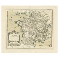
Antique Map of France, based on the work of Ptolemy
$363.08
$453.8620% Off
£269.04
£336.3020% Off
€304
€38020% Off
CA$502.27
CA$627.8320% Off
A$553.53
A$691.9220% Off
CHF 289.79
CHF 362.2420% Off
MX$6,799.14
MX$8,498.9220% Off
NOK 3,641.31
NOK 4,551.6420% Off
SEK 3,407.98
SEK 4,259.9720% Off
DKK 2,315.18
DKK 2,893.9820% Off
About the Item
Antique map titled 'Gallia Nova Tabula'. Ruscelli's map of France. This map originates from 'Espositione & introduttioni universali di Gir. Ruscelli sopra tutta la Geografia di Tolomeo (..)' published by Girolamo Ruscelli, 1561.
Girolamo Ruscelli (1500-1566) was a cartographer, humanist, and scholar from Tuscany. Ruscelli was a prominent writer and editor in his time, writing about a wide variety of topics including the works of Giovanni Boccaccio and Francesco Petrarch, Italian language, Italian poetry, medicine, alchemy, and militia. One of his most notable works was a translation of Ptolemy’s Geographia which was published posthumously.
- Dimensions:Height: 8.27 in (21 cm)Width: 11.34 in (28.8 cm)Depth: 0.02 in (0.5 mm)
- Materials and Techniques:
- Period:
- Date of Manufacture:1561
- Condition:General age-related toning. Original folding line. Minor wear and soiling. Italian text on verso. Please study image carefully.
- Seller Location:Langweer, NL
- Reference Number:Seller: BG-13534-31stDibs: LU3054335415002
About the Seller
5.0
Recognized Seller
These prestigious sellers are industry leaders and represent the highest echelon for item quality and design.
Platinum Seller
Premium sellers with a 4.7+ rating and 24-hour response times
Established in 2009
1stDibs seller since 2017
2,618 sales on 1stDibs
Typical response time: <1 hour
- ShippingRetrieving quote...Shipping from: Langweer, Netherlands
- Return Policy
Authenticity Guarantee
In the unlikely event there’s an issue with an item’s authenticity, contact us within 1 year for a full refund. DetailsMoney-Back Guarantee
If your item is not as described, is damaged in transit, or does not arrive, contact us within 7 days for a full refund. Details24-Hour Cancellation
You have a 24-hour grace period in which to reconsider your purchase, with no questions asked.Vetted Professional Sellers
Our world-class sellers must adhere to strict standards for service and quality, maintaining the integrity of our listings.Price-Match Guarantee
If you find that a seller listed the same item for a lower price elsewhere, we’ll match it.Trusted Global Delivery
Our best-in-class carrier network provides specialized shipping options worldwide, including custom delivery.More From This Seller
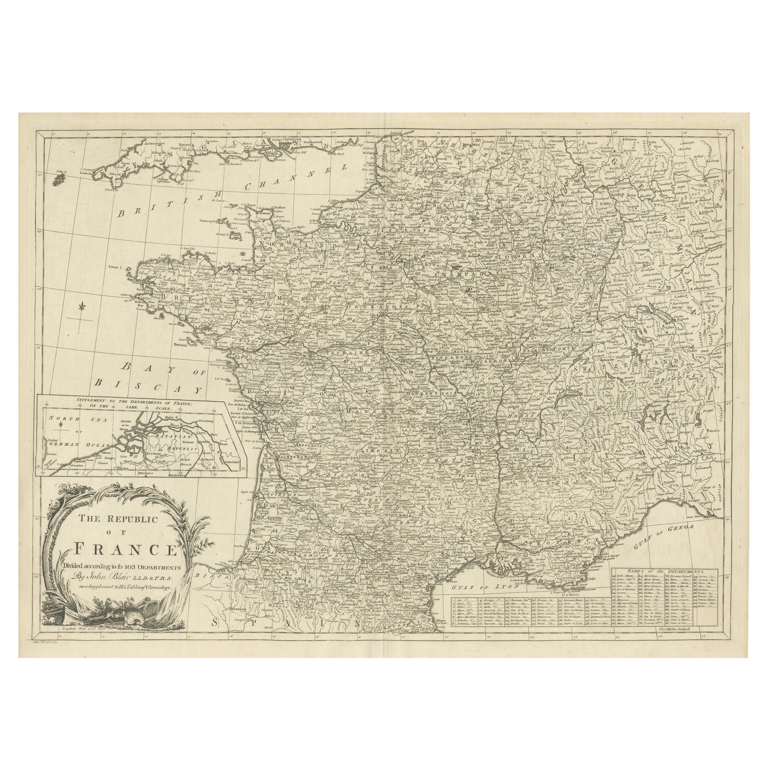
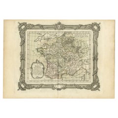
View AllAntique Map of France with Inset showing the Northern Departments
Located in Langweer, NL
Antique map titled 'The Republic of France divided according to its 103 Departments'. Decorative map of France. Includes a large cartouche and an in...
Category
Antique Late 18th Century Maps
Materials
Paper
$630 Sale Price
20% Off
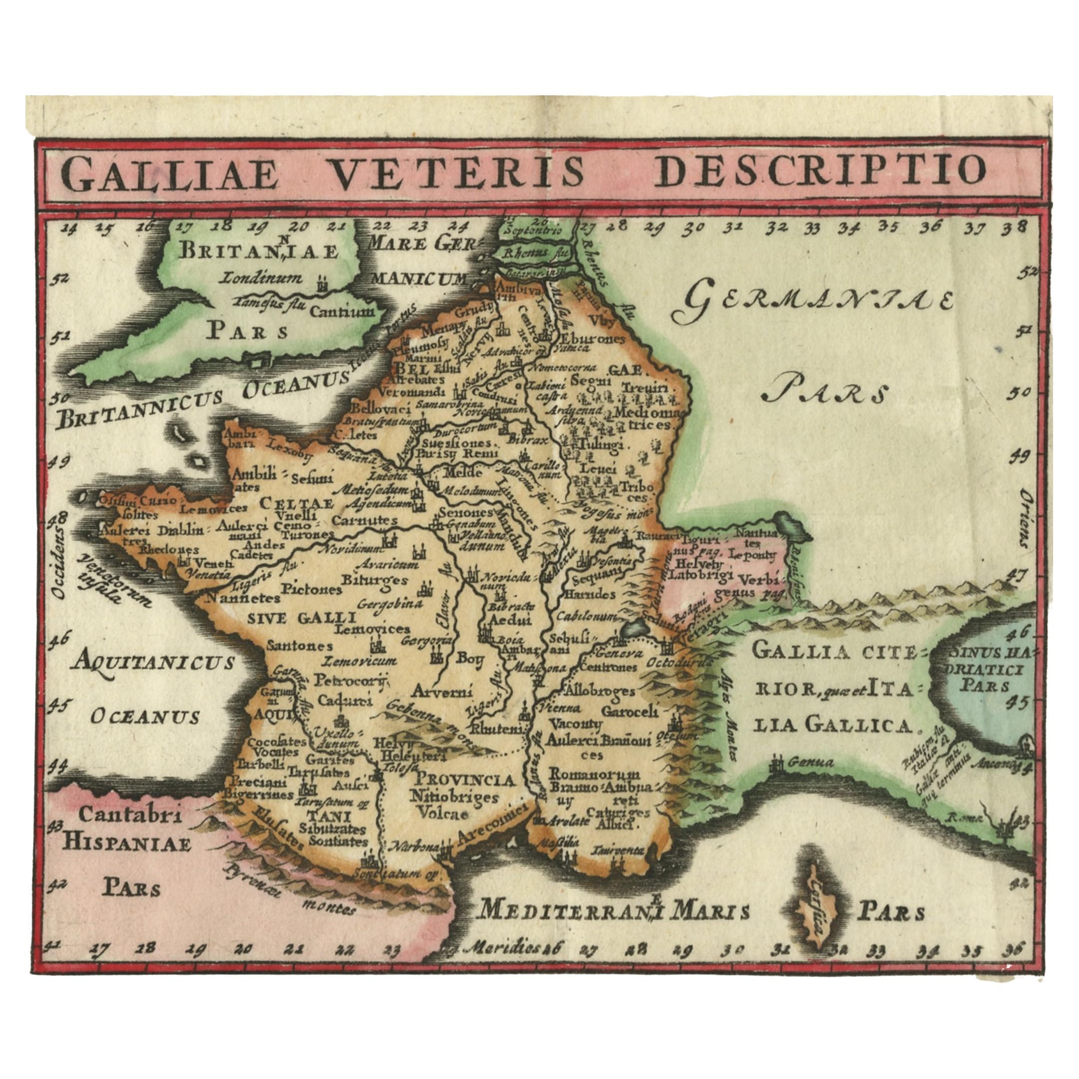
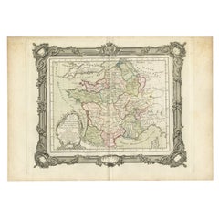
Antique Map of France by Cluver, 1685
Located in Langweer, NL
Antique map titled 'Galliae Veteris Descriptio.' Charming miniature map of France from the pocket atlas 'Introductionis in Universam Geographiam tam Veterem quam novam .. Acessit P. ...
Category
Antique 17th Century Maps
Materials
Paper
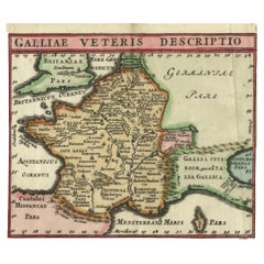
$167 Sale Price
20% Off
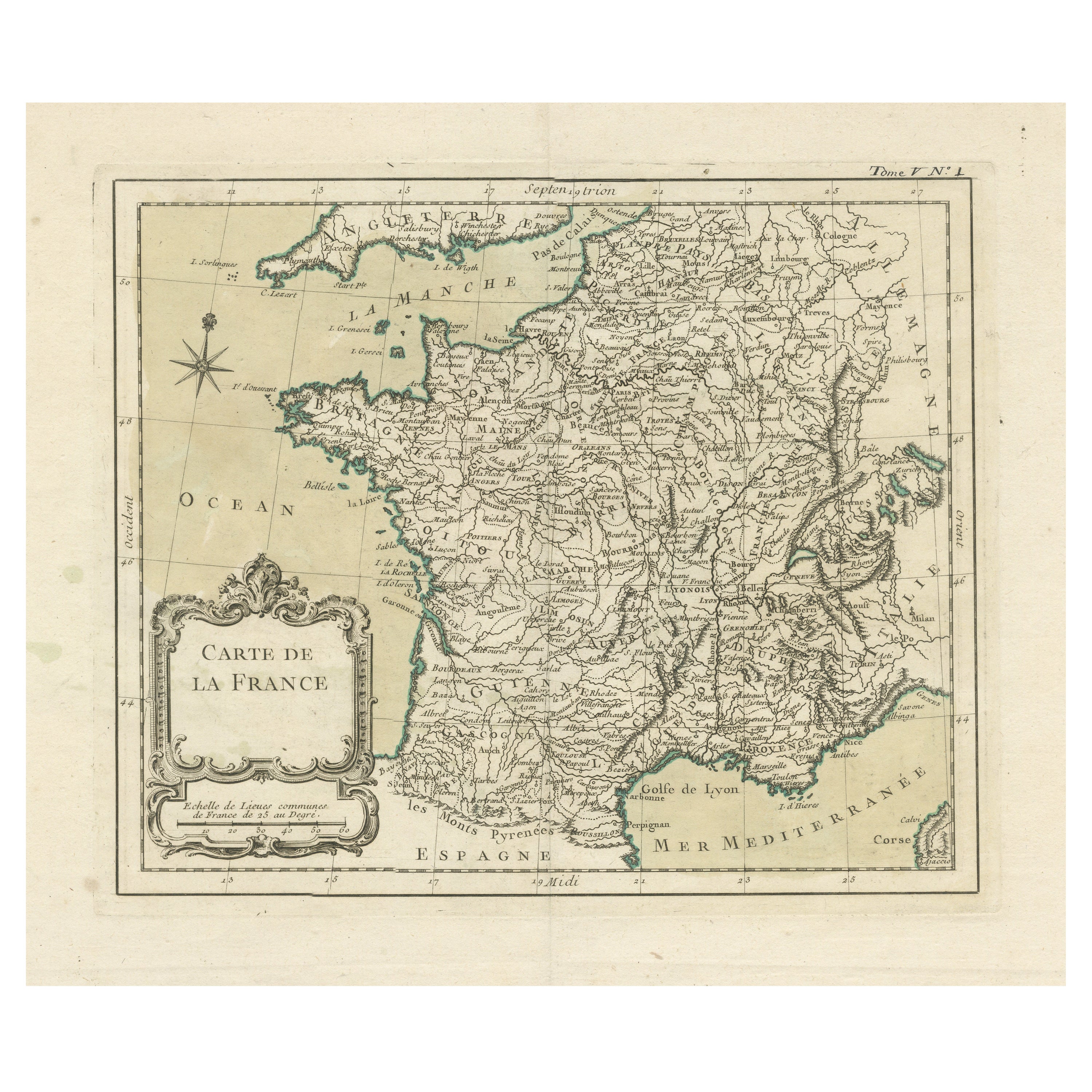
Antique Map of France with Decorative Title Cartouche
Located in Langweer, NL
Antique map titled 'Carte de la France'. Original old map of France. This map originates from 'Le Petit Atlas Maritime Recueil De Cartes et Plans Des Quatre Parties Du Monde (..) by ...
Category
Antique Mid-18th Century Maps
Materials
Paper
$229 Sale Price
20% Off
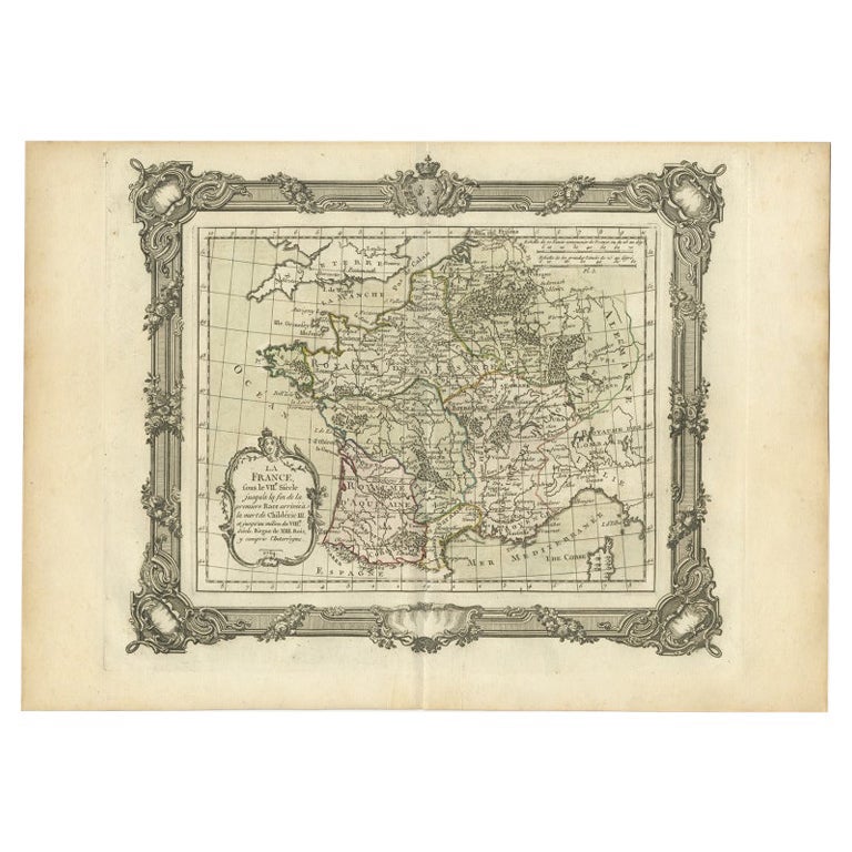
Antique Map of France in the 7th Century by Zannoni, 1765
Located in Langweer, NL
Antique map France titled 'La France sous le VIIe Siècle (..)'. Beautiful old map of France. This map originates from 'Atlas Historique de la France Ancienne et Moderne' by M. Rizzi ...
Category
Antique 18th Century Maps
Materials
Paper
$151 Sale Price
20% Off
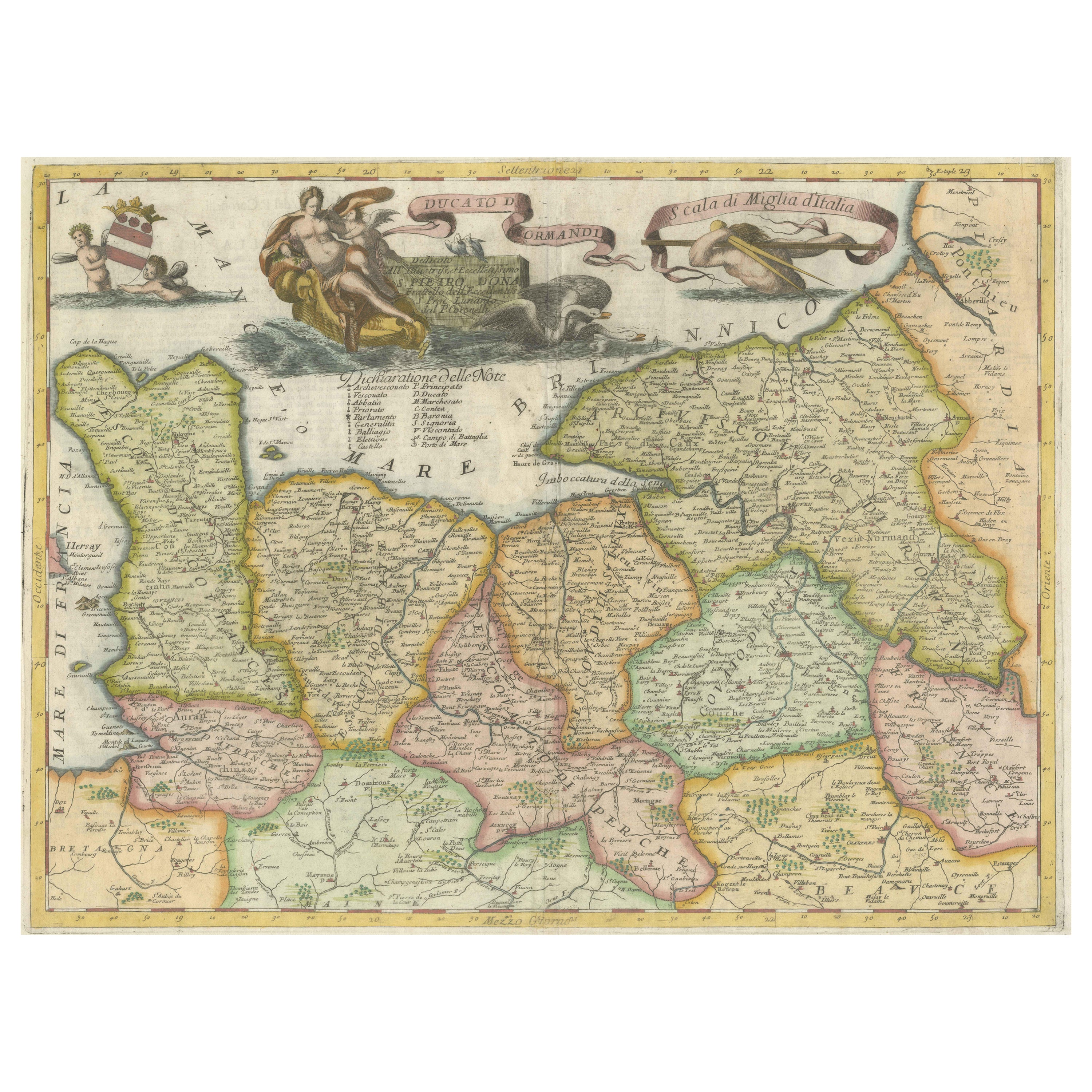
Decorative Original Antique Map of Normandy, France, circa 1690
Located in Langweer, NL
Original antique map titled 'Ducato D'Normandie Scala di Miglia d'Italia'. Very decorative map of Normandy, with a fine title cartouche featuring Leda ...
Category
Antique Late 17th Century Italian Maps
Materials
Paper

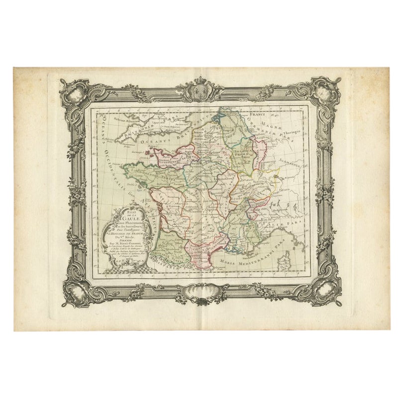
Antique Map of France in the 5th Century by Zannoni, 1765
Located in Langweer, NL
Antique map France titled 'Etat de la Gaule (..)'.
Beautiful old map of France. This map originates from 'Atlas Historique de la France Ancienne et Moderne' by M. Rizzi Zannoni. ...
Category
Antique 18th Century Maps
Materials
Paper
$151 Sale Price
20% Off
You May Also Like
Antique Map of France
Located in Dallas, TX
Nice antique map of France in wood frame. This would make a great gift for a collector. A wonderful accessory!
Category
Early 20th Century Decorative Art
Materials
Glass, Wood, Paper

$1,760
Large 19th Century Map of France
Located in Pease pottage, West Sussex
Large 19th Century Map of France.
Remarkable condition, with a pleasing age worn patina.
Recently framed.
France Circa 1874.
Category
Antique Late 19th Century French Maps
Materials
Linen, Paper

1590 Mercator Map Entitled "France Picardie Champaigne, Ric.0001
Located in Norton, MA
Description: Published in Amsterdam by Mercator/Hondius ca. 1590.
Ric.0001
Artists and Engravers: Map : 'France Picardie Champaigne cum regionibus adiacentibus'. (Map of the french provinces of Picardie and Champagne.) Copper engraved map of the french provinces of Picardie and Champagne, showing the cities of Caen, Paris, Melun, Auxerre, Verdun, etc. Copperplate engraving on verge type hand laid paper with watermark. Description: Published in Amsterdam by Mercator/Hondius ca. 1600.Artists and Engravers: Mercator was born in Rupelmonde in Flanders and studied in Louvain under Gemma Frisius, Dutch writer, astronomer and mathematician. The excellence of his work brought him the patronage of Charles V, but in spite of his favor with the Emperor he was caught up in the persecution of Lutheran protestants and charged with heresy, fortunately without serious consequences. No doubt the fear of further persecution influenced his move in 1552 to Duisburg, where he continued the production of maps, globes and instruments. Mercator's sons and grandsons, were all cartographers and made their contributions in various ways to his atlas. Rumold, in particular, was responsible for the complete edition in 1595. The map plates...
Category
Antique 16th Century Dutch Maps
Materials
Paper

1633 Map "La Souverainete De Sedan Et De Raucourt, Et La Prevoste Ric0011
Located in Norton, MA
1653 map entitled
"La Souverainete de Sedan et de Raucourt, et la Prevoste de Doncheri,"
Ric0011
Description:
Lovely map centered on Sedan and Doncheri and the Meuze River fr...
Category
Antique 17th Century Dutch Maps
Materials
Paper

France, Northern Part. Century Atlas antique map
Located in Melbourne, Victoria
'The Century Atlas. France, Northern Part.'
Original antique map, 1903.
Inset maps of 'France in Provinces' and 'Paris and Vicinity'.
Central fold as issued. Map name and number pr...
Category
Early 20th Century Victorian More Prints
Materials
Lithograph

1656 Jansson Map Metz Region of France Entitled "Territorium Metense" Ric0014
Located in Norton, MA
1656 Jansson map Metz Region of France entitled "Territorium Metense."
Ric0014
" Authentic" - Map of the historical region surrounding Metz, in Lorraine, France.
Oriented with ...
Category
Antique 17th Century Dutch Maps
Materials
Paper

More Ways To Browse
Antique Gallia
Cape Cod Map
F Colton
Ithaca Antique Map
J Thayer
Russia Globe
Salt Lake City Used Furniture
World Map Copper
Vintage Danish Tables And Chairs
Navy Blue Turkish Rug
Dutch Mid Century Modern Table
Paris Exposition 1925
Sterling Silver Dinner Sets
England Antique Plates
Rosenthal Century
Vintage Italian Ceramic
Black Scandinavian Modern Dining Chairs
Louis French Tables Fluted