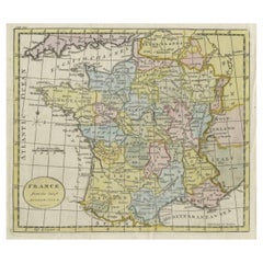
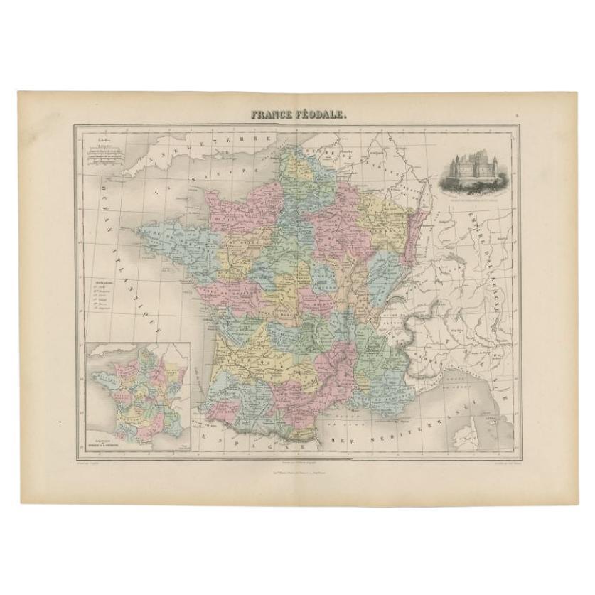
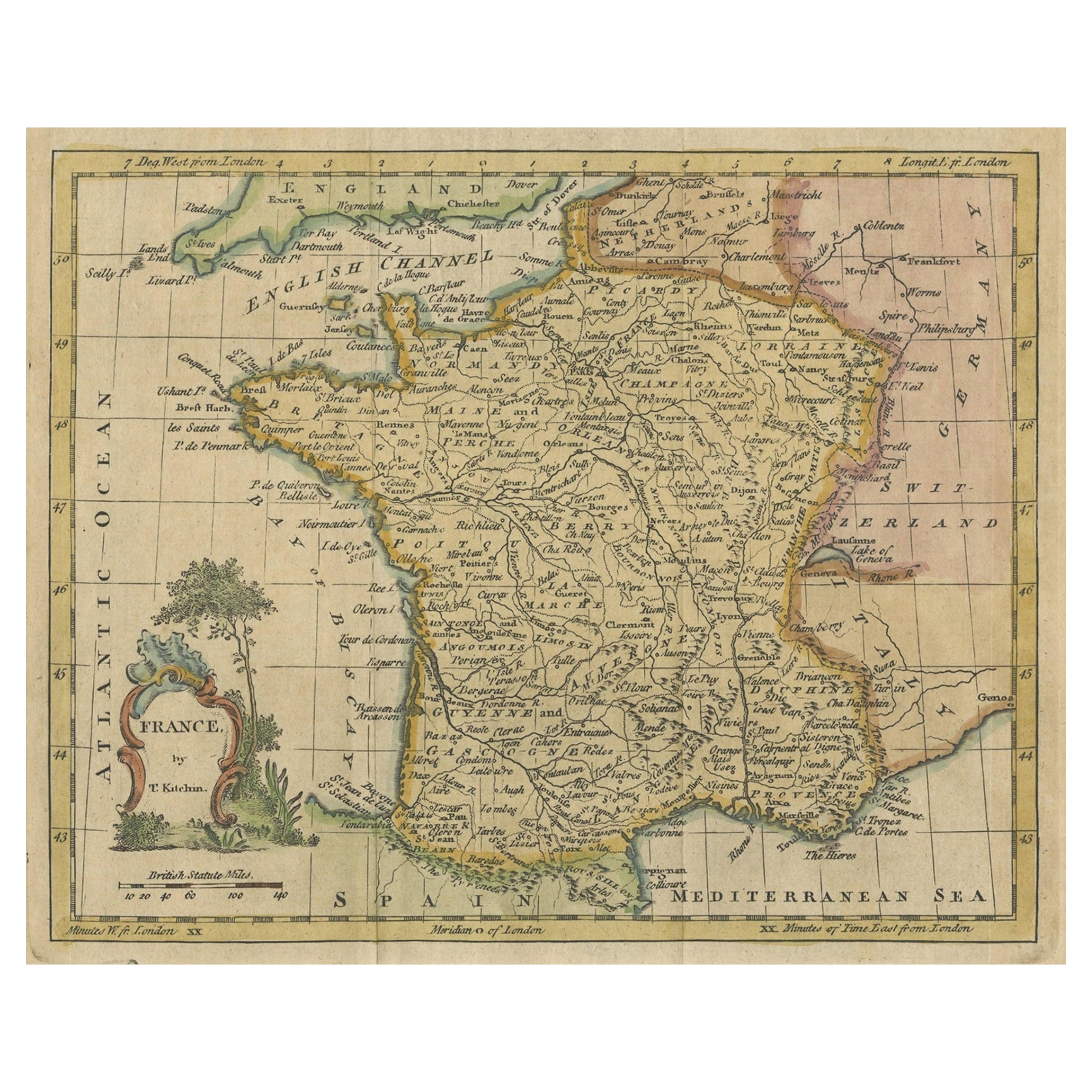
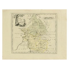
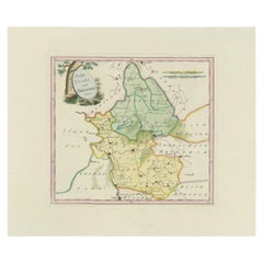
Antique Map of France, c.1795
View Similar Items


Want more images or videos?
Request additional images or videos from the seller
1 of 6
Antique Map of France, c.1795
About the Item
- Dimensions:Height: 8.47 in (21.5 cm)Width: 10.44 in (26.5 cm)Depth: 0 in (0.01 mm)
- Materials and Techniques:
- Period:
- Date of Manufacture:circa 1795
- Condition:
- Seller Location:Langweer, NL
- Reference Number:Seller: BG-033661stDibs: LU3054326190742
About the Seller
5.0
Platinum Seller
These expertly vetted sellers are 1stDibs' most experienced sellers and are rated highest by our customers.
Established in 2009
1stDibs seller since 2017
1,940 sales on 1stDibs
More From This SellerView All
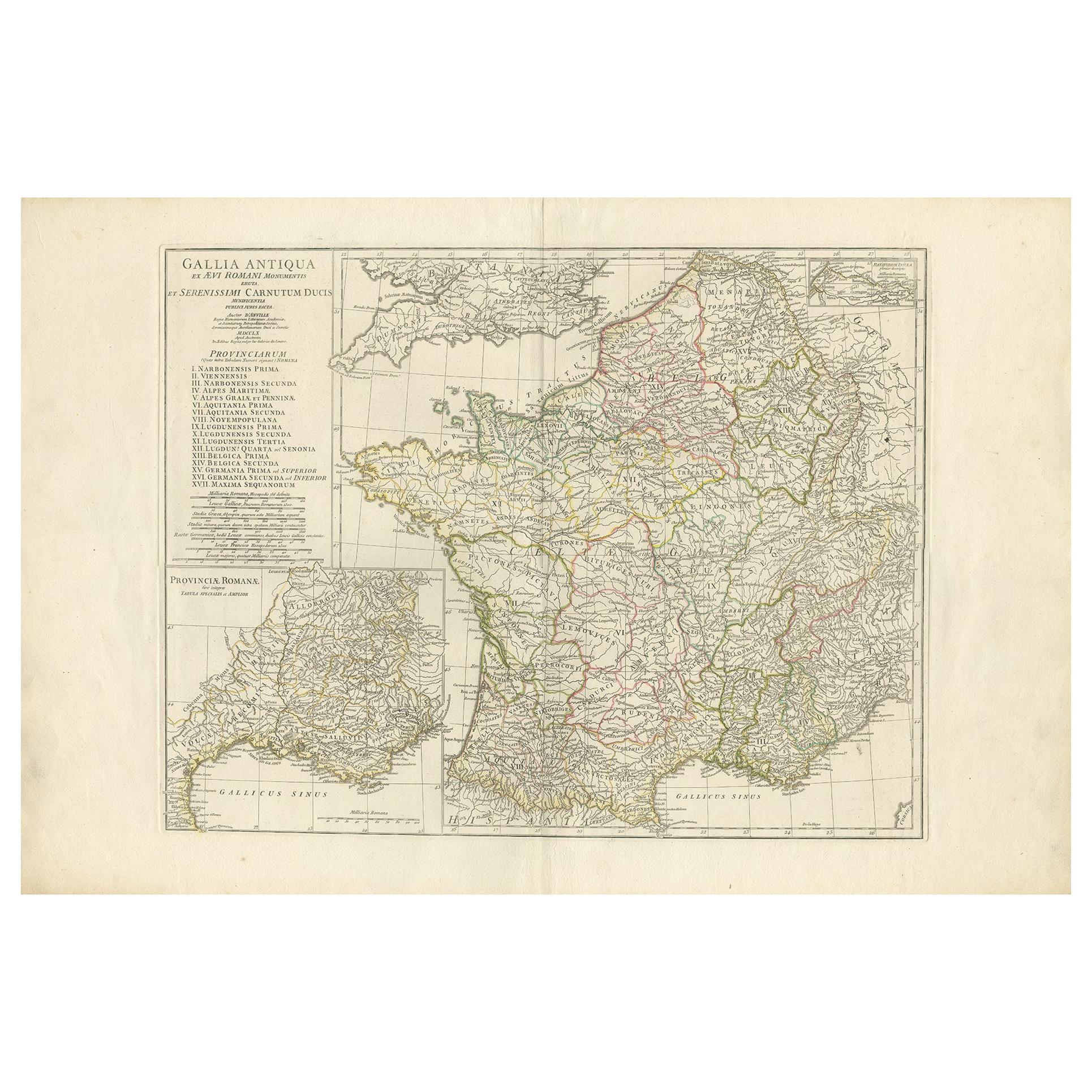
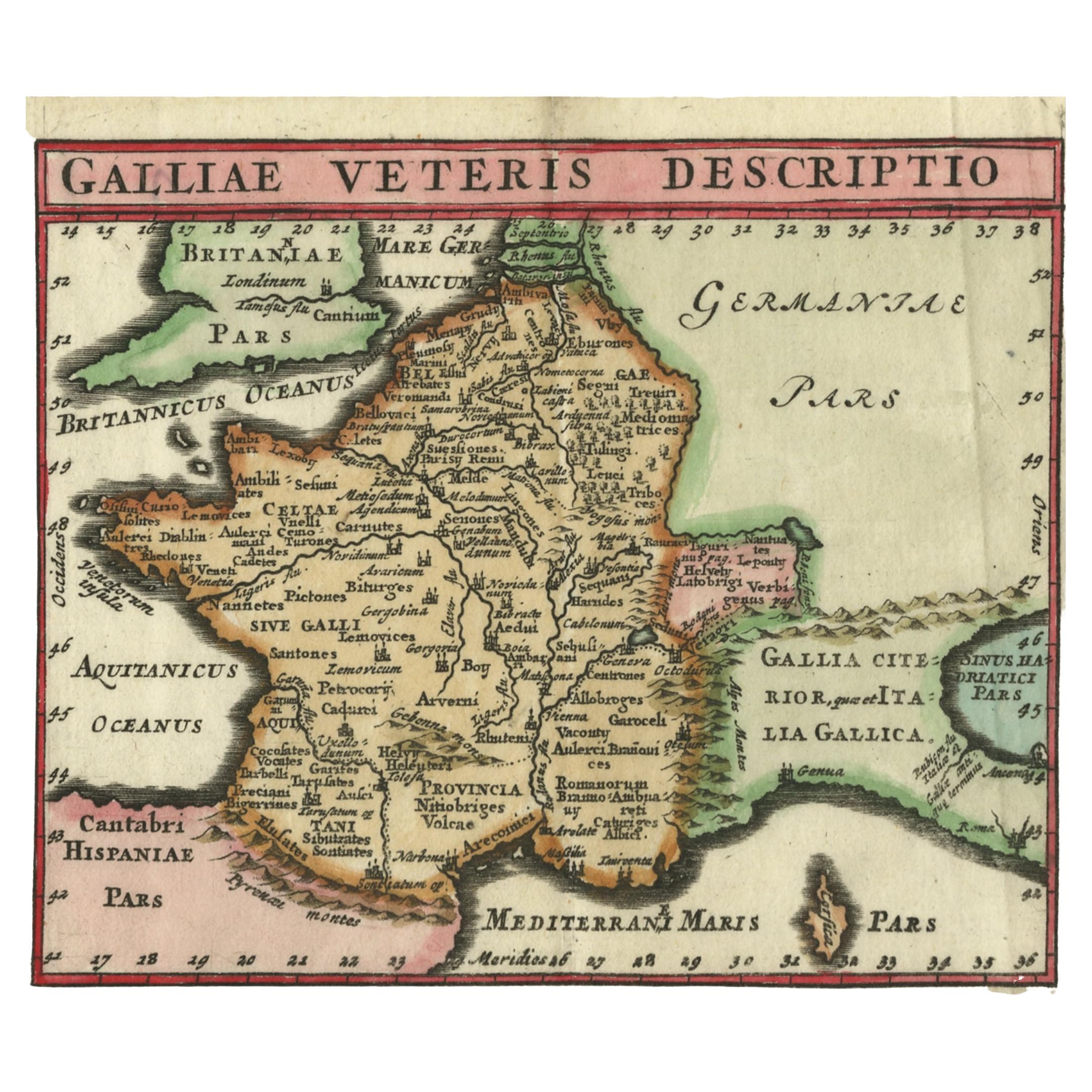
- Antique Map of France in Ancient Roman Times by d'Anville 'c.1795'Located in Langweer, NLAntique map titled 'Gallia Antiqua ex Aevi Romani Monumentis (..)'. Original, large, map of France in ancient Roman times. Bottom left, a large inset shows Gallia's southern most Rom...Category
Antique Late 18th Century Maps
MaterialsPaper
 $613 Sale Price30% Off
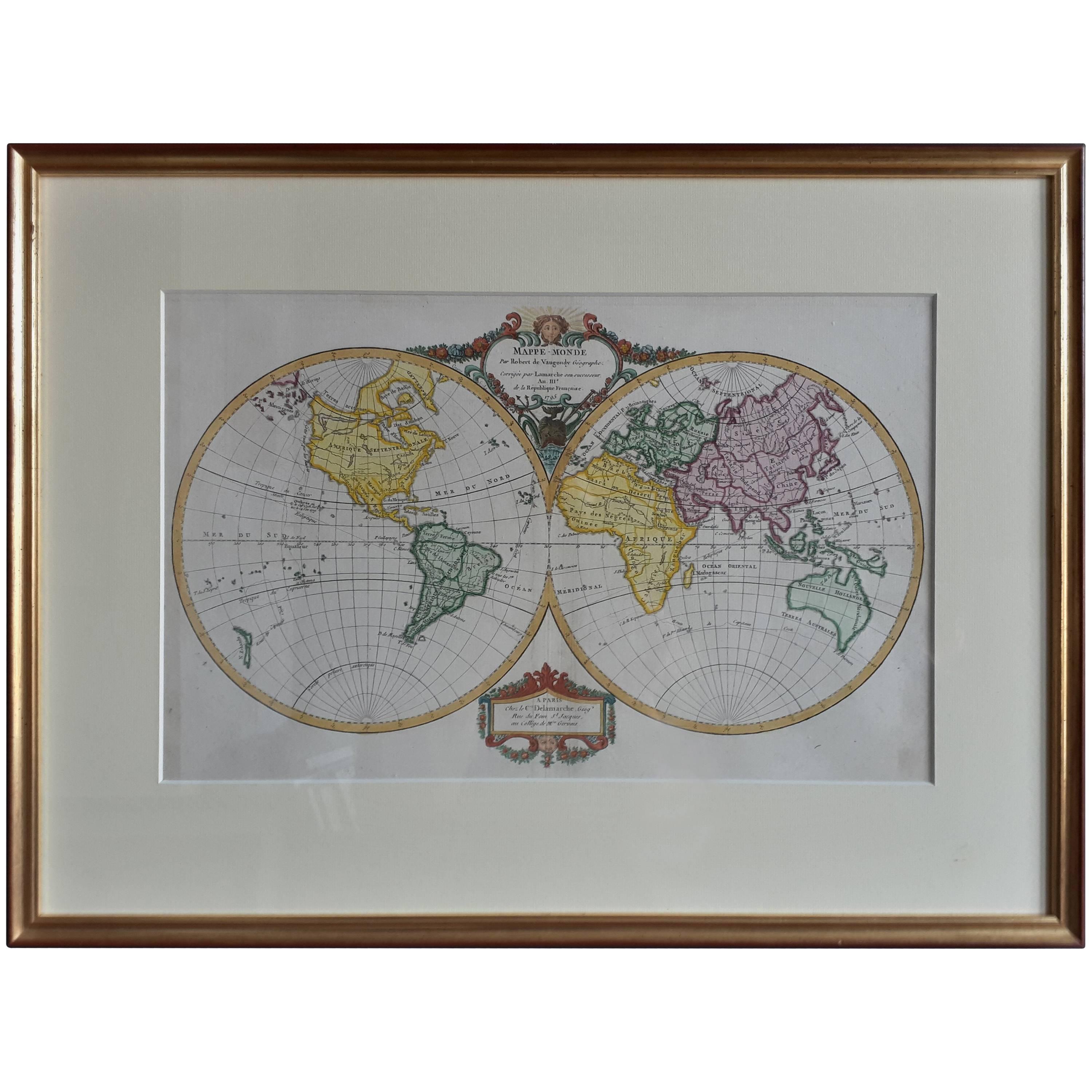
 - Antique Map of the World by R. de Vaugondy, 1795Located in Langweer, NLAttractive world map by Vaugondy but corrected and issued by Lamarche in year 3 of the French Revolution. Decorative cartouches.Category
Antique Late 18th Century Maps
MaterialsPaper
 $964 Sale Price20% Off
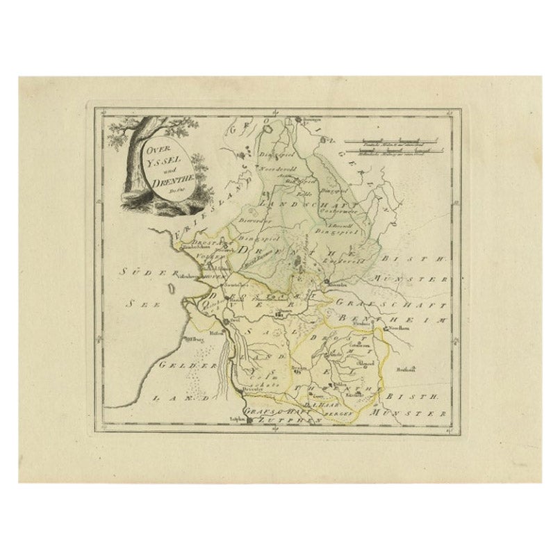
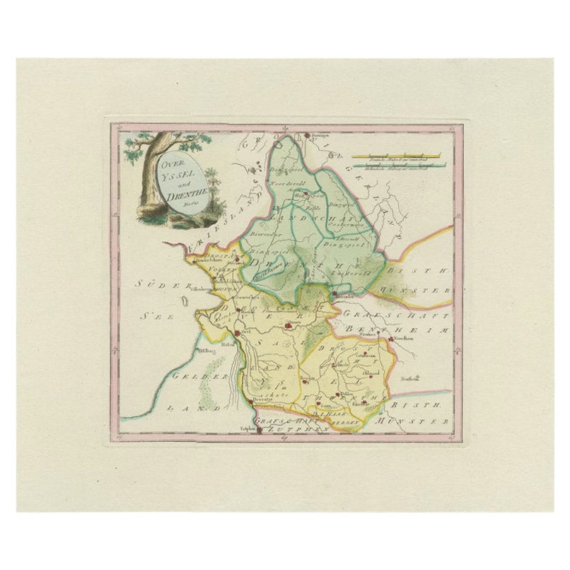
 - Antique Map of Overijssel and Drenthe by Von Reilly, c.1795Located in Langweer, NLAntique map titled 'Overyssel und Drenthe'. Decorative map of Overijssel and Drenthe, The Netherlands. From 'Schauplatz Der Funf Theile der Welt' (Wien: Reilly, 1791-1806), a world a...Category
Antique 18th Century Maps
MaterialsPaper
- Antique Map of Overijssel and Drenthe by Von Reilly, c.1795Located in Langweer, NLAntique map titled 'Overyssel und Drenthe'. Decorative map of Overijssel and Drenthe, The Netherlands. This map originates from 'Schauplatz Der Funf Theile der Welt' (Wien: Reilly, 1...Category
Antique 18th Century Maps
MaterialsPaper
- Antique Map of Spain and Portugal by Tardieu, circa 1795Located in Langweer, NLThe image is an antique map titled "Hispanie Betique et Lusitanie", which depicts the Iberian Peninsula during the Roman times, highlighting the provinces of Hispania Baetica (Betiqu...Category
Antique Late 18th Century Maps
MaterialsPaper
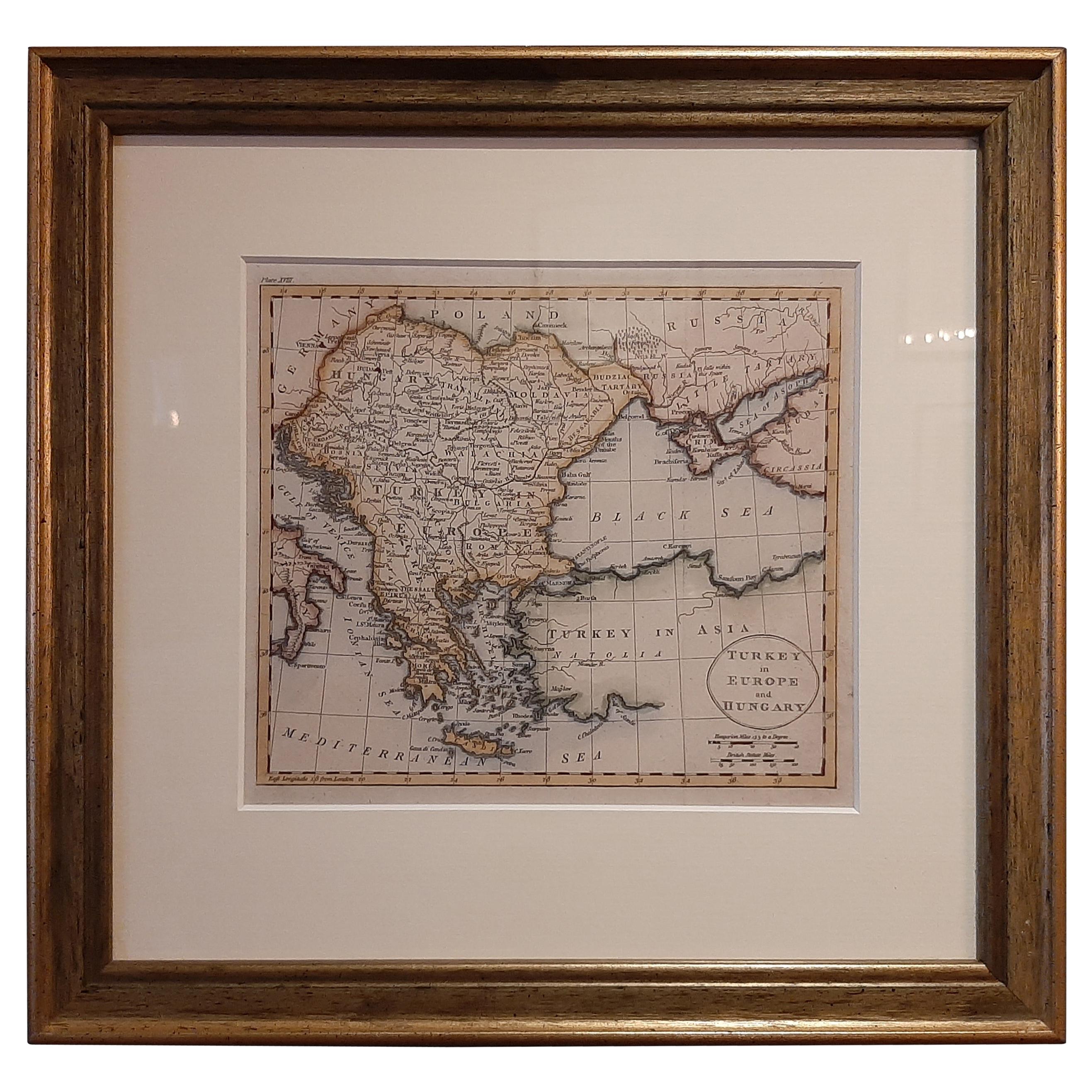
- Antique Map of Turkey in Europe by Russell, circa 1795Located in Langweer, NLAntique map titled 'Turkey in Europe and Hungary'. Original map of Turkey in Europe. Covers present day Northern Turkey, Greece, Albania, Romania, Hungary, Croatia, Bosnia Herzogovin...Category
Antique Late 18th Century Maps
MaterialsPaper
 $306 Sale Price20% Off

You May Also Like
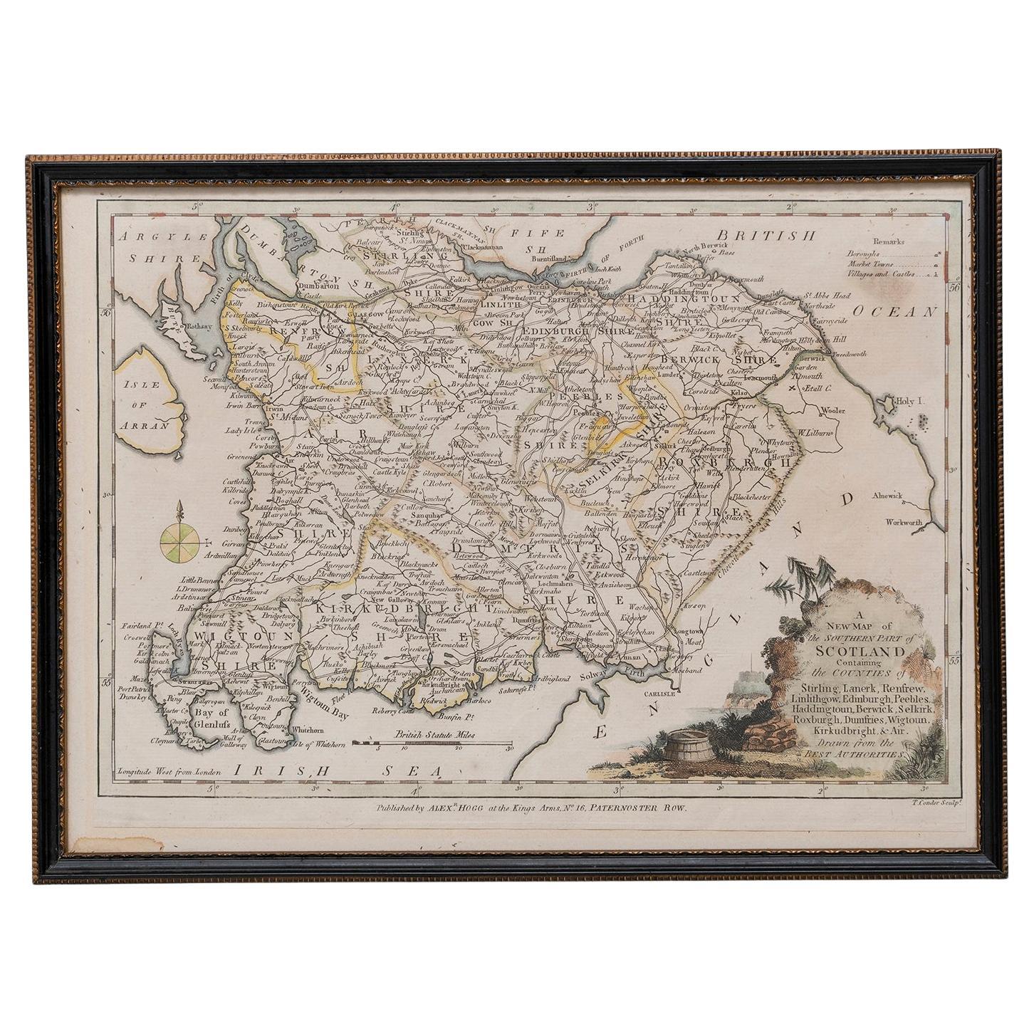
- Map Southern Scotland Thomas Conder Alex Hogg 1795Located in BUNGAY, SUFFOLKA new map of the southern part of Scotland containing the counties of Stirling, Lanerk, Renfrew, Linlithgow, Edinburgh, Peebles, Haddingtoun, Berwick, Selkirk, Roxburgh, Dumfries, Wigtoun, Kirkudbright & Air Published by Alex Hogg at the Kings Arms...Category
Antique 18th Century English Georgian Maps
MaterialsPaper
- Original Antique Map of France, Arrowsmith, 1820Located in St Annes, LancashireGreat map of France Drawn under the direction of Arrowsmith. Copper-plate engraving. Published by Longman, Hurst, Rees, Orme and Brown, 1820 Unframed.Category
Antique 1820s English Maps
MaterialsPaper

- Antique Map of Principality of MonacoBy Antonio Vallardi EditoreLocated in Alessandria, PiemonteST/619 - "Old Geographical Atlas of Italy - Topographic map of ex-Principality of Monaco" - ediz Vallardi - Milano - A somewhat special edition ---Category
Antique Late 19th Century Italian Other Prints
MaterialsPaper
 $228 Sale Price74% Off
 - Plan of Paris, France, by A. Vuillemin, Antique Map, 1845Located in Colorado Springs, COThis large and detailed plan of Paris was published by Alexandre Vuillemin in 1845. The map conveys a wonderful amount of information and is decorated throughout with pictorial vigne...Category
Antique 1840s American Maps
MaterialsPaper
- Geographical Antique Map of Principality of MonacoBy Bruno SantiniLocated in Alessandria, PiemonteST/609 - Interesting antique color map of Monaco Principality in French language : "Carte qui contient le Principauté de Piémont, le Monferrat et la comté de...Category
Antique Late 18th Century Italian Other Maps
MaterialsPaper
 $754 Sale Price20% Off
 - 1861 Topographical Map of the District of Columbia, by Boschke, Antique MapLocated in Colorado Springs, COPresented is an original map of Albert Boschke's extremely sought-after "Topographical Map of the District of Columbia Surveyed in the Years 1856 ...Category
Antique 1860s American Historical Memorabilia
MaterialsPaper


Recently Viewed
View AllMore Ways To Browse
French Antique Fairs
French 19c
Circa 1795
1795 French
Antique French 18th Century Map
Antique Map Fair
French Antiques 19c
London Antique Maps
London Map Antique
Ship Map
Map Of Britain
Antique Law Office Furniture
Antique Maps Of London
Antique Map Of London
Antique And Collectable Fairs
Antique Maps Amsterdam
Antique Furniture South London
Antique Map England