Items Similar to Antique Map of Ooststellingwerf by Kuyper, 1868

Want more images or videos?
Request additional images or videos from the seller
1 of 5
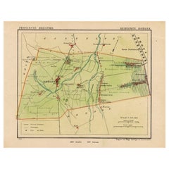
Antique Map of Ooststellingwerf by Kuyper, 1868
$119.05
$148.8120% Off
£88.49
£110.6120% Off
€100
€12520% Off
CA$164.37
CA$205.4720% Off
A$182.28
A$227.8520% Off
CHF 95.77
CHF 119.7220% Off
MX$2,227.12
MX$2,783.9020% Off
NOK 1,198.25
NOK 1,497.8220% Off
SEK 1,124.77
SEK 1,405.9620% Off
DKK 761.45
DKK 951.8120% Off
About the Item
Antique map titled 'Provincie Friesland - Gemeente Oost-Stellingwerf'. Map of the township of Ooststellingwerf including Makkinga, Oosterwolde and many other villages. This map originates from 'Gemeente-Atlas van Nederland' by J. Kuyper. Artists and Engravers: Published by H. Suringar.
Artist: Published by H. Suringar.
Condition: Good, passe-partout/matting included. Top left sl. bumped. General age-related toning, minor wear. Please study image carefully.
Date: 1868
Overall size: 29.5 x 27 cm.
Antique prints have long been appreciated for both their aesthetic and investment value. They were the product of engraved, etched or lithographed plates. These plates were handmade out of wood or metal, which required an incredible level of skill, patience and craftsmanship. Whether you have a house with Victorian furniture or more contemporary decor an old engraving can enhance your living space. We offer a wide range of authentic antique prints for any budget.
- Dimensions:Height: 10.63 in (27 cm)Width: 11.62 in (29.5 cm)Depth: 0 in (0.01 mm)
- Materials and Techniques:
- Period:
- Date of Manufacture:1868
- Condition:
- Seller Location:Langweer, NL
- Reference Number:Seller: BG-073171stDibs: LU3054327623212
About the Seller
5.0
Recognized Seller
These prestigious sellers are industry leaders and represent the highest echelon for item quality and design.
Platinum Seller
Premium sellers with a 4.7+ rating and 24-hour response times
Established in 2009
1stDibs seller since 2017
2,609 sales on 1stDibs
Typical response time: <1 hour
- ShippingRetrieving quote...Shipping from: Langweer, Netherlands
- Return Policy
Authenticity Guarantee
In the unlikely event there’s an issue with an item’s authenticity, contact us within 1 year for a full refund. DetailsMoney-Back Guarantee
If your item is not as described, is damaged in transit, or does not arrive, contact us within 7 days for a full refund. Details24-Hour Cancellation
You have a 24-hour grace period in which to reconsider your purchase, with no questions asked.Vetted Professional Sellers
Our world-class sellers must adhere to strict standards for service and quality, maintaining the integrity of our listings.Price-Match Guarantee
If you find that a seller listed the same item for a lower price elsewhere, we’ll match it.Trusted Global Delivery
Our best-in-class carrier network provides specialized shipping options worldwide, including custom delivery.More From This Seller
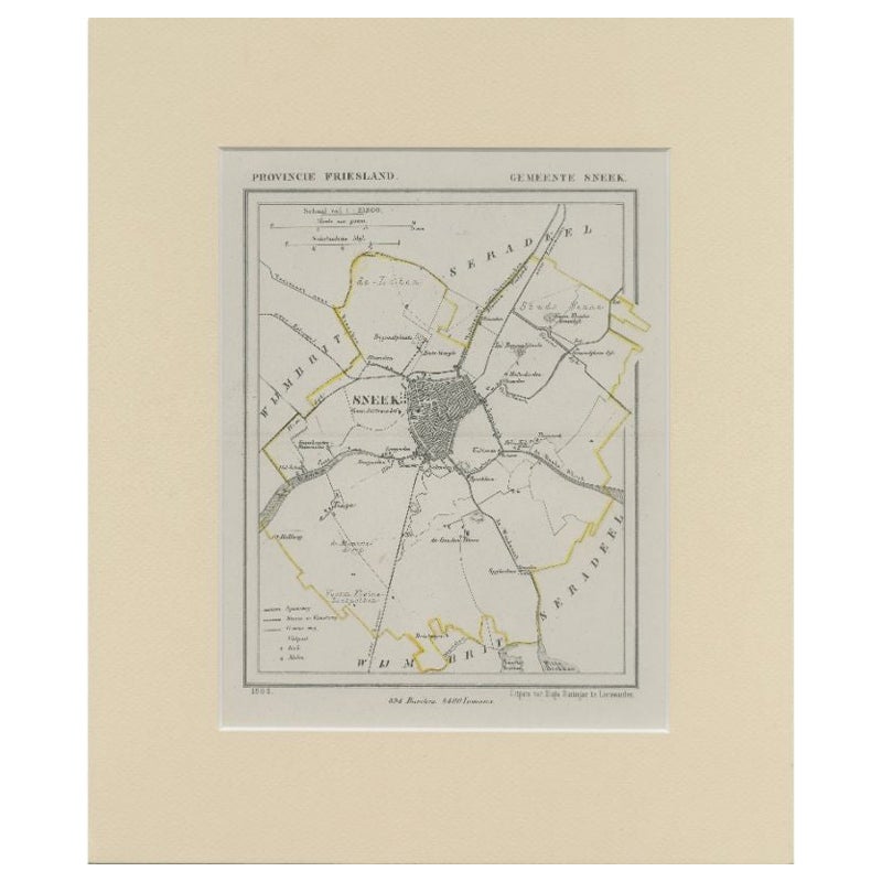
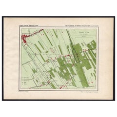
View AllAntique Map of Sneek by Kuyper, 1868
Located in Langweer, NL
Antique map titled 'Provincie Friesland - Gemeente Sneek'. Map of the township of Sneek, Friesland. This map originates from 'Gemeente-Atlas van Nederland' by J. Kuyper. Artists and ...
Category
Antique 19th Century Maps
Materials
Paper
$120 Sale Price
20% Off
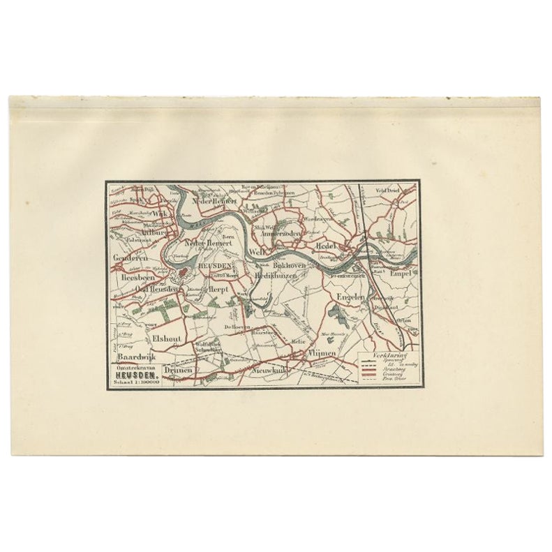
Antique Map of the Region of Heusden by Craandijk, 1884
Located in Langweer, NL
Antique map titled 'Omstreken van Heusden'. Old map of the region of Heusden also including cities and villages like Elshout, Aalburg, Hedel and Vlijmen. This map orginates from 'Atl...
Category
Antique 19th Century Maps
Materials
Paper
$82 Sale Price
20% Off
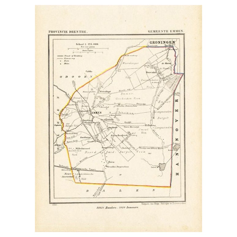
Antique Map of the Township of Emmen, Drenthe in The Netherlands, 1865
Located in Langweer, NL
Drenthe: Gemeente Emmen, Roswinkel, Werdinge, Zuidbarge. These scarse detailed maps of Dutch Towns originate from the 'Gemeente-atlas' of Jacob Kuyper. This atlas of all towns in the...
Category
Antique 19th Century Maps
Materials
Paper
$161 Sale Price
20% Off
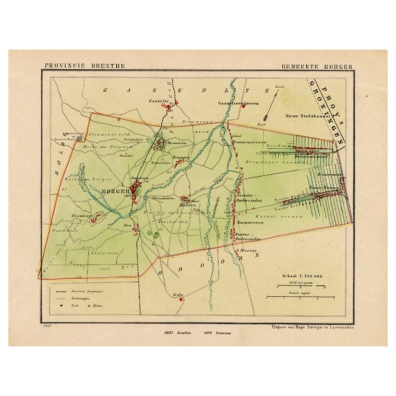
Original Antique Map of the Township of Borger in The Netherlands, 1865
Located in Langweer, NL
Drenthe - Gemeente Borger, Drouwen, Buinene, Westdorp. These scarse detailed maps of Dutch Towns originate from the 'Gemeente-atlas' of Jacob Kuyper. This atlas of all towns in the N...
Category
Antique 19th Century Maps
Materials
Paper
$171 Sale Price
20% Off
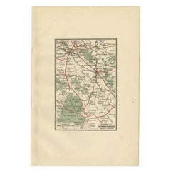
Antique Map of the Region of Oranjewoud by Kuyper, 1868
Located in Langweer, NL
Antique map titled 'Provincie Friesland - Gemeente Schoterland (Oranjewoud)'. Map of the township of Schoterland with a focus on the region of Oranjewoud. This map originates from 'G...
Category
Antique 19th Century Maps
Materials
Paper
$109 Sale Price
20% Off
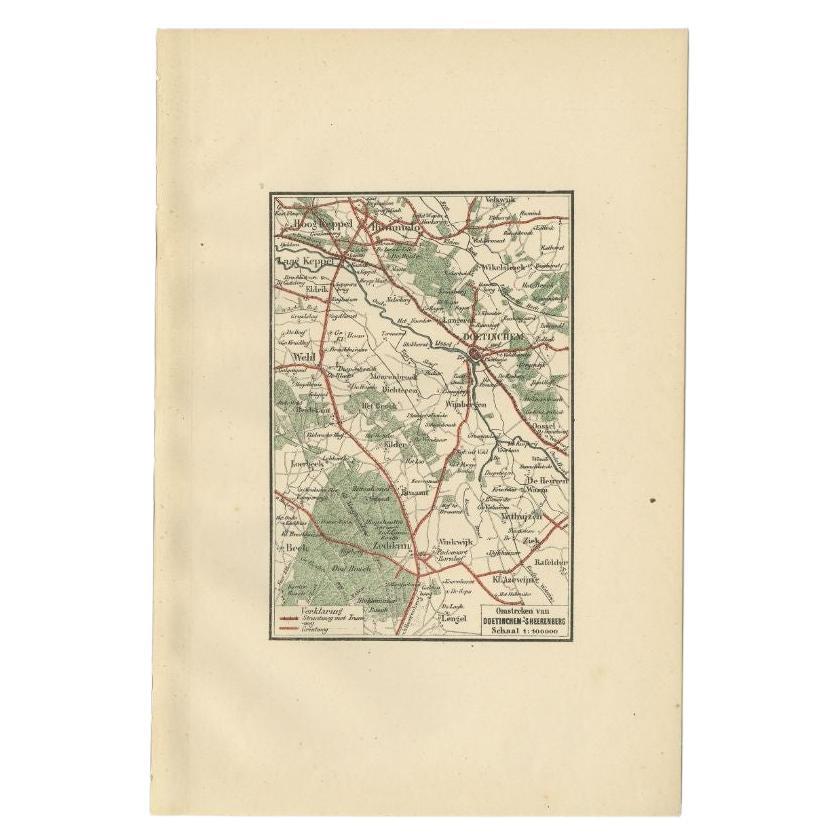
Antique Map of the Region of Doetinchem by Craandijk, 1884
Located in Langweer, NL
Antique map titled 'Omstreken van Doetinchem - 's Heerenberg'. Old map of the region of Doetinchem also including cities and villages like Keppel, Wehl and Zeddam. This map orginates...
Category
Antique 19th Century Maps
Materials
Paper
$82 Sale Price
20% Off
You May Also Like
Original Antique English County Map, Buckinghamshire, J & C Walker, 1851
Located in St Annes, Lancashire
Great map of Buckinghamshire
Original colour
By J & C Walker
Published by Longman, Rees, Orme, Brown & Co. 1851
Unframed.
Category
Antique 1850s English Other Maps
Materials
Paper

Original Antique English County Map, Huntingdonshire, J & C Walker, 1851
Located in St Annes, Lancashire
Great map of Huntingdonshire
Original colour
By J & C Walker
Published by Longman, Rees, Orme, Brown & Co. 1851
Unframed.
Category
Antique 1850s English Other Maps
Materials
Paper

Original Antique English County Map, Cambridgeshire, J & C Walker, 1851
Located in St Annes, Lancashire
Great map of Cambridgeshire
Original colour
By J & C Walker
Published by Longman, Rees, Orme, Brown & Co. 1851
Unframed.
Category
Antique 1850s English Other Maps
Materials
Paper

Original Antique English County Map, Leicestershire, J & C Walker, 1851
Located in St Annes, Lancashire
Great map of Leicestershire
Original colour
By J & C Walker
Published by Longman, Rees, Orme, Brown & Co. 1851
Unframed.
Category
Antique 1850s English Other Maps
Materials
Paper

Original Antique English County Map, Warwickshire, J & C Walker, 1851
Located in St Annes, Lancashire
Great map of Warwickshire
Original colour
By J & C Walker
Published by Longman, Rees, Orme, Brown & Co. 1851
Unframed.
Category
Antique 1850s English Other Maps
Materials
Paper

Original Antique English County Map, Nottinghamshire, J & C Walker, 1851
Located in St Annes, Lancashire
Great map of Nottinghamshire
Original colour
By J & C Walker
Published by Longman, Rees, Orme, Brown & Co. 1851
Unframed.
Category
Antique 1850s English Other Maps
Materials
Paper

More Ways To Browse
1868 Furniture
Ipswich Antique Furniture
Maps Balkans
Missouri Map
Antique Maps Of Texas
Antique Maps Virginia
Antique Railroad Scale
Jamaican Antique
Hindeloopen Furniture
Romania Map
Stanford Antique Furniture
Sardinia Map
Victorian Staircase
Nantucket Map
Afghanistan Antique Map
Antique Map Of Hawaii
Antique Florida Map
Map Of Syria