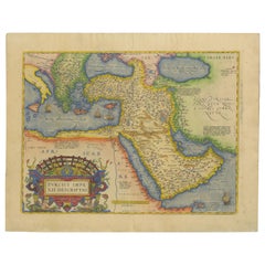
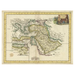
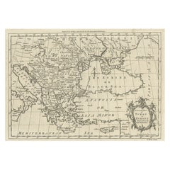
Antique Map of the Ottoman Empire: Detailed Engraving of the Turkish Realm, 1573
View Similar Items


Want more images or videos?
Request additional images or videos from the seller
1 of 11
Antique Map of the Ottoman Empire: Detailed Engraving of the Turkish Realm, 1573
About the Item
- Dimensions:Height: 18.12 in (46 cm)Width: 23.04 in (58.5 cm)Depth: 0 in (0.02 mm)
- Materials and Techniques:Paper,Engraved
- Period:
- Date of Manufacture:1573
- Condition:Good. The map is browned (spotted) around the edges, with a tear in the lower fold that has been backed into the image edge. These conditions suggest it has undergone some wear and aging but retains significant historical and visual interest.
- Seller Location:Langweer, NL
- Reference Number:Seller: BG-136501stDibs: LU3054341306762
About the Seller
5.0
Recognized Seller
These prestigious sellers are industry leaders and represent the highest echelon for item quality and design.
Gold Seller
Premium sellers maintaining a 4.3+ rating and 24-hour response times
Established in 2009
1stDibs seller since 2017
2,446 sales on 1stDibs
Typical response time: 1 hour
Authenticity Guarantee
In the unlikely event there’s an issue with an item’s authenticity, contact us within 1 year for a full refund. DetailsMoney-Back Guarantee
If your item is not as described, is damaged in transit, or does not arrive, contact us within 7 days for a full refund. Details24-Hour Cancellation
You have a 24-hour grace period in which to reconsider your purchase, with no questions asked.Vetted Professional Sellers
Our world-class sellers must adhere to strict standards for service and quality, maintaining the integrity of our listings.Price-Match Guarantee
If you find that a seller listed the same item for a lower price elsewhere, we’ll match it.Trusted Global Delivery
Our best-in-class carrier network provides specialized shipping options worldwide, including custom delivery.More From This Seller
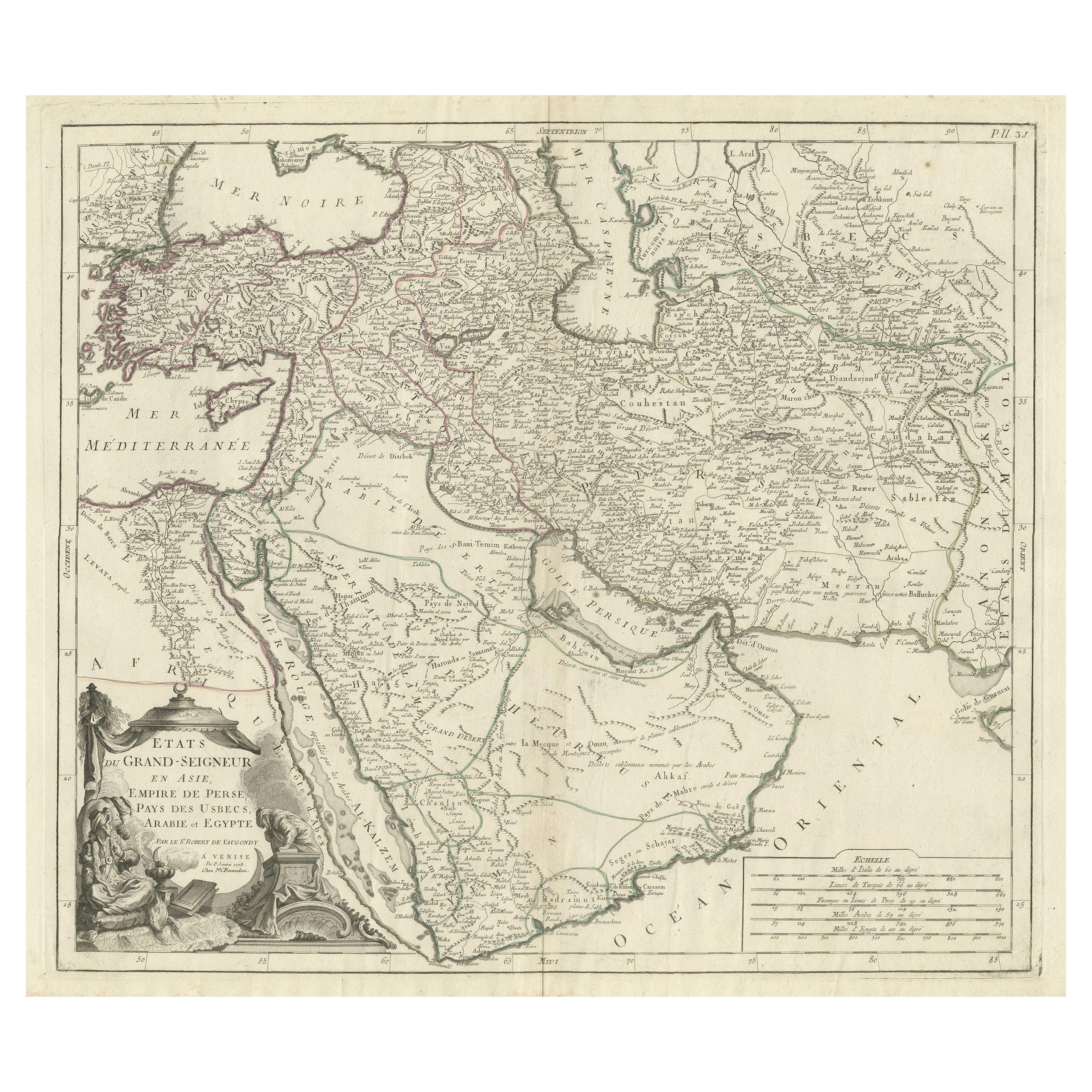
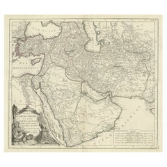
View AllDetailed Original Antique Map of the Turkish Empire with Arabia, 1778
Located in Langweer, NL
Title: Etats Due Grand-Seigneur En Asie, Empire De Perse, Pays Des Usbecs, Arabie et Egypte . . . 1753
Detailed map of the Turkish Empire, extending to the Black Sea, Georgia, the...
Category
Antique 1770s Maps
Materials
Paper
$444 Sale Price
20% Off
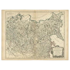
Detailed Original Antique Map of the Russian Empire in Asia, 1750
Located in Langweer, NL
Antique map titled 'Partie Orientale de l'Empire de Russie en Asie (..)'.
Detailed map of the Russian Empire in Asia.
Artists and Engravers: Gilles Robert de Vaugondy (1688-1766) was the head of a leading family of geographers in eighteenth century France. Gilles got his start when he jointly inherited the shop of Pierre-Moullart Sanson, grandson of the famous geographer Nicholas Sanson. The inheritance included the business, its stock of plates, and a roller press...
Category
Antique 1750s Maps
Materials
Paper
$546 Sale Price
20% Off
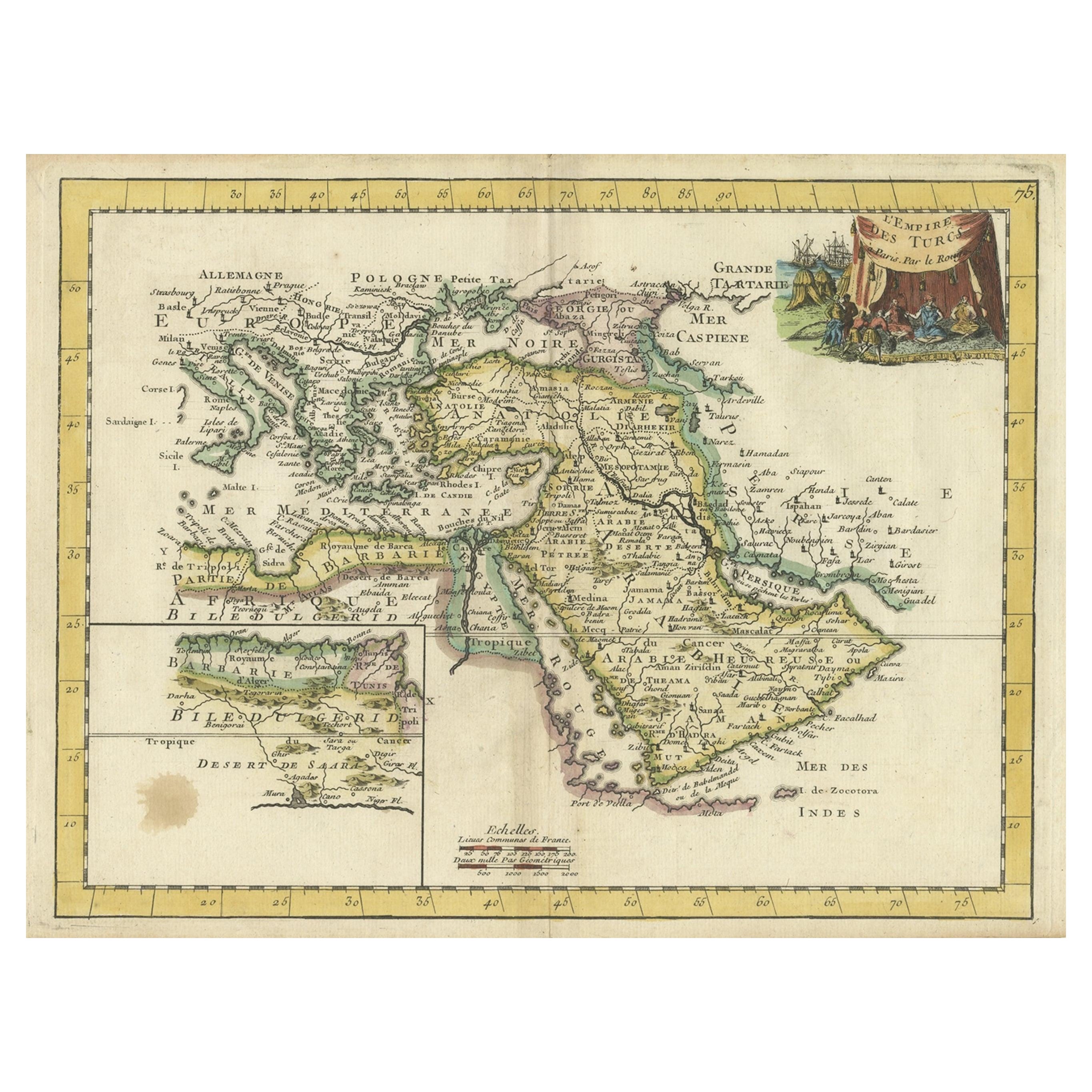
Orginal Antique Handcolored Map of the Turkish Empire, 1748
Located in Langweer, NL
Antique map titled 'L'Empire des Turcs'. Old map of the Turkish Empire with an inset of the North African regions. Originates from 'Atlas Nouveau Portatif' by G.L. le Rouge.
Artis...
Category
Antique 18th Century Maps
Materials
Paper
$331 Sale Price
35% Off
Antique Map of the Turkish Empire by Tirion 'c.1760'
Located in Langweer, NL
Antique map titled 'Nieuwe Kaart van het Turksche Ryk gelegen in Europa, Asia en Africa'. Original antique map of the Turkish Empire. The map is centered on the Mediterranean Sea but...
Category
Antique Mid-18th Century Maps
Materials
Paper

$1,296 Sale Price
20% Off
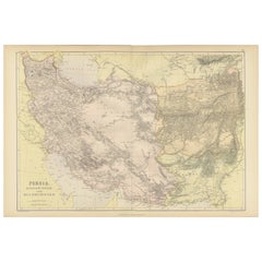
Oriental Realms: A Detailed Map of Persia, Afghanistan, and Beloochistan, 1882
Located in Langweer, NL
This historical map from the 1882 atlas published by Blackie & Son is a comprehensive depiction of Persia (modern-day Iran), Afghanistan, and Baluchistan (the region that includes pa...
Category
Antique 1880s Maps
Materials
Paper
$287 Sale Price
20% Off
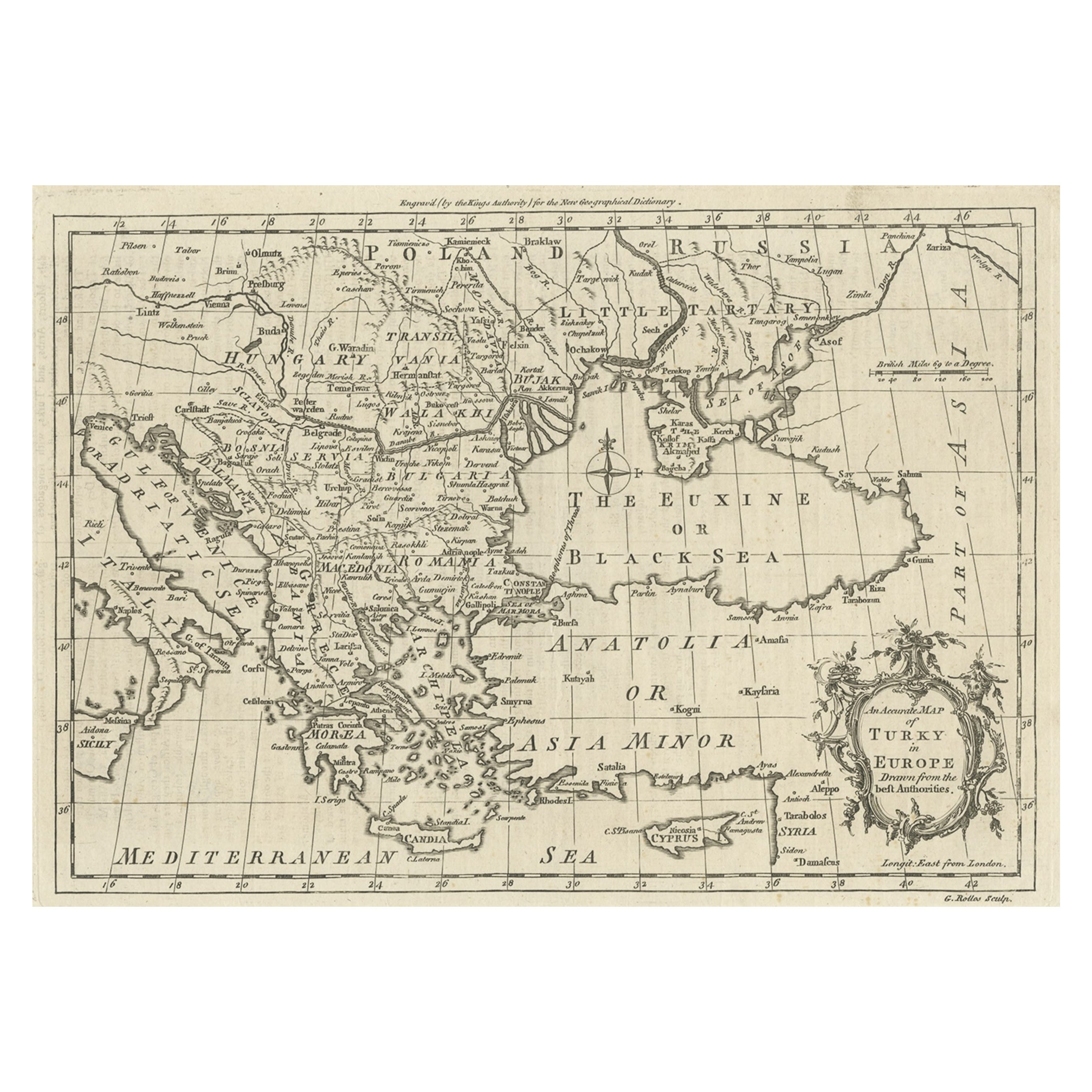
Map of the Ottoman Empire in Europe, incl. the Balkans, Greece & Turkey, c.1760
Located in Langweer, NL
Antique map Turkey titled 'An Accurate Map of Turky in Europe drawn from the best Authorities'.
Map of the Ottoman Empire in Europe, the Balkans, Greece, and Turkey in Europe. Engr...
Category
Antique 1760s Maps
Materials
Paper
$425 Sale Price
20% Off
You May Also Like
Super Rare Antique French Map of Chine and the Chinese Empire, 1780
Located in Amsterdam, Noord Holland
Super Rare Antique French Map of Chine and the Chinese Empire, 1780
Very nice map of Asia. 1780 Made by Bonne.
Additional information:
Type: Map
...
Category
Antique 18th Century European Maps
Materials
Paper

$584 Sale Price
30% Off
Antique Lithography Map, Gloucestershire, English, Framed Engraving, Cartography
Located in Hele, Devon, GB
This is an antique lithography map of Gloucestershire. An English, framed atlas engraving of cartographic interest, dating to the mid 19th century ...
Category
Antique Mid-19th Century British Victorian Maps
Materials
Wood

Antique Lithography Map, Northumberland, English, Framed, Engraving, Cartography
Located in Hele, Devon, GB
This is an antique lithography map of Northumberland. An English, framed atlas engraving of cartographic interest, dating to the mid 19th century a...
Category
Antique Mid-19th Century British Victorian Maps
Materials
Wood

Antique Lithography Map, Hertfordshire, English, Framed Engraving, Cartography
Located in Hele, Devon, GB
This is an antique lithography map of Hertfordshire. An English, framed atlas engraving of cartographic interest, dating to the mid 19th century an...
Category
Antique Mid-19th Century British Victorian Maps
Materials
Wood

Antique Lithography Map, Bedfordshire, English, Framed Engraving, Cartography
Located in Hele, Devon, GB
This is an antique lithography map of Bedfordshire. An English, framed atlas engraving of cartographic interest, dating to the mid 19th century and...
Category
Antique Mid-19th Century British Victorian Maps
Materials
Wood

Antique Lithography Map, Worcestershire, English, Framed Engraving, Cartography
Located in Hele, Devon, GB
This is an antique lithography map of Worcestershire. An English, framed atlas engraving of cartographic interest, dating to the early 19th centur...
Category
Antique Early 19th Century British Regency Maps
Materials
Wood
Recently Viewed
View AllMore Ways To Browse
16th Century Colored Engraving
Alexandria Designs
Pair Antique Footstools
Pair Of Italian Chrome Lounge Chairs
Pair Of Leather Accent Chairs
Paisley Throws
Palm Sterling
Pedestal Inlaid Wood Tables
Pillow Arm Sofa
Pouf Metal Base
Rattan Sun Lounge
Raw Wooden Table
Red Baccarat
Red Chair And Ottoman
Round Bar Carts
Round Onyx Table
Rustic Leather Dining Chair
Scandinavian Bentwood Chairs