
Antique Map of Southern Brazil by Bellin, circa 1750
View Similar Items


Want more images or videos?
Request additional images or videos from the seller
1 of 5
Antique Map of Southern Brazil by Bellin, circa 1750
About the Item
- Dimensions:Height: 10.63 in (27 cm)Width: 8.67 in (22 cm)Depth: 0.02 in (0.5 mm)
- Materials and Techniques:
- Period:
- Date of Manufacture:circa 1750
- Condition:Wear consistent with age and use. General age-related toning. Please study images carefully.
- Seller Location:Langweer, NL
- Reference Number:Seller: BG-034651stDibs: LU3054316263911
About the Seller
5.0
Platinum Seller
These expertly vetted sellers are 1stDibs' most experienced sellers and are rated highest by our customers.
Established in 2009
1stDibs seller since 2017
1,933 sales on 1stDibs
More From This SellerView All
- Antique Map of Tartary and Northeast Asia by Bellin, circa 1750By Jacques-Nicolas BellinLocated in Langweer, NLAntique map titled 'Carte de la Tartarie Occidentale'. Map of Tartary and northeast Asia, from Lake Baykal, Partie du Siberia in the north, Pays des Kalkas at the center, as well as ...Category
Antique Mid-18th Century European Maps
MaterialsPaper
- Antique Map of Siberia by Bellin, 1754Located in Langweer, NLAntique map titled 'Carte de la Siberie'. Detailed map of Siberia, extending from the White Sea and the Caspian Sea in the west to Irkuckoi Province, Jakutky on the Lena River and regions just to the east. Centered on the Jenisi River. Originates from Prévost's 'Histoire Générale des Voyages'. Artists and Engravers: Jacques-Nicolas Bellin (1703-1772) was among the most important mapmakers of the eighteenth century. In 1721, at age 18, he was appointed hydrographer (chief cartographer) to the French Navy. In August 1741, he became the first Ingénieur de la Marine of the Depot des cartes...Category
Antique 18th Century Maps
MaterialsPaper
- Antique Map of Scandinavia by T. Jefferys, circa 1750Located in Langweer, NLAntique map titled 'Sweden, Denmark, Norway & Finland'. An original mid-18th century copper engraved antique map of Scandinavia by Thomas Jefferys....Category
Antique Mid-18th Century Maps
MaterialsPaper
 $164 Sale Price21% Off
 - Antique Map of Pomerania by Schenk, circa 1750Located in Langweer, NLThe "Ducatus Pomeraniae" is a historical map depicting the Duchy of Pomerania, a region that straddles the modern border between northeastern Germany and Poland. Crafted with ornamen...Category
Antique Mid-18th Century Maps
MaterialsPaper
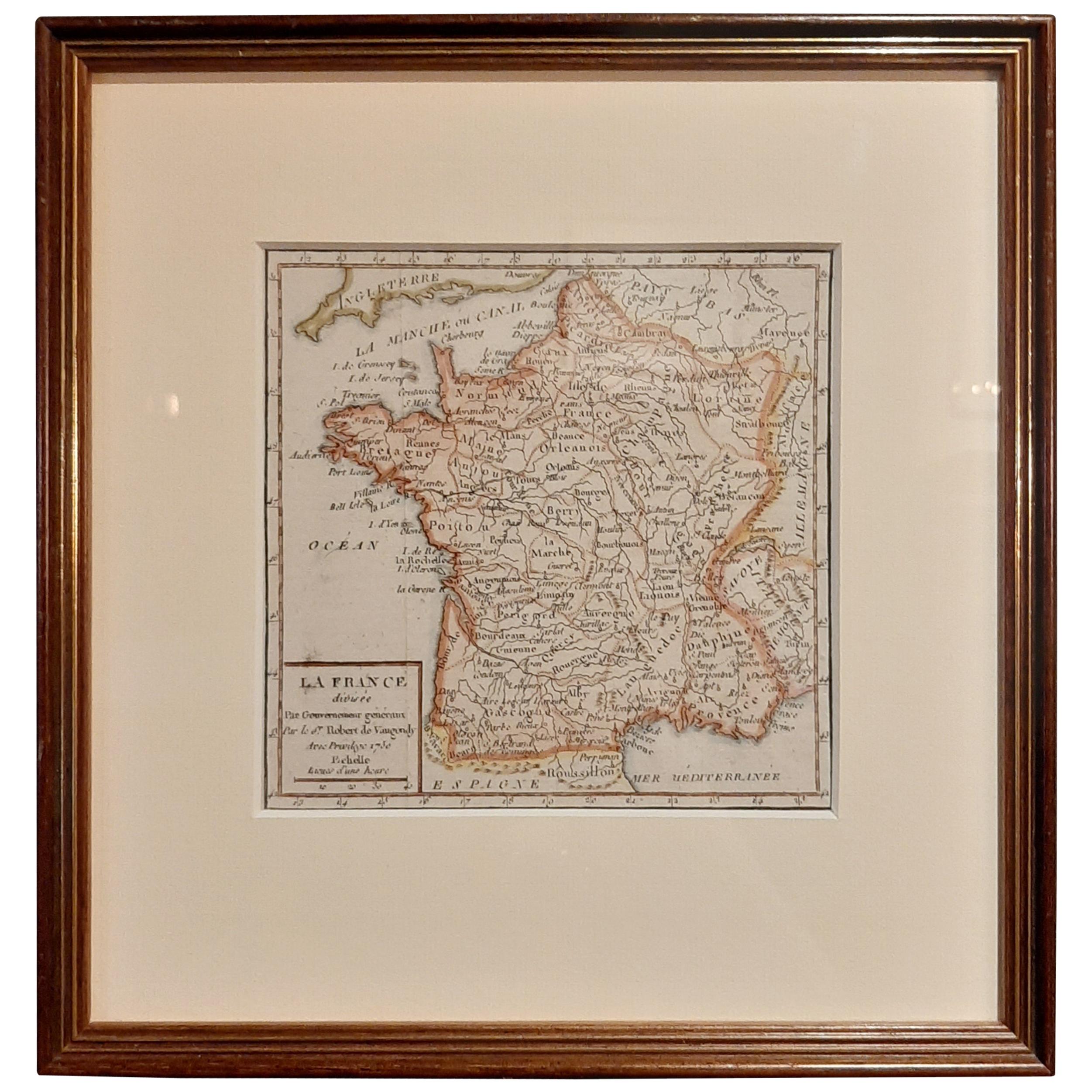
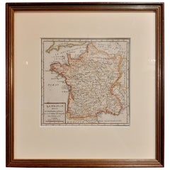
- Antique Map of France by Vaugondy, circa 1750Located in Langweer, NLAntique map titled 'La France divisée (..)'. Map of France published by Robert de Vaugondy, circa 1750. Frame included. We carefully pack our framed items to ensure safe shipping.Category
Antique Early 18th Century Maps
MaterialsPaper
- Antique Map of Japan by J.N. Bellin, 1752Located in Langweer, NLBellin's wonderfully detailed map of Japan from the atlas of Prevost d'Exiles' influential collection of travel narratives, Histoire Generale des Voyages. Considered the best general...Category
Antique Mid-18th Century Maps
MaterialsPaper
 $329 Sale Price34% Off


You May Also Like
- Captain Cook's Exploration of Tahiti 18th C. Hand-Colored Map by BellinBy Jacques-Nicolas BellinLocated in Alamo, CAThis beautiful 18th century hand-colored copper plate engraved map is entitled "Carte de l'Isle de Taiti, par le Lieutenant J. Cook" was created by Jacques Nicolas Bellin and publish...Category
Antique Mid-18th Century French Maps
MaterialsPaper
- West Coast of Africa, Guinea & Sierra Leone: An 18th Century Map by BellinBy Jacques-Nicolas BellinLocated in Alamo, CAJacques Bellin's copper-plate map entitled "Partie de la Coste de Guinee Dupuis la Riviere de Sierra Leona Jusquau Cap das Palmas", depicting the coast of Guinea and Sierra Leone in ...Category
Antique Mid-18th Century French Maps
MaterialsPaper
- Original Antique Map of Belgium by Tallis, Circa 1850Located in St Annes, LancashireGreat map of Belgium Steel engraving Many lovely vignettes Published by London Printing & Publishing Co. ( Formerly Tallis ), C.1850 Origin...Category
Antique 1850s English Maps
MaterialsPaper
- St. Christophe 'St. Kitts' Island: An 18th Century Hand-colored Map by BellinBy Jacques-Nicolas BellinLocated in Alamo, CAJacques Bellin's copper-plate map of the Caribbean island of Saint Kitts entitled "Carte De De l'Isle St. Christophe Pour servir á l'Histoire Genle. des V...Category
Antique Mid-18th Century French Maps
MaterialsPaper
- Original Antique Map of South America, circa 1830Located in St Annes, LancashireGreat map of South America Copper plate engraving Published by Butterworth, Livesey & Co., circa 1830 Unframed.Category
Antique Early 1800s English Other Maps
MaterialsPaper

- Original Antique Map / City Plan of Brussels by Tallis, circa 1850Located in St Annes, LancashireGreat map of Brussels. Steel engraving. Published by London Printing & Publishing Co. (Formerly Tallis), C.1850 Free shipping.Category
Antique 1850s English Maps
MaterialsPaper


Recently Viewed
View AllMore Ways To Browse
Map Of Brazil
Brazil Map
Antique Map Brazil
Antique Map Of Brazil
Paraguay Antique Map
Uruguay Antique Map
Antique World Map
World Map Antique
World Antique Map
Antique Map World
Antique Maps World
Antique World Map World Maps
Antique World Maps
Antique World Maps World Maps
Old Map
French Antique Decorative Collectibles
Antique Map Of World
Map Of World Antique