Items Similar to Antique Map of Southern India and Ceylon by Thomson, 1816
Want more images or videos?
Request additional images or videos from the seller
1 of 5
Antique Map of Southern India and Ceylon by Thomson, 1816
$167.31
$209.1420% Off
£123.86
£154.8320% Off
€140
€17520% Off
CA$231.52
CA$289.4020% Off
A$255.20
A$31920% Off
CHF 133.53
CHF 166.9220% Off
MX$3,131.27
MX$3,914.0920% Off
NOK 1,680.94
NOK 2,101.1720% Off
SEK 1,571.94
SEK 1,964.9320% Off
DKK 1,065.96
DKK 1,332.4520% Off
About the Item
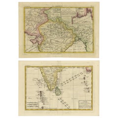
"Antique map titled 'Southern Hindostan'. A map of Southern India and the North of Ceylon. From Thomson's 'New General Atlas', 1816. Artists and Engravers: Engraved by Neele.
Artist: Engraved by Neele.
Condition: Fair, given age. Original middle fold, as issued. Creasing in the lower margin. Lower edge browned and with a few small tears, and several small spots of paper erosion and tiny on the image edge (reinforced on the rear with contemporary paper and acid-free archival tape). General age-related toning and/or occasional minor defects from handling. Please study image carefully.
Date: 1816
Overall size: 71.6 x 54.6 cm.
Image size: 0.001 x 59.8 x 50.8 cm.
Antique prints have long been appreciated for both their aesthetic and investment value. They were the product of engraved, etched or lithographed plates. These plates were handmade out of wood or metal, which required an incredible level of skill, patience and craftsmanship. Whether you have a house with Victorian furniture or more contemporary decor an old engraving can enhance your living space. We offer a wide range of authentic antique prints for any budget.".
- Dimensions:Height: 21.5 in (54.6 cm)Width: 28.19 in (71.6 cm)Depth: 0 in (0.01 mm)
- Materials and Techniques:
- Period:
- Date of Manufacture:1816
- Condition:
- Seller Location:Langweer, NL
- Reference Number:Seller: PCT-568121stDibs: LU3054327661132
About the Seller
5.0
Recognized Seller
These prestigious sellers are industry leaders and represent the highest echelon for item quality and design.
Platinum Seller
Premium sellers with a 4.7+ rating and 24-hour response times
Established in 2009
1stDibs seller since 2017
2,613 sales on 1stDibs
Typical response time: <1 hour
- ShippingRetrieving quote...Shipping from: Langweer, Netherlands
- Return Policy
Authenticity Guarantee
In the unlikely event there’s an issue with an item’s authenticity, contact us within 1 year for a full refund. DetailsMoney-Back Guarantee
If your item is not as described, is damaged in transit, or does not arrive, contact us within 7 days for a full refund. Details24-Hour Cancellation
You have a 24-hour grace period in which to reconsider your purchase, with no questions asked.Vetted Professional Sellers
Our world-class sellers must adhere to strict standards for service and quality, maintaining the integrity of our listings.Price-Match Guarantee
If you find that a seller listed the same item for a lower price elsewhere, we’ll match it.Trusted Global Delivery
Our best-in-class carrier network provides specialized shipping options worldwide, including custom delivery.More From This Seller
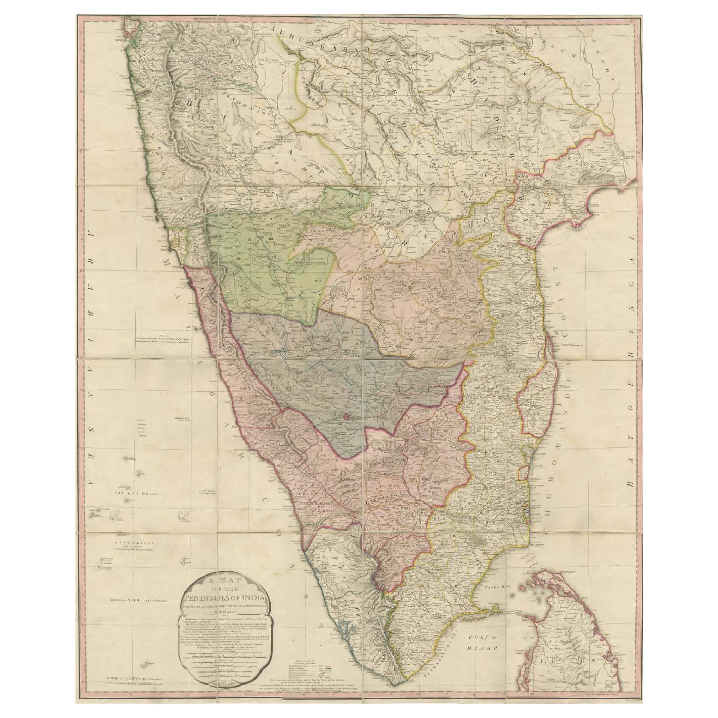
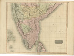
View AllOriginal Antique Map of the Peninsula of India with Part of Ceylon by Wyld, 1844
Located in Langweer, NL
This extensive map of India, spanning two sheets, draws from Reynell’s original map and incorporates data provided by Sir Archibald Campbell, as well as surveys conducted by Colonel ...
Category
Antique Mid-18th Century Maps
Materials
Paper
$1,147 Sale Price
20% Off
Free Shipping
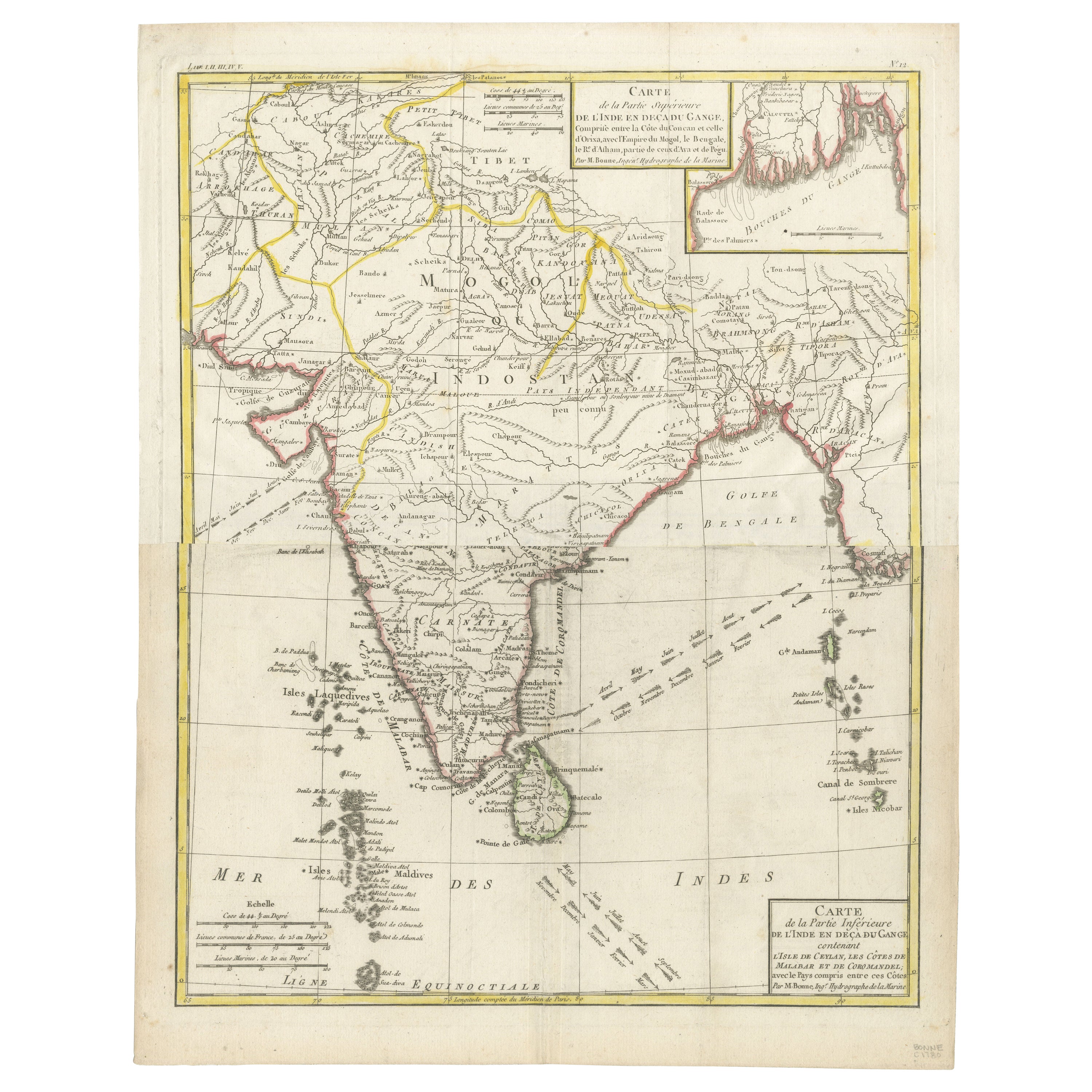
Map of India and Ceylon with Inset of Calcutta and the Ganges, by Bonne, 1780
Located in Langweer, NL
The map on offer is an antique copperplate engraving of India and Ceylon (Sri Lanka), created by Rigobert Bonne (1727-1794), a prominent French cartographer. Here is a breakdown of t...
Category
Antique 1780s Maps
Materials
Paper
$325 Sale Price
20% Off
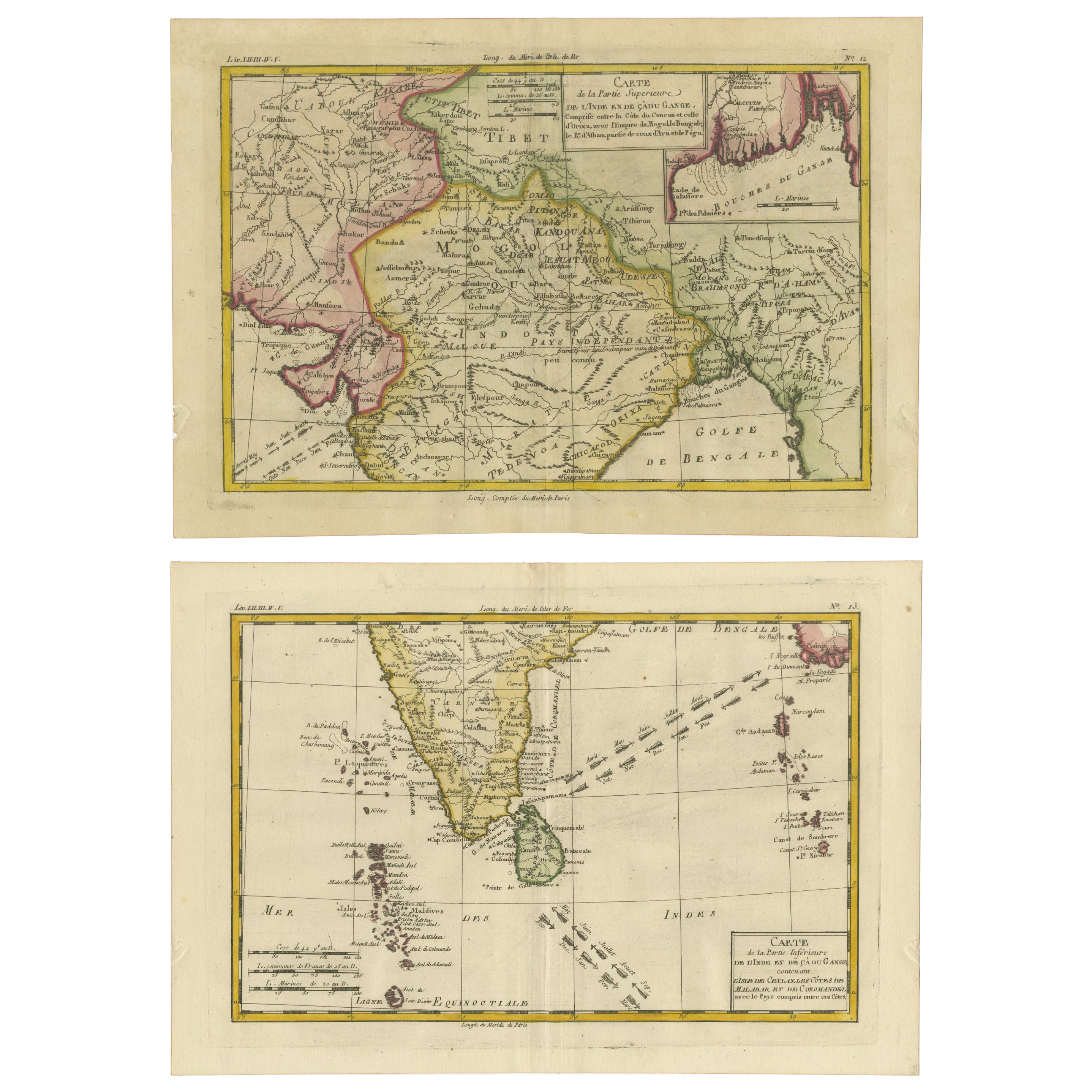
18th Century Cartographic Depiction of Upper India and Ceylon, 1835
Located in Langweer, NL
An exquisite set of two maps, 'Carte de la Partie Superieure De L'Inde en de Cadu Gange,' masterfully crafted by the renowned 18th-century French cartographer, Charles Marie Rigobert...
Category
Antique 1830s Maps
Materials
Paper
$420 Sale Price
20% Off
Free Shipping
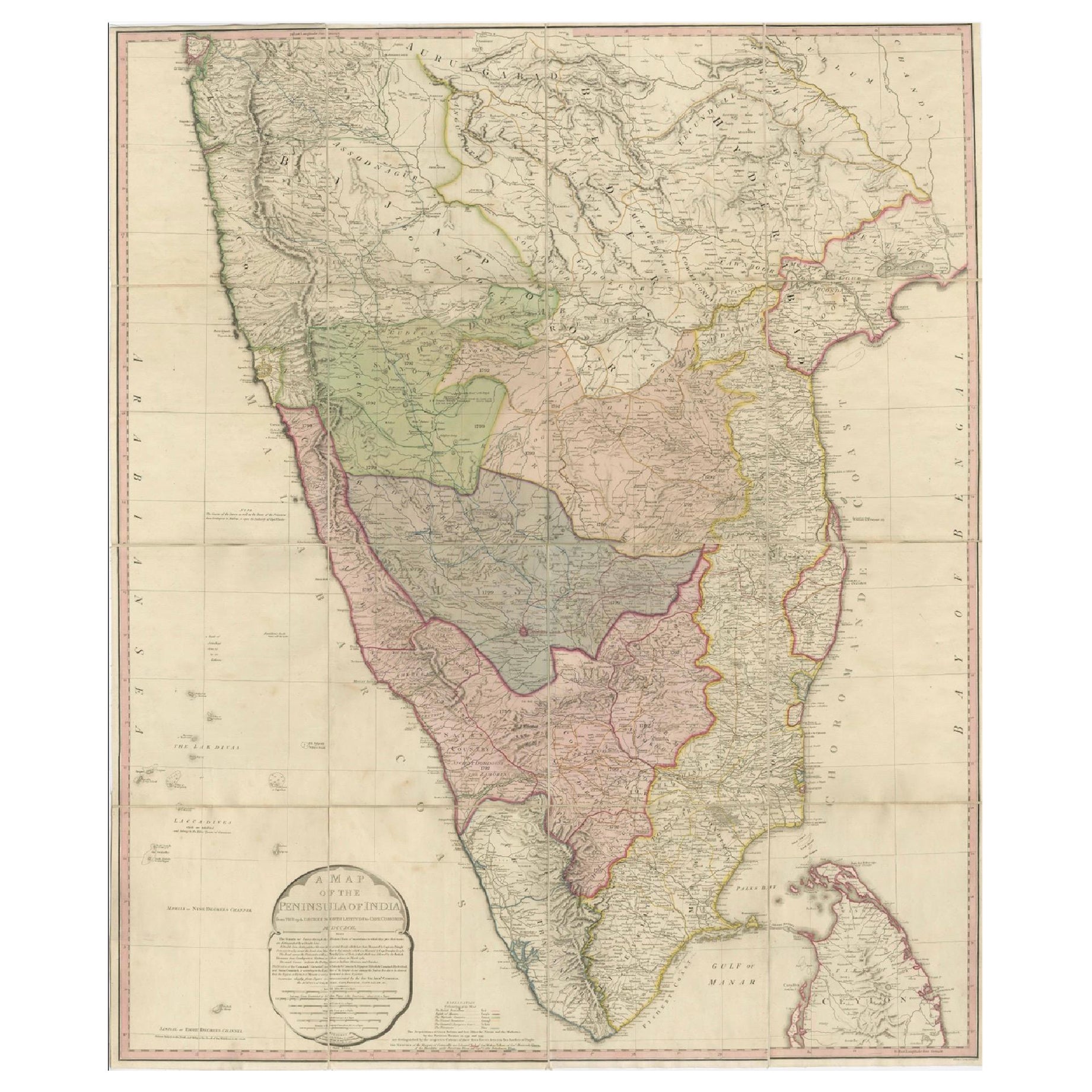
Large Decorative Colonial-Era Map of South India – Peninsula of India, 1800
Located in Langweer, NL
Antique Map of South India – “A Map of the Peninsula of India,” London 1800
This large and detailed antique map titled *A Map of the Peninsula of India* was published in London in 1...
Category
Antique Early 19th Century English Maps
Materials
Linen, Paper

1816 Large Southern Hindostan Map by J. Thomson – New General Atlas
Located in Langweer, NL
Title: 1816 Southern Hindostan Map by J. Thomson – New General Atlas
This map, titled "Southern Hindostan," was published in 1816 as part of J. Thomson’s *New General Atlas*. The ma...
Category
Antique 1810s Maps
Materials
Paper
$506 Sale Price
20% Off
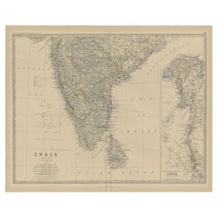
Old Map of Southern India and Ceylon 'Sri Lanka', 1882
Located in Langweer, NL
Antique map titled 'India (Southern Sheet)'.
Old map of Southern India and Ceylon (Sri Lanka). With an inset map of the South-Eastern Provinces of India. This map originates from...
Category
Antique 1880s Maps
Materials
Paper
$277 Sale Price
20% Off
You May Also Like
Original Antique Map of India by Dower, circa 1835
Located in St Annes, Lancashire
Nice map of India
Drawn and engraved by J.Dower
Published by Orr & Smith. C.1835
Unframed.
Free shipping
Category
Antique 1830s English Maps
Materials
Paper

India (Southern Sheet), English antique map by Alexander Keith Johnston, 1901
Located in Melbourne, Victoria
'India (Southern Sheet)', antique lithographic map by Keith Johnston.
Inset maps of 'Bombay Island & Town', 'Madras & Environs', and 'South-Eastern Provinces of India'.
Central vertical fold as issued.
495mm by 625mm (sheet)
Alexander Keith...
Category
Early 20th Century Victorian More Prints
Materials
Lithograph

Map Of India - Original Lithograph - 19th Century
Located in Roma, IT
Map of India is an original lithograph artwork realized by an Anonymous engraver of the 19th Century.
Printed in the series of "France Pittoresque".
Titled "France Pittoresque".
...
Category
19th Century Modern Figurative Prints
Materials
Lithograph

Antique 1803 Italian Map of Asia Including China Indoneseia India
Located in Amsterdam, Noord Holland
Antique 1803 Italian Map of Asia Including China Indoneseia India
Very nice map of Asia. 1803.
Additional information:
Type: Map
Country of Manufacturing: Europe
Period: 19th centu...
Category
Antique 19th Century European Maps
Materials
Paper

$584 Sale Price
20% Off
Antique French Map of Asia Including China Indoneseia India, 1783
Located in Amsterdam, Noord Holland
Very nice map of Asia. 1783 Dedie au Roy.
Additional information:
Country of Manufacturing: Europe
Period: 18th century Qing (1661 - 1912)
Condition: Overall Condition B (Good Used)...
Category
Antique 18th Century European Maps
Materials
Paper

$648 Sale Price
20% Off
Original Antique Map of South East Asia by Thomas Clerk, 1817
Located in St Annes, Lancashire
Great map of South East Asia
Copper-plate engraving
Drawn and engraved by Thomas Clerk, Edinburgh.
Published by Mackenzie And Dent, 1817
Unframed.
Category
Antique 1810s English Maps
Materials
Paper

More Ways To Browse
India Engraving
Antique Ceylon
Ceylon Furniture
Burgundy Map
Peninsular War
Taiwan Map
Used Furniture Alabama
Antique Chicago Maps
Thailand Map
Antique Dutch Bible
Antique Louisiana Map
Antique Maps Of Sicily
Patagonia Map
Sardinia Map
Antique Map Of Thailand
Antique Wooden Roller
Croatia Map
Map Of Native American Tribes