Items Similar to Copenhagen (Kiöbenhaven) Map with City View – Antique German Atlas Print, 1844
Video Loading
Want more images or videos?
Request additional images or videos from the seller
1 of 12
Copenhagen (Kiöbenhaven) Map with City View – Antique German Atlas Print, 1844
$418.59
£308.80
€350
CA$579.47
A$628.32
CHF 333.44
MX$7,738.51
NOK 4,132.78
SEK 3,900.39
DKK 2,664.74
About the Item
Copenhagen (Kiöbenhaven) Map with City View – Antique German Atlas Print, 1844
This finely detailed antique map titled 'Copenhagen (Kiöbenhaven)' presents a historical view of Denmark's capital in 1844. Produced by the German cartographer J. Meyer and published in his celebrated Meyer's Handatlas, this map combines precise cartographic detail with artistic embellishment, including a charming panoramic city view at the bottom edge. The layout captures the old fortifications, canals, and street plan of the city as it was in the mid-19th century, offering a fascinating glimpse into Copenhagen’s past urban structure.
J. Meyer’s Handatlas was known for its high-quality steel engravings and informative cartographic representations. This particular map stands out not only for its urban accuracy but also for its attractive border and finely engraved decorative elements. The inclusion of a German-language explanation adds to its historical interest, reflecting its origin in a time when German atlases held high prestige among European readers.
The walled city, detailed in the center, shows roads radiating outward into the countryside, along with harbor fortifications and docks that speak to Copenhagen’s maritime importance. Key landmarks and thoroughfares are clearly delineated, and the elegant city panorama enriches the composition, making it not just informative but also visually engaging.
This map is an excellent example of mid-19th-century European urban cartography. It appeals to collectors interested in Scandinavian history, antique town plans, or decorative engravings.
Condition report: Very good condition. Vertical fold line. Light foxing in outer margins. No tears or repairs. Engraving remains strong and detailed.
Framing tips: A dark wood or black frame pairs well with the monochrome aesthetic. Consider a warm white or pale grey mat to enhance the contrast and preserve the historical atmosphere.
- Dimensions:Height: 13.59 in (34.5 cm)Width: 16.34 in (41.5 cm)Depth: 0.02 in (0.5 mm)
- Materials and Techniques:Paper,Engraved
- Place of Origin:
- Period:
- Date of Manufacture:1844
- Condition:Very good condition. Vertical fold line. Light foxing in outer margins. No tears or repairs. Engraving remains strong and detailed.
- Seller Location:Langweer, NL
- Reference Number:Seller: BG-004071stDibs: LU3054311600571
About the Seller
5.0
Recognized Seller
These prestigious sellers are industry leaders and represent the highest echelon for item quality and design.
Platinum Seller
Premium sellers with a 4.7+ rating and 24-hour response times
Established in 2009
1stDibs seller since 2017
2,620 sales on 1stDibs
Typical response time: <1 hour
- ShippingRetrieving quote...Shipping from: Langweer, Netherlands
- Return Policy
Authenticity Guarantee
In the unlikely event there’s an issue with an item’s authenticity, contact us within 1 year for a full refund. DetailsMoney-Back Guarantee
If your item is not as described, is damaged in transit, or does not arrive, contact us within 7 days for a full refund. Details24-Hour Cancellation
You have a 24-hour grace period in which to reconsider your purchase, with no questions asked.Vetted Professional Sellers
Our world-class sellers must adhere to strict standards for service and quality, maintaining the integrity of our listings.Price-Match Guarantee
If you find that a seller listed the same item for a lower price elsewhere, we’ll match it.Trusted Global Delivery
Our best-in-class carrier network provides specialized shipping options worldwide, including custom delivery.More From This Seller
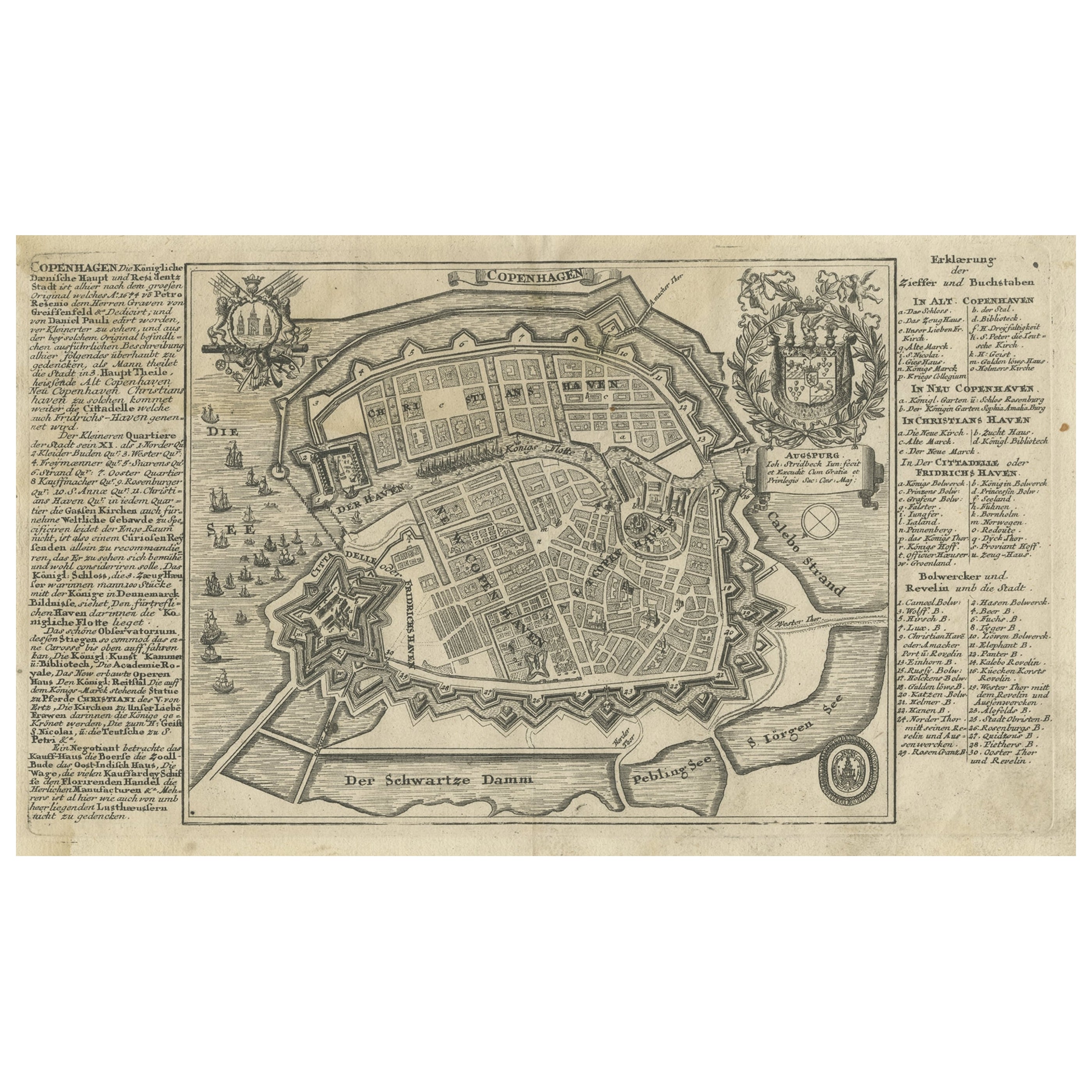
View AllAntique Map of the City of Copenhagen in Denmark c.1720
Located in Langweer, NL
Antique map titled 'Copenhagen'. Original antique map of the city of Copenhagen, Denmark. This map originates from 'Unterschiedliche dieser Zeit Beruffene Laender, Gegenden, Staedte ...
Category
Antique 18th Century Danish Maps
Materials
Paper
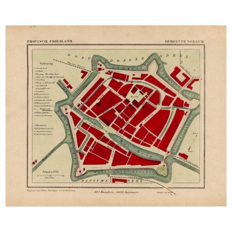
Antique Map of Dokkum a City in the North of Friesland, the Netherlands, 1868
Located in Langweer, NL
Antique map titled 'Provincie Friesland - Gemeente Dokkum'. Map of the township of Dokkum, Friesland. This map originates from 'Gemeente-Atlas van Nederland' by J. Kuyper.
The best-known event in Dokkum's history is the martyrdom of the Anglo-Saxon missionary Saint Boniface (Dutch: Bonifatius) in 754. Oliver of Cologne preached the Fifth Crusade in Dokkum in 1214 and Dokkum sent a contingent; the crescent in the coat of arms of Dokkum refers to this event. Dokkum acquired city rights in 1298. In 1572 Dokkum was sacked by the Spaniards after it had joined the Dutch Revolt...
Category
Antique 19th Century Maps
Materials
Paper
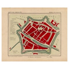
$172 Sale Price
20% Off
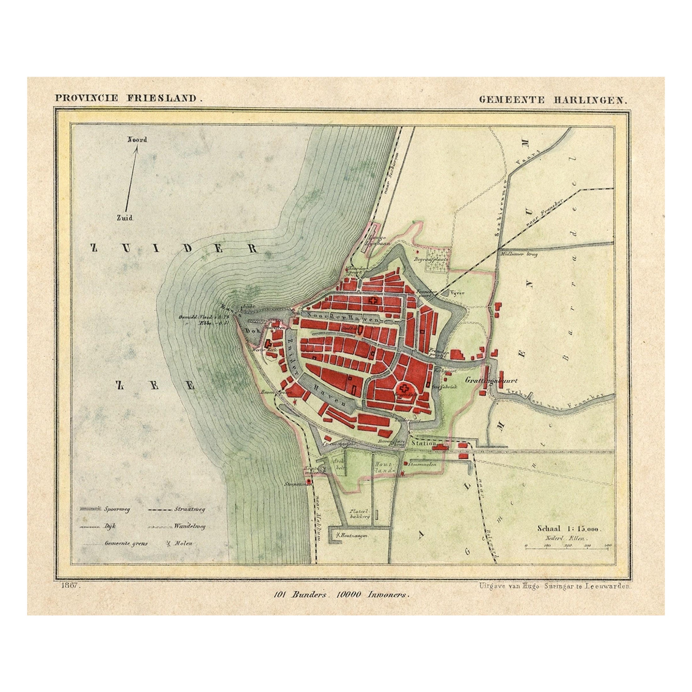
Antique Map of Harlingen, a Harbour City in Friesland, The Netherlands, 1868
Located in Langweer, NL
Antique map titled 'Provincie Friesland - Gemeente Harlingen'.
Map of the township of Harlingen, Friesland. This map originates from 'Gemeente-Atlas van Nederland' by J. Kuyper. ...
Category
Antique 19th Century Maps
Materials
Paper

$133 Sale Price
20% Off
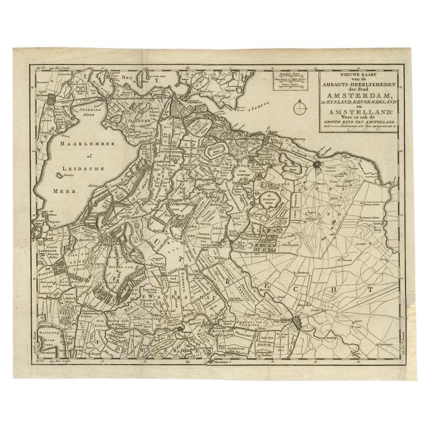
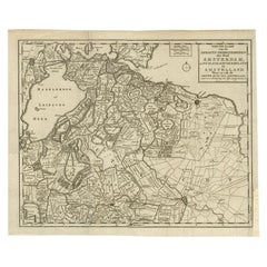
Antique Map of the Region of Amsterdam by Wagenaar, c.1760
Located in Langweer, NL
Antique map titled 'Nieuwe Kaart van de Ambagts - Heerlykheden der Stad Amsterdam, in Rynland, Kennemerland en Amstelland (..).' Detailed map of the administrative territories in the...
Category
Antique 18th Century Maps
Materials
Paper
$280 Sale Price
20% Off
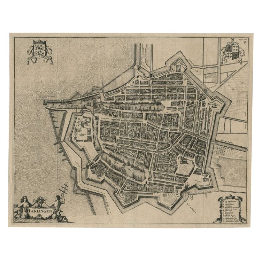
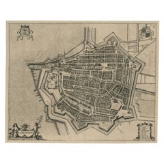
Antique Map of the City of Harlingen by Janssonius, c.1657
By Johannes Janssonius
Located in Langweer, NL
Antique map titled ‘Harlingen‘. This map depicts the city of Harlingen (Friesland, The Netherlands). Published by J. Janssonius, Amsterdam, c.1657.
Artists and Engravers: Johannes...
Category
Antique 17th Century Maps
Materials
Paper
$401 Sale Price
20% Off
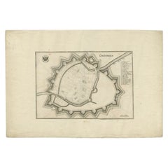
Antique Map of the City of Groningen by Merian, 1659
Located in Langweer, NL
Antique map titled 'Gröningen'. This print depicts the city of Groningen, the Netherlands. This print originates from 'Topographia Germaniae Inferioris (..)' by C. Merian.
Artist...
Category
Antique 17th Century Maps
Materials
Paper
$88 Sale Price
20% Off
You May Also Like
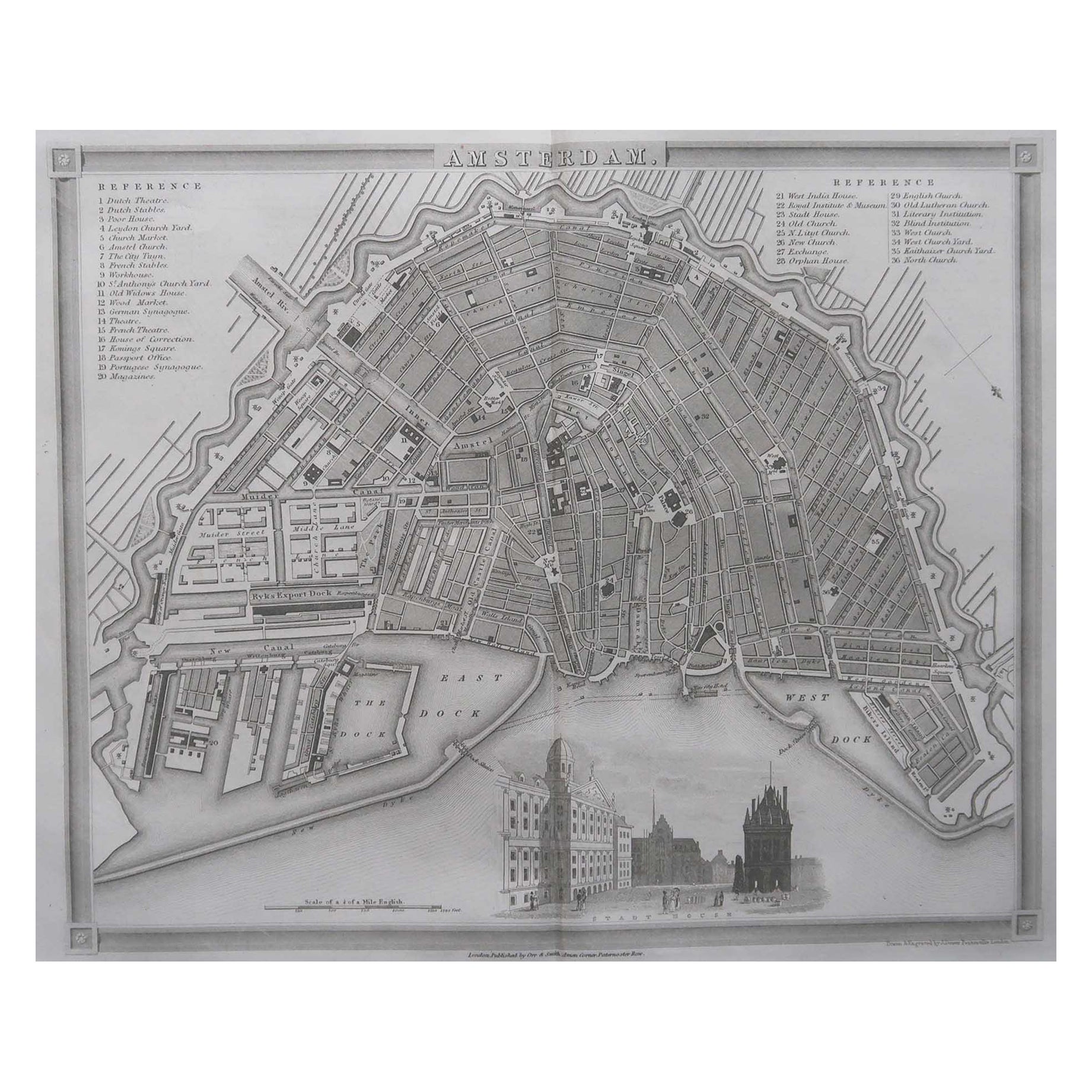
Original Antique Map or City Plan of Amsterdam, Netherlands. Circa 1835
Located in St Annes, Lancashire
Nice map of Amsterdam
Drawn and engraved by J.Dower
Published by Orr & Smith. C.1835
Unframed.
Free shipping
Category
Antique 1830s English Maps
Materials
Paper

Original Antique Map or City Plan of Geneva, Switzerland. Circa 1835
Located in St Annes, Lancashire
Nice map of Geneva
Drawn and engraved by J.Dower
Published by Orr & Smith. C.1835
Unframed.
Free shipping
Category
Antique 1830s English Maps
Materials
Paper

19th Century Reprint of 16th Century Harbor Map of Copenhagen
Located in Haddonfield, NJ
This reprint of 1587 antique map of Copenhagen, Denmark retains its original mid-century mat and has been recently reframed in classic wood frame. The muted sepia colored map is a wo...
Category
Antique 1880s Danish Baroque Maps
Materials
Wood, Paper

Original Antique Map or City Plan of Rome, Italy. Circa 1835
Located in St Annes, Lancashire
Nice map of Rome
Drawn and engraved by J.Dower
Published by Orr & Smith. C.1835
Unframed.
Free shipping
Category
Antique 1830s English Maps
Materials
Paper

Utrecht, Antique Map from "Civitates Orbis Terrarum"
By Franz Hogenberg
Located in Roma, IT
Braun G., Hogenberg F., Traiectum or Utrecht, from the collection Civitates Orbis Terrarum, Cologne, T. Graminaeus, 1572-1617.
Very fine B/W aquatint showing a view of Utrecht, with...
Category
16th Century Landscape Prints
Materials
Etching

Original Antique Map or City Plan of Venice, Italy. Circa 1835
Located in St Annes, Lancashire
Nice map of Venice
Drawn and engraved by J.Dower
Published by Orr & Smith. C.1835
Unframed.
Free shipping
Category
Antique 1830s English Maps
Materials
Paper

More Ways To Browse
Antique Atlas Furniture
Map Stand
Antique Maps Of Holland
Compass Rose Antique
Antique Furniture Portugal
Antique Maps Of Europe
Mexican Antiques
Map Of Africa
Mississippi Antique
Antique Furniture Plans
Ancient Collectibles
Antique Wood Coat Of Arms
Antique Quadrant
Antique Maps Of Africa
Antique Map India
Antique Map Of The South Of France
Antique English Maps
Indonesia Map