Items Similar to Engraved Map of the Lower Rhine, Meuse, Moselle, Scheldt, Ems & Weser, c.1700


Want more images or videos?
Request additional images or videos from the seller
1 of 5
Engraved Map of the Lower Rhine, Meuse, Moselle, Scheldt, Ems & Weser, c.1700
About the Item
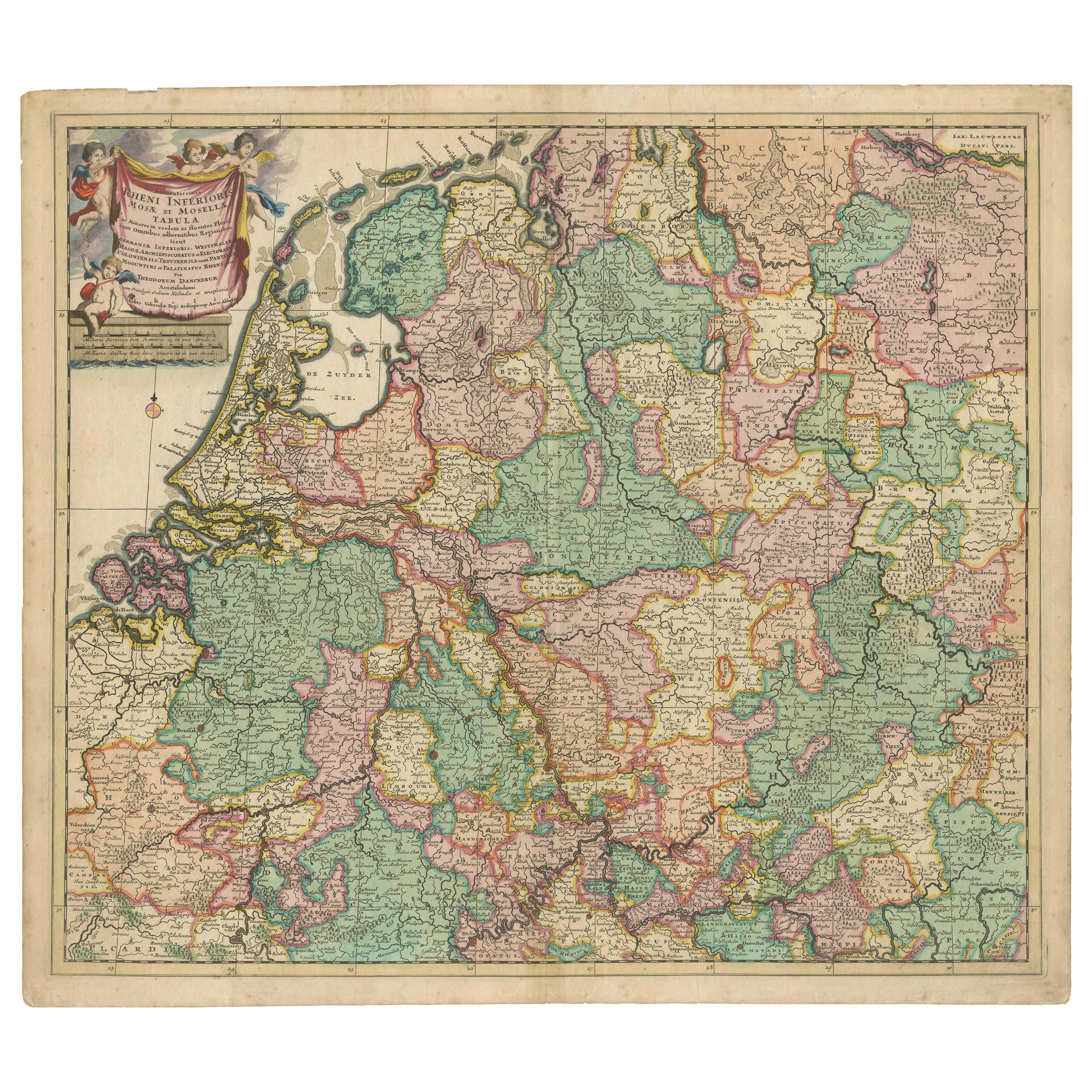
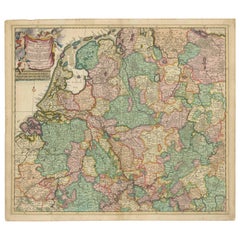
Beautiful original hand-colored antique map of a large part of Western Europe.
Title: Accuratissima Rheni Inferioris, Mosae et Mosellae Tabula.
Maker: T. Danckerts. Amsterdam, c. 1700.
This decorative engraving shows especially the basins of the Lower Rhine, Meuse, Moselle, Scheldt, Ems and Weser in Germany and showing Holland in full as well as a large part of nowadays Belgium. Nice title cartouche and scales.
- Dimensions:Height: 24.02 in (61 cm)Width: 21.26 in (54 cm)Depth: 0 in (0.02 mm)
- Materials and Techniques:
- Period:1700-1709
- Date of Manufacture:circa 1700
- Condition:Repaired: Small repair to top edge outside the map. Wear consistent with age and use. Middle fold as issued. Paper with minimal staining to edges and sm. repair to top edge outside the map.
- Seller Location:Langweer, NL
- Reference Number:
About the Seller
5.0
Platinum Seller
These expertly vetted sellers are 1stDibs' most experienced sellers and are rated highest by our customers.
Established in 2009
1stDibs seller since 2017
1,929 sales on 1stDibs
Typical response time: <1 hour
- ShippingRetrieving quote...Ships From: Langweer, Netherlands
- Return PolicyA return for this item may be initiated within 14 days of delivery.
More From This SellerView All
- Rare Theodore Danckerts Map of the Lower Rhine and Moselle River RegionsLocated in Langweer, NLOriginal antique map titled 'Accuratissima Rheni Inferioris Mosae et Mosellae Tabula'. Rare Theodore Danckerts map of the Lower Rhine and Moselle River Regions. The map covers the lo...Category
Antique Early 18th Century Maps
MaterialsPaper
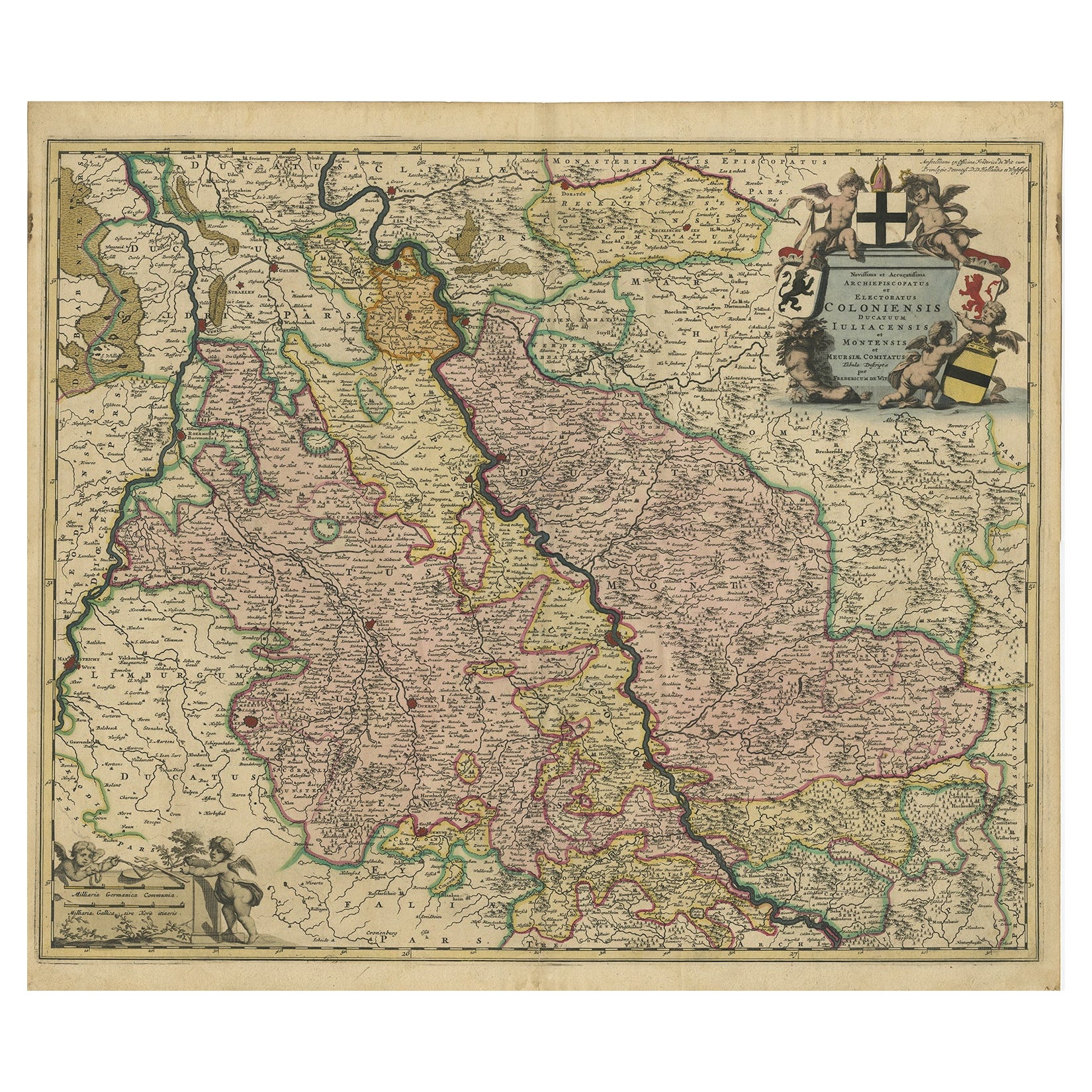
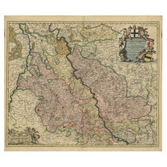
- Rhine Splendor: Antique Map of the Lower Rhine Region, circa 1680Located in Langweer, NLThe antique map titled 'Novissima et Accuratissima Archiepiscopatus et Electoratus Coloniensis Ducatuum Iuliancensis et Montensis et Meursiae Comitatus' is a handsome and detailed ma...Category
Antique 1680s Maps
MaterialsPaper
- Antique Map of the Upper and Lower Rhine by Cary '1811'By John CaryLocated in Langweer, NLAntique map titled 'A New Map of the Circles of the Upper and Lower Rhine'. Antique map covering an area from Westphalia and Lower Saxony in the north to France and Swabia in the south.Category
Antique Early 19th Century Maps
MaterialsPaper
- Antique Map of the Rhine and Moselle River Region in Germany and France, c.1680Located in Langweer, NLAntique map titled 'Tabula Geographica qui Pars Meridionalis sive Superior Rheni, Mosae et Mosellae (..).' Detailed map of the Rhine and Moselle River regions and contigous parts...Category
Antique 17th Century Maps
MaterialsPaper
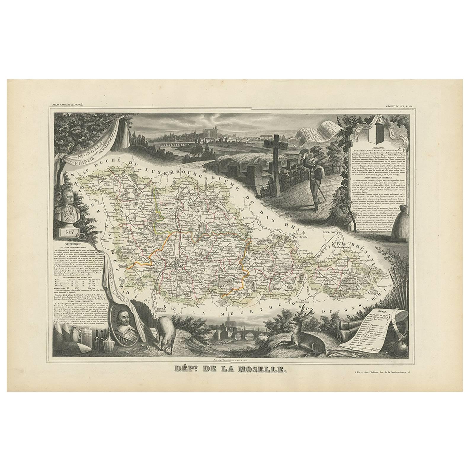
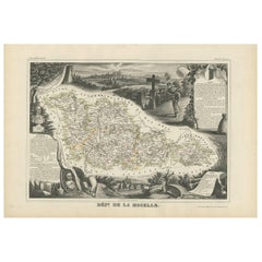
- Antique Map of Moselle ‘France’ by V. Levasseur, 1854Located in Langweer, NLAntique map titled 'Dépt. de la Moselle'. Map of the French department of Moselle, France. This area, part of the Alcase-Lorraine wine region, is known for its production of wines by...Category
Antique Mid-19th Century Maps
MaterialsPaper
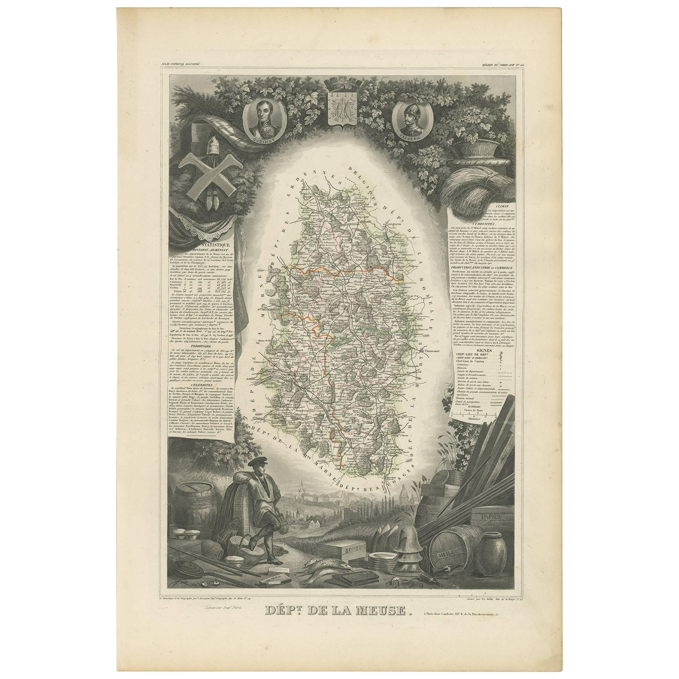
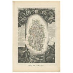
- Antique Map of Meuse ‘France’ by V. Levasseur, 1854Located in Langweer, NLAntique map titled 'Dépt. de la Meuse'. Map of the French department of Meuse, France. This area part of the Lorraine or Alsace-Lorraine wine regions. It is also known for its produc...Category
Antique Mid-19th Century Maps
MaterialsPaper


You May Also Like
- Germany West of the Rhine: A Hand-colored 18th Century Map by de WitBy Frederick de WitLocated in Alamo, CAThis original 18th century hand-colored map of the county of Moers, Germany entitled "Illustrissimo Celsissmo Principi GUILIELMO HENRICO D.G. Arausionum Principi Domino suo Clementis...Category
Antique Early 18th Century Dutch Maps
MaterialsPaper
- Original Antique Map of The Netherlands, Engraved by Barlow, Dated 1807Located in St Annes, LancashireGreat map of Netherlands Copper-plate engraving by Barlow Published by Brightly & Kinnersly, Bungay, Suffolk. Dated 1807 Unframed.Category
Antique Early 1800s English Maps
MaterialsPaper
- Original Antique Map of Sweden, Engraved by Barlow, 1806Located in St Annes, LancashireGreat map of Sweden Copper-plate engraving by Barlow Published by Brightly & Kinnersly, Bungay, Suffolk. 1806 Unframed.Category
Antique Early 1800s English Maps
MaterialsPaper
- Map of the Republic of GenoaLocated in New York, NYFramed antique hand-coloured map of the Republic of Genoa including the duchies of Mantua, Modena, and Parma. Europe, late 18th century. Dimension: 25...Category
Antique Late 18th Century European Maps
- Original Antique Map of Switzerland, Engraved By Barlow, Dated 1807Located in St Annes, LancashireGreat map of Switzerland Copper-plate engraving by Barlow Published by Brightly & Kinnersly, Bungay, Suffolk. Dated 1807 Unframed.Category
Antique Early 1800s English Maps
MaterialsPaper
- Map "Estuary- Mouth of the Thames"Located in Alessandria, PiemonteST/426 - Antique French Map of the estuary of the Thames, map dated 1769 - "Mape of the entrance of the Thames. Designed by filing of Navy cards fo...Category
Antique Mid-18th Century French Other Prints
MaterialsPaper


Recently Viewed
View AllMore Ways To Browse
Hand Colored Antique
T Engraved
Large Scale Map
Antique German Scales
Antique German Scale
Belgium Map
Engravings 1700
Map Of Belgium
Belgium Antique Map
Wood And Sons Plate
Antique Caribbean
Holland Utrecht
Antique Paper Globe
Small Antique Globes
Antique Map India
Antique Maps Of India
Antique Map Of India
Maps United Kingdom