
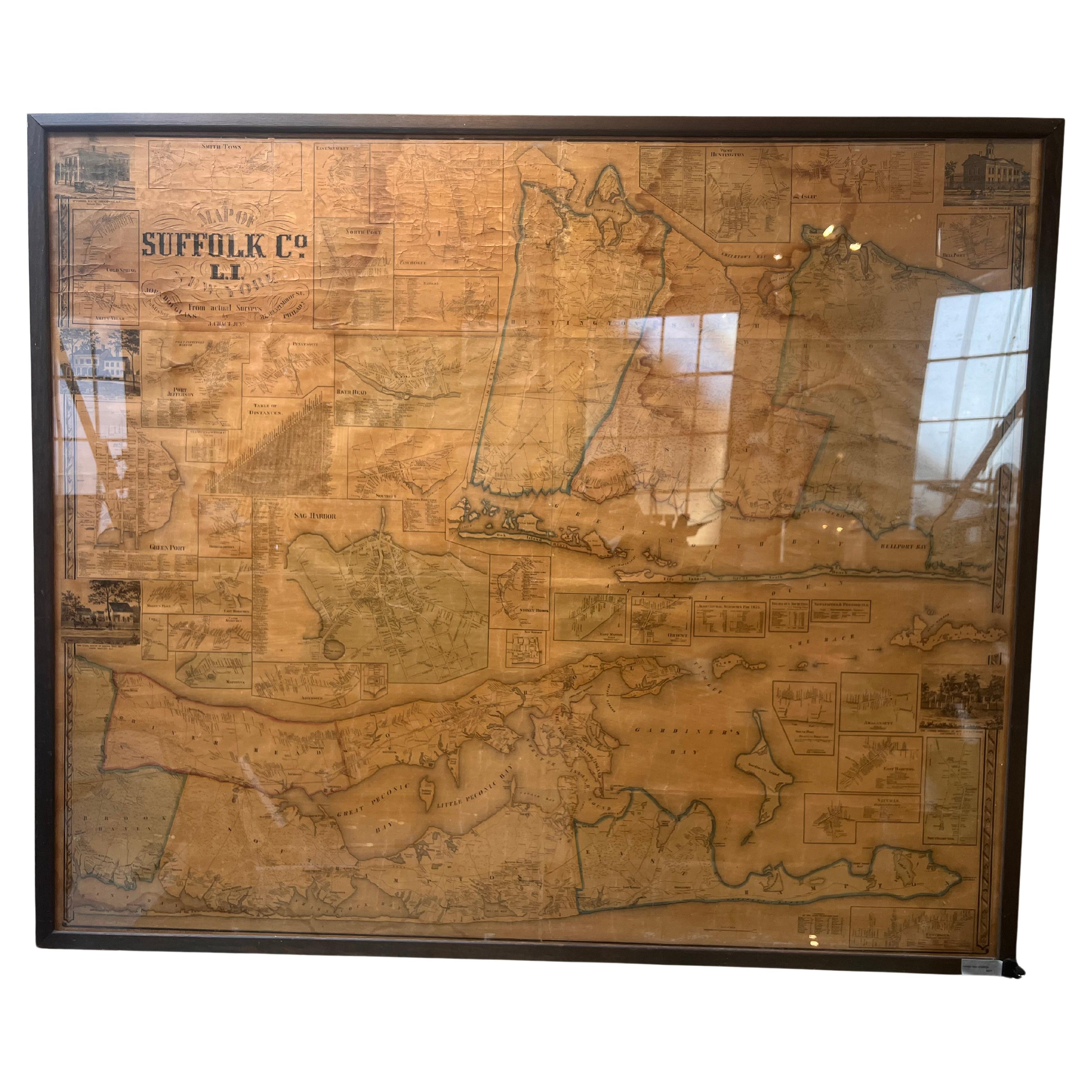
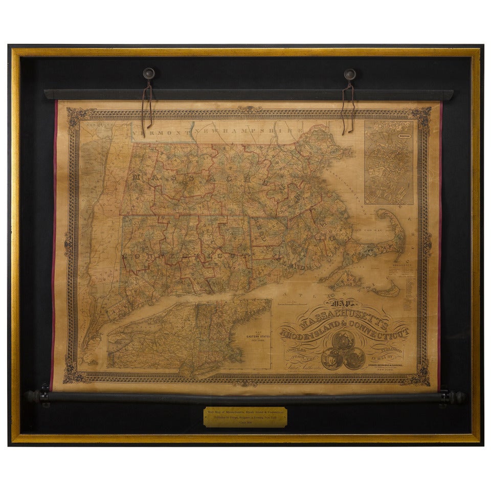
Framed Mid-19th Century Wall Map of Long Island, the Hamptons
View Similar Items


Want more images or videos?
Request additional images or videos from the seller
1 of 14
Framed Mid-19th Century Wall Map of Long Island, the Hamptons
About the Item
- Dimensions:Height: 51.5 in (130.81 cm)Width: 63 in (160.02 cm)Depth: 1 in (2.54 cm)
- Materials and Techniques:
- Place of Origin:
- Period:
- Date of Manufacture:circa 1855
- Condition:Wear consistent with age and use. some is some professional restoration on portions of the map. You can see in detailed images.
- Seller Location:Sag Harbor, NY
- Reference Number:Seller: B0081stDibs: LU225235649493
About the Seller
5.0
Vetted Seller
These experienced sellers undergo a comprehensive evaluation by our team of in-house experts.
Established in 2006
1stDibs seller since 2016
100 sales on 1stDibs
More From This SellerView All
- Framed Mid-19th Century Wall Map of Long Island, the HamptonsLocated in Sag Harbor, NYA Framed museum quality find. This large wall map dates to the mid-1800s. Detailed inset maps of, Sag Harbor, East Hampton, Amagansett, Shelter Island and most villages in Long Islan...Category
Antique Mid-19th Century American Maps
MaterialsLinen, Paper
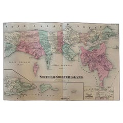
- Antique Map Long Island, Southold, Shelter Island, Orient, New YorkBy Beers Atlas Co.Located in Sag Harbor, NYAntique map of Long Island, Southold, Shelter Island, Orient, Great details, Names of homes, Roads and Businesses in 1870. Unframed. This is...Category
Antique Mid-19th Century American Early Victorian Prints
MaterialsPaper
- Large Antique 1859 Map of North AmericaLocated in Sag Harbor, NYThis Map was made by Augustus Mitchell in 1859 It is in amazing condition for being 163 years old. This price is for the rolled up easy to ship version of this piece. I will be Frami...Category
Antique Mid-19th Century American Maps
MaterialsCanvas, Paper

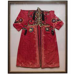
- 19th Century, Silk Bordered CaftanLocated in Sag Harbor, NYAmazing silk North African caftan, hand-stitched beautiful embroidered details. Framed in a large shadow box, this piece is a visual treat.Category
Antique Late 19th Century Moroccan Shadow Boxes
- Large Late 19th Century Wrought AndironsLocated in Sag Harbor, NYThis is a pair of large rod iron andirons from the late 19th century. They are connected by a removable rod iron chain. The hand crafted iron work has amazing...Category
Antique Late 19th Century American Victorian Fireplace Tools and Chimney...
MaterialsWrought Iron
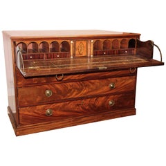
- 19th Century George III Secretary Desk/ChestLocated in Sag Harbor, NYA spectacular piece of English craftsmanship. The details are amazing. Desktop is tooled leather, multiple drawers as well as three hidden drawers in the trim and behind doors. This ...Category
Antique Mid-19th Century English George III Desks
 $10,500 Sale Price44% Off


You May Also Like
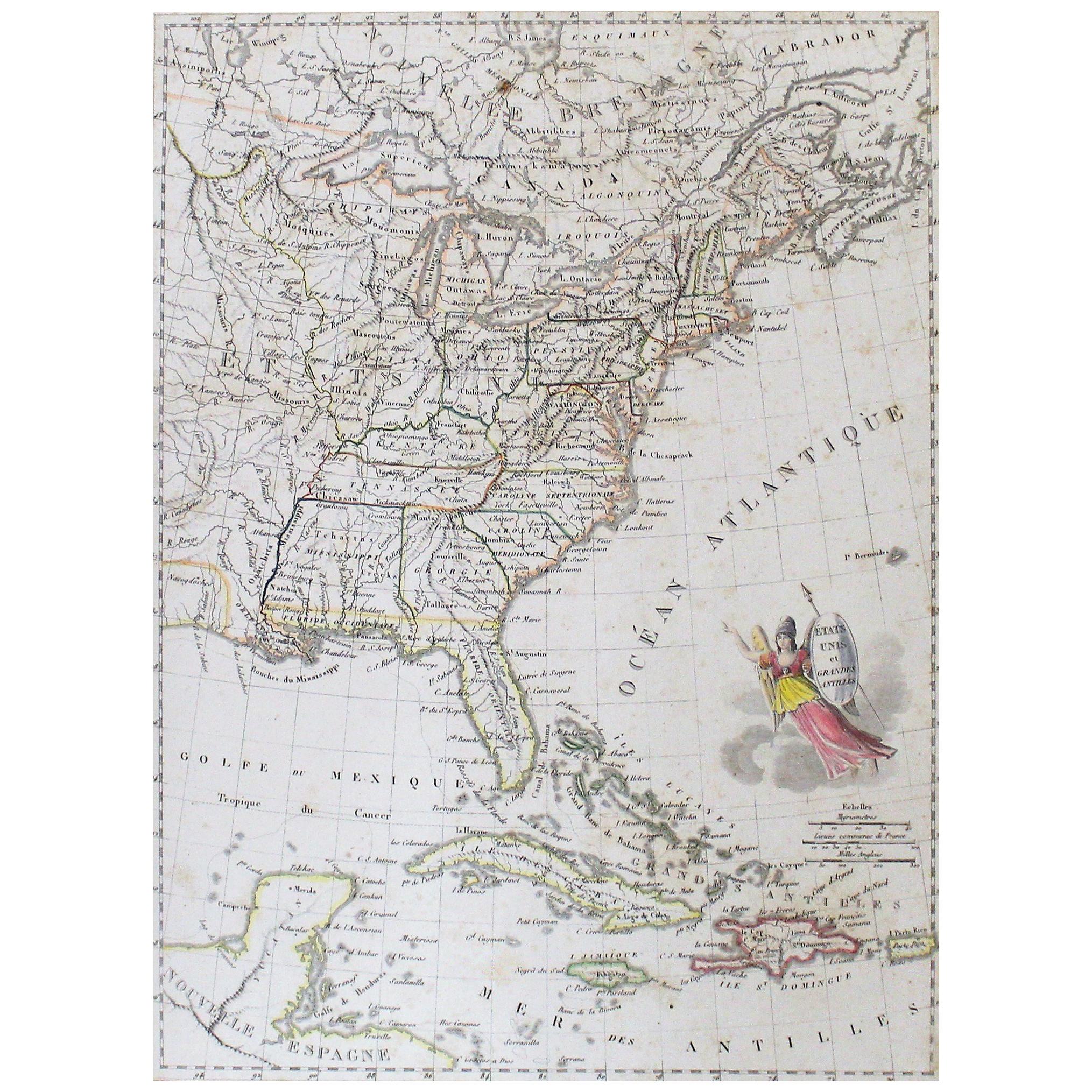
- Early 19th Century Hand Colored Map of the United States and Caribbean IslandsLocated in Hamilton, OntarioHand coloured early 19th century map by Giraldon of France titled "Etats Unis et Grandes Antilles" (United States and Greater Antilles).Category
Antique Early 19th Century French Maps
MaterialsPaper
 $595 Sale Price40% Off
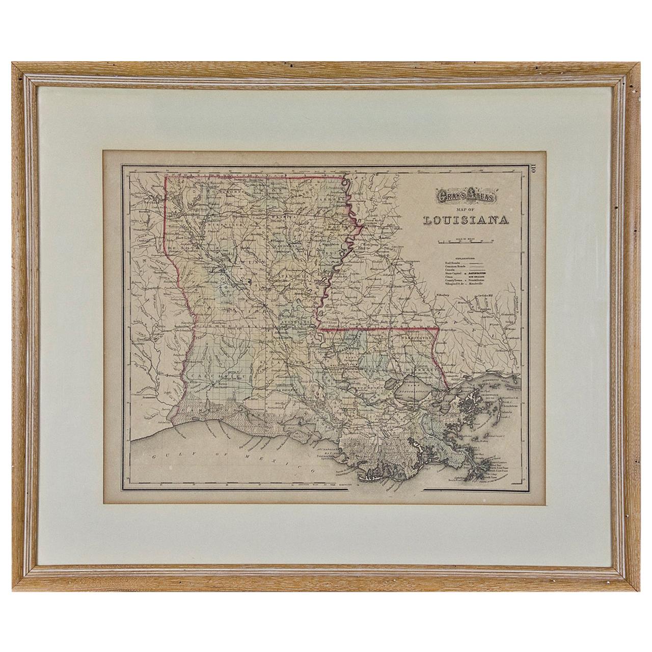
 - Louisiana: A Framed 19th Century Map by O. W. GrayBy Gray and CoLocated in Alamo, CAThis framed 19th century map of the Louisiana territory was published in "Gray's Atlas of the United States with General Maps of the World, accompanied by Descriptions Geographical, Historical, Scientific and Statistica" published in 1873 in Philadelphia by O.W. Gray and Son and Stedman, Brown and Lyon. It is a highly detailed map of Louisiana...Category
Antique Mid-19th Century American Other Maps
MaterialsPaper
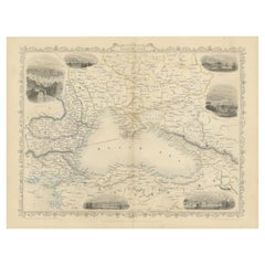
- Mid 19th Century Map of the Black Sea with Decorative Vignettes, 1851Located in Langweer, NLMap of the Black Sea and contingent lands, including Turkey, Russia, Georgia, Azerbaijan, Bulgaria, Crimea and Armenia, with decorative vignettes views of Sebastopol, Varna, Odessa, Sinope, Constantinople and Silistria. Fine antique map...Category
Antique Mid-19th Century Maps
MaterialsPaper
 $395 Sale Price20% Off
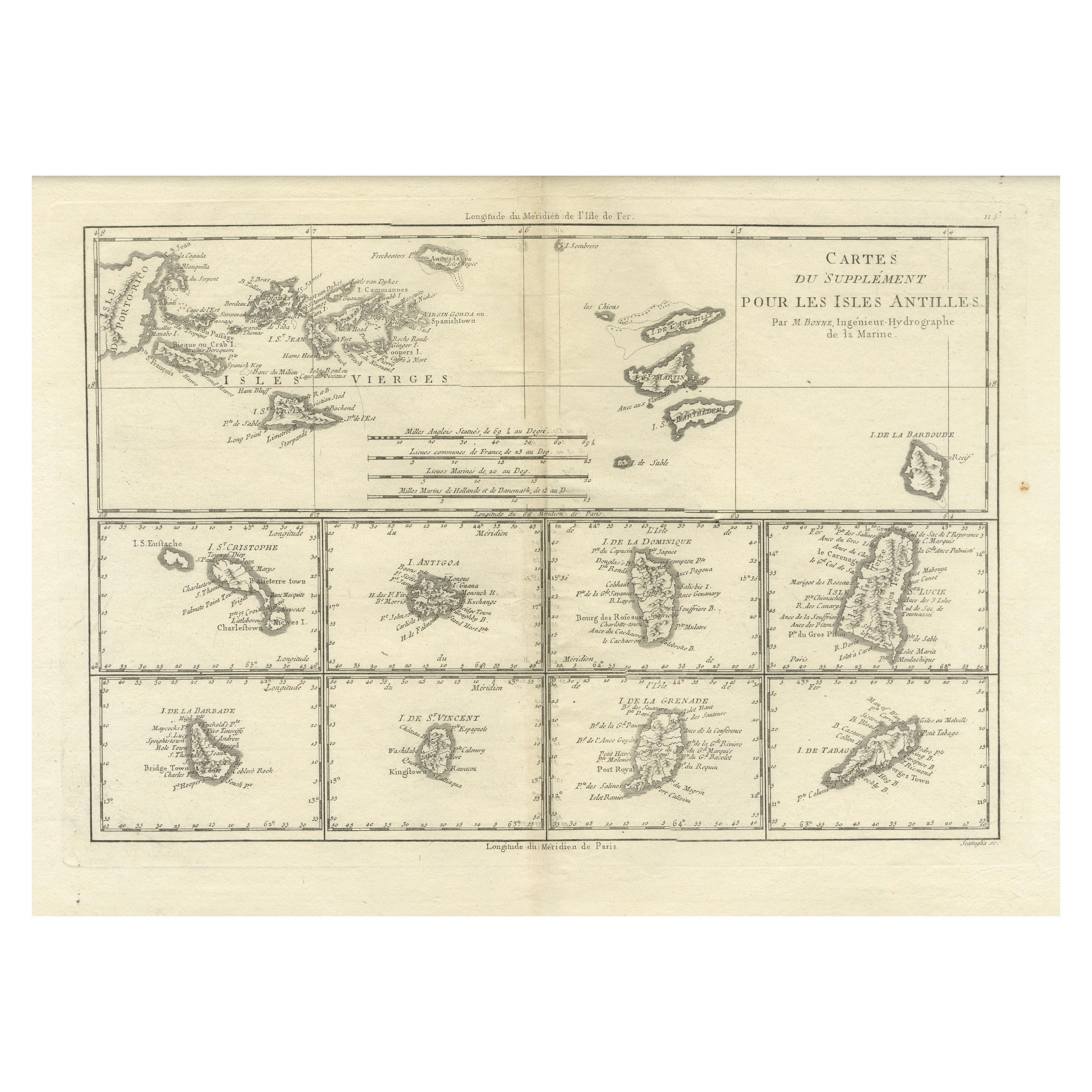
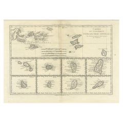
 - 18th Century Antique Map of the Virgin Islands and Caribbean Inset MapsLocated in Langweer, NLA fascinating piece of cartographic history! The map, titled "Carte du supplément pour les Isles Antilles," featuring inset maps of various islands in the Caribbean, is from the "Atl...Category
Antique Late 18th Century Maps
MaterialsPaper
- Antique Map of the Islands Within the Queen Charlotte's IslandsLocated in Langweer, NLAntique map titled 'Cote Septentrional de la plus grande des Isles de la Reine Charlotte (..)'. Map and coastal view of the islands within the Queen Charlotte's Islands (Santa Cruz I...Category
Antique Late 18th Century Maps
MaterialsPaper
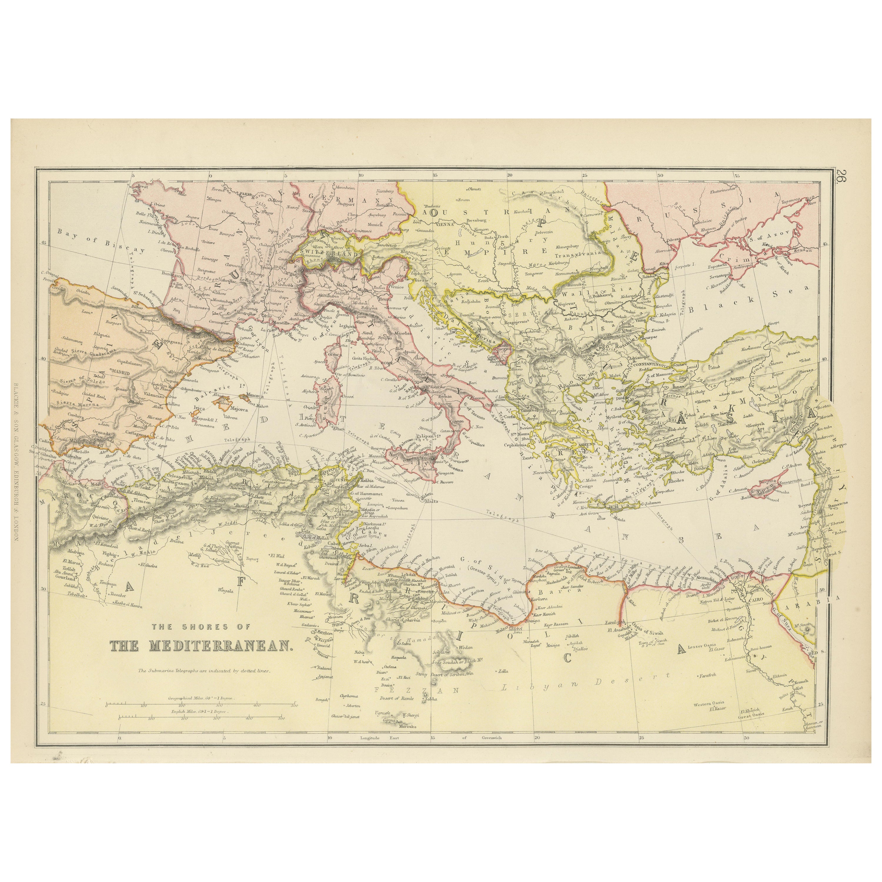
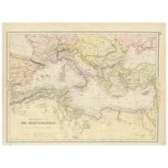
- Mediterranean Tapestry: A 19th Century Map of the Mediterranean Shores, 1882Located in Langweer, NLThis map, titled "The Shores of the Mediterranean," is part of the 1882 atlas by Blackie & Son, and it portrays the coastal regions that surround the Mediterranean Sea. It is a detailed representation of the diverse and historically rich countries that share the Mediterranean coastline, spanning from the Strait of Gibraltar in the west to the Levantine Sea in the east, and from the southern shores of Europe down to the northern coastlines of Africa. The map is a vivid document of the time, with each country along the Mediterranean basin meticulously outlined. The northern coast includes the southern parts of Europe, featuring Spain...Category
Antique 1880s Maps
MaterialsPaper


Recently Viewed
View AllMore Ways To Browse
World Map The World
Masque Theatre No
Radnor Furniture
Antique Maps Of British Isles
Map Measure
The Antiques Depot
Rand Mcnally Map Of Colorado
Map Of The Netherlands
Albania Antique Map
Antique Detroit Map
Antique Maine Map
Antique Maine Maps
Antique Map Of Detroit
Maps Balkans
Antique Louisiana Map
Antique Map Louisiana
Antique Map Of Maine
Antique Map Of Yorkshire